Transcription
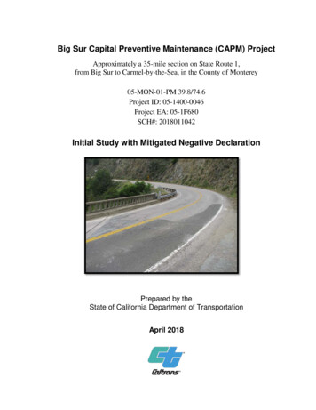
Big Sur Capital Preventive Maintenance (CAPM) ProjectApproximately a 35-mile section on State Route 1,from Big Sur to Carmel-by-the-Sea, in the County of Monterey05-MON-01-PM 39.8/74.6Project ID: 05-1400-0046Project EA: 05-1F680SCH#: 2018011042Initial Study with Mitigated Negative DeclarationPrepared by theState of California Department of TransportationApril 2018
General Information About This DocumentThe California Department of Transportation (Caltrans), has prepared this Initial Study with MitigatedNegative Declaration, which examines the potential environmental impacts of the Big Sur CAPM projecton approximately a 35-mile section of State Route 1, located in Monterey County California.The Draft Initial Study was circulated for public review and comment from January 26, 2018 to February26, 2018. A Notice of Intent to Adopt a Mitigated Negative Declaration, and Opportunity for PublicHearing was published in the Monterey County Herald on Friday January 26, 2018. The Notice of Intentand Opportunity for Public Hearing was mailed to a list of stakeholders that included both governmentagencies and private citizen groups who occupy and have interest in the project area. No comments werereceived during the public circulation period. The project has completed the environmental compliancewith circulation of this document. When funding is approved, Caltrans can design and build all or part ofthe project.Throughout this document, a vertical line in the margin indicates a change that has been made since thedraft document circulation. Minor editorial changes and clarifications have not been indicated.Hard copies of this document as well as the technical reports are available at: Caltrans District Office at 50 Higuera Street, San Luis Obispo, California 93401 Monterey County Free Library – Big Sur Branch, Highway 1 at Ripplewood Resort, Big Sur,CaliforniaElectronic copies of this document can be accessed at:Caltrans District 5 website (www.dot.ca.gov/d5/), underneath “District 5 Highlights”, select “Projects”and within “Monterey County”For individuals with sensory disabilities, this document can be made available in Braille, in large print, onaudiocassette, or on computer disk. To obtain a copy in one of these alternate formats, please call or write toCaltrans, Attn: Matt Fowler, Central Region Environmental, 50 Higuera, San Luis Obispo CA 93401; 805-5424603 (Voice), or use the California Relay Service 1 (800) 735-2929 (TTY), 1 (800) 735-2929 (Voice), or 711.
This page left intentionally blankBig Sur CAPM ii
SCH: 2018011042Mitigated Negative DeclarationPursuant to: Division 13, Public Resources CodeProject DescriptionThe California Department of Transportation (Caltrans) proposes to extend the service lifeand improve the existing pavement on State Route 1 from Big Sur (postmile 39.8) to Carmelby-the-Sea (postmile 74.6) in Monterey County. The project is approximately 35 miles long,stretching between Big Sur and Carmel-by-the-Sea. State Route 1 runs along the Californiacoastline.DeterminationCaltrans has prepared an Initial Study for this project and, following public review, hasdetermined from this study that the project would not have a significant effect on theenvironment for the following reasons:The project would have no effect on: existing and future land use, wild and scenic rivers,parks and recreational facilities, growth, farmland/timberland, community, hydrology,geology, soils, seismicity, topography, or paleontological resources.The project would not create any impacts due to: air quality, noise, vibration, or hazardouswastes/materials.In addition, the project would have no significant effect on: utilities or emergency services,traffic and transportation, water quality, or storm water runoff.In addition, the project would have no significant adverse effect on biological resources,cultural resources, or visual resources because the following avoidance and minimizationmeasures would reduce potential effects to less than significant:Visual Measures Preserve as much existing vegetation as possible. Prescriptive clearing and grubbingand grading techniques which save the most existing vegetation shall be employed. If vegetation control treatments are required, treatments shall utilize a pervioussurface such as crushed shale. If shale is not feasible, the surface material shouldmatch the color of the adjacent dirt to the greatest extent possible. The specific colorshall be determined by a Caltrans Landscape Architecture representative. All concrete end blocks and transition rail should receive aesthetic treatmentappropriate for the specific work location. The type of aesthetic treatment for theseconcrete elements shall be determined by a Caltrans Landscape Architecturerepresentative in collaboration with the Project Engineer. The post and beams of all new or replaced guardrail, metallic transitions, anchor postand end sections shall be colored and/or darkened to blend with the surroundings andreduce reflectivity. The specific color shall be determined by a Caltrans LandscapeArchitecture representative.Big Sur CAPM iii
Mitigated Negative Declaration The post and beams of all existing guardrail within the project limits which is notreplaced as part of this project shall be colored and/or darkened to blend with thesurrounding and reduce reflectivity. The specific color shall be determined by aCaltrans Landscape Architecture representative.Biological Measures Shoulder backing material will not be composed of recycled asphalt pavement (RAP)when placed around trees. If feasible, vegetation removal in the project footprint should be scheduled to occurbetween September 30 and February 1, which is outside of the typical bird nestingseason. If not feasible, preconstruction nesting bird surveys shall be conducted andno-work exclusion zones placed around any active nest, if found. Seacliff buckwheat plants found within the project footprint shall be relocated to asuitable adjacent habitat to avoid and minimized the potential impacts to Smith’s bluebutterfly habitat. Implementation of all protective measures set forth in the Programmatic BiologicalOpinions from the U.S. Fish and Wildlife Service for the protection of the Californiared-legged frog and for the protection of the Smith’s blue butterfly. The number of access routes, size of staging areas, and the total area of activity shallbe limited to the minimum necessary to achieve the project.Cultural Measures Cultural resources shall be avoided and protected from inadvertent effects through theestablishments of Environmentally Sensitive Areas (ESA). For archeological resources, Temporary Fence (type ESA) will be installed justoutside the edge of pavement to delineate the extent of where work is allowed at theseESA locations. For Historic resources located in very close proximity to paving and shoulder backingactivities where it is not feasible to install ESA fencing, temporary visual barriers(caution tape, delineators, cones, etc.) will be placed to indicate ESAs. Temporary/movable ESA barriers may be utilized to delineate small ESA areas, andmay be moved/reused for multiple ESAs as long as each barrier is placed prior towork occurring at each location, and may not be removed until after construction iscompleted at each location. Caltrans-defined ESAs shall be noted on design plans and delineated in the field priorto the start of construction activities. Modified construction techniques will also be utilized in some areas to ensure thatcultural resources will not be affected by adjacent construction activities. Shoulder backing will be eliminated in locations adjacent to archaeological resourcesand construction activities will be restricted to the previously disturbed highwayfootprint.Big Sur CAPM iv
Mitigated Negative DeclarationThis page left intentionally blankBig Sur CAPM vi
Project Description and BackgroundProject TitleBig Sur Capital Preventive Maintenance (CAPM) ProjectProject LocationThe project is located on State Route-1 (SR-1) in Monterey County, from TorreCanyon (PM 39.8) in Big Sur to San Luis Avenue (PM 74.6) in the City of Carmelby-the-Sea.Project Vicinity MapBig Sur CAPM 1
Project Description and BackgroundProject Location MapDescription of ProjectCaltrans is proposing to overlay approximately 35 miles of existing roadway on SR-1from postmile 39.8 in Big Sur to postmile 74.6 in Carmel-by-the-Sea. The projectintends to extend the service life and improve the ride quality of the existing roadway.The existing pavement is showing signs of deterioration which is negatively affectingthe ride quality of the roadway and is expected to continue to deteriorate if notappropriately addressed.To address this problem, Caltrans proposes to overlay the existing roadway with 0.15feet of dense graded Rubberized Hot Mixed Asphalt (RHMA-G). Cold planing of theexisting roadway will be required in some locations to maintain the original grade ofthe highway. Asphalt bridge approaches will be ground down and repaved withoverlay to match the existing roadway surface on the bridge deck. Bridge decks withexisting asphalt surfaces will be ground down to a depth of 0.15 feet and repaved withoverlay. Bridge decks with concrete roadway surfaces will not be ground down orpaved with overlay. At locations where pavement failure has been identified, theroadway will be removed to a depth of 0.33 feet and restored with Hot Mixed Asphalt(HMA) Type A before the area is repaved with overlay.Big Sur CAPM 2
Project Description and BackgroundThe existing asphalt dikes will be removed and replaced. Drainage inlets along theproject will be adjusted to match the new overlay grade as necessary. Any existingTraffic Monitoring Systems (TMS) and utility covers within the project limits willalso be adjusted to take the new overlay grade into account.Asphalt overlay pavement edge treatments and shoulder backing will be constructed.Shoulder backing will be placed at feasible locations throughout the project limits toprevent the new road edge from premature failure as well as reduce incidents ofpavement edge drop-off. Shoulder backing will not extend more than two feet fromedge of existing pavement. Shoulder backing will be constructed of compacted loosematerials (recycled asphalt pavement, clean material, etc.) and will not be paved over.Shoulder backing that may be placed within 100 horizontal feet of a culvert,watercourse, or bridge shall be constructed of crushed gravel or stone and will not useany type of materials containing asphalt.In addition, centerline rumble strips will be considered throughout the project limitsand will be installed during construction when appropriate.The project also proposes to incorporate several enhancements to improve roadwaysafety and pedestrian access:1. Upgrading the existing Metal Beam Guardrail (MGBR) to Midwest GuardrailSystem (MGS) where the existing MBGR cannot be raised to a height of 29inches above the roadway surface. Only existing MGBR will be adjusted orupgraded. The project will not install guardrail where there is no existingguardrail in place. The new MGS will be attached to an anchor post ortransitioned to the existing guardrail bridge attachments and end post. Nomodifications will be made to historic structures or walls.2. Upgrade the pedestrian curb ramps at Ocean Avenue in Carmel-by-the-Sea atpostmile 73.8. Two ramps will be installed on the pedestrian island at thenorthwest corner of the intersection to compliment recently installed ADAramps in the south west, south east and north east corner.3. Within the project limits, all warning signs will be removed and replaced withsigns made with Type 11 retroreflective sheeting and all regulatory signs willbe removed and replaced with signs made with Type 9 retroreflectivesheeting. Only existing signs will be replaced and no additional signs will beinstalled.Big Sur CAPM 3
Project Description and BackgroundThe project will occur within Caltrans right-of-way and is not intended to modify theexisting roadway geometry or capacity. The project will require one-way laneclosures and may require night work as part of the construction process.The estimated construction cost is approximately 21,210,000.The estimated construction time is approximately 150 working days.Surrounding Lands Uses and SettingWithin the project limits, SR-1 is a two-lane conventional highway from postmile39.8 to postmile 72.8 and expands to a four-lane conventional highway from postmile72.8 to 74.6. The traffic lane width varies between 10 to 12 feet wide. Paved outsideshoulder width also varies between zero to eight feet wide at certain locations, with amajority being four feet or less. Multiple turnouts and rest areas are present along SR1 within the region.The project stretches between Carmel and the Big Sur region, and is within theCarmel – San Simeon Highway Historic District. The region around Carmel is urbanwith homes and businesses located adjacent to SR-1. The Big Sur region isconsidered rural with homes, public space, and business sporadically spread alongSR-1. Both regions are popular tourist destinations and are visited year-round. Carmeland the Big Sur region are located along the California coast, with SR-1 windingthrough western slopes of the Santa Lucia Mountains. The region as whole contains avariety of geological features, natural abundance, recreational opportunities, andunique viewscapes.The project is located within an area included in Monterey County’s Big Sur CoastLand Use Plan (BSCLUP). Within the Big Sur region, the BSCLUP providesdevelopment standards to guide actions of all State and local agencies. The plan hasbeen prepared to carry out the requirements of the California Coastal Act of 1976 asthe primary component of a certified Local Coastal Program (LCP) that has beenapproved by the California Coastal Commission (CCC). The Coastal Act placesemphasis on environmental protection and public recreation which were importantconsiderations when formulating the plan. Within the basic objectives and policies ofthe BSCLUP, SR-1 is discussed as a special road of great local, state, and nationalsignificance. The basic policy is to take a strong and active role in guiding future useand improvement of SR-1 and all categories of land use related to and dependent onSR-1. The purpose of the plan will be to maintain and enhance the highway’saesthetic beauty and to protect its primary function as a recreational route. It isintended that the highway shall remain a two-lane road and provide walking and biketrails wherever feasible.Big Sur CAPM 4
Project Description and BackgroundThe project is also located within the Big Sur Coast Highway Management Plan(BSCHMP) area. The 2004 BSCHMP is the result of collaboration between theFederal Highway Administration and Caltrans. A large amount of stakeholder andcommunity input was used to develop the plan. The plan addresses several aspects ofthe Big Sur region such as: Corridor Aesthetics, Landslide Management & StormDamage Response, and Vegetation Management. The plan provides the frameworkfor ongoing collaboration to meet stakeholder’s common vision for the corridor.Other Public Agencies Whose Approval is RequiredThe following permits, review and approvals would be required for . Fish and WildlifeServiceProgrammatic BiologicalOpinions for Smith Blue Butterflyand California red-legged frogObtained concurrencefor use of ProgrammaticBiological OpinionMonterey CountyCoastal Development Permit(CDP)Project may be exemptfrom a CDP. Will requirefurther coordination afterproject approval.Big Sur CAPM 5
Project Description and BackgroundThis page left intentionally blankBig Sur CAPM 6
CEQA Environmental ChecklistCEQA Environmental ChecklistPROJECT DESCRIPTION AND BACKGROUNDProject Title:Lead agency name and address:Contact person and phone number:Project Location:Project sponsor’s name and address:General plan description:Zoning:Description of project: (Describe the wholeaction involved, including but not limited to laterphases of the project, and any secondary,support, or off-site features necessary for itsimplementation.)Surrounding land uses and setting; brieflydescribe the project’s surroundings:Other public agencies whose approval isrequired (e.g. permits, financial approval, orparticipation agreements):Have California Native American tribestraditionally and culturally affiliated with theproject area requested consultation pursuant toPublic Resources Code section 21080.3.1? If so,has consultation begun?Big Sur CAPM ProjectCaltrans, 50 Higuera Street, San LuisObispo CA, 93401Matt Fowler, 805-542-4603Monterey CountyCaltransCapital Preventive Maintenance Program(CAPM)Coastal ZoneCaltrans proposes to overlay the existingroadway on SR-1 in the Big Sur region. Theproject will occur within Caltrans right-ofway and is not intended to modify theexisting roadway geometry or capacity. Theproject will require lane closures and mayrequire night work as part of theconstruction process.The project stretches between Carmel andthe Big Sur region, and is within the Carmel– San Simeon Highway Historic District.U.S. Fish and Wildlife Service,Ventura OfficeLetters and emails have been sentregarding the project’s offering forconsultation under the PRC 21080.3.1 (AB52). No Consultation has been requestedat this time.Note: Conducting consultation early in the CEQAprocess allows tribal governments, leadagencies, and project proponents to discuss thelevel of environmental review, identify andaddress potential adverse impacts to tribalcultural resources, and reduce the potential fordelay and conflict in the environmental reviewprocess. (See Public Resources Code section21083.3.2.) Information may also be availablefrom the California Native American HeritageCommission’s Sacred Lands File per PublicResources Code section 5097.96 and theCalifornia Historical Resources InformationSystem administered by the California Office ofHistoric Preservation. Please also note thatPublic Resources Code section 21082.3(c)contains provisions specific to confidentiality.Big Sur CAPM 7
CEQA Environmental ChecklistThis page left intentionally blankBig Sur CAPM 8
CEQA Environmental ChecklistCEQA Environmental .M/P.M.E.A.This checklist identifies physical, biological, social and economic factors that might beaffected by the proposed project. In many cases, background studies performed inconnection with the projects indicate no impacts. A NO IMPACT answer in the last columnreflects this determination. Where there is a need for clarifying discussion, the discussionis included either following the applicable section of the checklist or is within the body ofthe environmental document itself. The words "significant" and "significance" usedthroughout the following checklist are related to CEQA, not NEPA, impacts. The questionsin this form are intended to encourage the thoughtful assessment of impacts and do notrepresent thresholds of significance.PotentiallySignificantImpactI. AESTHETICS: Would the project:a) Have a substantial adverse effect on a scenic vista?b) Substantially damage scenic resources, including, but notlimited to, trees, rock outcroppings, and historic buildings withina state scenic highway?c) Substantially degrade the existing visual character or qualityof the site and its surroundings?d) Create a new source of substantial light or glare which wouldadversely affect day or nighttime views in the area?II. AGRICULTURE AND FOREST RESOURCES: Indetermining whether impacts to agricultural resources aresignificant environmental effects, lead agencies may refer to theCalifornia Agricultural Land Evaluation and Site AssessmentModel (1997) prepared by the California Dept. of Conservationas an optional model to use in assessing impacts on agricultureand farmland. In determining whether impacts to forestresources, including timberland, are significant environmentaleffects, lead agencies may refer to information compiled by theCalifornia Department of Forestry and Fire Protection regardingthe state’s inventory of forest land, including the Forest andRange Assessment Project and the Forest Legacy AssessmentProject; and the forest carbon measurement methodologyprovided in Forest Protocols adopted by the California AirResources Board. Would the project:a) Convert Prime Farmland, Unique Farmland, or Farmland ofStatewide Importance (Farmland), as shown on the mapsprepared pursuant to the Farmland Mapping and MonitoringProgram of the California Resources Agency, to non-agriculturaluse?Big Sur CAPM 9Less ThanSignificantwithMitigationLess ThanSignificantImpactNoImpact
CEQA Environmental ChecklistPotentiallySignificantImpactc) Conflict with existing zoning for, or cause rezoning of, forestland (as defined in Public Resources Code section 12220(g)),timberland (as defined by Public Resources Code section 4526),or timberland zoned Timberland Production (as defined byGovernment Code section 51104(g))?d) Result in the loss of forest land or conversion of forest landto non-forest use?e) Involve other changes in the existing environment which, dueto their location or nature, could result in conversion ofFarmland, to non-agricultural use or conversion of forest land tonon-forest use?III. AIR QUALITY: Where available, the significance criteriaestablished by the applicable air quality management or airpollution control district may be relied upon to make thefollowing determinations. Would the project:a) Conflict with or obstruct implementation of the applicable airquality plan?b) Violate any air quality standard or contribute substantially toan existing or projected air quality violation?c) Result in a cumulatively considerable net increase of anycriteria pollutant for which the project region is non- attainmentunder an applicable federal or state ambient air quality standard(including releasing emissions which exceed quantitativethresholds for ozone precursors)?d) Expose sensitive receptors to substantial pollutantconcentrations?e) Create objectionable odors affecting a substantial number ofpeople?IV. BIOLOGICAL RESOURCES: Would the project:a) Have a substantial adverse effect, either directly or throughhabitat modifications, on any species identified as a candidate,sensitive, or special status species in local or regional plans,policies, or regulations, or by the California Department of Fishand Game or U.S. Fish and Wildlife Service?b) Have a substantial adverse effect on any riparian habitat orother sensitive natural community identified in local or regionalplans, policies, regulations or by the California Department ofFish and Game or US Fish and Wildlife Service?Big Sur CAPM 10Less ThanSignificantwithMitigationLess ThanSignificantImpactNoImpact
CEQA Environmental ChecklistPotentiallySignificantImpactc) Have a substantial adverse effect on federally protectedwetlands as defined by Section 404 of the Clean Water Act(including, but not limited to, marsh, vernal pool, coastal, etc.)through direct removal, filling, hydrological interruption, or othermeans?d) Interfere substantially with the movement of any nativeresident or migratory fish or wildlife species or with establishednative resident or migratory wildlife corridors, or impede the useof native wildlife nursery sites?e) Conflict with any local policies or ordinances protectingbiological resources, such as a tree preservation policy orordinance?f) Conflict with the provisions of an adopted HabitatConservation Plan, Natural Community Conservation Plan, orother approved local, regional, or state habitat conservationplan?V. CULTURAL RESOURCES: Would the project:a) Cause a substantial adverse change in the significance of ahistorical resource as defined in §15064.5?b) Cause a substantial adverse change in the significance of anarchaeological resource pursuant to §15064.5?c) Directly or indirectly destroy a unique paleontologicalresource or site or unique geologic feature?d) Disturb any human remains, including those interred outsideof dedicated cemeteries?VI. GEOLOGY AND SOILS: Would the project:a) Expose people or structures to potential substantial adverseeffects, including the risk of loss, injury, or death involving:i) Rupture of a known earthquake fault, as delineated on themost recent Alquist-Priolo Earthquake Fault Zoning Map issuedby the State Geologist for the area or based on other substantialevidence of a known fault? Refer to Division of Mines andGeology Special Publication 42?ii) Strong seismic ground shaking?iii) Seismic-related ground failure, including liquefaction?Big Sur CAPM 11Less ThanSignificantwithMitigationLess ThanSignificantImpactNoImpact
CEQA Environmental ChecklistPotentiallySignificantImpactLess ThanSignificantwithMitigationLess ThanSignificantImpactNoImpactiv) Landslides?b) Result in substantial soil erosion or the loss of topsoil?c) Be located on a geologic unit or soil that is unstable, or thatwould become unstable as a result of the project, and potentiallyresult in on- or off-site landslide, lateral spreading, subsidence,liquefaction or collapse?d) Be located on expansive soil, as defined in Table 18-1-B ofthe Uniform Building Code (1994), creating substantial risks tolife or property?e) Have soils incapable of adequately supporting the use ofseptic tanks or alternative waste water disposal systems wheresewers are not available for the disposal of waste water?VII. GREENHOUSE GAS EMISSIONS: Would the project:a) Generate greenhouse gas emissions, either directly orindirectly, that may have a significant impact on theenvironment?b) Conflict with an applicable plan, policy or regulation adoptedfor the purpose of reducing the emissions of greenhouse gases?Caltrans has used the best available informationbased to the extent possible on scientific and factualinformation, to describe, calculate, or estimate theamount of greenhouse gas emissions that may occurrelated to this project. The analysis included in theclimate change section of this document provides thepublic and decision-makers as much informationabout the project as possible. It is Caltrans’determination that in the absence of statewideadopted thresholds or GHG emissions limits, it is toospeculative to make a significance determinationregarding an individual project’s direct and indirectimpacts with respect to global climatechange. Caltrans remains committed to implementingmeasures to reduce the potential effects of theproject. These measures are outlined in the climatechange section of the document.VIII. HAZARDS AND HAZARDOUS MATERIALS: Would theproject:a) Create a significant hazard to the public or the environmentthrough the routine transport, use, or disposal of hazardousmaterials?b) Create a significant hazard to the public or the environmentthrough reasonably foreseeable upset and accident conditionsinvolving the release of hazardous materials into theenvironment?c) Emit hazardous emissions or handle hazardous or acutelyhazardous materials, substances, or waste within one-quartermile of an existing or proposed school?Big Sur CAPM 12
CEQA Environmental ChecklistPotentiallySignificantImpactd) Be located on a site which is included on a list of hazardousmaterials sites compiled pursuant to Government Code Section65962.5 and, as a result, would it create a significant hazard tothe public or the environment?e) For a project located within an airport land use plan or, wheresuch a plan has not been adopted, within two miles of a publicairport or public use airport, would the project result in a safetyhazard for people residing or working in the project area?f) For a project within the vicinity of a private airstrip, would theproject result in a safety hazard for people residing or working inthe project area?g) Impair implementation of or physically interfere with anadopted emergency response plan or emergency evacuationplan?h) Expose people or structures to a significant risk of loss, injuryor death involving wildland fires, including where wildlands areadjacent to urbanized areas or where residences are intermixedwith wildlands?IX. HYDROLOGY AND WATER QUALITY: Would the project:a) Violate any water quality standards or waste dischargerequirements?b) Substantially deplete groundwater supplies or interferesubstantially with groundwater recharge such that there wouldbe a net deficit in aquifer volume or a lowering of the localgroundwater table level (e.g., the production rate of pre-existingnearby wells would drop to a level which would not supportexisting land uses or planned uses for which permits have beengranted)?c) Substantially alter the existing drainage pattern of the site orarea, including through the alteration of the course of a streamor river, in a manner which would result in substantial erosion orsiltation on- or off-site?d) Substantially alter the existing drainage pattern of the site orarea, including through the alteration of the course of a streamor river, or substantially increase the rate or amount of surfacerunoff in a manner which would result in flooding on- or off-site?e) Create or contribute runoff water which would exceed thecapacity of existing or planned stormwater drainage systems orprovide substantial additional sources of polluted runoff?f) Otherwise substantially degrade water quality?Big Sur CAPM 13Less ThanSignificantwithMitigationLess ThanSignificantImpactNoImpact
CEQA Environmental ChecklistPotentiallySignificantImpactg) Place housing within a 100-year flood hazard area asmapped on a federal Flood Hazard Boundary or FloodInsurance Rate Map or other flood hazard delineation map?h) Place within a 100-year flood hazard area structures whichwould impede or redirect flood flows?i) Expose people or structures to a significant risk of loss, injuryor death involving flooding, including flooding as a
The California Department of Transportation (Caltrans), has prepared this Initial Study with Mitigated Negative Declaration, which examines the potential environmental impacts of the Big Sur CAPM project on approximately a 35-mile section