Transcription
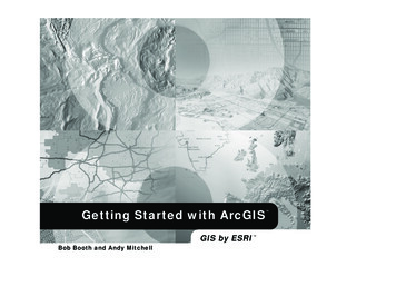
Getting Started with ArcGISGIS by ESRIBob Booth and Andy Mitchell
Copyright 1999 2001 ESRI.All rights reserved.Printed in the United States of America.The information contained in this document is the exclusive property of ESRI. This work is protected under United States copyright law and thecopyright laws of the given countries of origin and applicable international laws, treaties, and/or conventions. No part of this work may be reproducedor transmitted in any form or by any means, electronic or mechanical, including photocopying and recording, or by any information storage or retrievalsystem, except as expressly permitted in writing by ESRI. All requests should be sent to Attention: Contracts Manager, ESRI, 380 New York Street,Redlands, CA 92373-8100, USA.The information contained in this document is subject to change without notice.U.S. GOVERNMENT RESTRICTED/LIMITED RIGHTSAny software, documentation, and/or data delivered hereunder is subject to the terms of the License Agreement. In no event shall the U.S. Governmentacquire greater than RESTRICTED/LIMITED RIGHTS. At a minimum, use, duplication, or disclosure by the U.S. Government is subject to restrictionsas set forth in FAR §52.227-14 Alternates I, II, and III (JUN 1987); FAR §52.227-19 (JUN 1987) and/or FAR §12.211/12.212 (Commercial TechnicalData/Computer Software); and DFARS §252.227-7015 (NOV 1995) (Technical Data) and/or DFARS §227.7202 (Computer Software), as applicable.Contractor/Manufacturer is ESRI, 380 New York Street, Redlands, CA 92373-8100, USA.ESRI, ArcView, SDE, and the ESRI globe logo are trademarks of ESRI, registered in the United States and certain other countries; registration is pendingin the European Community. ArcGIS, ArcInfo, ArcSDE, ArcCatalog, ArcEditor, ArcMap, ArcToolbox, ArcPress, ArcIMS, 3D Analyst, GIS by ESRI, andthe ESRI Press logo are trademarks and ArcData, www.esri.com, www.geographynetwork.com, and www.gis.com are service marks of ESRI.The names of other companies and products herein are trademarks or registered trademarks of their respective trademark owners.Attribution.p65102/21/2001, 7:42 AM
ContentsGetting to Know ArcGISIntroduction31 Welcome to ArcGIS5What can you do with ArcGIS? 6Unique projects to daily business 9Tasks you perform with ArcGIS 11Tips on learning ArcGIS 162 Exploring ArcCatalog and ArcMap17Introducing ArcCatalog 18Viewing data in ArcCatalog 19Connecting to your data 20Introducing ArcMap 23Working with maps 24Exploring a map 25Adding a layer to a map 28Adding features from a database 29Changing the way features are drawn 30Adding labels to a map 33Working with the map layout 35Saving a map 41Printing a map 42What s next? 433 Exploring GIS data45Geographic data models 46Formats of feature data 50iiiTable of Contents.p65302/16/2001, 8:15 AM
12Conducting a GIS Project4 Planning a GIS project65What is GIS analysis? 66The steps in a GIS project 69Planning your project 715 Assembling the database77Organizing the project database 78Adding data to the project folder 83Previewing the data in ArcCatalog 88Examining the data in ArcMap 93Cleaning up the Catalog tree 1066 Preparing data for analysis109Data preparation tasks 110Defining the coordinate system for the elevation data 111What are coordinate systems? 118Projecting the river shapefile 120Exporting the river shapefile to the geodatabase 126Digitizing the historic park 128Merging the parcel layers 1487 Performing the analysis151Setting up for analysis 152Delineating the area the plant site should be within 153Delineating the areas the plant site should be outside of 158Finding the parcels that meet the location criteria 169Finding the vacant parcels 173Finding suitable parcels near roads and near the wastewater junctionFinding suitable parcels meeting the required total area 185Reviewing the analysis results 189176ivTable of Contents.p65GETTING STARTED WITH ARCGIS402/16/2001, 8:15 AM
8 Presenting the results195Designing the map 196Setting up the map page 198Creating the overview map 206Creating the map of suitable parcels 212Creating the map of highly suitable parcels 218Creating the parcel report 230Adding the list of site criteria to the map 233Adding the map elements 234Saving the map and printing it 248What s next? 250CONTENTSTable of Contents.p65v502/16/2001, 3:06 PM
Table of Contents.p65602/16/2001, 8:15 AM
Getting to Know ArcGISSection 1introduction.p65102/15/2001, 8:44 AM
introduction.p65202/15/2001, 8:44 AM
IntroductionWelcome to Getting Started with ArcGIS. This book is intended to help youget started using ESRI ArcGIS software and to illustrate the methodsand procedures involved in conducting a geographic information system(GIS) project. If you are new to GIS, this book is a great place to start youcan learn how to use a GIS to solve problems while you are learning to useArcGIS.This book is divided into two sections. The first section, Getting to KnowArcGIS , teaches you the basics of ArcGIS and GIS data. The secondsection, Conducting a GIS Project , begins with Chapter 4, Planning aGIS project , and is a sample GIS project that you can work through. Theproject is designed to let you work at your own pace, without the need ofadditional help. Readers who wish to complete the entire GIS projectsection of the book should plan to spend about eight hours of focused timeon the project.In order to get started, you will need ArcGIS installed on a Windows machine. You will also need to install the ArcTutor tutorial data on yourmachine or on a networked drive. Proceed to Chapter 1, Welcome toArcGIS , when you are ready to get started.3introduction.p65302/15/2001, 8:44 AM
introduction.p65402/15/2001, 8:44 AM
1Welcome to ArcGISIN THIS CHAPTER What can you do with ArcGIS? ArcGIS as a single-user GIS ArcGIS as a multiuser GIS Sample GIS tasks Tips on learning ArcGISWelcome to ArcGIS, ESRI s premier GIS software. You can do virtuallyany GIS job at any scale of complexity with ArcGIS, from conducting asingle analysis project on your own to implementing a vast, multiuser,enterprisewide GIS for your organization.Use this book to learn what GIS is all about, and in just a short time youcan begin to apply ArcGIS for all of your GIS needs.Today, GIS is used by thousands of different organizations and hundreds ofthousands of individuals to access and manage fantastically varied sets ofgeographically related information.In this chapter, you will find samples of real-world uses of ArcGIS, a briefdiscussion of the different ways that GIS is used, some examples of howArcGIS lets you use central GIS functions and, finally, some directions forlearning more about ArcGIS.5ch01.p65502/15/2001, 9:17 AM
What can you do with ArcGIS?A tax assessor s office producesland use maps for appraisers andplanners.A water department finds thevalves to isolate a ruptured watermain.A police department studiescrime patterns to intelligentlydeploy its personnel and tomonitor the effectiveness ofneighborhood watch programs.An engineering departmentmonitors the condition of roadsand bridges and producesplanning maps for naturaldisasters.A transit department producesmaps of bicycle paths forcommuters.A wastewater departmentprioritizes areas for repairs afteran earthquake.6ch01.p65GETTING STARTED WITH ARCGIS602/15/2001, 9:17 AM
A telecommunication companystudies the terrain to findlocations for new cell phoneantennae.A hydrologist monitors waterquality to protect public health.A biologist studies the impact ofconstruction plans on awatershed.A pipeline company finds theleast-cost path for a newpipeline.An electric utility models itscircuits to minimize power lossand to plan the placement of newdevices.A meteorologist issues warningsfor counties in the path of asevere storm.WELCOME TO ARCGISch01.p657702/15/2001, 9:17 AM
A business evaluates locationsfor new retail outlets byconsidering nearbyconcentrations of customers.An emergency managementagency plans relief facilities bymodeling demand andaccessibility.A police dispatcher finds thefastest route to an emergency.A water resource manager tracesupstream to find the possiblesources of a contaminant.A fire fighting team predicts thespread of a forest fire usingterrain and weather data.8ch01.p65GETTING STARTED WITH ARCGIS802/15/2001, 9:17 AM
Unique projects to daily businessYou can use ArcGIS in different ways, depending on thecomplexity of your needs.Some people use ArcGIS primarily as a single-usermapping and analysis tool, usually in the context of a welldefined, finite project. This common use of ArcGIS issometimes called project GIS. Other people use ArcGIS ina multiuser system designed to serve an organization songoing needs for geographic information. Multiuser GISis sometimes divided into departmental and enterprise GIS,according to a system s level of complexity and integrationwith the day-to-day operation of an organization.This book presents ArcGIS in the context of project GISbecause a project is a good, self-contained way to explore avariety of basic GIS functions.Project GISIn a GIS analysis project, an analyst faces a variety of tasksthat can be grouped into four basic steps.The first step is to convert a question, such as Where isthe best place for a new building? or How many potentialcustomers are near this store? , into a GIS database designand an analysis plan. This involves breaking the questioninto logical parts, identifying what layers of data will beneeded to answer each part, and developing a strategy forcombining the answers to each part of the question into afinal answer.The next step is to create a database that contains thegeographic data required to answer the question. This mayinvolve digitizing existing maps, obtaining and translatingelectronic data from a variety of sources and formats,making sure the layers are of adequate quality for the task,making sure the layers are in the same coordinate systemand will overlay correctly, and adding items to the data totrack analysis result values. Personal workspaces of filebased data and personal geodatabases are used to organizeproject GIS geodatabases.The next step is to analyze the data. This usually involvesoverlaying different layers, querying attributes and featurelocations to answer each logical part of the question,storing the answers to the logical parts of the question, andretrieving and combining those answers to provide acomplete answer to the question.The final step in a project-based analysis is tocommunicate the results of the analysis, usually to peoplewho do not use GIS and who have different levels ofexperience in dealing with maps. Maps, reports, and graphsare all used, often together, to communicate the answer tothe question.Multiuser GISIn a multiuser GIS, people in an organization from a fewin a single office to hundreds in different branches usethe GIS in different ways to support their daily tasks.Departmental GIS refers to systems developed within asingle department to support a key function of thedepartment. For example, a planning department mightroutinely use GIS to notify property owners of proposedzoning changes near their property.A departmental GIS is usually managed within thedepartment and often has specialists devoted to differentWELCOME TO ARCGISch01.p659902/15/2001, 9:17 AM
tasks. For example, a department might have its ownsystem administrator, digitizer, and GIS analyst.Departmental GIS is often customized to automate andstreamline procedures. For example, a planning departmentcould use a GIS application that finds the names andaddresses of parcel owners within a designated area andautomatically generates notification letters.The functions of a multiuser GIS are like those of a projectGIS, but on a larger scale and operating in a continuous,cyclical fashion. Planning is crucial for multiuser systems,but the rewards including increased operationalefficiency, better allocation of scarce resources,consistency of information, and better-informeddecisions are tremendous.An enterprise GIS spans departments in an organization.These large systems support multiple functions of anorganization, from daily business to strategic planning. Anenterprise GIS is usually managed as a part of theorganization s information technology infrastructure. Forexample, a city s enterprise GIS integrates the businessfunctions of building and maintaining the city. Theengineering department builds the infrastructure for asubdivision using the same geodatabase that the planningdepartment and assessor use to do their jobs.An organization s entire network becomes the platform foran enterprise GIS. To provide access to many users, anenterprise GIS stores data in commercial relationaldatabase management systems (RDBMSs), such asOracle , Informix Dynamic Server, andMicrosoft SQL Server , that have been spatially enabledby ESRI s ArcSDE (formerly SDE ) software.Using ArcSDE allows GIS data to be viewed and edited bymany people simultaneously. To make the most of anetworked system s capabilities, multiple seats of keyapplications, such as ArcCatalog , ArcMap , andArcToolbox , are deployed on desktop machines acrossan organization. Servers supply them with data and performprocessor-intensive tasks.10ch01.p65GETTING STARTED WITH ARCGIS1002/15/2001, 9:17 AM
Tasks you perform with ArcGISWhether you use GIS in a project or multiuserenvironment, you can use the three ArcGIS desktopapplications ArcCatalog, ArcMap, and ArcToolbox todo your work.ArcCatalog is the application for managing your spatialdata holdings, for managing your database designs, and forrecording and viewing metadata. ArcMap is used for allmapping and editing tasks, as well as for map-basedanalysis. ArcToolbox is used for data conversion andgeoprocessing.ArcCatalog provides a framework for organizing large anddiverse stores of GIS data.Different views of your data help you quickly find whatyou need, whether it is in a file, personal geodatabase, orremote RDBMS served by ArcSDE.Using these three applications together, you can performany GIS task, simple to advanced, including mapping, datamanagement, geographic analysis, data editing, andgeoprocessing.ArcCatalogArcCatalog lets you find, preview, document, and organizegeographic data and create sophisticated geodatabases tostore that data.WELCOME TO ARCGISch01.p65111102/15/2001, 9:17 AM
You can use ArcCatalog to organize folders and file-baseddata when you build project databases on your computer.You can also view and update metadata, allowing you todocument your datasets and projects.You can create personal geodatabases on your computerand use tools in ArcCatalog to create or import featureclasses and tables.12ch01.p65GETTING STARTED WITH ARCGIS1202/15/2001, 9:17 AM
You can symbolize your data in a wide variety of ways.ArcMapArcMap lets you create and interact with maps. In ArcMap,you can view, edit, and analyze your geographic data.You can query your spatial data to find and understandrelationships among geographic features.WELCOME TO ARCGISch01.p65131302/15/2001, 9:17 AM
You can create charts and reports to communicate yourunderstanding with others.With ArcMap, you can create maps that integrate data in awide variety of formats including shapefiles, coverages,tables, computer-aided drafting (CAD) drawings, images,grids, and triangulated irregular networks (TINs).ArcToolboxArcToolbox is a simple application containing many GIStools used for geoprocessing.You can lay out your maps in a what-you-see-is-what-youget layout view.14ch01.p65GETTING STARTED WITH ARCGIS1402/15/2001, 9:17 AM
Simple geoprocessing tasks are accomplished throughform-based tools.Accessing the ArcGIS desktop applicationsThe ArcGIS desktop applications can be accessed usingthree software products, each providing a higher level offunctionality. ArcView provides comprehensive mapping andanalysis tools, along with simple editing andgeoprocessing tools.More complex operations can be done with the aid ofwizards. ArcEditor includes the full functionality of ArcView,with the addition of advanced editing capabilities. ArcInfo extends the functionality of both to includeadvanced geoprocessing.Note that there are two versions of ArcToolbox: thecomplete ArcToolbox, which comes with ArcInfo, and alighter version of ArcToolbox, which comes with ArcViewand ArcEditor.ArcToolbox for ArcInfo comes with a complete,comprehensive set of tools (well over 150) forgeoprocessing, data conversion, map sheet management,overlay analysis, map projection, and much more.ArcToolbox for ArcView and ArcEditor contains more than20 commonly used tools for data conversion andmanagement.You can use this book with ArcView, ArcEditor, or ArcInfosince it uses functionality common to all three softwareproducts.See What is ArcGIS? for more information on ArcView,ArcEditor, and ArcInfo.WELCOME TO ARCGISch01.p65151502/15/2001, 9:17 AM
Tips on learning ArcGISThis book is intended to help you learn the basics ofArcGIS. You can use the other books that come withArcGIS to supplement the information in this book and tolearn more about other tasks you can perform usingArcGIS.The online Help system in ArcGIS also provides a wealthof information on using the software. Just click the Helpbutton on any toolbar or dialog box. To get moreinformation, see Using this Help system under the Helptopic Getting more help .When you want quick information about how to do aspecific task, you can look it up in three handy referencebooks: Using ArcCatalog, Using ArcMap, and UsingArcToolbox. These books are organized around specifictasks. They provide answers in clear, concise steps withnumbered graphics. Some of the chapters also containbackground information if you want to find out more aboutthe concepts behind a task.Building a Geodatabase provides a step-by-step guide tobuilding a geodatabase and implementing your geodatabasedesign in ArcGIS.Two other books, Modeling Our World and The ESRIGuide to GIS Analysis, present the concepts behind GISdata models and geographic analysis, respectively.The What s next? section at the end of this book listsadditional resources for learning ArcGIS and for gettinghelp in completing your own GIS projects.16ch01.p65GETTING STARTED WITH ARCGIS1602/15/2001, 9:17 AM
Exploring ArcCatalog and ArcMapIN THIS CHAPTER Introducing ArcCatalog Viewing data in ArcCatalog Connecting to data Introducing ArcMap Working with maps Exploring a map Adding a layer to a map Adding features from a database Changing layer symbolization Adding labels2Maps are the most commonly used tools for understanding spatial information. Whether you do analysis or editing, produce wall maps or illustratereports, design GIS databases or manage them when you work with GISyou work with maps. ArcMap allows you to work with all of your geographic data in maps, regardless of the format or location of the underlyingdata. With ArcMap, you can assemble a map quickly from predefinedlayers, or you can add data from coverages, shapefiles, geodatabases, grids,TINs, images, and tables of coordinates or addresses.Two other GIS applications ArcCatalog and ArcToolbox are designed towork with ArcMap. In ArcCatalog, you can browse, organize, and document your data and easily drag and drop it onto an existing map in ArcMap.Using the tools in ArcToolbox, you can project and convert data. If you areworking in ArcInfo, ArcToolbox also has tools for sophisticatedgeoprocessing. It has never been easier to use the power of GIS.In this chapter, you will create a map for a planning meeting of theGreenvalley City Council. You will use ArcCatalog to find the data andproduce the map in ArcMap. Laying out a map Saving a map Printing a map What’s next?17ch2.p651702/16/2001, 8:56 AM
Introducing ArcCatalogArcCatalog is the tool for browsing, organizing,distributing, and documenting an organization s GIS dataholdings.ArcCatalog starts, and you see two panels in theArcCatalog window.In this exercise you work for the (fictitious) City ofGreenvalley. The City Council is debating a proposal tobuild additional water mains downtown. As part of theprocess, the Council is reviewing water use in thedowntown area.You have been asked to make a map that shows the watermains in downtown Greenvalley and the relative water useat each parcel downtown.To make the map easy to read, you will add the data to ageneral-purpose map of the town.Start ArcCatalog1. Click the Start button on the taskbar.2. Point to Programs to display the Programs menu.3. Point to ArcGIS.4. Click ArcCatalog.The Catalog tree on the left side of the ArcCatalog windowis for browsing and organizing your GIS data. The contentsof the current branch are displayed on the right side of theCatalog window.18ch2.p65GETTING STARTED WITH ARCGIS1802/16/2001, 8:56 AM
Viewing data in ArcCatalogWhen you need more information about a branch of theCatalog tree, you can use the Contents, Preview, andMetadata tabs to view your data in many different ways.These are Preview views:In this example, the ArcInfo coverage cl contains streetcenterlines. It is located on a computer s E:\ drive in afolder called City.These are Metadata views:If you select a data source in the tree, you can view it inseveral ways, depending on the tab that you choose. Eachtab has a toolbar associated with it that allows you tomodify how you see your data.These are Contents views:EXPLORING ARCCATALOG AND ARCMAPch2.p65191902/16/2001, 8:56 AM
Connecting to your dataWhen you start ArcCatalog for the first time, the Catalogtree has a branch for each local hard drive. Branches forCoordinate Systems, Database Connections, GeocodingServices, Internet Servers, and Search Results can be addedby clicking the Tools menu and clicking Options, thenchecking the check boxes next to the branches you want toadd to the catalog. You can view the contents of a branchby double-clicking it or by clicking the plus sign beside it.2. Navigate to the ArcGIS\ArcTutor\Getting Started\Greenvalley folder on the drive where the tutorial datais installed. Click OK.You can also create new branches in the Catalog tree tomake it easier to navigate to your data. These branches arecalled connections.Before continuing, you will need to know where thetutorial data has been installed on your system.Make a connection to the tutorial dataNow you will add a connection to the folder that containsthe tutorial data. This new branch in the Catalog tree willremain until you delete it.1. Click the Connect to Folder button.1The new connection shows up as a branch in theCatalog tree.When you click the button, a window opens that lets younavigate to a folder on your computer or to a folder onanother computer on your network.20ch2.p65GETTING STARTED WITH ARCGIS2002/16/2001, 8:56 AM
Explore the Greenvalley folder connectionYou can now look at the tutorial data that you have added.1. Click the ArcGIS\ArcTutor\Greenvalley folder to viewits contents on the right side of the ArcCatalog window.2. Click the plus sign to expand the connection in theCatalog tree. This branch of the tree contains a folder,map documents, and a layer.The Greenvalley map document is a general-purpose mapof the City.The Water Use layer shows a set of parcels in Greenvalleywith a color scheme that indicates relative water use ateach parcel.Maps and layersMaps and layers are important ways of organizing anddisplaying data in ArcGIS.Maps, such as everyday paper maps, can contain manykinds of data. The data on a map is organized into layers,which are drawn on the map in a particular order. Each mapcontains a page layout where graphic elements, such aslegends, North arrows, scale bars, text, and other graphics,are arranged. The layout shows the map page as it will beprinted.The Greenvalley folder has a special icon to show that itcontains GIS data. By default, ArcCatalog recognizes manydifferent file types as GIS data including shapefiles,coverages, raster images, TINs, geodatabases, projectionfiles, and so on. If the list of recognized file types does notinclude a file type that you use in GIS analysis, you cancustomize ArcCatalog to recognize additional file types for example, text files as GIS data.Layers define how a set of geographic features will bedrawn when they are added to a map. They also act asshortcuts to the place where the data is actually stored notnecessarily the same place as where the layer file is stored.In this case, both the map and the layer refer to data that isstored in the Data folder.If you store your geographic data in a central database, youcan create maps and layers that refer to the database. Thismakes it easy to share maps and layers within anorganization and eliminates the need to make duplicatecopies of your data.EXPLORING ARCCATALOG AND ARCMAPch2.p65212102/16/2001, 8:56 AM
View the thumbnail sketch of the Greenvalley mapOpen the Greenvalley mapThe right-hand panel of ArcCatalog displays datasets inmany different ways. You can click an object in the leftpanel to view it in the right panel. One of the views thatcan be useful when you want to select a particular map isthe thumbnail view.You will use the Greenvalley map to provide context forthe information that the City Council wants.1. Double-click Greenvalley in the Catalog tree.1. Click the Thumbnails button on the Standard toolbar.11You can see the thumbnail sketch of the map.Double-clicking a map in the Catalog tree opens the map inArcMap.Sometimes you may want to start ArcMap without openingan existing map. You can start ArcMap by clicking theLaunch ArcMap button in ArcCatalog.Launch ArcMap buttonYou can also start ArcMap as you would any other programon your system, whether the Catalog tree is open or not.22ch2.p65GETTING STARTED WITH ARCGIS2203/01/2001, 11:03 AM
Introducing ArcMapArcMap is the tool for creating, viewing, querying, editing,composing, and publishing maps.Most maps present several types of information about anarea at once. This map of Greenvalley contains three layersthat show public buildings, streets, and parks.You can see the layers in this map listed in the table ofcontents. Each layer has a check box that lets you turn it onor off.ArcMap Table of ContentsPoint featuresinformation. The spatial information describes the locationand shape of the geographic features. The attributeinformation tells you about other characteristics of thefeatures.In the park layer, all the features are drawn with a singlegreen fill symbol. This single symbol lets you identifyareas that are parks, but it does not tell you anything aboutthe differences between the parks.In the street layer, the features are drawn with different linesymbols according to the type of street that the linesrepresent. This symbol scheme lets you differentiate streetsfrom other types of features and tells you something aboutthe differences between the features as well.In the buildings layer, the features are drawn with differentpoint symbols. The shapes and colors of the symbols allowyou to differentiate the institutions that they represent. Allof the schools are grouped together and drawn with aparticular symbol, so you can easily differentiate schoolsfrom the hospital or from City Hall. Each school symbol isdrawn with a different color, which lets you differentiatePine Elementary from Greenvalley High.Line featuresArea featuresWithin a layer, symbols are used to draw the features. Inthis case, buildings are represented by points, streets bylines, and parks by areas. Each layer contains two kinds ofEXPLORING ARCCATALOG AND ARCMAPch2.p65232302/16/2001, 8:56 AM
Working with mapsArcMap offers many ways to interact with maps.ExploringMaps let you see and interpret the spatial relationshipsamong features. You could use the map you have justopened to find City Hall, to identify parks near schools, orto get the names of the streets around the library.AnalyzingYou can create new information and find hidden patternsby adding layers to a map. For example, if you added alayer of demographic information to the Greenvalley map,you might use the resulting map to define school districtsor find potential customers. If you added layers of geologyand surface slope, you might use the map to identify areasat risk for landslides.Presenting resultsArcMap makes it easy to lay out your maps for printing,embedding in other documents, or electronic publishing.You can quickly make great maps of your data. When yousave a map, all of your layout work, symbols, text, andgraphics are preserved.ArcMap includes a vast array of tools for creating andusing maps. In the rest of this chapter, you will use some ofthese tools.CustomizingMaps are tools for getting a job done. You can create mapsthat have exactly the tools you need to help you completeyour job quickly. You can easily customize the ArcMapinterface by adding tools to existing toolbars (or removingthem) or by creating custom toolbars. You can save thesechanges to the interface with a particular map or for everymap that you open.You can also use the Visual Basic for Applications (VBA)programming language included in ArcMap to create newtools and interfaces. For example, you can create a VBAtool to make a table of the addresses of houses in a selectedarea. Once the tool is created, you can associate it with acustom toolbar and save it with a map for anyone to use.ProgrammingYou can build completely new interfaces for interactingwith your maps and create new, specialized classes offeatures. ArcGIS is built using Microsoft s ComponentObject Model (COM); all of the COM components areavailable to developers using a COM-compliantprogramming language. For more information aboutcustomizing ArcMap and ArcCatalog, refer to ExploringArcObjects.24ch2.p65GETTING STARTED WITH ARCGIS2402/16/2001, 8:56 AM
Exploring a mapYou can explore a map in several ways. The Tools toolbarcontains frequently used tools that let you naviga
Welcome to Getting Started with ArcGIS. This book is intended to help you get started using ESRIfi ArcGISŽ software and to illustrate the methods and procedures involved in conducting a