Transcription
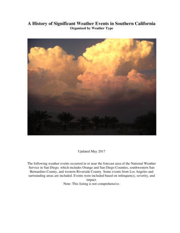
A History of Significant Weather Events in Southern CaliforniaOrganized by Weather TypeUpdated May 2017The following weather events occurred in or near the forecast area of the National WeatherService in San Diego, which includes Orange and San Diego Counties, southwestern SanBernardino County, and western Riverside County. Some events from Los Angeles andsurrounding areas are included. Events were included based on infrequency, severity, andimpact.Note: This listing is not comprehensive.
Table of ContentsHeavy Rain: Flooding and Flash Flooding, Mud Slides, Debris Flows, Landslides .3Heavy Snow, Rare Snow at Low Elevations .54Severe Thunderstorms: Large Hail, Strong Thunderstorm Winds, and Killer Lightning.63(See flash flooding in heavy rain section)Tornadoes, Funnel Clouds, Waterspouts, and Damaging Dust Devils .75Strong winds .90(For thunderstorm related winds, see severe thunderstorms)Extreme Heat 103Extreme Cold 111High Surf, Stormy Seas, Tsunamis, Coastal Flooding and Erosion 114Miscellaneous: Dense fog, barometric pressure, dry spells, etc .119
Heavy Rain: Flooding and Flash Flooding, Mud Slides, Debris Flows,LandslidesDate(s)WeatherAdverse Impacts1770, 1772,1780, 1810,1815, 1821,1822, 1825,1839, 1840,1841,18422.1850Various reports from missionsindicate significant flooding alongthe Los Angeles, Santa Ana andSan Diego Rivers, often changingthe entire courses.2.1852“Moderate flood resulted fromunprecedented rain in themountains. A severe flood year inSouthern California”.Extensive wind damage to property(F2). Streets swept clean by heavyrains.“Moderate floods occurring in theSanta Ana River Basin.”10.2.1858Category 1 hurricane hits San Diego,the only actual hurricane on record tostrike the U.S. West Coast. Impliedwinds of 75 mph.12.24.18611.23.1862Epic floods termed the “NoachianDeluge of California”. It rained 30days in succession, beginning12.24.1861 to 1.23.1862. 35” fell inLA. In San Diego over 7” fell inJanuary alone.3.30.1867Heavy rains hit San BernardinoCounty.4.1867A thunderstorm over Cajon Passdropped heavy rain for 30 minutes.The Santa Ana River in Anaheimran 4’ deep and spread in anunbroken sheet to Coyote Hills, 3miles beyond (present Fullerton).The LA River mouth shifted fromVenice to Wilmington. The worstflooding in San Diego Countyoccurred after six weeks of rain. Allof Mission Valley was underwater,Old Town was evacuated. The tidebacked its waters into the SanDiego River and cut a new channelinto the bay. 20 died in OrangeCounty.Flooded barley fields. Severalhomes were destroyed or damaged.Lumber mills in Mill Creek andSanta Ana canyons were destroyed.Flash flooding and debris flowsfour feet deep rushed down thecanyon and destroyed a roadleading to mountain mills.
12.18678.11-12.1873Torrential rains hit the San BernardinoMountains. Lytle Creek and CajonCreek united to form a river 180 feetwide in places, and 15 to 20 feet deep.Warm Creek and City Creek unitedand was half a mile wide. The SantaAna was raging.1.95” fell in San Diego from a tropicalstorm. 1.80” fell on 8.12, the wettestcalendar day in August on record.1.72” fell in Paradise Valley (SE SanDiego). Nearly 3” fell in “CajonRanch”. This was called the greatestsummer rainfall in history. Theprevious daily August rainfall recordwas 0.31” in 1867.12.4.18732.52” of rain fell in San Diego, theninth wettest calendar day on recordand the third wettest December day.1.1876Heavy rains.11.9.18792.68” of rain fell in San Diego, thefifth wettest calendar day on recordand the wettest November day.12.29-30.18794.23” fell in San Diego in 48 hours,the heaviest storm in 30 years.12.18.1880Heavy rains.1.12.18822.49” of rain fell in San Diego, thetenth wettest calendar day on recordand the second wettest January day.4.75” fell in Poway.Farm lands, orchards, vineyardsand buildings were destroyed.1’ of water was reported on theground at “Cajon Ranch”.A great flood occurred inundatingwide areas between Anaheim andWestminster.San Diego streets flooded.
5 ” of rain falls in Spring Valley.Fallbrook gets heavy rain (more than15” in the month). Rains continued allduring the spring with disastrousresults. This helped produce thewettest February in San Diego history(9.05”). It is the third wettest monthon record (wettest: 9.26” in 12.1921).The 1883-84 season ended as thewettest in San Diego history with25.97”.A heavy thunderstorm struck theCajon Pass area.Flooding and damage to crops,livestock and railroads in the area,including Temecula Canyon. SanDiego River “booming” throughMission Valley on 3.10.1884. TheSanta Ana River cut a new channelto the sea three miles southeast.11.21.1884A heavy winter storm brought fourinches of rain to LA, and six inches toCajon Pass.Newly laid railroad track waswashed out. Numerous mud slides.7.14.1886LA records its greatest 24 hr rainfallamount for July: 0.24”.12.18861.1887Heavy winter rains inundate westernSan Bernardino. One night in 1.188711 inches of rain fell in Cajon Pass.8.31.1889LA records its greatest 24 hr rainfallamount for August: 0.61”.10.12.1889A monsoon-type thunderstormbrought 7.58” to Encinitas in 8 hrs.0.44” fell in San Diego.2.19-23.189133” of rain was reported in Descansoin a 60 hour period. 2.56” in SanDiego. From 2.16 to 2.25, a total of4.69” fell in San Diego. ReverendFather Ubach of St. Joseph’s hadprayed for rain on 2.2.1891. Rain fellon snow in the San BernardinoMountains. 4.53” fell in SanBernardino on 2.23.2.14-20.18847.1884Flash flood waters rose to 50 feetdeep. Severe erosion occurredripping out an orchard, railroadlines and roads.A blocked culvert swamps entireSan Bernardino neighborhoods.Railroads were buried in mud inCajon Pass.Heavy damage and losses to homes,land, livestock, transportation andpower throughout the Tijuana andSan Diego River Basins. The worstwas flooding along the TijuanaRiver where all structures wereswept away and a man was killed.Three prospectors died at TableMountain in Baja California. SanBernardino and Riverside becameisolated as all railroad and highwaybridges were out for two to threeweeks. Lake Elsinore overflowed.
8.11.1891Thunderstorms above Redlands andRialto dropped intense rain.Flash floods in the Zanja drainagecrossed a street at ten feet deep.Some squatters and Indians weredrowned and their tents andbelongings were washed intoRedlands. Rialto and SanBernardino also reported debrisflows.8.12.1891Two thunderstorm cells merge. 16.10”at Campo; 11.50” in 80 minutes, arecord 80 minute rainfall for the state(and at one time the record 80 minuterainfall for the nation).3.23.1893Heavy rain around San Bernardino.Railroads were washed out as was abridge in town.12.1894Heavy rain.A flood took out a trestle betweenRialto and San Bernardino. MillCreek and the Santa Ana River alsoflooded.12.9.1898Heavy rain.Railroad washed out and ½ milecovered in mud in Rose Canyon,near Pacific Beach. A trestle inChollas was washed out. “Severalhundred dollars” in damage.7.20-21.1902A dying tropical cyclone brought 2” ofrain to the mountains and deserts ofSouthern California during a verystrong El Niño event of 1901-02.7.25.19020.83 inch of rain fell in San Diego, thewettest calendar day in July on record.4.1.1903At least 3.06 inches of rain fell in SanBernardino. Rain fell on snow in thehigh country.Bridges and roads were washed out.A man using a cable car fell intothe Santa Ana River and drowned.
1905-1907Heavy rainfall in 1905 in the ColoradoRiver basin.2.4-6.1905Heavy rains caused the San DiegoRiver to run for the first time in sixyears. 4.23” fell in San Diego in 43hours.3.15.19050.94” fell in San Diego in 30 minutes,the greatest 30 minute rainfall onrecord.3.24-25.19062.36” of rain fell in San Diego onWidespread flooding in Fallbrook.3.24, the wettest calendar day inStreets flooded and roads washedMarch on record. Almost 1” in threeout in the San Diego Metro area.hours. 7.48” fell at Cuyamaca, 4” atEscondido, Oceanside and Ramona,3” in El Cajon and Lakeside. Stormtotals: 6.41” in Oceanside, 6.30” inEscondido, and 2.78” in San Diego.Six day storm totals: 13.83” atCuyamaca, 3.29” in San Diego.A tropical storm came up into the Gulfof California and the southwesternUnited States, giving the mountainsand deserts heavy rainfall. Needlesreceived 5.66” of rain, twice thenormal of seasonal rainfall. Thisoccurred during the El Niño of 190506.8.18-19.1906The Colorado River swells andeventually breaches an ImperialValley dike. It took nearly twoyears to finally control the River’sflow into the Salton Basin and stopthe flooding. The result of thesudden influx of water and the lackof natural drainage from the basinresulted in the formation of theSalton Sea.12.1906A heavy storm dropped 2.5 inches onSan Bernardino in 24 hours.Runoff flooded San Bernardino. Arailroad was washed out betweenHighland and Redlands.1.10.1907A warm rain fell on snow.Flood around San Bernardino.
1.21-22.19094.53 inches of rain fell in SanBernardino. At Pine Crest (Crestline)7.00 inches fell in 24 hours. AtWaterman Canyon 4.11” in 24 hours.Heavy thunderstorm in the SanBernardino Mountains.Lytle Creek, Waterman Canyon andthe Santa Ana River all flooded.Railroad damage occurred in MillCreek and Colton.Flood waters damaged businessesin San Bernardino.12.31.19091.1.1910Heavy rain storm. 4.23” of rain fell inSan Bernardino.1.18.1914Heavy rain storm. Almost 9 inches ofrain fell at Lytle Creek, 0.64 inch inSan Bernardino. (Flooding rainscontinued through 2.21).The remnants of a tropical cyclonemoved northward across northern BajaCalifornia into the deserts of southernCalifornia with rainfall of 1 inch atRiverside. This occurred during thestrong El Niño of 1914-15.Lytle Creek and the Santa AnaRiver flooded at its highest stage in20 years. Railroads were severelydamaged. Colton was isolated.Damage in San Bernardino was the“worst in history” and homes in thewest of the city were flooded.Highways, water supplies and otherutilities were damaged. A trainfrom LA plunged into the SantaAna River in Colton.Colton was flooded and isolated.Orchards, highways and railroadsdamaged all over the northernInland Empire. One was killed.8.30.19098.26.19151.14-21.1916Widespread heavy rains in SouthernCalifornia. 8.5” fell during this periodin San Bernardino. 16.71” in 24 hoursat Squirrel Inn (near Lake Arrowhead)during 1.16 and 1.17, a record 24 hourrainfall for California until 1943.12.73” fell in the Morenaneighborhood of San Diego from1.10-1.13. More than 9” fell in twostorms in the Coachella Valley.Previous storms had deposited deepsnow in the mountains, adding to therunoff.Widespread flooding. At least 22dead. Roofs in Chula Vista, poultryfarm in Vista, boats in Coronadoand Newport damaged. Most citiescompletely inundated. Pine treesfrom Palomar Mountain floatingdown San Luis Rey River throughOceanside. The cities of Indio,Coachella and Mecca underwater.Ontario and Redlands were isolatedand roads, railroads and bridgeswere washed out.
1.25-30.1916Heavy rain exacerbates the floodingearlier in the month. Monthly rainfalltotals for 1.1916 ranged from 7.56” atSan Diego to 57.91” at Dorman’sRanch (in San Bernardino Mtns.,2,500’ elev.) 5” fell in less than 12hours in San Diego.8.20-21.1921The remnants of a tropical cyclonetracked northward into westernArizona from central Baja Californiagenerating rainfall of up to 2” in thedeserts and southern mountains ofsouthern California. This occurredduring the La Niña of 1920-21.9.30.19214” of rain fell on the deserts ofSouthern California as a result of adying tropical cyclone that crossedBaja California and moved intosouthwestern Arizona. 1.23” of rainfell in San Diego, the wettest calendarday in September on record.12.24-26.1921Heavy storm. 6.76” in LA. On 12.262.10” fell in Redlands, 1.71” in SanBernardino. From 12.17 to 12.27,30.64” fell at Squirrel Inn at LakeArrowhead.Heavy rains. 2.5 inches fell in SanBernardino.1.1-2.1922Most extensive flooding inSouthern California to date andresulted in 28 total deaths in theregion, 22 in San Diego County.This is the most destructive anddeadly weather event in San DiegoCounty History. The Lower Otaydam broke sending a 40’ wall ofwater downstream, killing 15. Afew others drowned in MissionValley and in the San Luis ReyRiver. The Sweetwater Dam alsobroke. Every large bridge in SanDiego County but one wasseriously damaged or destroyed.Four drowned in Orange County,two in a cottage floating down theSanta Ana River. Two drowned inSan Bernardino County. Totaldamage was nearly 8 million(1916 dollars).Flooded roads, bridges, railroads.Lake Arrowhead rose seven feet.Flooded roads, bridges, railroads.Santa Ana River rose three feet.
7.18.19227.10” of rain fell in Campo.10.4-5.1925On 10.4 2.95” fell at San Diego, thesecond wettest calendar day on recordand the wettest in October. On 10.52.75” fell in Palm Springs, the greatestdaily amount on record for October.3.23” at San Diego, the second wettestcalendar day on record. Other shortperiod rainfall records broken: 0.28”in five minutes, 0.75” in 30 minutes,1.16” in one hour, and 2.09” in 2hours. 0.65” fell in one minute atOpid’s Camp in the San GabrielMountains, the greatest one minuterainfall in state history. 3.85” fell inSan Bernardino, the greatest Aprilrainfall in 45 years. Monthly singleday rainfall records were set in Julian(3.70”), Riverside (3.07”), and Indio(0.76”).Continual rain for 6 days. 25.38” fellat Henshaw Dam (14.18” on 2.16),21.86” at Cuyamaca, 13.10” at ElCapitan, 10.70” at El Cajon, 9.54” atLa Mesa and 6.33” at San Diego.8.30” fell in San Bernardino and 5.60”in Riverside. On 2.15 5.28” fell inElsinore, the greatest daily rainfall onrecord. On 2.17, 12.81” at Cuyamaca,2.65” at El Capitan, 2.20” at El Cajon,1.47 at La Mesa. On 2.14 at midday,San Diego received 0.80” in 45minutes, and 0.25” in 5 minutes.Heavy warm rains melted mountainsnows. Snow Creek recorded 7” ofrain in one day.4.5.19262.11-17.1927Probably some flash flooding.Floodwaters and mud up to fourfeet deep inundated the eastern partof downtown San Diego andNational City, displacing 150families. Flood waters damaged andclosed all highways in the SanGabriel and San BernardinoMountains.Unprecedented flow of theWhitewater River. Floods washedout roads and bridges in ThousandPalms and Palm Desert. Leveesbroken, Thermal inundated. SeveralSan Diego County damsovertopped, causing widespreadflooding downstream. Bridges androads were washed out in east SanDiego metro area. In San Diego’snorth county, roads and bridgeswere wiped out, stranding residentsfor days. The San Dieguito Riverwashed out a section of hwy. 101.San Diego and Tijuana wereisolated for several days. Cropswere carried out to sea. In SolanaBeach Children rowed downCedros Ave in makeshift canoes.Large areas of Long Beach,Fullerton and Anaheim inundated.
9.18.1929A tropical cyclone moved northnorthwest just off the west coast ofBaja California, dissipating off thecoast of northern Baja California.Rainfall of up to 4” occurred in thesouthern mountains and deserts ofsouthern California on 9.18.5.1930Three inches of rain fell from a singlecloudburst in the Encinitas –Olivenhain area.A haystack was washed to theocean.12.29.1931Heavy rains hit the San BernardinoMountains.2.9.1932A heavy rainstorm hit San Diego’snorth county and the Inland Empire.9.28-10.1.1932Four days of heavy rains from a dyingtropical cyclone brought flooding toparts of the mountains and deserts ofsouthern California. Rainfall of 4.38”fell at Tehachapi in 7 hours on 9.30and four day storm total was 7.10”.This occurred during the El Niño yearof 1932-33.Waterman and East Twin Creekswere raging torrents, causingseveral mudslides and washingseveral cabins from theirfoundations. Thirteen mudslidesalong Rim of the World Drive.2.5 feet of water spilled overHodges Dam, flooding the SanDieguito Valley. All roads wereimpassable and so was the railroadat Sorrento Valley. One womandrowned in Loma Linda when herbus was caught in floodwaters.Some highways and bridges wereclosed. The Santa Ana River ran500 feet wide at Riverside.Flooding to parts of the mountainsand deserts. Floods on AguaCaliente and Tehachapi Creeksaround Tehachapi resulted in 15deaths.
12.30-1.1.1934A major storm. 7.36” in 24 hrs at LA(8.26” storm total since 12.30.1933).Storm totals in southern slopes ofmountains topped 12” (heaviest:16.29” in Azusa). Daily totals on 1.1:6.21” at Fullerton, 6.90” Placentia,5.16” Yorba Linda, 4.69” Buena Park,5.04” Anaheim, 5.38” Orange , 4.81”Garden Grove, 3.24” Newport Beach,2.96” Laguna Beach, 3.55” San JuanCap., 3” San Clemente, 2.65”Redlands, 2.68” Oceanside, 1.56”Carlsbad, 2.44” Escondido, 0.67” SanDiego , 0.48” Victorville.8.25.1935A tropical cyclone tracked northwardacross southern and central BajaCalifornia. The remnants spread intoArizona generating rainfall of up to 2”in the southern valleys, mountains,and deserts.8.9.1936A tropical cyclone tracked northnorthwestward across the Gulf ofCalifornia with the remnants trackingnorthward into western Arizona.Locally heavy rainfall occurred in themountains surrounding LA.2.4-7.19372.71” of rain fell in San Diego on 2.6,the third wettest calendar day and thewettest February day on record. 2.60”fell in 12 hours. For the storm, 8.20”fell in Descanso, 5.70” in Escondido.4.25” fell in Long Beach, a 24-hrrecord.45 die all over Southern Californiain floods. Walls of water and debrisup to 10’ high were noted in somecanyon areas.Flooding kills several. LA basinflooded in many communities.Hodges Dam overtopped. Mountainsnowmelt added to the flooding.
2.27-3.4.1938Storm of tropical origin. 11.06” at LA.More than 30” at several mountainstations of San Gabriel and SanBernardino Mountains (32.2” atKelly’s Kamp 8,300’ elev.). Morethan 22” in the Santa Ana Riverheadwaters. Considerable snow wasmelted, adding to the runoff. This ledto unprecedented flood control efforts,including a network of dams andcanals and concrete channels. On 3.32.80” fell at Descanso, 2.47” atEscondido, where the storm total was6.95”.210 reported dead or missing inflooding across SouthernCalifornia. 45 in Orange County, ofwhich 43 perished in MexicanAmerican Atwood from an 8 ft.wall of water. Hundreds injured.Santa Ana River floods, inundatesnearly all of northern OrangeCounty. Catastrophic damage tomore than 1,500 residences. 400cabins and buildings washed awayin and around San Antonio Canyon.Whitewater River floods, isolatesPalm Springs.7.27-28.1939A severe thunderstorm hit Needleswith 1.46” in nine hours from 6 pm to3 am.The remnants of a hurricane trackednortheastward across northern BajaCalifornia into southwest Arizonagenerating rainfall of up to 7” on themountains and deserts. Blythereceived more rain than wouldnormally fall in 1 year and Imperialreceived more rain than wouldnormally fall in 2 years. Four tropicalcyclones would impact SouthernCalifornia during the month ofSeptember 1939, an unprecedentedoccurrence. 1.21” fell in San Diego.Flash floods and debris flowsdamaged homes and businesses.9.8.1939A thunderstorm dropped 2.70” of rainon Needles. This was the first in aseries of storms to hit Needles with8.50” this month, almost double theentire seasonal average.Flash floods and debris flowswashed through city streets andwashed out railroads and highways.Several residences and a fewbusinesses were damaged.9.11-12.19394” of rain fell across the deserts andmountains as a dying tropical cyclonemoved across Baja California intosouthwestern Arizona. This was thesecond tropical cyclone to affectCalifornia during the busy month ofSeptember 1939. A strong El Niñocontributed to the activity.9.4-6.1939Floods through eastern canyonsinundate Thermal with 3’ of water.Extensive damage in Mecca.
9.19-21.1939A tropical cyclone movingnorthwestward, just off the west coastof Mexico, moved into southern BajaCalifornia and dissipated. Themoisture from this tropical cyclonegenerated rainfall of up to 3” in thedeserts and mountains.9.24-26.1939“El Cordonazo” or “The Lash of St.Francis” a tropical storm hits SouthernCalifornia and causes the greatestSeptember rainfall ever. The stormlost hurricane status shortly beforemoving onshore at San Pedro attropical storm strength. Torrentialrains: LA 5.42” in 24 hours, Mt.Wilson 11.60” (also records for themonth of September). Nearly 7” inthree hours at Indio from onethunderstorm. 9.65” at Raywood Flat,3.62” Needles, 1.51” Palm Springs. Athunderstorm preceding the tropicalstorm dropped 6.45” in 6 hours atIndio on 9.24. Needles measured8.50” this month, about double theseasonal average.0.65” rain fell in San Diego in 15minutes, the greatest 15 minuterainfall on record.45 killed in floods all over SouthernCalifornia, and 48 more at sea. 2million damage to structures alongthe coast and to crops. EasternCoachella Valley under 2’ of water.Californians were generallyunprepared and were alerted to theirvulnerability to tropical storms. Inresponse, the weather bureauestablished a forecast office forsouthern California, which beganoperations in February of 1940.3.62” at San Diego, the greatest 24hour rainfall on record. Chula Vistarecorded a one day rainfall of 3.67”,the highest for any day on record andonly the second rainstorm of morethan 3” on record in a single day.Elsinore (3.34”) and Indio (2.36”) setdaily records for the December.A heavy storm hit the San GabrielMountains and Mojave Desert.Victorville received 1.78”. Furthersouth, San Diego received 3.35”, thelargest three-day rainfall total onrecord in March.Heavy rains loosened soil in DelMar that led to a landslide along atrain track, derailing the train andkilling three.11.27.193912.23-24 .19403.12-14.1941The Mojave River flooded homesin the Oro Grande Wash. InWrightwood three houses weredestroyed from a mudslide in HeathCanyon. Mud and debris 6’ deepcovered Lone Pine Road.
8.9.1941A heavy thunderstorm struck Needles.Flash floods and debris flowsdamaged streets and highways.Several motorists were stranded,but no one was hurt.8.10.1941Thunderstorms in eastern CoachellaValley.Buildings damaged. Water 30”deep in Mecca.10.13.1942A midnight thunderstorm hit Uplandwith 2.25” of rain in just over onehour.1.23-24.194326.12” fell in 24 hours at HoegeesCamp in the San Gabriel Mountains,setting the state 24 hour precipitationrecord. More than 28” fell for thestorm at Camp Baldy, 14.28” inUpland, 7.23” in San Bernardino,4.56” at Palm Springs, and about 3” inVictorville.Heavy rainstorms hit the SanBernardino Mountains and InlandEmpire. Over four days LakeArrowhead received 13.36” and Perris4.87”.A major storm struck the SanBernardino Mountains and nearbyareas. During one eleven hour period,5.25” of rain fell in Crestline.Victorville had a storm total of 1.82”.An incredible thunderstorm complexbrought 3.90” of rain to TwentyninePalms in about three hours.Mud and debris washed downEuclid Avenue and flooded at leastone home. Four calves at anOntario dairy were washed away.Lytle Creek flooded, killing oneand forcing 150 families in SanBernardino and Colton to evacuate.Other roads and bridges in this areawere damaged or undermined. Allhighways surrounding Victorvillewere blocked.2.21-24.19433.3-5.194310.9.1943Damage was light because of recentwork done on flood channels.Only minor flood damage andclosed roads around Fontana.Flash floods and debris flowsblocked roadways and trappedvehicles. One house was seriouslydamaged.12.10.19432.56” of rain fell at San Diego, theeighth wettest day on record and thesecond wettest December day.2.21.1944A heavy storm struck San BernardinoCounty.Minor flooding problems aroundLytle Creek. A few bridges werewashed out around Victorville.8.18.1945Remnants of a hurricane producedthunderstorms in eastern CoachellaValley.Extensive damage at Oasis. Water18” deep in Mecca.
9.2.1945A heavy thunderstorm hitWrightwood.9.9-10.1945A tropical cyclone moving northnorthwestward just off the west coastof Baja California dissipated off thecoast of northern Baja California.Showers produced rainfall up to 2” inthe mountains.12.22.19452.60” of rain fell in San Diego, thesixth wettest calendar day and thewettest December day on record.Minor flooding closed some roadsand bridges around San Bernardino.7.30.1946A heavy thunderstorm struckTwentynine Palms.One house was destroyed by a wallof water. The garage and car in itwere carried a half mile away.9.29-10.1.1946A tropical storm moved northwardinto northern Baja California anddissipated with rainfall of up to 4” inthe mountains on 9.30 and exceeding4” in the mountains on 10.1. Thisoccurred during the El Niño of 194647. On 9.29 a particular cloudburstdropped 3” of rain in 30 minutes inSan Bernardino.A heavy thunderstorm struck Needles.On 9.29 around San Bernardino,farmlands, orchards and vineyardswere eroded and some roads weredamaged. Many homes wereflooded.8.8.19472.5.1948One residence was destroyed anddebris covered Lone Pine Road.Serious damage done to highwaysand railroads, including highway66.Steady rain and mountain snow hitSouthern California after a long dryspell. San Bernardino recorded 2.14”from this storm. Only 5.75” wasrecorded before this storm in theprevious year.An unseasonal thunderstorm broughtheavy rain to San Bernardino.Streets in northern San Bernardinoflooded.7.23.1948Thunderstorms in Palm Desert and LaQuinta.Homes flooded. Erosion damage toroads and canals.2.6.1950Heavy rain.Chino Creek inundates Hwy 71from Corona to Ontario.6.2.1948
7.6.1950A heavy thunderstorm erupted overthe Yucaipa Ridge area.8.27-29.1951A hurricane moving northnorthwestward just off the west coastof Baja California movednortheastward into northern BajaCalifornia and dissipated. Moisturefrom this tropical cyclone resulted inrainfall of 2 to 5” in the mountains anddeserts. Many roads were washed outin the Imperial Valley, but otherwiseno major damage occurred in southernCalifornia. This occurred during the ElNiño of 1951-52.1.13-18.1952Heavy rain hits Southern California ina few waves of storms. 5.52” fell inSan Bernardino over the six days. On1.18 3.17” fell in LA in 24 hours.A west-northwestward movingtropical storm southwest of BajaCalifornia dissipated. Moisture fromthis storm resulted in rainfall of up to2” in the mountains and deserts, withmost falling on 9.19. This occurredduring the El Niño of 1951-52.At least 8 died in flooded LA.Other flooding was reported inUpland and Ontario.Heavy rain dropped almost one inch inUpland.Heavy rain “averaged” about 3 inchesaround Upland and RanchoCucamonga and more than 4 inches inthe mountains.Flooding was reported in Uplandand homes were flooded in Ontario.Floods and debris flows struckthese communities and blocked ordamaged roads. Debris flows atleast 10’ deep in Arcadia nearlykilled people. Large boulderssmashed into homes. These debrisflows followed wildfires in the SanGabriel Mountains.Flood waters came down SanAntonio Canyon into Upland andRancho Cucamonga. A rescue wasmade of a couple. Debris flows upto two feet deep and flooding struckthese communities. Rock slidesclosed Rim of the World Highwayand City Creek 954A second heavy rain storm in a weekstruck Southern California.The rain fell on denuded slopesfrom a 640 acre wildfire on 6.30 inOak Glen. Mud and debris flowedinto Yucaipa.
7.12.1954Heavy thunderstorms struck theMorongo Basin.Flash floods hit Morongo Valley,Yucca Valley, and TwentyninePalms. Numerous roads wereseverely damaged and closed. Someroads were left covered in sand andmud.7.16-19.1954A northward moving hurricane madelandfall in central Baja California withthe remnants moving into Arizona.Rainfall of up to 2” occurred in themountains and deserts. This occurredduring the El Niño of 1953-54.On 7.16 a severe thunderstormstruck the Daggett area east ofBarstow. Eight miles of Hwy. 66were flooded. The highway wasalso flooded near Hinkley with 18”of water.11.10.1954A heavy storm dumped 2” of rain onSan Bernardino and up to 6” in thenearby mountains.Flash floods and debris flowscovered the mountains.Floodwaters inundated many partsof San Bernardino and mud slidesblocked and damaged mountainroads.7.19.1955Heavy thunderstorms struck desertareas of Twentynine Palms andBarstow. One cloudburst hit CherryValley with 3” of rain in 30 minutes.A 75’ stream of water crossed Hwy.66 at Hodge, southwest of Barstow.Washouts were also reportedaround Twentynine Palms.7.28.1955A heavy thunderstorm dropped morethan 2” of rain in Needles.Flooding at a railroad underpass 10’deep made a small lake. Rushingwater a quarter mile wide trapped acar, but occupants were rescued.8.4.1955Thunderstorms strike Barton Flats andNeedles.8.14.19558.23.1955Flash floods washed out a road andcaused minor slides around BartonFlats. In Needles, flash floodswashed out Hwy. 66 and damagedrailroads. 100 people were madehomeless as many washes turnedinto raging torrents.Heavy thunderstorms struck ForestTorrents of water up to 6’ deepHome (now Forest Falls) and Barstow. swept down Mill Creek Canyonleaving up to 5’ of sand and rockson the road. Huge boulders rolledonto the roadways.Heavy thunderstorms hit the SanHighways 66 and 91 were blockedBernardino Mountains and deserts.by “wide rivers” of flash floodwaters. Rocks and mud coveredroadways west of Barstow and inForest Home (Forest Falls).
1.25-27.1956A heavy storm in Southern Californiadropped 13.74” in Lake Arrowhead,7.97” in LA, 7.27” in Santa Ana,7.06” in San Bernardino, 4.00” inRiverside, 1.14” in San Diego, and0.74” in Palm Springs.4.18.1956Heavy thunderstorms struck Barstowand Victorville with an estimated1.25” of rain. One quarter inch hailwas also reported covering the ground.7.23-28.1956Strong monsoon flow hit the regionwith thunderstorms each day, evenwest of the mountains. On 7.24 anevening thunderstorm hit Barstowwith an estimated one inch of rain in30 minutes. Heavy
Rialto dropped intense rain. Flash floods in the Zanja drainage crossed a street at ten feet deep. Some squatters and Indians were drowned and their tents and belongings were washed into Redlands. Rialto and San Bernardino also reported debris flows. 8.12.1891 Two thunderst
