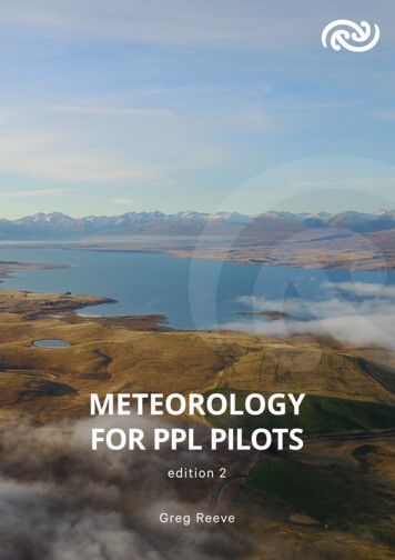
Transcription
AVIATION WEATHER – METEOROLOGYWHAT THE FAA REQURES YOU TO KNOW ABOUT AVIATIONMETEROLOGY.You must have knowledge of elements related to weather information by analyzingweather reports, charts, and forecasts from various sources with emphasis on: METAR, TAF, and FA Surface Analysis Charts Radar Summary Charts Winds and Temperature Aloft Charts Significant Weather Prognostic Charts Convective Outlook Charts AWOS, ASOS and ATIS ReportYou must be able to make a competent “go/no-go” decision based onavailable weather information.To enable you to do this we must study weather theory, patterns, hazards,forecasting, printed/ and graphic weather products, and sources of weather info.Sport Pilot Ground School 2008Created by Steve Reisser
Know US Time Zones (continental)PSTMSTCSTEST(FL)-3-2-1***-1**TO** 1 2Types of TimeCivilian (Local) AM and PMMilitary 00:01 to 24:00, Civilian time 1 PM become 13:00 (PM time 12)ALL aviation reporting are given in Universal Coordinated Time (UTC)which is designated as Zulu (Z) This is GMT (Greenwich Mean Time)To convert Local to Zulu as you will do in preparing a flight plan:1. Convert Local to Military2. Add Zulu Offset (Florida for EDT 4, EST 5)To convert Zulu to Local as you will do in interpreting weather reports1. Subtract Offset (Florida EDT -4, EST -52. If hour is greater than 12, then subtract 12Likely problem on Aeronautical Knowledge Exam involving conversionTake off from Denver at 1PM (MDT) and fly to Ogallala NE (CDT)Depart at 1 PM for 2 hour flight. What is the ETA in Zulu Time?a. What is the Z time at Denver (1 PM) military time is 13:00 then add 6 1900Zb. What is the estimated time of arrival (ETA) at Ogallala 19 2 2100ZWhat is local time at Ogallala? 2100-5 1600, -12 4 PMReturn to Denver departing 2200Z, what is local ETA at Denver?a. 22 2 24Z, -6 for Zulu offset 18:00 mil, -12 for local time is 6 SavingsLocal Z 7 6 5 4Z Local-7-6-5-4StandardLocal Z 8 7 6 5Z Local-8-7-6-5Sport Pilot Ground School 2008Created by Steve Reisser
METEOROLOGY – BASIC WEATHER THEORY1. CHANGES IN OUR ATMOSHERE OCCUR BECAUSE OF THE SUN2. 95 PERCENT OF ALL ACTIVE WEATHER HAPPENIN THE TROPOSPHERE (AVERAGE 36 MILES[Higher at equator, lower at poles).3. Air has weight and exerts 14.7 lbs/sq. inch at the sea levelMeasured by as Standard Pressure of 29.92 inches ofmercury and also as 1013.2 Millibars of pressure.Cooler, less dense (lower pressure)Pressure drops 1” per 1000 ftTemperature drops 2 C per 1000 ftWarmer & more dense(higher pressure)4. TEMPERATURE RISES WHEN HOT AND FALLS WHEN COOLReferred to as “Convective Heating and Cooling.”Sport Pilot Ground School 2008Created by Steve Reisser
Pressure AltitudePressure altitude is the height above a standard datum plane (SDP), which is atheoretical level where the weight of the atmosphere is 29.92 "Hg (1,013.2 mb) asmeasured by a barometer.Density AltitudeSDP is a theoretical pressure altitude, but aircraft operate in a nonstandardatmosphere and the term density altitude is used for correlating aerodynamicperformance in the nonstandard atmosphere. Density altitude is the verticaldistance above sea level in the standard atmosphere at which a given density is tobe found. The density of air has significant effects on the aircraft’s performancebecause as air becomes less dense, it reduces: Power because the engine takes in less air. Thrust because a propeller is less efficient in thin air. Lift because the thin air exerts less force on the airfoils.Effect of Pressure on DensitySince air is a gas, it can be compressed or expanded. When air is compressed, a greateramount of air can occupy a given volume. If the pressure is doubled, the density isdoubled; if the pressure is lowered, the density is lowered.Effect of Temperature on DensityIncreasing the temperature of a substance decreases its density. Thus, the density of airvaries inversely with temperature. This statement is true only at a constant pressure.Effect of Humidity (Moisture) on DensityWater vapor is lighter than air; consequently, as the water content of the air increases,the air becomes less dense, increasing density altitude and decreasing performance.
METEOROLOGY – BASIC WEATHER THEORYTroughHighsLowsRidgeHigh: Area of higher pressure surrounded by area of lower pressureElongated area of high pressure is called a “Ridge.”Low: Area of lower pressure surrounded by area of high pressureElongated area of low pressure is called a “Trough”Elongated area of neutral pressure (intersection of Ridge & Trough)is called a “Col”Isobars reveals the pressure gradient or change in pressure over distance.Sport Pilot Ground School 2008Created by Steve Reisser
Isobars and Pressure Gradients Difference in pressure create WIND. The closer the isobars the higherthe pressure gradient and associated winds.
METEOROLOGY – BASIC WEATHER THEORYCORIOLIS EFFECTSport Pilot Ground School 2008Created by Steve Reisser
METEOROLOGY – BASIC WEATHER THEORYFRICTIONAL FORCESCounter-ClockwiseWind H- L Pressure GradientClockwiseFrictional effects at surfacefurther alter Coriolis and pressuregradient movement of windSport Pilot Ground School 2008Created by Steve Reisser
Take advantage of winds from pressure regions.
Convective currents cause the bumpy, turbulent air sometimes experienced whenflying at lower altitudes during warmer weather. On a low altitude flight overvarying surfaces, updrafts are likely to occur over pavement or barren places, anddowndrafts often occur over water or expansive areas of vegetation like a group oftrees. Typically, these turbulent conditions can be avoided by flying at higheraltitudes, even above cumulus cloud layers.
METEOROLOGY – PLANETARY BOUNDRY LAYERThe planetary boundary layer (PBL) is also known as the atmospheric boundary layer(ABL) is a marked thermal layer at approximately the 850 ML level (5000-7000). Youwill see a marked drop in temperature because of a thermal inversion right at the PLB.Due to aerodynamic drag, there is a wind gradient in the wind flow just a few hundredmeters above the earth's surface—the surface layer of the planetary boundary layer. thewind gradient effect could cause a reduction of 40% to 50% of the geostrophic windspeed aloft (balance between the Coriolis effect and the pressure gradient) while overopen water or ice, the reduction may be only 20% to 30%. Wind speed increases withincreasing height above the ground.Be aware that when we look at Winds Aloft (FB)forecasts. You are likely to see marked changesin air temperature and wind speed betweenpublished 6000 and 9000 foot forecasts.
METEOROLOGY – BASIC WEATHER THEORYGLOBAL WIND FORCESConvective Heating and Cooling sets up basic global circulation patternsSport Pilot Ground School 2008Created by Steve Reisser
METEOROLOGY – LOCAL WIND FORCES
METEOROLOGY – LOCAL WIND FORCESEffect of Obstructions on WindAnother atmospheric hazard exists that can create problems for pilots. Obstructions on the ground affect the flowof wind and can be an unseen danger. Ground topography and large buildings can break up the flow of the windand create wind gusts that change rapidly in direction and speed. These obstructions range from manmadestructures like hangars to large natural obstructions, such as mountains, bluffs, or canyons. It is especiallyimportant to be vigilant when flying in or out of airports that have large buildings or natural obstructions locatednear the runway.
METEOROLOGY – LOCAL WIND FORCESMountains: While the wind flows smoothly up the windward side of the mountain and the upward currents helpto carry an aircraft over the peak of the mountain, the wind on the leeward side does not act in a similar manner.As the air flows down the leeward side of the mountain, the air follows the contour of the terrain and is increasinglyturbulent. This tends to push an aircraft into the side of a mountain. The stronger the wind, the greater thedownward pressure and turbulence become.Due to the effect terrain has on the wind in valleys or canyons, downdrafts can be severe. Before conducting aflight in or near mountainous terrain, it is helpful for a pilot unfamiliar with a mountainous area to get a checkoutwith a mountain qualified flight instructor.
METEOROLOGY – LOCAL WIND FORCESSEA BREEZES(off the sea)LAND BREEZES(off the land)Sport Pilot Ground School 2008Created by Steve Reisser
METEOROLOGY – BASIC WEATHER THEORYLOCAL WIND FORCESValley BreezesMountain BreezesCOLD AND WARM DOWNSLOPE WINDS (KATABATIC)CAN BE UP TO 50 KNOTS.DO NOT FLY IN OR NEAR MOUNTIANS WITHOUT SPECIAL FLIGHTINSTRUCTION. SERIOUS CONSEQUENCES IF YOU ARE NOT FULLYPREPARED FOR THIS AND OTHER HAZARDS (I.E. LENTICULAR CLOUDS)Sport Pilot Ground School 2008Created by Steve Reisser
METEOROLOGY – WEATHER PATTERNSSTABILITYStability is the resistance to vertical motion. Florida is not a stable environmentexcept during winter. CONVECTION (heat rising and producing high instability)Stable air cools at a rate less than standard lapse rate, unstable air cools at rategreater than standard lapse rate.Produces average “Lapse Rate”Adiabatic Heating/Coolingof -2 C or -3.5 F per 1000 feet.Standard Temperature at Sea Levelis 15 C or 59 F.1.2.3.4.General rule for estimating standardatmospheric temperature (C) up to35,000 feetDouble the altitude.Divide by 1,000.Subtract 15.Change the sign.INVERSIONS work backwards. Increase temperature with altitude to the “roof” of the inversionlayer.Created by Steve ReisserSport Pilot Ground School 2008
Atmospheric StabilityThe stability of the atmosphere depends on its ability to resist vertical motion.It is determined by the “Adiabatic” lapse rateAdiabatic heating and adiabatic coolingRising air expands and cools due to the decrease in air pressure as altitude increases. The opposite is true ofdescending air; as atmospheric pressure increases, the temperature of descending air increases as it iscompressed.The rate at which temperature decreases with an increase in altitude is referred to as its lapse rate. As airascends through the atmosphere, the average adiabatic lapse rate of temperature change is 2 C (3.5 F) per1,000 feetSince water vapor is lighter than air, moisture decreases air density, causing it to rise. Conversely, as moisturedecreases, air becomes denser and tends to sink. Since moist air cools at a slower rate, it is generally less stablethan dry air since the moist air must rise higher before its temperature cools to that of the surrounding air. The dryadiabatic lapse rate (unsaturated air) is 3 C (5.4 F) per 1,000 feet. The moist adiabatic lapse rate varies from 1.1 C to 2.8 C (2 F to 5 F) per 1,000 feet.InversionsInversion layers are commonly shallow layers of smooth, stable air close to the ground. The temperature of the airincreases with altitude to a certain point, which is the top of the inversion. The air at the top of the layer acts as alid, keeping weather and pollutants trapped below. If the relative humidity of the air is high, it can contribute to theformation of clouds, fog, haze, or smoke, resulting in diminished visibility in the inversion layer.
Characteristics of stable and unstable airStableUnstableTemperature decreasesas altitude decreases(inversion)Little or noneMore than normal so airrises as soon as liftingaction occursCloudsStratiform (flat, layered)Cumuliform (billowy,cumulus)TurbulenceRelatively littleTurbulent, yShowery, intermittent
METEOROLOGY – WEATHER PATTERNSMOISTUREEVAPORATIONLiquid to VaporCONDENSATIONVapor to LiquidSUBLIMATIONIce to VaporDEPOSITIONVapor to IceFREEZINGWater to IceMELTINGIce to WaterHUMIDITY – Amount of moisture in air. “Relative Humidity” is the actual moisture compared to thetotal that could be present in the air.DEWPOINT – Temperature where air can no longer hold water (just above 4F, expect fog)Calculation for expected cloud base AGL ((Temp(F) – Dew point(F)) / 4.4) * 1000We divide by 4 as an average because unsaturated air cools at 3/1000ft, two point decreases at1/1000 ft. Thus in convective current the dew point converges at about 4.4 degrees (2.5C)/1000 ftEx: temp 82F, dewpoint 62 [diff 20). Divide by 4 5 * 1000 give expected level clouds at 5000 AGL.FOG OCCURS WHEN TEMPERATURE IS WITHIN 2 DEGREES OF DEWPOINT !!Fog is a cloud that begins within 50 feet of the surface. More later on Fog.Sport Pilot Ground School 2008Created by Steve Reisser
METEOROLOGY – WEATHER PATTERNSCLOUDSStratus clouds (Stratoform) - no vertical development – flat but can be puffyCumulous clouds (Cumuloform) - vertical development – puffyCirrus clouds – very, very high and composed of ice – wisp appearance.Low Level clouds – SL to 6,500 feetMiddle Level clouds – 6,500 to 20,000 feet (clouds usually prefixed “alto”High Level clouds – above 20,000 feet (clouds always cirrus [cirroform]) Cumulus—heaped or piled clouds Stratus—formed in layers Cirrus—ringlets, fibrous clouds, also high level clouds above 20,000 feet Castellanus—common base with separate vertical development, castle-like Lenticularus—lens shaped, formed over mountains in strong winds Nimbus—rain-bearing clouds Fracto—ragged or broken Alto—meaning high, also middle level clouds existing at 5,000 to 20,000 feetSport Pilot Ground School 2008Created by Steve Reisser
BASIC CLOUD TYPES
METEOROLOGY – WEATHER PATTERNSLOW LEVEL CLOUDSSport Pilot Ground School 2008Created by Steve Reisser
METEOROLOGY – WEATHER PATTERNS - LOW LEVEL CLOUDSFOG: Base within 50 ft AGLTYPES OF FOGGround: less than 20 ft thickRadiation - - - - - - - - - - - - - - - - - - - - - - - - - forms in low-lying areas on clear, calm, humid nightsin stable air associated with high pressure systems.Dissipates with rising sun.Advection: Warm moist air moving over a coolersurface Wind is required to form advection fog.Up to 15Kts intensifies, above lifts to form stratusclouds.Upslope: Warm moist air forced upa sloping land mass. Upslope and advection fog, unlikeradiation fog, may not burn off with the morning sun, butinstead can persist for days. They can also extend togreater heights than radiation fog.Steam (sea smoke): cold, dry air - - - - - - - - - moves over comparatively warmwater. Also know as precipitation inducedIce Fog Temperature is much below freezing (-25F) and water vapor forms directly into ice crystals.Created by Steve ReisserSport Pilot Ground School 2008
“Aspertus”- 1st discovered 2003 – Stratoform, now moreprevalent in Midwest and other parts of the world.
METEOROLOGY – WEATHER PATTERNSMIDDLE LEVEL CLOUDSSport Pilot Ground School 2008Created by Steve Reisser
METEOROLOGY – WEATHER PATTERNSMIDDLE LEVEL CLOUDSAltocumulus-CastlellanusSuper LenticularAltocumulus-LenticularSport Pilot Ground School 2008Created by Steve Reisser
METEOROLOGY – WEATHER PATTERNSHIGH LEVEL CLOUDSSport Pilot Ground School 2008Created by Steve Reisser
METEOROLOGY – WEATHER PATTERNSCUMULOUS CLOUDS (Vertical Development)Sport Pilot Ground School 2008Created by Steve Reisser
METEOROLOGY – WEATHER PATTERNSPRECIPITATIONCAUSES1. Condensation/Deposition: grows in weight until it falls2. Coalescence: Big drops fall thru and absorb smaller droplets.3. Ice-Crystal Process at mid-high altitudes where water can exist below freezingas evidenced by “Super Cooled Droplets” that can exist down to -40 C.TYPESDRIZZLE (DZ) and RAIN (RA)Drizzle (less than .02 inches in diameterRain (equal or greater than .02 inches.Virga – Rain that evaporates before reaching the ground.Precipitation induced fog: evaporation from falling rain (very dense)Sport Pilot Ground School 2008Created by Steve Reisser
METEOROLOGY – WEATHER PATTERNSPRECIPITATIONICE PELLETS (PL) and HAIL (GR)Ice Pellets usually are associated with inversions when precipitation at thehigher level falls down to lower temperatures below and begin to freeze intosmall ice pellets. EXPECT FREEZING RAIN ABOVE !!! Also-most oftenassociated with warm fronts rather than cold fronts.Hail is caused by vertical cloud development (cumulonimbus) and ice grows tosuch a size as cannot be help up any longer. Can get up to 5 inches – 1 ½pounds in weight.SNOW (SN)Not the same as Ice Pellets.Flat – do not bounce or shatter onimpact. They can exist in high levelcloud formations within cirrus andare called “Fallstreaks.” Sport Pilot Ground School 2008Created by Steve Reisser
Sport Pilot Ground School 2008Created by Steve Reisser
METEOROLOGY – WEATHER PATTERNSAIR MASSESAIRMASS Body of air with uniform temperature and moisture,ORIGINATING from land “Continental” or from water “Maritime”Sport Pilot Ground School 2008Created by Steve Reisser
METEOROLOGY – WEATHER PATTERNSAIR MASSESAir masses change in speed, temperature & depth when moving out of sourceregion.HEATED FROM BELOW the air mass is modified to become unstable with“lake effect snows” and snowfall on “lee” side of mountains.Conversely, air masses COOLED FROM BELOW can result in a stable,condensation effects with statoform clouds and fog.Sport Pilot Ground School 2008Created by Steve Reisser
METEOROLOGY – WEATHER PATTERNSFRONTSFRONT: A boundary between air masses having different temperature andmoisture content. Often a “line of confrontation” with serious flying hazards.TYPESCold Front: Colder air slips beneath and overtakes warmer air.Warm Front: Warmer air rides above and overtakes cooler air.Stationary Front: (no movement) cool and warm air coexist in same region.Occluded Front: Fast moving cool air mass catches and merges with thewarm front often causing a low pressure area to form to the north.Sport Pilot Ground School 2008Created by Steve Reisser
METEOROLOGY – COLD FRONTSThe leading edge of a cold air mass overtakes and replaces warmer air at the surface. Cold fronts generally movefaster and have a steeper slope than warm fronts.Winds/clouds/precipitation — Cold-front passage is characterized by a temperature decrease; by a wind shiftfrom a southerly to a northwesterly direction; and, on occasion, by gusty winds. Convective clouds often develop inthe warm air ahead of the front. The warm and wet ground behind the front generates low-level convection and fairweather cumulus in the cold air.Fast-moving cold front — Very steep slopes and narrow bands of clouds, usually found ahead of the front.Showers and thunderstorms develop along the surface position, and a line of thunderstorms (squall line) frequentlydevelops ahead of the front.Slow-moving cold front — Less steep slopes and cloud systems that may extend far to the rear of the surfaceposition of the front.Sport Pilot Ground School 2008Created by Steve Reisser
METEOROLOGY – WARM FRONTSThe leading edge of a warm air mass overtakes and replaces colder air. Denser cold air close tothe surface forces the warm air to slide over it. This causes the front to lack direct push on the coldair, which in turn retreats slowly, resulting in a gentle frontal slope and a relatively slow-movingwarm front.Winds/clouds/precipitation —Moist and stable air — Produces clouds that are stratiform and widespread over the shallow front.Precipitation is continuous and induces widespread stratus in the cold air.Moist and unstable air — Produces widespread cloud masses in which altocumulus,cumulonimbus, and thunderstorms are embedded. Watch out for ice pellets and freezing rainabove.Sport Pilot Ground School 2008Created by Steve Reisser
STATIONARY AND OCCLUDED FRONTSStationary: “relatively” balanced between masses but incorporates whatever conditionsexist below (sea – moisture, dry land – reduced moisture, etc.)Warm-front occlusion — Occurs when the warmest air is under the cold front. When it overtakesthe warm front, the less cold air rides over the colder air, and cool air replaces cold air at thesurface.Cold-front occlusion — Occurs when the coldest air is under the cold front. When it overtakes thewarm front, it lifts the warm front aloft, and cold air replaces cool air at the surface.Sport Pilot Ground School 2008Created by Steve Reisser
METEOROLOGY – WEATHER HAZARDSTHUNDERSTORMSFormation when 1) Source of lift (heating, fast-moving front), 2) unstable air(nonstandard lapse rate), 3) high moisture content (temp/dew point close)Florida experiences “air mass thunderstorms” with Sea-Land breezes andassociated instability, but can turn to “Severe” with winds at or greater than50 KTS, hail ¾ inches or greater, and tornadoes.Single-cell, multi-cell and super-cell thunderstorms are common here.Frontal passage sometimes produces SQUALL LINES up to 300 miles in front.Sport Pilot Ground School 2008Created by Steve Reisser
Updrafts and Downdrafts can exceed 3,000 fpmSport Pilot Ground School 2008Created by Steve Reisser
Some storms occur at random in unstable air, last for only an hour or two, and produce only moderate wind gustsand rainfall. These are known as air mass thunderstorms and are generally a result of surface heating. Steadystate thunderstorms are associated with weather systems. Fronts, converging winds, and troughs aloft forceupward motion spawning these storms which often form into squall lines. In the mature stage, updrafts becomestronger and last much longer than in air mass storms, hence the name steady state.
METEOROLOGY – WEATHER HAZARDSStages of ThunderstormsCUMULOUS (vertical motion),MATURE (beginning rain)DISSIPATING (predominantlydowndrafts and visible “anvil” attop).HAZARDS: Squalls, Tornados, TurbulenceIcing, Hail, Ceilings, Engine water ingestionLightning.Sport Pilot Ground School 2008Created by Steve Reisser
LIGHTNING
ALL TYPES OF LIGHTNING: JUST KNOW THAT AIRPLANES & LIGHTNING DON’T MIX WELLAverage Output: 1 Terawatt/30,000 Amps for about 30 Microseconds @ 36,000 degrees F.(3 times the Sun’ssurface temperature).Cloud to GroundCloud to ive (“Bolts from the Blue”)BallVolcanic
Volcanic (Chili – May 2009)
Upper-Atmospheric LightningSprites are large scale electricaldischarges which occur high abovecumulonimbus, They often occur inclusters, lying 50 miles to 90 miles.Blue jets differ from sprites in thatthey project from the top of thecumulonimbus above athunderstorm, typically in a narrowcone, to the lowest levels of theionosphere 25 to 30 mile in altitude.Giant jets are located above athunderstorm over the ocean, andlasted under a second. Lightningwas initially observed traveling upat around 50,000 m/s in a similarway to a typical blue jet, but thendivided in two and speed at250,000 m/s to the ionosphere,where they spread out in a brightburst of light.Elves (Emissions of Light and Very Low Frequency Perturbations from ElectromagneticPulse Sources) often appear as a dim, flattened, expanding glow around 400 km (250miles) in diameter that lasts for, typically, just one millisecond .
Upper-Atmospheric Transient Luminous Event – Aurora Borealis
Sport Pilot Ground School 2008 Created by Steve Reisser METEOROLOGY – BASIC WEATHER THEORY 1. CHANGES IN OUR ATMOSHERE OCCUR BECAUSE OF THE SUN 2. 95 PERCENT OF ALL ACTIVE WEATHER HAPPEN IN THE TROPOSPHERE (AVERAGE 36 MILES [Higher at equator, lower at poles)