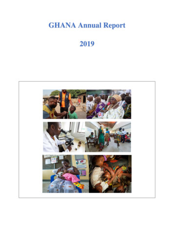
Transcription
Sani Pakush Expedition 2019 ReportMEF reference: 19-28Region: Pakistan, Batura Muztagh, KarakoramObjective: To climb a new route alpine style on Sani Pakush 6952m up the northeastspur and east ridge, making the second ascent of the mountain.Google Earth coordinates:Sani Pakushlat 36.566627 lon 75.380186Base camplat 36.620382 lon 75.549274Duration: 24th July to the 19th AugustExpedition members: Peter Thompson, Philip De-BegerSummaryIn 1998 I climbed the northeast spur of Sani Pakush during during a solo attempt onBeka Brakai Chhok. At that time the 13km walk from my base camp at Lupdor to SaniPakush was mainly easy, flat ice. However by 2019 the upper Batura Glacier hadchanged considerably. In 2019 we had hoped to make our base camp at China Campclose to Sani Pakush but our porters refused to go beyond Lupdor due to the difficultnature of the glacier. They told us that no one had been to China Camp for many years.By 2019 the route had also changed. There were more seracs on the route. There werealso several avalanche fault lines on the route and we feared there could be moreavalanches. There had been a lot of snow during the winter. We witnessed anavalanche next to the route which swept across the approach to the route.Nevertheless, we started acclimatising with several walks to 4600m above base camp.We then spent three days in the nearby Wartom Nala, sleeping at 4800m. Howeverwhen we attempted to make a carry to Sani Pakush we found the glacier very difficultwith no prospect of an easier way ahead. For this reason, and the avalanche danger onthe mountain, we decided not to attempt Sani Pakush.We summoned our porters and returned to Aliabad in the Hunza Valley. Here we wereable to get permission to attempt an unclimbed 5920m peak in the Khunjerab NationalPark above the Karakoram Highway near the Khunjerab Pass. Walking up to a bivi sitewithout porters, we attempted the peak. We reached 5800m but a very corniced finalridge and poor snow conditions prevented us reaching the summit.
Other InformationNowadays there are more flights from Islamabad to Gilgit and it is easier to get on them.They can be booked on the PIA website. The luggage allowance is 20kg, but you canpay for excess baggage. Getting a connecting flight to Gilgit makes it possible to reachthe Hunza Valley in a day from the UK.Permits are cheap for non commercial peaks in open zones. We got ours through ouragent Adventure Tours Pakistan for 150. No permits are required for peaks below6500m in open zones but they may require a No Objection Certificate from the AssistantCommissioner in Aliabad in the Hunza Valley. This takes a day or so. We got an NOCfor our peak in the Khunjerab National Park.Porter rates vary. A guide is useful in negotiations. For the Batura Valley they are easilyarranged at the Passu Ambassador Hotel near the start of the trek. We paid 700 rupeesper porter per stage for five stages to base camp, which took three days. We paid 350per stage for the unladen walk back, five stages. Tips are usual.Diary1. Flew Manchester to Islamabad.2. Flew Islamabad to Gilgit. Met our guide Mohammed Amin and drove to Karimabad inthe Hunza Valley.3. Shopped and drove to Passu.4. In Passu awaiting permit formalities and arranging porters.5. In Passu.6. Trekked to Yashpirt in the Batura Valley with eight porters and guide.7. Trekked to Guchism.8. Trekked to base camp at Lupdor 3800m. We had hoped to have a base camp atChina Camp close to Sani Pakush but the porters refused to go beyond Lupdor.Guide and porters left. Hiked to 4350m above base camp.9. Hiked to 4620m above base camp. Observations of Sani Pakush.10. Hiked to 4620m above base camp.11. Hiked up the Wartom Nala to a bivi.12. Hiked to bivi at 4800m.13. Returned to base camp.14. At base camp.15. Attempted carry towards Sani Pakush. We both had falls and cuts to our legs.Decided not to attempt Sani Pakush for reasons given above. Called for porters onsat phone.16. At base camp.
17. Six porters arrived and we trekked to Yashpirt.18. Trekked to Passu.19. Drove to Karimabad. In Aliabad applied for No Objection Certificate to climb in theKhunjerab National Park.20. Got NOC.21. Drove to KNP and walked to a bivi at 5200m from the Karakoram Highway.22. Snowfall.23. Attempted Peak 5920m (lat 36.874241 lon 75.349766) by the south ridge. Wereached 5800m but couldn’t climb the very corniced final ridge in poor snowconditions. Returned to bivi, arranged transport on the sat phone and walked downto the Karakoram Highway. Picked up and returned to Karimabad.24. Drove to Gilgit. Unable to get a flight for a while. Phil took the bus.25. Gilgit.26. Gilgit.27. Flew to Islamabad and Manchester.BudgetIncome Mount Everest FoundationBritish Mountaineering CouncilMontane Alpine Club Climbing Fund4400125016007250Expenditure International flightsVisas and UK travelLocal flights and transportFood and accommodationGuide and porters including insuranceAgency charges including permitsGas, expedition food, equipment hireInsurance160032071058021007406306207300
Approach from Lupdor and planned route.Sani Pakush on the right in 1998.
Sani Pakush in 2019 and planned route.AcknowledgementsThanks to the Mount Everest Foundation, the British Mountaineering Council and theMontane Alpine Club Climbing Fund for grants.Report compiled by Peter Thompsonpeterthompson137@gmail.com
Sani Pakush lat 36.566627 lon 75.380186 . Guide and porters including insurance 2100 Agency charges including permits 740 Gas, expedition food, equipment hire 630 Insurance 620 _ 7300 . Approach from Lupdor and planned rout