Transcription
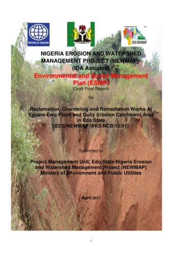
NIGERIA EROSION AND WATERSHEDMANAGEMENT PROJECT (NEWMAP)(IDA Assisted)Environmental and Social ManagementPlan (ESMP)(Draft Final Report)forReclamation, Channeling and Remediation Works AtEguare-Ewu Flood and Gully Erosion Catchment Areain Edo State(EDS/NEWMAP/WKS/NCB/16/01)Submitted toProject Management Unit, Edo State Nigeria Erosionand Watershed Management Project (NEWMAP)Ministry of Environment and Public UtilitiesApril 2017i
TABLE OF CONTENTPAGESTable of contentList of TablesList of FiguresList of PlatesList of Abbreviations and AcronymsList of PreparersExec. SummaryTOC-1TOC-4TOC-5TOC-6TOC-7TOC-9TOC-10CHAPTER ONE – INTRODUCTION1.1Introduction1-11.2Overview of the Nigeria Erosion and watershed ManagementProject (NEWMAP)1-21.3Environmental and Social Safeguards Concerns1-31.4Rationale for the ESMP1-31.5Objectives of the ESMP1-41.6Specific Tasks1-51.7Scope of Work1-61.8Deliverables1-7CHAPTER TWO – POLICY, LEGAL AND ADMINISTRATIVE FRAMEWORK2.1Introduction2-12.2Legal and Administrative Framework2-12.2.1 Administrative Structure for Environmental Managementat the Federal (National) Level2-12.2.1.1 Federal Ministry of Environment2-12.2.1.2 National Environmental Standards and RegulationsEnforcement Agency (NESREA)2-42.2.1.3 Other Relevant National Policies and Regulations2-52.2.2 Edo State Regulations relating to EnvironmentalManagement2-72.2.3 International Regulatory Framework2-10CHAPTER THREE – DESCRIPTION OF THE tion of Erosion Gully Site3-13.2.1 Location of the Erosion Gully at Ewu3-13.2.2 Factors that enhanced the Emergence of the GullyErosion at Ewu3-43.2.3 Geomorphology and Landscape3-53.2.4 Surface and Groundwater Hydrology3-71
3.33.43.53.63.2.5 Topographical Survey of the Ewu Esan Central GullyErosion3-10Proposed Intervention Project at Ewu Gully Site3-113.3.1 Aims of the Ewu Esan Central Gully Project3-113.3.2 Scope of Ewu Gully Rehabilitation work3-11Analysis of Project Intervention Options3-123.4.1 Alternative Options considered for the intervention3-12Quality Assurance and Quality Control (QA/QC) for theProposed Intervention Project3-20Description of Project Environment3-213.6.1 Overview of the Project State3-213.6.2 Physical Environment of Edo State3-223.6.3 Biological Environment of Edo State3-313.6.4 Specific Environmental Baseline Information on Ewu Site3-323.6.5 Physical Environment of Ewu Erosion Gully Site4-333.6.6 Biological Environment of Ewu Erosion Gully Site4-40CHAPTER FOUR – SOCIO-ECONOMIC CHARACTERISTICS ANDCONSULTATION WITH STAKEHOLDERS4.1Socio-economic Assessment4-14.2Methodology4-14.2.1 Data Collection Approaches4-14.2.2 Socio-economic Data Analysis4-24.3Socio-economic Analytical Results4-34.3.1 History and Governance4-34.3.2 Demographic Characteristics4-44.3.3 Sex Composition4-54.3.4 Age Composition4-64.3.5 Marital Status4-64.3.6 Religion4-74.3.7 Ethnic Composition4-84.4Analysis of Livelihoods Opportunities4-84.4.1 Educational Status4-84.4.2 Occupation, Income and Unemployment Characteristics4-94.4.3 Housing Characteristics4-124.4.4 Tenancy Pattern4-154.5Amenities and Facilities in the Community4-164.5.1 Sources of Energy4-164.5.2 Sources of Domestic Water4-174.5.3 Medical and Health Facilities4-184.5.4 Educational Facilities4-184.5.5 Water Points4-184.5.6 Waste Management Methods4-184.6Environmental Concern in the Community4-204.6.1 Perceived Environmental Impacts of the Gully Erosion 4-204.7Assessment of existing Formal and Informal Grievances RedressMechanism4-234.7.1 Stakeholder Engagement Plan4-254.7.2 Consultations with Relevant Stakeholders4-252
4.7.3 Anticipated Impacts of the Gully Erosion InterventionProject4-29CHAPTER FIVE – ASSESSMENT OF ASSOCIATED AND POTENTIALIMPACTS5.1Introduction5-15.2Associated and Potential Impacts Determination5-15.2.1 Project Activities and affected Environmental Media 5-35.3Associated and Potential Environmental Impacts5-55.3.1 Positive Impacts of Pre-construction and ConstructionPhase5-165.3.2 Negative Impacts5-165.3.3 Residual and Cumulative Impacts5-21CHAPTER SIX – ENVIRONMENTAL AND SOCIAL MANAGEMENT PLAN6.1Overview6-16.2Mitigation Measures for the Identified Project impacts6-36.3Institutional Arrangement for ESMP and Monitoring Plan6-366.4Capacity Building and Training Plan6-506.5Grievance Redress Mechanism6-556.6Environmental and Social Management and Monitoring Plan 6-556.6.1 Environmental and Social Management Plan (ESMP) 6-566.6.2 Environmental Monitoring and Evaluation6-866.6.2.1 Environmental Monitoring and Evaluation6-866.6.2.2 Implementation approach for the EnvironmentalMonitoring6-886.6.2.3 Implementation Approach for the EnvironmentalMonitoring6-896.7ESMP Budget and Schedule of Work6-936.7.1 ESMP Budget6-936.7.2 Schedule of Work for ESMP Implementation6-936.8Contractual Award Measures6-95CHAPTER SEVEN – SUMMARY AND CONCLUSIONREFERENCEANNEXES37-1
LIST OF TABLESTablesPages2.1Summary of IFC Performance Standards and Their Applicabilityto the Proposed Project2-143.1Mean Monthly Maximum Temperature in Edo State3-223.2Mean Monthly Rainfall (mm) in Edo State3-233.3Mean Monthly Relative Humidity in Edo State3-243.4Summary of Air Quality and Noise Measurements aroundEdo State3-253.5Nigerian Ambient Air Quality Standard3-263.6Air Quality Classification Based on TSP Values3-263.7Geologic Units of the Niger Delta3-293.8Monthly Temperature and Precipitation within the Study Area 3-353.9Typical Grain Size distribution of the Surface 2-M Depth of Soilswithin and around the Gully Erosion Site in Ewu3-383.10 Average Composition of the Grain Size Distribution of Soils withinand around the Gully Erosion site in Ewu, Edo State3-393.11 Vegetation Species around the Project Site3-423.12 List of Mammals in the Study Area3-433.13 List of Birds in the Study Area3-443.14 List of Reptiles in the Study Areas3-454.1Population Distribution in the Edo State and Esan Central LocalGovernment Area of the State4-45.1Project activities at the three phases of the proposed NEWMAPproject in Ewu Esan Central5-45.2The Potential Environmental and Social Impacts of the Project5-66.1Mitigation Measures recommended for the potential andassociated impacts of Ewu Gully Erosion Site RehabilitationProject6-166.2Roles and Responsibilities of the key stakeholders in theimplementation of the ESMP6-456.3Capacity Building Training Program proposed for theimplementation of the ESMP6-526.4Environmental and Social Management Plan for Ewu EsanCentral Gully Erosion Site Rehabilitation6-576.5Environmental, Social and Health Components and ImpactIndicators6-876.6Environmental Components, Monitoring Parameters andFrequency of Monitoring for the Project6-916.7Summarized Cost estimates for the Implementation of the EwuNEWMAP ESMP6-936.8ESMP Implementation Schedule of Work6-944
LIST OF .84.94.104.114.124.13PagesSatellite Imagery of Gully Erosion Site at Ewu Town3-3Satellite Imagery of Gully Erosion Site at Ewu Town3-4Digital elevation model of the Topography around Ewu GullyHead3-5Conceptual Model of Ewu Gully Head3-7Water Shed Catchment of the Gully Head at Ewu and Materialbalance around the Gully showing inflows3-8Vegetated Rock Walls3-19Typical Rock Chute Grade Control Structure3-20Articulated Concrete Block System3-20Map of Nigeria showing Edo State3-21Pattern of the Mean Monthly Maximum Temperature inEdo State3-23Pattern of Rainfall Distribution in Edo State3-24Mean Monthly Relative Humidity in Edo State3-24Structural Elements of the Niger Delta3-27Structural Elements of the Niger Delta3-28Administrative Map of Edo State showing Ewu Community 3-33Gully Erosion Site in the Ewu Town3-37General Geological Map of Nigeria3-38General Geological Map of Nigeria4-20Gender Distribution among Respondents4-5Age Categories among Sampled Respondents4-6Marital Status among Respondents in Ewu Community4-7Ethnic Composition in the Study Area4-8Education Status among the Sampled Respondents4-9Occupational Characteristics in Ewu Town4-10Income Distribution among the sampled Respondents4-12Housing Types in Ewu Community4-12Floor Materials used in Buildings4-13Type of Wall Materials used in Building4-13Type of Roof Materials used on Building4-15Types of Housing Ownership in Ewu Town4-16Waste Deposition Methods4-195
LIST OF PLATESPlatesPages3.1A Section of the Gully in Ewu, Esan Local GovernmentArea of Edo State3-23.2Gully at Ewu showing some affected Houses and tarred roadas at March 20173-23.3water Borehole at Ewu3-93.4Typical Rainwater Harvest Facility at Ewu3-93.5Stepped Baffle Chute3-133.6Soil Profile Obtained from a cut section in EhanlenCommunity Ewu3-393.7-10 Vegetation/Land Cover Types observed around Project Sitein Ewu3-423.11-12Some Birds observed during Fieldwork3-444.1Shrine on the Outskirt of Ewu Town4-74.2Garri Processing Machine in the Community4-104.3Extraction of Black Oil from Palm Kernel for Soap Making4-104.4Palm Kernel Crushing Machine4-114.5Semi-Detached Building in the Vicinity of the Gully Erosion Site4-134.6Mud and Block Materials used in Building Construction in theVicinity of the Gully Erosion Site4-144.7Long Span Aluminium used in the Ewu Town Hall4-154.8Low Tension Electricity Line in Ewu Town4-164.9Rain Water Harvesting in Ewu Town4-174.10 Private Borehole Water providing Water for the Residents ofEwu Town4-174.11 Waste Deposition in Drainage Channels4-194.12 Waste Deposition in the Gully Erosion Site4-194.13 Ewu Gully Erosion Head4-214.14 Ewu Monastery Road Devastated by Growing Gully Erosion 4-224.15 Secondary Gully Erosion Site close to Ewu Monastery Road 4-224.16 Secondary Gully Erosion Site close to Ewu Monastery Road 4-224.17-22 View of the Stakeholder engagement held at Ewu Community4-264.23 Eroded Building Foundation Consequent upon the Flood4-284.24 Structurally affected House Close to the Gully Head inEwu Town4-286
LISTS OF ABBREVIATIONS AND ACCRONYMSAIDSBEMEBODCITES MsHIVHSEIFCITCZITDZIMMLGAMDANASTNESREA NEWMAPNIMETNPCNWPPPPAPPPCPCFPADPIDPMQAQCRHRPFSPMU Acquired Immune Deficiency SyndromeBill of Engineering Measurement and EvaluationBiological Oxygen DemandConvention on International Trade in EndangeredSpeciesCarbon-MonoxideDissolved OxygenEnvironmental AssessmentEnvironment, Health and SafetyEnvironmental Impact AssessmentEnvironmental Management PlansEnvironmental Impact StatementEnvironmentally Sensitive AreaEnvironmental and Social Management FrameworkEnvironmental Safeguard OfficerEnvironmental and Social Management PlanFederal Ministry of EnvironmentFederal Environmental Protection AgencyFederal Road Safety CorpsGlobal Environmental FacilityGrievance Redress MechanismsHuman Immune VirusHealth Safety and EnvironmentalInternational Finance CorporationInter Tropical Convergence ZoneInter-Tropical Discontinuity ZoneImpact Mitigation MonitoringLocal Government AreaMinistries Department and AgenciesNigerian Advanced School of TheologyNational Environmental Standards and RegulationsEnforcement AgencyNigeria Erosion and Watershed Management ProjectNigeria Meteorological AgencyNational Population CommissionNorth WesterlyPolluter Pay PrincipleProject Affected PeoplePublic Compliant CommissionPrototype Carbon FundProject Appraisal DocumentProject Implementation ManualParticulate MatterQuality AssuranceQuality ControlRelative HumidityResettlement Policy FrameworkState Project Management Unit7
STDSWTDSTHCToRTSSTSPUSCSUSEPAVOCWB Sexually Transmitted DiseaseSouth WesterlyTotal Dissolve SolidTotal HydrocarbonTerms of ReferenceTotal Suspended SolidTotal Suspended ParticulateUnified Soil Classification SystemUnited States Environmental Protection AgencyVolatile Organic CompoundWorld Bank8
LIST OF PREPARERSBABATUNDE .Y. OSHO-Team Leader/ Environmental ManagementSpecialistPROF. A.AMUSAN- Soil Scientist / Erosion ExpertDr M. ADABANIJA- Geology/GeophysicsADEOLU. OJO- Environmental EcologistDr. O.J. TAIWO-Socio-economics/Stakeholder EngagementSpecialistOLAJIRE. ALAO- Environmental Management Specialist9
EXECUTIVE SUMMARYCHAPTER ONE: IntroductionEguare-Ewu, Edo State, gully site is one of the ten gully erosion sites that hadbeen selected by the SPMU of NEWMAP for Engineering Design andConstruction Works in a bid to control the erosion, inhibit the advancement ofthe gully from causing further damage and rehabilitate the gully. The project isfinanced by the World Bank (WB), Global Environment Facility, the SpecialClimate Change Fund, and the Government of Nigeria. Our team ofconsultants from Global Impact Environmental Consulting Ltd was engaged toprepare the ESMP for the project in line with standard procedures rldBankEnvironmental and Social Safeguard policies and Nigerian environmentalassessment guidelinesObjectives of the ESMPSpecific objectives of this ESMP are to: Set out the measures to be taken in addressing the identified adverseimpacts of the various components and activities of the project; Develop procedures and plans to ensure that the mitigation measureswill be implemented throughout the phases for the remediation work atthe Eguaren-Ewu Gully Erosion site; and Address the adequacy of the monitoring and institutional arrangementsfor the upper and lower watersheds in the intervention site.Terms of Reference and Scope of Work of the ESMP The consultant is expected to work in close collaboration with theSPMU project team, and the various other Agencies involved in theprojects; The consultant shall visit the intervention sites, to have a first-handoverview of the situation on ground at the site, so as to have adequateknowledge of the requirements for the ESMP; and environment is appropriately protected and environmental issues areappropriately mitigated.10
Specific scope of work is that the Consultant: Prepares ESMP, taking into consideration the activities in theintervention sites at Eguare-Ewu communities; The ESMP should contain an environmental and social checklist, to beused as a screening mechanism for the identified activities of theproject; and Identifies any regulations and guidelines, which will govern activities ofthe nature contemplated by the proposed project including Nationaland State legislation and regulations.DeliverablesThe deliverables are Inception, Draft and Final ESMP Reports, acceptable tothe Edo –NEWMAP SPMU, Edo State, and to the World Bank.CHAPTER TWO: Policy, Legal and Administrative FrameworkA number of relevant international, national and state environmental policies,guidelines, legal and administrative framework applicable to the operation ofthe NEWMAP were reviewed as they relate to the proposed NEWMAP projectat Eguaren-Ewu, Edo State.Specifically, World Bank OP/BP 4.01: Environmental Assessment (EA), one ofthe 10 2 Environmental and Social Safeguard Policies of the WB, employedby the bank to examine the potential environmental risks and benefitsassociated with Bank lending operations was reviewed. A detailed listing ofnational statutory documents put in place by the FMEnv to aid in themonitoring, control and abatement of industrial wastes and natural disasterswas produced in this chapter. Similarly, Edo State Regulations relating toEnvironmental Management was also reviewed.CHAPTER THREE: Description of Biophysical EnvironmentThe Eguare-Ewu Gully Site is located about halfway between Benin City andAuchi, just north of the Benin City – Auchi road in Edo State. A massive gullyhas developed near the lower part of Ewu town where the main road crosses11
the drainage line. The gully is very deeply incised and becomes shallowertowards the outlet, the length of the gully is about 1000 m. It steadilydecreases in depth from an initial depth of approximately 14 m at the gullyhead at the road in the village, to 8 m approximately 500 m downstream. Iteventually daylights approximately 700 m downstream. The streambed isrelatively steep for a section downstream of where the gully daylights. Thegully developed as a result of the road drainage, which collects flows fromacross the catchment and concentrates them to the gully site, together with anincrease in hardened surfaces in the catchment due mainly to anthropogenicinfluence which results in increased peak flows. The catchment that drains tothe gully at Ewu is approximately 2.4 km 2 in size determined by means of aGIS.Proposed Intervention Project in Eguaren-Ewu Gully SiteThe components of intervention project planned for this gully site are asfollow:Watershed Management: Storm water flows to be managed so that they donot cause unwanted erosion problems. By routing storm water around fields,contour ploughing, planting crops and minimizing the clearing of natural forestand bush that hold the soils and reduce peak flows effectively. Properwatershed management to include managing the peak flows in the catchmentthrough maintaining natural watercourses and wetland areas that currentlyattenuate flows naturally.Controlled Conveyance of Flows Into or Around the Gully: Various options forconveyance of flows into or around the gully were investigated as part of theConcept Design Study. It was found that diverting most of the flow around thegully head would be the most practical solution. This will allow for theconstruction of diversion channels, discharge chutes and stilling basins tooccur in relative safety, away from the gully head, while the flow continues tobe discharged into the gully head during construction.12
Backfill and Reinstatement of the Gully Head Upstream of the BypassConfluence: The gully head upstream of the bypass channel confluence willbe backfilled and reinstated, while the road that collapsed as a result of thegully erosion will be reconstructed. The geotechnical design includesconsideration of slope stability and soil erosion. Backfill material will bestabilized in the gully head to provide a suitable foundation for thereconstruction of the road.Use of Suitable Grass and Tree Species to Stabilize the Soils: It is proposedthat extensive use is also to be made of vegetation to improve the soil’sresilience to erosion. The grass species to be planted are Vetiveriazizanioides and Pueraria sp. as approved by NEWMAP. The tree species isAcacia sp.Quality Assurance and Quality Control (QA/QC) for the ProposedIntervention Project in Eguaren-EwuThe general conditions of contract are based on the World Bank harmonizedFIDIC document for large works. The specifications are mostly based on theSATCC standard specifications for workmanship and materials. The BritishStandards are also to be used. In the Bill of Engineering Measurement andEvaluation (BEME), the major quantities are as follows: Concrete 3300 m3 Structural steel 410 t Formwork 8600 m2 Fill earthworks 45 000 m3 Cut earthworks 38 000 m3 Volume of gabions 7400 m3 Filter Fabric 35 000 m3 Area to be vegetated 4.0 ha13
Description of the Project EnvironmentPhysical Environment of Edo State:Climate and Meteorology: Edo State has two principal seasons, rainy anddry, driven by the seasonal oscillations of the Inter-Tropical Discontinuity Zone(ITDZ) movement.Temperature and Sunshine: Maximum temperatures typically range between280C and 340C. The higher values are recorded in the dry months betweenDecember and March, which also coincide with periods of high sunshine.Mean sunshine hours per month vary from 53 hours in July to 176 hours inJanuary. The low sunshine hours in the region are associated with the thickcloud cover that prevails in this climatic belt for most of the year.Rainfall: Rainfall in Edo State is generally high, due to the relative proximity tothe coast. Rain falls all through the year with the peak between June andOctober and the highest number of rain days also occurred within the sameperiod. Lowest amount of rainfall occurs in the mo
4.6 Mud and Block Materials used in Building Construction in the Vicinity of the Gully Erosion Site 4-14 4.7 Long Span Aluminium used in the Ewu Town Hall 4-15 4.8 Low Tension Electricity Line in Ewu Town 4-16 4.9 Rain