Transcription
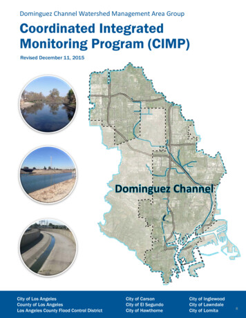
Dominguez Channel Watershed Management Area GroupCoordinated IntegratedMonitoring Program (CIMP)Revised December 11, 2015City of Los AngelesCounty of Los AngelesLos Angeles County Flood Control DistrictCity of CarsonCity of El SegundoCity of HawthorneCity of InglewoodCity of LawndaleCity of Lomita8
Coordinated Integrated MonitoringProgram for the Dominguez ChannelWatershed Management Area GroupCity of Los Angeles, Bureau of SanitationTOS S55C Enhanced Watershed Management Program (EWMP) for theDominguez Channel Watershed Management Area GroupFINALSubmitted June 28, 2014Revised April 7, 2015Conditional Approval Revision October 21, 2015Updated December 11, 2015Submitted to:California Regional Water Quality Control BoardLos Angeles Region320 West 4th Street, Suite 200Los Angeles, CA 90013-2343Prepared by:Dominguez Channel Watershed Management Area GroupCity of Los AngelesCounty of Los AngelesLos Angeles County Flood Control DistrictCity of CarsonCity of El SegundoCity of HawthorneCity of InglewoodCity of LawndaleCity of Lomita
COORDINATED INTEGRATED MONITORING PROGRAMFOR THE DOMINGUEZ CHANNEL WMA GROUPTable of Contents1.INTRODUCTION. 11.1WATERSHED MANAGEMENT PLAN AREA .21.2WATER QUALITY PRIORITIES.61.3CIMP OVERVIEW .71.3.1 Receiving Water Monitoring .81.3.2 Storm Water Outfall Monitoring .81.3.3 Non-Storm Water Outfall Program .91.3.4 New Development and Re-development Effectiveness Tracking .91.3.5 Regional Studies .91.3.6 Special Studies .102.RECEIVING WATER MONITORING PROGRAM. 112.1RECEIVING WATER MONITORING OBJECTIVES .112.2RECEIVING WATER MONITORING SITES .112.2.1 DCWMA ME Station, DOM-RW-DC01 .142.2.2 DCWMA TMDL Sites .142.3MONITORED PARAMETERS, FREQUENCY, AND DURATION OF MONITORING .172.4MONITORING COORDINATION .172.5RECEIVING WATER MONITORING SUMMARY .173.MS4 INFRASTRUCTURE DATABASE. 223.13.23.34.STORM DRAINS, CHANNELS AND OUTFALLS MAP AND/OR DATABASE REQUIREMENTS .22DC WATERSHED MANAGEMENT AREA GROUP’S MAP AND DATABASE INFORMATION .22REQUIREMENTS TABLE AND SCHEDULE FOR IMPLEMENTATION .23STORM WATER OUTFALL MONITORING PROGRAM . 284.1STORM WATER OUTFALL MONITORING SITES .284.1.1 NPDES Storm Water Outfall Sites .284.1.2 TMDL Outfall Sites .294.2MONITORED PARAMETERS, FREQUENCY, AND DURATION .294.3STORM WATER OUTFALL MONITORING SUMMARY .305.NON-STORM WATER OUTFALL PROGRAM . 345.1OBJECTIVES OF THE NSW PROGRAM .345.2APPROACH OVERVIEW .345.3NSW OUTFALL SCREENING AND MONITORING PROGRAM .375.3.1 GIS Database (Section 3 – MS4 Database).375.3.2 Preliminary Field Screening of Outfalls .375.4IDENTIFICATION OF OUTFALLS WITH SIGNIFICANT NSW DISCHARGE.375.5INVENTORY OF MS4 OUTFALLS WITH NSW DISCHARGE .375.6PRIORITIZED SOURCE IDENTIFICATION .385.7IDENTIFY SOURCES OF SIGNIFICANT NSW DISCHARGE .385.8MONITOR NSW DISCHARGE EXCEEDING CRITERIA .395.9NON-STORM WATER OUTFALL MONITORING PROGRAM SUMMARY .406.NEW DEVELOPMENT/RE-DEVELOPMENT EFFECTIVENESS TRACKING . 426.16.26.3PROGRAM OBJECTIVES.42EXISTING NEW DEVELOPMENT/RE-DEVELOPMENT TRACKING PROCEDURES .42SPECIAL CONSIDERATIONS FOR DATA MANAGEMENT AND REPORTING .42i
COORDINATED INTEGRATED MONITORING PROGRAMFOR THE DOMINGUEZ CHANNEL WMA GROUP6.3.1 Data Management .426.3.2 Additional Data .426.3.3 Reporting .436.4SUMMARY OF NEW DEVELOPMENT/RE-DEVELOPMENT EFFECTIVENESS TRACKING .447.REGIONAL STUDIES . 457.1REGIONAL STUDY PARTICIPATION.457.2OTHER POTENTIALLY RELEVANT REGIONAL STUDIES .457.2.1 Contaminated Sediment Management Plan.457.2.2 Southern California Bight (SCB) .458.SPECIAL AND PRELIMINARY STUDIES . 478.19.SPECIAL STUDIES REQUIREMENTS.47NON-DIRECT MEASUREMENTS. 489.1NON-DIRECT MEASUREMENTS FOR THE DCWMA GROUP CIMP.4810. ADAPTIVE MANAGEMENT. 4910.1 INTEGRATED MONITORING AND ASSESSMENT PROGRAM .4910.1.1Outfall Based Monitoring, Storm Drains, Channels, and Outfall Map(s) and/or Database .4910.1.2Storm Water Outfall Monitoring Program .4910.1.3Non Storm Water (NSW) Outfall Monitoring .5010.1.3.1Outfall Screening and Monitoring Plan .5010.1.3.2Inventory of MS4 Outfalls with NSW Discharges .5010.2 CIMP REVISION PROCESS .5011. DATA MANAGEMENT AND REPORTING . 5212. SCHEDULE FOR DCWMA CIMP IMPLEMENTATION . 5312.112.212.312.412.512.612.7CIMP IMPLEMENTATION REQUIREMENTS .53SCHEDULE CONSTRAINTS .53MONITORING SITES WITH AUTOSAMPLERS .53RECEIVING WATER MONITORING PHASED SCHEDULE .53STORM WATER OUTFALL MONITORING PHASE SCHEDULE .54NON-STORM WATER MONITORING PROGRAM SCHEDULE REQUIREMENTS .56NSW OUTFALL MONITORING PROGRAM .5613. REFERENCES . 58ii
COORDINATED INTEGRATED MONITORING PROGRAMFOR THE DOMINGUEZ CHANNEL WMA GROUPList of FiguresFigure 1-1. DCWMA Group Boundary .4Figure 1-2. Land Use in the Dominguez Channel Watershed Management Area.5Figure 2-1. Map of Receiving Water Monitoring Program .13Figure 3-1. Dominguez Channel Watershed Management Area with Land Use and HUC 12 Drainage Areas .24Figure 3-2. Dominguez Channel Watershed Management Area with DCWMA Group and JurisdictionalAgencies.25Figure 4-1. DCWMA Group Storm Water Outfall Monitoring Sites.31Figure 5-1. NSW Monitoring Program Process Chart .36Figure 12-1. Implementation Schedule for Major CIMP Elements .57List of TablesTable 1-1. List of Participating Permittees under the DCWMA Group.2Table 1-2. DCWMA Group Land Use.6Table 1-3. Categorized Water Body-Pollutant Combinations .6Table 2-1. Receiving Water Monitoring Program Locations .12Table 2-2. Summary of NPDES Receiving Water Monitoring Sites .14Table 2-3. TMDLs Addressed by Each Site.16Table 2-4. Constituents and Parameters Measured1 .18Table 3-1. Map and Database Status Schedule .26Table 4-1. Summary of Storm Water Outfall Monitoring Program Objectives.30Table 4-2. DCWMA Group Member Represented by Each Storm Water Outfall Monitoring Site(1).32Table 4-3. List of Constituents for NPDES and TMDL Storm Water Outfall Monitoring .33Table 5-1. NSW Outfall Program Summary Table.35Table 5-2. NSW Outfall Program Schedule Overview .38Table 5-3. List of Constituents for Non-Storm Water Outfall Monitoring .40Table 6-1. Development Review Process and Data Collection .43Table 6-2. Required Data to Track for New Development and Re-Development Projects per AttachmentE.X.A.44Table 6-3. Required Data to Track for New Development and Re-Development Projects per PartVI.D.7.d.iv .44Table 12-1. Receiving Water Monitoring Locations with Sampling Stations .54Table 12-2. Storm Water Outfall Sampling Station Schedule .55Table 12-3. NSW Outfall Program Schedule Overview .56iii
COORDINATED INTEGRATED MONITORING PROGRAMFOR THE DOMINGUEZ CHANNEL WMA GROUPAttachmentsAttachment A Watershed Management Plan Area BackgroundAttachment B Monitoring Location Fact Sheets and JustificationAttachment C Analytical and Monitoring ProceduresAttachment D ReportingAttachment E LACFCD Background InformationAttachment F City of Lomita Monitoring Requirements Letter (March 30, 2015), City of CarsonLetter of Intent to Join the DCWMA CIMP (August 26, 2015), City of LawndaleLetter of Intent to Join the DCWMA CIMP (August 12, 2015)iv
COORDINATED INTEGRATED MONITORING PROGRAMFOR THE DOMINGUEZ CHANNEL WMA A SMPSWAMPBest Management PracticeComprehensive Environmental Response, Compensation and Liability ActCoordinated Integrated Monitoring ProgramCoordinated Monitoring ProgramContaminated Sediment Management PlanCalifornia Toxics RuleDominguez ChannelDominguez Channel EstuaryDominguez Channel Watershed Management AreaDominguez Channel Watershed Management Area GroupEffective Impervious AreaEnhanced Watershed Management ProgramGeographic Information SystemHydrologic Response UnitsHydrologic Unit CodeIllicit Connection/Illicit DischargeLos Angeles County Flood Control DistrictLos Angeles Regional Water Quality Control BoardLow Impact DevelopmentLake Water Quality Management PlanMinimum Control MeasureMass EmissionMonitoring and Reporting ProgramMunicipal Separate Storm and Sewer SystemNational Pollutant Discharge Elimination SystemNon-storm WaterNational Weather ServiceQuality Assurance/Quality ControlOrder R4-2012-0175Receiving Water LimitationSouthern California BightSouthern California Coastal Water Research ProjectSouthern California Stormwater Monitoring CoalitionStandard Operating ProcedureStandard Urban Stormwater Mitigation PlanSurface Water Ambient Monitoring Programv
COORDINATED INTEGRATED MONITORING PROGRAMFOR THE DOMINGUEZ CHANNEL WMA GROUPAcronyms (continued)TIWRPTMDLTSSUSEPAWBPCWLAWQBELTerminal Island Water Reclamation PlantTotal Maximum Daily LoadTotal Suspended SolidsUnited States Environmental Protection AgencyWater Body-Pollutant CombinationWaste Load AllocationWater Quality Based Effluent g/kgmLMPNTUcMicrogram per kilogramMicrogram per literColony Forming UnitGrams per dayGrams per yearKilogramKilograms per yearMilligram per literMilligram per kilogramMilliliterMost Probable NumberToxic Unit Chronicvi
COORDINATED INTEGRATED MONITORING PROGRAMFOR THE DOMINGUEZ CHANNEL WMA GROUP1.IntroductionThe National Pollutant Discharge Elimination System (NPDES) Municipal Separate Storm Sewer System(MS4) Permit Order R4-2012-0175 (Permit) became effective on December 28, 2012. On June 27, 2013,the cities of El Segundo, Hawthorne, Inglewood, and Los Angeles (including the Port of Los Angeles), theCounty of Los Angeles and the Los Angeles County Flood Control District (LACFCD) (collectively knownas the Dominguez Channel Watershed Management Area (DCWMA) Group (DCWMA Group)) submitteda Notice of Intent to develop a collaborative approach to meet the requirements of the Permit, which includedeveloping an Enhanced Watershed Management Program (EWMP) and Coordinated IntegratedMonitoring Program (CIMP) for their respective portions of the DCWMA. In early June 2014, the City ofLomita joined the DCWMA Group. In late August 2015, the Cities of Carson and Lawndale joined theDCWMA Group.Attachment E of the Permit identifies the requirements of the Monitoring and Reporting Program (MRP).The MRP establishes monitoring, reporting, and recordkeeping requirements to implement the federalregulations under the Clean Water Act and the California Water Code. The primary objectives as stated inthe MRP are as follows:1. Assess the chemical, physical, and biological impacts of discharges from the MS4 on receivingwaters.2. Assess compliance with receiving water limitations and water quality-based effluent limitations(WQBELs) established to implement Total Maximum Daily Load (TMDL) wet weather and dryweather waste load allocations (WLAs).3. Characterize pollutant loads in MS4 discharges.4. Identify sources of pollutants in MS4 discharges.5. Measure and improve the effectiveness of pollutant controls implemented under the Permit.The DCWMA CIMP has been prepared by the DCWMA Group to address the requirements of the MRP.The CIMP is composed of the following five MRP elements (Part II.E):1. Receiving water monitoring2. Storm water outfall based monitoring3. Non-Storm Water (NSW) outfall based monitoring4. New Development/Re-development effectiveness tracking5. Regional studiesAdditionally, the DCWMA CIMP addresses the MS4 infrastructure data requested as part of the CIMPsubmittal (MRP Section VII.A), presents the adaptive management approach for the CIMP, discusses thedata management and reporting process, and outlines the schedule for implementing the CIMP.Attachments to the CIMP provide additional background on the DCWMA, factsheets for the monitoringlocations, analytical
Program for the Dominguez Channel Watershed Management Area Group. City of Los Angeles, Bureau of Sanitation TOS S55C Enhanced Watershed Management Program (EWMP) for the Dominguez Channel Watershed Management Area Group. FINAL. Submitted June 28, 2014 Revised April 7, 2015 Conditional Ap
