Transcription
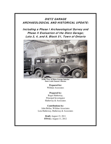
DIETZ GARAGEARCHAEOLOGICAL AND HISTORICAL UPDATE:Including a Phase I Archaeological Survey andPhase II Evaluation of the Dietz Garage;Lots 3, 4, and 9, Block 51, Town of Ontario1930s View of Dietz Garage InteriorPhoto Credit: Pannone CollectionPrepared for:Willdan AssociatesPrepared by:Roger Hatheway,Principal InvestigatorHatheway & AssociatesContributions by:John Bellas, Willdan AssociatesLora Hatheway, Hatheway & AssociatesDraft: August 15, 2011FINAL: August 11, 2012
PART IICULTURAL RESOURCE SETTINGThe history of the Dietz Garage is documented in sufficient detail to place it within agreater City of Ontario Surface Transportation Historical Context Statement, and atentative transportation context is presented herein. However, the intention of thefollowing historical background is not to present a detailed history of the growth anddevelopment of the City of Ontario. Rather, the purpose here is to place the constructionand occupation of the Dietz Garage within a greater City of Ontario transportationhistorical framework as required for determining the historical significance of the DietzGarage only. As a result, commonly available and previously well-accepted histories arequoted freely here, as are official websites and newspaper articles.PREHISTORIC AND HISTORIC BACKGROUND CITY OF ONTARIOPrehistoric Occupation in Vicinity of Project SiteIn late prehistoric times, the area was occupied by either the Gabrielino or Serrano Indianpeoples. It is also possible that the general region was jointly occupied by both groups.The Serrano and Gabrielino jointly interacted with each other, and with other such groupsas the Luiseno, Cahuilla, and the Chemehuevi (Kroeber 1925: 617, and Strong 1929: 8).The Serranos were exogamous, patrilineal village dwellers, occupying locationsthroughout the San Bernardino area. Ethnographic descriptions of the Gabrielino appearin numerous volumes. Some of the most widely regarded are those by Kroeber (1925),and Bean and Smith (1978).The Gabrielino appear to have entered the Los Angeles Basin around 500 B.C. Theyeventually occupied many of the Channel Islands, and the watersheds of the Los Angeles,San Gabriel, and Santa Ana Rivers. They were hunters and gatherers who spoke theCupan language. The social system was probably organized as a moiety system, and mayhave consisted of 27 elite, middle, and common classes. Their seasonal rounds wouldhave taken them to marine and terrestrial resource areas, with primary and secondaryvillages located near water sources.European contact occurred as early as 1542, when Juan Rodriquez Cabrillo landed atSanta Catalina Island. Spanish colonization began in earnest in the late 1700's with theestablishment of Mission San Gabriel in 1771. The aboriginal lifestyle rapidlydeteriorated. By 1900, as a result of introduced disease, relocation, and general hardship,the aboriginal way of life had virtually disappeared.Summary StatementNo prehistoric occupation of the project site or any property within the immediate vicinityof the project site is known.Dietz Garage Archaeological andHistorical Update27City of OntarioFINAL August 11, 2012
The Rancho Period to Chaffey PurchaseNote: The following information is taken from History of San Bernardino and RiversideCounties by John Brown, Jr. & James Boyd:Lying to the west of the “red hills” of Cucamonga is found Ontario, the town and colonythat in 1882 consisted of only a barren waste extending from the San Antonio Canon onthe north to the Rancho Santa Ana del Chino on the south and from Cucamonga on theeast to Rancho San Jose on the west. The early history of the colony is that of a part of theoriginal Cucamonga Rancho, which, after passing through many hands, finally came intothe possession, April 15, 1882, of Capt. J. S. Garcia and Surveyor J. S. Dunlap, through“an option for the purchase of that part of the grant known as the “San Antonio lands” atthe net sum of 60,000. This property comprised 6,216 acres, together with the water,water rights and privileges of San Antonio Creek, and the waste water of CucamongaCreek.Prior to this they had located at Riverside, for the purpose of engaging in the real estatebusiness, the Chaffey brothers, George B., Jr. and William B., and these progressivebusiness men soon formed the acquaintance of Captain Garcia, who was then residing atEtiwanda, where he owned a ranch and one-half of the water in Dry Canon and all thewater in Smith Canon. He sold his 1,000-acre property to the Chaffey Brothers. “Not longafterwards,” says Captain Garcia, “I went to San Francisco and interviewed theCucamonga Company and bonded their Cucamonga lands with one-half the water flowingfrom the San Antonio Creek for 60,000. I took John C. Dunlap as a partner and he wasto have one-half the commission over and above the price fixed by the company. M. L.Wicks of Los Angeles and Professor Mills of Mills’ Seminary, Oakland, were thenoperating largely at Pomona. As soon as my option was put on record in San Francisco,Mr. Wicks interviewed Mr. Dunlap and offered quite a sum for it. Chaffey brothers thenoffered Mr. Dunlap and myself the same price as the other parties for the option. Weconsented to let them have it and George Chaffey and myself went to San Francisco tomake arrangements with the Cucamonga Company. Our contract having beensurrendered, N. W. Stowell was set to work to make cement pipe and also put up the firsthouse in Ontario, between Eighth and Ninth. (Brown and Boyd 1922: 229)Summary StatementNo portion of the project site is known to be linked to the Rancho period of development.History of the City of Ontario: Model Colony to 1960Note: The following brief history is taken from the official City of Ontario website(http://www.ci.ontario.ca.us).It was in the first week of August 1881 when George Chaffey, a Canadian engineer,viewed the wastes known as the Cucamonga Desert and decided that this patch of land, ifproperly watered, could become productive and profitable. George and his brotherWilliam bought the "San Antonio lands," 6,218 acres with water rights for 60,000. Thiswas the nucleus of their new model colony.They subsequently expanded to the Southern Pacific Railroad tracks on the south. On thenorth, they took in the Kincaid Ranch at San Antonio Canyon, an all-important source ofwater.The Ontario Colony lands were quickly surveyed and went on sale in November 1882.The centerpiece was Euclid Avenue, eight miles long and two hundred feet wide, the twin"driveways" separated by a parkway, which was seeded in grass and lined with pepperDietz Garage Archaeological andHistorical Update28City of OntarioFINAL August 11, 2012
trees. George named Euclid Avenue after the great Greek mathematician whose bookElements of Geometry had been a favorite subject for George in school.The primary requirement, which had to be met before the land could be utilized, was thatwater had to be found and brought to the town. Chaffey laid miles of cement pipe for thispurpose and later the San Antonio Water Company drove a tunnel into the head of thecanyon to tap the underground flow—then an innovation in the field. The need for electricpower to lift water from deep wells led to the establishment of the Ontario PowerCompany.Another innovation in the settlement of Ontario was the provision, whereby, purchasers ofland automatically received shares in the water company. This would ensure purchasersthat a share of water proportional to their acreage would be piped to their land. Thiseliminated many problems that faced settlers elsewhere, where land rights and waterrights were kept separate.The results of George Chaffey’s labors showed what could be achieved. All too soon,however, the Chaffey brothers went off to Australia to attempt a repeat performance oftheir success as city planners here.Charles Frankish became the guiding force during Ontario’s early years. No matter whatthe activity he undertook, Frankish always threw himself into his work and wasdetermined to do the best possible job.In 1887, Ontario’s unique "gravity mule car" made its first run on Euclid Avenue. CharlesFrankish and Godfrey Stamm established the Ontario and San Antonio Heights RailroadCompany Engineer John Tays of Upland added the pullout trailer that allowed the mulesto coast downhill after each laborious pull from Holt to Twenty–Fourth Street. The mulecar served until 1895, when it was replaced by an electric streetcar and returnedtemporarily when a flood damaged the electrical generator in the powerhouse.On December 10th, 1891, Ontario was incorporated as a city of the sixth class under theCalifornia Constitution. It adopted a City Council-City Manager form of government. Themayor was at first called the "President of the Board," and was chosen by the Council, orthe Board of Trustees as it was then called, from among their number. Subsequently, thelaw was changed to allow the people to elect the mayor directly.Ontario first developed as an agricultural community, largely but not exclusively devotedto citrus. A few of the lovely Victorian "grove houses" still survive, relics of the dayswhen growers could pretend that they were living the graceful lives of the old Spanishdons—until it came time for harvest.Chaffey College, was founded by the Chaffey brothers as an agricultural college tosupport the local growers. It was there that Prof. George Weldon developed the Babcockpeach, an adaptation to California’s mild winters. The college has moved to RanchoCucamonga now, but Chaffey High School is still on what was originally a joint campus.A reminder of the heyday of the orange groves, the Sunkist plant remains to this day.Even though the groves have gone from the West End, Ontario is still close to the "tenmile center" of the industry. In addition to oranges, the production of peaches, walnuts,lemons and grapes was also important to the growth of Ontario and the adjoining city ofUpland.In 1923, Judge Archie Mitchell, Waldo Waterman, and some other airplane enthusiastsestablished Latimer Field. From that time on, the town became increasingly aviationDietz Garage Archaeological andHistorical Update29City of OntarioFINAL August 11, 2012
conscious. Urban growth pushed the fliers progressively east, until they took up theirpresent location, the Ontario International Airport. During World War II, this was a busytraining center for pilots of the hot Lockheed P-38 "Lightning," Howard Hughes’ twinboom fighter.Since World War II, Ontario has become a much more diversified community. The meantemperature of 61 degrees and the average rainfall of 18.4’ continues to attract moreresidents; with an approximate population of 165,000. The city has expanded from the0.38 square mile area incorporated back in 1891, up to almost 50 square miles. Theeconomy now reflects an industrial and manufacturing base. Ten thousand acres are zonedfor industrial use. With three major railroads, the San Bernardino, Pomona, and DevoreFreeways (10, 60, and 15), and the Ontario International Airport, Ontario is well providedwith major transportation resources. Its proximity to Los Angeles ensures that Ontariowill continue to grow in the years ahead.Ontario’s official song is "Beautiful Ontario," written by Paul Coronel in 1960. Theofficial flower is the Charlotte Armstrong rose, developed by local nurseryman JohnArmstrong and named for his first wife. At different times, Ontario has adopted as itsslogan or motto each of the following: The Model Colony; The Model City; OntarioOffers Opportunity; Pulse of the Inland Empire; Stop and Grow with Ontario; Gateway tothe Inland Empire; A Balanced Community; and The Gateway to Southern California.HOLT BOULEVARD: THE AUTOMOBILE COMES OF AGE IN THE CITY OFONTARIOThe following is taken from the “Holt Boulevard Historic Property Survey Report” forthe Pike’s Peak Ocean to Ocean Highway in Ontario, as prepared under the auspices ofthe City of Ontario, Planning Department. This document is utilized here as the basis fora transportation context statement describing, in part, the relationship that the DietzGarage had to the Ocean-to-Ocean Highway.Arriving from Europe, the automobile first appeared on the American scene during the1890s and was not regarded as having practical, workday uses. It was considered anelaborate “play thing” for the wealthy class. Nonetheless, it excited the curiosity ofAmerican mechanics, who immediately began construction adaptations of the Europeanmodels. The American version of the automobile continued to develop gaining muchpopularity and by 1905, 78,000 vehicle existed in the United States. As more well-to-dopeople acquired automobiles, social clubs such as the American Automobile Association(AAA) emerged as strong advocates for supporting recreation auto touring and longdistance road racing. Others vested groups such as local booster clubs, petroleumcompanies, and auto manufacturers and dealers banned together to push for new roadwayslinking one town to another promoting the American auto-tourism movement.Pike’s Peak Ocean-to-Ocean Highway is one of the nation’s first transcontinentalhighways commencing construction in 1912. The highway spanned the continent fromLos Angeles to New York and passed through Ontario, along Holt Boulevard. Leadingthe local chapter was no other than local town promoter and developer, Charles Frankish.It was quickly realized that Ontario’s participation in this new highway was key tofurthering economic prosperity as the highway would bring travelers directly to thedowntown.By 1920, Holt Boulevard had been transformed from a 2-lane scenic road lined withcitrus trees and grand Victorian homes into a modern 4-lane highway. It ultimatelybecame the main transportation route from Los Angeles to Palm Springs for the newestDietz Garage Archaeological andHistorical Update30City of OntarioFINAL August 11, 2012
class of automobile owners; the Hollywood movie stars and Beverly Hills socialites. Soonautomobile ownership was widespread and auto tourism was on the rise thanks to HenryFord’s Model T. The simple engineering and design applied with the assembly linetechnique allowed for the first time an affordable auto to be marketed to the middle class.Twenty-eight million cars were reported on the road by the end of the decade.Existing property owners and businesses along Holt Boulevard began to modify theirproducts, services and buildings to better address the needs of the highway motorist. Thisis evident by the many residential buildings that were converted to commercial or thosecommercial additions that were attached to the front of the residence. The businesses thatonce catered to railroad travelers such as the Casa Blanca Hotel expanded theiradvertising to Holt Boulevard to get the attention of the auto traveler. All types ofbusinesses began to develop along the side of the road. A certain number of travelerswould always be in need of gas and often times they grew hungry, tired, and restless.Soon gas stations, produce booths, hot dog stands, and auto camps sprouted up along HoltBoulevard to capitalize on these needs.Early on, petroleum companies began to enlist the services of strategically located liverystables, garages, hardware stores, and grocery stores to sell their gasoline. Initially, gaswas sold in cans, but soon gasoline pumps were installed near the road. This method ofselling gas quickly caught on and the first stand-alone gas stations began to appear. Manygas station owners also began selling additional products and services such as auto repairservices and tire sales. However, the most dominant auto-related business along HoltBoulevard was the automobile dealership.In the early 1920s, “autocamping” became the rage, and campgrounds equipped with tentssprang up along the highway. By the end of the decade, however, the camps became lessdesirable and “cabin camping” also referred to as “tourist courts” were popularized. Themodern tourist courts of the 1940s and 50s were professionally designed and much moresophisticated. They provided travelers with all the comforts of home including kitchens,bathrooms, electricity and comfortable furniture.Prior to the 1920s, automobile travelers had few choices in the way of restaurants on theroad. However, that changed as food stands, drive-in restaurants, diners, and full-servicerestaurants joined into the competition for the traveler’s attention and money.Food stands were often shacks virtually thrown together by farmers who owned propertyalong the highway and sold their produce and other homemade products to passingtravelers. Former citrus ranch home, The Orange Grove Inn, became famous for its friedchicken dinners and homemade marmalade. Some food stands also served hot,refrigerated or frozen foods such as hot dogs, hamburgers, cold drinks and ice cream. Inparticular, Vince’s sold fresh squeezed orange juice and french dip sandwiches in an openair 6-stool food stand. It would later develop into a full service restaurant becomingfamous for its spaghetti dinners. Meanwhile, the food stand evolved into a completelynew type of restaurant – one that was born of the automobile – the drive-in restaurant.Unlike the businesses that provided necessary products and services to travelers, roadsidetourist attractions and souvenir shops simply offered tourists a diversion from the road:Graber Olive, GE Hotpoint, Armstrong Nursery, the Ice Skating Rink, and both Fountainand Cucamonga Valley Wineries all benefited from this notion.Signing of the 1956 Federal Aid Interstate Highway Act sealed the fate of many small U.S. roads. This legislation authorized the appropriation of funds for the construction of theInterstate Highway System. Federal funding would absorb nearly all of the expenseleaving the states responsible for only 10% of the shared construction cost. As a result,Dietz Garage Archaeological andHistorical Update31City of OntarioFINAL August 11, 2012
much of the tourist traffic that traveled along Holt Boulevard was diverted to the I-10putting an end to the golden age example of Roadside architecture.The above quoted study “identified four patterns of development or themes that impactedthe development of Holt Boulevard; 1) Agriculture (1880-1940), 2) Industrial (1880), 3)Transportation and related businesses (1912-1956), and 4) Commercial (1880-Current).”In addition, “Five building typologies were identified through the first phase of the surveyeffort; 1) residential, 2) Agriculture & Industry/Warehouse Buildings (1925-1940), 3)automotive related building (1915-1950), 4) Auto tourism buildings, and 5)Commercial.” These themes and typologies are both interesting and useful, but it issuggested herein, that the evaluation of transportation related buildings and features in theCity of Ontario might first consider a much more broad-based context.City of Ontario: Surface Transportation Historical Context StatementOver time, various transportation components have formed a network of interconnectedlinear features in the vicinity of the City of Ontario. By way of example, nearly all oftoday’s transportation features in southern California are directly and/or indirectly relatedto much earlier transportation features. In point of fact, historic wagon roads and routes ofexploration were almost all preceded or antedated by Native American trails. Many, if notall of these wagon roads would eventually be replaced and/or bypassed as transportationcorridors by modern railroads and highways. Several key characteristics are hereidentified as a means of developing a meaningful City of Ontario Surface TransportationHistorical Context Statement. The continued replacement and/or bypassing of earlier withnewer transportation routes is perhaps the single-most important key characteristic of anymeaningful transportation context. A second key characteristic is that east-west and/orwest-east travel was, from prehistoric times to the present, a primary goal of travelers insouthern Ca
Chaffey College, was founded by the Chaffey brothers as an agricultural college to support the local growers. It was there that Prof. George Weldon developed the Babcock peach, an adaptation to California’s mild winters. The college has moved to Rancho Cucamonga now, but Chaffey Hi