Transcription
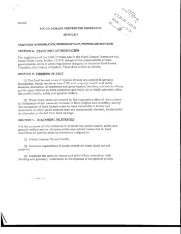
60.3 (d) ?;,FLOOD DAMAGE PREVENTION ORDINANCEARTICLE ISTATUTORY AUTHORIZATION, FINDINGS OF FACT, PURPOSE AND METHODSSECTION A. STATUTORY AUTHORIZATIONThe Legislature of the State of Texas has in the Flood Control Insurance Act,Texas Water Code, Section 16.315, delegated the responsibility oflocalgovernmental units to adopt regulations designed to minimize flood losses.Therefore, the County of Upshur, Texas does ordain as folknvs:SECTION B. FINDINGS OF FACT(1) The flood hazard areas of Upshur County are subject to periodicinundation, which results in loss of life and property, health and safetyhajzards, disruption of commerce and governmental services, and extraordinarypublic expenditures for flood protection and relief, all of which adversely affectthe public health, safety and general welfare.(2) These flood losses are created by the cumulative effect of obstructionsin floodplains which cause an increase in flood heights and velocities, and bythe occupancy of flood hazard areas by uses vulnerable to floods andhazardous to other lands because they are inadequate elevated, floodproofedor otherwise protected from flood damage.SECTION C. STATEMENT OF PURPOSEIt is the purpose of this ordinance to promote the public health, safety andgeneral welfare and to minimize public and private losses due to floodconditions in specific areas by provisions designed to:(1) Protect human life and health;(2) Minimize expenditure of public money for costly flood controlprojects;(3} Minimize the need for rescue and relief efforts associated withflooding and generally undertaken at the expense of the general public;
(4) Minimize prolonged business interruptions;(5) Minimize damage to public facilities and utilities such as water and gasmains, electric, telephone and sewer lines, streets and bridges located infloodplains;(6) Help maintain a stable tax base by providing for the sound use anddevelopment of flood-prone areas in such a manner as to minimize future floodblight areas; and(7) Insure that potential buyers are notified that property is in a flood area.SECTION D. METHODS OF REDUCING FLOOD LOSSESIn order to accomplish its purposes, this ordinance uses the following methods:(1) Restrict or prohibit uses that are dangerous to health, safety orproperty in times of flood, or cause excessive increases in flood heights orvelocities;(2) Require that uses vulnerable to floods, including facilities which servesuch uses, be protected against flood damage at the time of initialconstruction;(3) Control the alteration of natural floodplains, stream channels, andnatural protective barriers, which are involved in the accommodation of floodwaters;(4) Control filling, grading, dredging and other development which mayincrease flood damage;(5) Prevent or regulate the construction of flood barriers which willunnaturally divert flood xvaters or which may increase flood hazards to otherlands.
ARTICLE 2DEFINITIONSUnless specifically defined below, words or phrases used in this ordinance shallbe interpreted to give them the meaning they have in common usage and togive this ordinance its most reasonable application.ALLUVIAL FAN FLOODING - means flooding occurring on the surface of analluvial fan or similar landform which originates at the apex and ischaracterized by high-velocity flows; active processes of erosion, sedimenttransport, and deposition; and unpredictable flow paths.APEX - means a point on an alluvial fan or similar landform below which theflow path of the major stream that formed the fan becomes unpredictable andalluvial fan flooding can occur.APPURTENANT STRUCTURE - means a structure which is on the same parcelof property as the principal structure to be insured and the use of which isincidental to the use of the principal structureAREA OF FUTURE CONDITIONS FLOOD HAZARD - means the land area thatwould be inundated by the 1-percent-annual chance (100 year) flood based onfuture conditions hydrology,AREA OF SHALLOW FLOODING - means a designated AO, AH, AR/AO,AR/AH, or VO zone on a community's Flood Insurance Rate Map (FIRM) with a1 percent or greater annual chance of flooding to an average depth of 1 to 3 feetwhere a clearly defined channel does not exist, where the path of flooding isunpredictable and where velocity flow may be evident. Such flooding ischaracterized by ponding or sheet flow.AREA OF SPECIAL FLOOD HAZARD - is the land in the floodplain within acommunity subject to a 1 percent or greater chance of flooding in any givenyear. The area may be designated as Zone A on the Flood Hazard BoundaryMap (FHBM). After detailed rate making has been completed in preparation forpublication of the FIRM, Zone A usually is refined into Zones A, AO, AH, Al-30,AE, A99, AR, AR/A1-30, AR/AE, AR/AO, AR/AH, AR/A, VO, Vl-30, VE or V.BASE FLOOD - means the flood having a 1 percent chance of being equaled orexceeded in any given year.
BASE FLOOD ELEVATION (BFE) -The elevation shown on the FloodInsurance Rate Map (FIRM) and found in the accompanying Flood InsuranceStudy (FIS) for Zones A, AE, AH, A1-A30, AR, V1-V30, or VE that indicates thewater surface elevation resulting from the flood that has a 1% chance ofequaling or exceeding that level in any given year - also called the Base Flood.BASEMENT - means any area of the building having its floor subgrade (belowground level) on all sides.BREAKAWAY WALL - means a wall that is not part of the structural supportof the building and is intended through its design and construction to collapseunder specific lateral loading forces, without causing damage to the elevatedportion of the building or supporting foundation system.CRITICAL FEATURE - means an integral and readily identifiable part of aflood protection system, without which the flood protection provided by theentire system would be compromised.DEVELOPMENT - means any man-made change to improved and unimprovedreal estate, including but not limited to buildings or other structures, mining,dredging, filling, grading, paving, excavation or drilling operations or storage ofequipment or materials.ELEVATED BUILDING - means, for insurance purposes, a non-basementbuilding, which has its lowest elevated floor, raised above ground level byfoundation walls, shear walls, posts, piers, pilings, or columns.EXISTING CONSTRUCTION - means for the purposes of determining rates,structures for which the "start of construction" commenced before the effectivedate of the FIRM or before January 1, 1975, for FJRMs effective before thatdate. "Existing construction" may also be referred to as "existing structures."EXISTING MANUFACTURED HOME PARK OR SUBDIVISION - means amanufactured home park or subdivision for which the construction of facilitiesfor servicing the lots on which the manufactured homes are to be affixed(including, at a minimum, the installation of utilities, the construction ofstreets, and either final site grading or the pouring of concrete pads) iscompleted before the effective date of the floodplain management regulationsadopted by a community.EXPANSION TO AN EXISTING MANUFACTURED HOME PARK ORSUBDIVISION - means the preparation of additional sites by the construction4
of facilities for servicing the lots on which the manufactured homes are to beaffixed (including the installation of utilities, the construction of streets, andeither final site grading or the pouring of concrete pads).FLOOD OR FLOODING - means a general and temporary condition of partialor complete inundation of normally dry land areas from:(1) the overflow of inland or tidal waters.(2) the unusual and rapid accumulation or runoff of surface waters fromany source.FLOOD ELEVATION STUDY - means an examination, evaluation anddetermination of flood hazards and, if appropriate, corresponding water surfaceelevations, or an examination, evaluation and determination of mudslide (i.e.,mudflow) and/or flood-related erosion hazards.FLOOD INSURANCE RATE MAP (FIRM) - means an official map of acommunity, on which the Federal Emergency Management Agency hasdelineated both the special flood hazard areas and the risk premium zonesapplicable to the community.FLOOD INSURANCE STUDY (FIS) - see Flood Elevation StudyFLOODPLAIN OR FLOOD-PRONE AREA - means any land area susceptible tobeing inundated by water from any source (see definition of flooding).FLOODPLAIN MANAGEMENT - means the operation of an overall program ofcorrective and preventive measures for reducing flood damage, including butnot limited to emergency preparedness plans; flood control works andfloodplain management regulations.FLOODPLAIN MANAGEMENT REGULATIONS - means zoning ordinances,subdivision regulations, building codes, health regulations, special purposeordinances (such as a floodplain ordinance, grading ordinance and erosioncontrol ordinance) and other applications of police power. The term describessuch state or local regulations, in any combination thereof, which providestandards for the purpose of flood damage prevention and reduction.FLOOD PROTECTION SYSTEM - means those physical structural works forwhich funds have been authorized, appropriated, and expended and whichhave been constructed specifically to modify flooding in order to reduce theextent of the area within a community subject to a "special flood hazard" andthe extent of the depths of associated flooding. Such a system typically5
includes hurricane tidal barriers, dams, reservoirs, levees or dikes. Thesespecialized flood modifying works are those constructed in conformance withsound engineering standards.FLOOD PROOFING - means any combination of structural and non-structuraladditions, changes, or adjustments to structures which reduce or eliminateflood damage to real estate or improved real property, water and sanitaryfacilities, structures and their contents.FLOODWAY - see Regulatory FloodwayFUNCTIONALLY DEPENDENT USE - means a use, which cannot perform itsintended purpose unless it is located or carried out In close proximity to water.The term includes only docking facilities, port facilities that are necessary forthe loading and unloading of cargo or passengers, and ship building and shiprepair facilities, but does not include long-term storage or relatedmanufacturing facilities.HIGHEST ADJACENT GRADE - means the highest natural elevation of theground surface prior to construction next to the proposed walls of a structure.HISTORIC STRUCTURE - means any structure that is:(1) Listed individually in the National Register of Historic Places (a listingmaintained by the Department of Interior) or preliminarily determined by theSecretary of the Interior as meeting the requirements for individual listing onthe National Register;(2) Certified or preliminarily determined by the Secretary of the Interior ascontributing to the historical significance of a registered historic district or adistrict preliminarily determined by the Secretary to qualify as a registeredhistoric district;(3) Individually listed on a state inventory of historic places in states withhistoric preservation programs which have been approved by the Secretary ofthe Interior; or(4) Individually listed on a local inventory or historic places incommunities with historic preservation programs that have been certifiedeither:(a) By an approved state program as determined by the Secretary ofthe Interior or;6
(b) Directly by the Secretary of the Interior in states withoutapproved programs.LEVEE - means a man-made structure, usually an earthen embankment,designed and constructed in accordance with sound engineering practices tocontain, control, or divert the flow of water so as to provide protection fromtemporary flooding.LEVEE SYSTEM - means a flood protection system which consists of a levee,or levees, and associated structures, such as closure and drainage devices,which are constructed and operated in accordance with sound engineeringpractices.LOWEST FLOOR - means the lowest floor of the lowest enclosed area(including basement). An unfinished or flood resistant enclosure, usable solelyfor parking or vehicles, building access or storage in an area other than abasement area is not considered a building's lowest floor; provided that suchenclosure is not built so as to render the structure in violation of the applicablenon-elevation design requirement of Section 60.3 of the National FloodInsurance Program regulations.MANUFACTURED HOME - means a structure transportable in one or moresections, which is built on a permanent chassis and is designed for use with orwithout a permanent foundation when connected to the required utilities. Theterm "manufactured home" does not include a "recreational vehicle".MANUFACTURED HOME PARK OR SUBDIVISION - means a parcel (orcontiguous parcels] of land divided into two or more manufactured home lotsfor rent or sale.MEAN SEA LEVEL - means, for purposes of the National Flood InsuranceProgram, the North American Vertical Datum (NAVD) of 1988 or other datum,to which base flood elevations shown on a community's Flood Insurance RateMap are referenced.NEW CONSTRUCTION - means, for the purpose of determining insurancerates, structures for which the "start of construction" commenced on or afterthe effective date of an initial FIRM or after December 31, 1974, whichever islater, and includes any subsequent improvements to such structures. Forfloodplain management purposes, "new construction" means structures forwhich the "start of construction" commenced on or after the effective date of a
floodplain management regulation adopted by a community and includes anysubsequent improvements to such structures.NEW MANUFACTURED HOME PARK OR SUBDIVISION - means amanufactured home park or subdivision for which the construction of facilitiesfor servicing the lots on which the manufactured homes are to be affixed(Including at a minimum, the installation of utilities, the construction ofstreets, and either final site grading or the pouring of concrete pads) iscompleted on or after the effective date of floodplain management regulationsadopted by a community.RECREATIONAL VEHICLE - means a vehicle which is (i) built on a singlechassis; (ii) 400 square feet or less when measured at the largest horizontalprojections; (iii) designed to be self-propelled or permanently towable by a lightduty truck; and (iv) designed primarily not for use as a permanent dwelling butas temporary living quarters for recreational, camping, travel, or seasonal use.REGULATORY FLOODWAY - means the channel of a river or otherwatercourse and the adjacent land areas that must be reserved in order todischarge the base flood without cumulatively increasing the water surfaceelevation more than a designated height,RIVERINE - means relating to, formed by, or resembling a river (includingtributaries), stream, brook, etc.SPECIAL FLOOD HAZARD AREA - see Area of Special Flood HazardSTART OF CONSTRUCTION - (for other than new construction or substantialimprovements under the Coastal Barrier Resources Act (Pub. L. 97-348)),includes substantial improvement and means the date the building permit wasissued, provided the actual start of construction, repair, reconstruction,rehabilitation, addition placement, or other improvement was within 180 daysof the permit date. The actual start means either the first placement ofpermanent construction of a structure on a site, such as the pouring of slab orfootings, the installation of piles, the construction of columns, or any workbeyond the stage of excavation; or the placement of a manufactured home on afoundation. Permanent construction does not include land preparation, suchas clearing, grading and filling; nor does it include the installation of streetsand/or walkways; nor does it include excavation for basement, footings, piersor foundations or the erection of temporary forms; nor does it include theinstallation on the property of accessory buildings, such as garages or shedsnot occupied as dwelling units or not part of the main structure. For asubstantial improvement, the actual start of construction means the first
alteration of any wall, ceiling, floor, or other structural part of a building,whether or not that alteration affects the external dimensions of the building.STRUCTURE - means, for floodplain management purposes, a walled androofed building, including a gas or liquid storage tank, that is principally aboveground, as well as a manufactured home.SUBSTANTIAL DAMAGE - means damage of any origin sustained by astructure whereby the cost of restoring the structure to its before damagedcondition would equal or exceed 50 percent of the market value of the structurebefore the damage occurred.SUBSTANTIAL IMPROVEMENT - means any reconstruction, rehabilitation,addition, or other improvement of a structure, the cost of which equals orexceeds 50 percent of the market value of the structure before "start ofconstruction" of the improvement. This term includes structures which haveincurred "substantial damage", regardless of the actual repair work performed.The term does not, however, include either: (1) Any project for improvement ofa structure to correct existing violations of state or local health, sanitary, orsafety code specifications which have been identified by the local codeenforcement official and which are the minimum necessary to assure safe livingconditions or (2) Any alteration of a "historic structure", provided that thealteration will not preclude the structure's continued designation as a "historicstructure."VARIANCE » means a grant of relief by a community from the terms of afloodplain management regulation. (For full requirements see Section 60.6 ofthe National Flood Insurance Program regulations.)VIOLATION - means the failure of a structure or other development to be fullycompliant with the community's floodplain management regulations. Astructure or other development without the elevation certificate, othercertifications, or other evidence of compliance required in Section 60.3(b}(5),(c)(4), (c)(10), (d)(3), (e)(2), (e)(4), or (e)(5) is presumed to be in violation untilsuch time as that documentation is provided.WATER SURFACE ELEVATION - means the height, in relation to the NorthAmerican Vertical Datum (NAVD) of 1988 (or other datum, where specified), offloods of various magnitudes and frequencies in the floodplains of coastal orriverine areas.
ARTICLE 3GENERAL PROVISIONSSECTION A. LANDS TO WHICH THIS ORDINANCE APPLIESThe ordinance shall apply to all areas of special flood hazard with thejurisdiction of Upshur County.SECTION B. BASIS FOR ESTABLISHING THE AREAS OF SPECIAL FLOODHAZARDThe areas of special flood hazard identified by the Federal EmergencyManagement Agency in the current scientific and engineering report entitled,"The Flood Insurance Study (PIS) for Upshur County, Texas and IncorporatedAreas/' dated October 19, 2010, with accompanying Flood Insurance RateMaps dated October 19, 2010, and any revisions thereto are hereby adoptedby reference and declared to be a part of this ordinance.SECTION C. ESTABLISHMENT OF DEVELOPMENT PERMITA Floodplain Development Permit shall be required to ensure conforrnance withthe provisions of this ordinance.SECTION D. COMPLIANCENo structure or land shall hereafter be located, altered, or have its use changedwithout full compliance with the terms of this ordinance and other applicableregulations.SECTION E. ABROGATION AND GREATER RESTRICTIONSThis ordinance is not intended to repeal, abrogate, or impair any existingeasements, covenants, or deed restrictions. However, where this ordinanceand another ordinance, easement, covenant, or deed restriction conflict oroverlap, whichever imposes the more stringent restrictions shall prevail.10
SECTION F. INTERPRETATIO NIn the interpretation and application of this ordinance, all provisions shall be;(1) considered as minimum requirements; (2) liberally construed in favor of thegoverning body; and (3) deemed neither to limit nor repeal any other powersgranted under State statutes.SECTION G. WA
Therefore, the County of Upshur, Texas does ordain as folknvs: SECTION B. FINDINGS OF FACT (1) The flood hazard areas of Upshur County are subject to periodic . mains, electric, telephone and sewer lines, streets and bridges located in floodplains; (6) Help maintain