Transcription
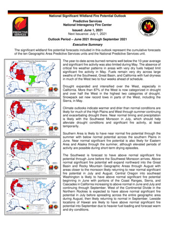
National Significant Wildland Fire Potential OutlookPredictive ServicesNational Interagency Fire CenterIssued: June 1, 2021Next Issuance: July 1, 2021Outlook Period – June 2021 through September 2021Executive SummaryThe significant wildland fire potential forecasts included in this outlook represent the cumulative forecastsof the ten Geographic Area Predictive Services units and the National Predictive Services unit.The year-to-date acres burned remains well below the 10-year averageand significant fire activity was also limited during May. The absence ofcritical fire weather patterns in areas with very dry fuels helped limitsignificant fire activity in May. Fuels remain very dry across largeswaths of the Southwest, Great Basin, and California with fuel drynessin much of the West two to four weeks ahead of schedule.Drought expanded and intensified over the West, especially inCalifornia. More than 87% of the West is now categorized in droughtand over half the West in the highest two categories of drought.Snowpack set new record lows in parts of the West, including theSierra, in May.Climate outlooks indicate warmer and drier than normal conditions arelikely for much of the High Plains and West through summer continuingand exacerbating drought there. Near normal timing and precipitationis likely with the Southwest Monsoon in July, which should helpalleviate drought conditions and significant fire activity, at leasttemporarily.Southern Area is likely to have near normal fire potential through thesummer with below normal potential across the southern Plains inJune. Near normal significant fire potential is also likely for EasternArea and Alaska through the summer, although elevated periods ofactivity are possible during short-term drying episodes.The Southwest is forecast to have above normal significant firepotential through June before the Southwest Monsoon arrives. Abovenormal significant fire potential will expand northward into the GreatBasin and Rocky Mountain Geographic Areas through August withareas closer to the monsoon likely returning to near normal significantfire potential in July and August. Central Oregon into southeastWashington is likely to have above normal significant fire potentialbeginning in June with portions of the Coast Ranges, Sierra, andCascades in California increasing to above normal in June and July andcontinuing through September. West of the Continental Divide in theNorthern Rockies is expected to have above normal significant firepotential in July before spreading across the entire geographic areaduring August, then likely returning to normal in September. Leesidelocations of Hawaii are likely to have above normal significant firepotential into September due to heavier fuel loading and forecast warmand dry conditions.
Past Weather and DroughtSnowpack across most of the West dropped to well below average values, including some record lowvalues in the Sierra. Above average temperatures and well below average precipitation dwindled analready meager snowpack across the Sierra and much of the West in May.Temperatures were generally near to below normal along and east of the Rockies, except for portions ofFlorida and the Northeast where rainfall deficits were also observed. Above average rainfall was observedacross the central and southern High Plains and eastward across much of Texas into the Lower MississippiValley. Dry conditions continued for eastern North Dakota into the Great Lakes, but timely precipitationand near to below normal temperatures helped limit significant fire activity. Near to below normaltemperatures were observed across much of Alaska with above average precipitation in the AlaskanPanhandle and portions of eastern Alaska.More than 87% of the western region is in drought with over half the region in extreme to exceptionaldrought. This represents the most expansive and intense drought for the West this century according tothe US Drought Monitor and Steve Bowen. Drought continues to intensify in California and parts of thePacific Northwest while persisting in the Great Basin and Southwest except for a small reduction innortheast New Mexico. Drought expanded in the Great Lakes and Carolinas but improved across much ofTexas.Thunderstorms developed in the Oregon Cascades, northern California, and the Great Basin around midMay, but large fire activity did not significantly increase. Periodic lightning was also observed in the Sierraand Arizona in May, but no significant activity resulted. The Palisades Fire in southern California burnedactively amid a weak marine layer and light winds illustrating some of the potential of dry fuels in California.Well above normal temperatures developed over the West Coast at the end of May, but overall, the lackof critical fire weather patterns and conditions limited significant fire activity.Left: Departure from Normal Temperature (top) and Percent of Normal Precipitation (bottom) (from PRISM Climate Group, Oregon StateUniversity). Right: U.S. Drought Monitor (top) and Drought Outlook (bottom) (from National Drought Mitigation Center and the ClimatePrediction Center)
Weather and Climate OutlooksENSO-neutral conditions are present with near-to-below average seasurface temperatures (SSTs) over the east-central to eastern equatorialPacific Ocean. Other teleconnection patterns, like the Madden-JulianOscillation, are likely to play bigger roles in shaping the weather andclimate patterns during ENSO-neutral conditions. The Climate PredicterCenter (CPC) forecasts an 67% chance that ENSO neutral conditionscontinue through summer. Long-range forecast guidance indicatesENSO neutral conditions are likely into fall with slightly below averageSSTs in the equatorial Pacific Ocean. A return to La Niña later this yearis possible, but there remains forecast uncertainty with this scenario.Geographic Area ForecastsAlaska: Normal fire potential is expected in Alaska for the summer,peaking in late June and early July, then rapidly decreasing with typicalend-of-season rains in late July and early August.Though the Brooks Range and northeast Interior are categorized asabnormally dry, most of these areas are still frozen and this will not havean impact on fire activity. Other regions are dry, particularly in the YukonFlats, the lower Matanuska Valley, and the Upper Tanana Valley. Thisspring has been mild, and a couple of moderate rainfall events andcooler temperatures kept fire activity low for the first weeks of fireseason.Wildfire activity is low to moderate at this time; the main potential is forsmall, human-caused ignitions that are easily suppressed. June typicallybrings increased lightning, which will drastically expand the amount oflandscape vulnerable to ignitions. Most stations are snow free, andsurface fuels are burnable. Most of the deeper duff layers remain toocold and moist to carry fire, but a week of typical June weather will createenough drying to bring these layers into burnable conditions.For the next few weeks, the Climate Prediction Center calls fortemperatures to be warmer in the west and wetter conditions in thesouth. Summer temperatures are forecast to be above normalstatewide, while precipitation is expected to be higher than normalacross the west.Normal conditions are expected across Alaska through the summer.During June, thunderstorm activity will peak around the solstice. Deeperfuels will contribute to wildfire behavior during this period and into Julybefore the seasonal rains of late summer typically bring an end to thefire season in August.Northwest: Significant fire potential is expected to increase to abovenormal for portions of southern and central Oregon into southeastWashington during June. Above normal significant fire potentialexpands to much of the Northwest Geographic Area, except fornorthwest Washington, by July and continue into September.Normal fire season progression across thecontiguous U.S. and Alaska shown bymonthly fire density (number of fires per unitarea). Fire size and fire severity cannot beinferred from this analysis. (Based on 19992010 FPA Data)The warm and dry trend continued in May across the region with the only exceptions in westernWashington. A portion of the Washington Cascades and a small area in southeastern Oregon receivedaverage precipitation, while the rest of the region received less than 50% of normal accumulation. Most of
eastern Washington and southwest Oregon saw less than 10% of average for the month. Maytemperatures started above average for most of the region, but cool temperatures in the second half of themonth resulted in near-normal temperatures for the month. A slow-moving trough lingered over the regionfor the third week of May, followed by a couple more systems in the final week of the month bringing somemuch-needed moisture. However, the region was drier than typical for the month.Snowmelt is underway due to the dry weather and lengthening days. Most of Washington’s mountains andMt. Hood in Oregon still have above normal snowpack, but Oregon’s basins now have snow waterequivalent between 0% and 48% of seasonal normal with some gains in the last week of May. Droughtconditions continued to worsen through the month. All of Oregon is now at least abnormally dry with 72%of the state experiencing at least severe drought conditions, 26% in extreme drought, and 4% now inexceptional drought. Washington has less drought, but 87% of the state is in at least abnormally dryconditions and 21% in severe drought.The wildfire activity remained light overall with approximately 200 fires and 1,700 acres burned reported.Human-caused starts from debris burning, agricultural burning and recreation fires accounted for most ofthe incidents. Lightning strikes did not produce significant fire activity. The number of fires and acres burnedwere less than the previous month. The largest incident burned over 800 acres in south central Oregon(Predictive Service Area (PSA) NW07) in timber and brush. Farther north along the slopes of the ColumbiaRiver, a grass fire burned 400 acres, which is not unusual for the location or time of year. Several fireshave been caught quickly that were reported as having more than normal intensity for this time of year incentral Oregon and Washington. Wind-driven fires in fine fuels and brush were reported as the mainproblems for containment efforts. Prescribed burning activities have been widespread throughout thegeographic area.The Washington Cascades have managed to retain an above average level of snow at higher elevations.Farther south in Oregon along the Cascade crest, only about 40% of the normal amount of snow is left.The middle elevations in Oregon are drier by comparison. With well below average moisture in May, fuelmoistures are trending towards minimum values in some of the PSAs for central Oregon and Washington.All PSAs are depicting below average heavy fuel moisture. Some relief arrived in the third week of themonth to improve fuels and smaller diameter dead fuels, but the moisture had minimal effect on the largefuels. Lower elevations in the geographic area have a varied response to the seasonal moisture. Fuelconditions in PSA NW10, NW06, and NW07 appear to be lower and reports from the field about firebehavior in those areas indicate fire season is two to four weeks ahead of schedule.The driest area in the region is the Columbia Basin. Green up is variable or completed. Brush, salt cedar,and cedars are receptive and abnormally dry. Farther south in the Metolius and Deschutes Basins, greenup is also complete at lower elevations. Native perennials have delayed green up response, and the brushremains stressed. This trend continues down into south-central Oregon where some Type 3 incidents weremanaged due to higher intensity problems in heavy fuels. The fine fuel production in all areas has beenreduced.Climate Prediction Center outlooks show likely warmer and drier than typical conditions for Oregon andWashington in June, except for an area of “equal chances” for dry, normal, or wet conditions extendingfrom the Olympic Peninsula through western Oregon. Outlooks continue to show warm and dry conditionsfor July through September. Fire danger is expected to rise above normal for most of the PSAs. Elevatedthreat for significant fires appears most likely in PSAs NW04, NW06, NW07, and NW10 starting in Juneand expanding to PSAs NW02, NW03, NW05, NW08, and NW09 in July through September. The elevatedthreat for significant fires will diminish late in September or October.
Northern California and Hawai’i: For June through August in North Ops, near normal significant firepotential is forecast for the Far East Side PSA (NC08), the mountains near the coast, and lower elevations.Above normal significant fire potential is forecast for most other mid and upper elevation areas. InSeptember, above normal significant fire potential is forecast for most of North Ops except for portions ofnortheast California. For Hawai’i, lee side areas are forecast to have above normal significant fire potentialwhile the remainder of the islands are likely to have near normal potential. However, locally above normalconditions will occur at times due to above normal loading of dry fuels.Precipitation in May was below normal, and this continues the trend of below average precipitation for the2020-2021 rainy season. Temperatures were above average in May. The low elevation grass crop ismostly cured now, and fuel loading among low elevation brush and grasses is lighter than average. Thenorthern high elevation snowpack is now mostly gone statewide, several weeks ahead of usual. The overalloutlook for the North Ops region is for drier and warmer than average conditions from June throughSeptember. Fire activity is expected to continue to increase in all areas in June as warm summer weatherbecomes predominant. Most mid and upper elevation areas are expected to have above normal significantfire potential from June through September, except for some coastal and far eastern areas. Lowerelevations remain at normal through August because strong downslope wind patterns are unusual duringsummer months and fuel loading is light. However, significant fire potential is likely to increase inSeptember due to the onset of north-northeast and offshore wind season. The Far Eastside PSA (NC08)is forecast to have near normal significant fire potential due to a light and less continuous fuel bed.Mountain areas near the coast should remain at normal potential because nearby sea surfacetemperatures (SSTs) are cooler than average and more onshore flow is expected.SSTs surrounding the Hawai’ian Islands range from slightly warmer than normal in the northwest to slightlycooler than normal near the Big Island. Temperatures throughout the region are expected to reflect theseSST trends through September. Dry weather in April and May has led to increasing drought throughoutthe region, especially on the lee sides of the islands. The four-month outlook calls for below averageprecipitation. Fuel loading increased due to the heavy rainfall in March. These fuels will dry out and becomevulnerable to fire spread, especially on lee sides, and occasionally elsewhere locally during periods of dryweather. Significant fire potential is above normal throughout the islands on the lee sides from June throughSeptember. Significant fire potential is normal elsewhere, although some local spots may see periods ofabove normal conditions during dry spells.Southern California: The significant fire potential will be near normal across the entire region in June andthen become above normal across most of the region July through September. However, the San JoaquinValley and the deserts will continue to have near normal significant fire potential.The weather pattern was progressive in May with a series of upper-level troughs and ridges moving intothe West Coast from the Pacific Ocean. Temperatures were near to above normal most of the monthacross interior southern California where there was abundant sunshine, while temperatures were belownormal across the coastal areas and coastal valleys where most mornings were overcast from the marinelayer. There were no periods of widespread triple digit heat away from the lower and eastern deserts untilthe last few days of the month, which is quite unusual for May. Like April, almost the entire region receivedlittle or no rainfall for the month. Scattered light showers and isolated thunderstorms occurred over theSierra on a few days as areas of low pressure moved into the Great Basin from the Pacific Northwest.These low-pressure areas also brought patchy light rainfall to the coastal areas from a very deep marinelayer. Above normal temperatures across the mountains in both April and May caused the snowpack inthe Sierra to completely melt. Winds were predominately onshore (from the south and west) and becamestrong across the mountains and deserts as troughs moved from the Pacific Northwest into the GreatBasin. There were no days with significant offshore winds in May.Drought across central and southern California continued to worsen in May as warm and dry conditionsremained. Much of the area is now under severe to extreme drought. The exceptional drought over thedeserts bordering Nevada and Arizona has spread into the southern Sierra. Areas of moderate droughtare over San Diego and Imperial Counties, and there are no longer any areas without drought. Both the1000-hour and 100-hour dead fuel moistures have been breaking records most of the month and the 100-
hour dead fuel moistures were below the 3rd percentile away from coastal areas. The new growth live fuelmoisture is continuing to gradually decrease and is now mainly between 80% and 100%. There are someareas where old growth live fuel moisture is between 60% and 80%. This live fuel moisture is well belownormal for this time of year.Expect little change in the weather in June as sea surface temperatures (SSTs) remain below normal overboth the Gulf of Alaska and the West Coast. These below normal SSTs will most likely cause a series oftroughs to move inland across the Pacific Northwest keeping excessive heat away from the area, but briefperiods of above normal temperatures are possible. The marine layer is expected to remain deeper thannormal in June likely causing below normal temperatures for the coast and coastal valleys. Temperaturesacross interior southern California will likely remain a little above normal. As usual, little or no rainfall isexpected across much of the area in June. The only exception will continue to be scattered light showersand isolated thunderstorms with any low-pressure areas that drop into the Great Basin from the PacificNorthwest and drizzle across the coastal areas when the marine layer gets exceptionally deep. Littlechange in SSTs is now anticipated across the Gulf of Alaska and the West Coast through the summermonths. Therefore, still expecting the high-pressure area that is usually located near the Four Cornersarea to be displaced farther to the south. This would cause a later start time to the monsoon and lessmonsoonal shower and thunderstorm activity than usual for southern California. Temperatures areexpected to be near normal during the summer months as high pressure oscillates back and forth over theDesert Southwest.Northern Rockies: Significant wildland fire potential for the Northern Rockies Geographical Area isexpected to be normal in June and again in September. However, during the month of July above normalfire potential is anticipated to develop west of the Continental Divide and expand eastward to include all ofthe geographic area in August.The latest US Drought Monitor depicts exceptional drought (D4) over North Dakota. Adjacent to that,eastern Montana is in the extreme drought (D3) category. Farther west of the Continental Divide, therehas been a trend towards developing drought resulting from a dry spring, especia
National Significant Wildland Fire Potential Outlook Predictive Services National Interagency Fir