Transcription
NDCRS SITE FORMTRAINING MANUAL:ARCHEOLOGICALSITESAuthors:J. Signe SnortlandL. Martin PerryLauren McCroskeyFern E. SwensonAmy C. BleierDivision of Archeology and Historic PreservationState Historical Society of North DakotaNorth Dakota Heritage Center & State MuseumBismarck, North 20
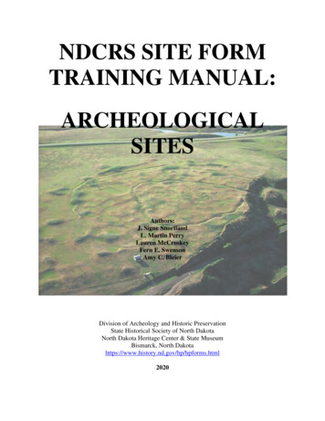
Entire contents copyrighted 2020State Historical Society of North DakotaAll rights reservedProduced by the Division of Archeology and Historic Preservation,State Historical Society of North DakotaCover photo: Double Ditch State Historic Site (32BL8), Burleigh County, North Dakota.NDCRS Archeological Site Form Manual—2020Page 2
INTRODUCTION . 6NDCRS AND GIS . 6CULTURAL HERITAGE FORM . 7HOW TO COMPLETE A NDCRS SITE FORM. 7General Rules for Completion of NDCRS Site Forms . 8PDF Site Forms . 8Steps to Complete a Site Form. 9How to Change Information (UPDATE) . 9Site Leads and Isolated Finds . 9Paleontological Sites . 10Defined Non-Sites and Property Types Requiring No Formal Documentation . 11SITE IDENTIFICATION—PAGE 1 . 12SITS# . 12FIELD CODE . 13SITE NAME . 13MAP QUAD . 13LEGAL DESCRIPTION . 13LTL . 14TOWNSHIP, RANGE, SECTION . 16SUBSECTION—QQQ/QQ/Q . 16NAD, UTM, ZONE . 16FEATURE TYPE. 17CULTURAL MATERIAL. 19SITE AREA . 21CULTURAL DEPTH . 21DEPTH INDICATOR . 22CM DENSITY . 22CULTURAL / TEMPORAL AFFILIATION. 23ENVIRONMENT . 26LANDFORM 1 . 26LANDFORM 2 . 26SLOPE / EXPOSURE. 29ECOSYSTEM . 29ELEVATION . 31NDCRS Archeological Site Form Manual—2020Page 3
CULTURAL RESOURCE MANAGEMENT . 32OWNERSHIP . 32FIELDWORK DATE . 32SITE CONDITION . 32COLLECTION . 32PROBE. 33FORMAL TEST/EXCAVATION . 33MANAGEMENT RECOMMENDATION OF THE RECORDER . 33ADDITIONAL INFORMATION . 33RECORDED BY AND DATE RECORDED . 34SHSND USE . 35STUDY UNIT . 35COMPONENT. 35VERIFIED SITE . 35CR TYPE . 35DESCRIPTIVE SECTION—PAGE 2 . 37ACCESS . 37SITE DESCRIPTION . 37CULTURAL MATERIAL DESCRIPTION. 37DESCRIPTIVE SECTION—PAGE 3 . 38DESCRIPTION OF SUBSURFACE TESTING . 38FIELD CONDITIONS . 38TECHNIQUES USED TO ESTIMATE SITE AREA. 38RATIONALE FOR SITE BOUNDARY DETERMINATION. 38CURRENT USE OF SITE . 38VEGETATION . 38VEGETATION COVER . 38SNOW COVER . 38DESCRIPTION OF COLLECTIONS OBSERVED & CONTACT INFORMATION . 39PROJECT NAME AND PRINCIPAL INVESTIGATOR . 39CONTRACTING FIRM OR AGENCY . 39DESCRIPTIVE SECTION—PAGE 4 . 40STATEMENT OF INTEGRITY . 40STATEMENT OF SIGNIFICANCE . 40NDCRS Archeological Site Form Manual—2020Page 4
REFERENCES CITED / COMMENTS . 40ATTACHMENTS SECTION . 41TOPOGRAPHIC MAP . 41SKETCH MAP . 41SITE PHOTOGRAPHS . 41CONTINUATION PAGE. 42CITED AND SELECTED REFERNCES . 43Codes of Previous Versions of the NDCRS Manual . 47NDCRS Archeological Site Form Manual—2020Page 5
INTRODUCTIONThe Division of Archeology and Historic Preservation (AHP) of the State Historical Society ofNorth Dakota (SHSND) has a mandate from the Federal Historic Preservation Program toincrease the number of cultural resources in the state recorded at a minimum documentationlevel. Minimum documentation level, as defined by the Department of Interior, is “location,style, condition, significance, or research needed to determine importance of any property”(HCRS 1980:6). The North Dakota Cultural Resources Survey (NDCRS) site forms are designedto record cultural resources at that level. This manual explains how to properly complete thearcheological site form. The information in the NDCRS system is used to update thecomprehensive plan for management of North Dakota cultural resources.The AHP staff encourages NDCRS system users to consult the following source for an overviewof the North Dakota State Historic Preservation Office and its articulation to the NDCRS:Swenson, Fern E., Paul R. Picha, and Amy C. Bleier2016 A Retrospective from the North Dakota State Historic Preservation Office. In TheNational Historic Preservation Act: Past, Present, and Future, edited by Kimball M.Banks and Ann M. Scott., pp 65-84. Routledge, New York.NDCRS AND GISThe AHP began incorporating site location information from the NDCRS files and the AHPSurvey Manuscript Collection into a comprehensive geographic information system (GIS) formatin 2002. Previously and newly recorded prehistoric archeological, historical archeological andarchitectural sites, site leads, isolated finds, and Class III cultural resource survey reports weredigitized. Staff digitized over 54,000 NDCRS files, and over 10,500 cultural resource inventoriescomprising the Manuscript Collection during this project. In 2008, all of the previously recordedNDCRS forms and manuscripts had been digitized. Newly submitted NDCRS forms and culturalresource surveys are added upon review by the AHP.That project was undertaken through a cooperative agreement between the Bureau of LandManagement (BLM) and the SHSND. The datasets represented in GIS allow planners, culturalresource professionals and others to make informed decisions regarding North Dakota’s culturalresources.In 2009, the AHP introduced a web viewer application that allows researchers to view andinteract with the spatial data on computers in the AHP office. Users of the application are notpermitted to modify the spatial/attribute data. Researchers seeking cultural resource spatial datashould contact AHP staff regarding appropriate protocols for data requests.All the NDCRS files and cultural resource reports are available for download in PDF format atthe AHP office.NDCRS Archeological Site Form Manual—2020Page 6
CULTURAL HERITAGE FORMThe Cultural Heritage Form was published online by the AHP in 2013. The form was created asa response to the call for a form to record non-archeological sites. The Cultural Heritage Formmay be used to document and initially record traditional cultural properties, sacred sites, and/orsites of cultural and religious significance to anyone. This form is not a formal determination ofsignificance by Federal, Tribal, and/or State officials.The Cultural Heritage Form is not required by the North Dakota State Historic PreservationOffice or the SHSND. The Cultural Heritage Form is not a substitute for the NDCRSarcheological, architectural, and historical archeological site forms. Locations identified andrecorded on the Cultural Heritage Forms are assigned identification numbers by AHP staff.HOW TO COMPLETE A NDCRS SITE FORMThe NDCRS system consists of three manuals and three site forms, delineated as: (1)archeological, (2) architectural, and (3) historical archeological. This document is thearcheological manual; it guides a user through step-by-step completion of the archeological siteform.Which site form to use? If a standing structure is present, use the architectural form. If a structureis no longer standing but archeological evidence is present, such as a foundation or scatter ofhistoric artifacts, use the historical archeological form. If the site is prehistoric, use thearcheological form.In a situation where a site has more than one component, use a combination of forms to recordall the components. For example, if a historic house stands beside a stone circle and issurrounded by a scatter of historic materials, follow these steps: complete (1) the architecturalform; (2) Page 1 of an archeological form and Page 1 of a historical archeological form; (3)complete the respective archeological and historical archeological Description sections; (4)complete the Attachments Section; and (5) use the same Field Code on all forms to link themtogether.When a site has multiple components, number all architectural features in consecutive orderbeginning with “1” prior to assigning numbers to the archeological and/or historicalarcheological features.If completing an update for a site form, do not re-number the previously recorded features.Page 1 of the archeological site form is arranged for entry into a digital database.For purposes of site form discussion and data entry, the term “field” refers to a single element orpiece of information. Each field is identified by a unique name. Examples of fields are SiteName, Cairn, and Additional Information.NDCRS Archeological Site Form Manual—2020Page 7
Several resources are listed in the Cited and Selected References section of this document.These resources are useful for discussion and depiction of cultural resources.General Rules for Completion of NDCRS Site Forms1. Site forms are available for download from the AHP ). One paper copy of the NDCRS site formmust be mailed to the AHP with a cover letter. Additionally, a PDF version of the siteform and the corresponding GIS shapefiles must be uploaded to the AHP-run FTP site.Emailed site forms are not accepted.2. Consult the appropriate NDCRS manual(s) or contact the AHP with questions orconcerns.3. A blank field means “absent” or “unknown.” If needed, explain in the DescriptiveSection why the information was not collected.4. If “Miscellaneous” and/or “Other” is coded in a field, describe what it represents in theAdditional Information field and in the descriptive section.5. If legal descriptions or any other piece of information exceed the space provided on Page1, attach a Continuation Page with: a) only those fields requiring additional space and b)the Field Code and/or SITS number.6. Re-check all forms before submitting them to the AHP. Confirm the legal descriptionsare accurate.7. Mail the completed form(s) with a cover letter to:Archaeology and Historic PreservationState Historical Society of North Dakota612 East Boulevard AvenueBismarck, North Dakota 585058. Allow up to 15 working days for processing by the AHP.PDF Site FormsThe NDCRS site forms are available as fillable PDFs athttps://www.history.nd.gov/hp/hpforms.html. The digital site forms have been created in AdobeAcrobat Pro. All forms should be usable with Adobe (program download/upgrade availableonline). The site forms utilize dropdown menus, check boxes, and text boxes.NDCRS Archeological Site Form Manual—2020Page 8
Steps to Complete a Site Form1. Download the PDF of the site form.2. Open the PDF using Adobe (available online).3. Use the Save A Copy command to name the document and save.4. Complete the form. If it is difficult to discern where the fields are located, click the“Highlight Fields” tab.5. Print the form and submit to AHP with a cover letter. Emailed versions of site formsare not accepted.6. Upload a PDF version of the site form to the AHP-run FTP site.7. Upload the corresponding GIS shapefiles to the AHP-run FTP site.How to Change Information (UPDATE)The statuses of sites are dynamic, and recording may errors occur. The procedure for changingdata is similar to that of initially recording a site. To change information, complete a Page 1 andindicate “Update” at the top of the page, enter the SITS#, legal description, and data for theproject. At a minimum, a Page 1 with the current condition should be completed. Changes forfeatures should be noted in the descriptive sections. Leave all fields blank that remainunchanged. Do not re-number previously recorded features. Photographs must be providedto verify the current condition and any changes to the features. Page 1 of the site form has adropdown icon at the top, right corner of the page. Select UPDATE in that field. Mail theupdated site form(s) to the address above; emailed versions are not accepted. Upload a PDFversion of the updated site form and the corresponding GIS shapefiles to the AHP-run FTP site.Submit updated information for every site revisited.If there is “no change” to the cultural resource, the best practice is to state this in the AdditionalInformation field and enter the Fieldwork Date. Include photographs of the feature(s).Site Leads and Isolated FindsIn the NDCRS database site leads and isolated finds are differentiated from SITS numbers. Thenumbers assigned to site leads and isolated finds include an ‘X,’ for example 32BLX9999.NDCRS Archeological Site Form Manual—2020Page 9
Site LeadsAs per the North Dakota SHPO Guidelines Manual for Cultural Resource Inventory Projects,“site leads are identified by two separate definitions. The first consists of a location reported bya landowner or other non-professional as containing cultural resources. These locations areidentified as site leads until such time as a qualified archaeologist can determine whether culturalresources exist in the area and, if so
Download the PDF of the site form. 2. Open the PDF using Adobe (available online). 3. Use the Save A Copy command to name the document and save. 4. Complete the form. . version of the updated site form and the corresponding GIS shapefiles to the AHP-run FTP s