Transcription
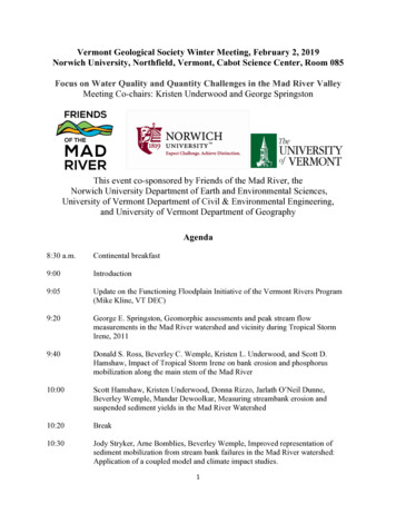
Vermont Geological Society Winter Meeting, February 2, 2019Norwich University, Northfield, Vermont, Cabot Science Center, Room 085Focus on Water Quality and Quantity Challenges in the Mad River ValleyMeeting Co-chairs: Kristen Underwood and George SpringstonThis event co-sponsored by Friends of the Mad River, theNorwich University Department of Earth and Environmental Sciences,University of Vermont Department of Civil & Environmental Engineering,and University of Vermont Department of GeographyAgenda8:30 a.m.Continental breakfast9:00Introduction9:05Update on the Functioning Floodplain Initiative of the Vermont Rivers Program(Mike Kline, VT DEC)9:20George E. Springston, Geomorphic assessments and peak stream flowmeasurements in the Mad River watershed and vicinity during Tropical StormIrene, 20119:40Donald S. Ross, Beverley C. Wemple, Kristen L. Underwood, and Scott D.Hamshaw, Impact of Tropical Storm Irene on bank erosion and phosphorusmobilization along the main stem of the Mad River10:00Scott Hamshaw, Kristen Underwood, Donna Rizzo, Jarlath O’Neil Dunne,Beverley Wemple, Mandar Dewoolkar, Measuring streambank erosion andsuspended sediment yields in the Mad River Watershed10:20Break10:30Jody Stryker, Arne Bomblies, Beverley Wemple, Improved representation ofsediment mobilization from stream bank failures in the Mad River watershed:Application of a coupled model and climate impact studies.1
10:50Beverley Wemple, Don Ross, Joanne Garton, Scott Hamshaw, Donna Rizzo,Investigating the effects of gravel roads on water quality in the Lake ChamplainBasin11:10Kristen L. Underwood, Scott D. Hamshaw, Mandar M. Dewoolkar, and Donna M.Rizzo, A Bayesian un-mixing model to define sources of suspended sediments inthe Mad River Watershed11:30Break11:35Rebecca Diehl, Beverley Wemple, Kristen Underwood, Don Ross, Evaluatingfloodplain potential for sediment and nutrient retention: Development of aframework to assist in Lake Champlain Basin planning11:55Jessica Louisos, Roy Schiff, Michele Braun, Ann Smith, Floodplain restorationand flood resiliency: An application of fluvial geomorphology along the DogRiver in Northfield, Vermont12:15Roy Schiff, Brian Cote, Corrie Miller, Improving Resiliency and Restoring FishPassage on Bradley Brook in Warren, Vermont12:35Lunch (pizza)2
AbstractsGeomorphic assessments and peak stream flow measurements in the Mad River watershed andvicinity during Tropical Storm Irene, 2011George E. Springston, Dept. Earth and Environmental Sciences, Norwich UniversityThe Mad River watershed (MRW) in central Vermont was heavily impacted by Tropical StormIrene (TSI) on August 28-29, 2011. Mean rainfall in the MRW was 157 mm (6.18 inches).Stream flow at the USGS stream gage at Moretown rose quickly, beginning about 6:00 a.m. onthe 28th and peaking at 668 m3/s (23,600 cfs) at 8:00 p.m. This was the highest peak flowrecorded at the gage in its 84--year period of operation.In the wake of the flood, the Vermont Geological Society organized volunteers to gather data onflood geomorphology and peak flows on impacted tributaries. One or more relatively straightchannel segments without abrupt widening or narrowing were identified on each stream. Fromthe fall of 2011 to October of 2014, teams visited Clark Brook (6.58 km2) in the Upper WhiteRiver watershed and Pine Brook (10.54 km2) and the Upper and Lower segments of StetsonBrook (11.29 and 12.51 km2) in the MRW. At each site the teams identified flood debris andevidence of scour, measured between 2 and 4 cross sections, a longitudinal profile, and clastsurveys, and documented the site with sketches and photos.All peak flows were calculated using the slope-area method of Chow (1959). Roughnesscoefficients were estimated using the methods of Cowan (1956) and Jarrett (1985). Froudenumbers in all cases were less than 1. Peak flows (m3/s): Clark 13.3, Pine 28.5, StetsonUpper 38.0, Stetson Lower 54. Peak bed shear stresses (N/m2): Clark 390, Pine 269,Stetson Upper 194, Stetson Lower 400. Peak unit stream powers (W/m2): Clark 604, Pine 504, Stetson Upper 339, Stetson Lower 974. The high unit stream powers are consistentwith the extensive scour and bedload transport observed on each stream.Comparisons with other stream gages along the Green Mountains of central Vermont shows thatalthough a plot of peak discharge versus drainage area shows a strong positive correlation, a plotof discharge per unit area versus drainage area shows a wide scatter, suggesting that other factorsbesides drainage area influence peak discharge.Although the rapid response by the volunteers in the fall of 2011 resulted in the promptdocumentation of critical geomorphic evidence of the flood, subsequent visits and further fieldwork in 2012 and 2013 showed that, in the absence of another large flood, even subtle evidenceof TSI was still visible more than 24 months after the event.3
Impact of Tropical Storm Irene on bank erosion and phosphorus mobilization along the mainstem of the Mad RiverDonald S. Ross1, Beverley C. Wemple2, Kristen L. Underwood3, and Scott D. Hamshaw4University of Vermont: 1Dept of Plant & Soil Science, 2Dept of Geography, 3Dept of Civil andEnvironmental Engineering, 4Vermont EPSCoRMovement of sediment, and associated phosphorus, from streambanks to freshwater lakes ispredicted to increase with greater frequency of extreme precipitation events. This higherphosphorus load may accelerate harmful algal blooms in affected water bodies, such as LakeChamplain. In the Mad River, extreme flooding from Tropical Storm Irene in 2011 causedextensive erosion. We measured stream channel change along the main stem between 2008-2011by digitizing available pre- and post-storm aerial imagery. Soils were sampled post-Irene at sixactive stream erosion sites, using an experimental design to measure differences in soil textureand phosphorus both with depth (90 cm) and distance from the stream. In addition to totalphosphorus (TP), we determined bioavailable (soil test) phosphorus (STP) and the degree ofphosphorus saturation (DPS). The six sites represented a 0.87-km length of streambank thatcontributed an estimated 17.6 x 10³ Mg of sediment and 15.8 Mg of TP, roughly the same asaverage annual watershed export estimates. At four sites, the STP and DPS were low andsuggested little potential for short-term phosphorus release. At two agricultural sites where thelateral extent of erosion was high, imagery showed a clear loss of well-established riparianbuffer. Present-day near-stream soils were elevated in STP and DPS. An increase in theseextreme events will clearly increase sediment loads. There will also be increasing concentrationof sediment phosphorus if streambanks continue to erode into actively managed agriculturalfields.Measuring streambank erosion and suspended sediment yields in the Mad River WatershedScott D. Hamshaw1, Kristen L. Underwood2, Donna M. Rizzo2, Jarlath O’Neil Dunne3,Beverley C. Wemple4, Mandar M. Dewoolkar2University of Vermont: 1Vermont EPSCoR, 2Dept of Civil and Environmental Engineering,3Spatial Analysis Lab, 4Dept of GeographyExcessive erosion and fine sediment delivery to river corridors and receiving waters degradesaquatic habitat, contributes to nutrient loading, and impacts infrastructure. In the Mad Riverwatershed and Lake Champlain Basin in Vermont, reduction in fine sediment delivery is apriority due to the role sediment-bound nutrients such as phosphorus play in exacerbatingeutrophication in portions of Lake Champlain. Measuring the amount of suspended sedimentyield and sources of erosion is therefore important for guiding watershed management efforts.This talk will share results from a UVM project to continuously monitor suspended sediment inthe Mad River and some of its tributaries between 2013 and 2016 using in-stream turbiditysensors. Additionally, a brief description of the use of drones to survey the main stem of the MadRiver for excessive streambank erosion will be presented.4
Improved representation of sediment mobilization from stream bank failures in the Mad Riverwatershed: Application of a coupled model and climate impact studies.Jody Stryker1, Arne Bomblies2, Beverley C. Wemple31Stone Environmental, Inc., Montpelier, VT; University of Vermont: 2Dept of Civil &Environmental Engineering and VT EPSCoR, 3Dept of GeographyWhile considerable research has established that in addition to surface and road erosion,streambank erosion and failure are primary mechanisms that mobilize sediment and nutrientsfrom the landscape. This mechanism and other hydrological processes driving sediment andnutrient transport are likely to be highly influenced by anticipated changes in climate,particularly extreme precipitation and flow events. This presentation summarizes efforts todevelop and apply a physics-based watershed model with more inclusive representation ofsediment that could be used for investigating impacts of climate change. Two existing models(the Bank Stability and Toe Erosion Model and the Distributed Hydrology Soil VegetationModel) were coupled to achieve mechanistic and spatially explicit simulation of streambankerosion and geotechnical failure at the watershed scale. This approach was then applied to theMad River watershed in Vermont, where locally obtained field data collected between 20122015 was used to parameterize, as well as calibrate and validate, the coupled model. The effectsof local trends in temperature and precipitation on discharge and sediment loading wereevaluated by using the calibrated Mad River model driven by meteorological inputs from generalcirculation models as well as from a statistical weather generator. This research adds to the bodyof evidence indicating that streambank erosion and failure can be a major source of suspendedsediments in a watershed, as well as potentially a major source of phosphorus. It also supportsother climate impact studies in showing that watershed response to increasing temperatures andprecipitation, and to an increasing trend in extreme events, includes higher peak discharges andsediment loads. The lack of anticipated trends in GCM data, specifically an increase inprecipitation and in extreme events, highlights the need for climate predictions in the form ofhigh-resolution time series that reflect local trends in both temperature and precipitation to betterinform predictive model applications.5
6
Investigating the effects of gravel roads on water quality in the Lake Champlain basinBeverley C. Wemple1, 2, Donald S. Ross3, Joanne Garton2, 6, Scott D. Hamshaw4, Donna M.Rizzo5University of Vermont: 1Dept of Geography,2Rubenstein School of Environment and NaturalResources, 3Dept of Plant & Soil Science, 4Vermont EPSCoR, 5Dept of Civil and EnvironmentalEngineering; and 6Vermont Agency of Natural ResourcesTransportation networks are a critical element of our society’s infrastructure, linkingcommunities and commerce, but with environmental effects that impact water quality and otherecosystem processes. The linear nature of roads and their tendency to cross topographicgradients influence watershed hydrologic processes on a scale far greater than one might expectfrom the small fraction of the land area they occupy. This presentation describes the emergingunderstanding of the role of rural road networks on the production of sediment and sedimentbound phosphorus (P) within the Lake Champlain basin, and the approaches used by ruralcommunities to mitigate these impacts while enhancing flood resiliency. We briefly describefield studies conducted in the Mad River watershed and the greater Winooski basin to quantifysediment and P production from unpaved rural roads, and results of both experimental andretrospective studies to assess the efficacy of management practices in reducing erosion alongroads. We also provide a brief description of efforts to translate this work into policy changesin Vermont that address the joint goals of water quality improvement and flood resiliency inrural, mountainous communities.7
A Bayesian un-mixing model to define sourcesof suspended sediments in the Mad River WatershedKristen L. Underwood1, Scott D. Hamshaw2, Mandar M. Dewoolkar1, and Donna M. Rizzo1University of Vermont: 1Dept of Civil & Environmental Engineering, 2Vermont EPSCoRThe effectiveness of mitigation measures for sediment impairment of our rivers is improved withinformation pertaining to sediment source types and locations. Statistically-based tools such assediment un-mixing models are one method for defining the relative proportions of sedimentsource groups that may be contributing to suspended sediment flux. We applied a Bayesian unmixing model to discern between surface and subsurface sources of suspended sediment in theMad River watershed (360 km2), and to quantify uncertainty on source apportionment estimates.Using fallout radionuclides as fingerprints (137Cs, excess 210Pb), the model apportioned therelative contributions of four source groups (agricultural topsoils, forested topsoils, roads, andstreambanks) for each of three suspended-sediment targets: (1) a catchment-scale sampling oftwo sequential summer 2015 storm events; (2) a sampling of the same two storm events fromthree tributaries comprising 31% of the total catchment drainage area; and (3) a sampling ofautumn 2015 storms from the same tributaries. Interpretation was supported by analysis ofsynoptically-measured suspended-sediment load quantified from regression models relying oncontinuous turbidity and discharge monitored at the outlets of the Mad River catchment and eachtributary. Un-mixing model results suggest that suspended sediment load at the catchment outletduring two summer storms was generated primarily from subsurface sources characterized aserosion from roads (36%) and stream banks/ gullies (40%), and that tributary source proportionsduring the same storms did not differ appreciably. Findings were substantiated by separatestudies of channel change from multi-date lidar and unmanned aerial system surveys, as well asobservations of road and road-ditch erosion during intense precipitation events during the studyperiod. Limited seasonal comparison of tributary sediment flux suggested a greater proportion ofsediment was sourced from agricultural surface soils in the autumn.8
Evaluating floodplain potential for sediment and nutrient retention: Development of a frameworkto assist in Lake Champlain Basin planningRebecca Diehl1, Beverley C. Wemple1, Kristen L. Underwood2, Donald S. Ross3University of Vermont: 1Dept of Geography, 2Dept of Civil and Environmental Engineering,3Dept of Plant & Soil ScienceLake Champlain remains an impaired water body due to excessive phosphorus and othernutrients derived from the surrounding landscape. Efforts to reduce nutrient loading often focuson protection or enhancement of floodplain features within river corridors that slow flood waters,capturing sediment and associated nutrients, or on restoration of floodplain connectivity todissipate energy of floodwaters thereby reducing the export of sediment and nutrients fromexcessive bank erosion. Because of the scope of the problem (e.g., nearly three-quarters ofassessed Vermont rivers have limited floodplain access), it is necessary to thoughtfully targetareas with the greatest potential.We are working to improve our understanding of the functioning of the floodplains along theriver corridors of the Lake Champlain Basin, including the rate of sediment and nutrientretention and the environmental controls on such rates. For this work, we rely heavily on existingdatasets, supplemented with field data collected at targeted sites, to develop a map of floodplainsurfaces, identify relevant environmental variables, and calculate retention rates. Statisticalmodels describing the relationship between environmental variables and existing (i.e., measured)floodplain functioning will be used to extend our understanding spatially, to river corridors forwhich sediment and nutrient retention rates were not measured, and in time, with floodplainmanagement actions.Robust hydrologic, hydraulic, soil nutrient, and geomorphic datasets exist for the Mad River.Additionally, floodplain access and community support make the Mad River an ideal place tostudy floodplain processes. Multiple floodplain sites have been established for monitoringsediment and nutrient retention. We will also test and calibrate our floodplain inundationmapping approach for those portions of the watershed whose drainage area is greater than 10mi2.In this presentation, we will provide examples of anticipated products and describe how suchproducts will be used to develop a framework and accompanying GIS dataset that allows riverand floodplain managers, as well as other LCB stakeholders, to quantitatively evaluate thebenefit of floodplain restoration, conservation, or enhancement on the retention of sediment andnutrients.9
Floodplain Restoration and Flood Resiliency: An Application of Fluvial GeomorphologyAlong the Dog River in Northfield, VermontJessica Louisos1, Roy Schiff1, Michele Braun2, Ann Smith21Milone & MacBroom, Inc., 2Friends of the Winooski RiverThe neighborhoods along the Dog River in Northfield, Vermont experience periodic flooding.The Town of Northfield took a progressive approach and facilitated the voluntary FEMA buyoutof several damage-prone properties along the Dog River and Union Brook. The principals offluvial geomorphology and hydraulics were used to evaluate alternatives to reduce flooding andimprove river and floodplain function. A berm was removed and 3.1 acres of floodplain wererestored. A Town park was created in the reclaimed floodplain area to improve local recreationand river access that can also store water during floods. The park includes ADA-accessiblewalking paths adjacent to Water Street, grass walking paths to access the river, play areas, sittingareas, and an amphitheater space. Floodplain restoration and park creation is an example of howcommunities can improve resiliency while also creating amenities in village centers.Improving Resiliency and Restoring Fish Passage on Bradley Brook in Warren, VermontRoy Schiff1, Brian Cote1, Corrie Miller21Milone & MacBroom, Inc., 2Friends of the Mad RiverA town-owned culvert that carried Bradley Brook under West Hill Road in Warren, Vermont,was in poor structural condition and in need of replacement. The culvert blocked passage ofbrook and brown trout, and was mostly incompatible with the channel morphology. BradleyBrook is a steep, headwater mountain stream that drains the eastern slopes of the GreenMountains. The bankfull width of the cobble and boulder channel is approximately 18 feet, andthe bankfull depth of the channel is 1 foot. Large wood is abundant in the channel near theculvert. A series of alternatives were evaluated to improve fish passage and improve conveyanceof water, sediment, large wood, and ice. Replacement of the existing culvert with a metal archwas the preferred alternative as it was the most cost-effective open-bottom structure to meet theproject objectives. An arch on cast-in-place concrete footings was installed in October of 2015that has an opening that is 18 feet wide and 9 feet tall. The Town administered the bid andoversaw construction. The bed of the channel in the arch was restored to facilitate fish passage.The new culvert has successfully reconnected about 5 miles of aquatic habitat and is moreresilient.10
Resources, 3Dept of Plant & Soil Science, 4Vermont EPSCoR, 5Dept of Civil and Environmental Engineering; and 6Vermont Agency of Natural Resources Transportation networks are a critical element of our society’s infrastructure, linking communities and commerce, but with environmental effects