Transcription
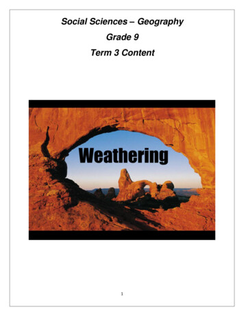
Social Sciences – GeographyGrade 9Term 3 Content1
UNIT1. INTRODUCTION ( PURPOSE OF THE TRAINING)LEGISLATIVE FRAMEWORKTHE CONCEPT GEOGRAPHYEach unit is arranged as follows: OverviewAims and skillsAssessment strategiesActivities andNotesAnnexures : Assessment exemplarsFor the user:Table of ContentsIntroductionUnit 1Surface forces that shape the earth: concept of weathering1.1 Physical (mechanical) weathering1.2 Chemical weathering1.3 Biological weathering1.4 impact of human activities on weatheringpage23347911Unit 2Surface forces that shape the earth: erosion and deposition2.1 Rivers – features of erosion and deposition along a river course2.2 Sea – features of erosion and deposition associated with wave action:the power of wave action and typical landforms2.3 Moving ice – features of erosion and deposition associated withglaciated landscapes2.4 Wind – features of erosion and deposition associated with wind131313Unit 3Surface forces that shape the earth: the impact of people on soil erosion:case study – agriculture as a contributor to erosion3016212730 Some of the activities in this training manual will be performed during the training sessions inpairs, individually and in class discussions. It is up the discretion of the facilitator which of theexercises to emphasise and which to complete in the time allocated to the session. Additional notes in this manual will help educators to develop their own class activities It is advised that educators read the notes in the manual privately to save time during the trainingsession.2
Resources needed: Any of the prescribed Grade 9 textbook and educator’s guide.Social Sciences CAPS document.Annual Teaching Plan.Pen and paper.ProjectorLap topINTRODUCTIONDear Social Sciences PractitionersWelcome to the CAPS Geography Grade 9 Content knowledge trainingsession. This manual has been developed to assist you follow all geographicconcepts critically to every topic. In order for learners to apply enquiry skills,they will need to have to have a full grasp and understanding of the content.REMEMBER memory skills remain important.Ice – breaker (inspiration)Read through the PPT presentation on Mrs Thompson perfume as inspiration for teaching.LEGISLATIVE FRAMEWORK(10 minutes)As stipulated in the Social Sciences CAPS:Both History and Geography should be taught and assessed during every term of the year Learners are trained to speculate, to debate, to make connections, to select, to prioritise and to persist, intackling real issues and important questions.Learners are encouraged to ask questions: Who? Where? What? Why? When? How? Should? Could? Is\ Are? The questions learners ask give teachers a good indication of prior knowledge, perceptions,interests, insights and concerns.Different forms of text (oral, written and visual) are central to both disciplinesLearners should write regularly, with a clear progression in length and complexity throughout.Concepts in GeographyGeography is the study of the human and physical environment. Geography is an integrated disciplinethat examines both physical and human processes over space and time. Geography helps us tounderstand our complex world. It offers us a bridge between the human and physical sciences.3
There are many branches of Geography. Physical Geography examines natural processes and features,including the atmosphere, landforms and ecosystems. Human Geography is concerned with the activitiesand impact of people on the earth.The concept that unifies Geography is space. All geographical phenomena have a spatial dimension.They also operate in a continuously changing environment.Geography therefore includes the study of: spatial patterns and trends: the location of people and places in the world; similarity and difference: how environments and lifestyles compare and the reasons for similaritiesand differences; movement: how and why people, goods, water, land and air move and change; Planet Earth: land, water and air; human settlement: where people live and why; human activities: what people do, how the environment affects them and how they affect theenvironment; interdependence: the links between climate, vegetation, wildlife, resource distribution, and humansettlement and activity; and Change: the changing nature of people and places. Geographical education contributes to literacy, numeracy and graphicacy or spatial literacy. It alsosupports the development of personal and social competence.UNIT 1:TIME: 1 hour, 30 minutesSURFACE FORCES THAT SHAPE THE EARTH: CONCEPT OF WEATHERINGOutcomes: at the end of the activity you will; define the following concepts: weathering, physical weathering, chemical weathering and biologicalweathering identify examples of different types of weathering Describe/determine the impact of human activities on weathering.Term 3:Week 11. WHAT IS WEATHERING?Weathering is the process by which rocks are broken down into small particles OR is the breakdown ofrock into smaller pieces through exposure to wind, water, heat, and cold (concept). Important facts about weathering:It is caused by the action of moving water, air, chemicals, plants, or animals and changing temperature.It is usually a very slow and invisible process.Weathering of rocks occurs in the same place and rocks are not moved.4
Soil is produced as a result of weathering.It wears away exposed surfaces over time and smoothens sharp, rough areas on rocks.There are three types of weathering, namely, physical, chemical and biological.1.1 PHYSICAL (MECHANICAL) WEATHERINGIs the breakdown of rock into smaller fragments by natural physical forces without changing its chemicalcomposition (concept). EXAMPLES OF PHYSICAL WEATHERINGFreeze-thaw/frost shattering/frost wedgingExfoliationThermal expansionSalt wedgingAbrasionFreeze-thaw/frost shattering: occurs when water freezes between the cracks and holes in a rock. The frozen water willexpand and forces the cracks in the rock to widen, eventually breaking the rock apart.Exfoliation: is the process by which the outer layers of rock slowly peel away due to pressure changes. The rock layerspeel off due to contraction (very cold) and expansion (very hot) as temperature changes.5
Thermal expansion: is the breaking down of rocks due to expansion and contraction of rocks as a result of extremerange of temperatures. This process is common in desert environments.Repeated swelling and shrinking of minerals with different expansion rates will also shatter rocks.Salt wedging: occurs when salts crystallize out of solution as water evaporates. As the salt crystals grow, they applypressure to the surrounding rock weakening it, until it eventually cracks and breaks down. Salt wedging is most commonin drier climates, such as deserts.Abrasion: is the breaking down and wearing away of rock material by the mechanical action of other rocks. Threeagents of physical weathering that can cause abrasion are moving water, wind, and gravity.6
ACTIVITY 1.1: MECHANICAL WEATHERINGDURATION: 15 MINUTESIn pairs answer the following questions;1.1.1 Identify different types of mechanical weathering from pictures labeled A to CAB1.1.2Discuss how exfoliation, thermal expansion and frost wedging are examples ofmechanical weatheringFEEDBACK7C
1.2 CHEMICAL WEATHERINGChemical weathering is the breakdown of rocks by chemical reactions or decomposes, dissolves, alters,or weakens the rock through chemical processes to form residual materials.Chemical weathering changes both the composition and appearance of rocks.EXAMPLES OF CHEMICAL WEATHERING Carbonation Hydrolysis Hydration Oxidation SolutionCarbonation: is a process by which carbon dioxide and rainwater or moisture in the surrounding environmentchemically react to produce carbonic acid, a weak acid that reacts with carbonate minerals in the rock.Simplified definition: Chemical weathering happens when the minerals that make up a rock are changed,leading to the disintegration of the rock(When water vapour (from rain water) reacts with carbon dioxide it forms carbonic acid)Chemical weathering happens quickly in warm, moist environments (both on and beneath the surface) becausewater is needed for the chemical reactions.It occurs with limestone or dolomite rocks and usually produces very fine, clay particles/material.Hydrolysis: combination of hydrogen and oxygenin water with rock to form new substancesThe reaction creates new compounds which tendto be softer and weaker than the original rockmaterial. The hydrolysis of feldspars produceskaolinite, which is clay.8
Hydration: is a process where mineral structure in therock forms a weak bond with water which causes themineral grains to expand, creating stress whichcauses the disintegration of the rock.Hydration often produces a new mineral compoundthat is larger than the original compound. Theincreased size expanse (widens/spreads) the rockand can lead to decay. Once hydration begins, itaccelerates other weathering processes and may alsobe accompanied by hydrolysis and oxidation.Oxidation: is a chemical reaction between some minerals in rocks and the oxygen in the air. Oxidationchanges iron minerals in rocks from a light grey colour to a brown-red colour. This is called rusting. The changein colour shows the change in the composition of the rock. This chemical reaction causes the rock to break up.Solution: is a process by which rock is dissolved in water.Solution most commonly occurs on rocks containing carbonates such as limestone, but may also affect rockswith large amount of halite, or rock salt. Solution of large areas of bedrock may cause sinkholes to form, wherelarge areas of the ground subside or collapse forming a depression.ACTIVITY 1.2: CHEMICAL WEATHERING1.2.11.2.215 MINUTESCarefully study each photograph A to F, showing weathered rocks and describe howchemical weathering affected each rock.What is the main agent of weathering that was common in the photographs?9
FEEDBACK1.3 BIOLOGICAL WEATHERINGBiological weathering is the disintegration (breaking down) or decay of rocks and mineralscaused by chemical or physical agents of organisms.EXAMPLES BIOLOGICAL WEATHERINGOrganic activity from lichen and algaeRock disintegration by plant growthBurrowing and tunneling organismsSecretion of acidsOrganic activity from lichen and algae:Organisms such as lichen and algae often live on bare rock and extract minerals from the rock by ionexchange mechanisms. This bio-chemical weathering process leaches minerals from the rock causing itto weaken and breakdown.The decaying of plant materials can also produce acidic compounds which dissolve the exposed rock.The presence of organisms growing, expanding, or moving across the surface of the rock also exerts asmall amount of abrasion and pressure that gradually cause the mechanical weathering of the rock as theorganisms extract various minerals.10
Rock disintegration by plant growth: The most common form of biological weathering is when plantroots penetrate into cracks and crevices of rocks and cause the rock to split or break into smaller particlesthrough mechanical weathering.Although, this process is gradual, it can be fairly effective at breaking apart rocks that may already have apre-existing weaknesses such as fractures, faults, or joints.Burrowing and tunneling organisms:Some animals may burrow or tunnel intorocks or cracks in rocks and cause therock to break down and disintegrate.Ants, earthworms, rabbits, woodchucks,and other animals dig holes in the soil.These holes allow air and water to reachthe bedrock and weather it.Secretion of acids: Some organisms,such as snails, barnacles, or limpets,attach themselves to rocks and secreteacid acids that chemically dissolve therock surface.11
1.4 IMPACT OF HUMAN ACTIVITIES ON WEATHERING Burning of fossil fuels/pollution makes air to be acidic, which leads to acid rain that eats away somesofter rocks. Removal of vegetation led to the decrease in chemical and biological weatheringUse of dynamites to blast large rocks (along the mountain side) to build roadsDiggings of tunnels for mining operations/quarries used for constructionUse of nitrogen fertilizersACTIVITY 1.3 SUMMATIVETIME: 30MINUTES1.3Study the diagram below, showing ways in which human activities impact on weatheringand in your groups answer the questions below1.3.1Identify ONE example from the diagram where each kind of weathering is taking place:a.physicalb.chemicalc.biologicala.Name some ways that human activities expose soil and rocks.b.How can exposing soil and rocks increase physical weathering?1.3.212
1.3.3a.1.3.4b.a.b.Describe ONE way that human activities contribute to increased chemicalweathering.What effect could increased chemical weathering have on the environment?What human activity has greatly increased biological weathering, as you can seefrom the diagram?Describe the effects of this activity on the earth’s surface.FEEDBACKUNIT 2TIME: 6 hoursSURFACE FORCES THAT SHAPE THE EARTH: EROSION AND DEPOSITIONOutcomes: at the end of the activity you will; Identify features of erosion and deposition by;1. rivers2. sea3. moving ice and4. windTerm 3:Week 2 – 32.1 RIVERS – FEATURES OF EROSION AND DEPOSITION ALONG A RIVER COURSEFeatures of erosion and deposition along a river courseWaterfall and rapidsBraided streamMeander stream & bendOxbow lakeLeveeFloodplainDeltaWATERFALL AND RAPIDSWaterfall is when water flow over a steep/high lying area in a river/steep descent of the water of a river.Rapids are areas of rough water, where a river tumbles over hard rock.BRAIDED STREAM/CHANNELA stream consisting of multiple small, shallow channels that divide and recombine numerous times forming a patternof strands of braids.13
MEANDER STREAMWhen a river follows a winding and turning course. At the bend of a meander, erosion occurs in the outer bank anddeposition occurs on the inner bankOXBOW LAKEAn oxbow lake is a meander cut off from the river by deposition of sediment/ a lake formed by a U-shaped curve in astream that was cut off from the rest of the stream.LEVEERidges found along the sides of the stream channel composed of sand or gravel.14
FLOODPLAINThe flat, wide area of land along a river is a flood plain. A river often covers its flood plain when it overflows itsbanks during floods.DELTAIs a triangular plain, usually at the mouth of the river, where alluvial soil/sediments are depositedACTIVITY 2.1:TIME: 30 minutes2.1Refer to the diagram below showing the features along course of the river from the source to itsmouth.2.1.1 Choose the terms from the box to identify the features labeled 1 to 10Interlocking spurs leveeestuarytributaryOxbow lakefloodplainsourcewaterfallMeanderriver cliff (outside meander bank)slip-off slope (inside meander bank)15
2.2 SEA – FEATURES OF EROSION AND DEPOSITION ASSOCIATED WITH WAVE ACTION: THEPOWER OF WAVE ACTION AND TYPICAL LANDFORMSTHE POWER OF WAVE ACTION Waves are caused by blowing winds over the sea The size of the wave depends on the distance a wave travels (fetch) and the strength of thewind. The greater the fetch the stronger the wind, the bigger the waves Forward movements of waves towards the beach/the waves that wash on the beach arecalled swash. Backward movement of the wavers returning from the beach/ the wave return down thebeach into the sea are called backwash. Larger waves are more powerful; wave power is determined by wave speed, wavelength andwater density.TYPICAL SEA LANDFORMS DUE TO EROSION AND DEPOSITIONSea features due to erosion and depositions as a result of wave powerHeadlands, Cliff, Beach, BayWavecut platform, Blowhole16
Sea cave, Arch, StackSand spits, LagoonTomboloSea cliffs: a high, steep, overhanging face of the rock along the seashore.Sea wave can lead to cliff retreat/movement. See example below.Headlands: a narrow piece of land that projects from the coastline into the sea. It is surrounded by water.Bay: a body of water partially surrounded/enclosed by land, with a wide outlet to the sea. It is surrounded by headlands.17
Bluffs or beach ridge: a high, steep bank as by a river or the sea/a cliff with a broad faceSea stacks: a steep, vertical column or columns of rock in the sea near the coast. It is formed by erosion when thebadland is being eroded.Natural bridges/arch: a remnant arch-shaped formation developed through erosion surrounding bedrock.Sea cave: a split/hollow opening, usually at the sea level, in a base of a sea cliff.18
Development of cave, arch and stack. It starts on a headland with a fault/crack, the power of the wave erodes theheadland forming a cave, further erosion leads to an arch and further a stack and stump.Beaches: an area covered with sand/small rocks that are next to an ocean/lake. Beaches made up of gravels andpebbles are called shingle beaches while beaches made up of sand are called sandy beaches.Sand spits: is an area of sandy deposit built up into a landform which projects a body of water/sea.19
Tombolo is sandbar connecting an island with the main land.Lagoon is an enclosed water body. When sandbar develops along the coast and encloses the sea water leaving a smallinlet through which water can move in or out. Lagoon in Knysna.ACTIVITY 2.22.2 Read the case study below and answer the following question.20TIME: 25 minutes
Couple’s garden falls into the sea asthey sleepA couple got the shock of their lives after waking upto find 6m of their back garden had quietly slippedinto the sea. While they slept, thousands of tonnes ofcliff face slid away, leaving their house just 40maway from the edge. One patch of ground nowreclaimed by the sea had been prepared just hoursearlier to plant potatoes. The couple said they had lostabout 9m of land in the past few years.Read more: .1What is feature the house built on?2.2.2Explain what has caused the back garden to slip into the sea.2.2.3What do you think will happen to the house in the future? Explain why you think so.2.2.4What colour is the sea near the land? Give the reason for your answer.2.2.5Demonstrate with a diagram how a sea cave, sea arch, sea stack develop.2.3 MOVING ICE – FEATURES OF EROSION AND DEPOSITION ASSOCIATED WITH GLACIATEDLANDSCAPESBasic conceptsGlacier: is a slow moving river of crystalline ice masses found in high altitude and latitude areas.Ice sheet: a layer of ice covering an extensive tract of land for a long period of time.Erosional features in glaciated landscapesCirqueTarnColArêtes and Matter horns:Hanging valleysRoche Moutannee21
Cirque: bowl shaped depression/hollows in glaciated mountain areasBergschrund: deep cracks of advancing glacier on a glaciated mountain. These form when a crevasse or wide crackopens along the headwall of a glacier; most visible in the summer when covering snow is gone.Tarn: lakes formed after the melting of snow at the bottom of the cirques/Tarns: A small mountain lake especially onethat collects in a cirque basin behind risers of rock material or in an ice gouged depression.22
Col: when two cirques are formed back to back/A saddle-like narrow depression formed by two headward erodingcirques that reduce an arête.Horn: pyramid shaped/sharp edged ridges resembling a knife, surrounded by cirques.Hanging valleys: valleys formed at the confluence points of the main glaciers and its tributary glaciers23
Roche mountannee: streamlined valleys on the rocky surface formed by glacial abrasion on the smooth side of themountainFjord: A drowned glaciated valley or glacial trough along a seacoast.Depositional glaciated utwash plainConcept: Till: is unsorted and unlayered rock debris carried and deposited by glaciers/ poorly sorted depositsErratics: When boulders of considerable size are deposited far from their origin, they called erratics.24
Moraines: is a landform where a glacier deposits the material (till) that it has been transported, and is made up ofunsorted angular rocks.Moraines have been classified into several categories (lateral, medial, ground, recessional, terminal); few are limited tomountain valleys, whereas others are associated with both ice sheets and valley glaciers.Drumlins: Drumlins are formed of till. They are elongated features that can reach a kilometre or more in length,500m or so in width and over 50m in height.It is common to find several drumlins grouped together. A collection of drumlins is called a swarm.Outwash Plains: Are Glacial stream deposits of stratified drift from melt-water, braided, and overloaded. They occurbeyond a glacial morainal deposit.25
Kettles: Forms when an isolated block of ice persists in a ground moraine, an outwash plain or valley floor after aglacier retreats; as the block finally melts, it leaves behind a steep sided hole that frequently fills with waterKame: rounded hill of sedimentEskers: under-glacial, stream channelACTIVITY 2.3TIME: 23 minutes2.3.1 Complete the cross word with the clues provided belowAcross2. Thick mass of ice formed through accumulation, compaction and recrystallization of snow5. Depression created when blocks of ice become lodged in glacial deposits and subsequentlymelted7. Grinding and scraping of rock surface by friction and impact of rock particles carried by ice8. Broad amphitheatre carved by glacier10. Pyramidal peak formed by glacial action in three or more cirques surrounding a mountain summitDown1. Process by which pieces of bedrock are lifted out of place by glacier3. Process that removes snow, ice or water from glacier4. Small lake in cirque6. Steep sided hill composed of sand and gravel originating when sediment collected in stagnatingice9. Layers of till deposited by glacier26
2.3.2 Label erosion features of a moving ice, 1 to 8 on the diagram below.Feedback.27
2.4 WIND – FEATURES OF EROSION AND DEPOSITION ASSOCIATED WITH WINDErosional features of windVentrifacts, BlowoutMushroom rockYardangs, InselbergVentrifacts: Multifaceted, sharp edged pebbles are called Ventrifacts. Stone with three facets is called Dreikanter.Blowout: In scanty vegetation and loose soil area, strong winds deflate the loose particles.Mushroom rock/rock pedestal is naturally occuring rock whose shape resembles a mushroom.Yardangs: is a sharp irregular ridge of sand lying parallel to the prevailing wind in exposed desert regions28
Inselberg: is an isolated hill, knob, ridge, outcrop or small mountain that rises abruptly from a gentle slope/virtuallylevel surrounding plain. A controversial landform of arid region as few such similar structures are seen in glacialareas.Depositional features of windDunesLoessSand dune: is a hill of loose wind-born sand29
Loess: Windblown siltACTIVITY 2.42.4.1TIME: 10 minutesIdentify the following features labeled A to CUNIT 3TIME: 1 hourSURFACE FORCES THAT SHAPE THE EARTH: THE IMPACT OF PEOPLE ON SOIL EROSION:CASE STUDY – AGRICULTURE AS A CONTRIBUTOR TO EROSIONOutcomes: at the end of the activity you will; explain how agriculture contributes to erosion study a South African case study on the impact of agriculture on soil erosion describe actions taken by people to limit soil erosion in agriculture30
Term 3:Week 4ACTIVITY 3.1TIME: 30 minutesWork in group, read the case study below about sugar cane farming in Kwazulu Natal and answer thefollowing questions;CASE STUDY: Sugar cane farming in KwaZulu NatalSugar cane is water loving, and so in many places, wetlands have been cleared to grow the cane. Inorder to use much land as possible, farmers have cleared the indigenous bush along the river coursesand planted cane right up to river banks. At planting time, fields are ploughed up by heavy machines.When the cane is harvested, it is burnt to remove the leaves and make cutting easier. The cut cane isloaded into trucks, and taken to the sugar mill for processing. These practices led to massive soil loss,and so some farmers have begun to change their ways. Here is what one member of this group offarmers has to say: “No sugar cane on my farm grows right up the river banks, or in the wetlands. I havereplaced the cane that was once there with thousands of indigenous trees, shrubs and grasses. We nolonger burn the leaves of my crops. Instead, we cut them off by hand, and spread them over the soilwhen we harvest. The rows of cane now go along the contours of the hillsides. We no longer ploughdeep furrows in the land, but plant using low-till methods that do not disturb the soil as much. It costsmoney to farm this way – but, if there are floods, I know my farm will be okay. The battle is to convinceothers. ”(Oxford Successful - Grade 9, page 118)1.2.3.4.5.6.Identify all the practices that contribute to soil erosionExplain why each practice increases soil erosion.Why have some farmers changed their practices?In a paragraph, describe the changes they have made and why each change is helpfulWhat else do you think sugar cane farmers could do to contribute less to erosion?Why do you think some farmers are reluctant to change? Give your own viewpoint on whether youthink they should be forced to changeFeedback31
BIBLIOGRAPHYBottaro J, Cohen S, Dilley L, Duffet D & Visser P: 2013, Oxford Successful Social Sciences Grade 9Learners Book /Teacher’s guide, Oxford University Press Southern Africa. Cape TownRanby P & Johannesson B: 2012, Platinum Social Sciences Grade 9 Learner’s book/Teacher’s guide,Maskew Miller Longman, Cape TownEarle J, Keats G, Edwards V, Sauerman C, Roberts J, Gordon J: 2012, Social Sciences Today Grade 9Learner’s book/Teacher’s guide, Maskew Miller Longman, Cape TownInternet ga.gov.au/rec2013 016 eolianwww.cbse-international.com/cbselandforms/1-3 lains/1-4 c-23 1342702950345Google search – sea wave, glacial landforms, river features, wind features, weathering32
Geography is an integrated discipline that examines both physical and human processes over space and time. Geography helps us to understand our complex world. It offers us a bridge between the human and physical sciences. Dear Social Sciences Practitioners Welcome to the CAPS Geography Grade 9 Content knowledge training session.