Transcription
MAY 2016Prepared for:COLUMBIA AVE CASE STUDY KISSIMMEE, OSCEOLA COUNTY, FLORIDAPrepared by:
CONTENTSStudy Background 1Corridor Selection 2Existing Conditions 3User Needs and Opportunities 7Complete Streets Design Elements 9Recommendations 12Improvements Map 12Typical Sections 13Next Steps 15Cost Estimate 15
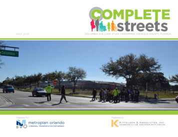
STUDY BACKGROUNDMetroPlan Orlando is developing a policy that establishes regional CompleteStreets goals and builds support for implementing Complete Streetsprojects on local and state roadways.MetroPlan Orlando’s Complete Streets Task Force assisted in thedevelopment of the draft policy, which defines Complete Streets as:“Complete Streets are planned, designed, constructed, operated, andmaintained to safely and comfortably accommodate people of all ages andability, including pedestrians, cyclists, transit users, motorists, and freightand service operators.”SELECTED CORRIDORS1. Orange Center Boulevard (Orlando, FL) - Lane reduction and enhancedbicycle accommodations to support community redevelopment2. Columbia Avenue (Kissimmee, FL) - Enhanced bicycle and pedestrianaccommodations to support future transit investment3. Howell Branch Road (Seminole County, FL) - Improve bicycle andpedestrian comfort and safety on large suburban arterialThe draft policy and its implementation tools seek to incorporate “CompleteStreets” thinking into the region’s transportation investments.As part of the policy development process, MetroPlan Orlando conducteda series of case studies to highlight strategies for incorporating CompleteStreets design principles into local projects. They identify viableopportunities for implementing the policy’s goals and provide guidance tolocal partners.Each case study corridor was selected to show specific teachable elementsof Complete Streets design and implementation.Looking west along Columbia Ave from Central Ave Elementary SchoolCOLUMBIA AVENUE COMPLETE STREETS CASE STUDYThe recommendations shown in this reportpresent design concepts for Columbia Avenue.The ideas presented have not been discussedwith local residents and any modifications tothe roadways should include public engagementand additional analysis before proceeding todesign or construction.Looking east along Columbia Ave near the Thacker Ave intersection1
CORRIDOR SELECTIONThe land use analysis identified areas where multimodal travel is in mostdemand. The transportation analysis identified corridors that would mostbenefit from Complete Streets investments by answering three questions:1.2.3.How well will it address safety issues?How well will it support existing infrastructure?How compatible is the street for complete streets improvements?No one criteria determined that an area is suitable, but overall, multiplecriteria highlighted viable areas and corridors for Complete Streets projects.T RANS PO RTAT IO N ANALYSI S High pedestrian and bicycle crash frequency High vehicle crash frequency Acommodates transit service Low heavy truck activity (less than 5%) Accommodates high frequency transit service Relatively low vehicular traffic volume (less than 20,000 veh/day)With the future addition of the Kissimmee Transit Circulator, this corridoralso presents a unique opportunity to illustrate how Complete Streetsimprovements can support transit investment.Thacker AveN Central AveArmstrong BlvdDyer BlvdN Hoagland BlvdColumbia Ave from N Hoagland Blvd to N Central Ave (shown below) rankedhighly in the land use and transportation evaluation. The following land useand transportation characteristics were seen along the corridor:LAND U S E ANALYSI S High Transportation Disadvantaged Index (measure of populationsthat have historically had significant unmet transportation needs) Medium population density Supportive future land uses/within Community Redevelopment Area Within 2 miles of high activity transit stop Within 2 miles of public park Within 0.5 mile of multiple educational institutionsN John Young PkwyMetroPlan Orlando’s planning area of Orange, Osceola, and SeminoleCounties is nearly 3,000 square miles. An analysis of land use andtransportation characteristics identified roads ready for a Complete Streetsstudy.W Vine StFeet021,0002,000Study CorridorStudy Corridor ExtentsCOLUMBIA AVENUE COMPLETE STREETS CASE STUDY
Rio Grande AveS Tampa AveN Central AveOhio AveN Main StRio Grande AveS Texas AveThacker AveS Tampa AveW Gore StPiedmont StShopping CenterStudy CorridorBus StopLow Density Local BusRoute CenterNeighborhoodActivityN MainN MainSt StRio Grande AveS Tampa AveSchoolCommercial1.InstitutionalCentral Avenue Elementary School2. Holy Redeemer Catholic SchoolIndustrialChurchVacant3. St John's Episcopal ChurchStudy Corridor4. First Baptist Church of Kissimmee5. The Church of Jesus Christ ofLatter-day Saints6. St.Sophia Russian Orthodox Church7. Holy Redeemer Catholic Church8. Fuego ChurchRetailLow DensityOfficeProposedCirculator Phase 1CommercialCommercialProposed Circulator Phase 2InstitutionalIndustrialProposed Circulator Phase 2 OptionIndustrialPublic/Recreational & InstitutionalVacantStudyCorridorTotal DailyBoardings AlightingsStudyCorridor(Oct - Dec2014)W Gore StW Vine StW Vine StN CentralAveN CentralAveOhio AveN JohnN JohnYoungYoungPkwyPkwyS Texas AveThackerThackerAveAveDoby AveJacobs PlW Columbia AveOrange Center BlvdW Columbia AvePiedmont StW Gore St1 - 2021 - 4041 - 8081 - 110700 DDHVOrange Center Boulevard, Orlando, FL550 DDHVN MainN MainSt StFeet1,600COLUMBIA AVENUE COMPLETE STREETS CASE STUDY290 DDHVSingle-Family ResidentialBus StopMulti-Family ResidentialBusRetailStop with Shelter134W Vine StThackerThackerAveAve800Church1. Christ Dominion Church2. Washington Shores Church of ChristMt. SinaiSeventh-day243. busstopsalongAdventistthe ChurchFuture LandUseTransitExisting Land UseDyerDyerBlvdBlvdHoaglandN HoaglandBlvdBlvd0Cookman AveDyerDyerBlvdBlvdS John Young PkwyPiedmont StSource:LynxCity of OrlandoSource:Source: Osceola CountyBus Stop with Shelter6Existing Land UsePedestrian GeneratorsArmstrongBlvdArmstrongBlvdRogers DrSpaulding RdS Goldwyn AveEccleston StN HoaglandN HoaglandBlvdBlvdLake Mann DrOhio AveDoby AveCookman AveDyer BlvdS John Young PkwyOrange Center BlvdW Columbia Ave2876W Gore StPiedmont StSource: Orange CountySource: Lynx, Google Maps, KAIJacobs Pl5Ohio AveRogers DrSpaulding RdArmstrong BlvdEccleston StN Hoagland BlvdLake Mann DrS Goldwyn AvePedestrian Generators: The corridor consists of many pedestrian generatorsPiedmont StPiedmont Stincluding several multi-family residential complexes, some single familySource: Lynx,Maps, KAItwo schools, 24 bus stops, and multiple retail shoppinghouses,sixGooglechurches,centers.Bus StopTransit: Link 56 runs along Columbia Ave and hasCity moderateof Orlandostudy corridor withto high boarding andSchoolalighting activity (the4. Mount Sinai Junior AcademySports Complexmost active stops experience 81-110 passengers/day).LinkCenter57 runsalong5. OrangeElementarySchoolJones High SchoolGore StJohn Young Pkwy and intersects with WColumbiaAve.6. Inthe future, the CityGeorge Barker Parkof Kissimmee plans for a transit circulator to connectdowntown KissimmeeShopping Centerwith Columbia Ave and the surrounding area. Phase1 intersectswith theStudyCorridorStudy Area at Central Ave and Main St and Phase 2 consists of two optionswith one runningalong ColumbiaAve from Armstrong Blvd to Thacker Ave.PedestrianGeneratorsN John Young PkwyOhio AveRogers DrAn existing conditions analysis enabled understanding of specific issues and1Orange Center Blvdopportunities along the study corridor. The maps below identify existingpedestrian generators, transit, existing and future land use, vehicular traffic,32crashes, and pedestrian and bicycle facilities.W Gore St4Jacobs Pl5hnJohnYoungYoungPkwyPkwySpaulding RdS Texas AveEccleston StOhio AveEXISTING CONDITIONSDoby AveCookman AveS Goldwyn AveLake Mann DrS John Young Pkwy1 /4AverageAnnualDailyTraffic (Vehicles / yLowDensity ResidentialSingle-Family MediumDensityResidential 5,000Single-FamilyDensity ResidentialMulti-Family MediumDensityMediumResidential3Multi-FamilyMedium Density ResidentialMulti-Family HighDensityResidential5,001- 10,000Commercial Multi-Family High Density ResidentialConservation Commercial10,001 - 15,000
Rio Grande AveNNCentralCentralAveAveS Tampa AveNNJohnJohnYoungYoungPkwyPkwyS Texas AveThackerThackerAveAveW Gore StNNMainMainStStRio Grande AveS Tampa AveJacobs PlCentralAveAveNNCentralPiedmont S Texas AveDoby ilyResidentialResidentialMulti-Family ResidentialResidentialMulti-FamilyMulti-Family y CorridorCorridorStudyStudy UseWAveW ColumbiaColumbia AveOrange Center BlvdOhio AveFeetFeetFeet4,0004,0001,600Rio Grande AveS Tampa AveNNJohnJohnYoungYoungPkwyPkwThackerThackerAveAvS Texas AveOhio AveOhio AveDoby AveOhio AveArmstrongBlvdBlvdArmstrongRogers DrPiedmont St2,0002,000800Jacobs PlPiedmont StW Gore StWW VineVine StStSource:City ndo000Cookman AveDyerDyerBlvdBlvdS John Young PkwyS Goldwyn AveNNHoaglandHoaglandBlvdBlvdSpaulding RdOhio AveRogers DrPiedmont StEccleston rsGeneratorsW Gore StWW VineVine StStSource:Osceola CountySource:Source:OsceolaOrangeCountyCountyLake Mann DrJacobs PlWAveW ColumbiaColumbia AveOrange Center BlvdArmstrongArmstrongBlvdBlvdSpaulding RdCookman AveDyerDyerBlvdBlvdS John Young PkwyS Goldwyn AveEccleston StNNHoaglandHoaglandBlvdBlvdSource:Lynx, GoogleMaps, AIKAILake Mann DrOhio AveDoby AveCookman AveDyerDyerBlvdBlvS John Young PkwyRogers DrArmstrongArmstrongBlvdBlvdS Goldwyn AveNNHoaglandHoaglandBlvdBlvBusBus StopStopBus StopBus5Bus StopStop withwith ShelterShelterBus Stop with ShelterSchoolSchool61.1. CentralCentral AvenueAvenue ElementaryElementary SchoolSchoolChurchEccleston tholicChrist DominionChurchSchoolChurch2. Washington Shores Church of ChristChurchFuture Lane Use: Most of the corridor will maintainitsexistinglandusesExistingLand Use: The study corridor is surrounded by predominantlySpaulding Rd3.John'sChurchW ColumbiaAveSinaiEpiscopalSeventh-dayAdventist Church3.3.StStMt.John'sEpiscopalChurchWColumbia ti and single family residential,retail, and institutional land aiAcademyand is emain3and single family communities make up most of the parcels north of the7 66Sports ComplexLatter-day SaintsSaintsElementary School5.Latter-dayOrange tly multi-family with pockets of commerciallandusenear theroad. Retail uses are primarily located southof theroadway with the Plaza6.6.St.SophiaRussianOrthodoxChurchJones HighSchool32W Gore StW Gore rCatholicChurchJohn Young Parkway intersection.del Sol shopping center in the west and big box shopping centers towardsGeorge Barker ParkW Vine St8.Church8. FuegoFuego CenterChurchShoppingthe middle of the corridor. Churches and schoolsare mostly located east of4ShoppingCenterShoppingCenterStudy CorridorPiedmont StStudyPiedmont StThacker Ave.Study CorridorCorridorLake Mann DrSingle-Family LowDensity ResidentialResidentialSingle-FamilyLow ResidentialSingle-FamilyLowDensity ResidentialResidentialSingle-Family MediumMediumDensityResidentialLow DensityResidentialSingle-FamilyMediumDensity ResidentialResidentialMulti-Family ensityMulti-FamilyDensityResidentialMedium Density alMulti-Family HighHighDensity lti-Family HighHigh DensityDensity ResidentialResidentialCommercial Multi-FamilyCommercialLow Density OfficeConservationCommercialConservation rialInstitutionalInstitutionalPublic/Recreational & InstitutionalMU -- VV (Vine Street)Street)MUStudy (VineCorridorStudyStudy CorridorCorridorW Gore StFutureFutureLandUseFutureLandLandUseUseW ColumbiaKissimmee,OrangeCenter Avenue,Boulevard,Orlando, FLFLCOLUMBIA AVENUE COMPLETE STREETS CASE STUDY
Rio Grande AveN MainN MainStSt5S Tampa AveJacobs PlN JohnN JohnYoungYoungPkwyPkwyS Texas AveThackerThackerAve AveOhio AveDoby AveCookman AveDyer DyerBlvd BlvdS John Young PkwyN HoaglandN HoaglandBlvd BlvdLake Mann DrS Goldwyn Ave1 /4Bus StopBus StopN CentralN CentralAve AvePiedmontStStW VineOrange Center BlvdW Columbia AveSource: City of OrlandoSource: Google Maps and KAISource: Google Maps and KAIFeetFeet1,6004,000FeetCOLUMBIA AVENUE COMPLETE STREETS CASE STUDY02,0004,000008002,000W Vine StPiedmontStStW Vine15,001- 20,000 20,000S Tampa AveLow Density Residential25 MPH Posted SpeedMedium Density Residential25SpeedNeighborhoodActivity40 MPHMPH PostedPostedSpeedCenterLow Density Office40 dustrialposted speedSchool zone without reducedPublic/Recreational & Institutionalposted zonespeedSchoolStudyCorridorwith 20 MPH reducedRio Grande Aveposted speedSchool zone with 20 MPH reducedW Gore Stposted speedN CentralN CentralAve AvePiedmont StIndustrial5,00110,001- -10,00015,000Vacant 20,000Existing Land UseAADT & DDHV (2014)AADT & DDHV (2014)W Gore StOhio AveArmstrongArmstrongBlvd BlvdRogers DrW Columbia AveN JohnN JohnYoungYoungPkwyPkwyS Texas AveJacobs PlThackerThackerAve AveOhio AveDoby AveCookman AveDyer DyerBlvd BlvdS John Young PkwyN HoaglandN HoaglandBlvd BlvdSpaulding RdS Goldwyn AveSource: FDOT and the City of KissimmeeEccleston StCommercial 5,0005,001- 10,000InstitutionalW Gore StRio Grande AveW Vine StSource: Orange CountySource: FDOT and the City of KissimmeeLake Mann DrAverage RetailAnnualDaily Traffic (Vehicles / Day) 5,000StudyCorridor10,00115,00015,001 -- 20,000N MainN MainStStOhio AvePiedmont St550 DDHV550 DDHV10,000 AADT10,000 AADTAverage Annual Daily Traffic (Vehicles / Day)Multi-Family ResidentialN CentralAve AveN Central700 DDHV700 DDHVOrange Center BlvdW Columbia Ave14,700 AADTW Columbia Ave14,700 AADT W Gore StN MainN MainStStJacobs PlThackerThackerAve AveS Texas Avethe entire length of the corridor. Substandard 4’ wide bikelanes are present21 - 4081 - 110Pedestrianbetween Dyer Blvdand CentralGeneratorsAve. According to the City of KissimmeeTransitTrails Master Plan, two off-street bike paths - Shingle Creek Regional TrailTransitand Kissimmee Trail Loop - are presentin the vicinityof the study corridor.Single-Family ResidentialS Tampa AveOhio AveOhio AveDoby AveCookman Ave290 DDHV290 DDHV7,100 AADT7,100 AADTArmstrongBlvd BlvdArmstrongRogers DrSpaulding RdDyer DyerBlvd BlvdS John Young PkwyS Goldwyn AveEccleston StN HoaglandN HoaglandBlvd BlvdPostedSpeed: The posted speed limit is 40 MPH. It consists of four schoolSource: Lynxzonesmarkedat the intersections of Dyer Blvd, Thacker Ave, John YoungSource: LynxPkwy,and near Central Ave Elementary School (includes 20 MPH reducedLake Mann Drspeed limit).N JohnN JohnYoungYoungPkwyPkwySource: Lynx, Google Maps, KAIArmstrongArmstrongBlvd BlvdRogers DrBus StopwithShelterBusStopwith ShelterBus StopLocalBusRouteChurchEccleston StBus Stop with ShelterAverageAnnual Daily Traffic (AADT) & Directional Design Hourly Volume1. ChristDominionChurchPhase 1ProposedCirculatorLocal Bus ShoresRoute Church of Christ2. Washington(DDHV): Based on 2014 FDOT and City of Kissimmee data, the highestSpaulding RdProposed Circulator Phase 2Mt.ProposedSinai Seventh-dayAdventistPhase 1 ChurchCrash History: Crash data between August 2012 and3.July2015Circulator(3 years)vehicle volumes along the studycorridor are between Dyer Blvd and John1Circulator Phase 2 OptionOrange Center BlvdSchool ProposedW Columbia AveProposed Circulator Phase 2City of Orlandoshows that a majority of crashes occurred at signalizedintersections.Young Pkwy with an AADT of 14,700 and DDHV of 700. According to the4. MountSinai Junior AcademySports ComplexTotal Daily Boardings AlightingsProposedCirculator Phase 2 OptionW Columbia Ave5. OrangeCenter Elementary SchoolDetailed bicycle crash data for 2008-2015 revealedthatCity of Kissimmee Comprehensive Plan, the corridor is located within the(Oct - Dec2014)the majority of6.JonesHighSchool32Gore St Total Daily Boardings AlightingsW GoreStbicycle crashes occur on the sidewalk,Wcrosswalk,oragainsttraffic.Multimodal Transportation District so the LOS standard is LOS E. Thisdata41 - 80GeorgeBarker Park(Oct - Dec2014)1 - 20suggest that the roadway is currently operatingatLOSCorbetter(basedShopping CenterW Vine St41 - 8041 -areStudy Corridor21-2040 present alongPedestrian and Bicycle Facilities: Continuous sidewalkson FDOT GeneralizedServiceVolume Tables).PiedmontStPiedmontStStW Vine81 - 1106Future Land UsePosted Speed and School ZonesPosted Speedand SchoolZonesOrangeCenterBoulevard,Orlando, FLFLW Columbia Avenue, Kissimmee,5W Columbia Avenue, Kissimmee, FL
Spaulding RdN JCentralAveN JCentralAveGeorge Barker ParkShopping CenterStudy Corridor1,640’W Vine StW Vine StOhio AveRogers Dr06 lized crosswalkNon-signalized crosswalkN MainN MainSt StLow Density ResidentialMedium Density ResidentialNeighborhood Activity CenterLow Density OfficeCommercialIndustrialW Columbia Ave&W Columbia Ave &OrangeCenter BlvdWArmstrongColumbia BlvdAveW ColumbiaAve &Dyer Blvd& S&John Young PkwyArmstrong BlvdDyer onalBike LanesIndustrialBike LanesVacantTrailNon-signalized crosswalkStudyTrail CorridorW Gore StRio Grande AveS Tampa AveJacobs PlPublic/Recreational & InstitutionalStudy CorridorW Gore StW Gore StPiedmont StMulti-Family ResidentialExisting Land UsePiedmont StS Texas AveW Gore StN JCentralN JCentralAveAveW Gore StStPiedmont1,420’Single-Family ResidentialRetailOrange Center BlvdW ColumbiaAve & BlvdOrange CenterWN ColumbiaAveSource:City of OrlandoHoaglandBlvd&Ave& S GoldwynN Hoagland Blvd3 /4ChurchIntersection Crashes1. Christ Dominion ChurchIntersection Crashes2. Washington Shores Church of ChristSegment Crash: Property3. Mt. Sinai Seventh-day Adventist ChurchDamage Only(PDO)SegmentCrash:PropertySchoolDamage Only (PDO)4.Mount SinaiJuniorSegmentCrash:InjuryAcademy5.Orange Crash:CenterInjuryElementary SchoolSegment6. Jones High SchoolN MainN MainSt StJacobs PlRio Grande AveRio Grande AveN JohnN JohnYoungYoungPkwyPkwyS Tampa AveS Tampa AveS Texas AveS Texas Ave6PDO1 Injury11 InjuryBicycleInjuryW Gore St1 50BicycleInjury##Crash JacobsHistory(Aug 2012 to July 2015)PlCrash History (Aug 2012 to July 2015)ThackerThackerAveAveOhio AveOhio AveOhio AveRio Grande AveRio Grande AveN JohnN JohnYoungYoungPkwyPkwyS Tampa AveS Tampa AveS Texas AveS Texas AveThackerThackerAveAveOhio AveOhio AveDoby AveCookman AveCookman AveDoby AveDoby AveS Goldwyn AveEccleston StS John Young PkwySource: Google MapsLake MannDr MapsSource:GoogleCookman AvePiedmont St18 InjuryPiedmont StOhio AveSource: Orange CountyBus Stop with Shelter6Pedestrian GeneratorsW Vine StOrange Center BlvdW Columbia AveW Gore St W Columbia AvePiedmont StBus Stop831 PDOW Gore St81 Pedestrian6 PDO Injury46 PDO46PDO25 Injury25Injury6PedestrianInjury7 Injury6PedestrianInjury1 BicycleInjury15 PDO1 Bicycle InjuryOrange Center Blvd1,120’City of OrlandoSports Complex78227818 PDO1816 PDOInjury16InjuryW GoreStPiedmontSt Injury2 Pedestrian2 PedestrianW Vine St InjuryOhio AveShingleShingleCreekCreekTrailTrailRogers DrRogers DrSpaulding Rd1,300’Jacobs PlW Columbia Ave36W Gore St W Columbia Ave36OrangeCenter BlvdOhio AveSpaulding RdEccleston StKissimmee Trail LoopKissimmee Trail LoopArmstrongArmstrongBlvdBlvdEcclestonLakeMann DrStN HoaglandN HoaglandBlvdBlvdS Goldwyn AveS Goldwyn AveSource: Signal Four AnalyticsLake MannSource:SignalDrFour Analytics5 PDODoby AvePiedmont St14 PDO14InjuryPDO 413Fatal3 Injury15 Injury35 PDO1 Pedestrian InjuryDoby AveSource: Lynx, Google Maps, KAI532Cookman AveCookman Ave20 PDO20PDO10 Injury6 PDOPiedmont St10 Injury1 Bicycle PDO171752Jacobs Pl5Orange Center BlvdOhio Ave1010307 30ArmstrongBlvdArmstrongBlvdRogers DrRogers DrSpaulding Rd8 PDO8PDO2 Injury12 InjuryS John DyerYoungPkwyDyerBlvdBlvdS John Young PkwySpaulding RdEccleston StN HoaglandN HoaglandBlvdBlvdEcclestonLakeMann DrStS John YoungPkwyDyerDyerBlvdBlvdS John Young PkwyS Goldwyn AveS Goldwyn AveLake Mann DrPiedmont StW Columbia&OrangeCenterAveBlvdW ColumbiaAve &ThackerAve& Ohio AveThacker AveW Columbia AveOrange&W Columbia Ave &Center BlvdColumbia& & S Tampa AveW NColumbiaAve &NWJohnYoungAvePkwyCentralFutureLandUse AveN John Young PkwyN Central AveOrange Center Blvd& Rio Grande AvePedestrian and Bicycle Facilities Signalized IntersectionsPedestrian and Bicycle Facilities Signalized IntersectionsOrange Center Boulevard, Orlando, FLOrangeCenter Boulevard,Orlando, FLWAvenue,W ColumbiaColumbiaAvenue, Kissimmee,Kissimmee,FLCOLUMBIA AVENUE COMPLETE STREETS CASE STUDY
USER NEEDS AND OPPORTUNITIESA design workshop with City of Kissimmee staff on March 16, 2016 providedadditional information on the redevelopment occurring along the corridor.The existing conditions analysis and design workshop were synthesized intosix overall user needs and opportunities.PED E ST RI A NNeed: The pedestrian generators and attractors include Central AveElementary School as well as three other elementary and middle schoolswithin a mile of the corridor, numerous multi-family complexes, and wellused bus stops where pedestrians frequently cross mid-block. There is aneed to provide a safe and comfortable environment along and across thecorridor for pedestrians.Opportunity: Complete Streets improvements should increase safe crossingopportunities in key areas and decrease vehicular speeds for enhancedsafety. Intersections should be completed with appropriate ADA compliantramps and crosswalks on all corners within the urban context. In addition,the future Kissimmee Transit Circulator will frequent this area and generatemore pedestrian trips.Next Steps: Conduct pedestrian counts at signalized intersections and midblock high pedestrian activity areas, conduct a corridor pedestrian crashanalysis, and evaluate potential for mid-block pedestrian crossings nearpedestrian generators.Students crosssing Central AveSubstandard bicycle facilities (4’ bike lane)COLUMBIA AVENUE COMPLETE STREETS CASE STUDYB ICYCLENeed: The bicycle facilities along Columbia Ave are substandard - with4’ bike lanes along most of the corridor and no bike facilities in somelocations. This causes many bicyclists to use the sidewalk and, as seen in thecrash data, most of the bicyclist crashes occur at driveways, sidewalks, orcrosswalks.Opportunity: Design improvements should include the accommodation ofsafe travel for bicyclists providing connections to surrounding land usesand the planned bike network. Recommendations include reducing vehiclespeeds to provide a more comfortable biking environment.Next Steps: Conduct a corridor bicycle crash analysis and evaluation of afeasible connection to the Shingle Creek Trail.T RANS ITNeed: The corridor is served well by transit and will continue to be servedby buses in the future.Opportunity: Bus stops should be improved to enhance accessibilityand should be located near safe pedestrian crossing opportunities. TheKissimmee Transit Circulator will provide an opportunity to significantlyincrease transit service in the corridor and connect it to major destinationssuch as downtown Kissimmee and the Osceola Regional Medical Center.Next Steps: Corridor-level analysis of bus stop accessibility and placementbased on surrounding land uses and safe pedestrian crossing opportunities.Non ADA compliant pedestrian curb rampNon-accessible bus stops just west of ThackerAve7
VEHICUL A RNeed: Resurfacing is necessary due to roadway cracking and deterioration.As seen by traffic volumes, excess vehicular capacity is available along thecorridor. Wide cross sections and high speeds along some of the corridormake the pedestrian and cyclist environment uncomfortable.Opportunity: In order to enhance pedestrian and bicyclist safety andcomfort, it is recommended that the design and posted speed be set at 35mph.Next Steps: Conduct a pavement analysis, program resurfacing of ColumbiaAve to include Complete Streets elements, and conduct a traffic study tofurther justify lane reduction.F REIGHTNeed: Heavy truck percentages along the corridor are moderate, rangingfrom 2% to 5%.Opportunity: Complete Streets improvements should consider a design thataccommodates a typical delivery bus (WB-52) vehicle. City of Kissimmeeshould also consider encouraging larger trucks bound for the land uses onthe western end of the corridor to use US 192 (Vine Street).Next Steps: Incorporate freight mobility and livability components intoanalysis.Wide roadway cross section encourages high vehicle speedsCOMM UN I T Y RE DE V E LO P ME NTNeed: Multiple vacant and underutilized parcels exist along Columbia Ave.Opportunity: The proposed US 192 BRT and Kissimmee Transit Circulatorbring an opportunity to redevelop several parcels within the vicinity of thestations - Armstrong Blvd and Emory Ave. Complete Streets improvementscan capture, support, and encourage transit-oriented developmentmomentum in the area.Next Steps: Leverage development activity by seeking public-privatepartnership for implementation of Complete Streets elements.8Proposed site of US 192 Emory Ave station west of John Young ParkwayCOLUMBIA AVENUE COMPLETE STREETS CASE STUDY
COMPLETE STREETS DESIGN ELEMENTSEach roadway is unique, and should respond to the user context. A complete street may includesidewalks, bike lanes, special bus lanes, comfortable and accessible public transportation stops,frequent and safe crossings opportunities, median islands, accessible pedestrian signals, curbextensions, narrow travel lanes, roundabouts, landscaping, lighting, and many other features.These elements address users that operate within all realms of the cross section - cartway zone,buffer zone, and sidewalk zone.There are a number of nationally recognized design manuals and guidebooks that present thedesign characteristics for complete streets and how these characteristics should relate to theirenvironment. In all, they share a common understanding that designing for the comfort and safetyof the most vulnerable users better serves the safety of everyone. A commonly used, yet notexhaustive, list of innovative Complete Streets elements is provided below based on cross sectionrealm.Cartway ZoneBuffer ZoneC ART WAY ZO N EDesign Speed: Vehicular travel speed has a measured impact on comfort and safety forpedestrians and bicyclists. With increased vehicular speeds comes increased difficulty forpedestrians to cross roadways. Faster speeds increase the force with which a vehicle strikes apedestrian, leading to more severe injuries and less likelihood of survival. Many design guidelinesfor Complete Streets recommend posted speeds be set between 20 mph to 35 mph. Many designguidelines also stipulate that the design speed of the roadway should equal the posted speed.Geometric design elements, such as horizontal and vertical curves, block length, and vehicularlane widths should reinforce that posted speed.Buffer ZoneRoadway Width: Wider streets experience higher average and 85th percentile speeds thannarrow streets. As street widths widen, accidents per mile increase. Wider streets act as barriersto pedestrian travel, making it difficult to cross the roadway. The number of travel lanes and thewidth of the travel lanes also impact the roadway width.Raised Medians: Raised medians provide a refuge for pedestrians crossing the roadway, allowingsomeone to negotiate one direction of travel at a time. These commonly include landscaping toincrease comfort for pedestrians.Pedestrian Connectivity: Sufficient opportunity for safe and comfortable pedestrian access alongand across a roadway can be accomplished through the use of well-marked pedestrian crosswalksat intersections and mid-block crossings that can include rectangular rapid flashing beacons. Inurban neighborhood contexts, crossing opportunities could be spaced as frequent as every 300660 feet.COLUMBIA AVENUE COMPLETE STREETS CASE STUDYSidewalk ZoneMiles per Hour203040Probability of Fatality5%37-45%85%Faster vehicle speeds decrease likelihood of survival.Credit: United Kingdon Department of Transportation, 1987. “Killing Speeds andSaving Lives.” London, England.9
Curb Extensions: Curb extensions decrease the overall width of the roadwayand can serve as a visual cue to drivers to slow down. Curb extensionsencompass several different treatments including mid-block traffic calming,horizontal deflections, transit stops, and on-street parking lane bulb-outs.Other Traffic Calming Elements: Speed control elements manage speedsand reinforce safe, pedestrian-friendly speeds. These elements includespeed humps, speed tables/raised intersections, speed cushions, andraised in-pavement crosswalk lights. The elimination of excessive right-turndeceleration lanes can encourage slower speeds along the road
with Columbia Ave and the surrounding area. Phase 1 intersects with the Study Area at Central Ave and Main St and Phase 2 consists of two options with one running along Columbia Ave from Armstrong Blvd to Thacker Ave. EXISTING CONDITIONS 7,100 AADT 14,700 AADT 10,000 AADT 290 DDHV 700 DDHV 550 DDHV W Columbia Ave
