Transcription
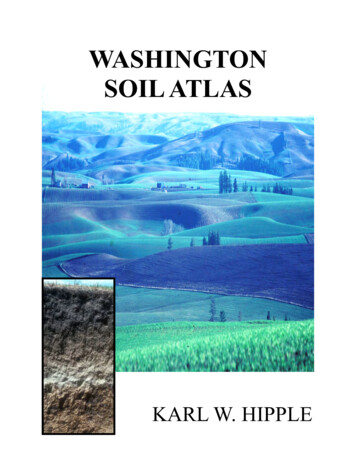
WASHINGTONSOIL ATLASKARL W. HIPPLE
The Washington Soils Atlas features many soils from throughout Washington State. Ithas been prepared to assist readers develop an understanding about the variability ofWashington soils and as an aid to further the reader’s knowledge of soils.The soils included in this atlas, were selected from several hundred different soilswhich have been identified and mapped in Washington State. Each of the soils havecharacteristics that make it a unique soil individual much like each person is a uniqueindividual.The intent of this atlas is to present some of the different soils mapped and correlatedin Washington and to demonstrate how their unique characteristics impact their useand management. Both physical and chemical properties have dramatic impacts on asoil’s use and/or management. This atlas only presents brief comments regarding theirlimitations that impact management but much more information is available from theNatural Resources Conservation Service. Complete information on the soils in Washington State is available online using the Web Soil Survey tool .htmA brief section on soil formation is also included and it explains facts regarding the soilforming factors and how individual soils form. Again, most soil survey reports containsections that explain in more detail the formation of soils that are mapped in each soilsurvey area.Roylene Rides at the DoorState ConservationistNRCS WashingtonThe U.S. Department of Agriculture (USDA) prohibits discrimination in all its programs and activities on the basis of race, color,national origin, age, disability, and where applicable, sex, marital status, familial status, parental status, religion, sexual orientation,genetic information, political beliefs, reprisal, or because all or a part of an individual’s income is derived from any public assinstance program. (Not all prohibited bases apply to all programs.) Persons with disabilities who require alternative means forcommunication of program information (Braille, large print, audiotape, etc.) should contact USDA’sTARGET Center at (202) 720-2600 (voice and TDD). To file a complaint of discrimination, write to USDA, Director, Office of CivilRights, 1400 Independence Avenue, S.W., Washington, D.C. 20250-9410, or call (800) 795-3272 (voice) or (202) 720-6382(TDD). USDA is an equal opportunity provider and employer.1
This book, the Washington Soils Atlas, is the result of a long-term project by thecooperators of the Washington State National Cooperative Soil Survey (WA NCSS)partnership. The WA NCSS partnership is formed of federal, regional, state, and localagencies and institutions. The partnership works together to investigate, document,inventory, classify, and interpret soil resources in Washington State and to assist usersdevelop, interpret and use standard or custom products made from soil survey data.The Washington Soils Atlas was conceived and endorsed by partnership members in2001 at the WA NCSS Annual Planning Conference hosted by Washington NRCS inSpokane, WA. This agreement quickly resulted in the publication of several yearlyplanning guides or calendars (2001, 2002, 2003, 2004, 2005, and 2006). Each yearlyplanning guide or calendar focused on presenting photographs of soil profiles andlandscapes plus a small amount of additional related information to introduce andeducate a wide variety of users on the topic of the value and critical importance ofWashington State’s soil resources.The Washington Natural Resources Conservation Service provided overall projectleadership but because of routine employee transfers and priority shifts, this projectslowed and finally stopped in 2006. WA NCSS cooperators that provided funding forpublication and distribution of the planning guides are: USDA US Forest Service(USFS), USDA Natural Resources Conservation Service (NRCS), Washington StateUniversity (WSU), and the Washington Society of Professional Soil Scientists (WSPSS).The project was re-invigorated by the NRCS IN 2011 to develop the previously existingmaterials into a completed final product. This Washington Soils Atlas is that product andthe NRCS wishes to again thank the WA NCSS cooperators and individual soilscientists, both active and retired, who assisted in these efforts.I would like to also recognize and acknowledge all of the soil scientists who havemapped soils in Washington State over the years. It is their hard work and skillful datacollection that have made these invaluable data available to Washington State residentsand others throughout the world. It also enables the dispersion of this information to awide variety of customers throughout the state and the world. A small number of soilscientists have also collected the photographs that are contained in the WashingtonSoils Atlas. Without the exemplary efforts of this group of soil scientists the extremelyvaluable data of the Washington NCSS database would not exist or be available toproduce excellent customer products and services.2
Dr. Karl W. Hipple was born and raised on a small dairy farm in northwesternPennsylvania. He is a Viet Nam era Navy veteran. He obtained a B.S. degree inSecondary Education with an emphasis in Biology and Physical Science from OldDominion University in Norfolk, Virginia in 1972. He obtained M.S. and PhD degreesfrom the University of Idaho in Moscow, Idaho in 1976 and 1981 respectively.He worked as a soil scientist for the Idaho Soil Conservation Commission (1981) andthe Natural Resources Conservation Service (formerly Soil Conservation Service) from1982 until he retired in 2010. He held the following positions: 1) Soil Scientist, LatahCounty Idaho Soil Survey, Moscow, ID; 2) Soil Scientist, Lewis, Nez Perce and WesternHalf of Clearwater Counties, Idaho Soil Survey, Orofino, ID; 3) Soil Survey ProjectLeader, Custer and Lemhi Counties Idaho Soil Survey, Salmon, ID; 4) Soil SurveyProject Leader, Butte County, Idaho, Salmon, ID; 5) Washington State Soil Correlator,Spokane, WA; 6) Washington State Soil Survey Database Manager and ManuscriptEditor, Spokane, WA; 7) Washington State Soil Scientist, Spokane, WA; and 8) NationalLeader Soil Survey Interpretations at National Soil Survey Center in Lincoln, NE. Heserved as Chairman of the National Technical Committee for Hydric Soils from 2002 until2008 and Acting Director, National Soil Survey Center from January 2009 until August2009.3
This Washington Soils Atlas is designed to present information about Washington State soils inan organized format to a nontechnical audience. The intention is to assist readers understandthe importance of soil. Soil is a vital natural resource to residents of Washington because itserves numerous functions that assist residents to live and to earn an income. It also producesfood and fiber for populations of the world.Soil serves to regulate, partition, and filter air and water. It supports the projects built into andonto it and serves as a building material for other projects. Soil nourishes the plants thatproduce food and fiber for animal and human consumption. The soil assists in decomposingand recycling organic materials, and it preserves natural and cultural history. Therefore, soil iscomplex and it is also a fundamental material for all life.Soil, in its usual state, is made up of about 25 percent air, 25 percent water, 5 percent organicmatter, and 45 percent mineral matter. When compacted those percentages change and henceso do the soil’s properties. When compacted, water intake is reduced, there is less air for plantuse, and because water can’t infiltrate, soil erosion increases. It is important to take care ofWashington’s soil resources.The soils presented in this atlas were selected from several hundred soil series recognized,mapped, and correlated in Washington State. Each of the soil series has a distinctive set ofcharacteristics that make it a unique individual just as each person is a unique individual. Theselected group of soils represents most of the unique soil features that occur within Washington.This was done because it is impractical to demonstrate each mapped and correlatedWashington soil but the soils of this atlas can represent all Washington State soils. Soil seriesare named after geologic formations, geographic locations, and some soil names are “coined” ormade up by soil scientists who describe, map, and correlate soils from within the National4
Cooperative Soil Survey (NCSS) program. Soil series are correlated by NCSS soil scientists sothat anywhere a particular soil individual occurs it is identified and called by the same name.Photographs of the soils show the various layers or soil horizons and they also show arepresentative landscape where each soil series occur. Along the left side of each soil profile isa scale in inches. Along the right side of each soil profile are labeled the major genetic horizonsof the soil using letters and numbers. These letters and numbers are used by soil scientists toshow the soil forming process that has taken place in the development of each soil horizon.The genetic soil horizons have been simplified for this atlas. As one can easily see in thephotographs, each “A” horizon and each “B” horizon do not look alike. The soil scientist whodescribed these soil profiles, used knowledge gained in university studies and experiencegained from identifying, describing, mapping, and correlating soil in many locations inWashington State or other states to help determine how each horizon has developed from theoriginal soil parent material. The soil horizon designators are useful in making comparisonsamong soils. A brief discussion or definition of each genetic soil horizon designator is found inthe glossary of this atlas. The subscript identifiers are defined in Appendix 1 of this atlas.Appendix 2 provides a map and brief description of the Land Resource Regions in Washington.The glossary terms may be helpful to assist users to understand certain words that are used todescribe each soil. The definitions have been simplified to help more users understand them.More detailed definitions and information can be found in soil survey documents andpublications like the Soil Survey Manual (http://soils.usda.gov/technical/manual/) and SoilTaxonomy xonomy/) .All soils are classified according to a recognized national system (Soil Taxonomy). Thistaxonomic classification system was developed to classify the hundreds of thousands of soilsthat occur in the world. It is a dynamic system that can be adjusted or added to when new kindsof soils are recognized that don’t fit the current system. The soil classification systemresembles the systems that are used for classifying plants and animals. The soil classificationsystem is mainly used by soil scientists to identify a soil individual, compare one soil to another,and to group soils together that have similar properties and uses.Other information that is included for each soil series is the soil classification at the familylevel. It includes several items which describe soil depth, drainage class, parent material,arrangement of soil horizons, and other information. Also included is information on climate,topography, elevation, natural plant community, soil use(s), andmanagement considerations. Management considerations are based on soil properties thatimpact the soil’s use. In many cases, mitigation measures must be used to modify the soil tomake use of it for a specific purpose. A map that shows where the soil series is located withinthe state is also included for each soil series. A link is also provided for the official soil seriesdescription that is maintained for each soil series in the NCSS database.5
Soil forms layers or horizons, roughly parallel to the earth’s surface, in response to fivesoil forming factors. The whole soil, from the surface to the lower depths, developsnaturally as a result of these five factors. The five factors are: 1) parent material, 2),relief or topography 3) organisms (including humans), 4) climate, and 5) time. If a singleparent material is exposed to different climates then a different soil individual will form.If any one of the five factors is changed but the remaining four factors remain the same,a new soil will form. This is called “soil genesis”.It is thought that roughly 95 percent of the world’s soils have been moved or transportedto their present location. Only 5 percent of the world’s soils are “residual soils” or soilsthat formed in place from the existing parent material. However, there are otherdifferences in soils that are determined by whether a soil is formed in mineral material(sand, silt, and clay) or whether a soil formed in organic material (plant and/or animalmatter that is in various stages of decay and decomposition). Soils that formed indominantly organic material are classified as Histosols according to Soil Taxonomy.Parent material contributes both chemical and physical properties to an individual soil.Geologic events have provided Washington with a wide variety of parent materials. Inmore recent times, many of us are familiar with blowing dust (loess) and volcanic ashfrom the eruption of Mount St. Helens in 1980. These are two of the parent materialsthat contribute to Washington State’s soils. Probably the most common parent materialwhich covers almost all of the land surfaces in Washington is volcanic ash fromnumerous eruptions of the Cascade Mountains in the western United States. Thevolcanic ash is very common either by itself on the surface (volcanic ash mantles) ormixed with other material in surface horizons. Volcanic ash has very specific propertiessuch as very light weight, capacity to hold large amounts of water, and susceptibility tocompaction by vehicles when it is wet. These are some factors that influence soilgenesis in Washington State.There are also many rock formations in Washington so there are many kinds of rocks inWashington soils. Examples are granite, schist, limestone, basalt, tuff, and manyothers. Glaciers from the highest mountains in Washington and from north ofWashington in Canada have ground up many kinds of rocks and pushed glacial till6
along the earth’s surface and commonly deposited it far from the source and creatingyet another kind of parent material.Water has transported and deposited large quantities of material in all parts of the statewhich has created another kind of parent material. Slower flowing water carriesparticles such as sand, silt, clay, and tiny rocks downstream until the water slowsenough that the materials drop out of the water and form sediments that become parentmaterial. Fast-moving water carries gravel and cobblestones from a wide variety of rockformations downstream and deposits them in various locations to form another kind ofparent material. Material that has been transported by water is called alluvium.Swampy areas or old lakes collect dead and/or dying plants and animals to form peatwhich is also a parent material. PeDW deposits, protected from decay by being saturatedwith water, form the organic soils (Histosols). They may contain small amounts ofmineral matter like sand, silt, and clay. These low-lying areas commonly collectedvolcanic ash when it was deposited from the air and when it was washed off adjoininguplands.It is thought that about 70 to 75 percent of the earth’s crust is made up of sedimentaryrocks and the remaining 25 to 30 percent is made up of igneous rocks and glacialmaterials. Coarse-grained igneous rocks such as granite weather to sandy types ofmaterials thus soils that formed from these kinds of rocks have a sandy texture. Finegrained sedimentary rocks such as siltstone and shale weather to finer texturedmaterials; thus soils that formed from these types of rock are more clayey.All of the different kinds of parent material have been subjected, in varying degrees, tothe other four soil forming factors. All five of the soils forming factors are acting at thesame time at different rates of speed and with different degrees of efficiency.Very few Washington landscapes are flat. Most of them exhibit some relief ortopography related to the type of landform that they occupy. A landscape location 1)has an elevation either above or below another part of the landscape, 2) has a distinctshape (convex, concave or linear), 3) faces a specific compass direction, and 4) is onlyone component of the landscape. These factors influence drainage, runoff, deposition,and erosion as well as the collection of solar energy.The most common flat landscapes are those in wide valleys along rivers. The soils inthese areas typically are poorly drained or moderately well drained and have verylimited runoff. During floods, soil material commonly is deposited in these landscape7
positions and erosion generally is not a concern. Erosion from surrounding slopes alsoresults in additional depositions of soil material on the valley bottoms. Theselandscapes are often cooler because of cold air drainage from higher surroundingareas. Livestock often over-use these areas which results in compaction of the surfacesoil.South-facing slopes (south aspects) are warmer and dry out faster because theyreceive more solar heat than north-facing slopes (north aspects). This affects soilgenesis because the warmer temperatures speed up most chemical reactions andincreases the evaporation of water from the soil profiles. The drier nature of southaspects, results in production of different natural plant communities than those on themore moist north aspects. The shape and aspect of the topography also contributes tohow the slope disperses water. Concave-shaped slopes tend to concentrate waterwhich causes more erosion and runoff. Convex-shaped slopes tend to disperse watermore uniformly. Concave positions in flatter landscapes tend to collect water and thesesoils are more poorly drained and may have a water table near the surface.Washington’s climate, like its topography, varies greatly from place to place. In fact,soil climate changes quite rapidly in very short distances. Annual precipitation variesfrom about 7 inches in parts of the Columbia Basin to more than 300 inches in theOlympic Rainforest. Some areas in Washington receive very little snowfall and otherareas receive many feet of snow in winter. Accumulation of snow in winter and meltingof snow during the spring and summer provides runoff water in areas whereprecipitation is low. Great differences in temperature and in the number of frost freedays also occur across Washington.Temperature changes with increases and decreases in elevation and it also changeswith aspect. Moisture and temperature differences are also evident in soil genesis also.Climate directly and indirectly effects soil formation. Less development occurs in drierareas because as water quickly moves into and through a soil it increases the rate ofweathering of soil materials. For example, soluble materials such as organic matter,clay, and calcium carbonate and other salts are moved downward in a soil profile andsometimes out of a soil profile if enough water is available. In general terms, the depthat which soluable material occurs in a soil profile indicates the amount of water that thesoil individual receives. Thus a record of the average annual precipitation and averageannual soil temperature on each site is important.The amount of moisture within a soil profile also impacts the soil pH. Soil pH is adetermining factor in the kinds of plants that can grow on a soil. It also affects theavailability of other nutrients that plants need to grow.8
If a soil is wet, soil characteristics illustrate that fact. Soils that have a water table thatmoves upward and downward during different times of the year contain mottles (rustyspots) or what soil scientists call “redoximorphic features” that are similar to spots thatform on a shovel that is left out in the rain. These yellowish and orange “rusty spots”help soil scientists determine where a water table occurs in a soil. Most of these wetsoils in Washington are in depressions or along rivers and streams. Soil wetness is aconcern for many uses unless the soil can be drained. When a soil is “too wet” there isalso very little if any room for air in the soil profile. Many kinds of plants and animals arenot able to live on or in these soils because of the lack of soil air. However, there areplants that have adapted to life on wet soils and these plants help a soil scientist identifywet soils.Both living plants and animals (including humans) affect natural soil formation. Thekinds of plants that grow on a soil impact the kind of plant residue that form and isincorporated into the soil. Surface soil horizons are most affected by the kinds of plantsthat grow on a site. Needles, twigs, leaves, stems, and roots of plants are incorporatedinto the soil and broken down by the different kinds of organisms that live in the soil. InWashington, soils that have darker surface horizons generally have more organic matterthan do those that have a lighter- colored surface horizon. Different kinds of plantsproduce materials that are acidic and others produce material that is alkaline. This toochanges the kind of soil that form on a site.Micro-organisms in the soils in Washington vary according to the kinds of plants thatgrow on the site, and the kinds of plants are impacted by precipitation, temperature, andsoil pH. Micro-organisms are present in all soils, and they occur in extremely largenumbers. One teaspoon of soil contains many millions of tiny, microscopicmicroorganisms. These organisms assist in the breakdown of soil parent material,organic matter, and other weathering products contained in the soil. They also producesubstances that help plants absorb nutrients and water from the soil.Other organisms such as worms that burrow into the soil create little channels thatassist in the movement of water and air into and through soil. Burrowing animals suchas voles, moles, and ground squirrels mix the soil as they dig homes which also helps tomove water and air into the soil profile.In Washington, it is obvious that dry soils support certain natural plants and wetter soilssupport different natural plants. For example, soils in the Columbia Basin (centralWashington) are some of the driest in Washington. Some of these soils only receiveabout 7 to 10 inches of precipitation annually. Grasses such as bluebunch wheatgrass9
and Idaho fescue and Wyoming big sagebrush can grow successfully in dry areas.Few trees grow in these areas except along rivers and streams.As soils receive more precipitation, a certain pattern of plants occur. In dry forest areas,ponderosa pine trees grow along with specific natural understory plants. The nextwetter forest zone is the Douglas-fir zone and it too has a certain group of naturalunderstory plants that grow with it. Western red cedar, Sitka spruce, noble fir and othertree species grow along with their specific natural understory plants in the wetter andcolder areas in Washington. Climate plays a huge role in soil formation in Washingtonand it also contributes to the several thousand kinds of soil that are identified, mapped,and correlated inside Washington States’ boundaries.Time is the last of the five soil forming factors to consider. However, this does not meanthat it is not important. Washington landscapes, and the soils developing on them, areproducts of dynamic on-going soil-forming processes. Time is just as important as eachof the other soil forming factors. Time, in the way most humans think of it for soilforming processes and soil landscape development is relatively long. In geologic time,many of the soil-forming processes and landscapes that result from weathering arerelatively temporary. Geologically speaking, landscapes are continually building anddegrading throughout time. It takes time for all things to happen even though somethings are now measured in nanoseconds.Young soils are usually easy to recognize because they have little or weak soil horizondevelopment and the horizons commonly are indistinct. The soil parent material andthe intensity of weathering have not yet produced highly visible evidence such as clay orcarbonate movement and deposition which form subsoil horizons. Normally, soilscientists think of soil development in terms of soil age. Older soils have more andstronger horizon development than do younger soils. Young soils are weakly developedand have indistinct soil horizons while older (mature) soils are strongly developed andhave well defined soil horizons.One of the first processes to occur during soil formation is the movement of organicmatter into the surface of a soil giving it a characteristic dark color. An often askedquestion is, “How long does it take to form an inch of topsoil?” This question has manydifferent answers but most soil scientists agree that it takes at least 100 years and itvaries depending on climate, vegetation, and other factors.In a wet, hot climate soil horizons will form fairly quickly compared to those in cold, dryenvironments. Therefore, soils in cold, dry climates develop rather slowly in10
comparison. It is not just the amount of time that determines the degree of soildevelopment but also the parent material, climate, vegetation, and intensity of soilforming factors during that time that ultimately determine soil development.Washington State has a variable environment for soil development. Elevation rangesfrom 0 feet (sea level) at the shore of the Pacific Ocean to more than 14,000 feet at thesummit of Mount Rainier in Pierce County and the average annual precipitation rangesfrom about 6 inches to more than 300 inches. Geologic formations and their rock typesare also highly variable in composition as well as in age. Several thousand soil seriesare identified, mapped, and correlated in Washington State so soil variability is huge.Very few soils are suited to all uses without some kind of modification. Washingtonsoils are a substantial resource supporting Washington’s economy through farming,ranching, recreation, and timber production. The soil-forming factors have produced afascinating number of soil individuals in Washington for our use. It is important that weuse them wisely and responsibly so that future generations can do the same.11
Alderwood soils are in the foregroundABw2Bg2CdLocation of Alderwood soils12
Land Resource Region AParent material: Glacial tillExtent: ExtensiveClimate: Average annual precipitation is about 40 inches, and average annual soiltemperature is about 50 degrees F. The marine climate is characterized by cool, drysummers and mild, wet winters.Depth: 20 to 40 inches to a dense layerDrainage: Moderately well drainedAverage frost-free period: 180 to 220 daysElevation: 0 (sea level) to 800 feetSoil order: Inceptisols - Immature soils with weakly expressed features andlimited horizon development.Family classification: Loamy-skeletal, isotic, mesic Vitrandic DystroxereptsAlderwood soils are on foothills and valleys in Jefferson, King, Mason, Pierce,Snohomish, and Thurston Counties, Washington.Uses: Timber production, hayland, pastureland, crop production, wildlife habitat,and urban uses.Cultivated areas are used to produce grapes, fruit crops, small grain, and hay.Natural vegetation is Douglas-fir, western red cedar, western hemlock, and red alder.Understory is Oregon grape, western brackenfern, western swordfern, and redhuckleberry.Management considerations: Alderwood soils have a perched water table is at 18to 36 inches at times from January to March in most years. The dense layer at 20 to40 inches restricts roots and limits water movement. The seasonally high water tablemust be considered when managing these soils.The official soil series descriptions is online at:https://soilseries.sc.egov.usda.gov/OSD Docs/A/ALDERWOOD.html13
Anders soils are in areas between the rock outcropsAABBw2RLocation of Anders soils14
Land Resource Region BParent Material: Wind-blown silts (loess) that includes small amounts of volcanic ashover hard basalt bedrockExtent: Moderately extensiveClimate: Average annual precipitation is about 14 inches, and average annual soiltemperature is about 48 degrees. The climate is characterized by hot, dry summersand cool, moist winters.Depth: 20 to 40 inches to hard bedrockDrainage: Well drainedAverage frost-free period: 90 to 150 daysElevation: 600 to 2,700 feetSoil order: Mollisols - grassland soils that have dark-colored surfaces and highnatural fertilityFamily classification: Coarse-loamy, mixed, superactive, mesic Typic HaploxerollsAnders soils occur on plateaus, benches, and on channeled scablands in Washingtonand Oregon. In Washington they are in Whitman, Adams, Lincoln and Grant Counties.In Oregon, they are in Sherman County, Oregon.Uses: Crop production, livestock grazing, recreation, and wildlife habitat.Cultivated areas are used to produce wheat, barley, and peas and lentils. Nativevegetation is grasses like Idaho fescue and bluebunch wheatgrass.Management considerations: Anders soils have hard basalt bedrock at 20 to 40inches below the surface. This limits water movement and root penetration. This limitsmanagement that requires excavation.The official soil series description is online at:https://soilseries.sc.egov.usda.gov/OSD Docs/A/ANDERS.htmlAnders soils are in the area of eastern Washington called the “channel scablands”.15
Bearrun soils are on unstable sloping areasA2Bw3BtLocation of Bearrun soils16
Land Resource Region BParent material: Colluvium from basalt with a mantle of volcanic ashExtent: Small extentClimate: Average annual precipitation is about 40 inches, and average annual soiltemperature is about 44 degrees F. The climate is characterized by warm, dry summers and cool, moist winters.Depth: 60 inches or moreDrainag
Dominion University in Norfolk, Virginia in 1972. He obtained M.S. and PhD degrees from the University of Idaho in Moscow, Idaho in 1976 and 1981 respectively. He worked as a soil scientist for the Idaho Soil Conservation Commission (1981) and . the Natural Resources Conservation Service (formerly Soil Conservation Service) from