Transcription
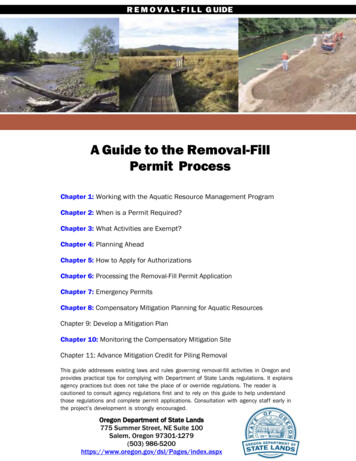
R E M O V A L - F I L L G UIDEA Guide to the Removal-FillPermit ProcessChapter 1: Working with the Aquatic Resource Management ProgramChapter 2: When is a Permit Required?Chapter 3: What Activities are Exempt?Chapter 4: Planning AheadChapter 5: How to Apply for AuthorizationsChapter 6: Processing the Removal-Fill Permit ApplicationChapter 7: Emergency PermitsChapter 8: Compensatory Mitigation Planning for Aquatic ResourcesChapter 9: Develop a Mitigation PlanChapter 10: Monitoring the Compensatory Mitigation SiteChapter 11: Advance Mitigation Credit for Piling RemovalThis guide addresses existing laws and rules governing removal-fill activities in Oregon andprovides practical tips for complying with Department of State Lands regulations. It explainsagency practices but does not take the place of or override regulations. The reader iscautioned to consult agency regulations first and to rely on this guide to help understandthose regulations and complete permit applications. Consultation with agency staff early inthe project’s development is strongly encouraged.Oregon Department of State Lands775 Summer Street, NE Suite 100Salem, Oregon 97301-1279(503) x
Contents1. Chapter 1: Working with the Aquatic Resource Management Program - At aGlance . 5Organization of the Aquatic Resource Management Program . 6How the Aquatic Resource Management Program Works with Other Entities . 7Permit and Authorization-Related Services Provided by the Aquatic ResourceManagement Program . 14Wetland and Waterway Mitigation Grants . 16Requesting Public Records . 16Reporting a Suspected Violation . 17Participating in Agency Improvements . 18Requesting Training or Speakers. 19Registering a Complaint or Compliment . 192. Chapter 2: When is a Permit Required? – At a Glance . 0Waters of This State - Types of Jurisdictional Waters and Their Boundaries . 1Definition of Removal and Fill . 12Removal-Fill Volume Thresholds . 13Calculating Removal-Fill Volumes . 15Special Situations: Activities That Cannot Be Permitted by Rule or Law . 183. Chapter 3: What Activities are Exempt? – At a Glance. 0State Forest Management Practices. 1Fills for Construction, Operation and Maintenance of Certain Dams and WaterDiversion Structures . 3Fill or Removal for a Change in the Point of Diversion . 3Navigational Servitude (Maintenance of the Navigational Channel) . 4Maintenance or Reconstruction of Water Control Structures . 4Maintenance or Emergency Reconstruction of Roads and Transportation Structures 5Prospecting and Non-Motorized Activities within Designated Essential IndigenousAnadromous Salmonid Habitat . 6Fish Passage and Fish Screening Structures in Essential Indigenous AnadromousSalmonid Habitat . 7Removal of Large Wood . 8Certain Voluntary Habitat Restoration Activities . 8Exemptions in State Scenic Waterways . 10Agricultural Exemptions . 11Examples of Normal Farming and Ranching Activities . 13Special Situations: Railroads, Tribal Lands and Environmental Remedial Actions . 164. Chapter 4: Planning Ahead - At a Glance . 0Identifying Regulated Waters on the Project Site . 1Retaining Professional Consultant Services . 6Exploring Alternatives to Avoid and Minimize Impacts. 7Planning to Mitigate for Unavoidable Impacts. 10Pre-design Permit Scoping: Identifying Other Permits and Their Requirements . 11Pre-application Meetings . 125. Chapter 5: How to Apply for Authorizations – At a Glance . 0Types of Permits . 1Completing the Application Forms . 13General Authorization Notification Instructions . 25
Placer Mining GA. 2Emergency Permit . 3Permit Waivers and Facility Siting Permits . 3Application Fees . 46. Chapter 6: Processing the Removal-Fill Permit Application – At a Glance0Processing General Authorization Notifications . 3Processing Individual Permit and General Permit Applications . 5Term and Expiration of the Permit . 16Permit Renewal and Transfer . 17Modifying a Permit . 20Special Permitting Situations (Permit Waivers and Facility Siting Permits) . 21Permit-Related Appeals . 237. Chapter 7: Emergency Permits – At a Glance . 25What is an Emergency?. 26The Procedure for Obtaining an Emergency Permit . 26After the Emergency . 30Chapter 8: Compensatory Mitigation Planning for Aquatic Resources . 33Evaluate Project Impacts . 33Select the Appropriate CM. 33a. Minimum acreage requirements. The minimum acreage requirement ensures thatacreage replacement is addressed. 45b. Increase factors. Any adjustments applied in this step would result in an increase in theamount of mitigation required due to several factors, including: differences between thefunctions/values lost at the impact site and the functions/values expected to be produced by theCM project, and temporal losses of functions. . 458. Figure 8-4: . 499. . 49c. Decrease factors. Any adjustment applied in this step would result in a decrease inmitigation requirements down to, but never below, the minimum acreage requirementsestablished in the first section. That is, a decrease factor can counteract any increase factorsbut will never cause the amount of mitigation required (per acre of impact) to be less than theestablished minimum acreage requirements. . 50 Mitigation requirement calculations. Section D of the accounting worksheet (Figure 8-6)provides step-by-step instructions for calculating mitigation requirements based on the answersprovided in Sections A, B, and C. The process is designed to ensure that the final per-acremitigation requirements never drop below the per-acre minimum established in Section A.51 Buffer calculations. A buffer is the area immediately adjacent to or surrounding a waterof this state that may be necessary to protect against conflicting adjacent land use and tosupport ecological functions (OAR 141-085-0510(11)). This section is only used if buffers willbe required as part of the mitigation plan. Management and long-term protection of the bufferwill typically be required. Buffer credits will be determined case-by-case by the Department andcredit will only be given for actions taken above and beyond other legal requirements (e.g.,Oregon Forest Practices Act, local ordinances, Oregon Department of Agriculture). The creditsawarded per acre of buffer will generally be lower than for restoration, creation, orenhancement of waters of this state (e.g., 10 acres per credit). 5110. Aquatic Resources of Special Concern- Special Considerations. 5411. Minor Wetland Impacts- Special Considerations . 5412. Mitigation Scenarios . 59Chapter 9: Develop a Mitigation Plan . lxxx13. Chapter 10: Monitoring the Compensatory Mitigation Site - At a Glance0Monitoring Methods . 2Data Analysis Standards . 6
Monitoring Reports . 6Monitoring Duration . 10Chapter 11: Advance Mitigation Credit for Piling Removal . 014. Appendix E Preparing the Alternatives Analysis . 1YOUR COMMENTS:- Use this link to e-mail comments regarding the Removal-Fill Guide to theDepartment: RF Guide-Permit Proc@dsl.state.or.us
Chapter 1: Working with the Aquatic Resource ManagementProgram - At a GlanceOrganization of the Aquatic Resource Management ProgramThe Aquatic Resource Management Program (ARM) is made up of two units:Operations Unit (including removal-fill regulatory, proprietary and jurisdictionaldisciplines) and the Planning and Policy Unit. Staff duties and links to contactinformation are provided.How the Aquatic Resource Management Program Works with Other EntitiesThe ARM coordinates with numerous local, state and federal agencies and otherentities in administering the removal-fill permit program and the state’s ownership ofcertain waterways in Oregon.Permit and Authorization-Related Services Provided by the Aquatic ResourceManagement ProgramThe ARM provides a variety of services to support the removal-fill permit processincluding: wetland determinations, wetland delineation report review, responding towetland land use notices, conducting pre-application meetings and providing assistancefor permit application processing. The ARM also administers the state’s ownership ofcertain waterways in Oregon including the issuance of leases, licenses, easements andregistrations.Wetland and Waterway Mitigation GrantsGrants are provided to construct state-sponsored mitigation projects related to thepayment in-lieu and in-lieu fee mitigation programs.Requesting Public RecordsMost records generated by DSL are public records and available upon request.Depending on the extent of the request, there may be a fee.Reporting a Suspected ViolationThe ARM investigates complaints of alleged removal-fill violations and unauthorizeduse of state-owned waterways. Certain information is essential to facilitate violationinvestigation and handling.Participating in Agency ImprovementsMembers of the public are invited to participate in a variety of efforts to improve theARM.Requesting Training or SpeakersSpeakers and trainers are available for a variety of ARM-related topics.Registering a ComplaintThis section provides information on how to report a complaint related to ARMperformance.
AcronymsChapter 1: Working with the Aquatic Resource Management ProgramDSL is organized into three program areas: Aquatic Resource Management, Common SchoolFund Properties and Business Operations and Support Services. In addition, DSL administersthe South Slough National Estuarine Research Reserve in Charleston in partnership with NOAA.A more detailed description of the Department can be found on the DSL website.The mission of the Aquatic Resources Management Program (ARM) is to conserve, restore andprotect the waters of this state and the ecosystem services they provide through implementationof the State’s removal-fill and wetlands planning and conservation laws. The ARM program alsomanages State-owned waterways to preserve the public trust rights of navigation, fishing, andrecreation.The ARM implements its mission while allowing responsible, sustainable economic developmentand exercise of private property interests. Waters are protected for their contribution to aquaticlife and habitats, fisheries, aquatic-based economies, public recreation, navigation, commerce,water quality, floodwater storage and other natural resource functions and values.Organization of the Aquatic Resource Management ProgramThe ARM is managed by a Deputy Director and is organized into two units: the OperationsUnit and the Planning and Policy Unit.The Operations UnitThe Operations Unit implements the permit program for conducting removal-fill activitiesin wetlands and waterways and the proprietary program for authorizing uses of stateowned waterways. The operations unit is divided into two geographic regions: thenorthern region (comprised of northwest and metro regional teams), southern region(comprised of mid-west, southwest, and eastern regulatory regional teams). Eachregional team includes the following personnel: Aquatic Resource Coordinators are responsible for processing removal-fillpermit applications, handling complaints of unauthorized activities, andcompliance monitoring of permits. Proprietary Coordinator are responsible for processing and managing leases,licenses, easements and registrations for uses of state-owned waterways Jurisdictional Coordinator are responsible for reviewing wetland land usenotices, reviewing wetland delineation reports and preparing jurisdictionaldeterminations.In addition, there is one Aquatic Resource Coordinator that serves as the OregonDepartment of Transportation liaison for state transportation removal-fill permits.RFG Chapter 1: Working With the ARMPage 1-6
AcronymsThe Planning and Policy UnitThe Planning and Policy unit develops aquatic resource management policies, providescertain wetland planning services to communities and provides technical specialistservices to support the work of the operations unit. It includes the following personnel: Wetlands Planner: Serves as the technical lead for wetland conservationplanning and protection programs. In coordination with the Aquatic ResourceSpecialist, assists local and regional governments, state agencies and federalagencies developing wetland protection plans and programs. Mitigation Specialist-1: Serves as the technical expert and interdisciplinaryspecialist to provide technical guidance to supervisors, staff and peers from otheragencies on all subjects related to wetland and waterways ecology andcompensatory mitigation. Mitigation Specialist-2: Serves as the agency lead on policy development,implementation and outreach on all subjects related to wetland and waterwayecology and compensatory mitigation. Aquatic Resource Specialist: Serves as the agency and state technical andscientific expert on aquatic resources (e.g. wetlands and waterways) includingbut not limited to aquatic resource delineation, management and regulation underthe Oregon Removal-Fill Law. Removal-Fill Specialist: Provides technical assistance to field operations staffand promotes consistent interpretations in implementing the regulatory program. Proprietary Specialist: Manages complex, multiagency projects within stateowned waterways. Responds to complex technical questions concerningwaterway authorizations and other responsibilities of DSL in relation to themanagement of state-owned waterways.How the Aquatic Resource Management Program Works with Other EntitiesThe following sections provide a brief description of how the ARM coordinates withother state, federal and local agencies and consultants in administering removal-fill andproprietary duties.Working with Other State AgenciesCoordination with other state agencies in administering removal-fill and proprietaryduties is required under the agency’s State Agency Coordination Plan. In coordinatingwith other state agencies, DSL is responsible for:RFG Chapter 1: Working With the ARMPage 1-7
Acronyms Ensuring that state agencies have the opportunity to provide input on removal-filland proprietary applicationsConsidering other agency recommendations for permit and authorization issuance ordenialIncorporating other agency recommendations into permit and authorization conditionsBrokering resolution of conflicting requirementsSoliciting input to resolve violations for unauthorized activitiesOther state agencies routinely participate in the development of removal-fill andproprietary improvements and rule revisions. Many state agencies also serve on theInteragency Review Team (IRT) for mitigation banks. The following list provides adescription of how various state agencies interface with the ARM.Oregon Department of Fish and Wildlife (ODFW)ODFW serves as a consultant to DSL on all matters related to fish and wildlife habitat insupport of the ARM. In this capacity, ODFW: Provides input to DSL on permit and authorization applications andresolution of violations to reduce a proposed project’s impact to fish andwildlife habitatDeveloped the Oregon Guidelines for Timing of In-Water Work, which areincorporated into removal-fill permit conditionsAdministers fish passage requirements and fish passage plan reviews (this can berequired by ODFW even if there is no DSL permit)Issues scientific take permits generally associated with work-area isolation whenendangered fish are present in the waterwayIssues in-water blasting permitsApproves fish screening and bypass structuresServes on the IRT for mitigation banksDevelops and implements the Oregon Habitat Conservation StrategyServes as lead state agency on salmon recoveryOregon Department of Environmental Quality (DEQ)DEQ serves as a consultant to DSL on all matters related to water quality. DEQprovides the following services that support the ARM: Through its responsibility for the Federal 401 water quality certification program,DEQ reviews Clean Water Act permit applications for the Corps. DEQ may alsoprovide input to DSL on removal-fill permit applications about the potential waterquality effects of a proposed removal-fill project. DEQ issues stormwater (NPDES) permits that are frequently required forremoval-fill related activities. DEQ administers the Total Maximum Daily Load (TMDL) standards for waterquality, which are considered in the removal-fill permit process.RFG Chapter 1: Working With the ARMPage 1-8
AcronymsOregon Department of Parks and Recreation (OPRD)OPRD provides input within State Scenic Waterway (SSW) to the ARM: OPRD administers the SSW Act. For activities in SSW, coordination withOPRD about project consistency with the State Scenic Waterway Act isrequiredDepartment of Land Conservation and Development (DLCD)DLCD reviews proposed projects located in the coastal zone for consistency with thefederal Coastal Zone Management Act.Oregon Water Resources Department (OWRD)OWRD may review applications for water storage or uses that may require a waterright from OWRD.Oregon State Marine Board (OSMB)If a proposed project involves a dock or other structure in the waterway, OSMB mayprovide input to DSL to address safety requirements.Oregon State Police (OSP)OSP routinely provides the following services in support of the ARM: Assisting with criminal actions associated with unauthorized activities Accompanying DSL staff as necessary on-site visits to ensure staff safety Assisting DSL in the investigation of unauthorized activitiesWorking with Federal AgenciesMany projects in wetlands and waterways will require a federal Clean Water Act permitfrom the Army Corps of Engineers. The Corps’ Portland District Office websiteprovides further information on the federal permitting requirements. While the Corps isresponsible for coordinating with other federal agencies, DSL also interacts with avariety of federal agencies. The following list provides a brief summary of how DSLcoordinates with each federal agency.The Army Corps of EngineersThe Corps and DSL use a joint permit application for proposed removal-fill activities;however, each agency independently reviews the application and issues its own permit.The Corps and DSL coordinate by: Routinely sharing information and coordinating to resolve issues encounteredduring the permit process for each agency Routinely sharing information to resolve violations for unauthorized activities andnon-compliance with permitsRFG Chapter 1: Working With the ARMPage 1-9
Acronyms Developing and implementing programmatic expedited permitsActing as co-chairs on IRTs for mitigation banksResolving wetland boundary issues for specific sitesDeveloping technical methods such as wetland functions and valuesassessments, wetland delineations and stream assessmentsThe Environmental Protection Agency (EPA)The EPA is responsible for administering the Clean Water Act through the Corps.However, EPA interfaces with the removal-fill program by: Providing input on removal-fill permit applications Handling enforcement for unauthorized activities subject to the Clean Water Actand coordinating with DSL on joint enforcement actions Serving as a member of IRTs for mitigation banks Participating in the development of technical methods such as wetland functionsand values assessments, wetland delineations and stream assessments Participating in the development and implementation of programmatic expeditedpermitThe National Marine Fisheries Service (NMFS)NMFS is responsible for administering the Endangered Species Act (ESA) for listed fish.Although the responsibility for coordination and consultation with NMFS rests with theCorps, NMFS interfaces with the removal-fill program by: Providing input on removal-fill permit applications Handling enforcement for unauthorized activities subject to the ESA Serving as a member of IRTs for mitigation banks if ESA species are involved Participating in the development of programmatic expedited permits if ESAspecies are involvedThe U.S. Fish and Wildlife Service (USFWS)USFWS is responsible for administering the Endangered Species Act (ESA) for plantsand animals. Although the responsibility for coordination and consultation with USFWSrests with the Corps, the USFWS interfaces with the removal-fill program by: Providing input on removal-fill permit applications Routinely serving as a member of IRTs for mitigation banks if ESA species areinvolved Participating in the development of programmatic expedited permits if ESAspecies are involvedRFG Chapter 1: Working With the ARMPage 1-10
AcronymsWorking with the TribesThe government-to-government policy of DSL was originally established in 1998 inresponse to Governor’s Executive Order EO-96-30 on state/tribal relations. This policycommits DSL to: Include affected tribal interests in the review of agency actions likely to affecttribal members or resources of tribal interest Thoughtfully consider tribal comments concerning pending decisions and actions Provide materials to each tribal government that explain DSL’s roles andresponsibilities in natural resource managementIn furtherance of this policy, the ARM sends each potentially affected tribe a copy ofremoval-fill and proprietary applications during the public review period. The Tribes aregiven the opportunity to comment on the proposed activities set forth in the applications,and staff work closely with Tribal staff to address any concerns they may have. Inaddition, ARM management participates in Cultural Resources and Natural ResourcesWorkgroup meetings to share information with the Tribes on DSL’s activities related tonatural resource management.Working with Local GovernmentsTo ensure land use compatibility with permit actions, DSL works with city and countygovernments in the following ways: Jurisdictional coordinators provide input to local government on land useapplications that may involve work in wetlands and waterways through theWetland Land Use Notification program. The Wetlands Planner provides technical assistance to local government withtheir Goal 5 (Natural Resources) requirements including development of localwetland inventories and local ordinances implementing wetland and waterwayprotections. Proprietary coordinators and aquatic resource coordinators consult with localgovernments during the proprietary and removal-fill application processes toensure that projects are consistent with local comprehensive plan and zoningordinances and local wetland and waterway protection ordinances, whereapplicable.Working with Watershed Councils and Soil and Water ConservationDistrictsDSL works with councils and districts to facilitate voluntary restoration activities andcollaborate on specific permit actions. These two organizations: Provide technical assistance to applicants Provide watershed specific information to DSL May comment on removal-fill and proprietary applications Conduct voluntary restoration activities Obtain grants from the mitigation fundRFG Chapter 1: Working With the ARMPage 1-11
AcronymsWorking with Environmental Justice Communities and theEnvironmental Justice Task ForceEnvironmental justice (EJ) is equal protection from environmental and health hazards, andmeaningful public participation in decisions that affect the environment in which people live, work,learn, practice spirituality, and play. "Environmental justice communities" include minority andlow-income communities, tribal communities, and other communities traditionallyunderrepresented in public processes. In response to the need for equal protection for allOregonians, the Oregon Legislature created the Environmental Justice Task Force (EJTF) toprotect minority and low-income populations from disproportionate environmental impacts. DSL isa participating natural resource agency in the task force and has an active representative to theEJTF. The agency seeks to provide all interested people with knowledge of and access todecision-making that affects Oregon’s waters and the communities connected to them.The development of EJ tools such as the EJTF Best Practices Handbook and the EPAconstructed geospatial tool EJSCREEN, are improving the agency’s ability to identify EJcommunities and ensure meaningful public participation.The agency may post a notice of an application and opportunity to comment at a localgovernment building, public library, or other appropriate locations to ensure minority and lowincome communities are included and aware of a proposed action. The agency also makes papercopies of an application available to any person upon request.In some circumstances the agency may hold a public meeting in an affected community toprovide information on an application and allow for public comment at the meeting.Working with ConsultantsApplicants for removal-fill permits typically hire consultants to prepare wetlanddelineation reports, removal-fill permit applications, mitigation plans, and monitoringreports. DSL cannot recommend consultants, but there are resources on the DSLWaterways & Wetlands web pages to help:Wetlands in Oregon and Consultant Summary.RFG Chapter 1: Working With the ARMPage 1-12
AcronymsARM staff work closely with consultants in a variety of ways by: Providing technical and regulatory updatesParticipating and collaborating with consultants inprofessional forums (e.g., Society of WetlandScientists)Revie
DSL is organized into three program areas: Aquatic Resource Management, Common School Fund Properties and Business Operations and Support Services. In addition, DSL administers the South Slough National Estuarine Research Reserve in Charleston in partnership with NOAA. A more detailed description of the Department can be found on the DSL website.