Transcription
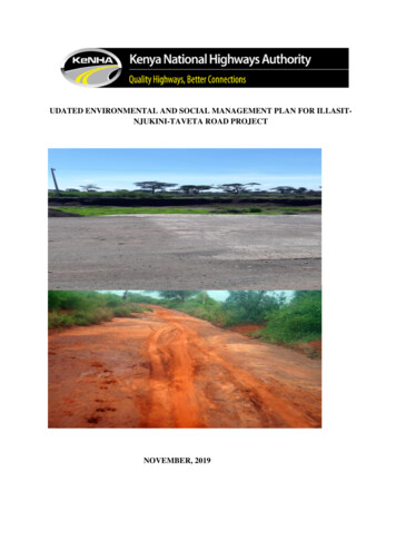
UDATED ENVIRONMENTAL AND SOCIAL MANAGEMENT PLAN FOR ILLASITNJUKINI-TAVETA ROAD PROJECTNOVEMBER, 2019
ContentsCHAPTER: ONE .11.1 INTRODUCTION.11.2 Rational and objectives of ESMP .11.3 Scope of the ESMP .21.4 Structure of the ESMP .21.5 Intended users.21.6 Project Location and Description .21.7 Project Objectives .31.8 Brief Description of Project Activities .31.9 Pre-Construction Phase .31.10 Road Inventory .31.12 Material Exploration .31.13 Water for Construction .41.14 Locations for Construction Camps .41.15 Construction Phase .41.16 Post-Construction Phase .4CHAPTER: TWO .52.0 Physical, Social-Economic and Environmental Baseline Conditions .52.1 Administrative Structures .52.2 Population Structure and Distribution .52.3 Socio-Economic Indicators .52.4 Health Indicators .62.5 Education .62.6 Wildlife and Tourism .62.7 Topography .72.8 Geology and Soils .72.9 Climate and Rainfall .72. 10 Vegetation characteristics.72.11 Land use and other economic activities.82.12 Surface Water Resources and Hydrology .82.13 Soil Erosion and Degradation .82.13 Air Quality .82.14 Noise.9
2.15 Solid and Human Waste Disposal .9CHAPTER: THREE.103.0 BENEFICIAL AND ADVERSE IMPACTS .103.1 Positive/Beneficial Impacts .103.1.1 Employment Opportunities .103.1.2 Improved Local Socio-economy .103.1.3 Ease of Road Transport in the Project Area .103.1.4 Improved Living Standards .103.1.5 Increased Security .103.1.6 Better Education Opportunities .103.1.7 Improved National Transport .113.1.8 Road Safety .113.1.9 Empowerment of Women .113.1.10 Improved Drainage.113.1.11 Improved Access to Services .113.1.12 Reversal of Rural-Urban Migration .123.2 Negative Impacts .123.2.1 Impact on Topography.123.2.2 Impacts on Water Ways and Drainage Sites.123.2.3 Impacts on Soil Environment .123.2.6 Impacts on Ambient Noise Level .143.2.7 Impacts on Fauna .153.2.8 Impact on Ecological Resources .153.2.9 Construction of Site / Camp Buildings .153.2.10 Impact on Land Use .153.2.11 Rivers / Streams .153.2.12 Rivers / Streams .153.2.13 Impacts on Public Health - HIV/AIDS/STIs .153.2.14 Impacts on Occupational Health and Safety .163.3 ENVIRONMENTAL ENHANCEMENT & MITIGATION PROGRAM .16CHAPTER: FOUR .234.0 Institutional and Legal Framework for Environmental Management Guiding theESMP .23CHAPTER: FIVE .245.0 Stakeholders Consultations .24ii
5.1 The Objectives of Community Consultations .245.3 Grievance Redress Mechanism .255.4 Complementary Initiatives .255.5 Responsibilities and Institutional Arrangements .25CHAPTER: SIX .276.0 The ESMP Matrix .276.2 MONITORING AND REPORTING .376.3 CONCLUSION AND RECOMMENDATIONS .37CHAPTER: SEVEN .38APPENDICES .38APPENDIX 1: .397.1 AIR EMISSION MANAGEMENT AND MONITORING PLAN .39Surveys . Error! Bookmark not defined.Roles and Responsibilities .42Training, Awareness and Competency .42Reporting and Notification .42APPENDIX 2: .437.2 NOISE AND VIBRATION MANAGEMENT AND MONITORING PLAN .43Surveys .46Roles and Responsibilities .46Training, Awareness and Competency .467.3 ECOLOGICAL MANAGEMENT AND MONITORING PLAN .47Roles and Responsibilities .52Training, Awareness and Competency .53APPENDIX 4: .547.4 WASTE MANAGEMENT AND MONITORING PLAN .54Table 7-4 WASTE MANAGEMENT AND MONITORING PLAN .56Table 7-5 Typical Waste Stream to be Generated . Error! Bookmark not defined.Auditing .65Roles and Responsibilities .65Training, Awareness and Competency .65Reporting and Notification .66APPENDIX 5: .677.5 WATER RESOURCE MANAGEMENT AND MONITORING PLAN .67Table 7-5 WATER RESOURCE MANAGEMENT AND MONITORING PLAN .68iii
Surveys .80Roles and Responsibilities .80Training, Awareness and Competency .80Reporting and Notification .80APPENDIX 6: .827-6 EROSION AND SEDIMENT CONTROL MANAGEMENT AND MONITORINGPLAN.82Table 7-6 EROSION AND SEDIMENT CONTROL MANAGEMENT ANDMONITORING PLAN .83Surveys .91Roles and Responsibilities .91Training, Awareness and Competenc .91Reporting and Notification .91APPENDIX 7: .927.7 SPILLPREVENTION AND RESPONSE MANAGEMENT AND MONITORINGPLAN.92Risk Assessments .101Spill Response .101Roles and Responsibilities .101Training, Awareness and Competency .102Reporting and Notification .102APPENDIX 8: .1037.8 HAZARDOUS MATERIALS MANAGEMENT PLAN.103Table 7-8 HAZARDOUS MATERIALS MANAGEMENT PLAN .104Surveys .107Roles and Responsibilities .107Training, Awareness and Competency .107Reporting and Notification .107APPENDIX 9: .1087.9 BORROW PIT/QUARRY/RAW MATERIALS MANAGEMENT PLAN .108Table 7-9 BORROW PIT/QUARRY/RAW MATERIALS MANAGEMENT PLAN.109Surveys .112Roles and Responsibilities .112Training, Awareness and Competency .112Reporting and Notification .112iv
7.10 COMMUNITY IMPACTS MANAGEMENT PLAN.113Table 7-9 COMMUNITY IMPACTS MANAGEMENT PLAN .114Surveys . Error! Bookmark not defined.Roles and Responsibilities .119Training, Awareness and Competency .119Reporting and Notification .119List of FiguresFigure5-1 stakeholder engagement at Njukini and Rombo Town.27Figure 7.3 public baraza at Chala Chief’s Office, Njukini.140Figure 7-4 Public Baraza at Rombo Town.141Figure 7-5 Section of the road with deep galley.142v
CHAPTER ONE: INTRODUCTION1.1 Background informationThe updated Environmental and Social Management Plan (ESMP) for the proposed Dualing ofIllasit – Njukini – Taveta Highway through Public Private Partnership (PPP) mechanism, hasbeen prepared to provide practical strategies through which the envisaged negativeenvironmental and socio–economic impacts are going to be mitigated and monitored. The ESMPhas been prepared based on anticipated negative impacts due to project activities, prevailingbaseline environment, relevant regulations, and best international environmental managementpractices during construction. The ESMP has proposed measures to prevent, abate and offset orreduce the foreseeable negative consequences (impacts/risks) of the project activities topermissible levels. The ESMP shall be the guiding document for implementation of projectduring design, construction, operation, decommissioning and maintenance phases of each projectcomponent.1.2 Rational and objectives of ESMPIn the light of the anticipated impacts associated with the proposed project, such as air pollutionfrom dust particles, water pollution, noise pollution among other effects it was considerednecessary to prepare this road project specific Environmental and Social Management Plan(ESMP) for the proposed intervention work which is directed at protecting and minimizing anypotential adverse environmental and social impacts.The ESMP further aims at managing and keeping the negative impacts and risks of the proposedroad project at minimum while enhancing the significant positive and beneficial impacts.Specific objectives are;1) To ensure that every project operation complies with relevant Environmental and SocialRegulations and international best practices in management and coordination ofenvironmental and social issues during construction;2) Environmental and social performance indicators, monitoring requirements and reviewprocedures for the Project activities;3) To identify likely environmental, social and safety risks and impacts that may emerge asconsequences of project activities during implementation and post construction period;4) To propose remedial or corrective measures to risks and negative impacts that have beenenvisaged throughout projects life cycle; and5) Propose institutional arrangements, relevant regulations, roles and responsibilities ofvarious stakeholders that will be critical in implementation and monitoring of the ESMP.6) Identify the roles and responsibilities of the environmental and social safeguardofficers of the project; and1
7) Communicate environmental and social expectations and requirements throughoutthe project life cycle.1.3 Scope of the ESMPThis Environmental and Social Management Plan (ESMP) has been prepared to identify theenvironmental and social management and mitigation actions required to implement theproject in accordance with the requirements of the relevant National and InternationalEnvironment and Social Regulations. It provides an overview of the environmental and socialbaseline conditions on the routes of the proposed project, summarizes the potential impactsassociated with the proposed construction and pavement works and sets out the managementmeasures required to mitigate any potential impacts in a series of discipline specificEnvironmental & Social Management Plans (ESMPs).1.4 Structure of the ESMPThe ESMP outlines the environmental and social management processes and proceduresapplicable to the project and includes the topics which are common to all environmental andsocial disciplines.The ESMP is structured as follows: Chapter 1: Introduction and objective of the ESMPChapter 2: Physical, Social-Economic and Environmental Baseline ConditionsChapter 3: Beneficial and Adverse ImpactChapter 4: Institutional and Legal Framework for Environmental Management Guidingthe ESMPChapter 5: Stakeholder EngagementChapter 6: ESMP Matrix and Conclusion and RecommendationChapter 7: : Appendices1.5 Intended usersThe aim of this document is to communicate to the Project Team (including contractor, sub–contractors and Safeguards team), the potential environmental and social issues associatedwith the proposed project, the procedures and mitigation measures that are required to beimplemented. The Project Team will utilize this ESMP during project execution to achieveeffective, appropriate environmental and social management.1.6 Project Location and DescriptionThe project road length is approximately 66 km and traverses Taveta Sub-County of Taita TavetaCounty and Kajiado West Sub-County of Kajiado County.The project starts at the junction with A23 road at Darajani market centre and veers in a Northerlydirection through Chala, Chumvini, Njukini, Olgirira, Rombo, Entarara among other marketcentres before ending at Illasit in Kajiado County.2
1.7 Project ObjectivesThe main objective of the proposed road is to improve traffic movement within the region ofTaita Taveta and Kajiado counties, most importantly for the road to serve as an important link tothe area where large scale agriculture in crops and livestock farming are the main economicactivities. The road will assist in opening up the areas along the project roads and their areas ofinfluence, and encourage economic and social development in the region, as well as improveeconomic region integration between Kenya and Tanzania.1.8 Brief Description of Project ActivitiesThe proposed Illasit-Njukini-Taveta (66KM) project roads consist of upgrading gravelledsurface to bitumen standard roads. The work will generally consists of clearing the topsoil,earthworks and excavation of longitudinal ditches, construction of culverts and several bridges,pavement construction, erosion control measures, drainage improvement, safety improvementsincluding reflectorized paved markers , sidewalks, and other ancillary works. The project roadwill remain as a 2-lane and will largely follow the existing road with minor re-alignment.1.9 Pre-Construction PhaseThe pre-constructional activities cover the initial investigations and assessment phase. The maincomponents being: road Inventory, geological and geotechnical investigation, materialexploration, search for water for construction, locations of construction camps, and alignmentcharacteristics.1.10 Road InventoryInventory surveys of the road were carried out, in order to collect all the information in preprepared standard formats concerning the actual condition of road, existing structures and otherroad furniture. Requirement of additional retaining structures, cross drainage/side drainageworks and remedial measures was also assessed. The inventory work also included identificationof deficient geometric and weak pavement locations requiring improvements.1.11 Geological and Geotechnical InvestigationGeological and Geotechnical Investigations were conducted for the entire project road betweenIllasit-Taveta. The exercise had two main objectives:i)ii)To investigate the sub-grade strength of the existing road,To explore sources of naturally-occurring materials for road construction withineconomic haulage distance along the project corridor,1.12 Material ExplorationDuring the field work, the materials team explored the project corridor for various constructionmaterials within economic haulage distance. These materials consist of:a)b)c)Lateritic gravel materials suitable for filling, sub base and base layers.Crushed rock for surfacing, concrete works, drainage structures, and also asalternative for road pavement base layer construction.Naturally-occurring sand for construction purposes.3
1.13 Water for ConstructionThe main sources of water for people within these two counties are major rivers in the projectarea including Tsavo, Lumi, Njoro and Mabatini (Kitobo) rivers. Also, permanent springs arefed by the hydrological system that drains from Mount Kilimanjaro. The principal and most wellknown is the Mzima springs that has been tapped to supply clean water to consumers as distantas Mombasa. The other major springs in the sub-county include Njukini, Njoro, Kitobo, Kitivo,Ziwa Serengwa and Madulu. Mechanized boreholes with manual pumps are also installed. Thecontractor is recommended to construct boreholes along the corridor as the source of water forcamp purposes and surface water for construction purposes. Where it becomes necessary to usea particular source of water with questionable quality, then, remedial measures would berecommended to ensure that the quality of concrete is not impaired.1.14 Locations for Construction CampsDuring the investigation of the project areas, many locations were identified as possible sites forcamp construction. Discussions were held with officials of the two (2) counties and it was agreedthat the contractor’s campsite constructed at Rombo Town before the commencement of theproject, the county authorities will consult with the local authorities of the designated areas toensure that the selected locations are free of all encumbrances or traditional hindrance. Thecontractor will be allowed to construct it camp(s) at said location(s) on condition that thecontractor abide by all traditions and norms of the locals.1.15 Construction PhaseTwo (2) typical roadway sections are envisioned to pave the existing two-lane road.1.16 Post-Construction PhaseThe post construction phase will cover issues relating to the operation and maintenance of theproject such as:a) Maintenanceb) Area wide traffic management and enforcement mechanisms, which will focused on:c) Road Safety features (such as warning signs, speed restrictions, traffic calming measures,drains, stopping lay-bys within settlements, junction improvements and direction signboards)d) Environmental improvements;e) Public education and enforcement plans.4
CHAPTER TWO: PHYSICAL, SOCIAL-ECONOMIC AND ENVIRONMENTALBASELINE CONDITIONS2.1 Administrative StructuresThe proposed project passes through Loitoktok constituency in Kajiado West Sub-county ofKajiado County, and Taveta constituencies in Taveta sub-county in Kajiado County.Kajiado County borders the Republic of Tanzania to the southwest, Taita-Taveta County to thesoutheast, Machakos and Makueni counties to the east, Nairobi County to the northeast, KiambuCounty to the north and Narok County to the west. It lies between longitudes 36º 5’ and 37º 5’east and 1º 0’ and 3º 0’ south. The altitude of the county ranges between 1120m and 1960mabove sea level. It covers an area approximately 21,900.97 square kilometers and is divided intofive administrative constituencies.Taveta County borders Kwale County to the southeast, Kilifi County to the east, Makueni, Kituiand Tana River counties to the north, Kajiado to the northwest and the Republic of Tanzania tothe west/southwest. The county is divided into four administrative constituencies namelyMwatate, Voi, Wundanyi and Taveta. Geographically, the county lies between latitudes 30 16south and 40 south and longitudes 3 5 east and 40 east. The altitude of the county ranges between304m and 1000m above the sea level. The county covers an area of 17,084 km² of which a bulk62% or 11,100 km² is within Tsavo East and Tsavo West National Parks. The remaining 5,876km² is occupied by ranches, sisal estates, water bodies such as Lakes Chala and Jipe in Tavetaand mzima springs, and the hilltop forests which occupy less than 100 km² or approximately 10km² out of 587.5 km².2.2 Population Structure and DistributionAccording to 2009 Population census, Taita Taveta County had a population of 284,657 with71,090 households and a population density of 16.66 people per km2. Kajiado County had apopulation of 687,312 with 173,464 households and a population density of 31.38 people perkm2. However, the population densities in the project area influence are 19.32 per km2 and 13.2per km2 in Taveta and Kajiado West sub-counties respectively.2.3 Socio-Economic IndicatorsAccording to the District development plans of 2008 – 2012 (for the Taveta and Kajiado districtsbefore they became counties with the new constitution), the poverty situation is severe withabsolute poverty affecting over 55% and 52% of the total population in Taita Taveta and KajiadoCounties respectively.County poverty levels have been largely affected by high vulnerability to shocks and especiallythe frequency and intensity of d
effective, appropriate environmental and social management. 1.6 Project Location and Description The project road length is approximately 66 km and traverses Taveta Sub-County of Taita Taveta County and Kajiado West Sub-County of Kajiado County. The project starts at the junction with A23 road at Darajani market centre and veers in a Northerly

