Transcription
Preparations for Water SamplingChapter 1 ofSection A, National Field Manual for the Collection of Water-Quality DataBook 9, Handbooks for Water-Resources InvestigationsTechniques and Methods 9–A1Supersedes USGS Techniques of Water-Resources Investigations,Book 9, Chapter A1, Version 2.0U.S. Department of the InteriorU.S. Geological Survey
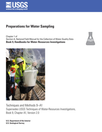
Cover: Photograph showing preparations for collection and processing of water-quality samplesat Conowingo Dam, Md. (USGS monitoring station 01578310). Photograph by Brenda Majedi, U.S.Geological Survey.
Preparations for Water SamplingBy U.S. Geological SurveyChapter 1 ofSection A, National Field Manual for the Collection of Water-Quality DataBook 9, Handbooks for Water-Resources InvestigationsTechniques and Methods 9–A1Supersedes USGS Techniques of Water-Resources Investigations,Book 9, Chapter A1, version 2.0U.S. Department of the InteriorU.S. Geological Survey
U.S. Department of the InteriorRYAN K. ZINKE, SecretaryU.S. Geological SurveyJames F. Reilly II, DirectorU.S. Geological Survey, Reston, VirginiaFirst release: 1998, online as Techniques of Water-Resources Investigations,book 9, chapter A1, version 1.0Revised: 2005, online as TWRI, book 9, chapter A1, version 2.0Revised: November 2018, online as Techniques and Methods, book 9, chapter A1For more information on the USGS—the Federal source for science about the Earth, its natural and livingresources, natural hazards, and the environment—visit https://www.usgs.gov or call 1–888–ASK–USGS.For an overview of USGS information products, including maps, imagery, and publications,visit https://store.usgs.gov.Any use of trade, firm, or product names is for descriptive purposes only and does not imply endorsement by theU.S. Government.Although this information product, for the most part, is in the public domain, it also may contain copyrighted materialsas noted in the text. Permission to reproduce copyrighted items must be secured from the copyright owner.Suggested citation:U.S. Geological Survey, 2018, Preparations for water sampling: U.S. Geological Survey Techniques and Methods, book9, chap. A1, 42 p., https://doi.org/10.3133/tm9A1. [Supersedes USGS Techniques of Water-Resources Investigations,book 9, chap. A1, version 2.0.]ISSN 2328-7055 (online)
iiiContentsAbstract.11.0 Introduction.11.1 Roles and Responsibilities for Water-Quality Personnel.22.0 Site Selection.42.1 Site Access and Permission to Collect Data.52.2 Selection of Surface-Water Sites for Water-Quality Sampling.52.2.1 Site Selection in Flowing Water.62.2.2 Site Selection in Still Water.62.2.3 Site Selection in Tidal Waters.72.3 Selecting Groundwater Sites.72.3.1 Reconnaissance for Selection of a Groundwater-Monitoring Station.72.3.2 Reconnaissance for Selecting Existing Wells.83.0 Preparation for Water-Quality Record Keeping.93.1 National Water Information System Files.103.1.1 Establishing a New Site in NWIS.103.1.2 Documentation of an Existing SITEFILE in NWIS.113.2 Site Information Management System.143.3 Forms for Field Notes, Analytical Services, and Chain of Custody.143.3.1 Personal Computer Field Form.144.0 The Project Work Plan.154.1 Standard Operating Procedures.154.2 Quality-Assurance Plan.154.3 Project Data-Management Plan.165.0 Final Preparation for Field Sampling.175.1 Safety Preparedness.185.1.1 Job Hazard Analysis.195.1.2 Site Hazard Analysis.195.1.3 Safety Training.225.2 Station and Project Files.22Acknowledgments.22References Cited.27Appendix A. Forms to Establish a New Site in the Groundwater Site Inventory.31
ivFigures1–1.Example of a traffic-control safety plan. (Modified from U.S. GeologicalSurvey, 2014b).211–2. Examples of maps to document site locations: A, site-location map forRock Creek Park in Washington, D.C., and B, sketch of a well site.251–A.1. Form 9–1904–A—U.S. Geological Survey schedule for establishing a newsurface-water site in the Groundwater Site Inventory (GWSI).321–A.2. Form 9–1904–A—U.S. Geological Survey schedule for establishing a newgroundwater site in the Groundwater Site Inventory .1–7.Example of groundwater site inventory activities.2Minimum information required for electronic storage of a surface-waterSITEFILE record in the GWSI, and surface-water-quality data in QWDATAof the USGS NWIS.11Minimum information required for electronic storage of a surface-waterSITEFILE record in the GWSI, and surface-water-quality data in QWDATAof the USGS NWIS.13Checklist for preparation to conduct field sampling.17Example—Job Hazard Analysis for water-quality measurements in the field.19Information to be included in a station folder for surface-water-qualitymonitoring stations.23Information to be included in a station folder or well file for groundwater-qualitymonitoring stations.24
vConversion FactorsU.S. customary units to International System of UnitsMultiplyByTo obtainLengthinch (in.)2.54inch (in.)25.4centimeter (cm)millimeter (mm)foot (ft)0.3048meter (m)mile (mi)1.609kilometer (km)Volumegallon (gal)3.785liter (L)gallon (gal)0.003785cubic meter (m3)gallon (gal)3.785cubic decimeter (dm3)million gallons (Mgal)3,785cubic meter (m3)DatumAltitude, as used in this report, refers to distance above the vertical datum.Abbreviations and SymbolsASRanalytical services request formBQSBranch of Quality Systems (USGS)COCchain of custodyCRPcontinuous records processingDICdissolved inorganic carbonDIWquality-assured deionized water with resistance greater than or equal to 18megaohms (MΩ)DOCdissolved organic carbonDODU.S. Department of DefenseEDIequal-discharge increment, isokinetic sampling methodEPAU.S. Environmental Protection AgencyEWIequal-width increment, isokinetic sampling methodGPSglobal positioning systemGWPDGroundwater Technical Procedures Document (Cunningham and Schalk, 2011)GWSIGroundwater Site Inventory (USGS NWIS database for site information andgroundwater data)
viHIFHydrologic Instrumentation Facility at Stennis Space Center, Mississippi (USGS)IBWinorganic-grade blank water, water with certified analysis for trace elements andother inorganic constituents, and suitable for blank QC samples for analysis forinorganic constituents and dissolved organic carbonICinorganic carbonJHAJob Hazard AnalysisLliterNAWQANational Water-Quality Assessment Project (USGS)NFMNational Field Manual for the Collection of Water-Quality Data (USGS)NFSSNational Field Supplies Service (also referred to as “One Stop”—USGS)NWISNational Water Information System (USGS)NWIS-TSNWIS time series (USGS NWIS database for continuous water data)NWQLNational Water-Quality Laboratory (USGS)OBWorganic-grade blank water, water with certified analysis for nonvolatile organiccompounds, and suitable for blank QC samples for analysis for pesticides,pharmaceutical compounds, and hormonesPCFFpersonal computer field formPVCpolyvinyl chlorideQAquality assuranceQAPquality-assurance planQCquality controlQWquality of waterQWDATAQuality of Water database (USGS NWIS database for discrete water data)SHASite Hazard AnalysisSIMSSite Information Management System (USGS)SOPstandard operating procedureUSDAU.S. Department of AgricultureUSGSU.S. Geological SurveyVBWblank water for volatile organic carbon compounds, OBW that is purged withnitrogen gas and certified free of VOCsVOCvolatile organic carbon compoundWMAWater Mission Area (USGS)WSCWater Science Center greater than greater than or equal to less than less than or equal to
viiRequirements and RecommendationsAs used in the U.S. Geological Survey (USGS) “National Field Manual for the Collectionof Water-Quality Data” (NFM), the terms “required” and “recommended” have the USGSspecific meanings described below: The terms “require,” “required,” and “requirements” in reference to USGS protocolsindicate that USGS Water Mission Area (WMA) policy has been established on thebasis of research or consensus of the technical staff, and has been reviewed by waterquality specialists and other professionals having the appropriate expertise. Technicalmemorandums and other documents that define USGS WMA policy are cited in theNFM. USGS field personnel are instructed to use required equipment and proceduresas described in the NFM. Departure from or modifications to stipulated requirements,if necessary for accomplishing specific data-quality requirements or study objectives,must be independently quality assured and documented (Office of Water QualityTechnical Memorandum 2002.13—U.S. Geological Survey, 2002). The terms “recommend,” “recommended,” and “recommendation” indicate that, onthe basis of research or consensus, there are several acceptable alternatives to a givenprocedure or equipment selection in the NFM. Relevant technical memorandums andpublications pertinent to such recommendations are cited in the NFM to the extentthat such documents are available. Specific requirements, data-quality objectives, orother constraints of a project may affect the choice of recommended equipment orprocedures. Selection from among the recommended alternatives should be based onreferenced research and sound field judgment, and reasons for the selection must bedocumented. Departures from or modifications to the recommended procedures mustbe independently quality assured and documented (Office of Water Quality TechnicalMemorandum 2002.13—U.S. Geological Survey, 2002).
Chapter A1. Preparations for Water SamplingBy U.S. Geological SurveyAbstractThe “National Field Manual for the Collection of WaterQuality Data” (NFM) provides guidelines and procedures forU.S. Geological Survey (USGS) personnel who collect dataused to assess the quality of the Nation’s surface-water andgroundwater resources. This chapter, NFM A1, provides anoverview of preparations for water sampling, which includessite reconnaissance, project work plans, quality-assuranceplans, basic equipment and supplies needed for fieldwork,safety precautions, and planning for data management. Itupdates and supersedes USGS Techniques of Water-ResourcesInvestigations, book 9, chapter A1, version 2.0, by F.D. Wilde.Before 2017, the NFM chapters were released in theUSGS Techniques of Water-Resources Investigations series.Effective in 2018, new and revised NFM chapters are beingreleased in the USGS Techniques and Methods series; thisseries change does not affect the content and format of theNFM. More information is in the general introduction tothe NFM (USGS Techniques and Methods, book 9, chapterA0) at https://doi.org/10.3133/tm9A0. The authoritativecurrent versions of NFM chapters are available in theUSGS Publications Warehouse at https://pubs.er.usgs.gov/.Comments, questions, and suggestions related to the NFM canbe addressed to nfm-owq@usgs.gov.1.0 IntroductionThe “National Field Manual for the Collection of WaterQuality Data” (NFM) is the official and citable protocol forthe collection of water-quality data by the Water MissionArea (WMA) of the U.S. Geological Survey (USGS). TheNFM provides guidelines and procedures for USGS personnel who collect data for water quality in surface water andgroundwater, with detailed, comprehensive, and citableprocedures. National USGS program and project personnel who collect water-quality data, as well as those in USGSWater Science Centers (WSCs), and including projects supported by the USGS Cooperative program, are mandated touse protocols provided in the NFM (USGS Office of WaterQuality Technical Memorandum 2002.13—U.S. GeologicalSurvey, 2002). Formal training, as provided in the USGS class“Field Water-Quality Methods for Groundwater and SurfaceWater,” and field apprenticeships supplement the informationprovided in the NFM and are needed to collect unbiased,high-quality data.The USGS National Field Manual provides detailed,comprehensive, and citable procedures for monitoring thequality of surface water and groundwater. Formal trainingand field apprenticeships supplement the informationprovided in the NFM.Chapter A1 of the NFM addresses the initial preparations for making water-quality measurements and collectingsamples for water quality at surface-water and groundwatersites. All of the preparations fall within an individual projectwork plan that provides the project objectives and methods toguide the upcoming fieldwork and data processing.This chapter updates and supersedes USGS Techniques of Water-Resources Investigations, book 9, chapterA1, version 2.0 (Wilde, 2005). It provides guidance for thefollowing procedures—reconnaissance and selection of waterquality-monitoring sites, the creation of station folders thatcontain supporting information on sites and data-collectionactivities, project work plans, quality-assurance plans, basicequipment and supplies needed for fieldwork, safety precautions, accurate and efficient record keeping, and planningfor data management. Thorough planning during the initialphases of a water-quality study will result in timely and reliable products.Before 2017, the USGS NFM chapters were releasedin the USGS Techniques of Water-Resources Investigationsseries. Effective in 2018, new and revised NFM chaptersare being released in the USGS Techniques and Methodsseries; this series change does not affect the content andformat of the NFM. More information is in the generalintroduction to the NFM (USGS Techniques and Methods,book 9, chapter A0—U.S. Geological Survey, 2018a) athttps://doi.org/10.3133/tm9A0. The authoritative currentversions of NFM chapters are available in the USGSPublications Warehouse at https://pubs.er.usgs.gov.Comments, questions, and suggestions related to the NFMcan be addressed to nfm-owq@usgs.gov.
2 Chapter A1. Preparations for Water Sampling1.1 Roles and Responsibilities for Water-QualityPersonnelFundamental to water-quality sampling is the fact that theanalytical results can be no better than the sample on whichthe analysis was performed. Therefore, it is critical that eachstep in the process of collecting and processing water-qualitysamples is carried out by using approved USGS protocolswhile staying within the framework of project objectives.Protocols and project objectives must be documented to ensureaccuracy and timeliness of the data. Each member of a USGSwater-quality team plays an important role in both the processof collecting samples for analysis of water quality, and managing resulting data in the National Water Information System(NWIS). USGS field personnel have the ultimate responsibility for the high quality and objectivity of USGS water-qualitydata. Communication and collaboration among field, laboratory, and project personnel are essential to producing validdata from the sampling effort.Chapter 502.2 of the USGS Manual on FundamentalScience Practices (U.S. Geological Survey, 2011) coversUSGS policies for planning and conducting data collectionand research. USGS personnel who conduct fieldworkfor water resources should be familiar with this documentas well as other WMA policies and protocols covered inthe NFM. See table 1–1 for examples of groundwater siteinventory activities.Each member of a USGS water-quality team plays animportant role in the process of collecting samples foranalysis of water quality and managing resulting datain NWIS.Table 1–1. Example of groundwater site inventory activities.[USGS, U.S. Geological Survey]Before the site visitReview considerations for well selection and installation (U.S. Geological Survey, 2006a; Lapham and others, 1997).Review background information.Obtain permission to gain access to the site and to collect samples from the well.Update well files—record changes in ownership and land use.Contact utility companies (gas, water, and electric) before digging or drilling.Determine whether the pump may or may not be removed from the well by field personnel (removal is not recommended, as personal safetycould be compromised). The owner’s permission is required to remove a pump—the USGS could be liable for damage to pump or well.Obtain information needed about the site that could interfere with or interrupt sampling. For example: Hours of pump operation and scheduled downtime. Pumping rate or rates. Holding tanks or chemical treatments. Electrical service to the site. Scheduled maintenance for pumps or related equipment. Scheduled site maintenance, such as painting, construction, and defoliation. Seasonal water-level declines that make the well unusable. Times of denied access—for example, no access while the owner is out of town. Special site-access needs—for example, clearance with a site owner or site operator, keys to unlock access to the site, animals. Restrictions on the location.Before and during the site visitRecord conditions that could compromise study objectives, including potential point or nonpoint sources of contamination. For example: Nearby wells that could affect well hydraulics. Condition of well, such as rusting or punctured casing or poor surface seal. Has the well been adequately developed? Could well-development artifacts compromise sample integrity? Land use and land cover. Application of salt on nearby roads during winter, or application or use of herbicides and pesticides. Landfills or other waste-management facilities. Industrial, commercial, and agricultural complexes and discharges.
1.0 Introduction 3Table 1–1. Example of groundwater site inventory activities.—Continued[USGS, U.S. Geological Survey]During the site visitMeasure water level in each well. Record water-level measurements on the appropriate field form(s), and in the Groundwater Site Inventory(GWSI) and Quality of Water Data (QWDATA) databases.Identify potential difficulties with the type of equipment and sample-collection methodology to be used. (Note that sampling plans will haveto be modified accordingly.)Update field folders. Note site conditions that could affect the quality of data collected from that well. Note changes in land use.Verify well identification number and make sure that it is clearly and permanently labeled. Check that identification number corresponds with number in the field folder and on site and location maps. Correct any mistakes or uncertainty about well identification and well location.Verify type of pump, well diameter, and use of holding tanks, pressure tanks, chemical treatments. Check whether oil is floating on the water column in a well equipped with an oil-lubricated pump. Make sure that the downhole treatment system is turned off before collecting water samples. Determine whether the intended sampling device is suitable for use.Establish optimum pumping rates for purging and sample collection and decide where to route excess discharge. Adjust pumping rate to ensure adequate purging of the well without entrainment of atmospheric gases due to excessive drawdown. Route water away from the well to prevent (1) creating muddy and slippery conditions and (2) damage to or defacement of the propertyto which you were granted access.Check that well structure is intact. Wells used for groundwater studies should be “sounded” annually to check whether depth to bottom corresponds with well-constructioninformation or whether the well is filling with loose materials (Lapham and others, 1997). A decrease in depth to bottom could indicatethat the well casing is collapsing, that there is a breach or corrosion of well screen or casing, or that the well is improperly designed toretain aquifer materials. Borehole caliper and downhole-camera video logs can identify a damaged or broken well casing. A downhole camera can identify aplugged screen or accumulation of sediment in the well. Aquifer tests, such as slug tests, can be used to check the hydraulic connection between the well and the aquifer. The surface seal of a U.S. Geological Survey monitoring well should be intact and the well should be capped. Concrete pad should berepaired if cracked or separated from outer casing. A tight-fitting well cap should have a small ventilation hole.Check well access for sample-collection points. Sample-collection points need to be near the wellhead, ahead of where water enters pressure tanks, holding tanks, or treatment systems. At wells where an access point close to the well is not available, it might be possible to install a hose bib or tap at the wellhead. Because it usually is not possible to control the pumping rate of a supply well, the field person may need to set up a hose-and-valve systemto control the rate at which water is sampled and to reduce the likelihood of backflow of water stored in plumbing lines.Check well access for water-level measurements. The construction of some supply wells makes water-level measurements difficult orimpossible. Although it is often possible to slip a weighted steel or electric well tape below the pump to obtain a water-level measurement, thepump can be damaged if the weight or tape becomes entangled in the pump. The weight should be attached so that it will snap off thetape under stress. Water levels can be estimated through the air line on some wells. Sometimes field personnel are permitted to remove the pump from the well to obtain a measurement. However, pump removal can bedifficult and time consuming, is potentially unsafe, and could damage the pump or well. A note should be made in the well file if there is no access for a depth measurement.
4 Chapter A1. Preparations for Water Sampling Responsibilities of field personnel— Field personnel must maintain their professional andtechnical expertise in all water-quality-sampling anddatabase techniques relevant to the needs of theirindividual data-quality objectives. They ensure that USGS protocols are followed forall water-quality monitoring and related activities. They adhere to project work plans, standardoperating procedures (SOPs), and quality-assuranceplans (QAPs). They communicate in a timely fashion with projectmanagers and supervisors on the routine progress ofall water-quality activities as well as abnormal situations or problems that may arise. They document and obtain approval for any deviations from USGS official protocols. They network with personnel from other projectsto optimize productivity of projects and quality ofUSGS products. Responsibilities of project managers— Project managers direct and manage project activities in the field and laboratory. These tasks includethe management, analysis, and archiving of data. They ensure that monitoring and data analysis forwater-quality activities meet the needs of the FederalGovernment, the USGS, the Water Science Center(WSC), cooperating State and local agencies, andthe public. They develop a written work plan for the projectthat includes or refers to standard USGS-approvedprotocols, a schedule for completing tasks and deliverables, and a budget. They develop a project QAP, with guidance, asappropriate, from water-quality specialists and theUSGS Office of Quality Assurance. The project QAPis referenced to the WSC QAP and USGS standards. They ensure that all aspects of the project SOPsand QAP are understood and followed by theirproject personnel. They network with personnel from other projects tooptimize productivity of projects and quality of allUSGS products. Responsibilities of project supervisors— Project supervisors are informed about eachproject as soon as a proposal is written and arekept informed of progress during the timespan ofeach project. They review project proposals to ensure that they areappropriate to the USGS mission and that the projectobjectives are achievable within the resources ofthe project. They review project work plans, budgets, timelines,and deliverables and conduct regular project reviewsto assure that projects are meeting their goals. They ensure that staff and resources are available toachieve project objectives in a timely manner.2.0 Site SelectionSite selection occurs early in the process of projectplanning. Considerations for site selection include the appropriate quantity and locations of sampling sites, data-qualityobjectives, types of data and samples to be collected, siteaccessibility, safety, and project budget. The process of selecting sites for water-quality monitoring begins with assemblingand reviewing all available relevant information for the studyarea and data collection. Site-selection process Review the project plan and understand the purposefor which the various types of data will be collected. Compile a surface-water and (or) groundwater siteinventory for the study area from the USGS NationalWater Information System (NWIS) SITEFILE,which is managed with the Groundwater SiteInventory (GWSI) subsystem software. In additionto the SITEFILE, the GWSI contains site-characteristic information for groundwater sites, such as wellconstruction and casing information. Using the siteinventory, identify existing gage and well sites and,as appropriate, compile background information andavailable records for those sites. Review historical information in NWIS, the USGSSite Information Management System (SIMS), andother data sources. Note site location, description,and access. Review any previously collected physical, chemical,and biological data that may be stored in the Qualityof Water Database (QWDATA), the discrete waterquality subsystem of NWIS. Make field reconnaissance trips prior to selectingsampling sites to verify information in the NWISand SIMS databases. Evaluate each potentiallocation with respect to project needs. During reconnaissance trips, verify gage and well locations andconstruction details.
2.0 Site Selection 5 Determine or confirm latitude and longitudeat each potential location by using a globalpositioning system (GPS), maps, and (or) landsurvey techniques. Speak with staff who have knowledge of and familiarity with the selected sites. Verify that the selected sites are representative of thesystem intended for study.2.1 Site Access and Permission to Collect DataUSGS policy specifies that permission must be securedbefore entering public or private property to select samplingsites, install wells, or collect samples (USGS Water ResourcesDivision Memorandum 90.34—U.S. Geological Survey,1990). Permission can be granted by a landowner or otherresponsible
The "National Field Manual for the Collection of Water-Quality Data" (NFM) is the official and citable protocol for the collection of water-quality data by the Water Mission Area (WMA) of the U.S. Geological Survey (USGS). The NFM provides guidelines and procedures for USGS person-nel who collect data for water quality in surface water and