Transcription
System Assessment and Validation for Emergency Responders (SAVER)Geographic Information SystemSoftware Selection GuideJuly 2013Prepared by Space and Naval Warfare Systems Center AtlanticApproved for public release; distribution is unlimited.
The Geographic Information System Software Selection Guide was funded underInteragency Agreement No. HSHQPM-12-X-00031 from the U.S. Department ofHomeland Security, Science and Technology Directorate.The views and opinions of authors expressed herein do not necessarily reflect those of theU.S. Government.Reference herein to any specific commercial products, processes, or services by tradename, trademark, manufacturer, or otherwise does not necessarily constitute or imply itsendorsement, recommendation, or favoring by the U.S. Government.The information and statements contained herein shall not be used for the purposes ofadvertising, nor to imply the endorsement or recommendation of the U.S. Government.With respect to documentation contained herein, neither the U.S. Government nor any ofits employees make any warranty, express or implied, including but not limited to thewarranties of merchantability and fitness for a particular purpose. Further, neither theU.S. Government nor any of its employees assume any legal liability or responsibility forthe accuracy, completeness, or usefulness of any information, apparatus, product, orprocess disclosed; nor do they represent that its use would not infringe privately ownedrights.Distribution authorized to Federal, state, local, and tribal government agencies foradministrative or operational use, July 2013. Other requests for this document shall bereferred to the SAVER Program, U.S. Department of Homeland Security, Science andTechnology Directorate, OTE Stop 0215, 245 Murray Lane, Washington, DC 20528-0215.
FOREWORDThe U.S. Department of Homeland Security (DHS) established the System Assessment andValidation for Emergency Responders (SAVER) Program to assist emergency respondersmaking procurement decisions. Located within the Science and Technology Directorate (S&T)of DHS, the SAVER Program conducts objective assessments and validations on commercialequipment and systems and provides those results along with other relevant equipmentinformation to the emergency response community in an operationally useful form. SAVERprovides information on equipment that falls within the categories listed in the DHS AuthorizedEquipment List (AEL). The SAVER Program mission includes: Conducting impartial, practitioner-relevant, operationally oriented assessments andvalidations of emergency responder equipment; and Providing information, in the form of knowledge products, that enablesdecision-makers and responders to better select, procure, use, and maintain emergencyresponder equipment.Information provided by the SAVER Program will be shared nationally with the respondercommunity, providing a life- and cost-saving asset to DHS, as well as to Federal, state, and localresponders.The SAVER Program is supported by a network of Technical Agents who perform assessmentand validation activities. Further, SAVER focuses primarily on two main questions for theemergency responder community: “What equipment is available?” and “How does it perform?”As a SAVER Program Technical Agent, the Space and Naval Warfare Systems Center(SPAWARSYSCEN) Atlantic has been tasked to provide expertise and analysis on key subjectareas, including communications, sensors, security, weapon detection, and surveillance, amongothers. In support of this tasking, SPAWARSYSCEN Atlantic developed this selection guide forgeographic information system software, which falls under AEL reference 04AP-03-GISSSystem: Geospatial Information (GIS).Visit the SAVER section of the Responder Knowledge Base (RKB) website athttps://www.rkb.us/saver for more information on the SAVER Program or to view additionalreports on GIS software or other technologies.i
POINTS OF CONTACTSAVER ProgramU.S. Department of Homeland SecurityScience and Technology DirectorateOTE Stop 0215245 Murray LaneWashington, DC 20528-0215E-mail: saver@hq.dhs.govWebsite: https://www.rkb.us/saverSpace and Naval Warfare Systems Center AtlanticAdvanced Technology and Assessments BranchP.O. Box 190022North Charleston, SC 29419-9022E-mail: ssc lant saver program.fcm@navy.milii
TABLE OF CONTENTSForeword . iPoints of Contact . iiExecutive Summary . v1. Introduction . 12. GIS Overview . 12.1 GIS Software Types . 12.2 GIS Resources . 22.2.1 Hardware. 22.2.2 Software . 32.2.3 Spatial Data . 32.2.4 Personnel. 32.3 GIS Functional Capabilities . 32.4 Data Models . 52.5 Geographic Data Models . 63. Software Selection Process . 63.1 Needs Analysis . 83.1.1 Identify Stakeholders . 83.1.2 Determine GIS Uses and Applications . 93.2 Requirements Definition . 123.2.1 Collecting Information. 123.2.2 Standards. 133.2.3 Business Policies . 133.2.4 Requirements Validation Activities . 133.3 Product Identification. 143.3.1 Internet Research and Literature Review . 143.3.2 Requests for Information . 153.4 Product Selection . 153.4.1 Implementation Factors . 153.4.2 Cost Factors . 153.4.3 Software Requirements . 163.4.4 Requirements Priorities . 17iii
3.4.5 Vendor Surveys . 193.4.6 Feature Comparison Matrix . 193.4.7 Product Comparison Matrix . 193.4.8 Product Comparison Matrix Analysis . 203.5 Product Assessment . 224. Summary . 23Appendix A.Glossary of Terms. A-1Appendix B.Example GIS Architectures . B-1Appendix C.GIS Data Standards. C-1Appendix D.Sample Product Information Summary . D-1Appendix E.References.E-1LIST OF TABLESTable 2-1. Basic GIS Functional Capabilities. 4Table 2-2. Advanced GIS Functional Capabilities . 4Table 3-1. GIS Software Selection Process . 7Table 3-2. Sample GIS Software Functionality Considerations . 10Table 3-3. Sample GIS Websites . 14Table 3-4. Sample GIS Software Support Considerations. 16Table 3-5. SME Requirements with Derived Weights–Example . 18Table 3-6. Product Comparison Matrix Vendor Response Example. 19Table 3-7. Product Comparison Matrix Analysis with Product Rankings Example . 21LIST OF FIGURESFigure 3-1. GIS Data and Information Flow . 11iv
Geographic Information System Software Selection GuideEXECUTIVE SUMMARYGeographic information system (GIS) software tools enable crisis managers and emergencyresponders to improve situational awareness and enhance decision making. These tools display,store, manage, and analyze geospatial data; offer robust visualization capabilities at variousgeographic scales; and provide the user with multiple-layer mapping, spatial analysis, and patternmodeling capabilities. Before implementing these capabilities, emergency response agenciesneed to evaluate multiple GIS software products and select options that support missionrequirements, improve operational practices, and enhance knowledge sharing within theircommunities.This guide describes a comparative evaluation process that is divided into five activities: Needs analysis; Requirements definition; Product identification; Product selection; and Product assessment.Critical components used in the software selection process are listed in the feature comparisonmatrix and the product comparison matrix.The feature comparison matrix uses vendor responses to identify software products that supportthe criteria identified by the stakeholders. The vendor responses for each product will becompared to each criterion and scored based on whether the product is reported to meet thecapabilities specified by the stakeholders. A completely populated matrix will reflect thefunctions, features, and requirements supported by each product.The product comparison matrix will be used to generate product rankings (highest to lowest)relative to criteria that have been weighted by identified stakeholders. This type of analysis usesnormalized weighting for each criterion and results in a score for each criterion and for eachproduct. The scores are then summed and result in a ranking for each product. The productswith higher scores are then considered for final product assessment.An assessment may focus on the operational environment, interoperability, and functionalcapabilities required for satisfactory user operation. The assessment process may require thedevelopment of a standardized environment so that all products can be evaluated equally underthe same conditions using the same data.This software selection approach should not be construed as an endorsement or recommendationby the U.S. Government of any particular software application.v
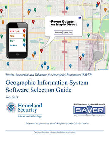
Geographic Information System Software Selection Guide1.INTRODUCTIONGeographic information systems (GIS) use hardware and software tools to collect, display,analyze, manage, and store geographic data. These tools offer robust visualization features atvarious geographic scales; give users multiple layer mapping, spatial analysis, and patternmodeling capabilities; and often provide customization features that support unique,agency-specific GIS solutions.Emergency response agencies intending to procure a GIS solution will be faced with the task ofevaluating multiple products with similar capabilities and levels of complexity. This guidepresents a selection process that can be used to evaluate GIS software tools. The processinvolves performing a needs analysis, developing requirements, researching available products,and conducting a product assessment. By using this approach, agencies will be better able toidentify and select GIS solutions that best meet their current and future operational needs.2.GIS OVERVIEWMapping tools are essential to crisis managers and emergency responders; however, manyagencies still use printed resources, such as map books, which are not always current ororganized for quick reference. Moreover, command centers often have access to a wide range ofdata but with limited ways for responders to view that information.A GIS solution can help solve these problems by providing emergency response teams with rapidaccess to a more comprehensive tactical picture, which can reduce response times and increaseoperational efficiency. An agency needs to consider standards, procedures, and work processesas well as trained personnel when selecting a GIS.Computer applications such as spreadsheets, statistical software, or computer-aided draftingpackages can process simple geographic or spatial data, but this does not necessarily comprise aGIS. A GIS has the following capabilities: Links spatial data (e.g., features such as a fire hydrant) to a specific location on a map; Incorporates individual data layers (e.g., roads, hospitals, and schools); Incorporates database management systems; and Incorporates tools for data compilation, geographic query, spatial analysis andgeoprocessing, image visualization, and cartographic representation.GIS has a wide variety of uses including resource management, development planning, andcalculating emergency response times. The information derived from these and otherapplications of GIS can be distributed over the Internet or other LANs/WANs.2.1GIS Software TypesSeveral types of GIS software products are available in the market and worth considerationduring the software selection process. The following list, compiled from the EnvironmentalSystems Research Institute’s (ESRI’s) GIS dictionary, describes the most common types ofsoftware. The use of ESRI information in this handbook is not intended to indicate anendorsement of the company or their products.1
Geographic Information System Software Selection Guide Add-ons/Extensions: Refers to optional software modules that add specialized toolsand functionality to an existing core software application; Computer-aided design (CAD): Refers to software that provides the ability todesign, draft, and display graphical and geographic information; Desktop mapping: Refers to software for personal computers, ranging from systemsthat can only display data to full data manipulation and analysis capabilities; Global positioning system (GPS): Refers to a collection of hardware, software, anddata that provides the ability to view, collect, and edit geographic data and base mapsin the field with or without a GPS receiver; Image processing: Refers to software that manipulates remotely-sensed data(e.g., aerial photographs, satellite imagery) to improve the interpretation and thematicclassification of the image; Internet mapping: Refers to software that provides the ability to deliver dynamicmaps, data, and basic spatial functions over the Internet; Mobile GIS: Refers to software that provides mapping, GIS, and GPS integration tofield users through handheld and mobile wireless devices; Photogrammetry: Refers to software that extracts useful information (e.g., distancebetween two objects) from photographic images, particularly for the creation ofaccurate maps; Routing/Delivery GIS: Refers to software that plans and adjusts optimal deliveryroutes; Spatial database: Refers to software that edits and organizes spatial data and itsrelated descriptive data for efficient storage and retrieval; and Web service: Refers to software that is not dependent on the operating system of ahardware platform but is accessible over the Internet for use in a wide range of otherapplications.2.2GIS ResourcesA GIS solution is a complex system requiring the following resources for operation: hardware,software, data, and personnel. All of these resources, as described below, need to be consideredduring the GIS software selection process.2.2.1 HardwareA wide range of hardware types can support a GIS solution including centralized servers,desktop computers, laptops, and handheld devices. Examining the agency’s current and futurecomputing resources is necessary to ensure sufficient capability will exist to support GISsoftware and system operation. Some GIS applications will require robust servers, workstations,and network bandwidth for extensive data acquisition, geoprocessing, data analysis, andmanagement operations. Conversely, other applications will only require terminals linked to adistributed network for application access, data display, and spatial querying.2
Geographic Information System Software Selection Guide2.2.2 SoftwareGIS software provides the functions and tools necessary to conduct analyses and develop dataand information products. This software includes the agency’s primary GIS software package aswell as extensions that perform spatial analysis, image processing, and thematic mapping. GISsoftware may require updates, subscription service fees, and technical support contracts. ManyGIS packages offer the following key components and capabilities: A database management system (DBMS); Tools for the input and manipulation of geographic information; Tools that support geographic query, analysis, and visualization; and A graphical user interface (GUI) for easy access to tools and scripts.2.2.3 Spatial DataSpatial data consists of vector and raster features. Vector, or linear, features include points,lines, and polygons with attributes such as size, type, length, area, and volume. Raster, or grid,features consist of identically sized square cells, or pixels, with a unique value assigned to eachcell. Typical vector data sets include roads, landmark locations, and building footprints. Typicalraster data sets include thematic classifications, topographic elevations, and aerial photographs.Spatial data is often presented in tabular form to compare data or consolidate information.Many GIS solutions employ a DBMS to help organize, manage, and document data. This datamay include various types of spatial data such as vector, raster, and tabular as well as non-spatialdata such as photographs, law enforcement records, and metadata. Data standards are importantto ensure maximum utility and interoperability of dissimilar data sets and sources.GIS data becomes outdated quickly and therefore needs to be updated on a regular basis. Somevendors require a subscription to routinely update this data.2.2.4 PersonnelGIS technology is of limited value without trained personnel to operate and manage the system.Developing specific GIS functional requirements will help identify the skilled personnel neededto run a particular system. These personnel may include technical specialists and databaseprogrammers, who design and maintain the system, as well as analysts, who perform spatialoperations and data development activities. It is recommended that agencies include skilledpersonnel in the conceptual design, physical design, implementation stages, and subsequentlong-term operation of the GIS.2.3GIS Functional CapabilitiesGIS software functional capabilities can be grouped into two general categories, basic andadvanced. Table 2-1 and Table 2-2 present a representative sample of these capabilities. Fordefinitions of terminology, see the glossary in Appendix A.3
Geographic Information System Software Selection GuideTable 2-1. Basic GIS Functional CapabilitiesInput CapabilitiesOutput CapabilitiesDigitization of maps, images, etc.Create/manage databaseScanning of text, images, etc.Symbolize featuresKeyboard entryPlot dataFile input/transferUpdate dataRaster to vector/vector to raster conversionBrowse dataTopology rulesSuppress dataAttributesGenerate reportsReformatting digital dataWeb mapping applicationsTable 2-2. Advanced GIS Functional CapabilitiesCapabilityDescriptionQuery Spatial or attribute queryGenerate Features,Views, and Graphs Generate features, buffers, viewshed, perspective view,elevation cross-section, and graphsManipulate Features Classify attributes Rubber sheet stretch of datasets Dissolve and merge Conflate Clip features Subdivide area Scale changeAddress Locations Address match or address geocodeMeasurement Measure length, perimeter, area, volumeSpatial Analysis Graphic overplot Nearest neighbor search Topological overlay Correlation analysis Adjacency analysis Linear referencing Connectivity analysisSurface Interpolation Interpolate spot height, spot heights along a line, isoline(contour), and watershed boundaries4
Geographic Information System Software Selection GuideCapabilityDescriptionVisibility Analysis Line of sightModeling Arithmetic or weighted modelingNetwork Analysis Shortest route Generate viewshed Defining service coverageBy implementing GIS capabilities, emergency response agencies can realize significant benefits.Some examples of these benefits are described below.Spatial Analysis: Using readily available GIS census data, emergency responders can performbuffer analyses to identify key demographic features for particular areas. During a chemicalspill, for example, an emergency responder could create a buffer that extends 20 miles and clipthe census data to estimate the number of people in the area who may be impacted during anevacuation. A web-based mapping application could then be used to post the results, which willhelp decision-makers formulate informed response strategies.Data Layering: Emergency responders can use GIS tools to create accurate area maps withnumerous layers of critical information such as roads, airports, hospitals, schools, waterdistribution, electric grids, underground cables, sewers, mass transit, etc. In addition, topographycan be used where terrain elevation is a consideration, and aerial and satellite images can be usedto provide an actual view of a desired area.Data Reprojection: Reprojection facilitates data sharing by automatically converting the dataformats and attributes of different sources into a single standard map view. Having the ability toread multiple GIS data formats and then reproject the data is very important. For example,during a natural disaster that encompasses multiple jurisdictions, agencies often share GIS datathat was created in different formats and projections.Replication: Replication synchronizes data entered in the field to a master database; therebyenabling all personnel accessing the system to share and maintain the same information. Thistechnology is particularly useful for emergency responders lacking network connectivity since itallows GIS data entered offline to be automatically updated in a master database once aconnection to the network can be reestablished. Additionally, GIS software applications runningon mobile computers, laptops, and handheld devices (i.e., tablets and smartphones) enableemergency responders to enhance their situational awareness before, during, and after an event.For example, during Hurricane Katrina emergency responders needed to keep track of housesthat had been searched in order to prevent duplication of effort. Using GPS-enabled handhelddevices, the responders were able to edit the GIS data in the field and then synchronize the datathey collected with the master database after returning to their base of operation. This data wasthen uploaded to the Internet, where all personnel could see the areas that had been canvassedand those that still needed to be canvassed.2.4Data ModelsData models describe how geographic data will be displayed and stored by the system. Theselection of a data model that simplifies information to a useful form without oversimplifying itto the point that features are misrepresented is essential. The process of data modeling involvesthree phases: conceptual, logical, and physical.5
Geographic Information System Software Selection GuideConceptual Data Modeling: Defines in broad and generic terms the scope and requirements ofthe database such as a collection of roads and buildings.Logical Data Modeling: Specifies the user’s view of the database with a clear definition ofattributes—e.g., road types, road names, building addresses, year of construction—and theirrelationships. Logical data models are system-independent models used by developers asguidelines in creating the operational database.Physical Data Modeling: Specifies the file organization of the database (e.g., where theconceptual and logical data pertaining to roads and buildings resides in the database).2.5Geographic Data ModelsA geographic data model is “an abstraction of the real world that incorporates only thoseproperties thought to be relevant to the application at hand [that] defines specific groups ofentities, their attributes, and the relationships between these entities” (University of Texas atAustin, 2013). Examples of geographic data models include the following: Cartographic data model: Points, lines, and polygons (topologically encoded) withone, or only a few, attached attributes, such as a land use layer represented aspolygons with associated land use code. Extended attribute geographic data model: Geometric objects such as points, lines,and polygons, but with many attributes, such as census tract data sets. Conceptual object/spatial data model: Explicit recognition of user defined objects,associated spatial objects, and sets of attributes for each defined object such as thefollowing:o User objects such as land parcels, buildings, and occupants, each havingits own set of attributes but with different associated spatial objects;o Polygon for land parcel; ando Footprint for building. Conceptual objects/complex spatial objects model: Multiple objects and multipleassociated spatial objects such as the following:o A street network with street segments having spatial representations ofboth line and polygon type; ando Street intersections having spatial representations of both point andpolygon type.3.SOFTWARE SELECTION PROCESSSelecting the right GIS software solution can be challenging for an agency due to the number ofavailable products that have similar capabilities and levels of complexity and yet must supportmultiple stakeholders with varying objectives. To address these challenges, a thorough softwareselection method is required.6
Geographic Information System Software Selection GuideDescribed below is a comparative evaluation process, a weight-based criteria model thatleverages inputs from subject matter experts. This process will help agencies identify, assess,and validate commercial off-the-shelf (COTS) and government off-the-shelf (GOTS) products aswell as freeware and custom software products. However, with many methods available, and nocurrent standards, alternative processes need to be reviewed to determine the best solutions foran agency.The comparative evaluation process is organized into five general activities. Table 3-1 definesthese activities. Not all process activities or steps may be necessary, but all are mentioned tocover the range of information that may need to be considered when choosing a softwaresolution.Table 3-1. GIS Software Selection ProcessActivitiesProcess StepsIdentify stakeholdersNeeds AnalysisDetermine geographic information system (GIS)uses and applicationsExamine existing practicesIdentify GIS functionsIdentify GIS data and informationCollect informationRequirementsDefinitionIdentify standardsIdentify business policiesDefine data requirementsValidate requirementsProduct IdentificationConduct Internet researchIssue Request for Information (RFI)Consider implementation factorsConsider cost factorsConsider software requirements factorsPro
Incorporates database management systems; and Incorporates tools for data compilation, geographic query, spatial analysis and geoprocessing, image visualization, and cartographic representation. GIS has a wide variety of uses including resource management, development planning, and calculating emergency response times.