Transcription
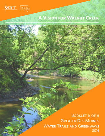
A Vision for Walnut CreekPhoto: City of CliveWalnut CreekBooklet 8 of 8Greater Des MoinesWater Trails and Greenways20161
Table of ContentsBooklet 1: Water Trails and Greenways PlanBooklet 1 provides an overview of the broader Water Trails and Greenways Plan including vision,goals, strategies, policies, and implementation considerations. Please read through Booklet 1to understand the larger framework that will directly impact each individual river and creek.Booklet 2: Beaver CreekBooklet 3: Des Moines RiverBooklet 4: Fourmile and Mud CreeksBooklet 5: Middle and North RiversBooklet 6: Raccoon RiverBooklet 7: South Skunk River and Chichaqua GreenbeltBooklet 8: Walnut CreekOne Vision 3Existing Conditions 4Recommendations 5Key Projects 7Recommendation Maps 8Symbology Explained 102
One Vision, Many CommunitiesThe Greater Des Moines Water Trails and Greenways Plan establishes a regional vision for our rivers, creeks, andgreenways. Through extensive community engagement, and with the help of a strong steering committee, a clearregional vision emerged.Regional VisionThe water trails and greenways of Greater Des Moines will be a natural haven, healthy ecosystem, signaturerecreational destination, economic driver, and community focal point that welcome people of all ages, abilities,interests, incomes, and cultures to connect with their rivers, creeks, and greenways.Greater Des Moines Water Trails and Greenways planning areaThis BookletThe Greater Des Moines Water Trails and Greenways Plan looks at more than 150 miles of waterways. This booklet providesan overview of Walnut Creek, including recommendations to improve its environmental, recreational, and economicpotential for the entire community. There are companion booklets for each waterway, as well as an overall Plan bookletcovering common strategies and practices.3
Existing ConditionsMiles in study area: 21Floodplain in public ownership: 18%Jurisdictions within study area: Dallas County, Urbandale, Clive, Windsor Heights, West Des Moines, Des MoinesCurrent number of access points: 0Primary Water Quality Impairment: Category 4, BacteriaWhile much of Walnut Creek has a trail that adjoins it and several regional parks that border it, there are no points that allowfor creek access for play, fishing or paddling. It is second to the Des Moines River in its visibility from roadways especially inkey locations along 73rd and 63rd Street but little is done to highlight this natural feature. While paddling this shallow creekis seasonal, it does offer a unique opportunity to recreate along backyards, near local businesses and near local roadways.Due to the number of parks that border the creek, it offers a lot of potential for family-friendly accesses for wading andplaying. Before paddling is encouraged in the creek, the dams along the creek need to be mitigated.Flooding has increased along the creek has increased in recent years and water quality challenges continue to plague thiscreek that is a feeder to the Des Moines drinking supply. These issues are being addressed by the Walnut Creek WatershedManagement Authority and its recently adopted watershed plan. Additional projects are planned along the creek andcan be found in the recently adopted Clive Greenbelt Master Plan and the Windsor Heights Comprehensive Plan. Formore information about the existing conditions of Walnut Creek, please refer to the State of the Rivers report published inFebruary of 2016.Walnut Creek4
RecommendationsGreat things are envisioned for Walnut Creek with the development of a watershed plan to improve the water quality andflooding impact of the creek, as well as Clive’s master plan for the greenbelt and the Windsor Heights Comprehensive Plan.Recommendations listed here are meant to support and complement other regional planning efforts.Access and ConnectionsWhile there are fewer opportunities for in-water activity compared to other waterways in the area, the trail that runsadjacent to this creek offers multiple uses. Navigation by small water craft is possible during a short window of high waterflow, typically after rainfall events. Three boat access points have been recommended, yet attention should be paid tocreating spaces for trail users to interact with the creek. These connections could include soft trails for birdwatching, safeplaces for families to play, rock-type steps into the water, places for respite, public art to interpret the ecology of the creek,and fishing nodes.The area around the Clive Aquatic Center and City Hall, as well as Colby Park and Walker Johnston Park offer immediateopportunities not only for carry-down boat access, but other creek hub activities due to the existing parking, restrooms,and playgrounds. The area around 73rd Street and University Avenue offers a redevelopment opportunity with a focus onbusinesses that turn toward the paved and water trails while restoration and landscape improvements could turn this areainto a gateway feature for Windsor Heights.A major concern that needs to be addressed is the lack of access those living in West Des Moines have to the trail systems.Efforts should be made to develop more trail and on-street connections to the trail.Connections to city centersIntersections with parks and greenspace5
Programming and ConservationSignage interpreting the water cycle is highly recommended along the trail adjacent to the creek into Water Works Park.From the headwaters in Dallas County to the treatment plant at Water Works, this highly-used trail offers a uniqueopportunity for many citizens to learn about the source of their drinking water and the nature of water-quality challenges.Interpretive signage integrated with public art is recommended along the creek.Additional opportunities exist to visually showcase the creek and greenbelt. Views of the creek are available on bridges at63rd Street/1st Street and 73rd Street. It is recommended to improve the aesthetics through restoration and capture theattention of the thousands of people who drive along these potentially scenic sections every day.Additional restoration should be implemented according Walnut Creek Watershed Plan. Whenever possible, the 500-yearfloodplain should be protected and maintained as a habitat corridor.Natural restoration practicesPlaying and interacting with the riversClive Greenbelt Master PlanThe Clive Greenbelt Master Plan will help achieve a community-based vision forthe greenbelt that will help drive economic re-development, natural resourcesrestoration, recreation, and public health in the community.The Greenbelt Master Plan will enhance the greenbelt and create new kWalnut Creekand thePlanlarger–watertrails andgreenways system. The plan outlinespolicies, practices, infrastructure, and more to build on the success of the greenbelt.Below is an outline of the strategic framework for the plan moving forward.Strategic Framework: Key DirectionsStrategic Framework: Key Directions6
Key ProjectsProjectLocationJurisdictionDam MitigationWalnut CreekClive,WindsorHeights TBD Dam mitigation projects mustbe conducted prior to accessimprovements where grade controlstructures exist in-streamActivity HubClive City Hall/Aquatic CenterClive Carry-down access Wading area Wayfinding, interpretive Connect to the paved trails and the city Pursue multi-activity programming andfamily-friendly designClive BusinessConnections86th StreetEconomic HubUniversity andCliveNW 75th StreetActivity HubColby ParkWindsorHeightsKey AmenitiesWading areaTrash receptaclesExtend park to business areaLighting and signage Wayfinding and interpretivesignage Benches Trail hubNatural playspacesWading areaCarry-down accessConsiderations All-ages design for kids, families, etc.Varied experiencesConnect to businessesCarry-down access near Cool Basilparking lot for visibility Emphasize connections to trail andcreek Consider orientation, such as backpatios at restaurants overlooking creek Connect both to the trails and toWindsor Heights Align with trail hub planning andprogramming Find connections to trails south to WestDes Moines and Des MoinesActivity HubAurora AvenueUrbandale Fishing space and amenities Place for respite Create visual connections to the trailActivity HubWalkerJohnston ParkUrbandale Fishing spaces and amenities Trash receptacles Wading area Combine with park activities Future programming opportunities*Additional initiatives can be found in the Water Trails and Greenways Plan: Booklet 1Walnut Creek7
Walnut CreekPotential Water Trail Designation: RecreationPotential Experience Level: IntermediateGiven the extreme seasonality to adequate depth of water, a fewcurrent dam-like grade control structures and requiring someboat control, this section of Beaver Creek has the potential to bedeveloped as a Recreation Level water trail that will be attractiveto users with experience. In order to obtain this designation, aminimum of two carry-down accesses should be constructed,grade control structures should be mitigated, and increasedmaintenance including cleaning of access points and removal ofcreek-wide logjams.*See appendix regarding more detailed considerations andimplications of these designations.8
Walnut and North Walnut Creek AdditionsAurora Ave.Walnut Creek Regional ParkWalker Johnston ParkColor CodesPotential HubsOther IconsExistingEconomic HubMile MarkerPotentialActivity HubWalnut CreekCounty BoundaryAmenitiesCarry-down AccessRestroomsFishing AccessWater FountainWading AccessBike ShopBirdingRespiteParkingConservation AreaConservation andPark Land (Public)100-year FloodplainBicycle/Pedestrian FacilitiesTrail NeededExistingFuture9
Symbology ExplainedCarry-down AccessCarry-down accesses are for non-motorizedpaddling such as kayaking, tubing, or canoeing.Site design involves many factors, and shouldfirst look at the Iowa DNR’s Developing WaterTrails in Iowa guidelines. Lesser accesses aredenoted by the portage symbol, and may notrequire the same level of infrastructure oramenities. Lighting and trash cansParkingRestroomsLaunch typesWatercraft and bicyclelockers Interpretive andwayfinding signageWading AccessWading spaces are where we can get our feetwet. They can be designed for mucking among All ages accessnatural vegetation and sandbars or as play Restrooms/showersspaces with steps and stones. No matter the Benches and restingdesign, wading areas allow us the opportunitypoints in view of accessto physically connect to the water and nature.FishingFishing is a popular activity all along the creeksand rivers. Creating access points can providesafe and comfortable areas that supportanglers. Rock outcroppings, docks, and otherdesigns offer different experiences. Universaldesign is critical since fishing is often amulti-generational activity. RestroomsLights and trash cansSpaces for relaxingAll-ages/abilitiesdesign Parking and bicycleparkingRespiteAreas to relax, take in the view, and enjoy theriver allow people to find a moment of respitein the metro. These areas can be naturalgreenspaces or more urban like the PrincipalRiverwalk depending on the context of thearea and desire of the community.10 Benches with a view Picnic areas and tables Paths and trails alongwater
Economic HubWater trails can play a role in developingeconomic hubs. These hubs typically representthe convergence of multiple assets, suchas a river, trails, residential and economicclustering, and other factors. These aredestinations that draw in visitors for multiplereasons. The scale changes for smaller orrural communities, but the economic impactsremain. These hubs are opportunities forsupportive development along the rivers. Event spacesParkingRestroomsLaunch typesBicycle parkingPublic artRestaurants and shopsLiveries/outfittersShuttle serviceActivity HubActivity hubs leverage existing attractionsinto destinations where multiple activitiesconverge. These hubs take advantage ofnearby parks and trails to create spaces forlonger visits and multiple activities. Oftenmulti-generational and family-friendly spaces,these hubs should be planned with a diverseaudience in mind and combine severaldifferent reasons to visit. Play spaces Educationalopportunities Areas to eat, relax andplay Programming Restrooms and trashcans Lights Bicycle parking WayfindingConservation AreaA key component to fully enjoying the riversand creeks is ensuring their natural quality andsustainability over time. Creating connectedspaces for habitats, restoring wetlands andreducing flooding, and educating the nextgeneration of river stewards are central piecesto the long-term health of the waterways. Educationalprogramming Interpretive signage Habitat connectivity Wetlands restoration FloodplainmanagementSoft TrailsUnpaved walking, hiking, and birding trails Educationgive people access to nature and offer a muchprogrammingdifferent experience than paved trails. They Interpretive signage foralso do not disrupt wildlife connections andhistory or birdingcan provide the opportunity for education Maintenance andprogramming.conservation11
Walnut CreekA Day in 202512Imagine a Saturday afternoon spent biking through nature along WalnutCreek. You and your family ride from your home in Clive along the trail andadjacent to the creek, passing by interpretive art and signage that tell thestory of Walnut Creek’s path from its headwaters to its confluence withthe Raccoon River. Your kids learn about the important role Walnut Creekplays in the quality of our drinking water. Feeling a little thirsty, you makea stop at Colby Park, where your kids kick off their shoes and wade intoWalnut Creek to cool off. After a short break, you are back on your bikesand passing by the wooded areas of Ashworth and Water Works Park.
63rd Street/1st Street and 73rd Street. It is recommended to improve the aesthetics through restoration and capture the attention of the thousands of people who drive along these potentially scenic sections every day. Additional restoration should be implemented according Walnut Creek Watershed Plan. Whenever possible, the 500-year