Transcription
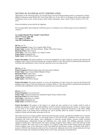
SECTION 401 WATER QUALITY CERTIFICATIONApplications for the following projects are currently being reviewed by Regional Board staff for consideration of WaterQuality Certification under Section 401 of the Clean Water Act. If you wish to be informed of the status and/or finalCertification action on any of these projects and/or further information, please contact Valerie Carrillo at (213) 5766759.Project descriptions are provided by the Applicant.We encourage public input during the Certification process. Comments on any of these projects may be submitted inwriting to:Los Angeles Regional Water Quality Control Board320 W. 4th Street, Suite 200Los Angeles, CA 90013Attn: 401 Certification UnitFile No.: 16-138Project Proponent: County of Los Angeles Public WorksProject Name: October 2105 Storm Disaster: Bridge 1209 at Deer CanyonReceiving Waters: Deer CanyonCity/County: City of Los Angeles, Los Angeles CountyProject Status: Pending ReviewPublic Notice: 10/07/2016 to PresentProject Description: The project proposes to reverse the degradation of Lopez Canyon by removing the historical fillplugging Lopez Canyon Creek and restoring the ecological richness of this alluvial plain by planting and promoting therestoration and establishment of native flora and vigorously treat exotic plant growth.File No.: 16-136Project Proponent: Mountains Recreation and Conservation AuthorityProject Name: Lopez Canyon Habitat Mitigation ProjectReceiving Waters: Lopez CreekCity/County: Unincorporated, Los AngelesProject Status: Pending ReviewPublic Notice: 10/07/2016 to PresentProject Description: The project proposes to reverse the degradation of Lopez Canyon by removing the historical fillplugging Lopez Canyon Creek and restoring the ecological richness of this alluvial plain by planting and promoting therestoration and establishment of native flora and vigorously treat exotic plant growth.File No.: 16-133Project Proponent: City of LakewoodProject Name: Lakewood Stormwater and Runoff Capture Project at Bolivar ParkReceiving Waters: Del Amo ChannelCity/County: Lakewood, Los AngelesProject Status: Pending ReviewPublic Notice: 9/30/2016 to PresentProject Description: The purpose of the project is to capture dry and a portion of wet weather runoff in order toeliminate the transport of metals and other pollutants to the Los Cerritos Channel during dry weather, to capture at leastthe first flush of wet weather runoff to reduce the load of pollutants transported downstream to the metals TMDLcompliance point at the Stearns Street monitoring site, and to possibly reduce the amount of potable water use forirrigation of parks and other public open space in the city.This project involves excavation, backfill, channel drop inlet diversion structure, and Obermeyer Rubber Gate in channel;and a pretreatment device (20 CFS), two new pump stations (5 CFS and 20 CFS), installation of new pumps, motors,mechanical and storm drain piping, valves abandoning or removing existing utilities, pressure testing, pavementremoval/replacement, underground storage and infiltration area, water quality skid, building expansion, electricalequipment modifications, instrumentation and controls, planting, irrigation, picnic shelters, and T-ball backstop locatedoutside of channel. The work occurs at two locations: Los Angeles County Flood Control District parcel and channellocated southeast corner of the intersection of Del Amo Boulevard and Downey Avenue, and Bolivar Park which islocated at 3300 Del Amo Boulevard, both in the City of Lakewood. Additional work will be located within the Del AmoBoulevard frontage road extending from Obispo Street to the County owned parcel, described above.
The City of Lakewood will be responsible for long term maintenance of the project.File No.: 16-132Project Proponent: City of Los Angeles Bureau of EngineeringProject Name: Aliso Creek – Limekiln Creek Restoration ProjectReceiving Waters: Los Angeles RiverCity/County: Los Angeles, Los AngelesProject Status: Pending ReviewPublic Notice: 9/21/2016 to PresentProject Description: The Aliso Creek – Limekiln Creek Restoration Project is a grant project funded by Proposition O,which includes the design and construction of facilities to improve the water quality of impaired City of Los Angeleswaters. The purpose of the project is to construct Best Management Practices (BMPs) at the confluence of the Aliso andLimekiln Creeks in order to remove trash and pollutants from the stormwater.To provide dry and wet weather diversion from 102-inch storm drain pipe, a concrete diversion structure with a12-inchtall, concrete diversion berm is recommended. Diverted flows are pretreated and then pumped to bioretention basins forfiltration.File No.: 16-130Project Proponent: Limoneira Lewis Commnity Builders, LLCProject Name: East Area 1 Specific Plan ProjectReceiving Waters: Santa Clara RiverCity/County: Santa Paula, Ventura CountyProject Status: Pending ReviewPublic Notice: 9/20/2016 to PresentProject Description: SCE contractor shall first remove the vegetation and other deleterious materials where required.Contractor would then construct a hardened water crossing consisting of 6” reinforced concrete pavement at theappropriate location, install a water bar, construct a rip-rap apron (24” minimum loose rocks), and cut the existingcorrugated metal pipe culvert as necessary at the location specified. The contractor would also construct bin-walls, gradethe adjacent slope, rehabilitate the existing access road, construct a second water bar and compacted soil cement bermalong access road at the locations shown on the plan, and install a 24” McCarthy drain. At each location the SCEcontractor shall grub and clear within the construction limits. The material that can be chipped and used for ground cover,will. The remaining material will be removed and disposed at a dump site. Natural vegetation shall be maintained forerosion control. SCE plans to reuse and spread the cut material on site to the extent possible. Any excess soil that cannotbe reused will be hauled off to and SCE-approved waste facility. Revised grading quantities will/can be provided with therevised grading plans. The final quantities of soil removed by SCE will likely change based upon the final grading planand as-built design.File No.: 16-128Project Proponent: Southern California EdisonProject Name: Access Road to Tower M1-T6 on the Gould-Sylmar 220kV Transmission Line (SAP80047594)Receiving Waters: Unnamed ephemeral streamCity/County: North of Sylmar, Los Angeles CountyProject Status: Pending ReviewPublic Notice: 9/20/2016 to PresentProject Description: SCE contractor shall first remove the vegetation and other deleterious materials where required.Contractor would then construct a hardened water crossing consisting of 6” reinforced concrete pavement at theappropriate location, install a water bar, construct a rip-rap apron (24” minimum loose rocks), and cut the existingcorrugated metal pipe culvert as necessary at the location specified. The contractor would also construct bin-walls, gradethe adjacent slope, rehabilitate the existing access road, construct a second water bar and compacted soil cement bermalong access road at the locations shown on the plan, and install a 24” McCarthy drain. At each location the SCEcontractor shall grub and clear within the construction limits. The material that can be chipped and used for ground cover,will. The remaining material will be removed and disposed at a dump site. Natural vegetation shall be maintained forerosion control. SCE plans to reuse and spread the cut material on site to the extent possible. Any excess soil that cannotbe reused will be hauled off to and SCE-approved waste facility. Revised grading quantities will/can be provided with therevised grading plans. The final quantities of soil removed by SCE will likely change based upon the final grading planand as-built design.File No.: 16-126Project Proponent: Sean DonohueProject Name: Final Remedial Grading at Kuntz Property and Portion of Donahue Property to Remove Uncertified Fill
Receiving Waters: Walnut CreekCity/County: Covina, Los Angeles CountyProject Status: Pending ReviewPublic Notice: 9/09/2016 to PresentProject Description: This project will remove fill soil from the Kuntz property (2376 Cameron Avenue) and a portion ofthe Donahue property (2374 Cameron Avenue) in accordance with the October 14, 2015 plans and specifications byGeoKinetics. The work is intended to satisfy the LA Superior Court Final Judgement for case no. KC048793 dated July26, 2013.File No.: 16-125Project Proponent: Alameda Corridor East Construction AuthorityProject Name: San Gabriel Trench Grade SeparationReceiving Waters: Alhambra Wash and Rubio WashCity/County: Alhambra and Rosemead, Los Angeles CountyProject Status: Pending ReviewPublic Notice: 9/06/2016 to PresentProject Description: Under RWQCB certification number 11-010, the Alameda Corridor-East Construction Authorityproposed to eliminate four at-grade railroad crossings along the Union Pacific Railroad (UPRR) in the City of SanGabriel. These improved crossings occurred at Ramona Street, Del Mar Avenue, Mission Drive, and San GabrielBoulevard. The 2.1 mile stretch of railroad consisted of four at-grade crossing and no grade separations between therailroad and vehicles or pedestrians. The proposed Project included the lowering of the existing railroad into a trench thatwould be located in the City of San Gabriel although construction activities would take place in the Cities of Alhambraand Rosemead. The purpose of the proposed Project was to eliminate traffic delays and safety hazards associated with thefour proposed intersections in the San Gabriel Valley.The proposed project is a continuation of those field activities, consisting of completing the access road to Rubio Wash,sealing/filling concrete seams, removing the concrete arch at Alhambra Wash, and general Project area demobilizationwill be completed between now and early to mid-2017.File No.: 16-121Project Proponent: Metabolic StudioProject Name: Los Angeles Water WheelReceiving Waters: Los Angeles RiverCity/County: Los Angeles, Los Angeles CountyProject Status: Pending ReviewPublic Notice: 8/22/2016 to PresentProject Description: The proposed project involves installation of an inflatable rubber dam across the trapezoidalconcrete-lined Los Angeles River channel width to impound low flows, construction of a subgrade dam foundation acrossthe channel width and construction of intake and discharge structures on the western channel sidewalls. The channelmodifications would divert low flows to turn a water wheel that would be constructed as part of the project outside of theriver channel, as well as to provide a non-potable water supply for irrigation of local parks. The project also involvesconstruction and operation of an approximately 72-foot diameter water wheel outside of the river channel (outside watersof the U.S.). The water wheel would be located partially between two warehouse buildings, and would be embeddedpartially below grade (one half below/one half above). Approximately 9,500 cubic yards of soil would be removed tocreate the water wheel pit and adjacent maintenance area. The water wheel pit would be hydraulically connected to theLos Angeles River via an intake pipe and a discharge pipe that would connect into the intake and discharge structures.File No.: 16-106Project Proponent: AltaSea at the Port of Los AngelesProject Name: Berths 57 & 58 Wharf ImprovementsReceiving Waters: East Channel, Los Angeles HarborCity/County: San Pedro, Los Angeles CountyProject Status: Pending ReviewPublic Notice: 7/26/2016 to PresentProject Description: The proposed project would take place in and over navigable waters of the United States atBerths 57 and 58 in the Port of Los Angeles, Los Angeles Harbor, in the City and County of Los Angeles,California. Pier 1 is a historic landfill and concrete-pile-supported wharf structure which was constructed in 19121913, and in use starting in 1914. The project would remove and replace the existing concrete and asphalt deck of anexisting concrete-pile supported wharf on Pier 1 between Berths 57 and 58 to install 42, 24-inch diameter concretepiles over a linear distance of 120 feet, between the existing concrete piles. The proposed concrete piles are ofsimilar diameter compared to the existing concrete piles but are of a different shape; these would improve structural and
seismic stability and provide a greater load capacity to a section of the existing wharf which is being used by AltaSeaunder a lease agreement with the Los Angeles Harbor Department (LAHD). A total of 20 creosote-treated timber piles(in three clusters) associated with the wharf fender system would be replaced. The fender system provides a bufferbetween the wharf and vessels when they are at berth. Both types of piles and the replaced concrete deck would beconsistent with the original design and construction materials of this historic wharf. The project would rehabilitate anexisting wharf over navigable waters of the United States. No waters of the United States would be lost as a result ofthe proposed federal action because the proposed spacing of the concrete piles would not constitute a "discharge offill" nor have the "effect of fill" as described at 33 CFR 323.3(c).File No.: 16-095Project Proponent: Southern California EdisonProject Name: Catalina Island Seawater Well Riprap RepairReceiving Waters: Pacific OceanCity/County: Avalon, Santa Catalina Island, Los Angeles CountyProject Status: Pending ReviewPublic Notice: 7/11/2016 to PresentProject Description: The proposed project would stabilize the previously armored slope that was damaged by a discretestorm event. The project would utilize 817 cubic yards of rock rip rap, 281 cubic yards of which fall below the HighestAstronomical Tide. The rip rap would be placed on 0.034 acre of jurisdictional waters of the U.S. over 115 linear feet. Allwork would be completed using a crane from the top of the bank.File No.: 16-086Project Proponent: Los Angeles Department of Water and PowerProject Name: Sylmar Ground Return System Replacement ProjectReceiving Waters: Santa Monica BayCity/County: Santa Monica, Los Angeles CountyProject Status: Pending ReviewPublic Notice: 6/21/2016 to PresentProject Description: The SGRS (Sylmar Ground Return System) is an integral component of the Pacific Direct Currentintertie (PDC') transmission system, which transmits bulk electrical power between Southern California and the PacificNorthwest. The PDCI is a bipolar direct current (DC) transmission line, and it therefore cannot operate reliably without afunctioning ground return system. The marine facility, consisting of buried cables and an electrode array located on theocean floor, requires replacement because of physical and operational deficiencies. The proposed Project, consisting ofreplacement of the marine facility of the existing SGRS, will be located primarily in Santa Monica Bay. Utilizing existingconduit the marine cables will be pulled from the existing vault under the parking lot and Will Rodgers State Beach andcontinues under the ocean floor to a location approximately 1,200 feet offshore in Santa Monica Bay. From there, themarine cables will be installed within plowed furrows several feet below the ocean floor, extending to the proposedelectrode array, which will be located approximately two miles from shore on the surface of the ocean floor at a depth ofabout 100 feet below mean sea level.File No.: 16-082Project Proponent: Los Angeles Department of Water and PowerProject Name: Castaic Creek Maintenance, Elderberry Forebay Sediment Removal, and Spillway Repair WorkReceiving Waters: Castaic Creek, Elderberry Forebay, Castaic LakeCity/County: Castaic, Los Angeles CountyProject Status: Pending ReviewPublic Notice: 6/13/2016 to PresentProject Description: The Los Angeles Department of Water and Power (LADWP) operates and maintains the CastaicPower Plant (CPP), which is a hydro-generating station. This facility is a major electrical source for the City of LosAngeles, serves as backup generation during emergencies or scheduled closure of in-city generating stations, and serves tostabilize the power grid. The purpose of the project is to perform basin maintenance, remove the build-up of sediment inthe Elderberry Forebay, and to repair the spillway retaining walls. This project is a renewal of the Castaic CreekMaintenance Project and Spillway Repair Work (File No. 11-137) with an additional sediment removal activity.File No.: 16-075Project Proponent: Catalina Island ConservancyProject Name: Middle Canyon Bridge Replacement ProjectReceiving Waters: Middle Canyon Creek, Pacific OceanCity/County: Los Angeles CountyProject Status: Pending ReviewPublic Notice: 5/20/2016 to Present
Project Description: The Catalina Island Conservancy proposes to replace three bridges on Middle Ranch Road. Theexisting structural condition of the bridges is inadequate based on the findings of an evaluation performed by FuscoeEngineering. The bridges are of timber construction and are supported on timber piles of unknown length. Theabutments are constructed of timber walls retaining cobble and dirt fill. Removal of the existing bridges will involve (1)removal of timber embankments that support the existing bridges; (2) cutting bridge piers at or below grade that are inthe channel; and (3) re-contouring the streambank under the bridge to match the upstream and downstream grade.File No.: 16-073Project Proponent: Los Angeles County Flood Control DistrictProject Name: Calgrove Fire Emergency Protective Measures Maintenance and RepairsReceiving Waters: South Fork Santa Clara RiverCity/County: Unincorporated Newhall, Los Angeles CountyProject Status: Pending ReviewPublic Notice: 5/18/2016 to PresentProject Description: The purpose of the proposed maintenance and repair activities (project) is to maintain during thenext five years of burned watershed recovery the debris protection functions and capacities of the existing post fireemergency measures above the Crescent Valley Mobile Home Park. The measures were installed to capture and divertfrom the mobile home park units as much debris flow as possible during a moderate to severe storm event. Therefore,cleanout and repair activities need to be implemented immediately after storms and before storm season to restore thedebris barriers' protection capacities for future storms during the five-year watershed recovery period.File No.: 16-069Project Proponent: Southern California EdisonProject Name: Mandalay- San Miguel Pole Replacement (TD708641)Receiving Waters: Santa Clara RiverCity/County: Ventura, Ventura CountyProject Status: Pending ReviewPublic Notice: 5/4/2016 to PresentProject Description: The Project involves the replacement of two existing 3-pole wood H-Frames (six wood poles total),located on the northern and southern sides of the Santa Clara River with tubular steel poles (TSP's). In addition, the 66kVTransmission conductors that span over Santa Clara River will be replaced with larger conductor.File No.: 16-060Project Proponent: Seacoast FarmsProject Name: Seacoast Farms Mitigation ProjectReceiving Waters: Un-named drainage (“Ferro Ditch”), tributary of Revolon Slough, Calleguas Creek, and PacificOcean at Mugu LagoonCity/County: Near Somis, Ventura CountyProject Status: Pending ReviewPublic Notice: 4/19/2016 to PresentProject Description: To remove inert debris (mostly concrete rubble) deposited in the drainage to inhibit further erosionand construct a permitted inert debris fill to stabilize the drainage bottom from further erosion and improve stability ofchannel slopes.File No.: 16-055Project Proponent: Southern California EdisonProject Name: SCE Santa Clara On-Ramp ProjectReceiving Waters: Santa Clara RiverCity/County: City of Ventura, Ventura CountyProject Status: Pending ReviewPublic Notice: 4/15/2016 to PresentProject Description: The purpose of this action is to upgrade existing facilities by removing five wooden H-Framepoles and two steel poles, installing five tubular steel poles (TSPs) including geotechnical bores at the location of thenew TSPs, the installation of a new riser and the creation of temporary access/egress routes. The Project will replace fiveexisting wooden H-Frame poles and 2 steel poles with five tubular steel poles and one unnamed pole in the middle of theriverbed. One TSP located at the northern end of the project will be installed with a new riser. In addition, prior toinstalling the TSPs, geotechnical bores 30 feet deep will be conducted at each TSP location.
File No.: 16-047Project Proponent: Pulte HomesProject Name: Erringer Road Debris Basin ImprovementReceiving Waters: Arroyo SimiCity/County: Simi Valley, Ventura CountyProject Status: Pending ReviewPublic Notice: 4/8/2016 to PresentProject Description: The purpose of the project is to modify the existing debris basin and surrounding areas to provideflood-control system functioning as described in the original approved hydrology report for the surrounding TractNumber 3045. Current deficiencies include: (1) inadequate dam freeboard (clearance) over the 100-year storm eventlevel; (2) total 100-year storage volume is smaller than shown in the original approved report; and (3) the 100-yearrunoff rate in the downstream road drain exceeds the maximum allowed rate. The proposed project will correct thesedeficiencies by (1) grading the debris basin to a depth ranging from 10 to 20 feet lower than the existing grade; (2)modifying the debris basin dam by constructing a new intake tower and a new emergency spillway (16-foot widereinforced concrete box channel) and by widening the top width of the dam from 15 feet to 20 feet; (3) gradingdownstream area containing Drainage A to depth approximately 5 feet lower than the existing grade; (4) placing rip-rapbank protection at the outlet of the new emergency spillway and at the interface between Drainage B and the debrisbasin; and (5) converting a portion of Drainage C to a 5-foot-wide reinforced concrete box culvert to allow water to passunder the proposed maintenance access road.File No.: 16-039Project Proponent: Los Angeles County Flood Control DistrictProject Name: Santa Anita Debris Dam Seismic Strengthening and EnlargementReceiving Waters: Los Angeles River, Santa Anita WashCity/County: Arcadia, Los Angeles CountyProject Status: Pending ReviewPublic Notice: 4/4/2016 to PresentProject Description: The Los Angeles County Flood Control District (District) is undertaking modifications of the debrisdam to meet the safety requirements of the California Department of Water Resources - Division of Safety of Dams(DSOD). Remediation of the seismic deficiencies at the debris dam would involve improvements to the intake tower,embankments, and spillway. These improvements would result in DSOD removing the operational restrictions on thefacility, thereby restoring the debris dam's water conservation capability. The addition of a 4-foot ogee weir to thespillway would further increase the water conservation capability of the debris dam by creating additional storage. Theproposed project would improve public safety, prevent flood damage to downstream communities, and increase waterconservation opportunities.File No.: 15-174Project Proponent: County of Los Angeles Department of Public WorksProject Name: Elizabeth Lake Road at Mile Marker 16.09Receiving Waters: Unnamed tributary to Elizabeth LakeCity/County: Leona Valley, Los Angeles CountyProject Status: Pending ReviewPublic Notice: 3/8/2016 to PresentProject Description: The overall project is a road maintenance project. The purpose of the culvert work is to providesafety. The three culverts associated with the work either have headwalls that are within 4 feet of the edge of the travelway or have at least a 4 foot drop behind them. The scope of work consists of constructing 1½ inches of Asphalt RubberHot Mix (ARHM) over 4 inches of Cold-in-Place Recycled Asphalt Concrete Pavement (CIRACP) and 1 ½ inches ofARHM on 2 inches of Asphalt Concrete (AC) over 4 inches of CIRACP along Elizabeth Lake Road between 2453 feetwest of Munz Ranch Road to 2095 feet east of Bouquet Canyon Road. The project also includes the installation ofguardrails and concrete barriers, in addition to the reconstruction of portions of approximately 54 driveways to match thenew finished pavement surface.Three culverts along Elizabeth Lake Road with headwalls that are within 4 feet of the edge of the travel way or have atleast a 4 foot drop behind them will be modified including reconstruction of existing headwalls, installation of horizontaltrash racks, installation of corrugated metal pipe (CMP) extensions, and soil backfill to join existing ground. Culvertspecific details are provided below. The maximum excavation depth associated with construction of headwalls will beapproximately 2 feet.File No.: 13-091Project Proponent: Sullivan Equity Partners, LLCProject Name: Old Ranch Road ResidentialReceiving Waters: Sullivan Canyon Creek
City/County: Brentwood, Los Angeles CountyProject Status: Pending ReviewPublic Notice: 3/2/2016 to PresentProject Description: The project consists of the construction of a new private driveway, grading for two residential pads,and construction of two new single-family homes and related accessory structures on a divided 12-acre lot (AssessorsParcel Number (APN) 4432-010-012 and APN 4492-012-024). The two pads will be approximately 1.23 acres and 1.46acres respectively. The development will include a 1,110-foot long paved private driveway that follows the contour andtraverses the canyon and serves both residences. Site construction will fill portions of the canyon while cutting portions ofhillsides in other areas. To convey storm flows from upslope drainage areas to the north, concrete culverts will be utilizedto direct flow into a designated drainage. The drainage will convey flow into a culvert northeast of the larger pad. Watersfrom the southern portion of the canyon will follow the contours of the canyon and flow into another culvert systemsoutheast of the larger pad. These culverts will tie into two concrete pipes. The pipes will converge and flow downhilltoward the existing LADWP storm drain system at Old Ranch Road.File No.: 15-116Project Proponent: TNHC Canyon Oaks, LLCProject Name: Canyon OaksReceiving Waters: Unnamed ephemeral drainage, Las Virgenes CreekCity/County: Calabasas, Los Angeles CountyProject Status: Pending ReviewPublic Notice: 2/9/2016 to PresentProject Description: The proposed project involves the development of residential, commercial, and public open spaces /trail uses on the underdeveloped site. The residential component would include a gated community with 67 sing-familydetached homes and four affordable units within two duplexes, each linked via pathways to a residential-exclusiveclubhouse with resort-style amenities. The commercial component would consist of a 67,580 square-foot, 120 room, fourstory hotel. Approximately 80 percent of the site (61.5 acres) would be preserved as open space. The project also providesan internal walkway system and public sidewalk linkages to afford access to existing, local trail systems surrounding thesite. To enable access to and from the project site, a new "Street A" extension to Agoura Road would be constructed.File No.: 16-021Project Proponent: Southern California Edison Company, Hazem GabrProject Name: Castaic Creek Deteriorated Pole TD956343 ReplacementReceiving Waters: Castaic CreekCity/County: Castaic, Los Angeles CountyProject Status: Pending ReviewPublic Notice: 2/9/2016 to PresentProject Description: SCE plans to replace the existing deteriorated wood pole with an in-kind wood pole atapproximately the same location. The Project area includes a 25-foot radius temporary construction work area requiredfor equipment and vehicle access for pole removal and replacement. In the center of the construction work area, a 10x10foot soil excavation/disturbance site around the pole for ground-disturbance to remove the existing pole and install thereplacement pole. The site will be returned to its pre-construction contours following pole replacement.File No.: 16-020Project Proponent: Southern California Edison Company, Hazem GabrProject Name: Deteriorated Pole Replacement TD942677 – Castaic CreekReceiving Waters: Castaic CreekCity/County: Castaic, Los Angeles CountyProject Status: Pending ReviewPublic Notice: 2/9/2016 to PresentProject Description: SCE is continually repairing, maintaining, upgrading and replacing distribution facilities throughoutits service territory. Ongoing operation and maintenance (O&M) activities are necessary to ensure safe, reliable serviceand as mandated by the California Public Utilities Commission. In some cases, ground-disturbing activities may beassociated with these maintenance operations, especially where poles and associated equipment are being removed andreplaced. The Project consists of replacing two deteriorated wooden H-frames (Poles 1871664E/1871665E) and (Poles1871666E/ 1871667E). The structures would be replaced with hybrid H-frames adjacent to the existing structures.File No.: 16-019Project Proponent: Southern California Edison Company, Hazem GabrProject Name: Mesa 500 kilovolt (kV) SubstationReceiving Waters: Rio Hondo and unnamed tributaries to the Los Angeles River
City/County: Monterey Park, Los Angeles CountyProject Status: Pending ReviewPublic Notice: 2/9/2016 to PresentProject Description: The main activity associated with the Project involves the construction of an approximately 69.4acre, 500/220/66/16 kV substation (i.e., Mesa Substation) in place of the existing, approximately 21.6-acre, 220/66/16 kVMesa Substation. The Project is located primarily on approximately 86.2 acres of SCE fee-owned property. Constructionof the propos
Los Angeles Regional Water Quality Control Board 320 tW. 4 h Street, Suite 200 Los Angeles, CA 90013 Attn: 401 Certification Unit File No.: 16-138 Project Proponent: County of Los Angeles Public Works Project Name: October 2105 Storm Disaster: Bridge 1209 at Deer Canyon Receiving Waters: Deer Canyon City/County: City of Los Angeles, Los Angeles .


