Transcription
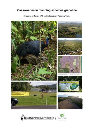
Cassowaries in planning schemes guidelinePrepared by Terrain NRM for the Cassowary Recovery Team
Cassowaries in Planning Schemes GuidelinePrepared by Terrain NRM for the Cassowary Recovery Team20/12/2012Executive summaryCassowaries are an endangered species threatened by development. Certain outcomes fromdevelopment can assist cassowary populations to persist and recover. This non-statutory guidelineidentifies provisions for cassowaries that could be incorporated into local government planningschemes. It applies predominantly to identified cassowary areas and populations under threat in theWet Tropics bioregion.The guideline provides information on cassowary mapping resources and methods, including DEHP’scassowary habitat mapping. The guideline includes definitions for the various mapped categories ofcassowary habitat and corridors.Outcomes recommended in the guideline include the following: Cassowaries and their habitat and habitat links are referred to in the Strategic framework. Mapping identifies cassowary habitat and habitat links including primary, secondary andrehabilitating habitat, non-remnant corridor and additional areas identified through new mapping. Fine-scale mapping (particularly of local corridors) is undertaken in cassowary areas andpopulations under threat. A material change of use, reconfiguring a lot or operational work within cassowary habitat or ahabitat link is assessed against cassowary provisions in a code. Within critical habitat links,assessable development includes clearing of small areas and development in existing clearedareas. Cassowary habitat and habitat links are protected. Development is located outside of habitat and habitat links. Development adjacent to cassowary habitat and habitat links is low density due to roadkill threat. Traffic-producing development addresses cassowary roadkill. Fences allow cassowary access in cassowary habitat and habitat links. Development does not increase hazards from cassowary-human interaction. Offsets are restricted to non-cassowary habitat residual impacts.The Commonwealth Environment Protection and Biodiversity Conservation Act 1999 (EPBC) alsoregulates certain development impacts on cassowaries.IntroductionThe purpose of this non-statutory guideline is to assist local governments drafting SPA planningschemes or planning scheme amendments to incorporate cassowary provisions. The purpose is alsoto assist state government, conservation groups, development industry and others reviewing draftplanning schemes or amendments regarding cassowaries. This guideline focuses on localgovernment areas covered by the Far North Queensland Regional Plan 2009-2031 (FNQRP) i.e.Cassowary Coast, Cairns and Tablelands Regional Councils and Yarrabah and Wujal WujalAboriginal Shire Councils, but may also assist other local government areas with cassowarypopulations, i.e. Townsville City and Hinchinbrook and Cook Shire Councils.The Wet Tropics population of the southern cassowary Casuarius casuarius johnsonii (hereafterreferred to as cassowary) is listed as an endangered species under the Queensland NatureConservation Act 1992 and the Commonwealth EPBC Act. The Queensland government hasprepared planning scheme guidelines for some threatened species, e.g. South East Queenslandkoalas, but not for cassowaries. This non-statutory cassowary guideline was prepared by TerrainNRM for the Cassowary Recovery Team in consultation with stakeholders, particularly governmentand conservation.The Cassowary Recovery Team is a group of organisations working together to implement theRecovery Plan for the Southern Cassowary and protect cassowaries, habitats and corridors fromthreats through better planning, monitoring and community involvement. Recovery plans set out the
research and management actions necessary to stop the decline of, and support the recovery of,listed threatened species or threatened ecological communities. Terrain is a community-based notfor-profit Regional Body supporting natural resource management in the Wet Tropics region. Terrainhas also prepared a planning scheme guideline for the Mahogany glider which is another endangeredspecies affected by development in FNQ.This guideline is informed by the statutory FNQRP Regional Policy 1.1 Biodiversity Conservation,Areas of ecological significance (AES) mapping, and by the non-statutory FNQRP ImplementationGuideline for Section 1.1 – Biodiversity Conservation (Biodiversity Guideline). As a state interest,FNQRP Regional Policy and AES mapping must be reflected in planning schemes. Local governmentmay identify additional biodiversity values (e.g. cassowaries) for its planning scheme. FNQRP and theBiodiversity Guideline do not provide cassowary-specific mapping or policies. Many of the measuresin FNQRP and the Biodiversity Guideline or standard biodiversity provisions will generally benefitcassowaries. However cassowaries are an endangered species particularly threatened bydevelopment and require particular environmental outcomes from development in order forpopulations to persist and recover. This cassowary guideline assumes planning schemes will includegeneral biodiversity provisions, and therefore focuses on additional cassowary-specific measures.Recent Queensland government planning legislation amendments have resulted in reducedregulation of certain development by state government and increased opportunity for localgovernment to decide future land use outcomes. These changes have increased the importance oflocal government planning schemes in determining the cassowary’s future.The Recovery Plan for the Southern Cassowary and Significant Impact Guidelines for theEndangered Southern Cassowary identify habitat clearing and fragmentation as the major threats tocassowaries’ long-term survival, with vehicle strike and dog attack the number one and two directcauses of mortality. The Recovery Plan’s overall objective is “to secure the long-term protection ofcassowary populations through improved planning mechanisms supported by robust monitoring,threat abatement and community engagement programmes”. Recovery Plan specific objectives andactions include to “institute a more coordinated and stronger planning response to developmentissues in cassowary habitat” and “help develop better planning scheme mechanisms to protectcassowary habitat”.This voluntary guideline identifies various potential planning scheme provisions for cassowaries. It isnot intended that all the provisions be included in any one scheme. Nor does this guideline identify allpossibilities. There are various ways to structure planning schemes and it is hoped that Councils willwork with DSDIP, DEHP, cassowary experts and others to incorporate an effective selection ofcassowary provisions into planning schemes.Cassowary areas and populations under threatThis guideline is intended to apply predominantly to “Areas and populations under threat” identified inthe Recovery Plan for the Southern Cassowary, rather than isolated habitat fragments in denselydeveloped areas with no modern cassowary records.The Recovery Plan identifies eight key areas in the Wet Tropics which are seriously threatened bydevelopment activities (p14):1. Mission Beach2. Daintree/Mossman lowlands3. Kuranda/Black Mountain corridor4. Cairns hill slopes5. Mulgrave Valley/Malbon-Thompson Range6. southern Atherton Tablelands7. Graham/Palmerston/Moresby Range, and8. Kennedy Valley/Murray River floodplain.These same areas are also listed in DEWHA’s Significant Impact Guidelines for the EndangeredSouthern Cassowary (p19). There is no official map of these “cassowary areas and populations underthreat”.
Strategic frameworkA selection of the following outcomes for the Strategic framework is recommended: Strategic framework specific outcomes (possibly in the biodiversity element of the naturalenvironment theme) include “Cassowary habitat and habitat links are protected from the impactsof development” and “Habitat extent, condition, connectivity and resilience are improved forcassowary areas and populations under threat”. Land use strategies include “Cassowary habitat and habitat links in cassowary areas andpopulations under threat are identified and protected from development, and residential densitiesin adjacent areas are kept low to avoid increasing traffic generation”. Cassowary areas and populations under threat in the local government area are broadly namedor mapped in the Strategic framework. Councils that do not have the resources to undertake detailed cassowary habitat and habitat linkmapping flag this future mapping intent in the Strategic framework. Likewise, ecologically effectivecassowary road crossing infrastructure design, costing and reasonable and relevant charging areflagged.Tables of assessmentA selection of the following outcomes for the Tables of assessment is recommended: Development that is a material change of use, reconfiguring a lot or operational work withincassowary habitat or a habitat link is assessable against cassowary provisions in a code. Thisincludes development in existing cleared areas within a habitat link. This also includes clearing forfirebreaks. Clearing of any cassowary habitat in an identified cassowary habitat link in an urban area isimpact assessable. Unless property-scale mapping of cassowary habitat and habitat links and correspondingappropriate code provisions are included in the planning scheme, development in cassowaryhabitat and habitat links is impact assessable.Explanatory notes:Clearing cassowary habitat in urban areas for urban purposes is often exempt under current IPAplanning schemes. The clearing of even a small area may result in fragmentation of an importantcassowary habitat link. Development in cleared areas in narrow habitat links can irreversibly severhabitat links.N.B. Under the EPBC Act, any planned actions which exceed certain thresholds may have asignificant impact on a matter of national environmental significance (the cassowary) and should bereferred to the federal environment minister; e.g. clearing more than 1500m2 of cassowary habitat forany purpose other than a single dwelling on an existing lot; any clearing of cassowary habitatassociated with a watercourse; clearing in certain buffers adjacent to habitat, etc. See the followinglink for more pping outcomesA selection of the following mapping outcomes is recommended: Zones, precincts, local plans and overlay maps are informed by appropriate cassowary habitatand habitat links mapping. Cassowary habitat and habitat links are mapped in a “cassowary” or “priority species” overlaymap. A “biodiversity areas” overlay map includes all current AES mapping plus additional cassowaryhabitat and habitat links not captured by the AES mapping. Mapping shows all cassowary habitat and habitat links, including Primary habitat, Secondaryhabitat, Rehabilitating habitat and Non-remnant corridor. Mapping highlights habitat and habitat links where additional outcomes apply, e.g. cassowaryareas and populations under threat, revegetation areas and road crossing zones. Property-scale mapping identifies local habitat links (including strategic cleared areas) particularlyin urban and rural residential areas in cassowary areas and populations under threat.
Mapping identifies strategic rehabilitation areas to be revegetated or at least remain open tocassowary movement.Cassowary habitat and habitat links are zoned Conservation (Level 2) or at least EnvironmentalManagement and Conservation (Level 1).Cassowary “areas and populations under threat” are zoned Conservation.Local plans are prepared for cassowary “areas and populations under threat”. The spatial extentof the local plan includes the main areas where development would generate motor traffic throughthe cassowary habitat and habitat links.Cassowary habitat and habitat links are not zoned for residential development or touristaccommodation.Non-conservation zones (e.g. residential, commercial and industrial) are not introduced orextended in cassowary habitat or habitat links.Habitat and habitat links in a conservation zone in a current IPA planning scheme are zonedConservation in the SPA scheme.Habitat and habitat links in a non-conservation zone in a current IPA planning scheme areidentified as constrained in the SPA scheme.Residential zones adjacent to cassowary habitat, habitat links and “areas and populations underthreat” are low density.Explanatory notes:Mapping resources are listed in the “Cassowary mapping resources” section below. A key resource isDEHP’s cassowary habitat mapping.AES mapping alone is not adequate for cassowary mapping in a planning scheme. AES mapping isbroad scale, not property scale, and excludes some important habitat and habitat links.Mapping of cassowary habitat links is critical. Some open/cleared areas that are critical componentsof cassowary habitat links are not yet meaningfully mapped, including in AES and StrategicRehabilitation Areas mapping.Some new mapping (particularly local corridors) is a necessary part of plan making in cassowary“areas and populations under threat” to prevent cassowary decline through habitat fragmentation.1:10,000 scale mapping of habitat linkages has been effective in some fragmented areas of MissionBeach.Code outcomesA selection of the following outcomes is recommended for inclusion in codes applying to mappedcassowary habitat and habitat links, e.g. biodiversity areas overlay code, conservation zone code, andcertain residential, precinct and local plan codes:“Development” means a material change of use, reconfiguring a lot or operational work.General code outcomes: Code purpose statements refer to threatened species including cassowaries. Code overall outcomes include that cassowary habitat and habitat links are protected. Code purpose statements or overall outcomes refer to not increasing development density incassowary “areas and populations under threat” to minimise motor traffic and cassowary roadkill. A specific cassowary/priority species overlay code is provided. A biodiversity areas overlay code includes a specific category of outcomes that apply to mappedcassowary habitat and habitat links.Habitat and habitat links outcomes: Development is located, designed and operated to maintain and enhance the extent, condition,connectivity and resilience of cassowary habitat and habitat links, and allows cassowarypopulations and individuals (including dispersing and breeding cassowaries) to safely accessadequate feeding, drinking, breeding (including nesting) and resting habitat and remain connectedin the landscape. Urban development is located wholly outside of cassowary habitat and habitat links. Clearing is avoided in cassowary habitat and habitat links. The development footprint (including building envelopes, roads and fire breaks) does notencroach into cassowary habitat or habitat links.
Open areas within habitat links are retained as open or are revegetated.Connectivity to adjacent habitat links is retained.Habitat links are a minimum width of 200 metres in urban areas and exclude development.Additional strategic habitat is created.An appropriately qualified person assesses fire break clearing requirements in cassowary habitatand habitat links, particularly in rainforest vegetation.Explanatory notes:The major threat to the long-term survival of cassowaries is clearing and fragmentation of habitat.DEWHA’s Significant Impact Guidelines for the Endangered Southern Cassowary provides thefollowing information: Habitat and corridor requirements are described in the “Key landscape values for the cassowary”section including feeding habitat, breeding habitat, water, resting habitat and corridors formovement (pp 7-8). Guidelines for ecological site assessment are provided in the “Survey guidelines for thecassowary” section (pp10-11). This could inform a Planning Scheme Policy. Multiple habitat links decrease the risk of antagonistic encounters between territorial cassowaries(p14). Corridors should be a minimum width of 200m if development abuts either side (p18).See Fencing outcomes for additional habitat link provisions specific to physical barriers toconnectivity.Traffic outcomes: Development maintains and enhances cassowary road crossing safety. Roads are not constructed in cassowary habitat or habitat links. On-site road design speed is less than 60 km/h. Traffic-producing development is avoided in cassowary habitat and habitat links. Development adjacent to cassowary habitat and habitat links and cassowary “areas andpopulation under threat” is low density and maximises active (walking & cycling) transport. Development that produces motor traffic within or through cassowary habitat or habitat links (onsite or off-site) reasonably contributes to ecologically effective cassowary road crossinginfrastructure. Streetscaping does not include cassowary attracting plants, e.g. cassowary food plants.Explanatory notes:Roadkill is the major direct cause of cassowary mortality. Development generally increases traffic.The standard outcome of a range of residential dwelling densities including medium densities is notappropriate in cassowary areas.A development’s production of motor traffic through onsite and offsite cassowary habitat and habitatlinks should be considered, including over the lifetime of the development.In cassowary areas and populations where there is clear link between the impacts of developmentand cassowary roadkill, Councils could investigate the possibility of a cassowary road crossinginfrastructure charges plan. Such a plan could design and cost the cassowary road crossinginfrastructure needed in a local area as a result of local traffic-producing development and conditionreasonable and relevant contributions from local development towards the construction of theinfrastructure. Research has shown that fences, culverts, static signage and psychological trafficcalming are not effective traffic solutions for cassowaries. There is currently no proven effectiveinfrastructure.A planning scheme policy could list cassowary food plants. Food plants information is available /food-plants/Fencing outcomes: Structures do not reduce cassowary access to on-site habitat and habitat links and adjacenthabitat and habitat links, including waterways. Fences are not installed in cassowary habitat and habitat links. Property boundaries (as opposed to building envelopes) within or adjacent to cassowary habitatand habitat links are not fenced. Cassowaries can readily pass through all fences within cassowary habitat and habitat links.
Building envelope fences are opaque to cassowaries and dogs, and are cassowary-proof anddog-proof.Explanatory notes:Cassowaries are vulnerable to entrapment by fences through which they can see habitat on the otherside (e.g. chain-link). Fencing a building envelope rather than a property boundary assists landscapepermeability for cassowaries. Opaque fences around building envelopes help prevent dogs withinfrom seeing cassowaries and barking and displacing them from habitat and links. Opaque fences helpreduce cassowary desire to enter building envelopes. Fence design should address the significantsize difference between chicks and adults; e.g. so chicks and parents aren’t separated. Fences oftenbecome ineffective or counter-productive post-cyclone.Cassowary-human interaction outcomes: Development avoids interaction of people and cassowaries. Development (including shared residential pathways) is located wholly outside of cassowaryhabitat and habitat links; Landscaping within building envelopes does not include cassowary food plants.Explanatory notes:Cassowaries are potentially dangerous. Development within or adjacent to cassowary habitat andhabitat links may increase this hazard.Offset outcomes: Offsets result in a net gain for cassowaries. Offsets are restricted to non-cassowary habitat residual impacts. Offsets are invested in a cassowary Non-remnant corridor within a Cassowary Corridor.Dog outcomes: Cassowaries are not deterred from utilising habitat and habitat links by dogs. Development restricts keeping and movement of dogs in cassowary habitat and habitat links andadjacent areas. Urban development is located wholly outside of cassowary habitat and habitat links.Explanatory notes:Dog attack is the second highest recorded cause of cassowary mortality. Dog barking, odours, etcmay deter cassowaries from utilising habitat and habitat links. Restricting dogs to within buildingenvelopes with opaque fences might reduce cassowary/dog interaction. Locating developmentoutside of cassowary habitat and habitat links will help prevent increased dog ownership within habitatand links. Proponents could undertake to make their development dog-free. Dogs may be referred toin a planning scheme policy.NB The management of domestic animals is typically regulated through local laws rather thanplanning schemes. Planning schemes provisions may limit keeping and movement of dogs in somedevelopment.Cassowary mapping resourcesIn addition to AES mapping, the mapping data sources listed in this section could inform mapping forzones, local plans, precincts, overlays etc regarding cassowary habitat and habitat links.Categories within some of these mapping resources are explained in the “Definitions” section.As explained in the Mapping outcomes section above, it is likely that habitat linkages in someimportant areas have not yet been accurately mapped. Additional mapping to fill such gaps isrecommended.
DEHP Threatened Species unitDEHP Threatened Species unit have collated GIS files of a selection of cassowary mappingresources listed below into zipfiles. The files include metadata listing the references. There are threedifferent datasets; the poly and line features are best for map production, and the consolidatedfeatures can be used for analysis (if needed). Regarding licensing, sources must be acknowledged inany external publication. For further information on the zipfiles, contact DEHP Threatened Speciesunit: Paula.Peeters@ehp.qld.gov.au.The zipfiles are available ty/threatened-species-planning.htmlFNQROC IBAPFFNQ Regional Organisation of Councils (FNQROC) has developed an Interactive BiodiversityAssessment and Planning Framework (IBAPF). The IBAPF combines maps of various biodiversityassets in the FNQ region, including known cassowary habitat and corridors, and can be used to mappriority habitats and corridors to protect and restore, including through planning schemes. For moreinformation on IBAPF, contact: t.sydes@fnqroc.qld.gov.au.Expert panelIn cassowary “areas and populations under threat”, the following mapping process is recommended: organise a meeting in the local government area with local cassowary experts from community,industry and government including Traditional Owners; present the meeting with existing cassowary maps; ask the meeting to identify any significant gaps in existing mapping, particularly local cassowarycorridors; engage a biodiversity planning consultant to produce property-scale habitat link mapping forpriority areas identified by the meeting; show the consultant’s draft map to the experts for comment; add the finalised map to existing mapping.Primary resourcesThe following resources are priority cassowary mapping resources that cover most of the Wet Tropicsregion:Biotropica Australia, 2005 A framework to establish lowland habitat linkages for the SouthernCassowary (Casuarius casuarius johnsonii) between Cairns and Cardwell. Report commissioned bythe Australian Rainforest Foundation, Cairns.DEHP Cassowary habitat mappingSource: http://www.derm.qld.gov.au/property/mapping/order data.htmlThis is a key source of cassowary habitat mapping.The current version is Version 6b from 2009.Cassowary habitat map categories include primary, secondary, rehabilitating and non-remnantcorridor.DERM 2009, Distribution of cassowary habitat in the Wet Tropics bioregion, Queensland (3rd Edition),DERM, Queensland.This document describes the processes and background information used to map cassowary habitatin the Wet Tropics bioregion to produce the Cassowary habitat mapping Version 6b from 2009.DEWHA, 2010, Significant impact guidelines for the endangered southern cassowary (Casuariuscasuarius cations/pubs/casuarius-casuarius-johnsonii.pdfMap 2: Potential southern cassowary habitat in this report shows Cassowary Habitat and i-map.pdf
Some important Cassowary Corridors identified here are not clearly identified in AES or DEHPmapping.Page 14 of the report notes that “corridors not shown on Map 2 may also be important”.The GIS files are available ty/threatened-species-planning.htmlLatch, P. 2007. Recovery plan for the southern cassowary Casuarius casuarius johnsonii. Report toDepartment of the Environment, Water, Heritage and the Arts, Canberra. Environmental n-cassowary/pubs/sth-cassowary.pdfFigure 2: Distribution of cassowary habitat Wet Tropics mapping identifies the following categories:essential habitat, general habitat, rehabilitating habitat, potential habitat links for restoration.Wet Tropics Management Authority 2006, Draft Wet Tropics Coastal Cassowary Corridor Network:Strategic Priorities (prepared for the Australian Rainforest Foundation).Secondary resourcesThe following resources provide additional information:DEHP Cassowary incident assessment database, DEHP Cassowary sightings database and DEHPVehicle related cassowary deaths maps. Contact: DEHP Threatened Species unitDEHP -onlineVegetation Management Act: Essential Habitat mapping.http://www.derm.qld.gov.au/vegetation/code review 06/eh review.html“Essential habitat” generally includes remnant cassowary habitat but excludes non-remnant orrehabilitating cassowary habitat and corridors. Therefore protection of “essential habitat” alone is notadequate for cassowary conservation.Cairns region resourcesThe following resources are specific to the Cairns Regional Council area:Daintree Region Cassowary Group Cassowary Sighting sowary Coast region resourcesThe following resources are specific to the Cassowary Coast Regional Council area:Biotropica Australia, 2008 Wongaling Creek Habitat Linkages.Biotropica Australia, 2009 Wongaling - South Mission Beach Habitat Linkages.Biotropica Australia, 2010 South Mission Beach (Lugger & Kennedy Bays) Habitat Linkages Indicative Cassowary Movement Corridors Map.C4 Cassowary sightings spreadsheet. Contact: c4@cassowaryconservation.asn.auGoosem, M., Moore, L. A., Byrnes, P. and Gibson, M. (2011) Mission Beach Road Research: Impactson Cassowaries and other Fauna and Strategies for Mitigation. School of Earth and EnvironmentalScience, James Cook University, 20Cassowary%20Report%20final.pdfThis report contains various maps of cassowary zones and some corridors in the Mission Beach area.Community conservation organisation resourcesThe following community conservation organisations have knowledge of local cassowary habitat andhabitat links:
Community for Coastal and Cassowary Conservation (C4): c4@cassowaryconservation.asn.auDaintree Region Cassowary Group: http://www.daintreecassowary.org.au/Kuranda Conservation Community Nursery Inc.: http://www.kurandaconservation.org/Kuranda Envirocare: http://www.envirocare.org.au/Mission Beach Cassowaries: http://www.missionbeachcassowaries.com/WPSQ Tully Branch: http://tully.wildlife.org.au/Traditional Owners should be consulted, e.g. Rainforest Aboriginal Peoples Alliance; t link: A cassowary “habitat link” is equivalent to a cassowary “corridor” or “habitat linkage”.Significant Impact Guidelines for the Endangered Southern Cassowary notes that corridors formovement “may include open areas as well as vegetated areas” (p7).Building envelope is not defined under SPA and for the purpose of this guideline means the areawithin a lot that may contain dogs and does not include habitat or habitat linkages.The following cassowary habitat mapping category definitions/descriptions are condensed fromDERM (DEHP) 2009 Distribution of cassowary habitat in the Wet Tropics bioregion, Queensland.Primary habitat: remnant regional ecosystems where there is an accurate and verified record of acassowary and the ecosystem is known to be preferentially used by cassowaries for breeding, feedingand general activity; also includes secondary habitat in “identified cassowary corridors”.Secondary habitat: remnant regional ecosystems where there is an accurate and verified record of acassowary, but is not known to be preferentially used as habitat; also includes remnant vegetation nototherwise considered habitat and rehabilitating habitat that is within “identified cassowary corridors”.Rehabilitating habitat: non-remnant vegetation characterised by predominantly native species thathas been disturbed and is regenerating. Prior to disturbance it would have been classified as eitherPrimary or Secondary habitat. It provides shelter and supplementary feeding and breeding resources.Rehabilitating habitat sometimes provides linking habitat that cassowaries use to traverse betweenPrimary or Secondary habitat. Also includes disturbed or regenerating vegetation that wo
environment theme) include "Cassowary habitat and habitat links are protected from the impacts of development" and "Habitat extent, condition, connectivity and resilience are improved for cassowary areas and populations under threat". Land use strategies include "Cassowary habitat and habitat links in cassowary areas and