Transcription
(iii) ::: ; ":, Agrlc ullur. :::;. -'Number 1391 . Description of theEcoregions of theUnited States
/.';;\:?;;.\(;lAn). United State.Department ofAgricultureForestServiceOctober1980Description of theEcoregions of theUnited StatesCompiled by Robert G. BaileyFormerly Regional geographer, Intermountain Region;currently geographer, Rocky Mountain Forest andRange Experiment StationPrepared in cooperation with U.S. Fish and WildlifeService and originally published as an unnumberedpublication by the Intermountain Region,USDA Forest Service, Ogden, Utah
In April 1979, the Agency leaders of the Bureau of Land Management, Forest Service, Fish and Wildlife Service, Geological Survey,and Soil Conservation Service endorsed the concept of a nationalclassification system developed by the Resources Evaluation Techniques Program at the Rocky Mountain Forest and Range ExperimentStation, to be used for renewable resources evaluation. The classification system consists of four components (vegetation, soil, landform,and water), a proposed procedure for integrating the components intoecological response units, and a programmed procedure for integratingthe ecological response units into ecosystem associations.The classification system described here is the result of literaturesynthesis and limited field testing and evaluation. It presents oneprocedure for defining, describing, and displaying ecosystems withrespect to geographical distribution. The system and others areundergoing rigorous evaluation to determine the most appropriateprocedure for defining and describing ecosystem associations.Bailey, Robert G.1980. Description of the ecoregions of the United States. U. S. Departmentof Agriculture, Miscellaneous Publication No. 1391, 77 pp.This publication briefly describes and illustrates the Nation's ecosystemregions as shown in the 1976 map, "Ecoregions of the United States." Acopy of this map, described in the Introduction, can be found between thelast page and the back cover of this publication. The description of eachregion includes a discussion of land-surface form, climate, vegetation, soils,and fauna.
ContentsPageIntroduction . . . . . . . . . . . . . . . . . . . . . . . . . . . . . . . . . . . . . . . . . . . . 11000 POLAR DOMAIN . . . . . . . . . . . . . . . . . . . . 31200 Tundra Division . " 31210 Arctic Tundra Province . 41220 Bering Tundra Province . . . . . . . . . . . . . . . . . . . . . . 6Highland Provinces . . . . . . . . . . . . . . . . . . . . . . . . . . . . . . . . . . . . 7M1210 Brooks Range Province . 71300 Subarctic Division. . . . . . . . . . . . . . . . . . . . . . . . . . . . . . . . . 81320 Yukon Forest Province . 8Highland Provinces . 11M 131 0 Alaska Range Province . '. 112000 HUMID'TEMPERATE DOMAIN . 132100 Warm Continental Division . 132110 Laurentian Mixed Forest Province . 14Highland Provinces . 16M2110 Columbia Forest Province . 162200 Hot Continental Division . 182210 Eastern Deciduous Forest Province . 192300 Subtropical Division . 222310 Outer Coastal Plain Forest Province . 222320 Southeastern Mixed Forest Province . 242400 Marine Division . 262410 Willamette-Puget Forest Province . 27Highland Provinces . 28M2410 Pacific Forest Province . 28iii
2500 Prairie Division . 312510 Prairie Parkland Province . 322520 Prairie Brushland Province . 342530 Tall-grass Prairie Province . 352600 Mediterranean Division . 372610 California Grassland Province . 38Highland Provinces . 39M2610 Sierran Forest Province . 39M2620 California Chaparral Province . 413000 DRY DOMAIN . 443100 Steppe Division . 443110 Great Plains Shortgrass Prairie Province . 453120 Palouse Grassland Province . 473130 Intermountain Sagebrush Province . 483140 Mexican Highlands Shrub Steppe Province . 49Highland Provinces . 50M3110 Rocky Mountain Forest Province . 50M3120 Upper Gila Mountains Forest Province . 52P3130 Colorado Plateau Province . 54A3140 Wyoming Basin Province . 563200 Desert Division . 583210 Chihuahuan Desert Province . 583220 American Desert Province . 604000 HUMID TROPICAL DOMAIN . 634100 Savanna Division . 634110 Everglades Province . 644200 Rainforest Division . 65Highland Provinces . 66M4210 Hawaiian Islands Province . 66Selected References . 69Appendix 1: Regional climates, based on the Koppensystem of classification . 73Appendix 2: United States land area classified by ecoregion . 75Ecoregions Map . BackCoveriv
IntroductionPublic land management agencies are increasingly involved in regionaland national long-range planning and in efforts to classify all landsaccording to their capabilities and availability to produce goods andservices in a balanced national program. During the past few years,these agencies have generally recognized the need for a comprehensivesystem for classifying ecosystems as an aid to achieving quality landmanagement.Regional variations in climate, vegetation, and landform areimportant in the development of ecosystems; and, often, differentregions have very different management problems. For this reason, itis important to recognize regional differences at the highest level in theclassification. This regionalization facilitates (l) planning at thenational level, where it is necessary to study management problemsand potential solutions on a regional basis; (2) organization andretrieval of data gathered in a resource inventory; and (3) interpretation of inventory data, including differences in indicator plants andanimals among regions.A map titled "Ecoregions of the United States," published in 1976,shows an initial attempt to systematically divide the country intoecosystem regions. This map, along with a brief narrative thatdescribed the approach and development of the system, was preparedby the Forest Service for the Interior Department's Fish and WildlifeService as an aid in its National Wetlands Inventory. This map is nowbeing used in making assessments required by the 1980 ResourcesPlanning Act and in the Roadless Area Review and Evaluation(RARE II) program.The supporting descriptions of the areas shown on the map arefirst published here. They make the meaning of the map clearer andfurther explain the principles of the classification system. The objective
has been to provide a broad synthesis of our current knowledge aboutthe ecosystem geography of the country that may be a useful referencefor persons who desire an overview on a comparable basis.This publication gives, for each province, a brief description of thedominant physical and biological characteristics, under five headings:land-surface form, climate, vegetation, soils, and fauna. The descriptions are based on information compiled from many sources. Theprincipal ones are listed in Selected References. Land-surface form isdescribed using the terminology and classification of E. H. Hammond(1964). Climate descriptions are based largely on Koppen's classification, summarized in Appendix 1. Soil information is given by namingthe principal soil orders of the Soil Taxonomy (Soil Survey Staff 1975).The approximate area of each province and section, and theproportionate extent of each in the United States are listed in Appendix2. The Yukon Parkland Province (1310) has been deleted because itwas felt to be an unrealistic and arbitrary division of interior Alaska.All land formerly shown on the map as being in the Yukon Parkland isnow shown in the Yukon Forest Province.2
1000Polar DomainClimates of the polar group, located at high latitude, arecontrolled chiefly by polar and arctic air masses. As a group, theseclimates have low temperatures, a severe winter season, and onlysmall amounts of precipitation. Maximum precipitation in all thepolar climates comes in summer. In areas where summers are shortand temperatures are generally low throughout the year, temperatureefficiency rather than effectiveness of precipitation becomes critical ininfluencing plant distribution and soil development. Two majordivisions have been recognized and delimited in terms of temperatureefficiency - the tundra and the subarctic (taiga).1200 Tundra DivisionThe northern continental fringes of North America from the ArcticCircle northward to about the 75th parallel lie within the outer zone ofcontrol of arctic-type air masses. These conditions produce the tundraclimate, that Koppen designated by symbol ET. Average temperatureof the warmest month is colder than 50 of. (10 C.) but warmer than32 F. (O C.).The tundra climate has a very short, cool summer and a long, severewinter. At most only 188 days in the year have a mean temperaturewarmer than OOC., and sometimes these are as few as 55. Precipitationis light, often less than 8 in. (200 mm.), but since the potentialevaporation is also very low, the climate is humid.Vegetation on the tundra consists of grasses, sedges, and lichens, withwillow shrubs. Traced southward the vegetation changes into birchlichen woodland, then into the needleleaf forest. In some places, adistinct tree line separates the forest from tundra. Koppen used thisline, which coincides approximately with the 50 F. (10 C.) isothermof the warmest month, as a boundary between subarctic and tundraclimates.3
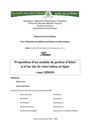
The soil particles of tundra are produced almost entirely by mechanicalbreakup of the parent rock and have suffered little or no chemicalalteration. Inceptisols with weakly differentiated horizons aredominant. Continual freezing and thawing of soil moisture hasdisintegrated the soil particles. Like the soils of the northerncontinental interior, soils of the tundra are affected by the permanentlyfrozen condition called permafrost. The permafrost layer is more than1,000 ft. (300 m.) thick over most of this region; seasonal thaw reachesonly 4 to 24 in. (10-60 cm.) below the surface.Geomorphic processes have a distinctive pattern in the tundra regions,and a variety of curious landforms results. Under a protective sod ofsmall plants, the soil water melts in summer producing a thick mudwhich may flow downslope to create bulges and terraces and lobes onslopes. The freeze and thaw of water in the soil sorts the coarseparticles and gives rise to patterned ground with such features as stonerings, stone polygons and stone stripes. The coastal plains havenumerous lakes of thermo karst origin, formed by melting ofground ice.1210 Arctic Tundra ProvinceNorthernArcticcoastaipiain, 68,900sq. mi. (178,500sq. km.)Land-surface form. - The north coast of Alaska is a broad, levelplain, generally less than 1,000 ft. (300 m.) in elevation. Rollingfoothills rise near the Colville River and gain altitude southward intothe Brooks Range. The entire province is under continuous permafrostto depths of 2,000 ft. (600 m.) in some areas. In summer, thousands oflakes and marshes dot the plain.Climate. - The severe Arctic climate reaches temperatures of -60 F.(-51 C.) in winter. Average annual temperature is only 10 F. (-12 C.)to 20 F. (-6 C.). Precipitation is very low throughout the year;average annual precipitation is only 7 in. (180 mm.). The extremelynorthern location of this province subjects it to great differences inamount of sunlight received at various times of the year. In summerthe sun remains above the horizon from only 2 to as many as 85 daysdepending on the latitude; in winter it can remain below the horizonfor as long as 67 consecutive days. All sunlight is received at obliqueangles that average 41 0. The growing season averages only 2 weeks peryear.Vegetation. - Permafrost limits the rooting depth of plants andforces surface water drainage; this creates extensive marshes and lakes.Cottongrass-tussock, the most widespread vegetation system in theArctic, is associated with sedges, dwarf shrubs, lichens, mosses, dwarf4
Water.redge tUl1drtl of/he Arctic TundfQ Proll;nct 011 the Arcticcoas/a/ p/a;11of Afaska. (U.S. FISh and Wikffi/e s.,.,ict.)birch, Labrador-tea, and ci.1quefoil. Th highl y productive systemsproduce 500-1 ,(0) (227 454 kg.) pounds/ acre, and are importantsources of food for caribou and waterfowl. Several forbs nowerbrightly in t short summer.Soils. - The soils are wet, cold Inceptisols that have weakly differentiated horizons. Soils occupying south slopes and low moraines arewell d rained and loamy with permafrost and ice features. They areunderlain by coarse outwash and till. Localized areas of poorlydrained clayey soils occu py uplands. Soils of the lowlands are deep,wet. and silty. There is no su rface water in winter and only moderaten ows in the summer. Su pp es of ground water are very limited.Faulli. -Mammals of the Arctic include brown bear, wolf, wolverine,caribou, Arctic hare, mink, weasel, and lemming. Ptarmigans, ravens,hawks, and open cou ntry owls are common . Shore and lake areas arerich habitat for millions of migra ti ng waterfowl and shorebirds duringthe summer momhs. Polar hear, walrus, and Arctic fox are commonon the ice pack and coastal areas during the winter. Gyrfalcon havealso been secn o n sea ice.,
1220 Bering Tundra Province ward Pt'ni1Utlia, 8e,ing arid Brnfol &y C(}Q la/ plailtS,86.700sq. mi. (]14,(j()()sq. km.)Land-surface (ann. - The Bering Tundra is a western extension ofthe Arctic coastal plain, a broad lowland area rising gradually to theeastward. General topography is less than 1, XXl ft. (300 m.) in elevation, broken in places by small mountain groups that rise 2,500-3,500fl. (800-1,100 m.). Standing waler is present in thousands of shallowlakes and marshes along the coast. Two large braided rivers, the iowerYukon and Kuskokwim, flow out of the province to the southwest.Climate. - The Bering Tundra climate is less severe than that on theArctic slope but it also has cold winters and warm summers. Annualprecipitation averages 17 in. (430 mm.). Temperatures range from90 F. (32 "C.) to -70"F. (-57 "C.). Permafrost is continuous undermost of the area.VegetatJon. - Vegetation along the wet coastal areas is chiefly sedgeand oottongrass; woody plants grow on higher sites. Birch-willowalder thickets interspersed with alpine tundra vegetation are extensiveon the Seward Peninsula and in transition zones between the beachand forest. The lower Yukon and Kuskokwim valleys are dominatedby white spruce, mixed with cottonwood and balsam poplar. It is atall, relatively dense growth, with dense undergrowth of thinleaf alder,willow, rose, dogwood, and various species of berry bushes.Soils. - Coastal soils are wet, cool, inceptisols over sill, sand, andmarine sediments. The lower Yukon and Kus kokwim valley bottomshave pockets of Entisols with no soil horizons. Grou nd water throughOUllhe area is limited, but some is available in the major river valleys.Surface water ceases to flow in winter on the Seward Peninsula, butflows continuously further south.Fauna. - River bottom lands provide excellent habitat for furbearers,game birds, and moose. Upland and coastal areas support brown andblack bear, wolf, wolverine, coyote, caribou, reindeer, snowshoe hare,red fox, lynx, beaver, moose, squirrels, mice, weasel, mink, andmarten. Along the northern Bering Sea coast, polar bear, walrus, andArctic fox are occasionally found. The coastal areas provide extensiveand excellent habitat for migrating waterfowl and shorebirds. Otherbird species in the area include ospreys, falcons, grouse, ravens,golden eagles, and various hawks and owls.,
Highland ProvincesMI2IO Brooks Range ProvinceNQrt r"Akrsklr, jJ,JOOsq. ml, (lJ8,{)()()sq. km.JLand-surfaa ronn. - The Brooks Range is a nonhem extension ofthe Rocky Mountain system and extends 600 mi. (970 km.) westwardfrom Canada to the Chukchi Sea. Its rugged mountains reach elevations of 9,(0) ft. (2.700 m.) in the east and decrease to 3,(0) fl. (91))m.) in the west. Broad U-shaped valleys and morainal topographyshow evidence of glaciation. A series of rolling plateaus and lowmountains, the Arctic foothills, borders the coastal plain to the north.Dimale. - The climate of the Brooks Range is similar to that of theArctic coastal plain, but precipitation increases at the higher al titudesand at the east end of the range. Precipitation averages' to IS in.(180-390 mm.), but drainage is rapid because soils have low holdingcapacity and steep slopes. Summer temperatures reach 90 to lOO"F.(32 0 to 38"C.), but winter temperatures drop as low as 75 F. (-60"C.).Since the province lies above the Arctic Circle, it experiences severaldays of 24-hr. sunlight in June, and several sunless days in December.Vegetation. - In the higher alpine areas, plant cover is discontinuousover barren rock. It consists chiefly of low mats of such herbaceousand shrubby species as dwarf arctic birch, crowberry, Labrador-tea,arctic willow, resin birch, and dwarf blueberry. Lower elevations maybe covered by a very productive mat of sedge and shrub that is valuableas forage for caribou. Cotlongrass, bluejoint, mosses, dwarf willow,dwarf birch, Labrador·lea, and bistort are common. Regeneration ofmost species is extremely slow; some mosses require more than 60years to recover from disturbance.Soils, - The mountains are underlain by folded and faulted lime-stone, the foothills by various sediments. Soils are rock y and poorlydeveloped. Inceptisols cover the lower slopes. Glacial and alluvialdeposilS occur in the valleys and al the base of the mountain slopes.Pennafrost is continuous under the entire area.Fauna. - The Brooks Range is an important big game area in Alaskaand supports brown and black bear, wolf, wolverine, cari bou, andDall sheep. Smaller mammals include marmot, red and Arctic fox,ground squirrel, lemming, and pika. Raptors prominent in many areasinclude golden eagles, marsh hawks, gyrfalcons, snowy and otheropen count ry owls. Brooks Ra nge is an important resting area formigrating waterfowl and songbirds during the summer.7
1300 Subarctic DivisionThe sou rce region for the continental polar ai r masses is south of thetundra zone between tat . SOoand 70" N. This climate type shows verygreat naJ range in temp(rature; winters are severe and the smallannual precipitation is concentrated in the three warm months. Thisclimate, called here the continental subarctic climate, is classified asDie by Koppen. This cold, snowy forest climate is moist all year, andsummers are cool and short. Less than 4 months of the year haveaverage temperatures warmer than 50 F. (Ioce.).Winter is the dominant season of this continental subarctic climate.Because monthly average subfreezing temperatures continue through 6to 7 consecutive months, all moisture in the soil and subsoil freezesolidly 10 depths of many f . Summer warmth is insufficient to thawmore than a few surface feet; so permafrost prevails under large areas.Seasonal thaw penetrates from 2 10 14 fL (0.6 to 4 m.) depffiding onIatilud , aspect, and kind of tround.Th subarctic climal zone ccincide:s with a great belt of needleleafforest, often referrtd to as boreal forest, and open lichen woodland,called th taiga. Most trees are small and have less valu for lumberthan for pulpwood.Inceptisols with pockets of wet, organic Histosols are associated withthe arctic needleleaf forest. These light gray soils are wet, stronglyleached, and acid; th(')' have a very distinct layer beneath the upperJDOStlayer of humus and forest litter. Agricultural potential is poor.Added to the natural infertility of soils is the prevalence of swampsand lakes left by the departed ice sheets. Ice scoured some rocksurfaces and stripped off the overburden entirely. Elsewhere rockbasins were formed and stream courses danuned; trus made countlesslakes.1320 Yukon Forest Provincelnt riQr Aluskil.18J.'OO q. mi. f480.600sq. km .}. nd-slilface fonn , - A series of broad valleys, dissected uplands.and lowland basins covered by alluvial deposits extends across interiorAlaska between the Broo ks and Alaska Ranges. Five major river.;provid the outstanding hydrologic features of the area: the upperYukon, Porcupine, Tanana, Koyukuk, and upper Kuskokwim. Rivervalleys are wide and channels extensively braided; in some areas theycontain hundreds of small lakes and marshc-;. Elevations are generallyless than 2,OCKJ ft . (600 m.). Small mountain groups and isolatedpeaks, mostly near the Canadian border, rise to heights of S,500-6,OCXlft. ( 1,700-1,800 m.) .
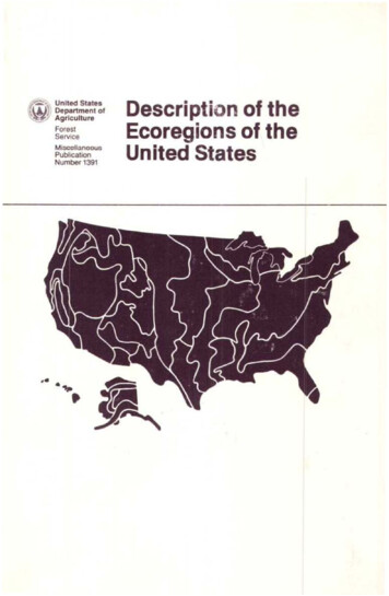
BorfOljoresl oj slunted block spruce in the Yukon Forest Pro ince,Kuskokwim Riwr, Alasko. -.
Clintllie. - The semiarid climate has extreme temperatures. Summersatt short and hot, up to lOOOf". (38"(:.): winters are long and severe,and temperatures fall as low as ·75 Of. (-60"C.). Average annualprecipitation is only 17 in. (430 mm.). Pennafrost is discontinuous inthe major river valleys, but cnntinuou on north-facing slopes and inthe higher elevations of the province. Temperature inversions,frequent in upland areas in winten, result in wanner temperatures onlower slopes than in bOllom lands.Vegetation. - The major river bottoms support dense white sprucecottonwood-poplar forest 011 the nood plains and south-facing slopesup to about 1,00 ft. (300 m.) devation. Undergrowth is denseshrubbery, including green and thinleaf alder, willow, dogwood, andberries. The oUler valley edges support evergreen and coniferousforests, often with pure stands of black spruce. Undergrowth iswillow, dwarf birch, crowberry, fem, blueberry, lichens, and mosses.Upland areas are generally covered by a rather dense white sprucebirch·aspen-popJar forest. Pure stands of white spruce grow nearstreams. Typical undergrowth includes willow, alder, fern, berries,grasses, and mosses. Root systems are shallow. Water balance is likelythe factor limiting grOwth in most of these areas because of the hot,dry summer climate. Scattered but extensive bogs occupy old riverlerraces, ponds, and sloughs. Their vegetation is chieny sphagnumand other mosses, sedges, bog rosemary, and Labrador-tea. Marginalareas may support willow and alder. Alpine tundra covers isolatedareas above 3,00 ft. (900 m.).Soib. - River bottom and lower slope soils have generally deep. welldrained Inceptisols, with underlying sands, sills, and gravels tha t areonly slightly weathered. Soils on north-facing slopes are shallow andpoorly developed and have continuous pennafrost. Upland soils thatsupport spruce· hardwood forests are wdl drainai, shallow Inceptisols.Bog soils are Histosols.Fauna. - The spruce-hardwood forests provide excellent habitat forfurbearen, woodland game birds, and mammals. Brush zones andimmalUre forests recov ring from fires furnish esp«ially good browsefor moose. Black and brown bear, wolr. wolverine, caribou, andmoose are common game spedes. Smaller mammals include red rox,heaver. mink, muskrat, weasel, land octer, marten, SQuirrels, andmice. Upland birds include sharptail, spruce and ruffed grouse,plarmigan, hawks, woodland owls, and ravens. Cliffs along theYukon and Porcupine Rivers support several raptor species: osprey,gyrfalcon, hawks, and the endangered American peregrine falcon.
Highland ProvincesM1310 Alaska Range ProvinceAlaska Range, Alaska Peninsula, Aleutian Islands102,200 sq. mi. (264,700 sq. km.)Land-surface form. - The Alaska and Aleutian Ranges are a continuation of the Pacific Coast Mountains in an arc across the northernPacific. The high rugged and glaciated peaks of the Alaska Range,which include Mt. McKinley at 20,320 ft. (6,193.5 m.), and the2,OOO-mi. (3,219 km.) volcanic arc of the Aleutian Mountains andIslands, typify the ruggedness of the area. The only major rivers arethe Susitna and upper Copper River; several large lakes are on theAlaska Peninsula. Coastlines are dissected, steep sloped, and rocky.Climate. - The Alaska Range and north Alaska Peninsula have atransitional climate of severe winters and hot, dry summers.Temperatures range from 90 F. (32 C.) to -70 F. (-56 C.). Precipitation averages only 16 in. (420 mm.) annually. The south AlaskaPeninsula and Aleutian Islands fall in the maritime zone. Theirtemperatures are slightly less severe in winter, down to -40 OF. (-40 C.);but precipitation is as much as 65 in. (1,650 mm.). Winds are often asevere problem on the islands. Permafrost is discontinuous on southfacing mountain slopes and is generally absent from the southernAlaska Peninsula and Aleutian Islands.Vegetation. - Vertical vegetative zonation in the Alaska and AleutianRanges extends from dense bottom land stands of white spruce andcottonwood on the Copper and Susitna River flood plains and lowterraces, and black spruce stands on poorly drained areas up to 1,000ft. (300 m.) elevation. Upland spruce-hardwood forests of whitespruce, birch, aspen, and poplar with a moss, fern, grass, and berryundergrowth extend to timberline at about 2,500-3,500 ft. (760-1,100m.). Tundra systems lie above timberline ending upward at thepermanent ice caps. Low shrubs and herbaceous plants form discontinuous mats among rock and rubble. White mountain-avens maycover entire ridges in the Alaska Range and are associated with mosscampion, black oxytrope, arctic sandwort, lichens, grasses, and sedges.The low-lying north shore of the Alaska Peninsula is an area ofstanding water, sedges, and cottongrass; the south shore has more of abrush system centered around alder thickets, devilsclub, willow,mountain ash, and berries.11
In the Aleutians, dominant plants are low heath shrubs, crowberry,bog blueberry, mountain cranberry, alpine-azalea, and dwarf willow.Moist, low elevation areas are often tall grass meadows interspersedwith dense low heath shrubs.Soils. - Bottom land and terrace soils of the Copper and SusitnaRivers are stratified, well drained Entisols. The Entisols have nopedogenic horizons. Upland hardwood forest soils are mostly shallow,well drained Inceptisols. North-facing slopes have continuous permafrost. Soils that support the moister tundra areas range from wetInceptisols to Histosols. Alpine Inceptisols are generally shallow andpoorly developed, with discontinuous to continuous permafrost.The Aleutian soils are poorly developed Inceptisols and Histosols androck areas.Fauna. - The Aleutian Islands support no large mammals. Foxes,bald eagles, and hawks are the primary predators on the millions ofseabirds that use the islands and rocks for rookeries. Such marinemammals as seal, sea lion, and sea otter are abundant and use theislands for hauling out and rookeries.The Alaska Peninsula and Alaska Range support large big gamepopulations of moose, Dall sheep, black and brown bear, wolf,caribou, and wolverine. Smaller mammals include beaver, red fox,lynx, otter, marten, squirrels, weasel, and various rodents. Migratingwaterfowl and shorebirds use the coastal areas extensively in thesummer. Golden eagles, ptarmigan, ravens, and hawks inhabit theuplands; the rich fish resources support bald eagles and osprey on thecoastline.12
2000Humid TemperateDomainThe climates of the humid temperate group are those of mid latitudes(30 to 60 ) occupying the zone in which both tropical and polar airmasses are important climatic factors. The midlatitudes are a beltsubject to cyclones; much of the precipitation in this belt comes fromlifting of moist air along fronts within those cyclones. Strong climaticseasons are characteristic of the midlatitude climates - seasons inwhich temperatures as well as precipitation show strong annual cycles.In these environments, the seasonal fluctuation of energy and temperature is greater than the diurnal. The midlatitude climates have a distinctive winter season, which the tropical climates do not.The humid temperature domain comprises the humid midlatitudeforests of broadleaf deciduous and needleleaf evergreen trees. Thevariable importance of winter frost determines six divisions: warmcontinental, hot continental, subtropical, marine, prairie, andMediterranean.2100 Warm Continental DivisionSouth of the eastern area of the subarctic climate, between latitudes40 and 55 N. and extending from the continental interior to the eastcoast, lies the humid warm-summer continental climate. Its location isintermediate between the source regions of polar continental airmasses to the north and maritime or continental tropical air masses tothe south. Alternations of these air masses create strong seasonalcontrasts in temperature.13
In the Koppen system this area lies in the Dfb, described as a cold,snowy, winter climate that has a warm summer. The Dfb climate has 4to 8 months when temperatures exceed 50 0 P. (10 C.) with no dryseason. The warm summer specified by the letter b is one in which theaverage temperature of the warmest month is colder than 72 0p.(22 C.). Precipitation is ample all year but is substantially greaterduring the su
efficiency - the tundra and the subarctic (taiga). 1200 Tundra Division The northern continental fringes of North America from the Arctic Circle northward to about the 75th parallel lie within the outer zone of control of arctic-type air masses. These conditions produce the tundra climate, that Koppen designated by symbol ET. Average temperature