Transcription
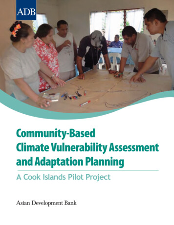
Community-BasedClimate Vulnerability Assessmentand Adaptation PlanningA Cook Islands Pilot Project
Contents1349ForewordIntroductionA Participatory Approach to Adaptation PlanningTools for Participatory Adaptation PlanningAdaptive Capacity Assessment ChecklistHousehold Vulnerability SurveyCommunity Climate Vulnerability and Risk AtlasesPriority Risk Identification Tool2021Sample of Resulting Risk Assessment and Priority Adaptation ActionsLearning from Experience: Lessons to Guide ReplicationKey Benefits of a Participatory Approach to Climate Risk ManagementPotential for sian Development Bankgeographic information systemglobal positioning systemIntergovernmental Panel on Climate ChangeAll photos and maps, except for the one in page 22, were provided by Te Rito Enua. The photo on page 22 was from theCook Islands News.The views expressed in this publication are those of the authors and do not necessarily reflect the views and policies of the AsianDevelopment Bank (ADB) or its Board of Governors or the governments they represent. Accounts presented here are anecdotaland do not represent comprehensive impacts of projects or programs.ADB does not guarantee the accuracy of the data included in this publication and accepts no responsibility for any consequenceof their use.By making any designation of or reference to a particular territory or geographic area, or by using the term “country” in thispublication, ADB does not intend to make any judgments as to the legal or other status of any territory or area.ADB encourages printing or copying information exclusively for personal and noncommercial use with proper acknowledgmentof ADB. Users are restricted from reselling, redistributing, or creating derivative works for commercial purposes without theexpress, written consent of ADB.Note: In this publication, “ ” refers to US dollars.
ForewordBuilding a safe, secure, and resilient community is one of the strategic goals ofthe Cook Islands’ National Development Plan. The Asian Development Bank(ADB) directly supports the attainment of this goal by providing loans andtechnical assistance grants to improve economic and social infrastructureand public sector service delivery. Under its Pacific Climate Change Program, ADBalso assists in enhancing country and subregional initiatives on climate change. Theprogram focuses on three key areas: (i) fast-tracking and scaling up climate changeadaptation and mitigation, (ii) building capacity to enable the integration of climatechange into national development plans and programs, and (iii) promoting moreeffective development partner responses.This publication documents the experience from a pilot adaptation project,Protecting Island Biodiversity and Traditional Culture in the Cook Islands throughCommunity-Based Risk Management. The project was funded under the ADBregional technical assistance, Promoting Climate Change Adaptation in Asia and thePacific (RETA 6420). The RETA focuses on developing and pilot-testing innovative,low-cost adaptation interventions in line with ADB’s conscious effort to synthesizeand disseminate lessons on effective climate change adaptation responses. Thispublication is part of a series of knowledge products designed to document ADBadaptation projects and outcomes, and to provide a better understanding of whatmakes adaptation actions effective.ADB’s support for the project highlights its commitment to put in place climatechange solutions that are adapted to local contexts and guided by the interests oflocal communities, including the poor and vulnerable. ADB views local adaptationand community participation as crucial in addressing the diverse range of physicaland human geographic circumstances in the region, which express themselves indiffering patterns of vulnerability and in the varying levels, timing, and nature ofclimate change risks.We hope that this publication will provide insights into how climate changeadaptation may be strengthened and accelerated through community-based riskassessment and participatory planning. The process and tools used in the projectwere designed in consultation with the communities, local experts, relevantgovernment agencies, and other development organizations. ADB encouragesreplication of the process and tools in ways that are best suited to local conditionsand the needs of vulnerable communities.1
Community-Based Climate Vulnerability Assessment and Adaptation PlanningThe pilot adaptation project as well as this publication would not have been possiblewithout the support of the Japan Special Fund and the Government of the UnitedKingdom for RETA 6420. The project was initially supervised by Edy Brotoisworo,principal environment specialist, Pacific Department, and implemented by theconsulting team of Mona Matepi, George de Romilly, and John Waugh.James Roop, senior environment specialist, Pacific Department, finalized the project,and drafted this report with consultant Jean Laguerder. Charles Rodgers, seniorenvironment specialist, Regional and Sustainable Development Department, gaveinvaluable technical advice. Joe Mark Ganaban did the layout, and Teri Temple editedthis report. Cecilia Caparas and Lorie Rufo provided technical support and coordinatedthe publishing process. Linel Ann Reyes provided administrative assistance.ADB is grateful for the effective partnership with the Cook Islands communities ofArutanga, Matavera, Rua’au, and Ureia; the Government of the Cook Islands through itsNational Environment Agency; local nongovernment organization, Te Rito Enua; andthe World Wide Fund for Nature, which provided both technical support and counterpartfunds for the project. Finally, the community vulnerability assessments conducted bythe Red Cross and other nongovernment organizations in the Cook Islands laid thefoundation for this work, and their contributions are greatly appreciated.Robert WihtolDirector GeneralPacific DepartmentXianbin YaoDirector GeneralRegional and Sustainable Development Departmentconcurrently Chief Compliance Officer2
IntroductionThe Cook Islands, like some of its neighboring small island developing states inthe Pacific, has been endeavoring to build greater climate resilience. Since 2003,the government, in partnership with the Red Cross and other organizations,has undertaken vulnerability assessments and adaptation planning in severalcommunities. Building on these initiatives, the government partnered with the AsianDevelopment Bank (ADB) and the World Wide Fund for Nature to undertake a pilotadaptation activity that could be replicated across the country’s inhabited islands.The basic idea was to field-test a participatory approach that integrates local knowledgeand engages vulnerable communities in the formulation of adaptation plans that willbe operable and most relevant to their circumstances. Integral to this idea was thedevelopment of practical tools, along with information and education, to ensure thatthe communities will have the necessary capacity to analyze climate risk and decide onadaptation strategies.The community risk profiles and adaptation plans that came out of the project haveenhanced the vulnerability assessment and risk reduction efforts in the pilot sitesin two distinct ways. First, they have brought into focus a number of important riskspreviously not considered in government vulnerability and risk assessments. Second,they have triggered direct actions at the individual, household, and community levelsthat can augment limited public resources and capability for adaptation. The communityvulnerability and risk atlases have been turned over to the national geographicinformation systems (GIS) office of the Ministry of Infrastructure and Planning, and arenow informing government planning and decision-making processes. The incorporationof the community priority adaptation actions into government policies and programsis gaining momentum.This publication captures and shares the process, tools, and lessons from the project.It shows how community-based risk assessment and participatory planning can beimplemented and used to strengthen and speed up local adaptation. With this, we hopeto contribute to the growing knowledge base on adaptation, as well as to advance ADB’sinterest in developing and scaling up innovative, low-cost adaptation interventions.3
A Participatory Approachto Adaptation PlanningThe project sites were four villages on two isles of the Cook Islands—Arutangaand Ureia in Aitutaki, and Matavera and Rua’au in Rarotonga.Lying largely on coasts, known climate change risks confronting these villagesinclude more floods and droughts, stronger cyclones and increased frequencyof category 4 and 5 cyclones, extreme weather changes, and more intense andfrequent heat waves. Findings from the Climate Change Adaptation Program (CLIMAP)of the Asian Development Bank in 2004 1 were used as baseline for the communityvulnerability assessment and adaptation planning.14Climate modeling exercises under CLIMAP projected that the Cook Islands, by 2060, will face(i) a rise in sea level of 0.5–0.8 meter (m); (ii) more heavy rainfall events, with daily total precipitationreaching more than 200 millimeters and hourly total precipitation above 50 millimeters; (iii) more than80% decline in the average monthly precipitation in certain areas, from their 1960–1991 records; (iv) anincrease in significant wave height from 10.8 m to 12.0 m due to stronger cyclones; and (v) more intensecyclones, with peak winds reaching more than 47.8 m per second.
A Participatory Approach to Adaptation PlanningThe project was implemented in phases, following the steps shown in the diagram below.Participatory Adaptation Planning ProcessPreparationPlanningStep 1DeterminemethodologyStep 4Undertake communitymappingStep 2Procure hardwareand softwareStep 5Prepare thevulnerability and riskatlasesStep 3Train communitymappersStep 6Conduct communityplanning isk Profiles andAdaptation Plansincorporatedinto governmentplans, policies,and programsTourism, a major economic sectorin the Cook Islands, will bethreatened by climate change5
Community-Based Climate Vulnerability Assessment and Adaptation PlanningStep 1. Determine the Methodology for Preparing a Geographic InformationSystem-Based Climate Vulnerability and Risk Atlas1. A set of indicators for mapping community vulnerability was developed in consultationwith government agencies. These indicators addressed the geophysical and socioeconomicfactors affecting vulnerability, including adaptive capacity. The development of theseindicators drew from a number of authoritative sources that include the Cook Islands'initial national communication to the United Nations Framework Convention on ClimateChange and a project financed by the Global Environment Facility, the Special Programon Adaptation to Climate Change for vulnerable marine and terrestrial biodiversity in theeastern Caribbean.2. A system was designed for capturing the information in the form of a contextually relevantset of fields, symbols, and tags that will enable economic, social, and other informationinputs from the communities to be incorporated.3. Hardware and software requirements and specifications were determined. By ensuringthat these were compatible with the government’s geographic information system (GIS), themapping activities were made much more expedient. However, the cost and complexity of aGIS can also impede working on a larger scale.Step 2. Acquire and Configure Required Software and HardwareHardware and software compatible with the government’s GIS platform were procured andconfigured based on the areas of value and concern to the communities.Step 3. Conduct the Training of Community MappersA total of 25 community members, representing a cross section of the populations in Aitutakiand Rarotonga, including community leaders, resource users, and professional resourcemanagers, were trained on community vulnerability mapping using preconfigured globalpositioning system (GPS) equipment. They were selected by the communities and embodieda wide range of interests, including technological (interest in GPS among the youth),thematic (natural resource management, and disaster preparedness and prevention amongthe working population), and staying abreast of the changing world (community elders).The training included introductory courses in (i) participatory mapping, (ii) vulnerabilityand risk assessment and climate models, (iii) use of GPS in mapping, (iv) GIS and mappingassets, and (v) map interpretation. Two training activities were held, each taking 4 days:2 days of classroom instruction and a 2-day field practicum.A valuable insight into the prevailing community value systemsurfaced in the training. Working in teams without guidancefrom the trainers, participants were asked to map communityfeatures of particular interest or concern. Invariably, the first itemsmapped by the different groups were the marae, ritual platformscentral to Polynesian culture and history. Aside from this, the initialresults ranged from recreation (football pitches) to economicallyimportant sites (pa’i, or taro swamps, and tourism sites), and socialsites (churches, schools, and community centers). Such otherimportant sites as water infrastructure and areas of pollution wereadded only after further reflection.Participatory mapping in AitutakiDiscussions during the training went beyond climate change andclimate adaptation to deeper social issues, such as cultural erosion,6
A Participatory Approach to Adaptation Planningloss of language, unsustainable resource use, invasive species, and out-migration. Thisprovides an example of how adaptation planning may be framed within a broader suiteof development issues.Step 4. Undertake Community Mapping1. Project-trained community facilitators led the actual conduct of community mapping.Using handheld GPS units, they worked with the communities to establish control points,determine and collect data points, and take photographs for a visual baseline. Whereresources permitted, household surveys were also undertaken to evaluate and maphousehold-level vulnerabilities.2. GPS data were converted into GIS layers and integrated, as necessary, withgovernment GIS maps to produce working drafts for the adaptation planning workshops.Government base maps provided data on elevation, infrastructure, land use and landcover, and geology. Community data layers added sociocultural data, primarily ofsignificant cultural sites. Other relevant data layers were also incorporated, includingremote sensing imagery; downscaled global climate models; and available GIS layers onthe hydrology, physical features, and biotic communities of the project sites.3. Short community profiles were developed for all four project sites based on thecommunity mapping and household survey results. These profiles set the context for thecommunity-based adaptation planning.Community mapping with theuse of hand-held GPS units4. Fieldwork was done to validate the results of the participatory mapping exercises.The activity led to a significant new observation: the watersheds of both Aitutaki andRarotonga are infested with invasive species—the balloon vine and the mile-a-minuteweed. These infestations have yet unknown implications on the resilience of thecommunity water resources.Step 5. Prepare the Geographic Information System-Based CommunityClimate Change Vulnerability and Risk Atlases1. A map series was produced for each community, addressing the issues raised by theparticipants in the training and mapping exercises.2. Data from these maps were analyzed and compiled into community vulnerabilityatlases. Paper map versions of the atlases were initially used and aided the adaptationplanning workshops.3. The map files were shared with the government and incorporatedinto the government GIS database. This has updated the national GISdatabase of assets vulnerable to climate and disaster risks, with inputsfrom the communities.Paper map developed duringthe training in RarotongaStep 6. Conduct Community Workshops to Review ClimateChange Risks and Develop Adaptation StrategiesWorkshops were convened to develop the adaptation framework forthe communities. The Arutanga and Ureia communities in Aitutakidecided to come under a single framework because of their significantgeographic and social overlaps. Each adaptation framework wasformulated following an assessment of the risks recorded in the7
Community-Based Climate Vulnerability Assessment and Adaptation Planningcommunity climate vulnerability and risk atlas. In accordance with what is mostimportant to the community, adaptation plans were fleshed out and priorityadaptation options were specified. Village councils, island councils, interestedmembers of the site communities, and representatives of several governmentagencies participated in the workshops.Notably, many traditional practices were confirmed during the workshops as havingconsiderable value in adaptation. For example, the traditional system of resourceallocation under the ra’ui, a protected area under customary law, can be harnessedto improve the resilience of vulnerable water resources. Traditional housing andbuilding designs, as compared with modern architecture, are more suited to theanticipated increase in extreme heat events. The positioning of the marae bycustomary leaders in pre-missionary times is also instructive. A marae is a communalsacred place that serves religious and social purposes. In Matavera, all marae arelocated along the upper boundary of the village, making them less vulnerable tosea-level rise and storm surge. The wisdom that went with the site selection for themarae could be revived in contemporary infrastructure and settlement planning.OutputsThe community risk profiles and adaptation plans that resulted from the project haveenhanced the vulnerability assessment and risk reduction efforts in the pilot areas intwo distinct ways.First, they have brought into focus important risks previously not considered ingovernment vulnerability and risk assessments. Examples are (i) probable runoff dueto intense rains from landfills situated near the communities, which could adverselyaffect drinking water supply and the adjoining aquatic and coastal ecosystems;(ii) the location of community disaster response shelters in areas vulnerable tosea-level rise and storm surge inundation; and (iii) the prolific spread of invasivealien vines, which can lead to changes in vegetation and forest cover with resultingimpacts on biodiversity and water resources.Second, they have triggered direct actions at the individual, household, andcommunity levels. While many of the priorities identified by the communitieswould require support from national government, the donor community, and insome cases, the private sector (e.g., insurance),the inclusion of self-reliant measures in thecommunity adaptation plans will augmentlimited public resources and capabilityfor adaptation.The community vulnerability and risk atlasesare now with the national GIS office of theMinistry of Infrastructure and Planning,where they are used to inform governmentplanning and policy making. Incorporationof the community priority adaptation actionsinto government policies and programs isongoing and gaining momentum. All thepriority adaptation actions are scheduled to beimplemented in the short term.8Community consultationutilizing vulnerability maps
Tools for ParticipatoryAdaptation PlanningThe project developed and used a number of practical tools to facilitatevulnerability and risk assessment and adaptation planning processes. Thesetools also supported community capacity building, and may be drawn upon asa continuing source of data and information or a guide for future similar actions.Adaptive Capacity Assessment ChecklistAdaptive capacity is a key variable that could increase or decrease vulnerability.Defined by the Intergovernmental Panel on Climate Change (IPCC) as “the ability ofa system to adjust to climate change (including climate variability and extremes) tomoderate potential damages, to take advantage of opportunities, or to cope with theconsequences,” it is basically dependent on the availability of human, technical, andfinancial resources. Adaptive capacity varies from community to community and isinfluenced by a host of factors, including knowledge, social networks, and the presenceof predetermined or prepositioned response measures. While not a precise science,a community’s level of adaptive capacity may be gauged by looking at the availabilityof the various relevant resources at the time the assessment is made.For this project, an adaptive capacity assessment checklist was used to assistcommunities in determining their adaptive capacity levels. Adaptive capacityassessments were backed by the results of a household vulnerability survey thatquantified access to resources, revealed the condition of homes and buildings, andprovided indications of the existing level of awareness of climate change risks andresponse measures, among other data. Prior review by the project implementers of allrelevant political, social, economic, and environmental action plans that could impactthe risk management process also supported the adaptive capacity assessments.Adaptive Capacity Assessment ChecklistProcess: Determine the resources and thereafter the availability of these resources to the communities to evaluatetheir adaptive capacity to climate change.Data sources: Participants’ knowledge/awareness, household vulnerability survey, government action plans, andexpert judgment.Does the community have Yes/NoRemarksKnowledge (including indigenous knowledge) and awareness of climate change risks?Awareness of appropriate mechanisms (including indigenous coping mechanisms)to address climate change risks?Ability to implement appropriate climate change risk management mechanisms asmeasured by access to resources (human, technical, financial, social capital, governmentor social support, natural resources, etc.) and ability to deploy such resources?9
Community-Based Climate Vulnerability Assessment and Adaptation PlanningHousehold Vulnerability SurveyA survey was conducted to get a picture of the vulnerability of individual households.The survey encompassed a range of issues, including the structural soundness andcondition of homes and buildings; access to food, water, cooking fuel, and energysupplies; waste disposal practices; farming and livestock activities; disaster experiencesand response mechanisms; and susceptibility to climate-related illnesses. It alsogathered perceptions about changes in climate, vegetation, and shoreline. The surveyresults were incorporated into the vulnerability and risk assessments.Household Vulnerability Survey Form(Sample from Aitutaki)Questionnaire administrator:Questionnaire completed by:Date:House number/address:Questions about householdName of informant/s:Number of occupants:Household data (start with eldest):NameGender (Male/Female)Age: 60 , 16–60, 5–15, up to 5OccupationHow many years have you lived in Aitutaki? years or whole life Questions about building/houseDo you own or rent the house?Age of building/structure (in years)Current condition of building and roof: (tick box)ExcellentGoodFairBadRoof conditionBuilding conditionProne to flooding? Yes No Is the house raised above ground? Yes No Approximately how many meters above the ground is it raised? (meters)What method has been used to raise the house above the ground? (tick box)Piles Raised foundation Other methods Describe other methods used:What is the house made of?Concrete Concrete Block Wood Plywood Metal/Tin Thatch Coral/ Lime Others(%)(%)(%)(%)(%)(%)(%)(%)Roof typeOutside wallsMain dwelling (inside walls, ceiling, etc.)Floor/foundation type10
Tools for Participatory Adaptation PlanningWho built the house (building): (tick box)Professional builders Amateur builders Informal builders Others SpecifyNumber of rooms:Size of main building (dwelling): (in square meters)Estimated value of the main building: Is your house (building) insured? Yes No By how much? Size of other buildings on land: 1) (in square meters)2) (in square meters)Use of other buildings on land: 1) 2)Value of other buildings on land: 1 ) 2) Questions about foodWhat are your main foods? (list)What percentage are imported foods? or purchased locally? or grown by yourself ?List foods grown by yourselfHave you ever had a food shortage or shortage of certain types of food? Yes No Fill in the table below the required data for the three (3) most recent food shortagesShortage 1Shortage 2Shortage 3Date (month and year)Caused by (e.g., no ship, cyclone destroyed crops)Length of shortageType of food that was in short supplyAction taken to deal with shortageDo you preserve any foods? Yes No If yes, what foods? (list)How do you preserve them? (e.g., traditional, modern, drying, salting, recovery and preserving before and after cyclone damage to crops)Do you store food or maintain food stocks in your home? Yes No If yes, how do you store food?Food ted Number of Days Supply Would LastNumber of AppliancesNot applicableNot applicableWhat fuel do you use for cooking?Main Cooking FuelFirewoodGasElectricOthers%Questions about water supplyDo you have piped water? Yes No Do you have water tank/s? Yes No If yes, what material is it made from? Plastic Metal Others SpecifyWhat is the size of the water storage tank? litersIs it in good working condition? Yes No Does your roof catch rain? Yes No If yes, how extensive is the guttering to catch rain?All around the house Half of the house A single spout (guttering-piece) Pump from tank to house Main source of drinking water :Public system only Community system only Public and community system Bottled Catchment, tanks, drums Well/borehole Springs 11
Community-Based Climate Vulnerability Assessment and Adaptation PlanningQuestions About EnergyEnergy SourceMains connectedOwn generatorOther power sources (indicate type)None%Not applicableDo you have water heating? (tick box)Gas Electric None Solar Does your house have natural ventilation and/or shade on the north side? YesDo you have air-conditioning or fans for cooling the house? Yes No No Questions about wasteWhat type of toilet do you have?TypePour flushFlushLong dropCompostingHow ManyWhat happens to wastewater? Septic tankWastewater disposalWastewater treatment Type: NoneDo you have separate soak pit for gray water? Yes No How do you get rid of your rubbish?Location (Inside or Outside) Waste DisposalHoleCollectedOpen burningOthers%Questions about farming and livestockFarming/Agriculture TypeSubsistence/domesticCommercialOthersCrops: (List)%Livestock ActivityPoultryPiggeryGoatOthersEstimated NumberNoneValue of farm (if applicable): Where is your growing activity? Close to household Away from household Where is your livestock activity? Close to household Away from household Questions about storm surges and rain floodsFill in the table below with the required data for the three (3) most recent floods:Flood 1Date (month and year)Caused by (e.g., cyclone rain, cyclone waves)Floodwater depth in house (meter)Depth on compound (meter)Duration of floods in main house (minutes or hours)Damage to building/house structure or electrical system ( )Damage to building/house contents (e.g., food, clothes) ( )Damage to crops ( )Damage to livestock ( )Damage to other possessions (e.g., cars) ( )12Flood 2Flood 3
Tools for Participatory Adaptation PlanningWhat actions have been taken by the household to prevent flooding?Have you ever considered moving your house to a place less vulnerable to flooding, or building up on pillars? Yes No Have you actually done so? Yes No If no, why have you not moved or built on pillars?If yes, where is this place you have moved to?Questions about climate and vegetationDo you think the climate has changed over time? Yes No If yes, what changes have you noticed?What do you think caused these changes?Has the vegetation changed over time? Yes No If yes, has it increased or decreased than 10 or 20 years back? Increased Decreased Have there been bushfires in your area? Yes No If yes, what was the main cause of these fires?Questions about shoreline changesHow has the shoreline, lagoon, or coral reef changed over the years?What caused these changes?Have you noticed any changes to your livelihood as a result of changes in the shoreline, lagoon, or coral reef? Yes No What are these changes?Questions about health and climate changeDo you have any areas of standing water around your house (e.g., plastic or metal containers that collect water, broken or blocked drainpipes,and unused boats)? Yes No Does anyone in your house have asthma or other respiratory ailments? Yes No Has anyone in your house ever suffered from dengue fever or malaria? Yes No Do you have anyone in your house who is infirm or needs assistance to undertake daily chores? Yes No Community Climate Vulnerability and Risk AtlasesFive distinct maps showing the vulnerability of the communities to flooding, drought,intense heat events, cyclone-force winds, and sea-level rise and storm surge comprisethe community climate vulnerability and risk atlases (samples from Rua’au are onpages 14–17). The maps enabled the communities to see their position in the officialgeography and how the sites that are important to them may be impacted by climatechange. Printed copies of these maps simplified the identification o
Adaptive Capacity Assessment Checklist Household Vulnerability Survey Community Climate Vulnerability and Risk Atlases Priority Risk Identification Tool 20 Sample of Resulting Risk Assessment and Priority Adaptation Actions 21 Learning from Experience: Lessons to Guide Replication Key Benefits of a Participatory Approach to Climate Risk Management