Transcription
DOMINICAN REPUBLIC CLIMATECHANGE VULNERABILITYASSESSMENT REPORTSEPTEMBER 2013This report is made possible by the support of the American people through the U.S. Agency for International Development (USAID).The contents are the sole responsibility of Tetra Tech ARD and do not necessarily reflect the views of USAID or the U.S. Government.
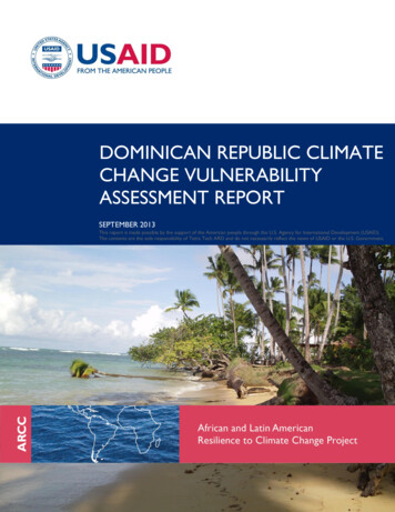
ACKNOWLEDGEMENTSThe authors would like to thank Ms. Christine Mataya, Mr. Jose Oviedo, Mr. Miguel Morales, Mr. NickThomas, Ms. Emiko Guthe, Ms. Kelly Miller, Ms. Erin Upton-Cosulich, and Ms. Emilie Schnarr for theircontributions, as well as the many local partners who directly contributed to this report, includingUSAID/Dominican Republic, the National Office of Meteorology, the Ministry of Environment andNatural Resources, the National Institute of Water Resources, and many others.Prepared by:1. Ms. Patricia Caffrey, Team Leader2. Mr. Leif Kindberg and Mr. Carter Stone, Deputy Team Leaders3. Mr. Juan Carlos de Obeso and Dr. Sylwia Trzaska, Climate Scientists4. Mr. Ruben Torres, Marine Scientist5. Mr. Gerald Meier, Environmental Management SpecialistCover Photo: Las Terrenas Dominican Republic, Carter Stone, 2013.This publication was produced for review by the United States Agency for International Development byTetra Tech, through a Task Order under the Prosperity, Livelihoods, and Conserving Ecosystems(PLACE) Indefinite Quantity Contract Core Task Order (USAID Contract No. AID-EPP-I-00-06-00008,Order Number AID-OAA-TO-11-00064).Tetra Tech Contacts:Cary Farley, Ph.D.Chief of PartyAfrican and Latin American Resilience to Climate Change (ARCC)Arlington, VATel.: 703-822-5668Cary.Farley@alarcc.comAnna FarmerProject ManagerBurlington, VTTel.: 802-658-3890Anna.Farmer@tetratech.comDominican Republic Climate Change Vulnerability Assessment Reporti
DOMINICAN REPUBLIC CLIMATECHANGE VULNERABILITYASSESSMENT REPORTAFRICAN AND LATIN AMERICAN RESILIENCE TO CLIMATE CHANGE (ARCC)SEPTEMBER 2013iiDominican Republic Climate Change Vulnerability Assessment Report
CONTENTSACKNOWLEDGEMENTS .iACRONYMS AND ABBREVIATIONS . v1.0 EXECUTIVE SUMMARY . 12.0 BACKGROUND . 92.1 PURPOSE AND APPROACH . 92.2 CONTEXT . 113.0 EXPOSURE . 143.1 CLIMATE ANALYSIS . 143.1.1 Data and Methods . 153.2 RAINFALL . 173.2.1 Review of Rainfall Characteristics . 173.2.2 Long-term Historical Rainfall Evolution and Projections . 193.2.3 Summary. 213.3 MEAN TEMPERATURE . 223.3.1 Main Mean Temperature Characteristics . 223.3.2 Variability, Long-term Evolution, and Projections . 223.3.3 Summary. 233.4 OTHER FACTORS: WIND AND SEA-LEVEL RISE. 233.4.1 Wind . 233.4.2 Sea-level Rise . 233.5 CONCLUSIONS. 244.0 SENSITIVITY . 264.1 OVERVIEW OF SENSITIVITY . 264.1.1 Climate and Non-Climate Stressors . 264.1.2 Spatial Analysis: Flooding, Land Use, Population Centers, andPrimary Physical Characteristics (Rivers, Mountains, Valleys, etc.) . 274.1.3 Marine and Coastal Analysis . 294.2 SENSITIVITY IN EACH CLIMATE-SENSITIVE HOTSPOT . 334.2.1 Yaque del Norte—Montecristi/Santiago . 334.2.2 Bajo Yuna–Samaná Bay and Peninsula . 394.2.3 Bávaro/Punta Cana. 424.2.4 Santo Domingo . 474.3 OVERALL CONCLUSIONS RELATED TO SENSITIVITY . 495.0 ADAPTIVE CAPACITY . 515.1 INSTITUTIONAL ANALYSIS . 515.1.1 National Level and Sub-National Overview . 515.1.2 Yaque del Norte — Montecristi/Santiago. 555.1.3 Bajo Yuna — Samaná Bay and Peninsula . 555.1.4 Bávaro/Punta Cana. 565.1.5 Santo Domingo . 566.0 RECOMMENDATIONS . 586.1 ADAPTIVE PATHWAYS . 58Dominican Republic Climate Change Vulnerability Assessment Reportiii
6.2 PATHWAY 1: DISASTER RISK REDUCTION AND EARLY WARNING SYSTEMS . 596.3 PATHWAY 2: DEVELOPMENT PLANNING: INFRASTRUCTURE AND LAND USE . 646.4 PATHWAY 3: MANAGEMENT AND CONSERVATION OF COASTAL HABITATSAND WATERSHEDS. 687.0 BIBLIOGRAPHY. 758.0 ANNEXES . 808.1 ANNEX A: CLIMATE ANALYSIS – DOMINICAN REPUBLIC . 808.2 ANNEX B: OPTIONS ANALYSIS PARTICIPANTS LISTS .121ivDominican Republic Climate Change Vulnerability Assessment Report
ACRONYMS AND ABBREVIATIONSARCCAfrican and Latin American Resilience to Climate ChangeBCRDDominican Republic Central BankCCUClimate Change UnitCEBSECentro para la Conservación y Ecodesarrollo de la Bahía de Samaná y su Entorno, Inc.CODIAColegio Dominicano de Ingenieros, Arquitectos y AgrimensoresCODOPESCA Consejo Dominicano de Pesca y AcuaculturaCOECentro de Operaciónes de EmergenciasCOOPRESCA Cooperativa de Pesca y Prestadores de Servicios Turísticos de La CaletaCORAASANSantiago Water and Sewerage CompanyCMIP5Coupled Model Inter-comparison Project Phase 5CNENational Energy CommissionDGODTDirección General de Ordenamiento y Desarrollo TerritorialDR VADominican Republic Climate Change Vulnerability AssessmentEGEHIDEmpresa de Generación Hidroeléctrica DominicanaENSOEl Niño Southern OscillationFEDOMULa Federación Dominicana de MunicipiosFundezurzaFundación por el Saneamiento de La ZurzaFUNDEMARFundación Dominicana de Estudios MarinosGCMGeneral Circulation ModelsGPAGlobal Programme of Action for the Protection of the Marine Environment from Landbased ActivitiesGRIDGlobal and Regional Integrated DataGRUMPv1Global Rural-Urban Mapping Project, Version 1GTZGerman Agency for Technical CooperationIDDIInstituto Dominicano de Desarrollo IntegralIGERMunicipal Institute of Risk ManagementINAPAThe national water and sewerage authorityINDRHINational Institute of Water Resources in the Dominican RepublicDominican Republic Climate Change Vulnerability Assessment Reportv
INFOTEPInstituto Nacional de Formación Técnico ProfesionalIPCCIntergovernmental Panel on Climate ChangeLAPOPLatin American Public Opinion ProjectMARENAMinistry of Environment and Natural ResourcesMPAMarine Protected AreaMSDMid-Summer DroughtNAPHNorth Atlantic High PressureNCENational Emergencies CouncilNGONongovernmental OrganizationOFDAOffice of U.S. Foreign Disaster AssistanceONAMETNational Meteorological OfficePESPayment for Ecosystem ServicesPSA-CYNPago por Servicios Ambientales Hídricos en la Cuenca del Río Yaque del NorteRCDRReef Check Dominican RepublicRCPRepresentative Concentration PathwaySLRSea-Level RiseSTRMShuttle Radar Topographic MissionSSTSea-Surface TemperaturesTNCThe Nature ConservancyUNEPUnited Nations Environment ProgrammeUSAIDU.S. Agency for International DevelopmentviDominican Republic Climate Change Vulnerability Assessment Report
1.0EXECUTIVE SUMMARYThe U.S. Agency for International Development (USAID)/African and Latin American Resilience toClimate Change (ARCC) Project conducted the Dominican Republic Climate Change VulnerabilityAssessment (DR VA) from December 2012 to May 2013 in response to requests from the USAID/LatinAmerica and Caribbean Bureau and USAID/Dominican Republic. The overall DR VA approach has sixsteps: a desk review of all relevant literature, a scoping visit, a field assessment phase, data compilationand analysis, a presentation of results, and a participatory analysis and definition of climate adaptationoptions. The assessment seeks to improve understanding of climate change impacts on watersheds andcoastal resources — as well as the people dependent on them — in the four climate-sensitive hotspotsthat the assessment targets. The methodology for the integrated assessment is multi-scalar and multilocational (it focuses on four climate-sensitive hotspots — urban and coastal — encompassing PuntaCana/Bávaro; Yaque del Norte [Montecristi/Santiago]; Bajo Yuna [Samaná Bay and Peninsula]; and SantoDomingo). Its organizational structure follows the major components of the widely acceptedproposition that vulnerability is a function of three things: exposure to a stress (in this case climatic);the sensitivity of a community, livelihood, or natural system to that stress; and their adaptivecapacity to recover from the impacts of that exposure. The most vulnerable communities/householdsare those with high exposure, high sensitivity, and low adaptive capacity. To assess these factors, climate,watershed, marine and coastal resources, and institutional analyses were conducted in the targetedhotspots.EXPOSUREThe climate analysis methodology involved a literature review of climate in the Caribbean Region and inthe Dominican Republic; an analysis of historical climate variability and trends in selected areas in orderto provide a context for projected changes in the future climate; and climate projections for the sameareas. The analysis of variability and trends compared two periods, 1960-1984 and 1985-2012, to assesschanges in mean and frequency of precipitation, temperature and wind, and the amplitude of rainfalldecadal variability in the Dominican Republic. Climate projections were developed by downscalingoutput of eight General Circulation Models (GCM) 1 under two emission scenarios (high and lowemissions) from the latest projection archive (Coupled Model Inter-comparison Project Phase 5[CMIP5], Taylor et al., 2012) to meteorological station level, resulting in mean projected climateconditions (temperature and precipitation) in two 30-year periods ending in 2030 and 2050. A completemethodology of this analysis appears in Annex A of the complete report.0FThe findings of the literature review of climate and analysis of historical climate variability and trends inrainfall, temperature, and wind lead to the following conclusions: 1Strong regional differences in seasonal and annual rainfall exist; temperature is mainly defined byaltitude.Ten different general circulation models with different resolutions and different architectures were used, and the two outliers werediscarded.Dominican Republic Climate Change Vulnerability Assessment Report1
All regions experience strong inter-annual rainfall variability linked to El Niño-Southern Oscillation(ENSO) as well as a decadal variability related to the Tropical Atlantic; decadal variability in theTropical Atlantic also strongly affects the frequency of hurricanes. No robust and consistent long-term changes in rainfall variability were found. Temperature, on theother hand, exhibits a consistent increasing trend on the order of 0.5-1 C during past decades. There is an indication of fewer extreme rainfall events in the Yaque del Norte watershed, inaddition to more extreme events in the Santo Domingo watershed in the recent period, but noconsistent pattern related to changes in flood patterns could be isolated. Analyses of changes in wind speed and direction did not yield robust and significant results;therefore, observed changes in beach erosion rates cannot be directly attributed to changes in wind.Climate projections for temperature and precipitation reveal medium- and long-term potential for: A decrease in rainfall in May (a rainy month in all stations) and an increase in December (a drymonth in all stations); and Temperature increases for 2030 and 2050, which are projected to be 0.5-1.0 C and 1.0-2.5 Crespectively and will increase evaporation and induce additional water stress.Furthermore: Sea-level rise will likely exacerbate coastal flooding and beach erosion; and The intensity of tropical storms and their accompanying precipitation will increase as ocean andglobal temperatures continue to rise. Combined with environmental degradation, tropical stormdamage will worsen.SENSITIVITYSensitivity is the degree to which a system will be affected by, or responsive to climate stimuli (Smit andPilifosova, 2001). The current and anticipated climate impacts will increase the sensitivity of communitiesand natural systems in the four studied areas, making them increasingly vulnerable to these elements ofexposure. The assessment found that, while sensitivity varies slightly among the studied areas, principalpoints of sensitivity are where flooding, storm surge, and coastal zone degradation affect populations andnatural systems. Communities susceptible to flooding and storm surge are adversely and directlyaffected by the impact of flooding on roads, housing, businesses, and farm fields. Marine habitats sufferclimate and non-climate induced impacts that have an indirect impact on the well-being of coastalcommunities by diminishing livelihoods that depend on fishing and the tourism industry. The study foundthat sensitivity to climate change manifests in the following ways:1F Increasing temperatures will continue to strain agricultural systems and groundwater availability andquality due to the possibility of hotter and drier conditions in Yaque del Norte, where precipitationis projected to slightly decrease. Increased frequency and intensity of flooding due to the combination of more intense storms andenvironmental degradation is likely to disproportionately affect already sensitive systems (e.g.,livelihoods on the edge, people in poverty, coastal infrastructure). Populations on the margin of the economy (particularly those located in urban areas of Los Mina,Hoyo de Puchula, Fracatán, La Esperanza, and el Hoyo de Elias) as well as rural small farmers are2Dominican Republic Climate Change Vulnerability Assessment Report
more sensitive to impacts of disasters (floods, dry periods, landslides) because they have limitedresources with which to influence and increase adaptive capacity. 22F1F Coastal zones (particularly mangroves and coral reefs) are particularly sensitive to sea-level rise andmore extreme storms because of existing problems with critical habitat destruction fromdevelopment pressures, overfishing, and other threats. Local communities are very sensitive to these same factors, which will likely increase the risk tocoastal communities of flooding, diminish fisheries stocks, and degrade natural tourist attractions inthe absence of more comprehensive resource management planning. Residential households and the agriculture and tourism sectors heavily depend on ground andsurface water supply, which are sensitive to localized land use and likely to experience decreasingrecharge and quality due to evaporation and salt water intrusion. Inadequate sewage managementfurther compromises water quality. In the absence of adequate sewage treatment facilities, most rawsewage is dumped into the aquifer through injection wells called “pozos filtrantes” or directly intorivers and the ocean, worsening water quality and increasing health risks.Non-climate stressors, including population, land, and economic pressures, exacerbate thesemanifestations of sensitivity and will continue to impede efforts to reduce vulnerability of communitiesand natural systems. Populations inadvertently increase their vulnerability as they exploit naturalresources to support their livelihoods (e.g., unsustainable fishing, forestry and agriculture practices)causing irreversible damage to natural systems.ADAPTIVE CAPACITYAdaptive capacity is the inherent ability of a livelihood system, or community, to absorb climate changeshocks and to buffer the impacts of those shocks. It is often described as recovery power or as a set ofassets and strategies that result in resilience. For this assessment, adaptive capacity was gauged byreviewing the existing capacity and potential of communities, institutions, policies, and programs toaddress the sensitivities. The limited assessment of adaptive capacity and the collection of local adaptiveresponses included a secondary literature review in addition to an institutional analysis at the nationaland sub-national levels triangulated with focus group discussions and key informant interviewsconducted in the four climate-sensitive hotspots. Overall findings from the institutional analysis follow: Climate change policy and plans have been developed at the national level. The National Meteorological Office (ONAMET) and the National Institute of Water Resources inthe Dominican Republic (INDRHI) have established a solid foundation with which to strengthen andexpand their capacity to collect data and analyze and disseminate climate information. Climate change action is emerging at the national level, but has not yet reached sub-national levels. Guidelines, capacity, and resources to support implementation of adaptation measures are still weakat all levels and across ministries. There is a lack of coordination and integration across ministries and policies.2Adaptive capacity refers to the potential or capability of a system to adjust to climate change so as to moderate potential damages, totake advantage of opportunities, or to cope with consequences (Smit and Pilifosova, 2001).Dominican Republic Climate Change Vulnerability Assessment Report3
It is anticipated that capacity, guidance, coordination, and collaboration will improve when the newclimate change law takes effect. To ensure that the law is effective, other actions will need to follow, such as the development anddissemination of clear guidelines; the effective enforcement of the law; and capacity building toensure that the public is informed and capable of complying. Locally generated adaptive responses exist but are not leveraged to bring to scale. Institutional capacity to respond to disasters and improve the management of watersheds and waterexists within some public agencies and NGOs but is not implemented to scale or linked with climatechange policy and programs. As the devolution of the National System for Prevention, Mitigation and Response to Disasters takesplace, inter-institutional coordination and citizen awareness of the relationship between climatechange and risk and disaster management pose challenges. Inadequate land-use and development planning and enforcement increase disaster risk in areas proneto flooding.ADAPTIVE PATHWAYS AND RECOMMENDATIONSKey donors and decision-makers participated in multi-stakeholder options analysis meetings in April inSanto Domingo, Samaná, Montecristi, Santiago, and Punta Cana. Participants discussed results, validatedpathways, and defined strategies and recommendations based on evidence generated from theassessment. The adaptation pathways, strategies, and an overview of key recommendations aredescribed herein (detailed recommended actions are provided in the recommendations section of thereport).Given the factors of exposure and sensitivity and gaps in adaptive capacity felt across the four hotspots,adaptive strategies need to be defined to improve policy and guidance, develop institutional capacity, andengage citizens (individuals, civil society organizations, and private businesses) to prevent, mitigate, andmanage potential damage caused by flooding. To reduce the vulnerability of populations, livelihoods, andnatural systems exposed to increases in extreme rainfall events and sea-level rise that will induceflooding (combined with storm surges), three adaptive pathways guide the direction that institutionalactors can follow to strengthen resilience and adaptive capacity:1. Disaster Risk Reduction and Early Warning Systems;2. Development Planning: Infrastructure and Land Use; and3. Management and Conservation of Coastal Habitats and Watersheds.Much work has already been done in the Dominican Republic in this regard; therefore recommendationsto improve adaptive capacity build on the policies, guidance, institutional capacity, and engagementplatforms that already exist – at the national and local levels. These three pathways provide a higherlevel framework with which to define and prioritize options for action – or recommendations forstrengthening resilience and adaptive capacity. The pathways are distinct in dealing with climatevulnerability at different temporal scales.The development planning and habitat management and conservation pathways are intended to developadaptive capacity over the long term by shifting how development, land use, and natural resourcemanagement and conservation currently take place. It is envisioned that recommendations for thesepathways would establish physical infrastructure, improve land use, and revive critical habitats that will4Dominican Republic Climate Change Vulnerability Assessment Report
protect communities, livelihoods, and natural systems from the anticipated sea-level rise and increasedintensity of rainfall events that will exacerbate flooding. On the other hand, the pathway to reduction ofdisaster risk related to flooding is primarily aimed at protecting populations and improving theirresilience in response to increasing flood risks in the short term. All three pathways depend on a crosscutting recommendation to build capacity to collect, analyze, and use climate information, and leverageexisting analysis, communications, and local networks to support the development of effective earlywarning systems and long-term planning processes for resource use, as well as land and infrastructuredevelopment.DISASTER RISK REDUCTION AND EARLY WARNING SYSTEMS PATHWAYStrengthen the capacity of stakeholders to improve preparedness and response to floodinduced disaster: Increase awareness about vulnerability to climate change and the need for natural disasterpreparedness (Centro de Operaciónes de Emergencias [COE], municipal governments, neighborhoodassociations, mothers’ clubs, private businesses, and tourism clusters). Strengthen the capacity of organizations best placed to improve both disaster risk preparedness andresponse in populations susceptible to flooding (National Council for Climate Change, InstitutoNacional de Formación Técnico Profesional [INFOTEP], Ministries of Labor and Public Administration,academic institutions, Red Cross, ONAMET, National Emergencies Council [NCE], COE). Link local actors and agencies on the “front-lines” of disaster risk preparedness and reduction withnational agencies that can support their development and ability to respond (NCE, COE,nongovernmental organizations [NGOs], municipal and provincial governments, private businesses,neighborhood associations, tourism clusters, academic institutions, etc.).Improve development and communication of climate and natural disaster information: Strengthen the national network of meteorological stations and staff capacity to produce long-termclimate records and improve tropical storm tracking (INDRHI and ONAMET). Produce climate information tailored to specific sectors (INDRHI, ONAMET, ministries ofAgriculture, Environment and Natural Resources, Trade and Industry, CNE, etc.). Develop a national system to communicate incoming climate-related risks (ONAMET, INDRHI,NCE/COE, academic institutions, and sub-national governments).Strengthen inter-institutional and international collaboration to improve coordinatedpreparation and response to flood-induced disaster risk: Strengthen the application of the Ley de Gestion de Riesgos a Desastres (NCE, COE, NGOs, municipaland provincial governments, private businesses, neighborhood associations, tourism clusters,academic institutions, etc.). Define and implement coordinated plans for disaster risk response and early warning among keylead national and sub-national agencies (ONAMET; INDRHI; The Climate Change Unit; Ministries ofAgriculture, Environment and Natural Resources, and Trade and Industry; COE/CNE; academicinstitutions; neighborhood associations; and sub-national governments). Establish local multi-sectoral working groups to improve coordination for prioritizing, planning, andimplementing climate change and disaster risk response activities (COE, municipal governments,neighborhood associations, mothers’ clubs, private businesses, and tourism clusters).Dominican Republic Climate Change Vulnerability Assessment Report5
DEVELOPMENT PLANNING: INFRASTRUCTURE AND LAND USEStrengthen the capacity of professionals and institutions to prevent and mitigate climatechange risk exposure: Develop university courses to train specialized personnel on climate change, planning, and riskmanagement (academic institutions such as the Autonomous University of Santo Domingo, DirecciónGeneral de Ordenamiento y Desarrollo Territorial [DGODT], etc.). Train officials and other technical personnel to facilitate the development of land-use plans thatintegrate climate change adaptation (CCA) (personnel from the local governments and theDominican Federation of Municipalities, among others, would be targeted for the trainings).Improve urban and land-use planning to minimize exposure to climate change and risks tonatural disasters: Approve and apply the new Ley de Ordenamiento Territorial (DGODT, Ministry of EconomicDevelopment and Planning, and sub-national governments). Provide guidance and capacity building on how to integrate climate change adaptation into planningprocesses at national and sub-national levels (DGODT; Climate Change Unit; NGOs; Federations ofLocal Government including La Federación Dominicana de Municipios [FEDOMU]; Ministries ofEconomic Development and Planning, Environment and Natural Resources, and Agriculture; ConsejoDominicano de Pesca y Acuacultura [CODOPESCA]; etc.). Stabilize and control flooding by building physical barriers and restoring natural barriers (Ministry ofEnvironment and Natural Resources, sub-national governments, neighborhood associations, NGOs,private businesses, etc.).Strengthen environmental assessment and licensing policies, guidance, and enforcement inorder to prevent and mitigate environmental degradation and flooding: Continue to strengthen the environmental permitting process (NGOs and the Ministry ofEnvironment and Natural Resources). Educate NGOS,
Dominican Republic Climate Change Vulnerability Assessment Report 1 1.0 EXECUTIVE SUMMARY The U.S. Agency for International Development (USAID)/African and Latin American Resilience to Climate Change (ARCC) Project conducted the Dominican Republic Climate Change Vulnerability Assessment (DR VA) from December 2012 to May 2013 in response to .