Transcription
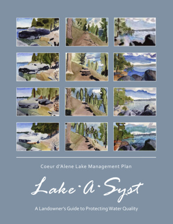
Coeur d’Alene Lake Management PlanA Landowner’s Guide to Protecting Water Quality
A special thanks to Sorensen Magnet School for allowing us to use these students’ artwork on the cover:Avery OwensKessler JohnsonHelenna O’BrienEthan SchwegelJaya MillerLydia HowardKate DuCoeurIan GiffordLubava FedoseyevBrayden LloydIan McClureMary MorseTubbs Hill in Three Views: The Story Behind the ProjectIn May 2011, the 2nd and 3rd grade classes at Sorensen Magnet School spent a full day on Tubbs Hill. They rotated between four stations, learning about native plants, native animals, conservation, and nature drawing, The next day, localartist Jessica L. Bryant (who also taught the drawing segment) came to the school for an artist-in-residence project. Sheworked with twelve 2nd and 3rd graders, three from each class, to paint landscapes of Tubbs Hill. The kids worked fromJessica’s photography of three different views from Tubbs Hill. They worked together in groups of four, all painting thesame view. Jessica focused on teaching value and color, helping the students learn to really see what they were lookingat. The finished paintings were used to generate a compilation poster showing all 12 pieces. The paintings are arrangedby class. The top two rows are the 2nd grade classes; the bottom two rows are the 3rd grade classes. They had just twohours of painting time together spread over two days. The kids showed remarkable focus and dedication to their artwork,and the results are spectacular!Posters are for sale through Sorensen for 15 each.
Coeur d’Alene Basin ĂŶĚŽǁ ŶĞƌ͛ Ɛ ' ƵŝĚĞ ƚŽ WƌŽƚĞĐƟŶŐ t ĂƚĞƌ Y ƵĂůŝƚLJ Sponsored byThe Coeur d’Alene Lake Management PlanState of Idaho, Department of Environmental Qualityand theCoeur d’Alene TribeMolly McMahon, Editor/ĚĂŚŽ ƐƐŽĐŝĂƟŽŶ ŽĨ Žŝů ŽŶƐĞƌǀ ĂƟŽŶ ŝƐƚƌŝĐƚƐMarch 2013
This page intentionally left blank for correct double-sided printing.
Coeur d’Alene Lake Management Plan - Lake*A*Syst Manual: IDEQ (208) 769-1422 and the CDA Tribe (208) 667-5772AcknowledgementsThe initial Lake*A*Syst program in north Idaho was developed for Priest Lake in 2000 by Glen Rothrockof the Idaho Department of Environmental Quality (IDEQ) and Lance Holloway of the Idaho Associationof Soil Conservation Districts (IASCD). The program was sponsored under the IDEQ Priest LakeManagement Plan. In 2005, a Pend Oreille program was developed by Gary Parker, Lake*A*SystCoordinator with the Bonner Soil and Water Conservation District. In 2008, a Hauser Lake program wasinitiated by the Hauser Lake Watershed Coalition and Kootenai Shoshone Soil and Water ConservationDistrict. In 2009, the Lake*A*Syst material was updated for Priest Lake by Molly McCahon,Lake*A*Syst Coordinator with the Bonner Soil and Water Conservation District.Development of the north Idaho Lake*A*Syst program included important contributions fromgovernment agency representatives, private organizations, and many community members. Contributinggroups included: the U.S. Department of Agriculture - Forest Service, Natural Resources ConservationService, Panhandle Lakes Resource Conservation and Development Council, IDEQ, Idaho Department ofLands, Idaho Department of Fish and Game, Idaho State Department of Agriculture, University of IdahoExtension, Panhandle Health District, Pend Oreille Basin Commission, Bonner County, Kootenai County,Bonner Soil and Water Conservation District, Kootenai-Shoshone Soil and Water Conservation District,IASCD, City of Hauser, Hauser Lake Watershed Coalition, Tri-State Water Quality Council, Lake PendOreille Nearshore Total Maximum Daily Load Committee, and involved citizens from the communities ofPriest Lake, Pend Oreille Lake, and Hauser Lake.The Lake*A*Syst program for the Coeur d’Alene Lake Basin was developed according to the Coeurd’Alene Lake Management Plan (LMP), a water quality plan finalized in 2009 and jointly implementedby the Coeur d’Alene Tribe and IDEQ. LMP staff contracted through the Bonner Soil and WaterConservation District to have Molly McCahon (an employee of IASCD) customize and update existingLake*A*Syst materials for the Coeur d’Alene Lake Basin. We gratefully acknowledge Molly for herexcellent work and experience in developing the materials that comprise this manual for home and landowners in the basin. Thank you, Molly, for your patience with the uncountable comments and editingsuggestions that came your way by LMP staff members.Idaho Department of Environmental QualityCoeur d’Alene Regional Office2110 Ironwood ParkwayCoeur d’Alene, Idaho 83814(208) 769-1422Coeur d’Alene TribeLake Management Department424 Sherman Ave., Suite 306Coeur d’Alene, Idaho 83814(208) 667-5772Front Cover Design: Watercolor prints from students of Sorensen Elementary School, Coeur d’AleneBack Cover Design: Coeur d’Alene Tribe GIS DepartmentPrinted on recycled paper, DEQ and Coeur d’AleneTribe, March 2013. DEQ costs associated with thispublication (PID LMPI, CA 12244) are available from theState of Idaho Department of Environmental Quality inaccordance with Section 60-202, Idaho Code.
Coeur d’Alene Lake Management Plan - Lake*A*Syst Manual: IDEQ (208) 769-1422 and the CDA Tribe (208) 667-5772This page intentionally left blank for correct double-sided printing.
Coeur d’Alene Lake Management Plan - Lake*A*Syst Manual: IDEQ (208) 769-1422 and the CDA Tribe (208) 667-5772Introduction to Lake*A*SystLake*A*Syst is an assessment program designed to assist shoreline property owners in making wellinformed decisions about property management. Although the information in this manual is tailored toproperty owners along Coeur d’Alene Lake and surrounding streams and rivers, much of the informationis applicable to anyone concerned with protecting our water resources: business owners, foresters,ranchers, decision-makers, and other community members. Water quality is a shared responsibility.While point source pollution is addressed through federal and state regulations, we rely on our entirecommunity to address nonpoint source pollution that continues to have enormous impacts on ournation’s waters.This manual consists of 11 sections, each addressing a specific topic. Each section is divided into twoparts: an information section and an assessment section for you to fill out. Not every section will beapplicable to your situation, but taken individually, they contain a great deal of information to assist youin becoming an informed steward of the land and water. Each section includes a Resource Directory ofprofessionals from local, state, federal, and non-profit organizations. Most of these agencies exist toassist landowners, and many provide on-site assistance. We encourage you to use these resources, inaddition to other organizations and companies you may be familiar with, to help guide your landmanagement decisions.How to use this manual:1. Read the facts and information at the beginning of each section. Terms in bold italics are definedin the glossary.2. Consider how the best management practices (BMPs) described can be implemented on yourproperty.3. Use the risk assessment worksheet(s) at the end of each section to analyze your property’sspecific needs.4. Use the action worksheet at the end of each section to make a plan to reduce your risks.5. Refer to the resource directory in each section for assistance on implementing your plan.Appendix B provides a compilation of the resource directories.Thank you for doing your part to protect our valuable natural resources.
Coeur d’Alene Lake Management Plan - Lake*A*Syst Manual: IDEQ (208) 769-1422 and the CDA Tribe (208) 667-5772This page intentionally left blank for correct double-sided printing.
Coeur d’Alene Lake Management Plan - Lake*A*Syst Manual: IDEQ (208) 769-1422 and the CDA Tribe (208) 667-5772Table of ContentsSection:1.Stormwater Runoff ManagementWhy is Stormwater Runoff a Problem? .1-1Our Responsibility .1-1Minimizing Stormwater Runoff.1-2Reducing Pollutants in Runoff .1-5Resource Directory.1-8Risk Assessment Worksheets.1-9Action Worksheet .1-112.Lawn and Garden ManagementWhy are Lawns and Gardens a Potential Problem? .2-1Vegetative Buffers .2-2Easy Care Lawns.2-2Garden Wisely.2-5Proper Debris Disposal .2-6Soil Stabilization .2-7Resource Directory.2-8Risk Assessment Worksheets.2-9Action Worksheet .2-113.Safe Drinking WaterIs Your Drinking Water Safe?.3-1Drinking Water Sources.3-1Protect Your Drinking Water .3-2Resource Directory.3-7Risk Assessment Worksheets.3-8Action Worksheet .3-114.Household Wastewater TreatmentIntroduction to Septic Systems.4-1Alternative Treatment Systems .4-2Why Worry About Wastewater? .4-3Installing a Septic System .4-4Maintaining Septic Systems.4-5Septic System Failure.4-6Conserve Water! .4-7Items That Don’t Go Down the Drain.4-7Resource Directory.4-8Risk Assessment Worksheets.4-9Action Worksheet .4-125.Household Hazardous WastesWhy are Hazardous Household Products a Problem?.5-1Product Disposal .5-2Safe Storage .5-3Petroleum Storage .5-4
Coeur d’Alene Lake Management Plan - Lake*A*Syst Manual: IDEQ (208) 769-1422 and the CDA Tribe (208) 667-5772Table of Contents (cont.)Section 5 - Household Hazardous Wastes (cont.)Storage Tanks—Above-ground, Underground, and Basement.5-4Controlling Road Dust .5-6Resource Directory.5-7Risk Assessment Worksheets.5-8Action Worksheet .5-106.New ConstructionWhy is New Construction a Concern? .6-1Pre-Construction Site Planning .6-3During Construction.6-4Sediment Control - Sedimentation .6-6Resource Directory.6-9Risk Assessment Worksheets.6-10Action Worksheet .6-127.Access Roads and Driveway RunoffWhy are Roads an Issue? .7-1Quality Construction - The Bottom Line .7-1Road Design and Layout.7-2During Construction.7-3Drainage Improvement Methods.7-4Ditch Design .7-7Culvert Design for Stream Crossings and Fish Passage.7-8Routine Road Maintenance .7-11Resource Directory.7-12Risk Assessment Worksheet .7-13Action Worksheet .7-148.Riparian, Pasture, and Forest ManagementDo Riparian, Pasture, and Forested Areas need Protection?.8-1Riparian Management .8-1General Planting Guide for Riparian Areas and Vegetative Buffers .8-4Pasture Management .8-6Forest Management.8-8Resource Directory.8-12Risk Assessment Worksheets.8-14Action Worksheet .8-179.Aquatic Invasive SpeciesWhat are Aquatic Invasive Species? .9-1Why Are They Here? .9-1Why Do We Care? .9-1What Can You Do? .9-2Prevention .9-3Early Detection, Rapid Response.9-5Control Methods .9-6Eurasian Watermilfoil .9-8
Coeur d’Alene Lake Management Plan - Lake*A*Syst Manual: IDEQ (208) 769-1422 and the CDA Tribe (208) 667-5772Table of Contents (cont.)Section 9 - Aquatic Invasive Species (cont.)Curlyleaf Pondweed .9-9Brazilian Elodea .9-10Hydrilla .9-11Parrotfeather Milfoil.9-12Yellow Floating Heart.9-13Common Reed.9-14Flowering Rush .9-15Purple Loosestrife .9-16Yellow Flag Iris .9-17Quagga and Zebra Mussels .9-18Crayfish.9-20Asian Clam.9-21Didymo.9-22Resource Directory.9-23Risk Assessment Worksheet .9-24Action Worksheet .9-2510. Boating and RecreationPlay Smart .10-1Personal Watercraft.10-1Boat Sewage and Waste .10-2Boat Maintenance and Operations .10-3Aquatic Invasive Species .10-3No-Wake Zones Prevent Erosion.10-4Recreation Along the Shoreline .10-4Off-Road Vehicles .10-4Resource Directory.10-5Risk Assessment Worksheet .10-6Action Worksheet .10-711. Heavy MetalsHistoric Mining .11-1Nutrient Effects on Heavy Metals.11-2Drinking Water .11-3Health Effects of Metals.11-4Fish Consumption Advisory for Coeur d’Alene Lake .11-5Institutional Controls Program.11-6Protection and Prevention .11-6Resource Directory.11-7Risk Assessment Worksheet .11-8Action Worksheet .11-9Appendix A: Glossary of Key TermsAppendix B: Master Resource DirectoryAppendix C: Citations
Coeur d’Alene Lake Management Plan - Lake*A*Syst Manual: IDEQ (208) 769-1422 and the CDA Tribe (208) 667-5772This page intentionally left blank for correct double-sided printing.
Coeur d’Alene Lake Management Plan - Lake*A*Syst Manual: IDEQ (208) 769-1422 and the CDA Tribe (208) 667-5772SECTION 1STORMWATER RUNOFF MANAGEMENTThis fact sheet addresses the impacts stormwater runoff has on water quality and how you can make a difference with Best Management Practices (BMPs). BMPs are actions you can take to protect our natural resources. The ultimate goal of this information is to minimize the negative impacts of stormwater runoffto lakes, rivers, and streams.1. Read the facts and information in the following pages.2. Fill out the risk assessment worksheets (p. 1-9) in order to analyze your property's specific needs.3. Fill out the action worksheet (p. 1-11), then take action!Why is Stormwater Runoff aProblem?Stormwater runoff is the flow of water from rain ormelting snow that does not soak into the ground due toimpervious surfaces. Under natural forested conditions, stormwater is absorbed into the ground, but asan area becomes developed or altered with structures,roads, and driveways, less water is absorbed into thesoil. Not only does this disrupt the entire water cycle,it increases the amount of water that needs to be diverted (Figure 1-1).Increased runoff is generally channeled into ditches,storm sewers, and road gullies, which often lead tolakes, rivers, and streams. Runoff picks up and carriespollutants such as fertilizers, pesticides, petroleum,heavy metals, and hazardous waste products. Themovement of these materials into surface water createsa number of problems, including excess aquatic plantand algae growth; low dissolved oxygen (used up bydecaying plants); negative impacts to fish, wildlife,and recreation; degraded spawning beds; and murkywater. Runoff that is not diverted flows overland andunmanaged, creates problems such as drinking wellcontamination, flooding, and erosion (Figure 1-2).Our ResponsibilityOur region is widely known for its world class fishing, immense beauty, and good water quality, whichmake it a popular destination for people worldwide.However, increased waterfront development raisesconcerns about how to maintain the good water quality we currently enjoy. If you live on the waterfrontyou have a special responsibility and opportunity toprevent water pollution. One important action totake on your property is the control of stormwaterrunoff. Homeowners are responsible for stormwaterretention or discharge from their property. Yourproperty alone is probably not a significant source ofpollution, but the cumulative effect of numerousproperties can have a substantial impact on waterquality.Figure 1-2. May 2008 photo taken by EPA of flood plumeat mouth of Coeur d’Alene River. Flood events carry thousands of tons of sediment and polluted runoff into Coeurd’Alene Lake.Figure 1-1. Improperly placed sediment controls allow polluted stormwater runoff into storm drain whichflows directly to surface water.1-1
Coeur d’Alene Lake Management Plan - Lake*A*Syst Manual: IDEQ (208) 769-1422 and the CDA Tribe (208) 667-5772Minimizing Stormwater RunoffTraditionally, the objective of stormwater management has been to transport runoff as quickly as possible through the drainage system to prevent floodingand protect lives and property. Years of research nowshows how contaminated stormwater negatively affects public health and wildlife habitat. New practices encourage decreasing runoff rather than merelydiverting it.Reducing the amount of impervious surface on yourproperty and directing runoff into an area where watercan infiltrate are the best ways to minimize runoff.Ideally, stormwater should move slowly and absorbinto the ground. Impervious surfaces are hardenedsurfaces that don’t allow water to pass through. Thesesurfaces include roofs, sidewalks, carports, roads,driveways, and patios (Figure 1-3). As you lookaround your property for stormwater problems, remember that you may not see the impacts created bystormwater coming off your property. Water fromyour land may quickly run off your driveway, alongthe curb, into a clogged culvert, and flood a road twomiles down. In other words, everyone needs to dotheir part. If you reduce stormwater coming off yourproperty, the entire drainage system will have lesswater to manage.Consider stormwater and how it affects your property;walk your property during a heavy rainstorm, andwatch where the water drains. Look for areas of erosion, potential flooding and water draining directly tosurface water.If you have an existing house and landscape, reviewthe BMPs outlined in this section to address anystormwater runoff issues discovered while evaluatingyour property.If you are in the development phase, a general step-by-step process is recommended for property locatednear waterbodies, on steep slopes or gradients, and onland with highly erodible soils. Begin with a qualitysite plan for pre-construction, construction, and postconstruction. Use BMPs, and routinely practice pollution prevention. For more information on site planning and stormwater management, read Section 6,New Construction. Numerous online and communityresources are available (see Resource Directory, p. 18).Figure 1-3. Percentage of impervious surface related to infiltration rates following a 3-inch rain storm.1-2
Coeur d’Alene Lake Management Plan - Lake*A*Syst Manual: IDEQ (208) 769-1422 and the CDA Tribe (208) 667-5772Buildings and LandscapesFor buildings and landscapes, use the followingBMPs: Limit paving, compacted dirt and covered areas. Use permeable pavers, flagstones, river rock orplanted ground covers on patios, walkways andareas around buildings (Figure 1-4). Limit clearing and grading on slopes. Minimize cut and fill for roads, sidewalks, andfootpaths to reduce erosion and still provide access. Preserve existing vegetation. Only disturb areasthat are absolutely necessary for structures and access. Do not compact or pave wasted space such as cor-ners near buildings that are not large enough forparking or driving. Use steps when a walkway must go directly up anddown a slope, particularly near the shoreline. Install a rainwater catchment system to collect andreuse water for irrigation. In this region, a 2,000square foot (ft²) roof could easily generate over41,000 gallons of water a year (Figure 1-5). Install rain gutters and keep them free of debris.Place a rain garden below a downspout instead ofconcrete (Figure 1-6). Use native plants in your landscape, especially as abuffer around surface water. Native plants are verylow maintenance. If you are building a new house or garage, considerpositioning rooftops so they are perpendicular tothe slope. To reduce erosion, avoid creating walking pathsstraight down slopes. Compacted soil on footpathsalso promotes excessive runoff.Figure 1-4. Decorative permeable pavers.Figure 1-6. A rain garden installed below a downspout.Figure 1-5. Rain barrel installed below rain spout.1-3
Coeur d’Alene Lake Management Plan - Lake*A*Syst Manual: IDEQ (208) 769-1422 and the CDA Tribe (208) 667-5772Roads, Driveways, and Ditches Keep culverts unplugged (Figure 1-7); keep drain-age ditches deep and vegetated or rock-filled(Figure 1-8); and keep cut banks (above slope), andfill banks (below slope) from eroding by establishing vegetation. Minimize semi-impervious and impervious surfac-es. Use permeable alternatives wherever possible(Figure 1-9). Incorporate a good gravel base into your privateroads and driveways rather than compacted dirt.Figure 1-8. Recommended ditch design. Locate driveways and all walkways away fromslopes because steeper slopes have greater erosionpotential; if you must cross a hillside, follow thecontour of the slope. Minimize road crossings over waterways and crossat a right angle to the stream if possible. Sweep paved parking areas and walkways, insteadof washing them down with a hose, to prevent sediment, salt, and petroleum products from washingoff in runoff. Cover stockpiles of salt, sand, or soilwith a tarp or store them in a building. Use roadside areas covered with grass for runoffand snow storage instead of impervious and semiimpervious surfaces. Install water bars, rolling dips, trench drains, orFigure 1-9. Permeable pavers ondriveway allow stormwater to infiltrate.other diversion methods on sloping roads anddriveways to slow and divert runoff (Figure 1-10).For diversion techniques, see Section 7, AccessRoads and Driveway Runoff. Use existing natural drainage systems such as val-leys or other low areas instead of digging newditches. Design culverts and drainage structures to handleexcessive amounts of runoff. Assistance is available from numerous public agencies (see ResourceDirectory, p. 1-8).Figure 1-10. Decorative trench drain in driveway directsrunoff to vegetative landscaping for infiltration.Figure 1-7. The result of an undersized/clogged ditch.1-4
Coeur d’Alene Lake Management Plan - Lake*A*Syst Manual: IDEQ (208) 769-1422 and the CDA Tribe (208) 667-5772Reducing Pollutants in RunoffLawn and Garden CareStormwater is unavoidable, but its impacts can bereduced by keeping harmful chemicals and unwantedmaterials out of runoff. Pollution prevention is theeasiest way to keep the Coeur d’Alene Basin safe,clean, and inviting. Sources for concern are baresoils, roads, driveways, and yards. Stormwater andsnowmelt collect and transport the following pollutants to surface and/or ground water:Lawns and gardens near the shore must be carefullyplanned and maintained to prevent possible contamination to stormwater runoff. Grass clippings, excessfertilizer, and other yard wastes will wash away during storm events. Excess fertilizer will ad
4. Use the action worksheet at the end of each section to make a plan to reduce your risks. 5. Refer to the resource directory in each section for assistance on implementing your plan. Appendix B provides a compilation of the resource directories. Thank you for doing your part to protect our valuable natural resources.