Transcription
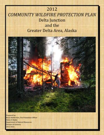
2012COMMUNITY WILDFIRE PROTECTION PLANDelta Junctionand theGreater Delta Area, AlaskaPrepared by:Bruce Balderston, Fire Prevention OfficerState of AlaskaDepartment of Natural ResourcesDivision of Forestry2012-2013
2012 Community Wildfire Protection PlanTable of ContentsSectionExecutive Summary1Community Profile2Community Collaboration3Plan Development Methodology4Community Risk Assessment Ranking5Wildfire Ignition Sources6Firewise Communities USA Program7Community Wildfire Survey Results and Analysis8Proposed Fort Greely Biomass ProjectImpact on Community Wildfire9Community Wildfire Protection Plan-Overview10Community Wildfire Protection Plan-Fire Prevention11Community Wildfire Protection Plan-Fire Suppression12Community Wildfire Protection PlanReduction of Wildfire Impact on the Community13Community Wildfire Protection Plan –Resident Concerns Regarding Wildfire in the Community14Wildland Urban Interface-Hazardous Fuels Reduction Projects15TABLESCWPP-Threat/Risk AnalysisCWPP-Risk Assessment Ranking2007-2012 Wildfire Ignition SourcesSection 5 Table 1Section 5 Table 2Section 6 Table 1APPENDICESCWPP Area Locator Maps (1-6)AppendixACommunity Business and Infrastructure ListAppendixBArea Resident SurveyAppendixCArea Resident Survey ResultsAppendixD
SECTION 12012 CWPPExecutive Summary
2012 Community Wildfire Protection PlanExecutive SummaryThe Delta CWPP has been prepared in accordance with the 2003 “Healthy ForestReforestation Act” (HFRA), which directs communities at risk of wildfires to develop arisk assessment and mitigation plan. Guidance for the Delta CWPP is based on“Preparing a Community Wildfire Protection Plan, 3/2004”, “Alaska InteragencyCommunity Wildfire Protection Plan Guide, 11/2005” and the “Community Guide toPreparing and Implementing a Community Wildfire Protection Plan, 8/2008”.The plan is based on information, data and demographic information dating from 2006.The thrust of the plan, however, is to present a concise overview of what is at risk, whyit is at risk and plans to reduce the threat to life and property from wildland fires in theregion.To match current demographic information (life and property at risk) taking into accountenvironmental factors, a specific and structured methodology is required to assure thatthe plan is reflective of actual wildfire threat and risk and that proposed mitigations willbe effective in addressing these threats and risks. The “methodology” section of thisplan addresses these key foundations of the plan.In addition to the foundation of information to develop a protection strategy there arefour distinct areas on which the overall plan needs to focus:1. Fire Prevention-The simple concept is that if you reduce the number of fireignitions you have reduced the threat to the community.2. Suppression-Once a fire starts, the effectiveness of all of the community’sfirefighting response and how the entities communicate and respond have adirect bearing on the magnitude and result of wildland fires in the community.3. Reduction of Wildland Fire Impact on the Community-When a fire starts andresources have responded to the threat, what programs are in place that willlessen the impact the fire has on the community?4. Resident Concerns Regarding Wildfire in the Community-It is important todiscover and understand what the concerns of residents in the community areregarding wildfire. Focusing on issues that are of little or no interest to thecommunity will insure failure of community-wide action.The information, background, summaries and recommendations in the plan will focus onaddressing these four key areas in the overall development of the plan.Implementation in all four areas is necessary to have a truly effective working plan.
SECTION 22012 CWPPCommunity Profile
2012 Community Wildfire Protection PlanCommunity ProfileDelta Junction is located at the convergence of the Richardson Highway and AlaskaHighway approximately 95 miles southeast of Fairbanks. The city developed along theeast bank of the Delta River, south of its junction with the Tanana River.Delta Junction lies at approximately 64.037780 North Latitude and -145.732220 WestLongitude (Sec. 23, T010S, R010E, Fairbanks Meridian). The area encompasses 17.3square miles of land.The Local Hazardous Mitigation Plan (LHMP) area extends along the Alaska Highwayfrom Johnson River crossing (Milepost 1380 Alaska Highway; 41.5 miles south of DeltaJunction) north to the Fairbanks North Star Borough boundary (Milepost 295Richardson Highway; 69miles north of Delta Junction). It is bordered on the east by aline due north from the Alaska Highway crossing at Johnson River to the boroughboundary and the Delta River on the west.This area of Interior Alaska experiences seasonal extremes. The average lowtemperature in January is -11 degrees Fahrenheit. The average high during July is 69degrees Fahrenheit. Temperatures have been recorded between a low of -63 degreesto a high of 92 degrees Fahrenheit. Average annual liquid equivalent precipitation is 12inches.The communities of the Delta Region vary from the subsistence-based and largelyAthabascan village of Healy Lake, which is not connected by road, to the military baseat Fort Greely, to the largely agricultural community east of Delta Junction. Constructionfor ground-based missile defense at Fort Greely has boosted employment since 2002,and construction employment related to Fort Greely and Pogo Mine should continue tobe high for several years.There has been a noted influx of Slavic immigrants into the Delta area over the last 20years. The Slavic population has risen from a handful of families to more than 100. The2000 census reported more than 300 people of Russian or Ukrainian ancestry. After thenear closure of Fort Greely in the late 1990s, students of Slavic descent comprisednearly 40 percent of the student body—a number that is now closer to 20 percent. ManyDelta area residents of Slavic descent have graduated from the Delta Mine TrainingCenter and are employed at the Pogo Mine on the Goodpaster River, approximately 40air miles from Delta Junction.The population of Delta Junction is approximately 1,158 and approximately 2,355 for theGreater Delta Area. (State of Alaska Hazard Mitigation Plan 2010). (Note: The GreaterDelta Area population includes the population in the unincorporated areas of the planarea. The 2010 U.S. Census, identified these as Big Delta and Deltana)
Delta Junction is strategically located to provide services to summer tourist traffic. TheVisitor Center is located at the "Triangle," where the Alaska Highway meets theRichardson Highway. Delta Junction also has an Elementary School, Middle School,High school (with track and football field) and the Career Advancement Center (tradesschool.Delta Junction and east of the city lie on the east bank of the Delta River about ninemiles south of the confluence of the Delta and Tanana rivers. The community isbordered on the south by the Alaska Range mountain system. Jarvis Creek flowsthrough Fort Greely and into the Delta River at the southern end of Delta Junction. TheGerstle River is southeast of Delta Junction, crossing the Alaska Highway near GeorgeLake Lodge. These three rivers and Jarvis Creek are glacier fed and have broadbraided streambeds.The Delta Area Forestry Orientation Guide 2009, Delta Area Overview states that localvegetation varies from highly volatile Black Spruce to the fire resistant hardwoods, suchas: Balsam Poplar, Aspen, and Paper Birch. Extensive stands of Black Spruce can befound intermixed with tussocks and bogs in the lowland flats and on north slopes. WhiteSpruce stands are normally found along the river bottoms and south slopes. Hardwoodstands are also found on south slopes and sites with well-drained soils. The mountainpasses are characterized by stands of stunted white spruce along the slopes up to3,300 feet elevations.
SECTION 32012 CWPPCommunity Collaboration
2012 Community Wildfire Protection PlanCommunity CollaborationDelta Area Forestry has been working with Firewise area protection concepts since themid 1990s, evaluating home sites, educating the public, and extensively mapping roadand Firewise rated structure locations.In 2001 the document “Alaska Communities At Risk From Wildfire”(January 2001)(appendix C) placed both Delta Junction and North Delta Junction in “Ranking1”(highest) for risk due to “Fire Behavior Potential” in conjunction with five other factors.Healy Lake community received a “Ranking 2”. Fort Greely and Whitestone communityreceived a “Ranking 4”.The Delta Community Wildfire Protection Plan (CWPP) is a collaboration of the peopleof the area as represented by City of Delta, Deltana Community Corporation, LocalEmergency Planning Committee (LEPC), Delta Junction Volunteer Fire Department ,Rural Deltana Volunteer Fire Department, Deltana Local Hazard Mitigation Plan (LHMP)Group, Fort Greeley Fire Department and Delta Area Forestry. Meetings have beenheld with the individual signers and/ or groups involved in the development of theCWPP.Delta Area Forestry also distributed the Community Wildland Fire Protection PlanArea Resident Survey (See Appendix C) to solicit community concerns regardingwildfire in the community. The results of this survey were used in the formulation of theCWPP Action Plan (See Section 7)The draft copy of the CWPP was distributed to the signers for review and comment andthe final product will be delivered to the signers by April 1, 2013.
SECTION 42012 CWPPPlan Development Methodology
2012 Community Wildfire Protection PlanPlan Development MethodologyThere are five key areas that have been defined in the development of the CWPP: Community Leadership Community Awareness Demographic Data Wildland Fire Risk and Threat Analysis Wildfire Ignition DataCommunity LeadershipA meeting was held with the following community groups or individuals to explain whatthe methodology, process, and timeline would be for the development of the plan :State of Alaska Forestry-Delta JunctionAl Edgren - Area ForesterCity of Delta Junction-City CouncilPete Hallgren - MayorMike Tvenge - City AdministratorRural Deltana Community CorporationBoard of DirectorsPaul Knopp - PresidentFort Greely Fire DepartmentJim Degnan - ChiefDelta Junction Volunteer Fire DepartmentVernon Heintz - ChiefRural Deltana Volunteer Fire DepartmentTim Castleberry - ChiefLocal Emergency Planning CommitteeMike Paschall - Chair
Community AwarenessA “firewise” questionnaire was developed to solicit community participation inexpressing citizen concerns and perceptions of needs regarding wildfire in thecommunity. The questionnaire was made available via the local newspaper, theinternet, at the Delta Forestry Office and at the Rural Deltana Fair. Results weretabulated and taken into consideration in the formulation of the plan. (See Appendix Dfor “Area Resident Firewise Survey”)Demographic DataIn analyzing assets threatened by wildfire, the area that comprises the Delta AreaForestry Protection area (See Protection Area Map) was divided into nineteen (19)geographic areas based on geographic and ownership parameters. For example, PogoMine and Fort Greely are separate areas based on location and the fact that the mine isprivate industry and Fort Greely is a Federal Military Installation. Each area is referredto as an “Area” for the purpose of the CWPP(See Appendix A for Locator Maps ofthe “Areas”).For each area the number of housing units was established. The number of housingunits was then used to rank each of the Areas, one through nineteen (1-19) numberone being the highest number of housing units and nineteen being the lowest.A review of the infrastructure list from the “2011 Delta Junction and Deltana LocalHazard Mitigation Plan” was reviewed, revised, and each of the items was assignedby location to one or more of the nineteen Areas.(See Appendix B for the CommunityBusiness and Infrastructure list.) Based on the numbers and significance of thebusinesses and infrastructure each area was assigned a value with one being thehighest value and five being the lowest value.The Areas were placed in a matrix entitled “Community Wildfire Prevention PlanRisk/Threat Analysis. (See the Community Wildfire Prevention Plan- Risk/ThreatAnalysis and Risk Assessment Ranking in the following section)Wildland Fire Risk and Threat AnalysisFor each of the nineteen areas a review was done to analyze the type and density ofthe fuels that would impact housing units, businesses, and infrastructure in a wildfire.This was listed as “Fuel Type/Density Threat”.The results of this analysis were ranked on a scale of one to five with one being themost volatile and densest of fuels with five representing no volatile fuels and no density.A second threat factor that was reviewed was “Threat of Fuels to Assets”. This wasan area by area analysis of the proximity fuels to assets and breaks between fuel loadsand assets. These were ranked on a scale of one through five with one being thehighest threat and five being the lowest threat.
Once these two categories were added to the matrix, a total score was computedincluding the number of housing units ranking, high value structures and communityinfrastructure ranking, fuels type/density threat and threat of fuels to assets rank. Basedon the total numerical score for each of the nineteen Areas, a Risk Assessment Rankwas established. See the Community Wildfire Prevention Plan- Risk/ThreatAnalysis. (Section 5-2)The results of this matrix were added into a second matrix entitled Community WildfirePrevention Plan- Risk Assessment Ranking. This matrix simply reviews theassessment categories and lists the Areas from number one to nineteen with one beingthe most at risk of loss and nineteen being the least at risk of loss.Wildfire Ignition DataThe final fire factor that was reviewed was the actual history of the ignition sources ofwildfires in the area over the past six years. The 2012 data is only seasonal informationthrough August 6, 2012. (See Tables 6-1 for 2007-2012 Wildfire Ignition Data)
SECTION 52012 CWPPCommunity Risk Assessment Ranking
2012 Community Wildfire Protection PlanCommunity Risk Assessment RankingThe CWPP Threat/Risk Analysis Table is located in Table Section 5-1. This table liststhe nineteen Areas in order 1-19, followed by the indicators of threat and risk. Thesecond table (Table Section 5-2) is the CWPP-Assessment Ranking in which each ofthe Areas are listed in order of highest to lowest risk of loss of community assets inrelation to wildland fire threat.Overall comments about wildland fire concerns for each of the areas:1. Pogo Mine (Area 17).Pogo mine is well situated with on-site firefightingequipment and personnel as well as aviation resources. Delta Area Forestryhas toured the mine and made specific recommendations for additionalclearances to protect structures. Forestry has also requested a generalizedtriage map indicating structure survival priorities in the event it is called up torespond to a fire at or close to the mine.2. Fort Greely (Area 15)- Fort Greely has equipment and personnel to respondto a wildland fire. They have mutual aid wildland fire response agreements inplace.The following twelve areas have a between 100 and 241 homes, businesses and/orinfrastructure, with high Fuel Type/Density Threat and/or Threat of Fuels to Assetindicators.3. NE Nistler (Area 7)4. Nistler/CW (Area 8)5. N. Delta Junction (Area 2)6. N. of Nistler (Area 6)7. N. Nistler to CWR (Area 9)8. Delta Junction (Area 1)9. Greater Delta (Area 4)
10. W Tan Loop Ext-East (Area 11)11. ALCAN to CW Rd. (Area 3)12. Greater Delta-East (Area 5)13. W Tan Loop Ext (Area 10)14. Big D (Area 12)The following five areas require targeted community based mitigations. These five areashave less than 50 residences, with little to no businesses and/or communityinfrastructure. Because of their distance and separation from other segments of thecommunity they will require location by location wildland fire mitigations.15. Quartz (Area 13)16. Goodpaster (Area 19)17. Tenderfoot (Area 14)18. Whitestone (Area 16)19. Healy Lake (Area 18)
SECTION 62012 CWPPWildfire Ignition Sources
2012 Community Wildfire Protection PlanWildlfire Ignition SourcesThe number of wildfires, the location and sometimes the severity of a fire is integrallylinked to the ignition source of wildfire. Once a fire starts, the weather, topography,suppression response times, issues of manpower, training and equipment come intoplay. However, prior to the start of a wildland fire, for each type of ignition source thequestions should be: Can we reduce or eliminate the frequency ignitions?To answer this question there must be a review of the data related to ignitions within theCWPP area. Since 2007 the CWPP area has experienced an average of 26 humancaused ignitions per season with an average of 3 lightning caused ignitions. (See Table6-1- “Wildland Fire Ignition Sources 2007-2012”)With lightning-caused fires the State of Alaska Division of Forestry has an aggressiveand ongoing program of doing flight detection surveys. The monitoring of lightningactivity is frequently done during fire season, ranging from daily to hourly monitoringdepending on weather and fuel conditions.A further breakdown of human caused ignitions shows that as a six year average thenumber of ignitions caused by people’s behavior is nearly 75%. In terms of protectingthe community, 75% of all wildfire could be eliminated from the community by a changein people’s behavior. Therefore a key component in the CWPP, will address a multiphase plan to change the public’s behavior in relation to safely igniting fires.
SECTION 72012 CWPPFirewise Communities USA Program
2012 Community Wildfire Protection PlanFirewise Communities USA ProgramThe Firewise Communities USA program is managed by the National Fire ProtectionAssociation. The aim of the program is educate the general public about the risk ofwildfire in the community and ultimately to reduce that risk.The program is a framework to bring community leaders together in a unified format toeducate the community and put fire authorities and experts in touch with the communityto reduce the impact of wildfire.The first step on the path to national recognition as a Firewise Community is thedevelopment of the Community Wildfire Protection Plan(CWPP).The benefits of becoming a Firewise Community include educating the community tothe threat and risk of wildfire, taking action to risks, opportunities for grant funding andassistance to continue and improve the program in the community.Under the right weather and fuel conditions, no community is safe from the potentialdevastation that wildfire poses to life and property. There are numerous case historiesof dozens, even hundreds of homes lost in a single fire. In 2011 a tree blown onto apower line destroyed 1,660 homes in Bastrop, Texas. With dry fuels and high winds thefire destroyed 600 homes in less than twenty-four hours with an additional loss duringthe following forty-eight hours. The miraculous fact of this fire is that driving past ten,twenty, thirty houses laying in ash piles, occasional single homes were unscathed.Luck? Luck had nothing to do with the fact that these homes survived while neighboringresidences were destroyed. The homes that survived the fire did not have fuels thatcarried the fire to the house, and they were protected from embers and firebrandsentering into or under the homes.The Bastrop fire is a perfect case study for the value of the concepts of the FirewiseCommunity USA program.
SECTION 82012 CWPPCommunity Wildfire Survey Results
2012 Community Wildfire Protection PlanCommunity Wildfire SurveyResults and AnalysisDuring the month of June and July 2012 a “Community Wildland Protection PlanArea Resident Survey” was conducted.(See Appendix C for survey). There were 120responses. This represents approximately 6% of the area’s population over the age ofeighteen.One hundred (100) surveys were collected at the Delta Forestry exhibit at the DeltanaFair with twenty (20) surveys conducted at informational meetings held in thecommunity to explain the CWPP process.The survey focused on three areas including:1. Residents’ concerns if wildland fire threatens their community.2. Residents’ concerns if wildland fire threatens their homes.3. Prioritized needs for the community regarding the threat of wildland fire.A summary of the results are as follows:(The exact computation of the survey results can be found in the Appendix D)Question:If wildland fire threatens Delta Junction or the Greater Delta Area, what are yourconcerns?Response RankAccurate informationLack of responders and equipmentPreparedness planningCoordination of activitiesOther12234
Question:If wildland fire threatens your home what are your concerns?Response RankResponse time for fire assistanceYour home’s ability to withstand firePreparedness planningCoordination of activitiesOther12345Question:Please prioritize the following from Greatest Need #1 to Lowest #6Response RankEmergency Preparedness and Communication ProgramsCommunity and Home Owner Wildland Fire Education ProgramsWildland Fire Suppression ProgramsWildland Fire Prevention ProgramsHazardous Fuels Reduction ProgramsRestoration of Fire-Adapted Ecosystems Programs122345The following conclusions can be reasonably drawn from the survey results.If wildland fire threatens Delta Junction or the Greater Delta Area, what are yourconcerns?Resident’s number one concern when wildfire occurs in the community is accurateinformation.Two items which tied for the second most important concern was-lack of respondersand equipment and preparedness planning.It can be said that these concerns can be addressed by improved communicationswhen wildfires occur. By providing timely, accurate and detailed information the arearesidents will be informed and be aware of the effectiveness and responsiveness ofarea responders, equipment and planning. Specific recommendations regarding theseconcerns are addressed in the Community Wildfire Protection Plan(See sections 1114)
If wildland fire threatens your home what are your concerns?Resident’s number one concern when wildfire threatens their homes in the community isresponse time for fire assistance.The second most noted concern was owner’s home’s ability to withstand fire.It can be said that these concerns can be addressed through improved communicationsas previously discussed as well as the development of a community-wide Firewise USAprogram implementation. Specific recommendations regarding these concerns areaddressed in the Community Wildfire Protection Plan (See sections 11-14).Please prioritize the following from Greatest Need #1 to Lowest #6Resident’s number one wildfire priority was listed as emergency preparedness andcommunications programs.The second most noted concern was both community and home owner wildland fireeducation programs and wildland fire suppression programs.Based on the community’s prioritizing of wildland fire issues they strongly reinforced theconcerns of communication, education and suppression programs. Specificrecommendations regarding these concerns are addressed in the Community WildfireProtection Plan (See sections 11-14).
SECTION 92012 CWPPProposedFort Greely Biomass ProjectImpact on Community Wildfire
2012 Community Wildfire Protection PlanProposed Fort Greely Biomass ProjectImpact on Community WildfireSiemens has entered into an agreement with the Department of Defense to begin toexplore a “biomass” heat generation plant at Fort Greely. The purpose of the plan is toreplace more costly fossil fuel with less costly “biomass” fuels.Though the timing of the project and the exact details of biomass locations, multipleagency approvals and a myriad of other details have not been completed there areseveral solid concepts that emerge from this type of project.1. The requirements for the project on an annual basis will be approximately110,000 tons annually. This converts to one to three thousand acres annually.2. The biomass will have a value which is yet to be determined, however, aconservative estimate is 30- 40 per ton or 210 - 280 per acre.Based on the calculated need for biomass at Fort Greely and the value of the biomassthe following conclusions can be reasonably drawn. Vendors providing the biomass to Fort Greely will be willing to paycompensation to land owners for clearing acres of plant material. Home owners, business owners, government agencies and other civicorganizations will have a financial incentive to remove hazardous fuelsfrom their properties in exchange for financial compensation. Through a properly managed, unified area effort removing hazardous fuelloading near residences, businesses and other infrastructure will reducethe risk of destruction from wildfire. By incentivizing fuels reduction a new and profitable alternative will beavailable to area residents in lieu of individual burns on their property-asignificant cause of area wildland fires.Though the biomass project is not completed or assured, it is clear that if the projectproceeds it can have a major positive impact on wildfire prevention and reduction ofhazardous fuels, thus lessening the threat of the impact of wildland fire on thecommunity. Details of the application of these concepts are discussed in theReduction of Wildfire Impact on the Community (Section 13).
SECTION 102012 CWPPCommunity Wildfire Protection Plan
2012 Community Wildfire Protection PlanThe Protection PlanThe protection plan that follows is broken down into the following four categories: Fire prevention (Section 11)Fire suppression (Section 12)Reduction of wildfire Impact on the community (Section 13)Resident Concerns Regarding Wildfires in the Community (Section 14)Within each of these areas there are two ingredients that are discussed. The first is“Current”. This information addresses what is currently in place to respond and copewith each of the four categories in the plan. The second is the “Plan” proposed forimproving each of the categories.Under the plan items for each of the categories additional plan details cover these threekey components: Action- What is proposed Purpose- What results can be expected through implementation ofthe action Timeline- A proposed start date, frequency and time continuum foreach actionTo implement the plan it will be critical for all signers of theCommunity Wildfire Protection Plan to meet as early as possible priorto the start of the 2013 fire season in the Delta Area. At this meetingthe signers should review the plan, determine who will take activeroles regarding implementing, coordinating, monitoring andaccessing each item in the plan.
SECTION 112012 CWPPFire Prevention
2012 Community Wildfire Protection PlanFIRE PREVENTIONCurrentFire PreventionDelta Forestry has a Fire Prevention program whichincludes student and community education regardingsafe burning practices.Area burning falls under specific state statutes whichincorporate proven safe burning practices. Key to theprogram is the permitting program which extends fromApril 1-August 31st each season.A significant safety feature of the permitting program isthe requirement that permits be activated by calling the“Delta Forestry Burn Permit Line” before burning. Thismust be done for each day one plans to burn. On a dailybasis Forestry knows who is burning, where they areburning and contact telephone numbers. When a permitis activated the caller is informed as to whether the daythey are calling is a “burn day” or “no burn day” based onobserved and predicted weather.A permit required for larger burns that requires a sitevisit/inspection during which time the exact parametersof the proposed burn are spelled out in detail in thepermitting process.In the event of burning that is not compliant, StateForestry has the legal authority to issue written warningsas well as misdemeanor criminal citations.PLANFire PreventionActionImprove the burn permit program to include permits thatare numbered and each time the permit is activated theburn permit number is listed.PurposeFor residents who burn more frequently, this change willhelp fire prevention personnel to make contact, to offerassistance with information on safe and effective burnpractices, conditions and fire considerations. Theintended effect is to reduce human caused fires that arethe result of unsafe burning practices primarily due tolack of experience and training regarding fire.TimelineThis program would be best if in place by April 1, 2013and run through August 2013.ActionIncrease the number of wildland fire informationalarticles in the local newspaper and expand theinformation to local radio stations and websites.
PurposeTo educate the public about burning permits, safeburning, and other wildland fire informationTimelineThese actions should be started by mid-March 2013.This should continue through the fire permit season, untilAugust 31 each year.
SECTION 122012 CWPPFire Suppression
Community Wildfire Protection PlanFIRE SUPPRESSIONCurrentFire SuppressionPrimary wildfire suppression in the community restsinitially on Alaska State Forestry-Delta Junction Station.Trained, qualified suppression personnel are typically onduty from mid-March though Mid-August annually. Anarray of fire apparatus including a model 212 helicopterare staffed as well as hand crews, all available torespond to fire calls.Community firefighting personnel and equipmentrespond to wildland fire calls with State Forestry. Theseinclude Fort Greely Fire, Rural Deltana Volunteer FireDepartment and City of Delta Volunteer Fire Department.The combined forces of wildland fire response in thecommunity has to date been quite effective in terms ofprotecting life and property.All of the responding wildland fire organizations in thecommunity have a his
Delta area residents of Slavic descent have graduated from the Delta Mine Training Center and are employed at the Pogo Mine on the Goodpaster River, approximately 40 air miles from Delta Junction. The population of Delta Junction is approximately 1,158 and approximately 2,355 for the Greater Delta Area. (State of Alaska Hazard Mitigation Plan .