Transcription
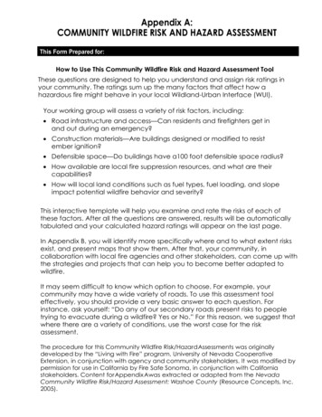
Appendix A:COMMUNITY WILDFIRE RISK AND HAZARD ASSESSMENTThis Form Prepared for:How to Use This Community Wildfire Risk and Hazard Assessment ToolThese questions are designed to help you understand and assign risk ratings inyour community. The ratings sum up the many factors that affect how ahazardous fire might behave in your local Wildland-Urban Interface (WUI).Your working group will assess a variety of risk factors, including: Road infrastructure and access—Can residents and firefighters get inand out during an emergency? Construction materials—Are buildings designed or modified to resistember ignition? Defensible space—Do buildings have a100 foot defensible space radius? How available are local fire suppression resources, and what are theircapabilities? How will local land conditions such as fuel types, fuel loading, and slopeimpact potential wildfire behavior and severity?This interactive template will help you examine and rate the risks of each ofthese factors. After all the questions are answered, results will be automaticallytabulated and your calculated hazard ratings will appear on the last page.In Appendix B, you will identify more specifically where and to what extent risksexist, and present maps that show them. After that, your community, incollaboration with local fire agencies and other stakeholders, can come up withthe strategies and projects that can help you to become better adapted towildfire.It may seem difficult to know which option to choose. For example, yourcommunity may have a wide variety of roads. To use this assessment tooleffectively, you should provide a very basic answer to each question. Forinstance, ask yourself: “Do any of our secondary roads present risks to peopletrying to evacuate during a wildfire? Yes or No.” For this reason, we suggest thatwhere there are a variety of conditions, use the worst case for the riskassessment.The procedure for this Community Wildfire Risk/Hazard Assessments was originallydeveloped by the “Living with Fire” program, University of Nevada CooperativeExtension, in conjunction with agency and community stakeholders. It was modified bypermission for use in California by Fire Safe Sonoma, in conjunction with Californiastakeholders. Content for Appendix Awas extracted or adapted from the NevadaCommunity Wildfire Risk/Hazard Assessment: Washoe County (Resource Concepts, Inc.2005).
1. AccessDesign aspects of roadways influence the hazard rating assigned to a neighborhood. Roadsthat are steep or less than twenty feet in width often impede two-way movement of vehiclesfor resident evacuation and access for fire suppression equipment. Hairpin turns and cul-desacs with radii of less than 45 feet can cause problems for equipment mobility. Visible, fireresistant, street and address identification and adequate driveway widths also reduce theoverall neighborhood hazard rating.Primary roads are those that most people use to access secondary roads and/orhomes. A primary road is typically paved and maintained by the County or the State.Primary Roads:o Two or more primary roads.1o One road or loop road (exit possible in two directions).3o One road in, one way out (one road, dead end) . 5At the narrowest point, primary roads areo More than 24 feet . 1o More than 20 feet and less than 24 feet . 3o Less than 20 feet. 5Slope:o Road grades of 5% or less. 1o Road grades more than 5% . 3Secondary Roads are smaller roads that are used to access homes or neighborhoods.They may or may not be paved or maintained by the County or the State.At the narrowest point, secondary roads areo More than 24 feet . 1o More than 20 feet and less than 24 feet . 3o Less than 20 feet. 5Secondary road terminus:o Loop roads or cul-de-sac with outside radius of 45' or greater . 1o Dead-end roads 200' or less in length . 3o Dead-end roads greater than 200'. 5Slope:o Road grades of 5% or less. 1o Road grades more than 5% . 3Secondary roads in our area are:o Mostly paved (more than 80%-100%) . 1o Some are paved (50%-79%) . 3o Few are paved (less than 50%) . 52 of 8
Accessibility: Fire trucks are very large, and can be difficult to maneuver. Can a largetwo-wheel drive truck drive up the road? Can two trucks pass each other side by side?Are there sufficient turnout spots where trucks can turn around? Hint: Think of UPS trucks.Two-wheel drive trucks can easily handle road surface and slopeand can pass each other side-by-side without pulling over . 1Narrow road surface and/or roadside vegetation make it difficult forvehicles to pass side by side, but vehicles don’t have to back up formore than twenty five feet for turnaround . 3Narrow road surface and/or roadside vegetation with limited turnarounds (vehicles have to back up more than 150') . 5oooBridges & Gates:Some fire departments will not drive over a bridge that has not been rated for weight.No bridges . 0All bridges in the area are rated for heavy vehicles . 1There are a few unrated bridges . 3Most bridges are unrated . 5Wood bridges can burn in wildland fires, rendering them impassible.No wood bridges . 0All bridges have non-combustible surface and structure.1Some secondary road bridges have wooden surfaces or structure . 3Some primary roads have wooden surfaces . 5Gates:No gates . 0Gates are equipped with fire dept access systems or no gates .1Most gates are equipped with fire department access systems . 3Locked gates will impede emergency access . 5Roadside Vegetation 10 feef from usable road edge :Grasses are mown to less than 4 inches, trees and brush are trimmed toprovide 10' of horizontal clearance, and 15' ofvertical clearance. 1oRoadside vegetation is mostly well maintained, but some areas needimprovement . 3Tall grass, brush and trees border and overhang the roadway . 53 of 8
SignageStreet and home address signs should be metal with reflective numbers on noncombustible posts. Signs need to be visible from any point of entry and not obscured byvegetation. Signs made from combustible materials won't survive the wildfire!Street signsPresent 90-100% . 1Present 75-89% . 3Present less than 75% . 5Address signs (house numbers)Present 90-100% . 1Present 75-89% . 3Present less than 75% . 52. Built EnvironmentWhen paired with good defensible space, appropriate home construction andmaintenance can help homes survive wildfire ignition. Vulnerable points on homesinclude roofs, gutters and eaves, venting, attachments such as decks and fences,windows, and siding. Chapter 7A of the California Building Code applies to newconstruction in designated wildfire-prone (WUI) areas. In addition to noncombustibleand ignition-resistant materials, Chapter 7A uses State Fire Marshal–approved standardtest methods that provide a way to evaluate and compare the performance ofexterior-use construction materials. Homes built after 2007, when California adopted theWUI Building Code, will have many important features to help prevent home ignition.You can learn more about home hardening at on the Insurance Institute for Businessand Home Safety website.Percentage of buildings in your area constructed or modified after 2007:90-100% . 175-89% . 3Less than 75% . 5Roofing materialsNon-combustible covering 90-100% . 1Non-combustible covering 80-90% . 5Non-combustible covering 70-80% . 8Non-combustible less than 70% . 10Siding materialsNon-combustible siding more than 75% . 1Non-combustible siding less than 75% . 5Unenclosed features (decks, wooden attachments such as fences, etc.)Less than 25% . 125-50% . 3More than 50% . 54 of 8
3. UtilitiesOverhead power lines can be a potential ignition source for wildfires. PG&E shouldregularly maintain vegetation near poles, and beneath power lines and transformers,as fires have been known to start from arcing power lines during windy conditions. Ifyou are concerned about vegetation that may pose a risk to electrical lines, call PG&Eat 1-800-PGE-5000.Utility ignition riskoAll utility lines are underground. 0Utility lines all above ground. 34. Defensible SpaceFuels are simply anything that can burn. All plants, from grasses to redwood trees, arefuels. It is also important to remember that the human-built environment of homes arepart of the fuels component in your area. The type, density, and condition ofvegetation, the homes themselves, the presence of other combustible materials (forexample wood piles, wooden fencing) together influence the ease of ignition,intensity, and duration of the fire. Defensible space is one of the factors thathomeowners can modify in order to improve the chances that a home or otherproperty avoids damage from a wildfire.Average lot size10 acres or larger . 11 to 10 acres . 3Less than 1 acre . 5Defensible space70% or more adequate . 130-70% adequate . 3Less than 30% adequate . 55. Fire ProtectionKnowledge of the capabilities or limitations of the fire suppression resources in aneighborhood can help municipality officials and residents take action to maximize theresources available. Factors considered in the assessment include:A. Availability, Number, and Training Level of Firefighting Personnel. When a fire begins inor near a neighborhood, having the appropriate firefighting personnel available torespond quickly is critical to saving structures and lives. Whether there is a local paidfire department, volunteer department, or no local fire department affects how longit takes for firefighters to respond to a reported wildland fire or to a threatenedneighborhood.B. The Quantity and Type of Fire Suppression Equipment has an important role inminimizing the effect of a wildfire on a neighborhood. Wildland firefighting requiresspecialized equipment.C. Availability of Water Resources is critical to fighting a wildland fire. Whether there is acommunity water system with adequate fire flow capabilities, or whether firefightersmust rely on local ponds or other drafting sites, affects how difficult it will be forfirefighters to protect the neighborhood.5 of 8
Water sourceo 500 gpm hydrants within 500' of structures . 1o 500 gpm hydrants or draft source within 1000' of structures . 2o Water source 20 minutes away roundtrip . 5o Water source 45 minutes away roundtrip . 10Fire department/protection district within 15 minuteso Career Department . 1o Combination Career/Volunteer . 3o Volunteer with Seasonal Staffing . 5o All Volunteer Department . 7o No Organized Department or extended response times . 106. Fire BehaviorPhysical conditions include slope, aspect, topography, typical local weather patterns, windpatterns, fuel type, and fuels density. With the exception of changes to the fuelcomposition, the physical conditions in and around a neighborhood cannot be altered tomake the neighborhood more fire safe. Therefore, an understanding of how these physicalconditions influence fire behavior is essential to planning effective preparedness activitiessuch as fuel reduction treatments. Physical conditions considered in the assessment include:A. Slope, Aspect, and Topography. In addition to local weather conditions, slope,aspect, and topographic features are also used to predict fire behavior. Steep slopesgreatly influence fire behavior. Fire usually burns upslope with greater speed andlonger flame lengths than on flat areas. Fire will burn downslope; however, it usuallyburns downhill at a slower rate and with shorter flame lengths than in upslope burns.East aspect slopes may experience afternoon downslope winds that may rapidlyincrease downhill burn rates. West and south facing aspects are subject to moreintense solar exposure, which preheats vegetation and lowers the moisture content offuels. Canyons, ravines, and saddles are topographic features that are prone tohigher wind speeds than adjacent areas. Fires pushed by winds grow at anaccelerated rate compared to fires burning in nonwindy conditions. Homes builtmidslope, at the crest of slopes, or in saddles are most at risk due to wind-pronetopography in the event of a wildfire.B. Fuel Type and Density. Vegetation type, fuel moisture values, and fuel density arounda neighborhood affect the potential fire behavior. Areas with thick, continuous,vegetative fuels carry a higher hazard rating than communities situated in areas ofirrigated, sparse, or non-continuous fuels. Dry weather conditions, particularlysuccessive years of drought, in combination with steep slopes or high winds cancreate situations in which the worst-case fire severity scenario can occur.CAL FIRE Fire and Resource Assessment Program (FRAP) Maps: California Department ofForestry and Fire Protection (CDF) has mapped areas of significant fire hazards based onfuels, terrain, weather, and other relevant factors. All of the State Responsibility Areas inCalifornia have been mapped as moderate, high or very high Fire Hazard Severity Zones.You can view maps for your area on the FRAP website at frap.fire.ca.gov/.6 of 8
FRAP Fire Hazard Severity Zone: Please download the FRAP maps from frap.fire.ca.gov or ask CAL FIREpersonnel for a copy. If you have GIS mapping capability, determine the percentage of each FHSZthat you have in the project area. If you can’t do it by GIS, an approximation is fine.Enter the percentages of the FHSZs below, then use those values to choose a value.:Very High FHSZ.High FHSZ.Moderate .Predominant FSHZModerate FHSZ. 3High FHSZ. 5Very High FHSZ. 7Slopeoooo%%%8% or less . 18% - 20% . 420% - 30% . 7More than 30% . 10Predominant aspecto North . 1o East . 3o West . 7o South . 10Fuelso Light density . 1o Medium density . 3o High density . 5Fire behavior situationso Situation #1 - Fine and/or sparse fuels surround structures; infrequentwind exposure; flat terrain with little slope and/or north aspect. Nolarge wildland fire history and/or moderate fire occurrence. . 3o Situation #2 - Moderate slopes; broken moderate fuels; some ladderfuels; composition of fuels is conducive to torching and spotting;conditions may lead to moderate suppression success; some firehistory and/or moderate fire occurrence. . 7o Situation #3 - Continuous fuels in close proximity to structures;composition of fuels is conducive to crown fires or high intensitysurface fires; steep slopes; predominately south aspects; dense fuels;heavy duff; prevailing wind exposure and/or ladder fuels that mayreduce suppression effectiveness; history of some large fires and/ormoderate fire occurrence. . 107. Contributing Risk FactorsPlease select the contributing risk factors on the table on Page 8.8. Risk and Hazard Assessment SummaryBased on the inputs entered into Sections 1 through 7, the community's risks and hazardsare summarized in the "Ignition Risk and Hazard Assessment Overview."7 of 8
IGNITION RISK AND HAZARD ASSESSMENT OVERVIEW FORFACTORSFACTORSRATINGRATINGIGNITION RISK ASSESSMENTHAZARD ASSESSMENTCONTRIBUTING RISK FACTORSACCESSHistory of LightningChooseIngress/EgressCamping ActivitiesChooseWidth of Primary RoadHigh Level of visitors/activitiesChooseUnderstory receptive to ignitionChooseThick brush and treesChooseUnmaintained Powerline CorridorsChooseHigh fuel loadsChooseHigh WindsChooseHistory of fire ignitionsChooseAdd other risk factorChooseAdd other risk factorChooseAdd other risk factorChooseAdd other risk factorChoosePassibilitySecondary Road TerminusPrimary SlopeStreet SignsAddress SignageRoadside VegetationNarrow SecondarySecondary PavedSecondary Road SlopeUnrated BridgesWooden BridgesGatesBUILT ENVIRONMENT2007 StandardsRoofing MaterialsSiding MaterialsFinal ScoresUnenclosed FeaturesSummary Rating10Summary Rating / ScoreHazard CategoryScoreLow Hazard 41Moderate Hazard41-60High Hazard61-75Very High HazardUTILITIESSPACEDEFENSIBLEUtility IgnitionRiskLot SizeDefensible SpaceFIRE PROTECTIONWater SourceFire Protection76 FIRE BEHAVIORFire Hazard Safety ZoneSlopeAspectFuelsFire Behavior¹ Summary rating for Ignition Risk Assessment is ajudgment call determined by planning committee.Clear Form8 of 8
Use this chart to consider which projects might be tackled, and how. Some Green colored risks could potentially betackled by neighborhood groups for little or no cost. The risks in the yellow category may need considerable planningand perhaps funding, but are modifiable. The Orange risks are physical features or infrastructure that are not easilymodified. Risks in this area will be better modified by education and planning.Risks that can probably be modifiedAccessGatesRoadside vegetationSignageStreetHouseHome Hardening/ConstructionRoofingSidingUnenclosed FeaturesDefensible SpaceDefensible SpaceMitigation Strategies Include:Risks that possibly can be modifiedAccess: BridgesUnrated BridgesWood BridgesWater and FuelsWater SourcesFire Behavior (stragegic fuel breaks)Mitigation Strategies Include:Fuels Density (fuels modification)Risks that cannot likely be modifiedACCESSPrimary Roads outPrimary Road widthPrimary Road SlopeSecondary widthSecondary TerminusSecondary SlopeSecondary SurfaceUtilitiesUndergroundFire BehaviorFire Hazard Severity ZonesSlopePredominant AspectEvacuation Planning, install "Knox Keys"Fuels Management, education, fundingEducation, outreach, fundingEducation, outreach, fundingEducation, outreach, retrofit, fundingEducation, outreach, retrofit, fundingEducation, outreach, retrofit, fundingEducation, outreach, funding, inspectionsEvacuation Planning, modificationEvacuation Planning, modificationDevelop further sources.Planning, funding, education, outreachPlanning, funding, education, outreachMitigation Strategies Include:Evacuation PlanningEvacuation PlanningEvacuation PlanningEvacuation PlanningEvacuation PlanningEvacuation PlanningEvacuation PlanningEducation, outreach, report issuesEducation, outreach, planningEducation, outreach, planningEducation, outreach, planning
windows, and siding. Chapter 7A of the California Building Code applies to new construction in designated wildfire-prone (WUI) areas. In addition to noncombustible and ignition-resistant materials, Chapter 7A uses State Fire Marshal-approved standard test methods that provide a way to evaluate and compare the performance of
