Transcription
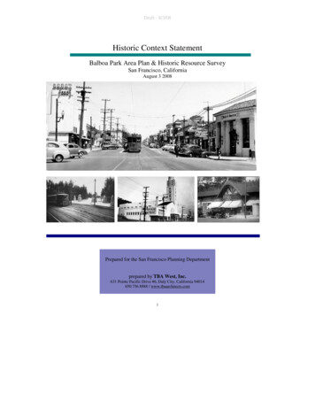
Draft - 8/3/08Historic Context StatementBalboa Park Area Plan & Historic Resource SurveySan Francisco, CaliforniaAugust 3 2008Prepared for the San Francisco Planning Departmentprepared by TBA West, Inc.631 Pointe Pacific Drive #6, Daly City, California 94014650.756.8888 / www.tbaarchitects.com1
Draft - 8/3/08Table of ContentsI.Introduction and Theme .3A. Time PeriodB. Period of SignificanceC. Geographic LimitsII.Synthesis of Information/HistoryA. Natural HistoryB. Native AmericansC. Spanish-Mexican PeriodsD. American Period1. The Industrial School2. House of Correction/Ingleside Jail3. San Francisco and San Jose Railroad4. Ocean Avenue Corridora. Ingleside Coursing Parkb. Ingleside Jail5. Residential Development6. Balboa Park - a Rationalistic park7. Balboa Park Area Transportation History8. Westwood Park9. Commercial Development10. Demographic PatternsIII.Balboa Park Area Plan: ArchitectureA. Property TypesB. Commercial CorridorsC. Architectural Styles in Subject AreaIV.Bibliography .47V.AppendicesA. Study Area MapB. Inventory of Construction Dates, Type, StylesC. Inventory of Character Defining Features262648
Draft - 8/3/08Exhibit 1: Subject Area, 1878 map of SanFrancisco, UCLA.I.Introduction and ThemesThe Balboa Park Area (Subject Area) acts as a hub and boundary line in San Francisco, acrossroad between the Ingleside, Westwood Park, Sunnyside, Excelsior and OuterMission neighborhoods. It also acts as a crossroad of historic themes: Balboa Park embodies distinctive characteristics of 20th Century recreationallandscaping, as naturalistic, romantic treatments of city parks gave way to morerationalistic uses, including the incorporation of civic structures and game fields. The Balboa Park Transit Area illustrates the historical development of urbantransportation networks, from 19th Century interurban steam railroads to modernelectric light rail cars. streetcarsuburb”developmentpatternwithin an urban environment.This context statement addresses multiple themes for an area that is defined as much as aboundary between neighborhoods than as a neighborhood itself.3
Draft - 8/3/08The Subject Area is defined by the Balboa Park Station Area Plan created by the SanFrancisco Planning Department as part of the Better Neighborhoods Plan in 2002.1Focused on the Balboa Park Station and Ocean Avenue transit corridors, the Subject Areais intersected by Interstate 280 freeway, with the Ocean Avenue commercial corridor tothe west, Balboa Park and Balboa Park Station to the east. Ocean Avenue divides masterplanned residential parks on the north from conventional gridded streets to the southwhere building types and construction dates can vary widely from lot to lot.The campus of City College of San Francisco, part of the Balboa Park Station Area encetotheschool’smasterplan.Actions recommended by the Balboa Park Station Area Plan in 2002 included rezoning,new development, and landscaping within the boundaries with the intention to betterserve the surrounding neighborhoods.A report on potential historic resources in the Subject Area prepared by Carey & Co. Inc.in 2005 identified an Ocean Avenue Neighborhood Commercial District and Balboa ParkHistoric District as potential historic districts, with a total of 49 contributing resources.The report further identified 15 potential individual historic resources with the SubjectArea.2An Environmental Impact Report (EIR) produced by the San Francisco venue,anda less-than-significant impact on a potential Balboa Park historic district, might ons.The San Francisco Planning Department contracted with TBA West in May 2008 toconduct a survey of the Subject Area. This historic context statement is prepared inconjunction with this survey.Time Period: 1845-1958The 1845 Mexican land grant creating the Rancho San Miguel defined the easternboundary of the Subject Area. The National Register of Historic Places utilizes a fiftyyear rule as a reasonable span of time for feasible professional evaluation of resources,and by 1958 significant development of the Subject Area had been completed. Thisstatement does address some post-1958 demographic patterns and construction activity ition.Periods of Significance: 1862 - ricResourcesReport”(Carey&Co.,Inc.,December 21, : 2004.1059E, September 21, 2007), 299.14
Draft - nsithub,andcommercialcorridor—havedifferent periods of significance. Balboa Park: 1908 - 1958.Dedicated as a city park in 1908, with significant landscaping and buildings, such asthe Balboa Park Pool, dating to the late 1950s. Balboa Park Transit Area: 1862 - 1958.Use of the area as part of an interurban transportation system begins with the SanFrancisco-San Jose Railroad in 1862. Professional evaluation of possible resourceshas been limited in this report to structures fifty years or older, but this period ofsignificance may extend into the 1970s as the hub transitioned to BART and theMUNI Metro light rail network. Ocean Avenue: 1895 - 1940The 1895 opening of the Ingleside Racetrack established the old Ocean House Roadas a commercial street, as saloons and restaurants moved in to serve the race crowds.After the creation and growth of surrounding residential districts, Ocean Avenuebecame home to small neighborhood businesses. The 1920s represent the height ofcommercial construction activity, and the majority of extant building stock dates fromthe period of 1915-1940.Geographic limits: As defined by the Balboa Park Station Area Plan, San FranciscoPlanning Department, October 2002.4 Subject Area includes parcels fronting OceanAvenue between Manor Drive on the west5 and San Jose Avenue on the east, withadditional parcels on Geneva Avenue. Eastern boundary parcels run from on San JoseAvenue from the east side of Ocean Avenue south to Mt. Vernon Street. Northernboundary includes all of Balboa Park to Havelock Street, the campus of the City Collegeof San Francisco and two former San Francisco Public Utilities Commission reservoirscurrently used as parking lots. City College and the reservoirs are excluded from thesurvey, but addressed briefly in this 02), 4-5.5Authors of this statement recommend extending western boundary to Fairfield Avenue to include the ElRey Theater building.45
Draft - 8/3/08II.Synthesis of Information/HistoryNatural eismadeupofFranciscansandstonebedrock with peaks from east to west at Thrift and Summit streets, a rocky outcrop atShields and Orizaba streets, and Brooks Park overlooking Lake Merced at Shields andVernon streets. Mount Davidson has mostly Franciscan chert at its peak, but transitionsinto Franciscan greenstone on the southern slope leading to valley.Mount Davidson and Merced Heights supported a mixed environment of scrub andgrassland featuring bunchgrass, Pacific reed grass (Calamagrostis nutkaensis), blueblossom syrinchium bellum), Douglas iris, pink current (Ribessanquineum), and golden yarrow. The west end of Merced Heights was often called“PansyHill”forthemanyjohnny-jump-ups (Viola tricolor) that flowered there.6 Prior todevelopment, the Ocean Avenue corridor was well known for seasonal wildflowers.7The Balboa Park and Balboa Park Station areas lie on the eastern incline of the valleybetween Mount Davidson and Merced Heights, consisting of arable land that wascultivated and farmed into the mid-20th Century.Anearbyspringpond,“LakeGeneva”on some maps,8 stood in the vicinity of the block bordered by Geneva, Niagra, Delanoand Cayuga streets, and acted as one source of Islais Creek. Now mostly attoday’sIslais Creek Channel.Native AmericansBefore the arrival of Europeans, the Ohlone peoples occupied the San Francisco BayArea. Culturally diverse Ohlone villages stretched from the Golden Gate east to theCarquinez Strait and south to Big Sur and Soledad. These communities, organized ghttotwelvedistinctlanguagessharing a common linguistic root.9 Named costeños (coastalpeople)bytheSpanish—modified to Costanoans bylaterarrivingEnglishspeakers—theOhlone suffereddepredations, deaths from disease and attack, and cultural loss during the Spanishcolonization beginning in the 1770s. Intense research into Ohlone society and historyonly began in the early 20th Century and most serious scholarship dates from the last fortyyears.106Greg Gaar and Ryder W. Miller, San Francisco: A Natural History (San Francisco: Arcadia Publishing,2006), 75-76.7“APleasantRide,”Weekly Alta California, January 29, 1853, page r’sOffice,May1,1863,Book2A&B,pages4547.9Malcolm Margolin, The Ohlone Way (Berkeley: Heyday Books, 1978). Researcher Randall Milliken hascompared degree of difference in Ohlone languages to that of modern Portuguese to modern Italian. SeeBean, 99.10Lowell John Bean, ed., The Ohlone Past and Present (Menlo Park: Ballena Press, 1994), xxii.6
Draft - 8/3/08To date, no evidence of permanent Ohlone settlement has been found in the project area.Early Spanish accounts mention tule reed boats in the vicinity of Lake Merced,suggesting its use as at least a seasonal campsite.11 The valley between Mount Davidsonand Merced Heights may have been a Native-American route from inland settlements.Spanish-Mexican Periods 1776-1846Spanish colonization of the San Francisco peninsula began in 1776 when an expedition oftwelve led by Juan Bautista de Anza from Monterey identified sites for a fort (thePresidio of San Francisco) and a mission (San Francisco de Asis, commonly known asMission Dolores). A full party of over 200 Spanish colonists arrived in June 1776 to buildboth.12 Ohlone people were theoretically to be the owners of the mission, indoctrinated tobecome Christians and citizens of the Spanish Empire. Whatever the original intention ofthe colonizers, Native-Americans made up an unpaid workforce to establish the Missionand adjoining pueblo of Yerba Buena, and suffered massive deaths from introduceddisease. Agriculture and cattle grazing were introduced to the area around the mission,with grazing ranging as far as modern Bernal Heights due east from the Subject Area.The pueblo of Yerba Buena and Mission Dolores depended on supplemental produce andlivestock produced farther down the peninsula at Mission Santa Clara,13 with a mainroad, the El Camino Reãl, connecting these communities. The section of modern San JoseAvenue on the eastern boundary of the Subject Area follows the line of the original ElCamino Reãl.14 Geneva”asawatering stop have been handed down,15 but no evidence of cultivation or settlement ofthe Balboa Park or Ocean Avenue area during the Spanish colonial era has beenidentified.Wars of independence began in Spanish America in 1810, and in 1821 Mexico became asovereign state. In 1833, the Mexican Congress secularized the mission lands, makinglarge tracts available to petitioners requesting ranch land from the government.In 1845, Jose de Jesus Noe applied to the California governor Pio Pico for a squareleague land grant near the established ranchos of Francisco de Haro and Jose Bernal.16Described as vacant in the petition, the land encompassed the future Balboa Park andOcean Avenue areas. Noe already had a ranch in the Mission District, but he sought morespace for his growing family and business holdings, which included a large orchard andgrazing cattle. Pio granted hingthe Rancho San Miguel.1711Laurence H. Shoup and Suzanne Baker. Cultural Resource Overview Lake Merced Transport. (SanFrancisco Water Management Program, January 1981), 11.12Mel Scott. The San Francisco Bay Area: A Metropolis in Perspective (Berkeley: University of CaliforniaPress, 1959), 9-11.13Scott, untyroad.”15Walter G. Jebe, Sr. SanFrancisco’sExcelsiorDistrict(Charleston, SC: Arcadia Publishing, 2004), 7.16A league was approximately 4,400 acres.17Mae Silver. Rancho San Miguel (San Francisco: Ord Street Press, 2001), 31-32.7
Draft - 8/3/08The boundaries of the Rancho San Miguel formed a rough octagonal diamond seRoad,today’sSanJoseAvenue, acted as the southeastern boundary running down to the modern San Franciscocounty line. According to one report, Noe had up to 2,000 cattle grazing on the ranchalong with 200 horses, and a large home.18 No evidence has been found of Noe farmingor grazing cattle specifically in the Subject Area.Another rancho, Laguna de la Merced, lay to the west of Noe’sland,andearlymapsindicate a road through ue’scurrent line. This path between rancho lands may have formalized an earlier Ohlone routeto Lake Merced.Noe served various roles in the civil government of the nearby pueblo, or village, ofYerba Buena. When the United States took control of Yerba Buena in 1846, Noe was theacting alcalde, or mayor.American PeriodExhibit 2. Ocean Avenue vicinity, date unknown,San Francisco (SF) Public Library.Exhibit 3: Location of Balboa Rec. Park, dateunknown, SF Public Library.As part of a war of expansion under theadministration of James Polk, the UnitedStates took control of Yerba Buena on July9, 1846. California formally became UnitedStates territory when the Treaty ofGuadalupe Hildalgo ended the MexicanAmerican War (1846-1848). Although thetreaty honored established Mexican landgrants, American settlers squatted on manyof the lands, forcing extensive litigation toprove land claims. ytheUnited States until late 1856.19Even before validation of his holdings, Noesold pieces of the Rancho San Miguel tovarious American speculators, includingJohn Meirs Horner in 1852. Soon after,Horner subdivided six hundred acres of theformer rancho for sale as home lots inEureka Valley and Noe Valley, naming the20plat“Horner’sAddition.”William Heath Davis. Sixty Years in California (San Francisco: A.J. Leary, 1889), 596. near 14th Street and Mission r’sOffice,BookCD,pages144145.188
Draft - eformuch of the subdivision until the 1880s and 1890s.In July 1854 the City and County of San Francisco bought 100 acres of land from andrehabilitationcenter.The House ofRefuge lot waspurchasedfor isco campus and Balboa Park, as well as the section of Interstate 280 freewayseparating them.The Industrial SchoolSan Francisco faced a great increase in juvenile crime in the 1850s. A Grand Jury reportcalled for a facility specifically for juvenile offenders outside of the prison system. InApril 1858, the San Francisco Bulletin thiskindinourcity,torescuethehundreds of deserted and vagrant children now in our midst, from a life of ibit 4. Industrial School, 1865, SF PublicLibrary.Because of funding issues, the House ofRefugeor“IndustrialSchool”(namedforitsgoal of teaching youth habits of al building stood on the higher westend of the lot, currently the site of the CityCollege football field. The east side of nd”whereIndustrialSchoolresidents planted and tended crops for useby the school.22The Industrial School was plagued by mismanagement from the beginning. Intended as amore humane way to rehabilitate juvenile offenders, it often had the opposite effect, aschildren whose only crime was homelessness would be incarcerated with feloniousteenagers. Just two years after its establishment, the facility almost closed after a nCaliforniaestablished new reform schools in Whittier and Ione, the Industrial School ceasedoperations, and San Francisco used the building as a new County Jail for Women.21San Francisco Recorder, Liber. 43, p. 413. Deed recorded July 28, 1854. Advertisements both by the citylooking for a site to purchase and from Horner selling lots were printed side by side in San FranciscoEvening Journal, April 8, 1854, page San Francisco Bulletin, July 20, 1858.9
Draft - 8/3/08Part of the County Jail for Women was demolished after damage from the 1906Earthquake. The rest remained in use until the entire site was cleared for the campus ofCity College of San Francisco in 1936.House of Correction/Ingleside dustrialSchoolin1876.Intended as a lock-up for criminalsconsidered within reach of reformation, the House of Correction cost 120,000 to buildand received its first prisoner September 4, 1876. The House of Correction wasnotoriously uncomfortable, if not inhumane. In 1908, reformers protested that �feetwide,and6½’feethigh.Eventually the facility became known as theIngleside Jail, named after the adjacentresidential neighborhood of the same name.The jail closed in 1934, and the buildingswere demolished for the new City Collegeof San Francisco campus.Exhibit 5. Ingleside House of Corrections, c, 1925,SF Public Library.The east side of the House of Refuge lotbeyond the railroad right-of-way continuedto be used agriculturally by the facilities upthe hill until the establishment of the land asBalboa Park in 1908.San Francisco and San Jose RailroadIn 1864, after debating a number of possible routes, the San Francisco and San JoseRailroad Company established a steam engine line that ran south from 25th Street andValencia Street through the Bernal Cut,25 of-way26 in the House of Refuge Lot before continuing south to Palo23In searching for a location for the House of Correction, the city considered the east half of the House eas“thelandthereisthebest”and“[l]arge iteofaHouseofCorrection,”San Francisco Chronicle,November 24, 1872.24Jack Black, YouCan’tWin(Edinburgh, London, San Francisco: AK Press, 2000)25The Bernal Cut is a manmade gap between the intersection of Mission and Randall streets and theintersection of San Jose and St. Mary avenues. Created for the railroad, to avoid climbing the ridgelineseparating the Mission District from Glen Canyon, the Cut was widened for automobile traffic and streetcaruse in 1927. Walter Rice, Ph.D., and Emiliano Echeverria. When Steam Ran on the Streets of SanFrancisco (Forty Fort, PA: Harold E. Cox, 2002), 63.26The entrance to the Industrial School still led by dirt path from San Jose Avenue, crossing the epolicestationmarksasectionofthispath.10
Draft - 8/3/08Alto on the peninsula. By 1872, the line extended farther into San Francisco to Third andTownsend streets.27Exhibits 6 & 7: Train system in the Balboa Park vicinity,dates unknown, SF Public Library.The promise of a rail line to deliver crops to market spurred agricultural activity in thefuture Balboa Park area, 28 astoftherailroadtracks.Elkton Station (not extant) was primarily used for the loading of goods rather edlanddeveloperstoplatfutureneighborhoods in the vicinity. To the west of the tracks, Levi Parsons recorded the annexof“SanMiguelCity”(SanJoseRoadtoHowth Street, Ocean Road to Mount Vernon) ��ontheeastsideofthestationfrom San Jose Road to Mission Road, Ocean to Sickles, in nglycongestedMission District30 made it a poor option for potential commuters. Large-scale ’tarriveintheBalboaParkandOceanAvenue areas are until the turn of the 20th Century.31The Southern Pacific Company gained control of the railroad in September 1868, and ranprogressively infrequent service on the route until the early 1920s when passenger serviceended completely. The Southern Pacific abandoned trackage north of the Elkton Station27From 1866-1872, the SF & SJ connected with old Market Street Railroad tracks and ran out Valencia toMarket Street and on to California Street. The line was rerouted to run from 25 th and Valencia to HarrisonStreet, Townsend Street, to terminate at Third Street in fy that they never knew the plow before, are being plowed now in prospect of the completion of theroad ”—“HowtheSanJoseRailroadGetsOn,”San Francisco Evening Bulletin, April 12, 1862, page ,Book2A&B,pages4547.30The Mission District population grew from 23,000 to 36,000 between 1870 and 1900. Vehicular traffic,including new horsecar and streetcar lines, added to the difficulty of getting long steam trains through anMiguelCity”stillundercultivation.11
Draft - 8/3/08in the 1940s, and the line from Ocean Avenue to San Bruno was given up after 1956 tomake way for the Interstate 280 freeway.32Ocean House RoadExhibits 8 & 9: Future Ingleside Terracesubdivision site and Lake Merced, 1910 nown,SF Public LibraryIn the mid-1850s a number of roadhousesserving as bars, restaurants, and often asillegal gambling venues, opened near LakeMerced. Intentionally located in a remotearea for both natural beauty and a degree ofremove from scrutiny, the earliestroadhouses included the Lake House,Rockaway House, and the Ocean House. Allwere reached via a path running west fromthe San Jose Road, through the valleybetween Mount Davidson and wspapersasearly as 1853,33 accommodated coach-linesto serve the roadhouses in 1854,34 and by1859 become large enough to for anomnibus line (large coaches pulled by teamsof horses). None of the original roadhousessurvive today.Adolph SutroIn 1881, Adolph Sutro bought a large portion of the former Rancho San Miguel,including most of the Ocean House Road. Sutro made his fortune in the creation of aventilation and drainage tunnel for the Comstock Lode silver mines in Nevada. When hesold out of the project, he returned to San Francisco and quickly earned a reputation ofmixing public philanthropy with financial pragmatism. Sutros’balancingactbetweencivic charity and profit speculation is demonstrated in his treatment of his propertiesstraddling the Ocean House oninitiativeandhorticulturalsciencepark.Although Sutro planned a diversity of vegetation for his forest, quick-growing blue gum32Rice, 61-69.“APleasantRide,”Weekly Alta California, January 29, 1853, page 1.34Lake House advertisement, Alta California, June 19, 1854.3312
Draft - 8/3/08eucalyptus trees quickly dominated the landscape. The forest stretched north from OceanHouse Road over Mount Davidson and Twin Peaks to the Inner Sunset district.In 1890, on the other side of Ocean House Road from his forest, Sutro platted the land utureInglesideDistrict’sstreetgrid,and most of its street names came from this subdivision.35Exhibits 10 & 11: Ingleside Inn, c. 1925(above), Ingleside Tea Room, date unknown,SF Public Library.Exhibit 12: Ingleside Track, 1895, SFPublic LibraryLakeview sold very poorly. Being remotefrom the city proper and lacking reliablepublic transportation downtown, the .Tenyearsafterthesubdivision’screation, the 1900 United States Censuslisted only 223 residents of Lakeview, withprofessions limited to support of thevegetable farms to the east and south(farmers, teamsters), the nearby racetrack(hostlers, saddlers, jockeys), or the weekendbusiness from day-trippers and racing fans(saloon keepers, bar tenders).36 ide Lakeview with basic street grading,sewers, or utilities.37 Lakeview as a namefor the area soon succumbed in popularity to“Ingleside,”aftertheInglesideInn,apopular roadhouse at the corner of OceanAvenue and Junipero Serra Boulevard.The Ocean House Road, generally calledOcean Avenue by the 1890s, received a fairamount of weekend traffic as a pleasuredrive. Sporting men traveled west to theroadhouses, while families and childrenjourneyed to the beaches or the wildflowerfields east of Lake Merced. The firstbuildings along Ocean Avenue wereconstructed to take advantage of this traffic.Saloons and restaurants spaced out along thedrive through the valley.38 These fornia State Library, Sutro Branch.36Ten percent of the Lakeview population was bartenders, saloonkeepers, and their families. TwelfthCensus of the United States, Sup. District 1, E.D. 141-142, June 1900.37The 1899-1900 Sanborn maps show eleven windmills and tank houses used with wells in Lakeview.38No buildings from the 19th Century survive on Ocean Avenue today; the earliest extant structure,constructed in 1900, is 1831-35 Ocean Avenue.3513
Draft - 8/3/08also depended on the crowds brought by twolarge recreational facilities established onOcean Road in the 1890s: the InglesideCoursing Park and the Ingleside Racetrack.Ingleside Coursing eservoirswestoftoday’sPhelanStreet in the 1890s. The Ingleside Coursing Park changed ownership frequently asbusiness and political climates varied. As residential building increased in the early eBoardofSupervisors.39 The track operated for the last time in 1910.Ingleside RacetrackThe Ingleside Racetrack opened onThanksgiving, November 28, 1895, drawingover 14,000 people to the area on that dayalone. The Pacific Jockey Club, led byEdward Corrigan, built the track on landnow bounded by Ashton Avenue, JuniperoSerra Boulevard, Ocean Avenue andHolloway Street.Exhibits 13 & 14: Ingleside Grandstand, 1895(above) and Automobile Races, 1900, SFPublic Library.To cater to the appetites and thirsts of theracing crowd, roadhouses, restaurants andsaloons opened nearby. Seven OceanAvenue structures are shown next to theracetrack on the 1899 Sanborn maps; fiveare listed as saloons while the other two arenoted vacant.40 The transportationcompanies also responded, establishing newspur lines to serve the track. The SouthernPacific ran tracks for its steam train up fromthe county lime to the west side of the track.In December 1895, the Market StreetRailway extended its Mission Street electricline west on Ocean Avenue from ExcelsiorAvenue and Mission Street to the track injust six days. Suddenly the former Lakeviewneighborhood had streetcar service.41“SupervisorsAskedtoStopCoursing,San Francisco Call, January 10, 1909, page 36.Of the fifteen total structures on Ocean Avenue between Ashton Avenue and Harold Avenue, ten aresaloons. 1899-1900 Sanborn maps 724, 725, 726.41Rice, 66.394014
Draft - 8/3/08After ten years of up and down success, theIngleside Racetrack held its final race onDecember 30, 1905. After the 1906Earthquake and Fires, the grounds and mostof the racetrack buildings were used as areliefcampforrefugees.“CampIngleside”housed the aged and infirm that had toabandon the heavily damaged Alms House(today’sLagunaHondaHospital).Exhibit 15: Camp Ingleside, date unknown,SF Public y,thecompany laid out Urbano Drive on the loop of the former track. No extant racetrackbuildin
Islais Creek emptied into a large bay estuary at today's Islais Creek Channel. Native Americans Before the arrival of Europeans, the Ohlone peoples occupied the San Francisco Bay Area. Culturally diverse Ohlone villages stretched from the Golden Gate east to the Carquinez Strait and south to Big Sur and Soledad. These communities, organized in