Transcription
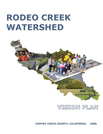
RODEO CREEKWATERSHEDVISION PLANCONTRA COSTA COUNTY, CALIFORNIA2008
AcknowledgementsThe Rodeo Creek Watershed Vision Plan is a collaborative project led by the Contra CostaResource Conservation District and Restoration Design Group. Project sponsors included:Contra Costa County Redevelopment AgencyContra Costa County Flood Control and Water Conservation DistrictContra Costa County Public WorksMuir Heritage Land TrustThe Contra Costa Resource Conservation District and Restoration Design Group would like tothank the guest speakers who contributed valuable information to the vision planning process:Laurel Collins, Watershed SciencesPaul Detjens, Contra Costa Flood Control and Water Conservation DistrictMarc Grisham, Rodeo Marina, LLCWarren Lai, Contra Costa County Public Works DepartmentVincent Manuel, Contra Costa County Redevelopment AgencyBert Mulchaey, EBMUDNelson Oliva, City of HerculesBeth Pardieck, Muir Heritage Land TrustJamie Perkins, East Bay Regional Park DistrictCarl Roner, Contra Costa County Flood Control DistrictVictoria Skerritt, Contra Costa County Public Works DepartmentRodeo Creek Watershed Vision Planning ParticipantsCarol ArnoldDiana TaeubelDiane CarverDominic RamirezErin Hallisy SmithFrank SilvaHeidi PettyJennifer PosedelJoanne WardJohn EllisJune LastiriLiz WarmerdamMargaret FariaMargrit HaafMary TaborMelody MathiasPat MunnellyRavi RandhawaRoger HartwellShirley StahlkeSuzanne and Richard BoardTara HallisyiiRODEO CREEK VISION PLANDECEMBER 2008Contra Costa RCDRodeo ResidentRodeo ResidentRodeo ResidentRodeo ResidentSupervisor Uilkema StaffContra Costa RCDHistorian/Rodeo ResidentCity of Hercules, MayorRodeo ResidentCrockett ResidentCity of Hercules StaffCREECR-10, Recreation DirectorR-10Rodeo ResidentRodeo ResidentRodeo ResidentEBMUDRodeo ResidentR-10Rodeo Resident
The Rodeo Creek Watershed Vision Plan Statement:“The Rodeo Creek Watershed planning group envisions a safe, clean, and healthy Rodeo Creek,with a well-connected watershed trail network, and an engaged and active creek community.”RDGRestoration Design Group, LLC2612b Eighth StreetBerkeley, CA 94710T 510.644.2798 F 510.644.2799www.restorationdesigngroup.comDECEMBER 2008RODEO CREEK VISION PLANiii
ContentsIntroduction. 1Watershed Vision Plan.1Public Process.1Community Outreach.1The Rodeo Creek Watershed. 3Physical Qualities of Rodeo Creek Watershed.3History of Rodeo Creek Watershed.3Social and Political Features of Rodeo Creek Watershed.7Biological Features of Rodeo Creek Watershed.9Channel Conditions in the Rodeo Creek Watershed.11Topics of Interest. 15Watershed Information/Coordination.15Connections and Waterfront.15Habitat/Creek.16Public Access/Safety.16Maintenance in the Lower Reaches of Rodeo Creek.16Goals and Actions. 17Vision. 19Safe, Clean, and Healthy Creek.19Well-connected Watershed Trail Network.19Engaged and Active Creek Community.20Opportunities and Next Steps . 21Lower Watershed Master Plan.21Connected Watershed Trail Network.21Fernandez Ranch Public Access and Restoration.22Coordination and Integration with Rodeo Redevelopment.22Rodeo Waterfront Restoration.22Storm Water Master Plan.22Continued Support for a Watershed Coordinator.22Conclusion. 23References. 24ivRODEO CREEK VISION PLANDECEMBER 2008
CrockettCarquinez StraitDrainagesRodeoqnezuu ii80SanPayaaaa rrBBCbbll ooStraitHerculesMartinezRodeo CreekWatershedPeytonSlough4Refugio CreekWatershedGarrityCreekWatershedPinoleAlhambra CreekWatershedSan Pablo CreekWatershedPinole CreekWatershed012MilesThe Rodeo CreekWatershed. Thewatershed is located inWestern Contra CostaCounty. Interstate 80and Highway 4 passthrough the watershed.The Cities of Herculesand Pinole are directlyto the south and thecommunity of Crockettis to the north. Thecommunity of Rodeo islocated within the lowerwatershed. Martinez iseast of the watershed.DECEMBER 2008RODEO CREEK VISION PLANv
List of FiguresThe Rodeo Creek Watershed1. . vAn Overview1. viiA Watershed Discussion2.2Watershed Size and Topography1.3Landslide Prone Areas1.4Average Yearly Rainfall1.4Population Density1.4Shoreline and Creek Location and Alignment, Circa 1850’s1.5Present Day Creek and Shoreline Location and Alignment1.5Historic USGS Topographic Maps and an Aerial Photograph3.6Land Use Patterns in the Watershed1.7Existing and Proposed Trail Network1.8Proposed Bay Area Ridge Trail1. .81936 Photograph of Flooding in Downtown Rodeo.4. .9Flood Control District Zones1.10Contra Costa Goldfields5.10Alameda Whipsnake6.10Channel Condition and Photopoint Locations1. .11Photopoints2. .12Channel Condition and Photopoint Locations1. .13Photopoints2. .14Recorded Notes on an Aerial Photograph7.15Public Meeting Participants2.17Young Creek Clean-up Volunteers8. .19Trail Damage from December 2005 along the Rodeo Creek Trail8.20Lower Watershed Tour2.20Rodeo Creek Vision Planning Meeting Participants2.21GPS Survey9.22Upper Watershed Tour8.231Council,23456789viThe Restoration Design Group. Data provided by Association of Bay Area Governments, Bay Area Ridge TrailContra Costa County and San Francisco Estuary Institute.The Restoration Design Group.The Restoration Design Group. Data provided by USGS, Google Earth.Unknown, Photograph provided by Contra Costa County Flood Control and Water Conservation District.Game, John. www.calphotos.com.Nafis, Gary. www.californiaherps.com.Notes by community members, basemap created by the Restoration Design Group.Contra Costa Resource Conservation District.Luebke, Michelle. Watershed Monitoring Coordinator, CCC Department of Conservation and DevelopmentRODEO CREEK VISION PLANDECEMBER 2008
DECEMBER 2008Restricted Public AccessOpen Public AccessProposed for ProtectionNo Current Public Access0aF Radilroa0.5HerculesBNSRod1eoeekMilesCrFranklin Canyon4Fernandez Ranch(MHLT)Carquinez StraitRegional Shoreline(EBRPD)doaeRFranklin Canyon Golf CoursesttyOpen SpaceViewpointeNeighborhood80CounCity BoundaryCommunityofRodeoificPacion oadnUlrRainCodeestra culpo errco of HinUn CityatrCoLegendLone TreePoint ParkRodeoMarinaChtir isRODEO CREEK VISION PLANviiBNSF RailroadDutra Ranch(MHLT)Gustin Ranch(MHLT)An Overview. TheUnion Pacific Railroadfollows the shoreline.Burlington NorthernSanta Fe (BNSF) Railroadtravels east-west. Thelower watershed isprimarily developed land,with the Viewpointeneighborhood being theneighborhood locatedhighest in the watershed.The upper watershed ispredominantly open spaceand agricultural lands.
IntroductionThis report documents the work and outcomeof the Rodeo Creek Watershed PlanningGroup. The planning process was open to thepublic and the group was comprised of localcommunity members and interested parties. Itmet between February and September 2008 toarticulate interests, concerns, and ultimatelya watershed vision for the Rodeo CreekWatershed in Contra Costa County, California.Watershed Vision PlanA Watershed Vision Plan is a watershed-basedplanning document that is meant to providea coherent vision of future projects in thewatershed. The plan is community based,respectful of private property rights, involvesonly voluntary actions and is developedthrough consensus. The Plan can be usedas a fundraising and planning tool and hasthe added benefit of being a collaborativeexperience that brings community memberstogether to develop goals and actions toenhance the watershed.Public ProcessThe Rodeo Creek Watershed Vision Planprocess consisted of a series of six meetings,two field trips and three watershed outreachevents. All events were open to the public.An invitation to the February 2008 kickoffmeeting was mailed to all 3300 propertyowners in the watershed and posters werewidely distributed. Presentations were madeto local community groups to introduce themto the concepts of the Watershed Planningprogram. The visioning process was designedto be open and collaborative and lead to acommunity-based, consensus-seeking visionof the watershed. The meetings, field trips andevents provided an opportunity for communitymembers to learn about their watershed,express their concerns and interests, andformulate goal statements and action items insupport of their vision.(Opposite) A WatershedDiscussion. Carl Ronerfrom the Contra CostaCounty Flood Controland Water ConservationDistrict talks about thecreek.1The six evening meetings were held atLefty Gomez Community Center in Rodeo,California, and generally included one hour ofpresentations followed by a one hour workingsession. Field trips were held on Saturdaymornings and members visited variousRODEO CREEK VISION PLANDECEMBER 2008locations in the watershed with presentationsby representatives from organizationsresponsible for managing the areas.Attendance at meetings and field trips variedbetween approximately 20 and 35 participants.See sidebar for speakers and topics from themeetings.Community OutreachCommunity Outreach for the Rodeo CreekWatershed Vision Planning program was ledby the Contra Costa Resource ConservationDistrict. The Watershed Coordinatororganized meetings, created publicityarticles and flyers, maintained e-mail lists tocommunicate with participants and served asthe point of contact during this program.The central location for watershed informationwas a web page created and maintained on theResource Conservation District web site (http://www.ccrcd.org) posting announcements ofthe Rodeo Creek Watershed Vision PlanningMeetings and events, meeting notes, a photolibrary and links to relevant web sites anddocuments. The web page also includedjurisdiction maps which were requested by theplanning group.The coordinator organized watershed outreachevents including an Earth Day Creek Cleanupand an educational watershed booth with thewatershed model at the Rodeo Chamber ofCommerce Chili Cook-off in September. Shealso recruited local community members toparticipate in the County’s Global PositioningSystem (GPS) Volunteer Creek MonitoringProgram in October 2008 to collect data tomonitor and assess Rodeo Creek.
Meeting and Field Trip TopicsMeeting 1 – February 21, 2008Speaker TopicsDefinition of a Watershed Vision Plan(Drew Goetting, Restoration Design Group-RDG)Introduction to the watershed(Erik Stromberg, RDG)Working Session TopicsGround rulesConcerns and interestsFuture speaker topicsMeeting 2 – March 20, 2008Speaker TopicsHistoric changes to Rodeo CreekWatershed(Laurel Collins, Watershed Sciences)Working Session TopicsParticipants wrote their interests andconcerns relating to the creek on largemaps of the watershedMeeting 3 – April 17, 2008Speaker TopicsContra Costa County Public WorksDepartment responsibilities formaintenance along the creek andthroughout the town of Rodeo(Warren Lai and Victoria Skerritt, ContraCosta County Public Works Department)Contra Costa Flood Control and WaterConservation District maintenance ofRodeo Creek(Paul Detjens, Contra Costa FloodControl and Water Conservation District)Pinole Creek Vision Planning Process(Drew Goetting, RDG)Contra Costa County RedevelopmentAgency plans for Rodeo(Vincent Manuel, Contra Costa CountyRedevelopment Agency)Field Trip 2 – June 7, 2008Site visits in the upper watershed includingthe carbon plant and Fernandez Ranchwith presentations by Beth Pardieck, MuirHeritage Land Trust; Paul Detjens, ContraCosta County Flood Control District andBert Mulchaey biologist, East Bay MunicipalUtility District.Working Session TopicsParticipants wrote their interests andconcerns relating to the creek on largemaps of the watershedField Trip 1 – May 3, 2008Site visits in the lower watershed includingthe flood control channel, the marina, themouth of the creek, and a drop structurewith information presented by Carl Ronerfrom the Contra Costa County FloodControl District and Vincent Manuel fromthe Contra Costa County RedevelopmentAgency.Meeting 4 – May 15, 2008Speaker TopicsMuir Heritage Land Trust’s role in thewatershed.(Beth Pardieck, Muir Heritage Land Trust)City of Hercules plans in the watershed(Nelson Oliva, City of Hercules)Working Session TopicsParticipants drafted goal statementsMeeting 5 – June 19, 2008Speaker TopicsEast Bay Regional Park District trailand park plans (Jamie Perkins, East BayRegional Park District)Working Session TopicsParticipants drafted action items insupport of the goal statementsMeeting 6 – September 25, 2008Speaker TopicsA proposal to redevelop the RodeoMarina.(Marc Grisham, Rodeo Marina, LLC)Working Session TopicsReview of the Rodeo Creek WatershedVision Plan.DECEMBER 2008RODEO CREEK VISION PLAN2
The Rodeo Creek WatershedThe Watershed Visioning Process relies ona shared understanding of the physical,historical, and social conditions in thewatershed. The planning group members bothreceived and contributed information to theplanning process.data from nearby Crockett (two miles northof the watershed) indicates that 95% of theprecipitation falls between October and April.This pattern of mild, wet winters and warm, drysummers is characteristic of northwestern ContraCosta County’s “Mediterranean” climate.Physical Qualities of Rodeo Creek WatershedHistory of Rodeo Creek WatershedThe underlying geology in the RodeoCreek Watershed is comprised primarily ofsandstone, siltstone, and shale (Graymer,1994). The bedrock in the watershed tends tobe highly erodable (Collins, 2008). Many ofthese rocks are sedimentaryThe Ohlone occupied the region, if not thewatershed as far back as 5,000-7,000 years ago.At the time, the vegetation in the watershedwas likely a combination of native bunchgrasses and woodlands. If it was managed atall, it was managed with fire which kept thewoodland under story clear and createdconditions preferable to fire tolerantor fire dependent plant species. Themouth of the watershed, in presentday Rodeo, was a broad tidal marshstretching along a mile of bay frontand approximately a quartermile upstream of the currentshoreline (Collins, 2008).Acres400100LegendMinor Contour (50')Major Contour (250')Rodeo CreekMinor TributaryElevationHigh PointLow Point00.51Watershed Size andTopography.Milesformationscreated 20million years agoand rich with fossils ofsea animals that livedat the time. Youngerformations include softrocks interspersed with theharder sandstones. Many ofthese formations have folded andtilted, leading to landslides in thesteeper, upper watershed, particularly on theRodeo shale (Alt and Hyndman, 1993).Soils in the watershed are primarily loamsand clay loams. Loams are soils composedof roughly even amounts of sand, silt, andclay. As the name implies, clay loams have ahigher proportion of clay. Clay loams are welldrained or moderately well drained soils thatdevelop from the sedimentary rock in the area.These soils generally support oaks, grasses,and forbs. These are not prime farmland soilsand are mostly used for grazing and rangelanduses (Soil Conservation Service, 1977).The Rodeo Creek Watershed averages 21 inchesof rain a year (CCCCDD, 2003). Historical3RODEO CREEK VISION PLANDECEMBER 2008Rodeo Creek Watershed lieswithin the historic Spanishland grant called El Ranchode Pinole, owned by DonIgnacio Martinez,the formercomandante ofthe pueblo ofSan Francisco.The townHigh Point 1085-ftname Rodeo was borrowed from the placenames Rodeo Valley, appearing on a map asearly as 1860, and Rodeo Creek, a name thatdates from at least 1865 (Dowling, 2007).Perhaps as early as the 1830’s, cattle begangrazing in the Rodeo Creek watershed. Thecattle grazing practices in the watershed wouldhave immediately changed the watershedby compacting soils in areas where cattleconcentrated, crushing the stream bed andbanks, reducing the thatch cover on thegrasslands, and substantially decreasing theamount of riparian vegetation along the creek.These changes increased the amount of runoff
eellSlSanaaRodeoioCreough4CreekekLegendFew landslidesP i Mostly landslidesnnleC0.5 rr ee e k1MilesPablo Bayy0CC oorr ddee llSaniaaThe population in the watershed remainedunder or around 1000 people through the 1920’s.By 1940, that number had grown to over 2,000.The modern era of urbanization began duringthe Second World War when people migratedto Rodeo in search of work in the wartimeindustries in Vallejo, Richmond, and othercenters of wartime industry (Collins, infall (Inches)Pole Creek17.217 5.18 75.18 25.19 75.19 25.20 75.20 25.21 75.21 25.22 75.22 25.23 75.23 25.24 75.25i innBy the late 1800’s, the Union Stockyard wasconstructed in the lower watershed. Alongwith the stockyard came a reservoir onthe creek, additional rail lines, and a longreach of creek culverted beneath redwoodplanking. The dam was located where presentday Interstate-80 crosses Rodeo Creek. TheBurlington Northern Santa Fe Railroad (thenknown as the Santa Fe Railroad) extended upthrough the watershed and reached Martinezthrough a tunnel in the upper watershed thatis still active (Collins, 2008). The constructionof this railroad and the associated roadsignificantly constrained the creek by reducingits floodprone width. When high flows came,rather than overtopping its banks and floodinga floodplain, the creek was now contained ina narrow canyon. The added erosive powercaused the creek to incise or erode its bed,creating an even deeper, narrower canyon.i80looBy 1874, the Union Pacific Railroad (thenknown as the Southern Pacific Railroad)traversed the shoreline at the mouth of RodeoCreek. Prior to construction of the railroad thecreek entered a marsh that was located wheremuch of the community of Rodeo is locatednow. The marsh extended as far inland as thepresent day location of Investment Street andthe creek meandered along the western edgeof the valley. See the maps on the followingpage for a comparison between the historicand present day creek alignment and marshextents. Maps at the time the railroad wasconstructed show that the creek was eithermodified in conjunction with the railroadactivities or had been previously straightenedand altered by local farmers into an alignmentclose to what exists today (Collins, 2008).rr ddfrom the watershed and destabilized the creekchannel. This intensified bank erosion alongthe creek channel (Collins, 2008).CC ooPablo Bayy00.51Miles804Legend1 Dot 10 People0(Top) Landslide ProneAreas. Landslidepotential is greatest inthe upper watershed.0.51Miles(Middle) Average YearlyRainfall. Rainfall isgreatest in the upperwatershed.DECEMBER 2008(Bottom) PopulationDensity. Populationdensity is greatest in thelower watershed.RODEO CREEK VISION PLAN4
C rr ee e koodeR ooloabn PSaLegend0Baa yy0.125Shallow BayBeach0.25MilesTidal FlatLagoonMuted Tidal MarshHistoric Creek Alignment4teinpo rdew ilroadAvenueuecficikC re eRo de oenAvPaParkerAvenueSanSaLefty odeoMarinaBBLegend0yaa y(Above) Shoreline andCreek Location andAlignment, Circa 1850’s.5(Below) Present DayCreek and ShorelineLocation and Alignment.RODEO CREEK VISION PLANDECEMBER 20080.1250.25MilesShallow BayTidal FlatHigh Elevation Tidal Marsh
1951195919682007A major storm and resulting flood in December1955 renewed calls for action to protect downtownRodeo from flood damage. The Contra CostaCounty Flood Control and Water ConservationDistrict (District) secured the interest of the USArmy Corps of Engineers in addressing the floodproblems in downtown Rodeo after additionalfloods in 1957 and 1958 galvanized Congressionaland local support for a flood protection project.By the 1960’s, Interstate-80 had been builtthrough the watershed (Collins, 2008), andCaltrans concrete-lined the creek within thefreeway corridor. In 1966 the Corps completedthe widening and channelization of RodeoCreek from the mouth to Interstate-80, adistance of 1.3 miles. The first half mile wasa rectangular concrete channel that fit in thetight corridor between existing houses andbusinesses. The remainder of the project was atrapezoidal earthen channel. While the Corps’project improved the flood carrying capacity,it did not significantly straighten or shift thealignment of the channel. The majority ofthe channel realignment occurred prior tothe 1900’s, around the time the Union PacificRailroad was constructed.Historic USGSTopographic Maps andan Aerial PhotographShowing Developmentin the Lower Watershedand Changes in CreekAlignment Between1951 and 2007.In the mid-1970’s, the development ofthe Viewpointe Subdivision upstream ofInterstate-80 channelized 0.7 miles of RodeoCreek between Interstate-80 and the BNSFRailroad. The development also constructedthree drop structures in this portion of the creekto slow down the erosive flows in the creek.Growth in the watershed continued throughthe rest of the century. The 2000 census setthe population of the watershed at 8,672(CCCCDD, 2003).DECEMBER 2008RODEO CREEK VISION PLAN6
Social and Political Features of Rodeo CreekWatershedon Franklin Ridge on the eastern edge of thewatershed: the 158-acre Dutra Ranch andthe 80-acre Gustin Ranch. Approximatelyone quarter of these properties are in thewatershed. MHLT also holds conservationeasements on 30 acres in the middle watershedto protect the federally listed Contra Costagoldfields plant species, California red-leggedfrog, western pond turtle, and riparian habitatalong Rodeo Creek (B. Pardieck, personalcommunication, September 9, 2008).Land UseCurrently, eighty-eight percent of thewatershed is in unincorporated Contra CostaCounty including the community of Rodeo.The remaining twelve percent is in the Cityof Hercules. An additional 10-15% ofthe watershed is within80rntCoed lesato r e rc urpco f Hin y oUn CitaCostaMiles4ty1un0.5Co0ChLegendFire StationGolf CourseCity BoundaryOpen SpaceNo CurrentPublic AccessProposedfor PreservationOpenPublic AccessRestrictedPublic AccessLand Use Patterns in theWatershed. The upperwatershed is primarilyopen space andagriculture lands. Thecommunity of Rodeois located in the lowerwatershed.adRoChurchthe Cityof Hercules’Herculessphere ofinfluence(CCCCDD, 2003). Asphere of influence is an areathat is subject to the influenceof city planning (zoning, generalplanning) even though it is notwithin the city boundaries.tieSchoolr isLibraryFifty nine percent of the watershed is zonedfor agriculture. Eighteen percent is zoned forparks and recreation or open space. Most ofthese three land use categories (agriculture,parks and recreation, and open space) arein the upper watershed upstream of theBurlington Northern Santa Fe Railroad(CCCCDD, 2003). The remaining 23% of thewatershed is zoned for urban land uses such ashousing, commercial uses, and industry.The Muir Heritage Land Trust (MHLT) ownsthree properties in the watershed. MHLT’smission is to hold and manage open space toimprove quality of life for current and futuregenerations. The largest property is the 702acre Fernandez Ranch, most of which is inthe Rodeo Creek watershed. The propertyincludes several thousand feet of Rodeo Creekand several thousand more of tributaries to themain stem. MHLT also owns two properties7RODEO CREEK VISION PLANDECEMBER 2008Immediately to the west of FernandezRanch is the 483-acre Franklin Canyonparcel. Again, most of FranklinCanyon parcel is in the watershed.The Muir Heritage Land Trustcurrently has a purchaseagreement to buy 423 acres ofthe Franklin Canyon parcel.The parcel consists mostly ofgrassland and oak woodland.ilroadIf completed, theBNSF Raacquisition couldclose a criticalgap in the BayArea RidgeTrail, and,along withthe existingFernandezRanch, would create over 1,100 acres ofcontiguous open space (Cuff, 2008).TrailsFour existing or planned trail networkstraverse the Rodeo Creek watershed: the SanFrancisco Bay Trail, the Bay Area Ridge Trail,the Rodeo Creek Trail, and the San FranciscoBay Area Water Trail.The San Francisco Bay Trail is a 500 mile longhiking and biking trail that will eventuallyencircle the San Francisco and San Pablo Bays.When completed, the Bay Trail will travelalong the Rodeo waterfront. Currently, thenearest completed portions are in Hercules andCrockett.The Bay Area Ridge Trail will be a 550 milehiking, biking, and equestrian trail that willloop the San Francisco and San Pablo Bays
yBaPabloCarquSanin80Carquinez StraitRegionalShorelineRodeoCreeezStraitMartinez RegionalShorelinek4RefugioCreekFranklin Canyon(Proposed PublicAccess)Fernandez Ranch(Future Public Access)LegendRodeo Creek Trail - ExistingCreek TributaryOther Trail - ExistingOther Trail - ProposedoOpen SpaceP i Open SpaceProposedneUrbanCreekRodeo Creek WatershedCreekPinole ValleylCity of PinoleParkGustinBay Area Ridge Trail - ExistingDutra RanchBay Area Ridge Trail - ProposedBay Trail - ExistingEBMUDBay Trail - Proposedalong the ridge tops. The trail will traverse thewatershed from the north through CarquinezStrait Regional Shoreline, across Highway 4,and up to the southern ridge of the watershedthrough Fernandez Ranch. Currently, only theportion of trail in Carquinez Strait RegionalShoreline is complete.The Rodeo Creek Trail extends along theRodeo Creek flood control channel fromapproximately ¼ mile upstream of the mouth(near Investment Street) to near MarinersPoint Court downstream of where the BNSFrailroad crosses the creek. The trail and threepedestrian bridges that cross the creek aremaintained by the Contra Costa County PublicWorks Department and under the advisementof the County Service Area R-10 CitizenAdvisory Committee, which advises the CountyBoard of Supervisors and administrativedepartment regarding parks and recreationfacilities and services for the Rodeocommunity. The land for the trail
as a fundraising and planning tool and has the added benefit of being a collaborative experience that brings community members together to develop goals and actions to enhance the watershed. Public Process The Rodeo Creek Watershed Vision Plan process consisted of a series of six meetings, two field trips and three watershed outreach events.