Transcription
Geoscience Evolution: Extensive Data Integration for Real Time Geosteering and Modeling in UnconventionalReservoirs*Vlad Karen Payrazyan1, Igor Kuvaev1, Igor Uvarov1, Rafael Aguilar1, Gerardo Gutierrez1, and Julian Stahl1Search and Discovery Article #42187 (2018)**Posted March 19, 2018*Adapted from oral presentation given at AAPG Eastern Section 46th Annual Meeting, Morgantown, West Virginia, September 24-27, 2017**Datapages 2018 Serial rights given by author. For all other rights contact author directly.1ROGII, Inc., Houston, Texas (karen@rogii.com)AbstractOver the past 5-7 years, effective and low-cost geosteering technologies became a game changer for unconventional development in NorthAmerica, allowing thousands of oil and gas companies to stay profitable during the ongoing economic downturn. Modern geoscience andgeosteering technologies indicate an increasing focus on IT and software, rather than downhole hardware tools. IT technologies have advancedenormously over the past 8-10 years, but these capabilities are not yet fully endorsed by the oil and gas industry. Modern computing power,low cost storage facilities, super-efficient algorithms, big data analysis, artificial intelligence and cloud collaborative technologies willeventually completely transform the current practices. This will lead to a new way of how we model reservoirs, geosteer wells, integrate dataand communicate with each other. But this process is an evolution, rather than a revolution, due to a fact that the oil and gas industry isconservative and adapts slowly to new technical and economic trends and realities.Knowing the true stratigraphic position of a well trajectory, constantly and proactively monitoring this position and adjusting as needed in realtime while drilling - represent a significant breakthrough in keeping the well in the best target zones no matter how thin those are. However,this is just the beginning. The next step in geoscience technology is to be able to integrate massive amounts of available data, such aspreviously drilled wells, production history, various types of logs, cores, seismic, maps, correlations, regional geological trends, etc. Connectthis with the modern IT capabilities and you get geoscience to be real time, high resolution, fully collaborative, intelligent and automatic.Part I – Geoscience TechnologiesRather than big scale regional geological and hydrodynamic modeling, this new wave of geoscience software technology will mainly befocused on a single well’s drilling efficiency, placement, life cycle and recovery factor. Building a static geological or flow simulation modelwill not be the end goal, it will be a natural automatic part of the well planning and execution process. The models will be sector, sub-seismic,
high resolution, high accuracy and integrating all available data. These sector models can be easily connected together as puzzle blocks into abigger picture at any time if needed.The sector models will be constructed automatically as a pre-job and corrected “on the fly” as you drill using the data from the current well andhundreds of previously drilled vertical and horizontal wells and their associated sector models. Massive data integration: wells, logs, cores,seismic, sedimentology, geochemistry and other data will be combined into a process while drilling a single well with a goal to drill each nextwell better and more efficiently than the one before. All this data seamlessly used “in the background” for the purpose of (for example)correcting the well trajectory will dramatically increase confidence of that decision. In addition to increased well productivity, this will lead totremendous savings in terms of LWD tools needed, data collected and pilot wells drilled.Part II – IT TechnologiesIn order to make this all happen, IT will bring to the table enabling and communication technologies. The key components are the following:1.Real time data streaming for monitoring and geosteering is already widely used, however real time geological interpretation, big dataintegration and multivariable analysis as you drill will be extremely important for lightning-fast decision making (Figure 1).2.Online, cloud-based collaborative environment will allow specialists to contribute to the project at any time, from any geographicallocation and from any electronic devices. Built-in communication tools and a centralized cloud data base will reduce non-productive time to aminimum, allowing for maximum efficiency in managing the execution of the project.3.Big data, artificial intelligence, automation, machine learning and predictive analytics will simply result in creating an additionalmember of your geoscience team – a robot (Figure 2). Not necessarily the one with hands and eyes, but the one that can (a) process and learnfrom hundreds or thousands of previously drilled wells, (b) analyze a wide spectrum of attributes, such as geology, production history,hydraulic fracture parameters and effects, EOR, etc., and (c) make predictions and recommendations for the new well given its specificconditions and further learn and update the multi-dimensional neuron networks.Part III – Closing the GapClosing the gap between the current practices of geoscience, mainly still built on the technologies of 1990s and early 2000s, and the ultramodern IT capabilities is imminent and is a matter of time. Parts of IT technologies described above are already available and widely used insome other industries, such as internet, medical or military. The challenge is to bring them together and adapt them to oil and gas data, which ingeneral is very dirty, inconsistent and unstable.Bringing these geoscience and IT technologies together is critical considering the new world we are living in now: the world of low oil prices,high drilling rates, unconventional developments and fast decision making. The industry is ready for a change. Now.
Imagine all of the above to be on your desktop or a tablet within the next 2-3 years, sounds ambitious? And yet this is how we imagine it atROGII while developing StarSteer geoscience technologies and SOLO cloud collaborative platform.
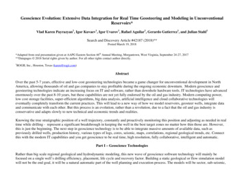
Figure 1. StarSteer - geosteering interpretation using multiple offset wells.
Figure 2. StarSteer - big data geosteering project.
Rather than big scale regional geological and hydrodynamic modeling, this new wave of geoscience software technology will mainly be focused on a single well's drilling efficiency, placement, life cycle and recovery factor. . Massive data integration: wells, logs, cores, seismic, sedimentology, geochemistry and other data will be combined .