Transcription
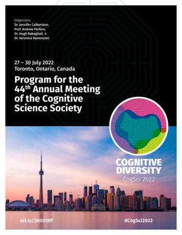
GEOSCIENCEINFORMATIONSOCIETYGeoscience Information NeedsinEducation and ResearchProceedings Volume 46 2018
Proceedings of the 53rd Meetingof the Geoscience Information SocietyNovember 4-7. 2018Indianapolis, IndianaGeoscience Information Needs in Education and ResearchEdited byCynthia L. ProsserProceedingsVolume 462018Geoscience Information Society
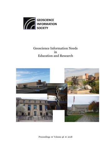
Copyright 2019 by the Geoscience Information SocietyMaterial published in this volume may be reproduced or distributed in any format via any meansby individuals for research, classroom, or reserve use. In addition, authors may use all or part ofthis work in any future works provided they credit the original publication by the Society,keeping in mind the following;Abstracts are reprinted with the permission of the Geological Society of AmericaGEOSCIENCEINFORMATIONSOCIETYISSN: 0072-1409For information about copies of this proceedings volume or earlier issues, contact:Publications ManagerGeoscience Information Societyc/o American Geoscience Institute4220 King StreetAlexandria, VA 22302-1502 USAOr consult the GSIS Website at: www.geoinfo.orgCover photos:Indiana State Museum: "Indiana State Museum" by istorija is licensed under CC BY-NC 2.0 . RetrievedOctober 25, 2019Indiana Obelisk (at the Indiana State Museum): "Indiana Obelisk by Robert Indiana, Indiana StateMuseum" by aimeedars is licensed under CC BY-NC-SA 2.0 . Retrieved October 25, 2019Eiteljorg Museum: "Indianapolis and GenCon" by CindyLouWho101 is licensed under CC BY-NC 2.0Indiana State Library: "2015.04.16-DSC01113" by martin kalfatovic is licensed under CC BY-NC-SA2.0 . Retrieved October 25, 2019Indianapolis Public Library: "Paul Philippe Cret with Zantzinger, Borie and Medary. Indianapolis PublicLibrary. 1917. Indianapolis, IN." by Jason M Kelly is licensed under CC BY-NC-SA 2.0 . RetrievedOctober 25, 2019
TABLE OF CONTENTSPREFACE: . . 4PART 1: GSA TOPICAL SESSION NO. 178 (POSTERS) 51. Our Time Around the Lake: A Hiking Tour Historical Geology Group ProjectHaroldson, Erik (Abstract Only) . 62. Use Your Neighbors Wisely: Sharing Best Practices in Sedimentary GeologyLicht, Kathy; Cope, Tim D.; Edmonds, Douglas A.; Elliot, William S.; Fluegeman,Richard; Moore, A. (Abstract Only) . . 73. Cave Pearl Data Logger Project – Building an Online Platform for Broader Impact andEducational OutreachBeddows, Patricia A.; Mallon, Edwards K. (Abstract Only) . 94. A New Model for Science Communication and Outreach: Interaction, InstructionalDesign, and InclusionMeisner, Caroline Bruno; Andrepont, Dori; Beazer, Danielle; Garcia, Melanie; McGrew,Allen J.; Metcalf, J. (Abstract Only) . . 105. Fairy Godmothers of Foraminifera? Using Storytelling to Communicate Marine ScienceKorpanty, Chelsea A.; Boehnert, S.; Boeske, S.; Borges, R.; Capparelli, F.; Cavaleiro, C.;Contreras, A.; Dallmayr, R.; Durian Toro, V.; Elyashiv, H.; Greco, M.; HernandezAlmeida, I,; Hohmann, S.; Hollstein, M.; Jackson, R.; Jacobi, L.; Kirillova, V.; Kraus, S.;Liu, Y.; Madaj, L.; Martinez Mendez, G.; Mendoza, P.; Muller-Dum, D.; Neto dosSantos, C.; Orfanoz, A.; Portilho-Ramos, R. C.; Rebotim, A.; Reyes Macaya, D. A.;Rossel, P.; Ruiz-Soto, S.; Saavedra-Pellitero, M.; Schmidt, C.; Selekere, N.; Soares, C.;Stone, J.; Tamborrino, L.; Tangunan, D.; Tobben, A.; Tondreau, N.; Wang, H.(Abstract Only) . . 126. Development of a Multi-Level Educational Smart Device Application to SupplementTrail Interpretation at Florissant Fossil Beds National MonumentGolub, Anna Rose; Johnson, Alyssa; Meyer, Herbert W.; O’Connor, Conni; Kelly,Michael M. (Abstract Only) . 147. Implementing Social Media Campaigns and Webinars to Promote Professionalization inPaleontologyLundgren, Lisa; Bex, Richard T.; Crippen, Kent J.; Gardner, Eleanor E.; Mills, Sadie M.;MacFadden, Bruce J.; (Abstract Only) . 168. Structuring Social Paleontology: A Description of Twitter Hashtags and UsersLundgren, Lisa; Bex, Richard T.; Crippen, Kent J (Abstract Only) . 18GSIS Proceedings, Volume 46, 20181
9. Geoscience Research and Information Needs for Supporting and Improving K-12 Earthand Space Sciences Teacher EducationCheek, Kim A.; Petcovic, Heather; Cervenac, Jason; Dahl, Robyn Mieko; Price, Nancy A.(Abstract Only) . 2010. Gaining Perspective with Google Earth Virtual Reality in an Introduction-Level PhysicalGeology CourseMcNamee, Brittani D.; Bogert, Kenneth (Abstract Only) . 2211. Using Spatial Multi-Criteria Evaluations to Assess Understanding and Ability in anIntroductory GIS Tutorial CourseRitter, John B.; Muhlenkamp, Quintin E. (Abstract Only) . . 2412. Assessment Methods for Undergraduate Stem Courses Integrating GeographicInformation TechnologyBadurek, Christopher A.; Miller, Wendy E. (Abstract Only) . . 2513. GIS and Geovisualization Methods for Assessing Impacts of the Flood of 2011 inBinghamton, NYBadurek, Christopher A. (Abstract Only) . 2614. Should You Be Concerned About Your Water Use? Cape Town, The City That ISRunning Dry!Isioho, K. Solomon; Isioho, Edna . . 2715. Investigating Undergraduate Students Reasoning About Socio-Hydrological Issues:Results from a Transdisciplinary Water CourseLally, Diane; Petitt, D. N.; Forbes, Cory; Brozovic, Nick; Franz, Trenton(Abstract Only) . 3716. Geologic Field Trip Guidebooks Web ArchiveBielskas, Amanda . 3817. Citizen Science or Crowdsourcing is ExploringDeis, Louise (Abstract Only) . . 4018. Increasing Open Educational Resources in the Earth Sciences Via Examination of theCopyright Status of Published WorksMusser, Linda R. . . 4119. Scientific Literature Uses in Geography: Indexing and “Overlap” in Four BibliographicToolsStirbu, Simona; Greco Ninfa (Abstract Only) . . 45GSIS Proceedings, Volume 46, 20182
20. Beyond Spreadsheets – R Interface for Initial Analysis and Visualization of “MediumData” From Environmental Monitoring NetworksLammers, Abigail M.; Beddows, Patricia A. (Abstract Only) . 4621. Evaluating the Effects of Removing Proposal Submission Deadlines in NSF’s Division ofEarth SciencesThomas, Mia S.; Jensen, Heidi B.; Harlan, Stephen S.; Smith, Dena M.; Patino, Lina C.(Abstract Only) . 47PART 2: GSIS MEETING SUPPLEMENTAL MATERIALS . 481. GSIS Schedule . 492. GSIS Business Meeting Minutes . . 513. Event Photos . . 56AUTHOR INDEX . . 67GSIS Proceedings, Volume 46, 20183
PREFACE:The Geoscience Information Society (GSIS) was established in 1965 as an independent nonprofitprofessional society. Members include librarians, information specialists, publishers, andscientists concerned with all aspects of geosciences information. Members are based in theUnited States, Canada, Australia, Sweden, Taiwan and the United Kingdom.GSIS is a member society of the American Geosciences Institute and is an associated society ofthe Geological Society of America. The GSIS annual meeting is held in conjunction with theannual GSA meeting, and the papers, posters, and forums presented are a part of the GSAprogram.Posters of the papers provided in these proceedings were given at the 2018 annual Meeting of theGeological Society of America held in Indianapolis, Indiana, November 4-7, 2018. Papers arearranged in the same order as the poster presentations. Where the entire paper is not available,the abstract is provided with the permission of GSA. Posters were presented all day with theauthors available during a two-hour session.The proceedings in this volume are divided into two parts:1. Poster papers presented at the GSA Poster Session No. 178: Geoscience Informationneeds in Education and Research2. GSIS Meeting Supplemental MaterialsThank you to all our poster presenters, the leadership of GSIS, and to the sessionconveners’/proceedings editors who have preceded us for their hard work in the name of theSociety and their contributions to our profession.Cynthia L. ProsserGSIS Technical Session Convener 2018GSIS Proceedings, Volume 46, 20184
Part 1: GSA Poster Session No. 178Geoscience InformationNeeds inEducation and ResearchTechnical Session ConvenerCynthia L. ProsserNovember 6, 2018GSIS Proceedings, Volume 46, 20185
Our Time Around the Lake:A Hiking Tour Historical Geology Group ProjectHAROLDSON, ErikDepartment of GeoscienceAustin Peay State UniversityPO Box 4418Clarksville, TN 37044A student group work project involving the creation of a guided hiking tour matched to thegeologic time scale has the advantage of informing public through outreach, while reinforcingconcepts in a historical geology course. In this project, students collaborated on developing ahiking tour around Devil’s Lake in Devil’s Lake State Park, Wisconsin, but it can be replicatednearly any place imaginable. Students worked in teams to create information views for individualtime periods which were enhanced with visuals in a google drawing. The individual drawings areaccessed via hyperlinked buttons on an online map of the hiking path. The entire project is thenorganized into a google site and made available to the public.To create the information views; geologic time periods were broken out and/or lumpedaccordingly with the number of groups desired, corresponding with the course enrollment.Students worked in groups to first develop a 600 – 1,200 word summary of their assigned timeperiods. After feedback is received from the instructor the students adjust their write-ups asneeded and incorporate them into a google drawing. The students then work to enhance thedrawings visually with various figures, which may include: a map of the tectonic plate alignment(where appropriate), flora and fauna present, type environments, etc. Very little guidance wasgiven allowing for creativity, although some standardization may help increase the overallappearance in future applications.To create the map; the instructor broke individual trail segments into geologic time units. Themap scaling was accomplished using the split command in ESRI ArcMAP. Other elements, suchas the lake outline, park roads and parking areas were digitized from various sources. Toincorporate the actual location geology; the map scale was adjusted to intersect a greatunconformity outcrop encountered on the hiking trail.Poster available online via GSA am/Paper323397.htmlGSIS Proceedings, Volume 46, 20186
Use Your Neighbors Wisely: Sharing Best Practices in Sedimentary GeologyLICHT, KathyDepartment of Earth SciencesIndiana University-Purdue University Indianapolis723 West Michigan Street, SL 118Indianapolis, IN 46202COPE, Tim D.GeosciencesDePauw University602 S. College AveGreencastle, IN 46135EDMONDS, Douglas A.Department of Earth and Atmospheric SciencesIndiana University1001 East 10th StreetBloomington, IN 47405ELLIOTT Jr., William S.Geology and PhysicsUniversity of Southern Indiana8600 University BlvdEvansville, IN 47712FLUEGEMAN, RichardDepartment of Geological SciencesBall State UniversityFine Arts Building (AR), Room 117Muncie, IN 47306andMOORE, A.Department of GeologyEarlham CollegeRichmond, IN 47374For the past three years, faculty who teach Sedimentary Geology courses from diverse highereducation institutions around Indiana have gathered in early August to exchange ideas aboutdiscipline-specific teaching and learning. The overall aim is to improve our courses andreinvigorate our teaching by: learning about how others structure their course, sharingGSIS Proceedings, Volume 46, 20187
instructional materials and assessments that others have found to be effective, gaining inspirationto implement new assignments/labs/field trips, and discussing common challenges and solutions.As a direct result of our workshops, nearly all participants have tried new approaches in theircourses, including revising assignments or assessments, and/or reflecting on learning goals andoutcomes. So far, about half of the faculty members who teach Sedimentary Geology at liberalarts colleges and state universities across Indiana have participated. Each workshop has a theme,such as field trips or project-based learning and assessment. Local pedagogical experts have beeninvolved to share best practices and individuals from the Indiana Geological and Water Surveywere invited to describe available resources. We have created a shared folder for instructionalmaterials that serves as an on-demand resource. The group has been an important sounding boardfor such diverse topics as new textbook development, minimizing risk on field trips and newsample acquisition. These inexpensive workshops have created a valuable new community ofcolleagues with whom we can have inclusive, in-depth discussions and share information aboutlocal field trips and other resources for teaching sedimentary geology in Indiana.GSIS Proceedings, Volume 46, 20188
Cave Pearl Data Logger Project – Building an Online Platform for BroaderImpact and Educational OutreachBEDDOWS, Patricia A.Department of Earth & Planetary SciencesNorthwestern University, Evanston, IL 60208-3130andMALLON, Edward K.Triple Point Design, LLCEvanston, IL 60202Online outreach can be challenging for technical projects because the audience for self-directedlearning material is diffuse and difficult to identify. The Cave Pearl Project developed an opensource data logging platform that is easy to assemble and capable of multi-year operation. Thesystem was published formally in 2018, with a project website/blog documenting the projectsince its inception in 2013. This has now reached 80k unique IP visits a year, providing insighton viewership demographics and project-level impact. The site’s content can be grouped intothree broad categories: 1) Technical how-to guides, with detailed build instructions andcalibration procedures. 2) Narratives on the challenges of deploying instruments in the field. 3)Classroom resources based on material used in the problem-based learning course EARTH 360Instrumentation at Northwestern University. Traffic is dominated by organic Google searches forentry-level material, and secondarily by links from Pinterest and Reddit. Seasonality is consistentwith school calendars in North American and Western Europe, indicating pedagogical use.Traffic for the more advanced technical material is driven by referrals from popular technicalforums (e.g. Arduino.cc, Dangerous Prototypes, Quora, etc) Low but continuous traffic arrivesfrom the project presence on open-source community sites like Hackaday, Publiclab, Scistarter,etc. Field reports draw negligible interest, and in 2018 that material was migrated to Twitter.While the USA represents 50% of the overall viewership, the per capita by country traffic isbiased towards Western Europe, with Germany leading. South and Central America, Africa, andmost of Asia are low (with the exception of India), implying this material is not yet reaching thescientific and educational communities who could benefit most from powerful but inexpensiveopen-source instrumentation.Poster available online via GSA am/Paper320230.htmlGSIS Proceedings, Volume 46, 20189
A New Model for Science Communication and Outreach:Interaction, Instructional Design, and InclusionMEISNER, Caroline Bruno1,ANDREPONT, Dori2,BEAZER, Danielle1,GARCIA, Melanie3,MCGREW, Allen J.4andMETCALF, J.512Earth and Physical SciencesGreat Basin College1500 College ParkwayElko, NV 89801Arts and Letters, Great Basin College1500 College ParkwayElko, NV 898013Computer TechnologiesGreat Basin College1500 College ParkwayElko, NV 898014Geology Department,The University of Dayton300 College ParkDayton, OH 45469-23645GSIS Proceedings, Volume 46, 2018Department of Geological SciencesUniversity of ColoradoBoulder, CO 8030910
Outreach presents a powerful venue to disseminate science to the public and policy makers. Aswe see with topical environmental issues involving water, climate and resources, scientists needto revise current communication techniques to improve science literacy by reinventing thescience education outreach paradigm.We start by embedding a local earth sciences professor, familiar with the field area, as a PI.Benefits of this approach provide connections with local media, regional geologicalorganizations, service clubs, land access, and sense of place. Her role is to manage the broaderimpacts, which includes producing instructional materials about the research. Core to thesematerials are short video-tutorials, filmed in the field, of CO-PIs and prominent regionalgeologists discussing the local geology, sampling techniques, and geochronology. Therecordings are available to students and the public on the Ruby Mountains Geology,Geochronology and Education YouTube Channel. These tutorials are linked to interactivefieldtrip guides using Google Maps the public can download prior to a hike or a road trip so theycan be viewed in areas with limited cellular service.Content modules regarding Metamorphic Core Complexes, Geochronology, and Methods are indevelopment and will be accessible as open educational resources (OER) in Canvas Commonsfor all geoscience educators to access. The content modules include learner outcomes, shortlectures, aligned self-check assessments, the interactive Google map of the field area, and linksto additional resources. To increase accessibility to all people interested in the earth sciences, allinstructional materials produced are Americans with Disabilities (ADA) Act compliant; thismeans the videos are closed captioned, and figures and photographs have alt text and can be readby a screen reader.An important aspect of this outreach approach is to build the instructional resources with a multidisciplinary team of English, graphic communications, and education undergraduates. Studentsin these disciplines will lend their knowledge in communication, illustrations, video editing, andpedagogy while gaining experience in the sciences. This model extends science dialogue out ofthe laboratory and into the homes of non-scientists, community members and policy makers.Poster Available online via GSA am/Paper320407.htmlGSIS Proceedings, Volume 46, 201811
Fairy Godmothers of Foraminifera?Using Storytelling to Communicate Marine ScienceKORPANTY, Chelsea A.1BOEHNERT, S.2BOESKE, S.2BORGES, R.2CAPPARELLI, F.2CAVALEIRO, C.2CONTRERAS, A.2DALLMAYR, R.2DURÁN TORO, V.2ELYASHIV, H.2GRECO, M.2HERNÁNDEZ-ALMEIDA, I.2HOHMANN, S.2HOLLSTEIN, M.2JACKSON, R.2JACOBI, L.2KIRILLOVA, V.2KRAUS, S.2LIU, Y.2MADAJ, L.2MARTÍNEZ MÉNDEZ, G.2MENDOZA, P.2MÜLLER-DUM, D.2NETO DOS SANTOS, C.2ORFANOZ, A.2PORTILHO-RAMOS, R.C.2REBOTIM, A.2REYES MACAYA, D.A.2ROSSEL, P.2RUIZ-SOTO, S.2SAAVEDRA-PELLITERO, M.SCHMIDT, C.2SELEKERE, N.2SOARES, C.2STONE, J.2TAMBORRINO, L.2TANGUNAN, D.2TOBBEN, A.2TONDREAU, N.2GSIS Proceedings, Volume 46, 201812
andWANG, H.2(1) MARUM Center for Marine Environmental SciencesGLOMAR Bremen International Graduate School for Marine SciencesUniversity of BremenLeobener Str. 8Bremen, 28359, Germany(2) MARUM Center for Marine Environmental SciencesUniversity of BremenLeobener Str. 8Bremen, 28359, GermanyStorytelling represents one of the oldest, most social forms of communication. It therefore canoffer a unique, personal approach to science communication and to establishing a dialoguebetween scientists and the general public. “Once Upon a Time a Scientific Fairy Tale” drawsupon the versatility of storytelling to promote scientific knowledge to children and adultsthrough illustrated short stories and poetry. The project was organized in 2016 by aninternational group of marine science PhD students and postdoctoral researchers at theUniversity of Bremen. In 2017 the first “Once Upon a Time ” volume was published withfunding from the “Show your Science” competition sponsored by the German sciencecommunication foundation Science in Dialogue (Wissenschaft im Dialog). The 12 stories andpoems in this volume relate various marine science themes – from marine biology, ecology, andgeology to human interactions with the oceans. The stories aim to convey, in a clear andengaging way, scientific content inspired by the authors’ (the scientists’) personal research andpassions. The “Once Upon a Time ” volume was published as an illustrated, free to downloade-book in English, German, and Spanish. In order to reach a wider readership, the e-book is alsobeing translated to Italian, French, Chinese, Portuguese, Hebrew, Filipino, Korean, and Russian.To promote the volume and science communication, the “Once Upon a Time ” group doesreadings of the stories and poetry in local schools and libraries and at science events. In additionto publishing a second volume (in progress), the group is seeking international collaboration withteachers, citizens, and scientists to expand the scope and readership of the “Once Upon aTime ” scientific storytelling network.GSIS Proceedings, Volume 46, 201813
Development of a Multi-Level Educational Smart Device Application toSupplement Trail Interpretation at Florissant Fossil Beds National MonumentGOLUB, Anna RoseGeology and Environmental GeosciencesLafayette CollegeVan Wickle HallEaston, PA 18042&Geoscientist-in-the-ParkFlorissant Fossil Beds National MonumentPO Box 185, Florissant, CO 80816JOHNSON, AlyssaInstitute of Arctic and Alpine ResearchUniversity of ColoradoBoulder, CO 80303&Geoscientist-in-the-ParkFlorissant Fossil Beds National MonumentPO Box 185, Florissant, CO 80816MEYER, Herbert W.National Park ServiceP.O. Box 185, Florissant, CO 80816O’CONNOR, ConniMuseum TechnicianFlorissant Fossil Beds National MonumentPO Box 185, Florissant, CO 80816andKELLY, Michael M.School of Earth and SustainabilityNorthern Arizona UniversityFlagstaff, AZ 86011GSIS Proceedings, Volume 46, 201814
People of all ages and educational backgrounds travel to Florissant Fossil Beds NationalMonument to experience the natural resources of the park. Existing trail exhibits at Florissantattempt to target this diverse audience through compelling, succinct language and avoid in-depthdiscussions and complex topics, instead hoping visitors will be inspired through staff interactionsor bookstore offerings. Our research objective is to explore visitor reactions to “in the moment”free choice learning through visitor interaction with a multi-level smart device application,Florissant Explorer: a tool to facilitate deeper learning at the monument. This research projectwas in part driven by Geoscientist-in-the-Park paleontology interns, who synthesized high-levelgeologic concepts critical to the comprehension of Florissant’s geology and produced scripts,graphics, paleoreconstructions, and other media. Florissant Explorer will let visitors choose fromthree different interpretive levels: a "Junior Ranger"; an inquisitive park visitor; and an advancedscience student. At each of the nine exhibits along Florissant Fossil Beds National Monument’sGeologic Trail, the application will enrich visitor experience by providing information on topicsranging from the origins of Precambrian granites and Eocene volcanics to climate methods usedin paleobotany. One example of this is at the trail exhibit titled "A Mammoth Change inClimate," where the application will explain concepts as complex as major climate changeillustrated in the Zachos curve. This app will be an innovative prototype with the potential forapplication to other National Park Service units as a national model. Florissant Explorer supportsthe mission of the National Park Service by fostering public education and awareness of ourplanet, and the multi-level nature of the application is designed to facilitate learning about theneed for preservation of the natural world in students of all ages.GSIS Proceedings, Volume 46, 201815
Implementing Social Media Campaigns and Webinars to PromoteProfessionalization in PaleontologyLUNDGREN, LisaCollege of EducationSchool of Teaching and LearningUniversity of Florida2423 Norman HallPO Box 117048Gainesville, FL 32608BEX II, Richard T.College of EducationSchool of Teaching and LearningUniversity of Florida2423 Norman HallPO Box 117048Gainesville, FL 32611CRIPPEN, Kent J.College of EducationSchool of Teaching and LearningUniversity of Florida2403 Norman HallPO Box 117048Gainesville, FL 32611GARDNER, Eleanor E.Biodiversity Institute & Natural History MuseumUniversity of Kansas1345 Jayhawk Blvd.Lawrence, KS 66045MILLS, Sadie M.Florida Museum of Natural HistoryUniversity of Florida1659 Museum RoadGainesville, FL 32611andGSIS Proceedings, Volume 46, 201816
MACFADDEN, Bruce J.Florida Museum of Natural HistoryUniversity of FloridaPO Box 117800Gainesville, FL 32611Social media provides countless opportunities for individuals to learn collaboratively as well ascontribute to scientific knowledge within digital contexts. The FOSSIL Project, a NationalScience Foundation-funded initiative, uses social media platforms (i.e. Twitter and Facebook) tounite paleontologists, regardless of level of expertise, as a more formalized paleontologicalcommunity. In the fall of 2016, the FOSSIL Project began offering a series of webinars topromote professionalization for community members. The FOSSIL Project created four four-partwebinar series in which each series consisted of four distinct webinars. Each series coveredspecific topics to encourage the development of paleontological knowledge and expertise,including fossil collection, preparation, identification, and curation. To bolster communityinvolvement, members of the FOSSIL social media team produced messaging campaignsspecific to each webinar series, drawing on best practices from marketing and educationalresearch. University researchers, student interns, and museum scientists collaborated to ensurethat messages were scientifically accurate, engaging, educative, and branded. The campaign foreach webinar resulted in different degrees of community engagement, with the “Process ofPaleontology” series seeing the greatest involvement in development and implementation, andthe “Women in Paleontology” series seeing the least. Through our description of these socialmedia campaigns and outcomes, we illustrate how social media can be used effectively to engagediverse community members fully in social paleontology via webinar development andimplementation, including soliciting content, increasing attendance, and participating in sociallearning.GSIS Proceedings, Volume 46, 201817
Structuring Social Paleontology: A Description of Twitter Hashtags and UsersLUNDGREN, LisaCollege of EducationSchool of Teaching and LearningUniversity of Florida2423 Norman HallPO Box 117048Gainesville, FL 32608BEX II, Richard T.College of EducationSchool of Teaching and LearningUniversity of Florida2423 Norman HallPO Box 117048Gainesville, FL 32611CRIPPEN, Kent J.College of EducationSchool of Teaching and LearningUniversity of Florida2403 Norman HallPO Box 117048Gainesville, FL 32611On Twitter, individuals can find and contribute knowledge to the scientific community,regardless of status (i.e. professional, amateur, or other). The paleontological community,consisting of museums and their representatives, academic researchers, amateur fossil collectors,paleontological artists and commercial fossil retailers, use Twitter and seemingly benefit fromthe collaborative nature of the platform. Such collaboration would represent an accessible andtransparent aid for accelerating the overall advancement of paleontology. However, to date, scantresearch has documented the structure of the paleontological social network on Twitter orexplored how it might impact the flow of information and eventual discovery. This study seeksto provide a robust description of the ways in which paleontology-specific information flowsthrough the social network on Twitter. Using an open-source network analysis software program,NodeXL, the social network for the top four paleontology-related hashtags was sampled (n 7,297 connections), analyzed and visualized. Members in the social network (n 3,386) werefurther classified based upon a taxonomy for how they described themselves and expressed theirstatus. Results indicate that the network includes a surprisingly diverse variety of members,GSIS Proceedings, Volume 46, 201818
including the public (63%), scientists (23%), education and outreach entities (12%) andcommercial entities (2%). Members of the public were central actors in the flow ofpaleontological information whereas scientists and science organizations served as key arbiters.The composition, structure and flow of information within this social network has implicationsfor the paleontological community as it seeks to expand access, recognize the contributions ofall, and support collaborations that improve the practice of science.GSIS Proceedings, Volume 46, 201819
Geoscience Research and Information Needs for Supporting and ImprovingK-12 Earth and Space Sciences Teacher EducationCHEEK, Kim A.Childhood Education, Literacy, & TESOLUniversity of North Florida1 UNF DriveJacksonville, FL 32224PETCOVIC, HeatherDepartment of Geological and Environmental SciencesandThe Mallinson Institute for Science EducationWestern Michigan University1903 W. Michigan Ave, Kalamazoo, MI 49008CERVENAC, JasonThe STEAM FactoryThe Ohio State University135A Scott Hall1090 Carmack Rd.Columbus, OH 43210DAHL, Ro
Technical Session Convener Cynthia L. Prosser November 6, 2018 . GSIS . Clarksville, TN 37044 A student group work project involving the creation of a guided hiking tour matched to the geologic time scale has the advantage of informing public through outreach, while reinforcing . 602 S. College Ave Greencastle, IN 46135 EDMONDS, Douglas A. .
