Transcription
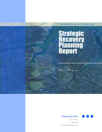
The Borough of OceanportStrategicRecoveryPlanningReportDRAFT October 3, 2014Clarke Caton HintzArchitecturePlanningLandscape Architecture
Strategic RecoveryPlanning ReportBorough of Oceanport,Monmouth County, New JerseyPrepared for:The Borough of OceanportOctober 3, 2014Prepared by:Clarke Caton HintzMichael F. Sullivan, ASLA, AICPPP License #5153ArchitecturePlanningLandscape ArchitectureElizabeth K. McManus, PP, AICP, LEED APPP License #5915
Strategic RecoveryPlanning ReportBorough of Oceanport,Monmouth County, New JerseyOceanportBorough CouncilOceanportPlanning BoardMichael Mahon, MayorEllynn M. Kahle, Council PresidentJerry BertekapRichard GalloJoseph A. IraceRobert D. LynchChristopher PagliaChristopher Widdis, ChairmanJames Whitson, Vice ChairmanJohn Kahle, Mayor’s Designee-At WillRick GalloCynthia DeSousaDavid GruskosWilliam JohnsonRobert KleibergMichael SavareseWilliam SullivanBorough CouncilProfessionalsJeanne Smith - Borough ClerkPlanning BoardProfessionalsJohn O. Bennett - AdministratorScott Arnette . - AttorneyArnette Law Firm LLCWilliam White, PE, CME - EngineerMaser ConsultingJeanne Smith, Board SecretaryRick DeNoia, Esq. - AttorneyRick DeNoia Law OfficeWilliam White, PE, CME - EngineerMaser Consulting
Table of ContentsIntroduction.1Existing Conditions. 3Damage from Superstorm Sandy. 9Vulnerabilities & Opportunities Highlighted by Superstorm Sandy.13Policy & Data Review. 15Recovery, Mitigation, Resilience &Adaptation Steps to Date. 23Community Input. 29Recommended Action Steps.35MapsEnvironmental Constraints.5Base Flood Elevation. 6Superstorm Sandy Inundation & Property Loss. 11Critical Facilities.12Predicted Impacts of Sea Level Rise In 2050.17Predicted Impacts of Sea Level Rise In 2100.18
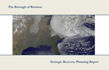
IntroductionHurricane Sandy was the deadliest hurricane of the 2012Atlantic Hurricane season, as well as one of the costlieststorms to impact the United States. It made landfallon October 29, 2012 along the southern coast of NewJersey near Atlantic City. Fortunately, it was downgradedto a post-tropical cyclone with hurricane force windsprior to landfall. Even with the downgraded status,the damage in New Jersey was unprecedented withapproximately 346,000 New Jersey homes damaged,of which 22,000 were uninhabitable and nearly 19,000businesses sustained damage of 250,000 or more.5The Borough of Oceanport has a history of floodingfrom the Shrewsbury River and its tributaries, includingthe Branchport Creek. At only 3.9 square miles, nearly25% of the Borough is located in the Special FloodHazard Area (defined as having a 1% annual chance offlooding).Superstorm Sandy resulted in extensive flooding in theBorough across or lands along Shrewsbury River (a tidalstrait), Branchport Creek, Turtle Mill Brook, OceanportCreek and Parkers Creek, as well as properties furtherA satellite image of the storm on October 29, with most of the U.S.coastline artificially highlighted.inland. Water levels in the Borough reached six feet inthe neighborhood between Blackberry Bay Park andSommers Boy Scout Park, as well as parts of Gooseneck Point, Horseneck Point andalong many parts of the Borough’s water bodies. Lesser water levels of one to four feetwere present in much of the Borough’s inland areas. Additionally, the flooding causedsignificant damage to the Borough’s municipal building, Old Wharf House communitycenter, police department, department of public works and the non-profit-owned firstaid building.In response to the storm’s impacts, the federal government allocated more than 50 billion to 19 federal agencies as part of the Disaster Relief Appropriations actof 2013. Of that allocation, 15.2 billion was appropriated for the HUD Community1Blake, Eric S.; Kimberlain, Todd B.; Berg, Robert J.; Cangialosi. John P. and Beven, John L., II. Tropical CycloneReport, Hurricane Sandy. National Hurricane Center. February 12, 2013.Page 1
Development Block Grant Disaster Recovery (CDBG-DR) program and, of this, 3.3billion was allocated for New Jersey and will be awarded in two rounds. New Jerseyreceived 1.8 billion in the first round (2013) and 1.5 billion in the second round(2014). This Strategic Recovery Planning Report (SRPR) is prepared for the Borough ofOceanport with funding provided by theNew Jersey Department of CommunityAffairs through its Post Sandy PlanningAssistance Grant Program. ThisState grant program is funded by theFederal CDBG-DR program allocation.Completion of a Strategic RecoveryPlanning Report is prerequisite foradditional funding from the Post SandyPlanning Assistance Grant Program;subsequent applications may requestfunding for master planning, ordinances,capital facilities planning and similarResidence in the process of being lifted above the flood elevationprojects.The Borough, as well as the State and Monmouth County, are now conducting postdisaster planning, which is defined as creating a vision for the community’s recoverythat addresses reconstruction, economic recovery and land use regulations. Theimmediate safety issues during and after a disaster are not addressed in this topic andare better addressed in emergency response planning. There are three broad categorieswhich municipalities should address in their post-disaster planning:Hazard Mitigation – The lessening of the potential adverse impacts of physicalhazards (including those that are human-induced) through actions that reducehazard, exposure, and vulnerability.Resilience – The ability of a system and its component parts to anticipate, absorb,accommodate or recover from the effects of a hazardous event in a timely andefficient manner, including through ensuring the preservation, restoration orimprovement of its essential basic structures and functionsAdaptation – The process of adjustment to actual or expected climates and theireffects in order to moderate harm or exploit beneficial opportunities.This Strategic Recovery Planning Report addresses each of these categories andprovides action steps for how Oceanport can perform hazard mitigation, increase itsresilience and adapt to a changing climate and weather events.Page 2Strategic Recovery Planning Report Borough of Oceanport, Monmouth County, New Jersey
Existing ConditionsThe Borough floods approximately half a dozen times a year, primarily due to rainevents. Flooding in the Borough can be extensive, given that 24.7% the Boroughis within the Special Flood Hazard Area with a 1% annual chance of flooding (alsoreferred to as the 100 year flood hazard area) and an additional 9.9% of land has a0.2% annual chance of flooding (also referred to as the 500-year flood hazard area).The Special Flood Hazard Area, as discussed herein, is sourced from the PreliminaryWork Maps for Monmouth County. These maps report a lower base flood elevation inmany parts of Oceanport as compared to previous flood hazard area mapping. TheBorough expressed concern about these base flootd elevations but recognizes that itmay address the problem by requiring, in its Borough Code, additional elevation forbuildings in the Special Flood Hazard Area.The extent of flooding varies significantly depending on whether precipitation occursduring low tide or high tide. Minor flooding, which generally occurs during low tide,is largely considered a nuisance, with flood waters reaching streets and open spacesrather than public or privately-owned buildings. More severe flooding is generallylimited to storms having significant levels of precipitation that occur during high tide.For example, flooded homes have occurred when a nor’easter arrives during high tide.In addition to 2012’s Superstorm Sandy, the Borough experienced significant floodevents in 1999, 2005, 2006, 2007, 2010 and 20115. The most commonly flooded streetsinclude Gooseneck Point Road, Bridgewaters Drive, Port-au-peck Avenue and thosestreets between Blackberry Bay Park and Sommers Boy Scout Park.Existing Flood Hazard AreasFEMA’s Preliminary Work Maps for Monmouth County.place about one-quarter of theBorough’s land area in the Special Flood Hazard Area. Within this area are base floodelevations ranging from 9 to 10 feet immediately adjacent to the waterbodies to asmuch as 8 feet at more inland properties. This generally includes: Horseneck Point,Gooseneck Point, the commercial area along East Main Street and lands along all ofthe Borough’s waterways. See the Environmental Constraints and Base Flood Elevationmaps on the following pages for additional information.3New Jersey Coastal Community Resilience Demonstration Project. NJ Sea Grant Consortium. December 2010Page 3
Another 10% of the Borough has a .2% chance of flooding annually (also referred toas the 500 year flood hazard area). This area is generally only covers the land adjacentto the Special Flood Hazard Area, but there are larger areas including: betweenMonmouth Boulevard, Branchport Avenue, Port Au Peck Avenue, and Myrtle Avenue;the neighborhood north of Avon Avenue; and additional areas of Fort Monmouth nearHorseneck Point and Oceanport Creek.Borough Flood Control Strategy & InfrastructureThe Borough’s flood control strategy is primarily composed of a series of 44 outfallsand open ditches that convey storm and flood waters to the surrounding waterwayssuch as Blackberry Bay and the Shrewsbury River. Example ditches in the Boroughinclude that which runs along Blackberry Bay Park, behind homes facing CayugaAvenue, and empties to the Blackberry Bay; a ditch which runs along the rear of homeson the south side of Genessee Avenue and empties to the Blackberry Bay; and a ditchwhich runs perpendicular to Seneca Avenue and empties into the Branchport Creek.Additionally, the Turtle Mill Brook at Oceanport’s southern boundary conveys waterfrom Borough lands to the Branchport Creek.Only a small portion of the 44 outfalls have backflow preventers. However, while theyare a useful mitigation strategy, backflow preventers have limited utility during high tideor other times of high water levels as the water can overtop not only the outfalls but theland itself. Notwithstanding, additional backflow preventers should be installed so asto reduce flooding during moderate or storm events and to extend time for residents tosafely evacuate during major flooding.Bulkheads serve as the primary protection from riverine flooding and are also subject toregulations in the Coastal Area Facitlies Review Act (CAFRA). However, the height, andtherefore the level of protection, of the bulkheads vary by property. The vast majority ofbulkheads in Oceanport are installed on private property and maintained by the ownersof the property where they are located. As such, there is no consistency in the level ofprotection or construction materials. Additionally, the benefits are questionable for anindividual property owner to install a higher and more protective bulkhead since floodwater could come through any adjacent and lower bulkhead.Public Water & Sewer UtilitiesOceanport’s potable water supply is provided by New Jersey American Water Co.and sanitary service is provided by the Two Rivers Water Reclamation Authority. Thetreatment plant is located on Raccoon Island in Monmouth Beach and serves membercommunities: Fair Haven, Little Silver, Monmouth Beach, Oceanport, Shrewsbury, andWest Long Branch, as well as Fort Monmouth. Additionally, Eatontown, Red Bank,Rumson, Sea Bright, Shrewsbury Township, and Tinton Falls are customers, sendingsome sanitary sewer flows to TRWRA.Page 4Strategic Recovery Planning Report Borough of Oceanport, Monmouth County, New Jersey
Emergency AlertThe Oceanport Police Department oversees mobile route (vehicle) and door-to-dooralerts. The alert staff includes bilingual participants. System activation requires theEmergency Management Coordinator (EMC) to contact the County first. The next inline to activate the system are (in descending order) the Deputy EMCs, Mayor, PoliceChief, and Captain of Police. The Police Coordinator directs the response and maintainsrecords and reports pertaining to emergency alerts. Emergency alerts (without thesiren) occur monthly.Oceanport has an emergency alert system composed of six electric outdoor warningdevices, with battery backup, to inform voluntary services of a call and residentsof evacuations and extraordinary security issues. It provides a siren and audibleannouncements, with some of the latterpre-recorded. In the event of a power outage,the batteries will last for two days. Afterpower is lost, mobile alerts are necessary.Notwithstanding the system’s soundcapabilities, it can be difficult for area residentsto hear the warnings during windy conditions.Installed in 2010, the Shrewsbury River EarlyFlood Warning System monitors water levelsin the river and provides river flooding alertsto the county and local Offices of Emergency.There are five gauges, including one inOceanport Volunteer First Aid and Rescue SquadOceanport on the bridge between GooseneckPoint and Little Silver, that monitor river levels for potential flooding from tropicalsystems, nor’easters, tides, and rainfall upriver. The system also collects data as abenchmark for future analysis. Oceanport’s designation as a National Weather ServiceStormReady community catalyzed this collaborative effort among jurisdictions affectedby Shrewsbury River flooding, Monmouth University, and the Stevens Institute ofTechnology.Federal Emergency Management Agency (FEMA) Community Rating SystemThe FEMA Community Rating System (CRS) is a voluntary program wheremunicipalities in the National Flood Insurance Program (NFIP) enact up to 18 floodprevention measures intended to reduce damage to flood-prone properties. Thenumber and effectiveness of these measures determine the discount level of standardflood insurance premiums to NFIP-enrolled properties in the municipality. The discountdoes not apply to Preferred Risk Policies.Oceanport originally enrolled in the program in 1977 and thereon began implementingmeasures supporting the CRS’s objective. In 2010, the Borough became a Class 8community where NFIP properties in Zone AE receive a 10% discount on their floodPage 7
insurance premiums and properties in Zone X (which is not considered a SFHA)receive a 5% discount. If the Borough implements additional measures such that it is aClass 1 community, properties can receive up to a 45% discount.The Borough implemented 13 measures worth a total of 1,333 credit points. The projectsworth the most points are: regularly inspecting and maintaining the drainage system(253), enforcing floodplain storage capacity and adopting the International BuildingCode (180), providing flood zone information and an updated Flood Insurance RateMap to interested parties (140), implementing a floodplain management plan (139),and annually disseminating a flood-related newsletter to residents in flood zones (116).Page 8Strategic Recovery Planning Report Borough of Oceanport, Monmouth County, New Jersey
Damage from Superstorm SandySuperstorm Sandy made landfall near Atlantic City on October 29, 2012 with 80 mphwinds and record-breaking low pressure for many cities hit by the storm. If Sandywas a hurricane at landfall, it would have been a Category 1 storm; fortunately it wasdowngraded to a post-tropical cyclone with hurricane force winds prior to landfall. Thestorm hit New Jersey during an exceptional high tide and caused extensive floodingin Oceanport, with many areas inundated in over three feet of water and some placesexperiencing flood levels of five plus feet.Similar water levels were seen across much of the neighborhood north of MonmouthBoulevard, as well as Gooseneck Point, Horseneck Point and along Branchportand Oceanport Creeks. Of the Borough’s 2,390 homesreported in the 2010 US Census, approximately 1200 (50%)sustained damage from flooding, wind and/or fallen trees.Approximately 800 homes (33%) experienced flood damageand 118 homes were substantially damaged, defined asdamage that exceeds 50% of the home’s market value. SinceSuperstorm Sandy, approximately 70 homes have beenelevated and several more are on the waiting list for funds todo so. Additionally, 28 homes have been demolished; however,23 new homes have been built in place of the demolishedResidence that suffered substantialhomes.damage during Super-storm SandyAs shown on the Superstorm Sandy Inundation & PropertyLoss map, the Borough has 44 properties identified as severe repetitive loss properties,which are summarily defined as any NFIP-insured residential property that has metat least one of the following for paid flood loss criteria since 1978: 1) four or moreseparate claim payments of more than 5,000 each (including building and contentspayments); or 2) two or more separate claim payments (building payments only) wherethe total of the payments exceeds the current value of the property.Flooding in Borough Hall from Superstorm Sandy was extensive, even reaching thelibrary and office that remained dry in a 1992 flood. Ultimately, Borough Hall will notbe repaired due to ongoing flood threats and due to the structural and water damagesustained during and after the storm. The majority of the building and surroundingarea were flooded with one or two feet of water; however, the lower level Councilchambers / public meeting room was flooded with four to five feet of water. A damagePage 9
report found many cracks in the foundation and settling slabs. The Borough is seekingfunds for relocation of the facilities on the municipal site.Additionally, the Borough’s other critical facilities – police department, departmentof public works, Old Wharf House community center and firstaid building on Pemberton Avenue– experienced flooding5.Fortunately, the firehouses on Main Street and Port-au-peckAvenue and the Maple Place and Wolf Hill Schools were largelyspared from flooding. The lack of flooding in the westernportion of the Borough allowed for Wolf Hill School to serve as atemporary shelter and headquarters for Police and Departmentof Public Works operations. Maple Place School was also used asa temporary shelter. To date, the Borough continues to conductmuch of its operations from temporary locations – for example,public meetings are held at Maple Place School and the municipalExisting Municipal Building that suffered substantial offices are located in the now-renovated Old Wharf Housedamage from Superstorm Sandycommunity center. See the Critical Facilities map on the followingpage for the location of these facilities in the Borough.Consistent with extensive damage to public and private properties, many of theBorough’s streets were flooded. Additionally, all of the Borough’s bridges were closedand/or inaccessible. The Borough was able to close the Pleasure Bay Bridge, BranchportAvenue Bridge and Gooseneck Point Bridge. The Oceanport Avenue Bridge was also notsafe to traverse due to flood waters at the Oceanport end of the bridge; however, theBorough was unable to close this bridge due to lack of access. The Branchport AvenueBridge sustained the most damage since flood waters overtopped the bridge. PleasureBay and Gooseneck Bridges, while traversable, were closed for security purposes – toprevent motorists from entering Oceanport while streets were flooded and dangerous totraverse. Notwithstanding the closing of bridges and streets with barricades and signs,motorists circumnavigated these warnings to access closed streets and bridges. Gatesthat lock, or otherwise prevent motorists from going through or around them, should beinstalled on these bridges in order for emergency management personnel to adequatelyprevent motorist from accessing the bridges and putting themselves in harm’s way.In addition to flooding, much of the Borough experienced significant power outages,including those that lasted more than a week. The lack of power contributed to damagein Borough by hampering clean-up. Additionally, the lack of power made communicationdifficult between emergency service personnel and Borough residents. Most notably,the lack of power limited the usefulness of the Borough’s emergency alert system. Thesystem is equipped with a battery; however, the battery was drained shortly thereafterand was therefore unable to provide alerts. Additionally, the alert system was unable tobe put back in service upon power restoration due to lighting damage to two of the sixelectric outdoor warning devices.4Page 10The first aid building is not a Borough-owned facility. Instead, it is owned and operated by nonprofit organization,Oceanport Volunteer First Aid and Rescue Squad.Strategic Recovery Planning Report Borough of Oceanport, Monmouth County, New Jersey
Vulnerabilities & OpportunitiesHighlighted by Superstorm SandyThere were few opportunities highlighted by Superstorm Sandy, but it did create theopportunity to evaluate the flood control infrastructure and to renew advancement ofproposals for flood protection.Lack of Flood CapacityThe Borough is nearly fully developed with no additional large areas of undevelopedland within the floodplain to use for flood storage capacity. State acquisition of floodprone land through the Blue Acres Program has focused on large areas that can makea significant contribution toward flood storage. However, in Oceanport nearly allwaterfront land consists of residential properties. As such, the Borough does not havethe opportunity to develop flood storage without acquisition of privately-owned anddeveloped land and subsequent conversion to open space. Doing so would not onlybe a very costly process, but would erode the Borough’s tax base since a significantnumber of high-value homes are located in these areas. As such, acquisition for privateproperty for open space purposes must be carefully considered.Flood & Stormwater InfrastructureThe Borough’s flood and stormwater infrastructure, which is largely composed ofditches and 44 outfalls, are not capable of moving water out of the Borough fastenough during heavy rain events that occur when the levels of surrounding waterbodies are high – most notably during high tide. As a result, there is localized floodingapproximately six times a year. As a result of the Borough’s largely built-out nature,there are very limited opportunities to utilize land for flood storage without the needfor acquisition of private property. Due to the limitations on such a major componentof green infrastructure – open space in flood prone areas – the Borough will need tocontinue to rely heavily on gray infrastructure – its system of pipes and outfalls.Page 13
The following identifies the vulnerabilities and necessary improvements to much of theBorough’s flood and stormwater infrastructure – both green and gray infrastructure. Green Infrastructure. Remove debris and sediment from stormwater conveyanceroutes believed to be impeding flood flows and causing flooding of adjacentproperties. This should include, but not be limited to Turtle Mill Brook. Gray Infrastructure. Examine and repair the stormwater drain system. This shouldinclude assessment of the Borough 44 outfalls to determine if installation ofbackflow preventers would provide additional protection or time for evacuation.Note that while backflow preventers may prove to be a critical improvement to theBorough’s system, they cannot prevent flooding when water overtops the outfallsand bulkheads; they can only prevent water from flowing back into the pipes.Notwithstanding, this improvement could prevent moderate flooding and extendthe time for residents to safely evacuate.In addition to this storm and flood waterconveyance and storage, the Boroughalso relies on its system of bulkheadsas the primary protection from riverineflooding. Nearly all bulkheads in Oceanportare installed on private property andmaintained by the owners of the propertywhere they are located. However, theBorough owns and maintains a smallportion of bulkheads, such as those alongpublic lands and those at street endsadjacent to the water. As such, there isno consistency in the level of protectionBlackberry Bay Park boat ramp and bulkheadsor construction materials. Additionally,there is no incentive for a property ownerto install a higher and more protective bulkhead since water will come through anyadjacent and lower bulkhead.Critical FacilitiesThe majority of the Borough’s critical facilities are located within the Special FloodHazard Area because of a shortage of developable land outside this area. See theCritical Facilities map earlier in this Report for the locations of critical facilities in theBorough. The location of the Borough’s critical facilities in the Special Flood HazardArea led to not only necessary repairs subsequent to Sandy, but also difficulties inconducting emergency operations during and after the storm. As discussed previously,flooding in Borough Hall from Superstorm Sandy was so extensive that the building willnot be repaired and a new facility will be created elsewhere. Additionally, the Borough’sother critical facilities –department of public works, police department, Old WharfHouse community center and first aid building– experienced flooding. Fortunately,Page 14Strategic Recovery Planning Report Borough of Oceanport, Monmouth County, New Jersey
the firehouses on Main Street and Port-au-peck Avenue and the Maple Place and WolfHill Schools were largely spared from flooding. Note that the first aid building is not aBorough-owned facility. Instead, it is owned and operated by Nonprofit organization,Oceanport Volunteer First Aid and Rescue Squad.The Borough is in the process and should continue seeking an alternative locationfor the municipal facilities that were substantially damaged, particularly the municipalbuilding, police department and department of public works. Location out of floodprone areas, or at a minimum above the flood elevation should be priorities for all newmunicipal facilities. Additionally, new and improved facilities should include back-upgenerators to support emergency service and municipal personnel, as well as displacedresidents, during flood events when a loss of power has also occurred.Limited Evacuation OptionsOceanport is a peninsula, or series of peninsulas, largely enveloped by the ShrewsburyRiver. During the flooding generated by Superstorm Sandy, none of the Borough’sbridges were safe to traverse. Consequently, the only evacuation routes not involvinga water crossing were westward toward Eatontown. However, there are limited streetsthat run east-west out of the Borough, with the primary street being Port-Au-PeckAvenue. There are no County evacuation routes in Oceanport so residents must travelsouth to Route 36 or west to reach a designated evacuation route. There is adequatesignage posted on Port-Au-Peck Avenue to alert residents on the best route awayfrom flood prone areas. However, this road has a history of flooding itself and, assuch, evacuation efforts can be complicated as residents and emergency vehicles seekalternative routes around flooded roads.Roadway elevations and evaluation routes should be studied to determine if raising theroad elevations will limit or prevent roadway flooding in a way that not only preventsroadway damage and extends time for evacuation but also does so in a way that isnot detrimental to community character. As such, the evaluation should include floodelevation and evacuation routes, but also land uses and setback of buildings to theroadway.Sea Level RisePlanning for the future should consider sea level rise. Doing so leads to policies andimprovements that will guide development out of harm’s way not only now but in thefuture and will ensure that policies remain relevant for decades to come. The PredictedImpacts of Sea Level Rise In 2050 and Potential Future Sea Level Rise In 2100 maps onthe following pages depict changes to the Special Flood Hazard Areas and the baseflood elevation in 2050 and 2100 under four sea level rise scenarios.Page 15
Rising sea levels will exacerbate the risks to the Borough’s population and economicactivity from flooding. Global sea levels rose an average rate of 0.6 inches per decadeduring the 20th century with the average rate increasing to 1.2 inches per decade sincethe 1990’s5. Since 1870, global sea levels have risen about 8 inches6 . While rates ofsea level rise have been and will continue to vary globally; those along the New Jerseycoast have risen faster than the global average due to land subsidence. Atlantic City,for example, has seen a sea level rise of 1.5 inches per decade since the earliest recordkeeping in 19127 . Global sea levels are projected to increase between .85 feet and 2.95feet above the 2005 sea level by 21008. While conditions in Atlantic City are differentthan those in Oceanport, the example illustrates the varying nature of global sea levelrise and the p
the Branchport Creek. At only 3.9 square miles, nearly 25% of the Borough is located in the Special Flood Hazard Area (defined as having a 1% annual chance of flooding). Superstorm Sandy resulted in extensive flooding in the Borough across or lands along Shrewsbury River (a tidal strait), Branchport Creek, Turtle Mill Brook, Oceanport


