Transcription
The Borough of RumsonStrategic Recovery Planning Report
BOROUGH OF RUMSONSTRATEGIC RECOVERY PLANNING REPORTJanuary 6, 2014Prepared by:11 Tindall RoadMiddletown, NJ 07748Martin T. Truscott, PP, AICPNJ Professional Planner No.: 02443The original of this document was signed and sealed in accordance with New Jersey Law.Stanley C. Slachetka, PP, AICPNJ Professional Planner No.: 03508
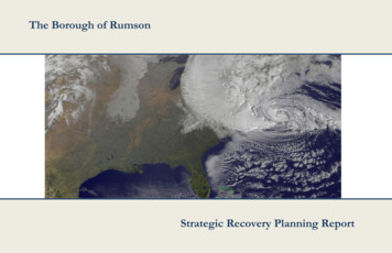
BOROUGH OF RUMSON — STRATEGIC RECOVERY PLANNING REPORTExecutive SummaryWhen Hurricane Sandy struck the coast of New Jersey on October 29, 2012, it brought extensive damage to Rumson Boroughfrom both storm surge and wind damage. Rumson reported that 284 properties within the Borough’s jurisdiction faced substantialdamage. 11 of the Borough’s sewage pump stations went offline due to floodwater inundation and/or power system failure. Treesand power lines throughout the Borough also fell, in some cases damaging buildings. The Borough also faced total power outagesfor 14 days.In response to the impacts faced by Hurricane Sandy, Rumson’s recovery efforts have been extensive. The Borough passed zoningamendments to adopt FEMA’s new Advisory Base Flood Elevations and to adjust building height for residences in high-risk areas.Rumson has also applied for FEMA Hazard Mitigation Grant Programs in order to elevate 32 homes, to construct flood mitigationinfrastructure improvements, to install flood gate barriers on all doors for the Department of Public Works building, to improveeight of the Borough’s sanitary sewer pump stations, and to replace two of the DPW’s underground fuel storage tanks.Rumson property and business owners have also received recovery aid from the New Jersey Department of Community AffairsCommunity Development Block Grant programs; the Borough has been awarded 1,200,000 for the Homeowner ResettlementProgram, 2,500,000 for the Homeowner Reconstruction, Rehabilitation, Elevation, and Mitigation program, 109,436 for SmallBusiness Grants, as well as 1,075,000 for Continuation and Enhancement of Essential Public Services. Furthermore, Rumson hasreceived 71 home loans from the Small Business Administration totaling 9,357,300 and one economic injury disaster loan totaling 4,800.Rumson Borough’s recommended municipal actions to promote recovery from Hurricane Sandy and to reduce vulnerabilities fromfuture storms include the following resiliency actions: updating and revising the Emergency Operation Procedures Manual based onthe Borough’s experience during Hurricane Sandy, developing a GIS database and user interface to inventory all Borough-ownedinfrastructure; compiling low-elevation aerials within identified special flood hazard areas; updating a more comprehensive BoroughMaster Plan; entering FEMA’s Community Rating System program; as well as municipal capital investments in public facilitiesimprovements such as sewer pump stations, bulkheads, and generators.PAGE i
BOROUGH OF RUMSON — STRATEGIC RECOVERY PLANNING REPORTAcknowledgementsMayor and CouncilJohn E. Ekdahl, MayorJoseph K. Hemphill, Council PresidentShaun BroderickBenjamin W. Day, Jr.Mark E. RubinFrank ShanleyLaura AtwellMartin M. Barger, Borough AttorneyBorough OfficialsThomas S. Rogers, Borough Administrator/Municipal ClerkFrederick André, Zoning OfficialDennis Peras, Construction OfficialDepartment of Public WorksMark T. Wellner, SuperintendentWastewater ManagementFrederick G. Shea, SuperintendentBorough EngineerDavid Marks, PE, CME, T&M AssociatesPAGE ii
BOROUGH OF RUMSON — STRATEGIC RECOVERY PLANNING REPORTTable of ContentsIntroduction . 5Description of Rumson Borough . 5Assessment of Existing Planning Documents . 5Borough of Rumson . 5Borough of Rumson Master Plan, 1988 . 5Master Plan Reexamination Report, 2012 . 5Land Use Plan Element, 1988 . 6Land Use Plan Element Amendment, 2002. 6Housing Plan Element and Fair Share Plan, 2008 . 6Stormwater Management Plan, 2006. 6Rumson Emergency Operation Procedures Manual . 6Monmouth County. 6Monmouth County Growth Management Guide, 1982 . 6Monmouth County Master Plan Draft, 2013 . 7Coastal Monmouth Plan, 2010 . 7Monmouth County Multi-Jurisdictional Natural Hazard Mitigation Plan, 2009 . 8Monmouth County Farmland Preservation Plan, 2008 . 8Monmouth County Open Space Plan, 2006 . 9Evaluation of Superstorm Sandy’s Impact on Rumson Borough . 9Storm Surge . 9Damage to Properties . 9Damage to Pump Stations . 10Damage to Rumson Department of Public Works’ Garage Storm Door . 10Community Vulnerabilities Exacerbated by Hurricane Sandy. 10Community Opportunities Created by Hurricane Sandy . 11Current Status of Post-Sandy Recovery Efforts . 11Municipal Efforts . 11Community Development Block Grant (CDBG) Disaster Recovery Programs . 11Small Business Administration Disaster Loans. 12FEMA’s Hazard Mitigation Grant Program (HMGP) Elevation Program . 12FEMA Public Assistance Grants . 12Other FEMA Applications . 12Residential Elevation of 32 Homes . 13West Park Area Neighborhood Flood Mitigation Project . 13Pump Station Flood Proofing and Generator Installation . 13Department of Public Works Garage Storm Door Installation . 13Shrewsbury Drive/Avenue of Two Rivers Bulkhead and Drainage Improvements . 13Department of Public Works Underground Storage Tank Removal and Replacement . 14Monmouth County Long Term Recovery Group . 14Rebuilding Approaches That Will be More Resistant to Damage from Future Storms . 14Recommended Municipal Actions to Promote Recovery from Hurricane Sandy and to ReduceVulnerabilities to Future Storms. 15PAGE iiiImmediate/Short-Term Range .15Mid-Term Range .15Long-Term Range .15Summary of Actions and Priorities .16
BOROUGH OF RUMSON — STRATEGIC RECOVERY PLANNING REPORTList of TablesTable 1: Census Tracts with “Severe” or “Major” Damage . 10Table 2: Assessment Reduction Code Guidelines . 10List of FiguresFigure 1: A Displaced Ship in Rumson Borough from the Storm Surge . 9Figure 2: More Displaced Ships in Rumson Borough from the Storm Surge . 9Figure 3: Wind Damage in Rumson Borough . 9Figure 4: A Rumson Home is Elevated. . 12List of MapsMap 1: Rumson Borough Regional Location . 17Map 2: Properties with Substantial Damage in Rumson Borough . 18Map 3: Municipal Facilities in Rumson Borough . 19Map 4: Coastal Floodplain Boundaries Preliminary Work Map . 20PAGE iv
BOROUGH OF RUMSON — STRATEGIC RECOVERY PLANNING REPORTIntroductionThis Strategic Recovery Planning Report (SRPR) will serve as ablueprint to guide the recovery of the Borough of Rumson from theeffects of Superstorm Sandy and to reduce vulnerabilities to futurestorms. Accordingly, the report will: Evaluate the impacts on affected community features inRumson and address the conditions created or exacerbated bythe storm; Articulate the planning goals, strategies, and priority actionsthat are most urgently needed to improve public safety,increase resistance to damage from future storms, andstimulate economic recovery; and Contain detailed descriptions of each of the projectsproposed; a statement of need that demonstrates how eachproject relates to the impacts of Superstorm Sandy; why theproject is important to the economic and environmentalhealth of the community; the major tasks associated witheach project; the estimated cost of implementation;identification of potential or actual funding sources to pay forproject implementation; and estimated implementation dates.Description of Rumson BoroughThe Borough of Rumson is a compact residential community with apopulation of approximately 7,044, (according to the U.S. CensusBureau’s 2012 estimate) and an area of approximately 5.2 squaremiles. The Borough is located in the coastal area of northeasternMonmouth County, bordered to the north by the Navesink River andto the south and east by the Shrewsbury River, and contiguous toFair Haven and Little Silver to the west (see Map 1 on page 17).Rumson is a mature community that has established harmoniouspatterns of land use and satisfactory public facilities and services. Thechallenge for Rumson is to manage further growth and changeswithin the Borough to assure that its quality of life is maintained.Rumson is a fully developed community that has developed in amanner consistent with County and State Plans.With the absence of a major State highway access from thesurrounding communities, and limited access to major shore points,Rumson has been able to successfully preserve an attractivetownscape. The Borough’s business areas are compact, pedestrian inscale, and relate well to adjoining residential streets.PAGE 5Proximity to the New York Metropolitan Region and other businessand commercial developments has significantly influenced the growthof the Borough. Rumson is situated about 40 miles to the south ofNew York City. Four miles to the west, residents have access to Exit109 of the Garden State Parkway. State Highway Route 35, whichparallels the Parkway, the Red Bank Station of the North JerseyCoast Line, and access to the ferry to Manhattan from AtlanticHighlands also provide Rumson with transportation to majormetropolitan communities.Rumson is located between the Shrewsbury and Navesink Rivers, butin addition to the primary and secondary watercourses in theBorough, there are a number of unnamed tributaries and ponds. TheBorough has historically maintained low-density zoning inenvironmentally sensitive areas of the Borough, particularly along theShrewsbury River and, in general, along the Navesink, both listed byNJDEP as Category-1 streams.The Borough’s established development pattern, the preservation ofwhich is the Borough’s primary goal, creates and supports a welldesigned mixed-use community. In addition, the Borough hasadopted a mixed-use overlay option in the General Business,Neighborhood Business, and Professional Office districts.Assessment of Existing PlanningDocumentsThis section of the SRPR will examine the adequacy of the existingplanning documents included below, at both the municipal andcounty level, and will describe what changes are needed, if any, tosupport municipal planning needs and goals related to post stormrecovery and to mitigate future storm impacts.Borough of RumsonBorough of Rumson Master Plan, 1988The Borough’s Master Plan, adopted in 1988, is a basis to regulateland use in a reasonable fashion consistent with the responsibility ofmunicipal government to promote the public health, safety, andgeneral welfare of the Borough, Monmouth County, the region, andthe State of New Jersey. In the Master Plan, the Borough looks atwhat needs to be done locally to continue to maintain a soundpattern of land use that ensures the health of the natural environmentand that responds to human needs. The following objectives includedin the Borough’s Master Plan are relevant to this SRPR:1) Maintain Rumson’s character as a residential community andthe quality of life it offers.2) Encourage the most appropriate use of land consistent withneighborhood character and its suitability for development.3) Establish appropriate population densities and limit theintensity of development to both preserve the naturalenvironment and to ensure neighborhood, community, andregional well-being.4) Maintain a satisfactory level of public facilities and services.5) Secure the public’s safety from fire, flood, panic, and othernatural and manmade disasters.6) Ensure that Rumson’s development does not conflict withthe development and general welfare of neighboringmunicipalities, the County and the State as a whole.7) Coordinate public development with land use policies toencourage the appropriate and efficient expenditure of publicfunds.8) Provide sufficient space in appropriate locations forresidential, recreational, commercial, and open space use.9) Locate and design transportation routes to promote the freeflow of traffic while discouraging congestion or blight.10) Prevent urban sprawl and degradation of the environmentthrough improper land use.11) Expand housing opportunities within the Boroughcompatible with neighborhood character and the needs ofpresent and future residents.12) Protect the natural resources and qualities of the Boroughincluding freshwater and saltwater wetlands, floodplains,stream corridors, open space, steep slopes, and areas withscenic, cultural and recreational values.These objectives assume that there will be no extensive natural orman-made disasters which would require major reconstruction orredevelopment of Rumson’s developed areas.Master Plan Reexamination Report, 2012The Borough’s Master Plan Reexaminations, adopted in 1997, 2002,and again in 2012, support the goals and objectives of the 1988Master Plan, and do not modify the prior endorsements. The 2012Reexamination Report recognizes that the Borough Master Planconsists of numerous documents and elements adopted by the
BOROUGH OF RUMSON — STRATEGIC RECOVERY PLANNING REPORTPlanning Board over the past four decades. The Planning Boardrecommends that, upon completion and adoption of thereexamination, the Borough compile the 1988 Master Plan and allsubsequent master plan element amendments and reexaminationsinto one reference document easily made available by Borough staffto the general public.Land Use Plan Element, 1988The land use plan element is based on the principles, objectives,assumptions, and policies set forth in the 1988 Master Plan. Rumsonis a mature community with little vacant land. It has harmonious landuse patterns and satisfactory public facilities and services. The majoremphasis of the land use element is to maintain the intensity of thesepatterns and assure the continued high quality of public servicesavailable to the Borough’s residents.At the same time, the land use element incorporates as arecommendation the housing element’s proposal to meet theBorough’s need for low and moderate income housing by includingcompanion dwelling units as a conditional use. The landmark sitesand districts of the historic preservation element have been includedas a land use consideration by proposing a landmark overlay zone asthe basis for preservation efforts.Land Use Plan Element Amendment, 2002The Borough’s land use element, reexamined in 2002, maintains thesame principles, objectives, assumptions, and policies set forth by the1988 Master Plan. The 2002 amendment also considers the need forsome land use changes, including enacting protective regulations foragricultural and horticultural uses, increasing required minimum lotsize in R-1 and R-2 zone districts, as well as some proposed land usechanges.Housing Plan Element and Fair Share Plan, 2008The Housing Plan Element includes the following components: An inventory of Rumson’s demographic, housing stock, andemployment characteristics. Rumson’s affordable housing obligation and growth share Rumson’s municipal ability to accommodate its affordablehousing obligationThe Fair Share Plan includes the following components: Identification of Rumson’s prior-round obligationEvaluation of unmet low and moderate income housing needRumson’s mechanisms to address its prior-round unmet needAccommodation of Rumson’s present and prospective fairshare for low and moderate income housingThe Plan also includes as an appendix the Vacant Land Inventoryand Analysis Report, adopted in 2003.Stormwater Management Plan, 2006The Stormwater Management Plan Master Plan Element wasamended in 2006. It provides a strategy for the Borough of Rumsonto plan for and manage increased runoff associated with futuredevelopment and land use changes. The Plan makesrecommendations to better regulate stormwater management. It isnot designed to resolve existing flooding or runoff problems, butrather to identify them for future correction. The Plan addressesgroundwater recharge, stormwater quantity, and stormwater qualityimpacts by including stormwater design and performance standardsfor new development and redevelopment. The Plan also addressesthe Borough’s suggested policy regarding the long-term operationand maintenance of existing and future stormwater managementfacilities.The relevant goals of the Stormwater Management Plan are: Reduce flood damage, including damage to life, property, andthe environment; Minimize, to the extent practical, any increase in stormwaterrunoff from any new development; Reduce soil erosion from development, redevelopment, andconstruction projects; Assure the adequacy of existing and proposed culverts andbridges, as well as for drainage; Maintain groundwater recharge; Prevent, to the greatest extent feasible, an increase in nonpoint pollution; Maintain the integrity of stream channels for their biologicalfunction, as well as for drainage; Minimize pollutants in stormwater runoff from new andexisting development to restore, enhance, and maintain thechemical, physical, and biological integrity of the waters ofthe State, to protect the public health, to safeguard fish and aquatic life and scenic and ecological values, and to enhancethe domestic, municipal, recreational, commercial, and otheruses of water;Protect public safety through the proper design and operationof stormwater basins;Properly manage and maintain existing natural ponds andwaterways on private property; andRegulate the stormwater impacts from properties within 300feet of a C-1 waterway that are unregulated by the MunicipalLand Use Law (MLUL) and the Residential SiteImprovement Standards (RSIS).Rumson Emergency Operation Procedures ManualThis manual, approved in 2010, sets forth the general policies andprocedures to be carried out by municipal and volunteer entities inorder to provide the citizens of the Borough with an effectiveintegrated emergency response plan designed to minimize the loss oflife and property during an emergency. The manual is comprised ofthe Basic Plan and the following accompanying annexes: Alerting,Warning, and Communications; Damage Assessment; EmergencyMedical; Emergency Operations Center; Emergency PublicInformation; Evacuation; Fire and Rescue; Hazardous Materials; LawEnforcement; Public Health; Public Works; Radiological Protection;Resource Management; Shelter, Reception, and Care; Social Services;Weapons of Mass Destruction; and Public Demonstrations and CivilDisorders.The purpose of the Emergency Operations Basic Plan is to protectlife and property in emergencies by coordinating response activitiesof municipal and volunteer entities to ensure their optimum use. Itprovides for actions to be taken to mitigate, prepare for, respond to,and recover from the effects of an emergency. The plan is an “allhazards” approach to emergency management and covers naturaldisasters, technological disasters, and national security crises.Monmouth CountyMonmouth County Growth Management Guide, 1982The Growth Management Guide (GMG) is the main planning toolused in Monmouth County. In 1982 it was adopted as theMonmouth County Master Plan. The GMG is intended to be aframework for other planning and decision making, and is a point ofPAGE 6
BOROUGH OF RUMSON — STRATEGIC RECOVERY PLANNING REPORTdeparture and a catalyst for an ongoing dialogue between the Countyand its municipalities.The Guide categorizes the entire Borough of Rumson as a SuburbanSettlement Growth Area. Suburban Settlement policies in this planinclude: Encourage a variety of residential types in the suburbansettlement Encourage the use of the neighborhood unit in the suburbansettlement Encourage the completion of missing freeway links Encourage the use of cluster development in all parts of thecountyIn 1995, the Monmouth County Planning Board adopted the Goals,Objectives, and Policies as an element of the GMG. Goals of theGMG relevant to this SRPR include the following: Air Resources: To promote land use planning that encouragesthe use of transit, walking and cycling, and the creation ofcenters in order to improve air quality by reducingautomobile trips and congestion. Centers: To promote new and revitalize older urban areasinto well designed mixed use centers with an easily accessiblecompact but varied core of residential, commercial, andcommunity services which provide employment and create aspecific identity. Comprehensive Planning: To promote comprehensiveplanning among all levels of government as well as the privatesector by sharing information and developing a continuingdialogue on regulations, plans, policies, and issues. Economic Development: To promote managed growth byproviding a suitable long-term economic climate andpreserving and enhancing the quality of life in MonmouthCounty for the attraction of new businesses and the retentionof existing businesses. Historic, Cultural, Natural, and Scenic Resources: To preservethe valuable historic, cultural, natural, and scenic resources ofMonmouth County. Housing: To provide housing opportunities for all residentsof Monmouth County. Transportation: To plan for a comprehensive and reliableintermodal transportation system that properly provides forPAGE 7 public safety and meets the needs of the County’s workers,residents, and visitors as well as respects the environment.Water Resources: To provide all of Monmouth County with asafe and pollution-free water environment, and conservevaluable water-oriented resources.Monmouth County Master Plan Draft, 2013The Monmouth County Planning Board is in the process ofundergoing a comprehensive update to the County Master Plan, withdrafts of its vision statement as well as goals, principles, andobjectives available on the Monmouth County Division of Planningwebsite.The Plan’s draft principles that are relevant to this SRPR include thefollowing: Comprehensive Planning: Planning issues are to be addressedfrom interdisciplinary perspectives to identify and assess bothinterdependent and collective impacts and opportunities. Thiswill minimize adverse impacts while maximizing benefits forall parties. Coordination: Effectual planning requires integration andcoordination both internally (horizontally) and with otherlevels of government (vertically). Approach: Comprehensive planning relies on the use of newand emerging technologies as well as traditional methods ofinput from stakeholders and citizens. Natural Resources: Natural resources are life supportinginfrastructure that all human and built environments aredependent upon to function and prosper. Investments in Preservation Areas: Aligning state, local, andcounty preservation strategies improves efficiency andreduces cost in protecting natural and unique resources. Preservation of Community Character: Protect andstrengthen the established character of municipalities andtheir unique, individual qualities. Recovery and Community Resiliency: Promote planning, landuse, and design strategies that increase the capacity to adaptphysically and economically to long-term environmentalchanges and natural hazards.– Objectives: Participate in long-term recovery, mitigation, andresiliency efforts to better protect people, businesses, and resources against environmental damage andnatural disasters. Assist in the coordination of the County’s long-termdisaster recovery planning initiatives. Provide assistance to other County agencies involvedin disaster response and emergency management. Provide technical assistance to municipalities indisaster recovery efforts.Investment in Growth Areas: Aligning state, local, and countyinvestment strategies improves efficiency and reduces cost inrepairing, and expanding systemic infrastructure.The Plan will be a vital coordinating tool used by municipalities,school boards, businesses, and other government agencies to helpguide efforts and actions that contribute to a strong, stable, andsustainable prosperity for those that call Monmouth County home.Coastal Monmouth Plan, 2010The Coastal Monmouth Plan was initiated by the Monmouth CountyPlanning Board to construct a plan for the future development andnatural resource conservation of the County’s Atlantic coastal region,which includes the Borough of Rumson and 29 other municipalities.The Plan was developed with the following goals and objectives:Goal: To create a vision and planning strategy for the CoastalMonmouth Region (CMR) to cooperatively addressdevelopment issues on a regional scale in a manner that issensitive to the area’s unique coastal setting, diversecommunity character and critical environmental, cultural andaesthetic resources.Objectives: To preserve and enhance the character and quality of life inthe CMR. To identify and assess current and future land use, economicdevelopment, public services, transportation, and designissues within the CMR. To identify development, redevelopment, and revitalizationopportunities within the CMR.
BOROUGH OF RUMSON — STRATEGIC RECOVERY PLANNING
BOROUGH OF RUMSON — STRATEGIC RECOVERY PLANNING REPORT PAGE ii Acknowledgements Mayor and Council John E. Ekdahl, Mayor Joseph K. Hemphill, Council President Shaun Broderick Benjamin W. Day, Jr. Mark E. Rubin Frank Shanley Laura Atwell Martin M. Barger, Borough Attorney Borough Officials Thomas S. Rogers, Borough Administrator/Municipal Clerk