Transcription
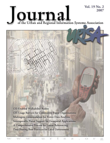
Volume 19 No. 2 2007Journal of the Urban and Regional Information Systems AssociationContentsRefereed5An Assessment of GIS-Enabled Walkability AuditsMarc Schlossberg, Asha Weinstein Agrawal, and Katja Irvin13Institutional and Organizational Barriers to Effective Use of GIS by CommunityBased OrganizationsAnn-Margaret Esnard23Coupling Multiagent Geosimulation and Spatial OLAP for Better GeosimulationData AnalysisWalid Ali, Bernard Moulin, Yvan Bédard, Marie-Josée Proulx, and Sonia Rivest33An Interoperable Portal Supporting Prototyping Geospatial ApplicationsMyra Bambacus, Phil Yang, John Evans, Marge Cole, Nadine Alameh, and Stephen Marley41A Comprehensive Process for Linear ReferencingKevin M. Curtin, Greta Nicoara, and Rumana Reaz Arifin51When Data Sharing Becomes Institutionalized: Best Practices in LocalGovernment Geographic Information RelationshipsDavid L. Tulloch and Francis HarveyOn the Cover:A common and humorous test of mental dexterity is the ability to walkand chew gum at the same time. These two simple tasks rarely conflictand are performed without thought. Over the past 10 years a new test ofmental dexterity has arisen with vast implications in the field of geospatialtechnology; can one walk and collect data at the same time?Research on walking and the built environment has acceleratedby an increased interest in the relationship between urban form andpublic health. As the research has progressed, so has the interest indeveloping ways to collect data at a very fine scale—in essence, tobe able to collect data at the streetscape level and link this data totransportation behavior.An article by Marc Schlossberg, Asha Weinstein, and Katja Irvin entitled An Assessment of GISenabled Walkability Audits examines the development and implementation of a GIS-based pedestrianaudit tool that allows users to collect data in electronic form using a handheld computer. The paper,which highlights Volume 19, Number 2 of the URISA Journal, identifies current shortcomings withwalkability audit tools but concludes that appropriately applying GIS-enabled pedestrian audit toolscan be an efficient way to collect and quickly analyze pedestrian infrastructure characteristics so thatplanners, practitioners, policy makers, and community members can make more effective decisions.
JournalPublisher:Urban and Regional Information Systems AssociationEditor-in-Chief:Jochen AlbrechtJournal Coordinator:Scott A. GramsElectronic Journal:http://www.urisa.org/journal.htmEDITORIAL OFFICE: Urban and Regional Information Systems Association, 1460 Renaissance Drive, Suite 305, Park Ridge, Illinois 60068-1348;Voice (847) 824-6300; Fax (847) 824-6363; E-mail info@urisa.org.SUBMISSIONS: This publication accepts from authors an exclusive right of first publication to their article plus an accompanying grant of nonexclusive full rights. The publisher requires that full credit for first publication in the URISA Journal is provided in any subsequent electronic orprint publications. For more information, the “Manuscript Submission Guidelines for Refereed Articles” is available on our website, www.urisa.org, or by calling (847) 824-6300.SUBSCRIPTION AND ADVERTISING: All correspondence about advertising, subscriptions, and URISA memberships should be directed to:Urban and Regional Information Systems Association, 1460 Renaissance Dr., Suite 305, Park Ridge, Illinois, 60068-1348; Voice (847) 824-6300;Fax (847) 824-6363; E-mail info@urisa.org.URISA Journal is published two times a year by the Urban and Regional Information Systems Association. 2007 by the Urban and Regional Information Systems Association. Authorization to photocopy items for internal or personal use, or the internalor personal use of specific clients, is granted by permission of the Urban and Regional Information Systems Association.Educational programs planned and presented by URISA provide attendees with relevant and rewarding continuing education experience. However,neither the content (whether written or oral) of any course, seminar, or other presentation, nor the use of a specific product in conjunction therewith, nor the exhibition of any materials by any party coincident with the educational event, should be construed as indicating endorsement orapproval of the views presented, the products used, or the materials exhibited by URISA, or by its committees, Special Interest Groups, Chapters,or other commissions.SUBSCRIPTION RATE: One year: 295 business, libraries, government agencies, and public institutions. Individuals interested in subscriptionsshould contact URISA for membership information.US ISSN 1045-80772URISA Journal Vol. 19, No. 2 2007
Editors and Review BoardURISA Journal EditorArticle Review BoardEditor-in-ChiefPeggy Agouris, Department of Spatial InformationScience and Engineering, University of MaineJochen Albrecht, Department ofGeography, Hunter College City Universityof New YorkThematic EditorsEditor-Urban and Regional InformationScienceVacantEditor-Applications ResearchLyna Wiggins, Department of Planning,Rutgers UniversityEditor-Social, Organizational, Legal,and Economic SciencesIan Masser, Department of Urban Planningand Management, ITC (Netherlands)Editor-Geographic Information ScienceMark Harrower, Department of Geography,University of Wisconsin MadisonEditor-Information and Media SciencesMichael Shiffer, Department of Planning,Massachusetts Institute of TechnologyEditor-Spatial Data Acquisition andIntegrationGary Hunter, Department of Geomatics,University of Melbourne (Australia)Editor-Geography, Cartography, andCognitive ScienceVacantEditor-EducationKaren Kemp, Director, International MastersProgram in GIS, University of RedlandsSection EditorsSoftware Review EditorJay Lee, Department of Geography, Kent StateUniversityBook Review EditorDavid Tulloch, Department of LandscapeArchitecture, Rutgers UniversityURISA Journal Vol. 19, No. 2 2007Grenville Barnes, Geomatics Program, Universityof FloridaMichael Batty, Centre for Advanced Spatial Analysis,University College London (United Kingdom)Kate Beard, Department of SpatialInformation Science and Engineering,University of MaineYvan Bédard, Centre for Research in Geomatics,Laval University (Canada)Barbara P. Buttenfield, Department ofGeography, University of ColoradoKeith C. Clarke, Department of Geography,University of California-Santa BarbaraKingsley E. Haynes, Public Policy andGeography, George Mason UniversityEric J. Heikkila, School of Policy, Planning, andDevelopment, University of Southern CaliforniaStephen C. Hirtle, Department of InformationScience and Telecommunications, University ofPittsburghGary Jeffress, Department of GeographicalInformation Science, Texas A&M UniversityCorpus ChristiRichard E. Klosterman, Department ofGeography and Planning, University of AkronRobert Laurini, Claude Bernard University ofLyon (France)Thomas M. Lillesand, EnvironmentalRemote Sensing Center, University of WisconsinMadisonPaul Longley, Centre for Advanced Spatial Analysis,University College, London (United Kingdom)David Coleman, Department of Geodesy andGeomatics Engineering, University of NewBrunswick (Canada)Xavier R. Lopez, Oracle CorporationDavid J. Cowen, Department of Geography,University of South CarolinaHarvey J. Miller, Department of Geography,University of UtahDavid Maguire, Environmental Systems ResearchInstituteMassimo Craglia, Department of Town &Regional Planning, University of Sheffield(United Kingdom)Zorica Nedovic-Budic, Department of Urbanand Regional Planning,University of IllinoisChampaign/UrbanaWilliam J. Craig, Center for Urban andRegional Affairs, University of MinnesotaAtsuyuki Okabe, Department of UrbanEngineering, University of Tokyo (Japan)Robert G. Cromley, Department of Geography,University of ConnecticutHarlan Onsrud, Spatial Information Scienceand Engineering, University of MaineKenneth J. Dueker, Urban Studies andPlanning, Portland State UniversityJeffrey K. Pinto, School of Business, Penn State ErieGeoffrey Dutton, Spatial EffectsGerard Rushton, Department of Geography,University of IowaMax J. Egenhofer, Department of Spatial InformationScience and Engineering, University of MaineJie Shan, School of Civil Engineering,Purdue UniversityManfred Ehlers, Research Center forGeoinformatics and Remote Sensing, University ofOsnabrueck (Germany)Bruce D. Spear, Federal Highway AdministrationManfred M. Fischer, Economics, Geography &Geoinformatics, Vienna University of Economicsand Business Administration (Austria)Myke Gluck, Department of Math andComputer Science, Virginia Military InstituteMichael Goodchild, Department of Geography,University of California-Santa BarbaraJonathan Sperling, Policy Development &Research, U.S. Department of Housing andUrban DevelopmentDavid J. Unwin, School of Geography, BirkbeckCollege, London (United Kingdom)Stephen J. Ventura, Department ofEnvironmental Studies and Soil Science,University of Wisconsin-MadisonNancy von Meyer, Fairview IndustriesMichael Gould, Department of InformationSystems Universitat Jaume I (Spain)Barry Wellar, Department of Geography,University of Ottawa (Canada)Daniel A. Griffith, Department of Geography,Syracuse UniversityMichael F. Worboys, Department of ComputerScience, Keele University (United Kingdom)Francis J. Harvey, Department of Geography,University of MinnesotaF. Benjamin Zhan, Department of Geography,Texas State University-San Marcos3
IntroducingThe World’s Most Advanced Patented TechnologyFor Change Detection And Change Analysis*Existing Ortho before changePictometry Oblique before changePictometry Oblique after changeReveal. Review. Recoup.ChangeFindr is the combination of Pictometry’s Change Analysis software and Hitachi’s HouseDiff service that automaticallyHow Pictometryoutlines and identifies changes in any structure whenand HouseDiff “By using both Pictometrycomparing two image data sets.can help:and HouseDiff we have found overThis exciting solution enables you to review change overone-and-a-half million dollarstimeintervals that you select. This allows you to capturein new valuations.”unreportedor under-reported improvements quickly andWhat tax assessmenteasilyduringyour discovery process. ChangeFindr givesprofessionals are sayingyouthebestof both worlds: verify reported changesabout Pictometry:“Our Appraisal Staff andyourself or use Pictometry’s Technical ServicesPlanning Commission GIS users haveto provide you with the verification report.dramatically reduced their number ofThe benefits? Find hidden revenues, reducesite visits, in some cases by 70%,expenses, improve productivity, as well as increaseby using Pictometry.”your tax base year after year, all from the convenienceof your desktop PC.“In less than a year ofactual use, we have recoveredmore costs than whatit cost us.”* Pictometry and Hitachi HouseDiff each have patented components used in ChangeFindr.HouseDiff is a registered service mark of Hitachi Software Engineering Co., Ltd.Let Pictometry’s innovative technologyexpand your productivity as it has forhundreds of assessors. To learn more 888-771-9714SAVE THE DATEOCTOBER 27-29SAN ANTONIO TX
An Assessment of GIS-Enabled Walkability AuditsMarc Schlossberg, Asha Weinstein Agrawal, and Katja IrvinAbstract: Research on walking and the built environment is a fairly recent area of inquiry, accelerated over the past ten yearsby an increased interest in the relationship between urban form and public health. As the research has progressed, so has theinterest in developing ways to collect data at a very fine scale—in essence, to be able to collect data at the streetscape level andlink this data to transportation behavior. This paper discusses the development and implementation of a GIS-based pedestrianaudit tool that allows users to collect data in electronic form using a handheld computer (i.e., a pocket PC or personal digitalassistant (PDA)). While, such tools may be useful for better understanding the relationship between the built environment andpedestrian behavior, the tools may be unnecessarily complex and unfocused. Specifically, these walkability audit tools could beimproved by: (1) applying unique sets of walkability measures to different types of walking environments; (2) perhaps focusingauditing activities on major streets and intersections only (e.g., do not audit neighborhood streets where possible); (3) includingsubjective as well as objective measures of the streetscape; (4) verify the accuracy of digital base maps before widespread implementation; and (5) continuously evaluating whether the simpler technology of pen and paper would be preferable alternatives.The authors conclude that appropriately applying GIS-enabled pedestrian audit tools can be an efficient way to collect andquickly analyze pedestrian infrastructure characteristics so that planners, practitioners, policy makers, and community memberscan make more effective decisions on behalf of walkability.IntroductionResearch on walking and the built environment is a fairly recentarea of inquiry, accelerated over the past ten years by an increasedinterest in the relationship between urban form and public health.As the research has progressed, so has the interest in developingways to collect data at a very fine scale—in essence, to be ableto collect data at the streetscape level and link this data to activetransportation behavior (Schlossberg 2007). However, the lackof quick and cost-effective tools for collecting block-by-blockdata about the streetscape has prevented more widespread research and application of such tools. This paper discusses thedevelopment and implementation of a GIS-based pedestrianaudit tool that allows users to collect data in electronic form using a handheld computer (i.e., a pocket PC or personal digitalassistant (PDA)).In a recent article on visualizing and measuring walkability,Schlossberg suggested looking forward to new technologicalapproaches. In theory, tools that could allow for detailed, GISenabled data collection about pedestrian environments on handheld computers would allow planners to better understand therelationship between specific characteristics of the built environment and their relationship to either overall walking within anarea or preferences for walking along one route or another. Oncethis relationship between the walking environment and walkingbehavior could be established, then specific recommendationsto improve walking conditions could be made to policy makers,planners, transportation officials, and other decision makers couldbe made to improve conditions for walking.This paper discusses the development and implementationof such a pedestrian audit tool and evaluates its promise for useURISA Journal Schlossberg, Agrawal, Irvinin future projects. The larger project within which this tool wasdeveloped examined correlations between aspects of the builtenvironment with the actual route choices that people make whenwalking from home to their nearest transit stations. The variableswithin this GIS-based audit tool were adapted from existingresearch literature and from other pedestrian audit tools, namelythe Pedestrian Environment Data Scan (PEDS) developed byDr. Kelly Clifton and Andrea Livi at the University of Marylandand Dr. Daniel Rodriguez at the University of North Carolina.This paper, however, will not focus on the types of data collected;rather, what follows is an evaluation of using this technology asa way to gather more detailed and nuanced data about walkableenvironments.Conceptual BackgroundAs researchers, practitioners, and policy makers have becomeincreasingly interested in the relationship between the builtenvironment and physical activity, recognition of tools thatappropriately measure urban form at a pedestrian scale has alsoincreased. Perhaps the best-known and utilized tool in this areais an environmental audit instrument called SPACES, a comprehensive tool that helps inventory the characteristics of and alonga roadway segment (Pikora, Giles-Corti et al. 2003). The authorscategorize different factors of a walking environment into fiveclassifications: (1) functional (physical attributes of the street),(2) safety (characteristics of a safe environment), (3) aesthetic(elements such as trees or gardens), (4) destination (relationshipof neighborhood services to residences), and (5) subjective.Moudon and Lee (2003) focused their work in a similar area,but dedicate more time to developing a conceptual framework5
for measuring walkability to help direct future research efforts. Todevelop their framework, they performed an exhaustive review ofmore than 30 published methodologies and inventorying toolsthat have been developed to assess walkability. They outlineda theoretical framework called the Behavioral Model of Environments (BME) that seeks to account for personal, physical,and internal responses factors that may explain the connectionbetween individual pedestrians and their walking environments.In essence, they are attempting to lay the theoretical frameworkfor focusing on the characteristics of place when considering therelationship between urban form and pedestrian behavior.McMillan (2005) also provides a conceptual framework forothers to follow when studying urban form and pedestrian accessibility. Through her focus on a child’s trip to school, McMillanrealized that urban form does not directly impact how a child getsto school, but rather a set of mediating and moderating factorsdo (McMillan 2005). Mediating factors include neighborhoodand traffic safety, as well as household characteristics such as theavailability of automobiles at home and the distance betweenhome and school. Moderating factors include parental attitudes,social or cultural norms, and sociodemographic characteristics(McMillan 2005). The importance of this research is to illustrate that while urban form may have an important impacton pedestrian behavior, other nonbuilt environmental factorsare also important. And in terms of our interest in audit toolsthemselves, McMillan’s research shows that such tools may yieldimportant data about the walking environment, but that suchurban form data only represents one component of the overalldecision-making process to walk or not.Clifton and Livi (2005) developed the Pedestrian Environment Data Scan (PEDS) audit tool, which included 78 measuresof streetscape characteristics that other research has shown toinfluence walkability. In addition to developing their tool, Cliftonand Livi studied the inter-rater reliability of the instrument tounderstand the potential of such tools to be used in broad geographic areas with a diversity of audit administrators. Despite awide range of street segment uses, conditions, and aesthetics, theyfound relatively high reliability scores for many of the questionscontained within the audit instrument. Ewing (2006) utilizedinput from urban design professionals to develop operationaldefinitions of the built environment relevant to pedestrians andtranslated those definitions into a field survey instrument (Ewing,Handy et al. 2006).While the development of these conceptual and operationalframeworks for assessing local walkability are important, researchers have been limited by the amount of time required to conductblock-by-block assessments of every street segment and intersection within a study area. As researchers identify more aspects ofthe built environment that may be important in creating walkableenvironments, the burden of applying those measures to eachstreet segment grows. In their study of two pedestrian and bicycling environmental audit tools, Emery found it challenging toreliably evaluate road segments (Emery, Crump et al. 2003).Recent technological innovations, however, have made it6possible to create audit tools that work within a GIS environment on PDAs, enabling data collection that is relatively quickand instantly embedded into an electronic and GIS-ready dataformat for more prompt analysis. We used just such a tool in ourstudy of pedestrian route choice, and the remainder of this paperwill report on this method of data collection.Project and Audit ToolBackgroundWe developed the pedestrian audit tool as part of a larger researchproject designed to understand how far people walk to rail stationsin the morning and what routes they take. Stages of the projectincluded surveying people who walked to transit stations, askingthem about their reasons for choosing the routes they do, mapping the routes they took to the station the day of the survey, andthen auditing the physical environment to determine whether thebuilt environment impacted the routes pedestrians took to accesstransit.1 Our goal was to collect data about the built environmentfor every street segment and intersection within one mile of fourtransit stops. We used the PEDS tool as our starting point fordeveloping the audit tool, but heavily modified the tool by addingand deleting variables to make the tool relevant to our particularstudy. Once we decided on the appropriate variables to use, wethen created an interface to allow the tool to work with GISsoftware on a PDA.2 We felt it was important to have differentvariables to audit the street segments and to evaluate intersections,so we created separate sets of variables to do just that. We fieldtested the tool and made modifications before collecting data.In all, our street segment audit consisted of six screen pagesper street segment, constituting approximately 25 different setsof variables, depending on the presence or absence of certainfeatures. The intersection audit consisted of two screen pages andsix variables (see Figure 1 for sample screenshots of the tool).We designed the audit tool to make it easy to use. In particular, we minimized the amount of screen “typing” and createddata-entry forms that were efficient and intuitive for the auditor.To do so, we used a variety of methods for data input, includingcheckboxes, drop-down menus, and text fields where we couldenter in observations that deviated from our predefined answerresponses. In addition to these standard questions, we customizedthe data-input interface with more advanced features designedto make data collection more efficient. One feature was the useof skip sequences to make the flow through the tool more seamless, and another was the use of an on-the-fly field default-settingfeature. In this default-setting feature, the user could save theanswers entered for one particular street segment and then loadthem automatically for the next street segment, thus minimizingthe data to be entered for the second segment. In general, streetsegments do not differ much from one block to the next, so thisautomatic field completion feature was a useful time-saving addition. It was still possible to alter answers to specific questionsin the default setting as needed, when one or two features of ablock segment were unique.Collecting data with this tool essentially involved walkingURISA Journal Vol. 19, No. 2 2007
Figure 1. Examples of the walkability audit data-entry formsalong each street segment (or intersection) and visually scanningthe environment as the audit questions were answered. At firstthis involved walking most of a street segment, pausing to lookaround, and then entering data while conducting additional visualscans if necessary. Over time, as the auditors became more familiarwith the local environment and comfortable with the audit tool,the data-collection process became more efficient; essentially theauditors were able to walk, scan, and enter data simultaneously.Thus, in some environments there was little additional timeneeded for data collection other than the time it takes to walkalong each street segment.3 That said, there is an incentive tominimize the number of audit questions because the more questions for any particular segment, the greater the concentrationneeds for the auditor and the greater the likelihood of error. Thedefault function mentioned previously helped significantly toachieve this efficiency without compromising quality.To enter data, the PDA needs to be preloaded with a map ofthe local area as well as the database entry tool. In our case, weURISA Journal Schlossberg, Agrawal, Irvinloaded the PDAs with edited TIGER street maps and intersection point maps that we created separately with GIS software.The auditor located the street segment on the PDA map wherehe or she was standing and simply tapped the street segment (orintersection) on the screen to call up the data-entry forms. Oncethe questions were answered, the data was automatically savedand associated with the street segment in the GIS file; thus, onlyone data-entry step is needed to both collect the audit data andprepare it for GIS analysis. This process was repeated until theaudit of the study area was completed.Overall completion time depended both on the size of thestudy area and the quantity of road segments in the study area. Inour study, the areas audited in the Portland, Oregon, region hadmuch higher densities of streets around transit stops than the areasaround the other study areas in San Jose and Oakland, California.Budgeting time for conducting the audit, therefore, depends onthe number of segments and intersections within a study area, andnot just on the size of the study area itself. Total data-collection7
Figure 2. Map of safety overlaid with actual pedestrian routes totransittime, thus, is a function of the average length of a street segment,the total number of street segments, the total data-entry questionsper street segment, the total numbers of intersections, and the totalnumber of audit questions for those intersections.Once the data is collected, it can be mapped easily becausethe data was entered directly into a GIS format. Figure 2 showsan example of a map created by using a pedestrian audit tool.Reflections andModificationsBased on our experience in developing pedestrian audit instruments for classroom and research projects, and with the recentcompletion of a major study of transit access by pedestrians,we offer five general areas for consideration when developingpedestrian audit tools:1. Verify the accuracy of the street base map before recordingany data.2. Develop data-gathering tools customized to street/pathtype.3. Consider focusing data collection only on major streets.4. Determine the relative importance of subjective versusobjective measures.5. Evaluate the utility of digital versus paper-and-pen technologyfor conducting audits.Ground Truth Base MapsIn our experience, with an accurate base map of streets (or sidewalks), collecting GIS-enabled data at a streetscape level wasgenerally straightforward and provided the analysis with a rich8dataset that would otherwise be impossibleto derive. Before using the tool in the field,however, it is critical to ground truth thestreet base map that will form the core ofthe dataset. As mentioned previously, weutilized the TIGER street file as our basemap and we did so because we wanted touse a freely accessible source of data thatwould be available to any community inthe United States for free. As is often thecase with TIGER data, some errors existbetween the TIGER map and the actualpresence or absence of streets around thetransit stops. In some cases, the TIGERdata included streets that did not exist,and in others streets existed that were notpart of the TIGER data. And TIGERdata is not particularly good at includingoff-street paths.It is also important to check theaddress ranges of the streets within theTIGER data to ensure they are consistentwith actual address ranges of the streets. We have experiencedaddress ranges that were one block off, meaning we had to correct these errors in the map by hand before it was possible toaccurately geocode our survey data. It is possible to add or deletestreet segments or adjust street ranges in the field on the PDA,but it is critically important that some basic ground truthing ofthe base GIS data be conducted prior to auditing the environment. Alternatively, one could use locally produced base mapfiles that would presumably be more up-to-date and accurate forlocal conditions.Customizing Data Collection by Street TypeBased on our experience, we have concluded that when auditing pedestrian environments, it would be useful to be able todifferentiate between street type when collecting data and thencollect data unique to each type of street or path. It became clearafter collecting data that arterial and collector streets required adifferent set of attributes to collect compared to neighborhoodstreets. For example, street width, sidewalk buffers, on-streetparking, and the number of high-volume driveways to crosswere all much more important on arterials and collectors wherethe volume and speed of vehicles presents much more of a safetythreat and level of discomfort compared to neighborhood streets.On neighborhood streets, at least in our study areas, aestheticand street features seemed to be less influential for a pedestrian’sability to walk. For these streets, perhaps the most importantfeature would be the presence of sidewalks. Customizing dataentry variables for different types of streets would streamline thedata-collection process and allow a greater range of streets to besurveyed in a shorter period of time. As mentioned previously,the tool we used had a built-in feature to save previous data-entryURISA Journal Vol. 19, No. 2 2007
Figure 3. An example of an audit tool that is customized by street typestreets could be assumed to be generally walkable and the focuswould concentrate on making the areas where high volumes andspeeds of automobiles and higher volumes of pedestrians wouldintersect safer and more enjoyable for pedestrians to navigate. Itis in these high-intersection places where interventions on behalfof walking might be best targeted. Comparing route choices androute avoidance by pe
audit tool that allows users to collect data in electronic form using a handheld computer. The paper, which highlights Volume 19, Number 2 of the URISA Journal, identifies current shortcomings with walkability audit tools but concludes that appropriately applying GIS-enabled pedestrian audit tools