Transcription
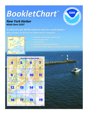
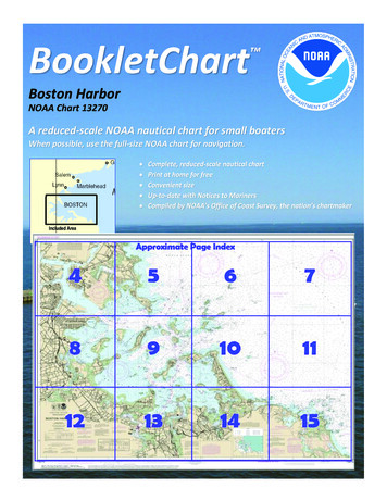
BookletChart Boston HarborNOAA Chart 13270A reduced-scale NOAA nautical chart for small boatersWhen possible, use the full-size NOAA chart for navigation.Included Area
Published by theNational Oceanic and Atmospheric AdministrationNational Ocean ServiceOffice of Coast Surveywww.NauticalCharts.NOAA.gov888-990-NOAAWhat are Nautical Charts?Nautical charts are a fundamental tool of marine navigation. They showwater depths, obstructions, buoys, other aids to navigation, and muchmore. The information is shown in a way that promotes safe andefficient navigation. Chart carriage is mandatory on the commercialships that carry America’s commerce. They are also used on every Navyand Coast Guard ship, fishing and passenger vessels, and are widelycarried by recreational boaters.What is a BookletChart ?This BookletChart is made to help recreational boaters locatethemselves on the water. It has been reduced in scale for convenience,but otherwise contains all the information of the full-scale nauticalchart. The bar scales have also been reduced, and are accurate whenused to measure distances in this BookletChart. See the Note at thebottom of page 5 for the reduction in scale applied to this chart.Whenever possible, use the official, full scale NOAA nautical chart fornavigation. Nautical chart sales agents are listed on the Internet athttp://www.NauticalCharts.NOAA.gov.This BookletChart does NOT fulfill chart carriage requirements forregulated commercial vessels under Titles 33 and 44 of the Code ofFederal Regulations.Notice to Mariners Correction StatusThis BookletChart has been updated for chart corrections published inthe U.S. Coast Guard Local Notice to Mariners, the National GeospatialIntelligence Agency Weekly Notice to Mariners, and, where applicable,the Canadian Coast Guard Notice to Mariners. Additional chartcorrections have been made by NOAA in advance of their publication ina Notice to Mariners. The last Notices to Mariners applied to this chartare listed in the Note at the bottom of page 7. Coast Pilot excerpts arenot being corrected.For latest Coast Pilot excerpt visit the Office of Coast Survey website hart.php?chart 13270(Selected Excerpts from Coast Pilot)Traffic Separation Scheme (Boston) has beenestablished in the approach to BostonHarbor. (See charts 13270, 13267, 13246,13260, and 13200.)The Scheme is composed basically of directedtraffic lanes each with one-way inbound andoutbound traffic lanes separated by adefined separation zone and twoprecautionary areas. The Scheme isrecommended for use by vessels approachingor departing from Boston Harbor, but is not necessarily intended fortugs, tows or other small vessels which traditionally operate outside ofthe usual steamer lanes or close inshore.The Traffic Separation Scheme has been designed to aid in theprevention of collisions at the approaches to major harbors, but is notintended in any way to supersede or alter the applicable NavigationRules. Separation zones are intended to separate inbound andoutbound traffic lanes and to be free of ship traffic, and should not beused except for crossing purposes. Mariners should use extremecaution when crossing traffic lanes and separation zones. (See 167.1through 167.15 and 167.75 through 167.77, chapter 2, for limits andregulations and Traffic Separation Schemes, chapter 1, for additionalinformation.)A precautionary area is at the junction of Traffic Separation Scheme(Boston) and the Eastern Approach Off Nantucket to Traffic SeparationScheme Off New York. (See U.S. Coast Pilot 2, Atlantic Coast, Cape Codto Sandy Hook, for a description of Traffic Separation Scheme Off NewYork. Consult charts 12300 and 13006 for the Off New York Scheme.)The precautionary area is bounded on the east by a circle with a radiusof 15.5 miles centered in 40 35’01”N., 69 59'58”W. and intersected bythe Traffic Separation Schemes at points in 40 23’45”N., 69 13’57”W.and 40 50’28”N., 68 58’40”W., and is bounded on the west by a lineconnecting the schemes at points in 40 36'46”N., 69 15'08”W. and40 48'02”N., 69 02'57”W.The precautionary area in the approach to Boston Harbor has a radiusof 6.17 miles centered on Boston Lighted Whistle Buoy B (42 22'42"N.,70 46'58"W.), excluding that area of the circle bounded by an imaginaryline extending between the outer limits of the inbound and outboundtraffic lanes.The separation zone is a 1-mile zone centered in the following positions:(i) 42 20'44"N., 70 39'04"W., (ii) 42 18'17"N., 70 01'08"W., and (iii)40 49'15"N., 69 00'49"W.Deer Island, on the northwest side of the entrance to Boston Harbor, isabout 1 mile long and is joined to the mainland by a fill. A sewagetreatment facility with numerous egg-shaped holding tanks is aconspicuous landmark on the south part of the island.Deer Island Light (42 20.4'N., 70 57.3'W.), 53 feet above the water, isshown from a red cylindrical tower on a black cylindrical pier on theouter end of a ledge that extends 0.3 mile southward from the island. Asound signal is at the light.Winthrop Head, about 1 mile northward of the northwestern end ofDeer Island, is a 100-foot hill covered with buildings and a tall red, white,and blue standpipe on top which is the most prominent mark in thevicinity. Sewage pump-out is available. Winthrop Beach lies along theshore just northward of Winthrop Head. About 0.2 mile off and parallelto Winthrop Beach is a breakwater about 0.4 mile long which is bareseveral feet at the highest tides and is fairly prominent. Small craft moorbehind the breakwater; there are no landings or facilities.Great Faun, the inner part of the shoal ground extending from thenortheastern side of Deer Island, is a partly drying flat, marked on itsouter part by a buoy which is about 1 mile northeastward of Deer IslandLight and 0.3 mile northwestward of Boston North Channel. LittleFaun, which uncovers on its inner part, extends 0.5 mile eastward fromthe southern end of Deer Island.Finns Ledge, covered 25 feet, lies on the western side of the entrance toBoston North Channel, the principal approach to the harbor. The ledge,marked by a lighted bell buoy, is at the outer end of shoal groundcovered less than 36 feet. The shoal ground extends about 2 milesnortheastward from Deer Island. Careful navigation is required in thechannel entrance, especially when incoming and outgoing vessels meet.U.S. Coast Guard Rescue Coordination Center24 hour Regional Contact for Emergencies2RCC BostonCommander1st CG DistrictBoston, MA(617) 223-8555
Lateral System As Seen Entering From Seawardon navigable waters except Western RiversPORT SIDEODD NUMBERED AIDSGREEN LIGHT ONLYFLASHING (2)FLASHINGOCCULTINGQUICK FLASHINGISOPREFERRED CHANNELNO NUMBERS – MAY BE LETTEREDPREFERRED CHANNELNO NUMBERS – MAY BE LETTEREDPREFERRED CHANNEL TOSTARBOARDTOPMOST BAND GREENPREFERRED CHANNELTO PORTTOPMOST BAND REDGREEN LIGHT ONLYRED LIGHT ONLYFLASHING (2)FLASHINGOCCULTINGQUICK FLASHINGISORED LIGHT ONLYCOMPOSITE GROUP FLASHING (2 1)COMPOSITE GROUP FLASHING (2 1)812"1"Fl G 6sLIGHTGR "A"Fl (2 1) G 6sG "9"Fl G 4s5DAYBEACON"2"Fl R 6sRG "B"Fl (2 1) R 6sG"5"UCGR"U"RGN "C"GRC "S"CANG6RG"G"NUNFor more information on aids to navigation, including those on Western Rivers, please consult the latest USCG Light List for your area.These volumes are available online at http://www.navcen.uscg.govRN "6"NUNR "8"Fl R 4sLIGHTED BUOYLIGHTLIGHTED BUOYGC "1"CANSTARBOARD SIDEEVEN NUMBERED AIDS2DAYBEACONR"2"
VHF Marine Radio channels for use on thewaterways:Channel 6 – Inter-ship safety communications.Channel 9 – Communications between boats andship-to-coast.Channel 13 – Navigation purposes at bridges, locks, andharbors.EMERGENCY INFORMATIONChannel 16 – Emergency, distress and safety calls toCoast Guard and others, and to initiate calls to othervessels. Contact the other vessel, agree to another channel, and then switch.Channel 22A – Calls between the Coast Guard and the public. Severe weatherwarnings, hazards to navigation and safety warnings are broadcast here.Channels 68, 69, 71, 72 and 78A – Recreational boat channels.Distress Call Procedures Make sure radio is on. Select Channel 16. Press/Hold the transmit button. Clearly say: “MAYDAY, MAYDAY, MAYDAY.” Also give: Vessel Name and/or Description;Position and/or Location; Nature ofEmergency; Number of People on Board. Release transmit button. Wait for 10 seconds — If no responseRepeat MAYDAY call.Getting and Giving Help — Signal other boaters using visual distress signals (flares,orange flag, lights, arm signals); whistles; horns; and on your VHF radio. You arerequired by law to help boaters in trouble. Respond to distress signals, but do notendanger yourself.HAVE ALL PERSONS PUT ON LIFE JACKETS!NOAA Weather Radio All Hazards (NWR) is a nationwide network of radio stations broadcasting continuousweather information directly from the nearest National Weather Service office. NWR broadcasts official WeatherService warnings, watches, forecasts and other hazard information 24 hours a day, 7 days a week.http://www.nws.noaa.gov/nwr/Quick ReferencesNautical chart related products and information - http://www.nauticalcharts.noaa.govQRInteractive chart catalog - .shtmlReport a chart discrepancy - hart and chart related inquiries and comments - page ContactUsChart updates (LNM and NM corrections) - http://www.nauticalcharts.noaa.gov/mcd/updates/LNM NM.htmlCoast Pilot online - htmTides and Currents - http://tidesandcurrents.noaa.govMarine Forecasts - http://www.nws.noaa.gov/om/marine/home.htmNational Data Buoy Center - http://www.ndbc.noaa.gov/NowCoast web portal for coastal conditions - http://www.nowcoast.noaa.gov/National Weather Service - http://www.weather.gov/National Hurrican Center - http://www.nhc.noaa.gov/Pacific Tsunami Warning Center - http://ptwc.weather.gov/Contact Us - tmFor the latest news from Coast Survey, follow @NOAAchartsThis Booklet chart has been designed for duplex printing (printed on front and back of one sheet). If a duplex optionis not available on your printer, you may print each sheet and arrange them back-to-back to allow for the properlayout when viewing.NOAA’s Office of Coast SurveyThe Nation’s Chartmaker
NOAA Chart 13270 A reduced -scale NOAA nautical chart for small boaters When possible, use the full -size NOAA chart for navigation. Included Area. 2 . outer pa rt by a buoy which is about 1 mile northeastward of Deer Island Light and 0.3 mile northwestward of Boston North Channel. Little Faun, which uncovers on its inner part, extends 0.5 .