Transcription
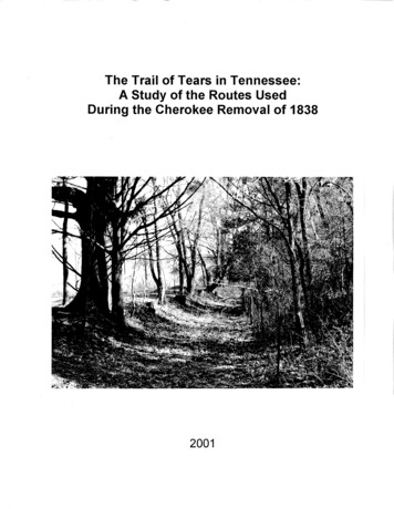
The Trail of Tears in Tennessee:A Study of the Routes UsedDuring the Cherokee Removal of 18382001
THE TRAIL OF TEARS IN TENNESSEE:A STUDY OF THE ROUTES USEDDURING THE CHEROKEE REMOVAL OF 1838Benjamin C. NanceTennessee Department of Environment and ConservationDivision of Archaeology2001
TABLE OF CONTENTSList of FiguresiiList of TablesiiiAcknowledgmentsivIntroduction1An Overview of Historical Events Leading to the Removal of the Cherokees3Results of the Survey of Routes Used By the CherokeesDuring Their 1838 Removal From Tennessee21Departure Points23Northern Route27Bell's Route33Benge's Route38Taylor and Brown's Route40Drane's Route42Archaeological Remains Related to the Trail of Tears43Conclusions45Appendix A. Recorded Tennessee Archaeological SitesPertaining to the Cherokees47Appendix B. Selected Photographs of Road Segments56Appendix C. Maps of the Removal Routes in Tennessee60References Cited68
LIST OF FIGURESPageFigure 1. Map of the Cherokee Nation in 17216Figure 2. Map of the Cherokee Nation 1819-18357Figure 3. General Map of the Land Routes Used During the Cherokee Removal 18Figure 4. Map of the Fort Cass Emigrating Depot24Figure 5. Cannon County. Road segment beside Highway 70S in Leoni57Figure 6.Robertson County. Road Segment near Harmony Church Road57Figure 7.Franklin County. Road Segment West of Winchester (facing east)58Figure 8.Franklin County. Road Segment West of Winchester (facing west)58Figure 9.Hardeman County. Road Segment Near Stewart Road59Figure 10. Humphrey's County. Portion of Old Road Near Conal co Roadii59
LIST OF TABLESPageTable 1. Removal Detachments, Their Conductors, Assistant Conductors,and Probable Points of Departure16Table 2. Recorded Tennessee Archaeological Sites Pertaining to the Cherokees 48iii
ACKNOWLEDGMENTSReports of this kind are not possible without the help of many peopleproviding information, advice, and technical assistance. Several people aided incompletion of the project that this report concerns, and their help is greatlyappreciated. The Tennessee Division of Archaeology's Trail of Tears projectoriginated from conversations between Division Director Nick Fielder and membersof the Tennessee Chapter of the Trail of Tears Association. Realizing the need fora comprehensive study of all portions of the trails used by the Cherokee during theremoval, Nick conceived the idea for a statewide study to map out the routes of theremoval detachments and look for surviving segments of the roads. Sam Smith,Historical Archaeologist for the Tennessee Division of Archaeology, offered adviceduring the early planning stage of the project and later helped conduct fieldexaminations of the routes in various parts of the state. Sam also edited the siteforms for the sites recorded during the survey, as well as the final report. His inputand guidance throughout the project were vital to the completion of the work.Suzanne Hoyal, Site File Curator for the Tennessee Division of Archaeology, alsoparticipated in the early planning stage for the project. Later she assigned sitenumbers to each of the recorded sites and processed them for inclusion in thestatewide archaeological site file.Steve Rogers of Tennessee HistoricalCommission was responsible for the administration of the Survey and PlanningGrant that was used to fund this project. The Tennessee Division of Archaeologyprovided matching funds in the form of salaries of staff members who helped withthe project and by providing the Division's vehicles and equipment.The Tennessee Chapter of the Trail of Tears Association is an organizationdedicated to preserving the history of the Cherokee Removal, and its members havedone much research on the subject. Several members of this organization providedinspiration, assistance, and information used in conducting this survey project. BillJones of Spencer, Tennessee helped Nick Fielder develop the idea of conducting astatewide survey to locate the routes used by the Cherokees during their removal.Mr. Jones has done extensive research on this subject, and he graciously sharedhis information with the Division of Archaeology staff. Floyd Ayres of Winchester,Tennessee also shared his research information concerning the route of the BellDetachment through Marion and Franklin Counties. Mr. Ayres took the time to showresearchers this route and provided some archival map information. The help of allmembers of the Tennessee Chapter of the Trail of Tears Association is appreciated.Tim Woods of Sewanee, Tennessee took time to show researchers roadsegments near his home. He also introduced us to Joe Yokely, a resident of theSewanee area, who shared his knowledge of the area. Mrs. Gladys Higgins, Mrs.Verna Higgins Wood, and Mrs. Marian Presswood, provided information concerningthe location of Fort Marrin the Old Fort, Tennessee area. Several landowners alsograciously allowed us access to their private property for field survey of roadsegments.iv
INTRODUCTIONThe Term Trail of Tears has come to encompass the overall process of theremoval of Indian tribes from their ancestral homes to territories west of theMississippi River. Over the course of several decades beginning in the 1790s, theUnited States Government pursued a policy aimed at obtaining land from the Indiantribes that then lived east of the Mississippi River. The policy ultimately resulted inthe Indian Removal Act of 1830, which had been strongly advocated by PresidentAndrew Jackson. During the next five years the government sought treaties with theindividual tribes to finalize the process of removing the Indians. The smaller, lessorganized tribes of the north gave little resistance, but the five large southern tribes,Cherokee, Chickasaw, Creek, Choctaw, and Seminole, strenuously resistedremoval. The Cherokees were the last to sign a treaty of removal, and that treaty,signed in 1835, was signed by a minority faction whose authority was questionable.The Cherokees continued to resist until 1837, when the United States Army beganto round them up and place them in stockades and camps to prepare them for aforced removal. John Ross, Principal Chief of the Cherokees, came to anagreement with General Winfield Scott, commander of the removal forces, that theCherokees would remove themselves under Ross's supervision. In 1838 theCherokee people began their journey to the west.The Trail of Tears is often thought of as one specific trail or road on whichthousands of Cherokees walked to their new home in what is now Oklahoma, butthe reality is much more complex. Approximately 16,000 Cherokee people, with ahandful of Creek Indians and black slaves, traveled in 17 different detachmentsusing three main land routes, several route variations, and a river route. Travelingby foot, wagon, and horse, some of the Cherokees were on the road for more thanthree months, most traveling in winter. Although there are no accurate records forthe number of deaths resulting from the removal, the estimate of 4,000 deathsduring the process of internment and removal is widely accepted.The focus of the Tennessee Division of Archaeology's study of the Cherokeeremoval was to identify the routes used by the various Cherokee detachments in1838 and to look for surviving segments of the road system that was then in place.Once identified, the routes were marked on U. S. G. S. topographic quad maps, andsurviving segments of road along these routes were identified on the maps. A statearchaeological site number was assigned to each route within a specific county, aconcept different than the traditional recording of specific archaeological sites withdistinct boundaries. This recording process will allow future researchers to conductmore detailed research on specific segments of the route.This report presents the results of the Tennessee Division of Archaeology'sstudy of the Trail of Tears in Tennessee. Though it is a completion report for theproject, it should by no means be seen as an ending point for research on the1
routes. The results of the project are a beginning point from which more detailedanalysis can be conducted. Individual researchers have already looked intosegments of the roads used during the 1838 removal. Their research into deedrecords, plat maps, and other archival resources has allowed them to pinpoint thelocation of the roads present in 1838. Such specific and detailed research is timeconsuming, thus it was not possible to do this level of analysis for all the routesacross the state. The overview presented by the recorded sites of the removalroutes will serve as a starting point for ongoing research concerning the Trail ofTears. The large volume of site maps generated by this project precludes theirinclusion in this report, but they are available in the Tennessee Division ofArchaeology's permanent site file for researchers of the trail.This report is divided into two main sections. The first presents on overviewof historical events leading to the removal of the Cherokees. The second presentsinformation on the routes used during the removal and the detachments that madethe journey. The report concludes with suggestions for areas for future research.2
AN OVERVIEW OF HISTORICAL EVENTSLEADING TO THE REMOVAL OF THE CHEROKEESThe Cherokees called themselves Ani'-Yun'wiya, the Principal People orsometimes Ani'-Kitu'hwagi, people of Kitu-hwa (an ancient settlement). The nameCherokee may have originated from a 1557 Portuguese narrative of De Soto'sjourney in which they were called Chalaque, and put in English as Cherokee asearly as 1708. The Cherokees' ancient tradition said that they had sprung from theCenter of the earth, and the first man and woman were Kana'ti and Selu. Accordingto a Delaware Indian tradition, the Cherokees, called Talligewi by the Delaware,were expelled from their home north of the Ohio River by the advancing Delawaretribe, aided by the Iroquois. The Iroquois took possession of the land around theGreat Lakes while the Delaware took the portion to the south and east (Mooney1972:15-19; Royce 1975:8-9).Hernando De Soto was probably the first white man to encounter theCherokees on his 1540 expedition through the country. The Cherokees met theEnglish in the early 17th Century and conflicts began immediately. The Cherokeesdefeated men of the Virginia Colony in 1634 near what is now Richmond, Virginia,forcing the Englishmen to seek a treaty with the Cherokees (Hoig 1996:4). TheCherokees once controlled a large expanse of land encompassing what is nowMiddle and Eastern Tennessee, most of Kentucky, northern Alabama and Georgia,and parts of North and South Carolina, Virginia and West Virginia (Royce 1884:Map of the Cherokee Nation). Trade with the Indian tribes could be prosperous forthe Europeans, particularly when they were supplying warring tribal factions thatneeded weapons and supplies. When James Needham and Gabriel Arthur begantrading with the Cherokees in 1673, there were three principal groups of towns. TheOverhill Cherokees lived on the western side of the Appalachian Mountainsconcentrated along the Little Tennessee River. The Middle Cherokees occupiedthe mountainous regions of East Tennessee and western North Carolina. TheLower Cherokees lived in northern Georgia, Alabama, and South Carolina. TheCherokee system of government, which was composed of many individual townchiefs, was frustrating for the English, and in 1730 Sir Alexander Cuming demandedthat the Cherokees provide one Principal Chief, modeled on the English monarchy,to negotiate treaties and trade agreements (Hoig 1996:4-6; Malone 1956:5-7; Satz1979:58-60).European powers were soon at war, fighting for control of the North Americancontinent, and the Cherokees, like other Indian tribes, were caught in the middle ofthe fighting. During the Seven Years' War, known on the North American Continentas the French and Indian War, the British promised to build a fort to help protect theCherokees from a possible invasion from the west by the French and their Indianallies. Fort Loudon was constructed in 1756-57 on the south side of the Little3
Tennessee River. Relations between the British and the Cherokees worsenedthroughout the war. In 1759 the Governor of South Carolina held a Cherokeedelegation hostage at Fort Prince George, though the Cherokees had been assuredof safe passage. Several Cherokees were killed during an attempt to rescue thedelegates, and the incident sparked an uprising. The Cherokees laid siege to FortLoudon in March 1760 and forced Captain Paul Demere to surrender. TheCherokees granted the garrison safe conduct as they abandoned the fort. Uponlearning that Demere had hidden weapons that he had promised to turn over, theCherokees attacked the retreating garrison, killing 23 and capturing the remainder.British retaliation was swift, and the Cherokees were forced to sue for peace (West1998:326-327; Hoig 1996:6-1 0; Satz 1979:60-61 ).Chief Corn Tassel came to power in the early 1770s and tried to maintainpeace between the Cherokees and white settlers who were moving into Cherokeeterritory. Settlement west of the mountains was forbidden by the Proclamation of1763, but white settlers largely ignored this decree. Colonial officials were obligedto seek land grants from the Cherokees, and large areas of the Cherokee Nationbegan to be ceded to the whites. In 1775 war erupted between the AmericanColonists and the British. The Cherokees were again forced to choose sides, andthey chose to back the British, hoping to regain some of their lost territory. Thedecision proved to be disastrous, as North Carolina and Virginia troops attackedand destroyed several Cherokee towns. The greatest resistance came from thewarriors of the Lower Cherokee towns, known as the Chickamaugans. TheAmerican Revolution ended in 1783, and in 1785 the Cherokees signed the Treatyof Hopewell, taking a step toward peace (Hoig 1996:7-12; Malone 1956:9-19).North Carolinians led by John Sevier formed the State of Franklin in 1784.The act was an intrusion of the Cherokee territory and conflict ensued. Sevier led amilitia group in raids against Cherokee towns. In 1791 William Blount, territorialgovernor of what would become the State of Tennessee, led a delegation tonegotiate the Treaty of the Holston. In return for land cessions the Cherokees werepromised an annual payment from the Federal Government. Conflicts continueduntil 1794 when the settlers organized what has become known as the NickajackExpedition, which destroyed the Lower Chickamaugan towns, forcing them to sign apeace treaty (Caldwell 1968:67-71 ).There was now a relative peace between the Cherokees and the settlers.Tennessee became a state in 1796, and the Cherokees continued to make landcessions in order to preserve the peace. It was inevitable to some, however, thateventually the entire Cherokee Nation must be consumed to satisfy the white man'shunger for land. It was the same for other tribes as well. The United Statesgovernment policy for the removal of Indian tribes began during the administrationof Thomas Jefferson. Jefferson wanted to "civilize" Indians by teaching themagriculture then assimilate them into white society. Those who did not want toaccept this civilization could go to new land out west. When the Indians resisted,4
Jefferson encouraged the government traders to keep the Cherokees in debt, sothat eventually they would be forced to sell the land to settle the debt. He steppedup this effort when it seemed inevitable that Napoleon Bonaparte was going to sendan expedition to Louisiana, which France had obtained from Spain. Jeffersonwanted to encourage white settlements as far west as possible to defend againstpossible French attacks. The French expedition to Louisiana never materializedbecause France and Britain went to war, and French troops were needed at home.France, strapped for cash, was forced to sell the Louisiana Territory to the UnitedStates in 1803 (Tucker and Hendrickson 1990: 125-135; Perdue 1989:50-51 ).The vast expanse of the Louisiana Territory gave Thomas Jefferson theterritory necessary to provide new homes for the eastern tribes, and he still hopedthat these eastern Indians would voluntarily remove themselves. The governmentappointed agents to circulate amongst the Indian tribes and promote the idea ofvoluntary removal (Hoig 1996:17-18).Henry Dearborn, President Jefferson'sSecretary of War, appointed Return Jonathan Meigs to the dual post ofSuperintendent of Indian Affairs for the Cherokee Nation and Agent for the WarDepartment in the State of Tennessee. Meigs replaced current Cherokee AgentThomas Lewis and established an office at Fort Southwest Point, located in presentday Kingston at the confluence of the Tennessee and Clinch Rivers (Smith 1993:51;Meigs 1981 :201-202).In 1809 the Cherokees held a national council in which they appointed acommittee of chiefs to direct land dealings for the nation. This move was to preventindividuals from trading Cherokee lands on their own. The decision stemmed fromland cessions made in 1805 and 1806 by Chief Doublehead, a prominent Chief inthe Lower Cherokee towns, in which the United States secretly gave Doublehead atract of land near Muscle Shoals, Alabama. When news of the deal was learned,Ridge, a prominent Cherokee warrior from the Upper Towns, assassinatedDoublehead. The assassination caused great tension within the Cherokee Nation(Hoig 1996: 18).The Cherokees continued to give up land through 1819. Figure 1 shows theapproximate extent of land controlled by the Cherokees as early as 1721, withmodern state boundaries also shown. In 37 different treaties between 1721 and1819, the Cherokee Nation was reduced to an area that occupied southeasternTennessee, northern Georgia, northeastern Alabama, and southwestern NorthCarolina (Figure 2). Minority factions of the Cherokees, mostly wealthy landowners,signed Treaties in 1817 and 1819, having been bribed by the promise ofcompensation for their land and all improvements in exchange for emigration to thewest. The poor Cherokees were compensated with a rifle, blanket, and kettle orbeaver trap. Constant pressure was kept on the Cherokees to give up this lastvestige of their once large nation (Perdue 1989: 52-53).5
.··. .· .·./KENTUCKY/. t.' .(\·./I//(·: . /·: ./VIRGINIA .·.-./ ·.,.··. - . -. -.-.-. -. .i. ·· -.- ·-·,,· '- /'. ,.1cumberlandQ)TENNESSEE,. I' -/· J .e .·. . .NORTH CAROLINA.-·/ · - . -· -·-. -·- "'"'·"'· -'.':.: L. .--. - .I.I.\. .&(';)) \,. . . .ALABAMA: · . GEORGIASOUTH CAROLibjA. . . .··· .··r······:.·· ·· . ·. ···· ······· .:···· :··.':.z.: S ,.I'.Figure 1. Map of the Cherokee Nation in 1721 (adapted from C. C. Royce, 1884). .·····.
. v.· ., .,. . . . ·.iNORTH.,HIWASSEE GARRISON. - TENNESSEE-·/(2ND CHEROKEE AGENCY)CAROLtNA ROSS'S LANDING:---.-.-.-.-.-.-.- ·- .·· ·'\It": ·-.-.-.-· . .-·'-·-.·-.'\ (, ':J'V C:J --.1 :., , .'\.ALABAMA.\ \:. NEW ECHOTA\GEORGIA\. \. . . . . .·.\. . . . . . . .0.\\.r\.\.Figure 2. Map of the Cherokee Nation, 1819-1835. . :,-:. .·-
The State of Georgia had ceded its western lands, those comprising what isnow Alabama and Mississippi, to the Federal Government in 1802. This was donewith a promise that the Federal Government would take away all Cherokee titles toland in Georgia, even though this act would be a violation of treaties made betweenthe United States and the Cherokees. This extinguishing of land titles was to bedone when it could be achieved peacefully and inexpensively. The Georgia Stategovernment felt that the 1803 purchase of the Louisiana Territory provided anopportunity for the government to carry out its promise.The situation for Georgia Cherokees worsened in 1829 when gold wasdiscovered in northern Georgia. Gold fever gripped the white Georgians, and theState Legislature passed several anti-Indian laws. Among the measures taken bythe state, Cherokees could not dig for gold, a Cherokee could not testify against awhite man, and contracts between a Cherokee and a white man had to bewitnessed by two whites. Worse yet, Cherokee lands were subdivided and offeredfor sale to whites through a lottery system. White settlers and the Georgia StateGuard drove many Cherokees from their homes, and some of the homes werelooted and burned. Alabama soon passed similar laws to restrict Cherokees (Hoig1996:33-35; Perdue 1989:55).Andrew Jackson was elected president in 1828, and in a speech to Congressthe following year he initiated a bill to remove all eastern tribes to land west of theMississippi. The Cherokees were well acquainted with Jackson, and Cherokeewarriors had fought under the General's command against the Creek Indians in the1812-1814 Creek War. His Cherokee allies played a crucial role in Jackson'svictory at Horseshoe Bend. Despite the aid that the Cherokees had given Jackson,he was adamant about removing them along with the other eastern tribes (Hoig1996: 36-38).Jackson's Indian Removal Bill became law in 1830, passing the House ofRepresentatives by just five votes. In the following year the Cherokees filed suitagainst the State of Georgia for the unjust laws passed by that state. Chief Justiceof the Supreme Court, John Marshall, decreed that the Supreme Court had no rightto control the Georgia State Legislature.Justice Smith Thompson gave adissenting opinion, stating that the treaties made between the United States and theCherokees were being violated by Georgia law.Benjamin Currey, a former Congressman, accepted the post ofSuperintendent of Indian Removal in the fall of 1831. Currey, a friend of AndrewJackson, began recruiting Cherokees for removal to the west. Despite the passageof the Indian Removal Act, the government still needed a treaty with each tribe inorder to remove them and gain possession of their lands. The Indian Removal Actdid not allow the use of force to remove the Indians. Among the southern tribes theCherokees were the last to sign such a treaty. The Choctaws signed one in 18308
and the Creeks, Chickasaws, and Seminoles signed in 1832. Principal Chief JohnRoss led strong opposition among the Cherokees.John Ross, born in 1790 in Turkey Town on the Coosa River in Alabama,was the son of Daniel Ross and Mollie McDonald. His ancestry was more Scottishthan Cherokee. John Ross's great grandfather was William Shorey, a Scotsmanwho had once served as an interpreter at Fort Loudon. Shorey married a Cherokeewoman named Ghigooie, and they had two children, William and Anne. Annemarried John McDonald, a Scottish trader who had served in the British Army duringthe Revolutionary War. As a commissary agent McDonald had supplied theCherokees during the conflict. Following the war McDonald became an agent forthe Spanish Government in negotiations with the Cherokees. He received 500 peryear for his services. In 1793, William Blount, governor of the Southwest Territorythat would become Tennessee, offered McDonald the position of United Statesagent to the Lower Cherokees. McDonald accepted the post though he still drewhis annual fee from the Spanish until 1798 (Moulton 1978: 1-5).In 1785 McDonald used his influence with the Cherokees to help save afellow Scotsman, Daniel Ross. Ross and a partner traded regularly with theChickasaw Indians. The Cherokees captured Ross and other members of his partyduring one of his trading excursions, and it was only through the intervention ofJohn McDonald that bloodshed did not ensue. Ross then established trade with theCherokees and married Mollie McDonald. Their third child was John Ross(Moulton 1978:5-8).John Ross grew up among the Cherokees, and his father made sure thatJohn and his siblings received a good education. John Ross became a merchantand also served in a company of mounted Cherokees During the Creek War. Helater married Elizabeth Henley, known to the Cherokees as Quatie. Though he wassurrounded by the Cherokee people throughout his life, his physical stature andeducational background made John Ross very different from them. Despite thedifferences, however, he won the respect of the Cherokee nation. Ross becamePrincipal Chief in 1828 after developing a Cherokee Constitution modeled on theUnited States Constitution. In his roll as chief, he led the fight to resist removal(Glass 1998: 811; Moulton 1978:8-14).Ross had been on a diplomatic trip to Washington in 1833 to argue againstremoval, and upon returning home, he found that his plantation in Georgia had beengiven away by the lottery. His wife and children had been turned out, and he had topay to stay the night. He found his family on the road to Tennessee, walking in arainstorm.Ross moved his family to Tennessee where he settled near theTennessee- Georgia State line (Hoig 1996: 41-42).Ross continued to frustrate the efforts of Andrew Jackson to remove theCherokees, and his Cherokee following was strong. Ross had refused to send9
delegates to meet with Jackson in Nashville in 1830. After Choctaw chiefs werebribed to sign away Choctaw lands later that same year, Ross was cautious aboutany dealings with the government. To help spread dissension within the Cherokeeranks, Jackson ordered that annuity payments that were paid to the Cherokees asstipulated in past treaties would now be paid to individual Cherokees instead of theCherokee governing body. This deprived Ross and his supporters of funds withwhich to employ legal services to fight Georgia and the Federal government (Hoig1996:44-46).A small faction within the Cherokee Nation was in favor of signing a newtreaty with the Federal Government and moving to the west away from theintimidation of the white man. Benjamin Currey claimed that most Cherokeessupported Ross because they had been intimidated. The opposition to Ross wasled by Major Ridge, his son John Ridge who was president of the Cherokee Council,Elias Boudinot, who was the editor of the Cherokee newspaper Cherokee Phoenix,and Andrew Ross who was John Ross's brother.Ross removed Boudinot as editor of the Cherokee Phoenix because he didnot want pro-removal sentiments printed. The paper's last publication came in1834. As Ross continued to fight removal, the Ridges, Boudinot, and others formedthe Cherokee Treaty Party. They met with Benjamin Currey in 1834 and discussedremoving Ross as Principal Chief so that a treaty could be signed. They met withJackson in Washington, and the President paid 3,000 for their travel expenses.Jackson later met with John Ross and offered the sum of 4.5 million dollars for theCherokee lands, but Ross demanded 20 million, thus stalling for more time.On March 29, 1835, Reverend John Schermerhorn, appointed by Jackson tobe a special commissioner to the Cherokees, met with the Treaty Party at NewEchota, Georgia to discuss details of a treaty with the Cherokees. Throughout theremainder of 1835 the rift between the Cherokee factions deepened. John Ridgeasked Governor Wilson Lumpkin of Georgia for help, Lumpkin responded by havingthe Georgia Guard arrest several of Ross's supporters to intimidate them. Finallyon December 5, 1835, the Georgia Guard crossed the border into Tennessee andarrested John Ross and his friend John Howard Payne, a playwright famous forwriting the song "Home Sweet Home." Ross and Payne were taken to Georgia anddetained at Camp Benton for nearly two weeks. This gave Schermerhorn time toassemble 300 to 500 Cherokees who would support the treaty. Having worked outthe details at this council, the Cherokee Treaty Party signed the Treaty of NewEchota on December 29, 1835. Fewer than 100 Cherokees attended when thetreaty was signed. The agreement stipulated that the government would pay theCherokees 5 million dollars for their lands, and the Cherokees would agree tomove to the western territories (Hoig 1996: 49-55; Ehle 1988:273, 290-296; Jahoda1975:221-223)10
Ross immediately organized a formal protest of the treaty and obtained thesignatures of 14,91 0 Cherokees opposed to the treaty. Threats were made againstthe pro-treaty Cherokees, and Schermerhorn was criticized for the manner in whichhe conducted treaty negotiations. Ross traveled to Washington to convince thesenate not to ratify the treaty, but his delegation was ignored as was public outcryagainst the questionable treaty. The Senate approved the treaty by one vote, andon May 23, 1836, President Jackson signed it into law. The fate of the CherokeeNation was now sealed.Although most Cherokees had fought against removal for many years, therewere others who had accepted the inevitability of the move and went west in theyears preceding the Treaty of New Echota. As early as 1782 a group of Cherokeessought the permission of Don Estevan Miro, governor of the then Spanish heldLouisiana Territory, to settle west of the Mississippi. The first Cherokees to actuallymove probably left around 1790, dissatisfied with the Treaty of Hopewell. Theysettled in what is now Arkansas where several conflicts ensued with the other tribesin the area, particularly the Osage, Sac and Fox tribes. Other groups arrived in thewest from the "Old Nation ". and some of these were conducted out west by thegovernment.A group under Chief Tahlonteskee arrived in 1810, and thegovernment conducted Jolly Party arrived in 1819. The Jolly Party traveled by boat,but other groups moved overland. Some used a road across Tennessee andKentucky into Missouri and then to Arkansas. This was the route that the main bodyof Cherokees would use in 1838. Others went by a southern route acrossTennessee, crossing the Mississippi River at Memphis. Groups with livestockfavored this more direct route, which passed through the Chickasaw Country. TheWestern Cherokee Nation occupied an area of Arkansas from 1810 to 1828, thenunder a treaty with the United States, they moved farther west into what
LIST OF FIGURES Figure 1. Map of the Cherokee Nation in 1721 Figure 2. Map of the Cherokee Nation 1819-1835 Page 6 7 Figure 3. General Map of the Land Routes Used During the Cherokee Removal 18