Transcription
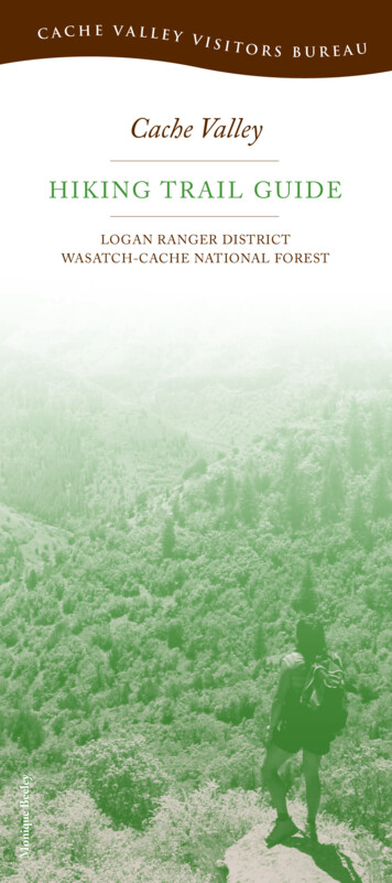
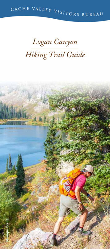
C a c h e Va l l e y Visitors BureauLogan CanyonMonique BeeleyHiking Trail Guide
LegendTrail Location GuideWASATCH-CACHENATIONAL ePine LakeTonyGrove7/812111065ilaal TrCanenil31 HighA-DRight2/4nd ForaLeft HkHandForkLimberPine
for trails:123an4gLoe Trailre ShorelinveRiBonnevillBridgerCGSpringHollowCGmaps not to scaleMAP 2for trails:MAP 4for trails:1600 EBonneville Shoreline Trail7Providence CanyonDam1 MileSecond9wy 8US HrailRiver TLogan Dry CanyonFirst DamHighCanalliTnerailGatewayTrail3rd DamUrban TrailsCanyonRoadTrail1900 NMAP 11500 EGreen CanyonLegendMAP 35A-D6118910
B EF ORE YO U G OEASY ACCESS UR BAN TRAILSThe trails on the maps are marked with their ForestService trail numbers, for example: 047There are four urban trails leaving from the First Damparking lot.Trail difficulty depends on your health and physicalcondition. Each trail map provides information onbeginning and ending elevations to assist you.A North. Logan Canyon to Green Canyon segment of theBonneville Shoreline Trail. Go through the tunnelunder the highway and follow the switchbacks upto the ancient shoreline. Continue north to GreenCanyon. This trail has some great views of Loganand Cache Valley.Wear sunscreen and drink plenty of water to avoiddehydration.Wear insect repellant and check yourself for ticks afterspending time in the mountains.BEast. The Gateway Trail. Go through the tunnelunder the highway. Head east up the canyon. Thetrail is parallel to the highway and ties into theRiver Trail.CEast. Highline Canal Trail. Walk uphill on theBonneville Shoreline Trail and turn right at the topof the hill. This 1.7-mile trail is cliffside with aweinspiring views.Please do not shortcut trails.Trail EtiquetteBikes yield to hikers and horses.Hikers yield to horses.Step off trail to downhill side to let horses pass.Please remove any litter you find along the trail.Use restroom facilities or bury waste in a 6-inch hole 200feet away from water.If you happen to encounter a rattlesnake along the trail,please leave it alone! It is a valuable part of the ecosystem.At elevations above 8,000 feet, wet, cold, and windyweather is possible at any time so be prepared. Trails inthe Bear River Mountains are generally above 5,000 feet.The air is thin, which puts extra stress on the heart andlungs and increases risk of sunburn.Carry your own water or use a quality pump and filter topurify water taken from backcountry streams and lakes.Giardia, a serious intestinal parasite, is prevalent.A guide to these and more extensive trails can be foundin the book Cache Trails. Another excellent resource is theNational Geographic map of the Bear River Range, whichshows comprehensive trails, trail numbers, elevations, andmotorized/nonmotorized use. Both are available at the CacheValley Visitors Bureau Gift Shop, 199 N. Main St. in Logan.D West. Canyon Road Trail. Look for the fancysidewalk against the cliff. This trail parallels CanyonRoad until it dead ends.
Logan Canyon Trailson Uinta-Wasatch-Cache National Forest1RI V ER T RAI L : 603Length: 3.7 miles; sections of trail are never more than1.5 miles longElevation Start/End: 4,900/5,400 feetDifficulty: EasyTrailheads: There are six entry/exit points:1. The Gateway trail ties into the River Trail under thehighway and over the river.2. Across US Hwy. 89 from the forest boundary signat the mouth of the canyon. The gate is usuallyclosed and locked. Park at the boundary sign andcross the road. GPS: N41º 44.516’ W111º 46.567’3. Red Bridge Trailhead (Mile post 463.2)4. Second Dam. GPS: N41º 44.777’ W111º 44.817’5. Bridger Campground just past Zanavoo.6. Spring Hollow Campground has a small parkingarea at the entrance. GPS: N41º 45.200’ W111º43.010’Features: The River Trail follows the Logan Citywater line, which is buried beneath the road and passesStokes Nature Center. The trail parallels the river and isnever more than a few hundred feet from US Hwy. 89,although traffic is not visible for most of its length. Thetrail goes south above Bridger Campground and GusLind Flat Summer Home Area. It passes Third Damand joins Riverside Nature Trail at Spring Hollowand then onto Guinavah. Moose have been seen nearthe river, and many species of birds and plants canbe observed.MAP 22RIVER SIDE NAT URE TRAIL : 0 5 2Length: 1.3 miles; this trail is closed to bicyclesElevation: 5,400 feetDifficulty: EasyTrailheads: There are two entry/exit points:1. Spring Hollow Campground has a small parkingarea at the entrance. GPS: N41º 45.200’ W111º43.010’2. Guinavah Campground, near the amphitheater.GPS: N41º 45.741’ W111º 42.150’Ref. Map (7.5 min.): Logan Peak, Mt. ElmerFeatures: The Spring Hollow section of this trail is widewith interpretive signs and benches. The section beforeGuinavah narrows and includes a steeper climb.MAP 23W IN D CAVES : 032Length: 2 miles one wayElevation Start/End: 5,100/6,000 feetDifficulty: ModerateTrailheads: Located 5.3 miles up US Hwy. 89. The trailhead is across from Guinavah-Malibu Campground.GPS: N41º 45.747’ W111º 42.212’Ref. Map (7.5 min.): Mt. ElmerFeatures: The delicate triple arch and natural cave is atthe top of the China Wall geologic formation on thenorth side of the canyon. This is part of the same formation found on the Crimson Trail on the south side.It is dry enough for hiking in early spring. Big-toothmaple trees are abundant and fossils from the Mississippian period are common.Trail Information: This is a popular trail because it isshort, steep, and uses lots of calories. This side of thecanyon is warm, so you may be lucky enough to seeor hear a rattlesnake. If you see a snake, please do notdisturb it. There are very few left in the canyon. Bringplenty of water and please do not cut through the trail’sswitchbacks.MAP 2
4C RIM S O N T RA I L : 015Length: 3 miles one way; this trail is closed to bicyclesElevation Start/Max: 5,200/6,000 feetDifficulty: ModerateTrailheads: Spring Hollow upper group area, 4.3 milesfrom Logan. GPS: N41º 45.200’ W111º 43.010’ orGuinavah Campground, 5.3 miles from Logan. GPS:N41º 45.741’ W111º 42.150’Ref. Map (7.5 min.): Logan Peak, Mt. ElmerFeatures: This trail was the “Senior Walk” for BrighamYoung College’s graduating class until the college closedin 1926. The school colors were crimson and gold—hence the trail’s name. Most of the trail follows theChina Wall on the south side of the canyon. This exposure gets more water than the north side, so the vegetation tends to be more lush. It also remains icy until latespring. The trail looks down on Guinavah Campgroundsome 600 feet below. The Spring Hollow end of thetrail is above the group reservation sites.Trail Information: Spring Hollow is just beyond ThirdDam. Cross the bridge, turn right, and park. The trailstarts a short walk up the road in the upper group areaat the small bridge. The Guinavah trailhead is across thebridge near the amphitheater parking area. Use cautionin descending the short, steep slope as you come off theChina Wall near Guinavah. There is steady climbing ateach end, but the view is worth the effort. Either wayyou can make a loop by meandering back on theRiverside Nature Trail.MAP 25RIGH T HAN D F OR K TRAILS(INCLUDING OLD EPHRAIM’S GRAVE)Elevation Start/Max.: 5,600/7,200 feetDifficulty: ModerateTrailhead: Right Hand Fork, Logan Canyon, BoulderMountain. GPS: Old Ephraim’s Grave Trailhead N41º46.656’ W111º 37.164’Ref. Map (7.5 min.): Temple PeakTrails: Hiking, and when dry, mountain biking andhorses056 Willow Creek—2.1 miles127 Ricks Canyon—3.9 miles607 Ephraim’s Cutoff—3.6 milesTrails: Hiking, and when dry, mountain biking,horses, and motorcycles055 Little Cottonwood—1.4 miles013 Steel Hollow—2.8 milesRoads: Hiking, and when dry, mountain biking,horses, motorcycles, ATVs, and JeepsFR 047 Cowley CanyonFR 147 Marie SpringsFR 056 Long HollowFR 153 Chicken CreekFR 007 Temple ForkThe Right Hand Fork area offers a variety of interconnecting trails and roads. Directions: Take US Hwy. 899.2 miles up Logan Canyon to Right Hand Fork Road.Turn right and travel 1 mile up Right Hand Fork (FR081) to the first junction. Stay to the left and the roadturns to gravel. The trailhead is .6 miles farther. Parkyour vehicle at the trailhead, and choose from a varietyof options. Many travelers enjoy a visit to the final resting place of the giant grizzly bear, Old Ephraim. Hisgrave is located on the east side of Long Hollow Road(FR 056). One way to hike to Ephraim’s stone monument from the Right Hand Fork Trailhead is to takethe Willow Creek Trail and Temple Fork (FR 007) andLong Hollow (FR 056) roads.MAP 3
6OL D J UNI P ER : 014Length: 5.8 miles one wayElevation Start/End: 5,400/7,200 feetDifficulty: ModerateTrailhead: Wood Camp turnoff, 10.4 miles from Loganon US Hwy. 89. GPS: N41º 47.800’ W111º 38.700’Ref. Map (7.5 min.): Mt. ElmerFeatures: A good view of the main ridge of the BearRiver Range can be seen from many points along thetrail. The paths of several winter avalanches are alsovisible and there are many flowering plants and shrubsduring the spring and summer. Fall colors are outstanding and generally peak in late September. The oldJardine Juniper is estimated to be over 1,500 years old.Trail Information: Cross the bridge at Wood Camp tothe small parking area up the hill. The trail crosses astreambed near the beginning and again about 1.5 mileslater on the south side of an open area. The trail dividesat the ridge above Cottonwood Canyon. The left forkgoes to the upper part of Cottonwood. Take the rightfork to the juniper. The trail splits at about 4 miles toloop around a hill; the left fork overlooks CottonwoodCanyon, while the right fork overlooks the Logan Canyon area. About midway around the loop a short spurtrail switchbacks down the hill to the tree. This trail isvery popular with mountain bikers.Utah State University Special CollectionsMAP 3
7WH I T E P I NE LA KE : 025Length: 4.5 miles one wayElevation Start/Middle/End: 8,000/8,800/8,400 feetDifficulty: ModerateTrailhead: Day use parking at Tony Grove Lake parkingarea (small fee). Overnight parking at the backcountrytrailhead ¼-mile below the campground. GPS: N41º53.686’ W111º 33.535’8NAOMI P EAK : 136Ref. Map (7.5 min.): Naomi PeakLength: 3.3 miles one wayElevation Start/End: 8,000/9,979 feetDifficulty: ModerateTrailhead: Day use parking at Tony Grove Lake parkingarea (small fee). Overnight parking at thebackcountry trailhead ¼-mile below the campground.GPS: N41º 53.686’ W111º 33.535’Ref. Map (7.5 min.): Naomi PeakFeatures: This is breathtaking alpine hiking typical ofthe Great Basin highlands. There are many stands of fir,spruce, and aspen. The glacial lake is in a beautiful setting of cirque cliffs and high mountains. Wildflowers areabundant, and their colors peak during July and August.Features: At 9,979 feet, Naomi Peak is the highest pointin the Bear River Range. The trail winds through spectacular meadows of wildflowers that are at their peak inJuly and August. The summit offers a breathtaking viewof the surrounding peaks and of Cache Valley.Trail Information: The trailhead is located at Tony GroveLake. From Logan take US Hwy. 89 (19.6 miles) to theTony Grove Road. Take Tony Grove Road (FR 003) 7miles to Tony Grove Lake. To help reduce the congestedparking at the lake, groups staying overnight or longershould park in the lower backcountry trailhead locatedjust below the campground. People day-hiking into thelake are welcome to park at Tony Grove Lake. The TonyGrove nature trail is 1.3 miles around the lake. The WhitePine Lake trail is easy to follow, but you will be graduallyclimbing the ridge dividing Tony Grove Lake and WhitePine Lake. From the ridge, the trail drops steeply down toWhite Pine Lake. Because there is an uphill grade bothdirections, allow at least four hours for this trip or longerif your group includes small children.Trail Information: The Tony Grove turnoff is 19.6miles from Logan, and the lake loop is 7 miles of pavedroad between the US Hwy. 89 turnoff and Tony GroveLake. The trail is well-defined, steep in a few places,and moderately rocky. Snowbanks persist into the summer and a cold wind usually blows on top. At the ridgethe trail continues to High Creek and Cherry Creekcanyons. The trail to Naomi Peak itself is south alongthis ridge. Trail 005 from Tony Grove to High Creekis officially known as the Mount Naomi Peak NationalRecreation Trail.MAP 4MAP 4
9H I G H C REEK : 005Length: 7 miles from Naomi Peak, 10 miles from TonyGrove Lake LoopElevation Start/End: 9,979/5,200 feetDifficulty: StrenuousTrailhead: Tony Grove Lake Loop, see the Naomi Peaktrail description (Trail #8) first. GPS: High Creek(continuation of Trail 8) N41º 53.686’ W111º 33.535’Ref. Map (7.5 min.): Naomi PeakFeatures: This trail winds through a riparian forest andparallels a booming mountain stream. It progresses intoa wide glacial valley, eventually opening into sub-alpinemeadows covered with wildflowers. The trail culminatesat 9,000 feet at High Creek Lake, a glacial cirque lakesurrounded by towering cliffs. Hikers enjoy numerouswaterfalls during the last 2 miles. This is also a populartrail for horseback riding.Trail Information: The trail continues from High CreekLake west to Cherry Peak and the city of Richmond, orsouth to Mt. Naomi and Tony Grove. There are numerous creek crossings between High Creek Lake andtrailhead. Trail 005 from High Creek to Tony Grove isofficially known as the Mount Naomi Peak NationalRecreation Trail. This is a wilderness trail with minimalmarkings so use a USGS 7.5 map and compass. Wilderness trails are only open to hikers, horses, and pack stock.MAP 410GREEN CAN YON TOTON Y GROVE : 005Length: 12 miles to Tony Grove TrailheadElevation Start/End: 6,100/8,100 feetDifficulty: StrenuousTrailhead: About 5 miles up Green Canyon Road,which starts at 1600 East 1900 North in Logan (technically North Logan). The road enters an open area andthe trail starts on the right side near a fence.GPS: N41º 46.150 W111º 46.146’Ref. Map (7.5 min.): Mt. Elmer, Naomi PeakFeatures: The trail follows the crest of the Bear RiverRange for several miles. Most of the trail is in theNaomi Peak Wilderness, and it passes Jardine, Beirdneau, and Elmer peaks. Some of the most rugged areasof the range can be seen from this trail.Trail Information: This is a two-car trail. The trailclimbs to just below the summit of Mt. Elmer, which isonly a few hundred feet from the trail. It circles aroundthe side of Mt. Elmer, down into the upper part of Cottonwood Canyon, then back up about 800 feet to ColdWater Spring near Tony Grove Lake. This hike is worththe effort. This trail can be easily lost, as numerous sheeptrails and avalanche debris chutes intersect it. This is awilderness trail with minimal markings so use a USGS7.5 map and compass. Wilderness trails are only open tohikers, horses, and pack stock.MAP 4
11T EMP LE FO RKS AW MI LL T RA I L : 062Length: 5.8 milesElevation Start/End: 5,960/6,600 feetDifficulty: ModerateTrailhead: 1.5 miles from the Temple Fork turnoff.GPS: N41º 49.590 W111º 34.518’Ref. Map (7.5 min.): Temple PeakFeatures: This very enjoyable walk along Temple ForkCreek leads you to the site of a saw mill that was builtin 1877 to provide lumber for buildings in Logan.Remnants of the road can be seen along the trail. Theroad from Logan to Temple Fork was built about fouryears before the mill closed in 1883. The mill burneddown three years later. Some of the equipment wassalvaged, but some pieces are still there. The foundations of cabins used by pioneer workers can also be seenin the clearing at the site. Look for the commemorativemonument for more information.Trail Information: The first 3.5 miles of this trail is partof the Great Western Trail, a north-south trail systemthat runs from Canada to Mexico through five westernstates in the United States. The trail splits at the secondbridge. Stay to the left to go to the saw mill. The trail tothe right continues on the Great Western Trail.12LIMBER P IN E : 004Length: 1.3 milesElevation Start/Max: 7,800/7,880 feetDifficulty: EasyTrailhead: Limber Pine Nature Trail, Bear Lake summiton US Hwy. 89, 30.7 miles from Logan.GPS: N41º 55.500’ W111º 28.300’Ref. Map (7.5 min.): Garden CityFeatures: This short walk has an elevation change ofonly 80 feet, which makes it fairly easy for all ages toexperience a forest of fir and aspen trees and meadowsfull of wildflowers. You’re headed to a large limber pine,which is actually several trees that have grown together.It is older than most other trees in the area. Lookforward to stunning views of Bear Lake from severalpoints.Trail Information: A series of signs along the trailprovides information about the area’s flora and fauna.The hike around the trail takes about an hour, althoughgroups with small children should plan to take a littlelonger. The trail has a couple steep sections and asmooth walking surface.MAP 3Milepost491.9
Dallas HolmesCache Valley Visitors Bureau435-755-1890800-882-4433199 N. Main St., Logan UTwww.explorelogan.comUinta-Wasatch-Cache National ForestLogan Ranger District435-755-36201500 E. US Hwy. 89, Logan UT
Features: This trail was the “Senior Walk” for Brigham Young College’s graduating class until the college closed in 1926. The school colors were crimson and gold— hence the trail’s name. Most of the trail follows the China Wall on the south side of the canyon. This expo