Transcription
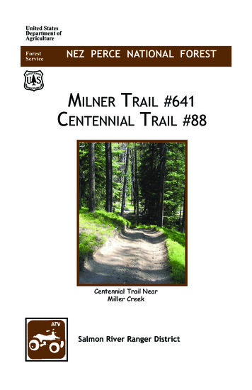
United StatesDepartment ofAgricultureForestServiceNEZ PERCE NATIONAL FORESTMilner Trail #641Centennial Trail #88Centennial Trail NearMiller CreekSalmon River Ranger District
Milner Trail #641 (15.9) MilesJust seven (7) miles south ofGrangeville is Fish Creek Trailhead, a point along the historicMilner Trail/State Wagon Roadthat once served miners fromMount IdahoWay Station to thegoldfields of Florence and Warren. It now serves as a multipurpose trail system.Gold was discovered in theFlorence Basin in 1861. Answering to the need for access, MosesMilner built the trail to Florence in the spring of 1862. Assoon as the Milner trail opened,hundreds-even thousands-ofpeople and pack animals walkedits tread. It took two or threedays to go from Mount Idaho toFlorence. After the discovery ofgold in Warren in the summer ofthat same year, the trail was extended across the Salmon Riverto Warren. The Milner Trailfrom Mount Idaho to Florencewas authorized by the territoriallegislature in 1864 as a toll trailcharging 3 per wagon and horseor mule, 1 per horseman, and 50cents per loaded pack animal.The 1890 territorial legislatureappropriated 50,000 for a StateWagon Road that would connectnorthern and southern parts ofIdaho territory.2The road, completed in 1891,followed the old Milner Trailexcept for the grade down thenorth fork of Slate Creek.Travel along the trail corridoris still possible although thewagon prism has been updatedin most places to carry recreation and logging traffic northfrom the Salmon River to Grangeville.Most of the travel today alongthis route is restricted to offhighway vehicles with short sections of shared access with localroad traffic. The Idaho Pathfinders clear the trail in the springfor ATV users.This route is open year-roundand is groomed by the Snodrifters Snowmobile Club in thewinter as part of the State Snowmobile program. The system isgraveled having a tread surfaceof 8-16 feet in width with goodsight distance and drainage. Thegrades are gentle and the facilityprovides a good travel way forbeginner users as well as moreadvanced users.
This trail section is open to alltrail users and proper trail etiquette is required to provide foruser safety and eliminate conflicts between user types. Becourteous and enjoy the trail.The trail is situated along thewest divide of Mill Creek andprovides many opportunities tosee views of Sourdough Peak,Earthquake Basin, Silver Ridge,Sawyer Ridge, and the accessroute over Gospel Peaks intothe Gospel-Hump Wilderness.The route is shared with elk,deer, moose, bear and domesticcows, as well as, many smalleranimals. Grouse and turkeysmay be seen along the routeand if one should stop, lookand listen they can enjoy manysongbirds.Much of the timber throughthis area has been harvestedand the ride takes the travelerthrough many stages of timberregeneration. The varied heightof the trees provides for scenicoverlooks along the route.Four-wheeling fun at Florence.Photo Credit: Idaho County Free Press3
Milner SectionLEGENDTo GrangevilleMilner ATV TrailRoadFish CreekCampground4649221Point of InterestRanger StationTollgate Ranch(Private)641Lone Fir HillWhite Bird Station(Private)221To White BirdFreeU243se RoadCold SpringsSaddle(4 Corners)221Point to PointFish Creek Meadowsto Road #4649Road #4649 junction toTollgate Ranch (private)Tollgate Ranch toLone Fir Hill#2009 to Cold Sprs Saddle4Miles1.86.3309To South Fork(HWY 14)Old AdamsRanger Station444Square Mountain1.72.1641To Florence
Centennial Trail - #88 (25.0) MilesEstablished in conjunction withIdaho's 1990 Centennial, Centennial Trail #88 is part of the muchlarger Idaho Centennial Trailsystem extending over 1200 milesfrom the Nevada border north tothe Canadian border.Centennial Trail #88 beginsat the junction of Road #221and #444 (at milepost 30 alongthe Grangeville Salmon Road#221). The trail passes throughthe Florence Basin winding alongold wagon roads and miner trailsconstructed to transport suppliesand miners from Grangeville toWarren and to service the Florenceinterior.Some of the trail remains asoriginal with little or minorconstruction over time.The Florence Cemetery isworth the stop. If you're ahistory buff, pick up a copy of"Florence Tells Her Secrets"brochure at the Nez PerceNational Forest Supervisor'sOffice.There are interpretive signs onthe kiosk at the cemetery. Thesigns are designed to help youlocate sites on the map. Use thebrochure as your guide as youtour the sites.The Florence cemetery is fullyaccessible to people with disAlong the route travelers will see abilities.signs where miners dug prospectpits, panned, sluiced, and dredgedin search of gold. Not much is leftThe parking lot has space forof the towns of Florence or Newsixvehicles with additionalFlorence, but the visitor has onlyspacefor parking nearby andto walk off the trail and remnantsthereisa one unit toilet andof mining activity can be found.picnictable.Trees have grown among theremains of log cabins, shafts, tailings, ditches and prospect pits.5
Centennial Trail - #88 (25.0) MilesFor the most part, the Centennial Trail has been reconstructedfor fire, mining, logging, andrecreation travel. The trail hasan unsurfaced width of 4-10 feet,with grade rolls, dips and belteddrains to provide surface drainage,but a lot of the streams are forded.Little Boulder and Miller Creekcrossings are fords and ridersshould use caution, particularlyduring high water flows in thespring and late fall.The route crosses the main roadat New Florence and then travelsalong the wagon road location tothe divide south of Sand Creek,where the trail has been designedto use the spur to the east knownas the Bullion Mine section. Thissection of the route was historically known as the Old WireBridge Trail, so named, becauseof the wire bridge located at CareyCreek across the Salmon River.The pack trail provided a muchneeded travel way linking minesto supply points at Florence to thenorth and Warren to the South.The trail was later upgraded to getmining equipment to the BullionMine.6Trail #88 from Gospel-HumpRoad #444 to Road #394 isopen yearlong to ATV travel.Travelers should be aware thatmost roads which cross the trailare closed or restricted, makingthe crossings the only portionopen to the motorized trail user.At Bullion Mine the trail isrestricted, eliminating ATV usebetween the Bullion Mine andthe Wind River Bridge. Thetrail to the river is 2.2 miles inlength and has 42 switchbacksat an average grade above 12%.Travel restrictions beginningfrom the #394 road limit allmotorized trail use on this section from September 15 to June15. The traveler needs to beaware of the travel restrictionsin this area and comply withthese restrictions so the trail isavailable for years to come.
Centennial SectionTo South ForkClearwater River(Hwy 14)To Grangeville221LEGENDCentennial ATV TrailRoadHungry RidgeRoadFour CornersCampground309Wilderness BoundaryOld AdamsRanger StationRanger StationClosed to AllMotorized Vehicles444Rocky BluffPoint of Interest221Square Mountain88Boulder Creek enceTownsite andCemetery3948839488To Salmon RiverSalmon RiverRD 1614To RigginsPoint to PointMilesMilepost 30, Grangeville1.2Salmon Road #221 toRocky BluffRocky Bluff to11.30Moon CabinMoon Cabin toFlorence2.80Florence to Wind RiverBridge on the SalmonRiver9.70Bullion Mine312Carey Cr.Wind River Bridge7
Trail CourtesyProviding recreational opportunities and managing the resource values for the public to enjoy depends on everyone's cooperation whenrecreating on OHVs. Remember the following tips: Remember others use the trails, too! Stay on existing roads and trails. Avoid steep slopes. While they provide a challenge fordrivers, repeated travel on them can cause serious erosionand introduce sediment into streams. Avoid riparian areas and wetlands. They providehabitat for more than seventy percent of wildlifeand aquatic species. Ensure that your vehicle's undercarriage and tires are notcarrying weed seeds, and wash vehicles before and aftertraveling roads and trails. The spread of noxious weedshas become a serious threat to wildlife habitat and rangelands. Do not approach or chase wildlife. They are stressedby many forms of human use. All prehistoric and historic artifacts and features (eitheron the ground's surface or buried underground) are protected by various laws and regulations. If you find evidence of past use of the Forest by prehistoric or historicpeople, please do not disturb the artifacts, sites or features. Contact the nearest Forest Service office to reportthe location of your discovery.8
Licensing & RegistrationYour motorcycle, ATV or UTV as well as your passengervehicle all require some type of Idaho registration - either alicense or a sticker before they can be operated on NationalForest roads. Vehicle and operator licensing requirementsfor OHVs in Idaho are available at the Idaho OHV PublicInformation website.Aside from the fact that it’s a legal requirement in the Stateof Idaho, there are a number of benefits to purchasing an OHVsticker for your machine. The Idaho Department of Parks andRecreation allocates money from sticker sales tofund things like motorized trail construction andmaintenance. Many of the OHV trail systems onthe Nez Perce NF have been developed in part withfunds from the sticker program.Parents - You are responsible for the actions of yourchildren under 18 years of age while they are operatingOHVs on the National Forest!Scenic vista on the Milner Trail.Photo credit - Idaho County Free Press9
Other OHV Trail Brochures AvailableOther OHV brochures are available for the Boundary/Divide Trailsand McComas Trails. Visitors can pick these brochures up at localforest service offices or download a brochure from our website at:www.fs.usda.gov/nezperceclearwater.Trail Access InformationFor additional sources of information on DRAMVU, please seethe NEPA project website for more information: http://www.fs.fed.us/nepa/fs-usda-pop.php/?project 17752. The current route-byroute direction can be found in the Nez Perce Forest Road and TrailAccess Guides available at: rdb5209985.pdf.Tread Lightly PledgeTravel and recreate with minimum impactRespect the environment and the rights of othersEducate yourself, plan and prepare before you goAllow for future use of the outdoors, leave it better thanyou found itDiscover the rewards of responsible recreation
NOTES
FOR MORE INFORMATIONSalmon River Ranger District304 Slate Creek RoadWhite Bird, ID 83554(208) 839-2211FAX (208) 839-2730Nez Perce National Forest Headquarters104 Airport RoadGrangeville, ID 83530(208) 983-1950FAX (208) 983-4099WEBSITE: www.fs.usda.gov/nezperceclearwaterLeave No Trace!Respect road and trail restrictions. Travel and camp only wherepermitted. Make no new trails or campsites. Leave no trace of yourvisit, and take no momentos. Instead, take photographs, and recallyour memories of time spent along the trail.The United States Department of Agriculture (USDA) prohibits discriminationin all its programs and activities on the basis of race, color, national origin, age,disability, and where applicable, sex, marital status, familial status, parentalstatus, religion, sexual orientation, genetic information, political beliefs,and reprisal. Persons with disabilities who require alternative means forcommunication of program information (Braille, large print, audiotape, etc.)should contact USDA’s TARGET Center at (202) 720-2600 (voice and TDD). Tofile a complaint of discrimination, write to USDA, Director, Office of Civil Rights,1400 Independence Avenue, S.W., Washington, D.C. 20250-9410, or call (800)795-3272 (voice) or (202) 720-6382 (TDD). USDA is an equal employmentopportunity provider and employer.#R1-08-015
Idaho's 1990 Centennial, Centen-nial Trail #88 is part of the much larger Idaho Centennial Trail system extending over 1200 miles from the Nevada border north to the Canadian border. Centennial Trail #88 begins at the junction of Road #221 and #444 (at milepost 30 along the Grangeville Salmon Road #221). The trail passes through