Transcription
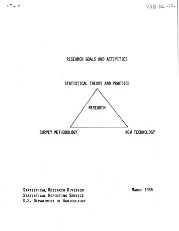
RESEARCH GOALS AND ACTIVITIESSTATISTICAL THEORY AND PRACTICESURVEY METHODOLOGYSTATISTICAL RESEARCH DIVISIONSTATISTICAL REPORTING SERVICEU.S. DEPARTMENT OF AGRICULTURENEW TECHNOLOGYMARCH 1986
tJ".JICONTENTSPAGEINTRODUCTIONOVERVIEW AN) MISSION OF REMOTE SENSING RESEARCH2OVERVIEW OF SAMPLING FRAMES AND SURVEY RESEARCHIIOVERVIEW OF OBJECTIVE YIELD RESEARCH24
-.'j1"','\ o·
"INTRODUCTIONThe Statistical Reporting Service's programs are organized in the following major areas:Crop and livestock estimates, statistical research and service, and work performed forothers. Research is conducted, to improve the Statistical methods and techniques used toproduce agricultural statistics.This research is done in support of the SRS long-rangeprogram for improving the accuracy of crop and livestock estimates at minimum cost andis directed toward better sampling, yield forecasting, and survey techn'iques.The purpose of this report is to provide an overview of the research presently underwayand research proposed for the future.An iSsue facing any research organization is to determine where to focus its researchefforts.The statistical research program in the Statistical Reporting ,Service has beensubjected to a very thorough review during the last year to determine where researchneeds to be directed and what areas need to be emphasized. The research program can bedescribed os involving three major activities (I)Research on statistical methodology This involves the development of newsampling and estimation procedures as well as a continual review of currentmethodology being used.Some examples of the type of research involvingstatistical methodology include the development of imputation procedures. toestimate for missing data and refusals. Continual work is underway to improve thecrop yield forecast models. The implementation of the Integrated Survey Programis raising many issues concerning optimum sample design for multi-purposemultiple frame surveys os well as improved multiple frame estimators.Recenttask force reports such os the Crop Reporting Board Standards report stronglyemphasize the need for more data analysis and the development of compositeestimators. Other research includes estimation using remotely sensed data.(2)Research on new technology - Technology research involves developing the use ofremote sensing technology and computer assisted telephone interviewingmethodology.Other research involves evaluating the use of supercomputers tohandle large data sets created by the remote sensing program. Other technologyinvolves development of procedur s to video digitize segments and the use ofstatistical graphics procedures. The evaluation and implementation of the newtechnology is guided by appropriate use of statistical theory and practice.(3)Research on im rovin surverocedures - It is becoming widely known thatmere y c anging the order 0 questions or the wording of a questio"ill change thelevel of an estimate.The evaluation of questionnaire design concepts is animportant research topic. Considerable research is underway to evaluate the useof historic data in an interviewing situation.Other research efforts focus onprocess quality control which involves the evaluation of all steps in a sample andsurvey process to ensure procedures were defined and correctly followed.The following sections outline the research program.goals and a 'Workplan for each research project.The research is outlined by definingComments, questions and suggestions about the research goals wi II.be appreciated.- I-
OVERVIEW AND MISSION OF REMOTE SENSING RESEARCHThe primary mission of the Remote Sensing Research program is to !) Explore alternativeuses of satellitedata for applicationto Agency programs; 2) Develop operationalprocedures for tho e applications; 3), Evaluate new methodolog , and; 4) Evaluate datafrom alternative satellites and sensors.SRS became involved in this area of research in 1972 when Landsat I was launched. TheSRS approach for using satellite data has been I) Remote sensing is simply anothermethod of data collection; 2) Remote sensing can supplement the existing SRS data.collection system but never completely replace it; 3) Data collection from satellites mustbe integrated with existing ground data surveys through rigorous statistical methodolog ,and; 4) Resource effective techniques must be developed for successful integration of thistechnology.SRS has mode good progress in this research area over the years. We have learned how touse satellite data for estimating acreage of major crops and made some progress in. specialty crop estimation.Howevei, these techniques are not yet cost effective.There isalso concern over the consistent level difference between remote sensing estimates andthe June Enumerative Survey. The amount of time required to make these estimates andthe people resources needed also must be reduced further.Satellite images are used asport of the operational area frame constructionprocess as a result of this research.Initial efforts to use satellite data for yield estimation were disappointing.HoweveJ,some'recent research in yield estimation with satellite data looks promising.FIELD LEVEL EDIT OF AREA FRAME DATAGoal:Develop edit procedures which allow data to be captured and edited at thefield level during the operational June Enumerative Survey. (JES)Background:Field level JES data are required as "ground truth" for input to remotesensing procedures.These data are presently obtained by capturing fieldlevel data records keyed for the JES and re-editing them for consistencyand one to one correspondence between the edited field level data and thefields on the photo. The field level edit is currently done after the JESwhich requires large expenditures of travel monies. A JES field level editwill save many resources.Other advantages to SRS include improvedquality control of JES crop data and automated selection of objective yieldsamples.Work Plan:Plans are being developed by Systems Branch to create a SAS edit forEnumerative Surveys.Remote Sensing Branch will work with SystemsBranch to ensure that the new edit will satisfy "ground truth" data .needsfor remote sensing applications. The new systems may be available for useon remote sensing project states in 1987 . Eldon Thiessen will be theRemote Sensing Branch coordinator.- 2 -
.' .·fREMOTE SENSING INDICA TIONSGoal:Provide Remote Sensing indications for major crops in Arkansas,Illinois, Indiana, Iowa, Kansas, Missouri and Oklahoma.Colorado,Background:Crop acreage estimation for major crops began as part of the AgRIST ARSprogram in 1980. ,Since 1980 the project has grown from two states toeight for the 1986 crop year.Work Plan:Estimates will be provided for Arkansas,Kansas, Missouri and Oklahoma.Colorad(), Illinois, Indiana, Iowa, ,Crop coverage will be as age ofU.S. Acreage 46Estimateswill be provided to meet Crop Reportingdates. Eldon Thiessen will coordinate these activities.Board year end dueCOUNTY ESTIMATESGoal:Provide County and crop reporting districtremote sensing techniques.Background:County and crop reporting district estimates of major crops were done inall states in the DClC project in 1985. This program will be continued for1986 with some software modification to improve processing.Work Plan:County and crop reporting district estimatesfor major cropsprovided to Arkansas, Colorado, Illinois, Indiana, Iowa, Kansas,and Oklahoma for the 1986 crop year. Indications will be providedformats; in hard copy printout, in a file that can be imported into2-3, and a file of card image records that can be input to thecounty estimation software. Eldon Thiessen will be the coordinatorRemote Sensing Branch county estimate work.- 3 -indicationsfor major crops fromwill beMissouriin threelotus 1agenciesfor the
DOCUMENTATIONGoal:Create user documentation and a training module outlining procedures formaking estimates from landsat and JES data.Background:The current procedures for using remote sensing techniques to produceacreage estimates are only partially documentated. A training module fornew statisticians is also needed. This documentation will make it easier totrain new people and make it possible to involve other people in SRS in theestimating process without experiencing mistakes that could undermine theprogram.All branch processing for small scale estimation work .is beingmoved to the Martin Marietta Data Systems center used by the agency forsmall scale estimation work for all data processing . Work Plan:User documentation will be created by Branch members as part of theconversion effort.Documentation should be completed by March 1987.Documentation of PEDITOR programs is being written as the programs areconverted to PASCAL. Eldon Thiessen will serve as project leader for userdocumentation and Richard Sigman will serve as project leader forPEDITOR program documentation.REFII\E SOFTWAREGoal:Make refinementsto PEDITOR softwaremodules and processingprocedures to streamline processing of landsat data for crop acreageestimation and increase the use of batch processing. (PEDITOR is a set ofsoftware that SRShas designed to process landsat data.)Background:The current PEDITOR programs hove been developed as stand alonemodules to process landsat and JES data for acreage estimates.Thesystem is highly flexible; however, the process requires considerableintervention of experienced personnel in order to complete the analysis.These refinements will make the system easier to use, provide greatersafeguards against mistakes, and reduce costs and analyst time.Thesoftware will be more suitable for use in an "operational" environment.Refinements will also be made to job streams and processing procedures topromote efficiency.Work Plan:EDITOR is a collection of computer programs used by SRS for processinglandsat data. PEDITOR is a derivative of EDITOR that can be transportedto several different computer systems. The development of PEDITOR hasinvolved rewriting various EDITOR programs in Pascal. This work is beingperformed by both SRS and NASA programmers and wi II be completed bythe fall of 1985. Some of the identified refinements are being incorporatedduring the rewriting process --especially in programs being written by SRS.The remaining refinements should be completed by mid- to late- 1986.Many of the other improvements to processing procedures will be addressedas we convert processing from BBN and NASAl Ames to the new computercenters in the fall of 1985 and the spring of 1986. Martin Ozga will be thetechnical coordinator of the project.-4 -
.c". fUSE OF MULTITEMPORAL SATELLITE DA TAGoal:Expand the use of multitemporaland wheat acreage.satellitedata to estimatecorn, soybeansBackground:tV\ost of the estimates that SRS has produced using satellite data have beenmade using a single date of imagery combined with JES ground truth data.F or the 1985 season multitemporal data was used to estimate winter wheatin Oklahoma and winter wheat and spring planted crops in Arkansas andMissouri.A fall 1984 scene was combined with a spring 1985 scene forOklahoma wheat estimates.A combination of spring and summer sceneswas used for estimates in Arkansas and Missouri.Workplan:The use of multitemporalcoverage will be expanded to more states asprocessing procedures are improved.This will provide additional cropcoverage without adding new States to the program.MAP PRODUCTS FROM REMOTE SENSINGGoal:Evaluatethe use of remote sensing for generationof map products,specialty crop estimation and the use of microcomputersfor processingsatellite dala.Background:SRS is currently involved in a coOperative project with the University ofCalifornia at Berkle;', NASA/Ames and the CaliforniaDepartmentofWater Resources (DWR) to develop procedures and software to estimatespecialty crops and provide map products for California.The projectdeveloped out of the needs of DWR to map crop acreages to estimatedemands for irrigation water and the SRS mission to provide small areaestimates for many of the same crops.Work Plan:An operationaltest will be conductedin 1985 using data from JESsegments and transect data collected by DWR from ground observations.These data will be combined with three dates of satelliteimagery toproduce state and county estimates for major and specialty crops and mapproducts for use by DWR and the California 550.Estimateswill becompleted by late December for use by the SSO and Crop Reporting Board.County estimates and map products will be completed in 1986. Most of thedata will be processed on a microcomputer;however, a supercomputerwillbe used for full frame processing.Results from this project will help evaluate the use of satellite data forthis application, the ability of a microcomputerto process satellite data,the feasibilityof distributiveprocessing 'and the feasibilityof acooperative effort to collect ground truth data. Richard Sigman will bethe technical coordinator.-5 -
t.REGRESSION ESTIMATORGoal:Find and eliminate the cause of consistent large downward bias of theremote sensing regressionestimator when compared to the directexpansion of the JES.Background:Since 1978, we have produced 40 estimates of corn, soybeans and winterwheat. In thirty-five cases, the regression estimate from remote sensinghas been below the JES direct expansion, while the regression estimate hasbeen above the JES only five times. Simulation studies conducted for SRSby Lockheed argue that the two estimators should be estimating the samelevel within a one percent relative difference.Several possibleexplanations are: I) Lockheed simulation results have under-estimated thebias; 2) Expansion errors; 3) Aggregation errors when. combining analysisdistrict estimates to a state total; 4) Classifier overfitting due to the useof ,JES data for both training the classifier and estimating regressionparameters; 5) Classifier overfitting due to "too much looking at the data"while developing the classifier . Work Plan:The Remote Sensing Branch will continue to investigate possible errors inexpansion or aggregation.However, these areas have been looked atbefore. A classifier training study will be conducted in Iowa and Missouriin the summer of 1985 to investigate the issue of non-independent trainingdata and overfittingthe classifier.A time-table for activities is asfollows:I. Collect ground data in Iowa and Missouri July-August 19852. Field level edit September 19853. Digitize segments September-October 19854. Data analysis November-April 19865. Report Completed August 1986Richard Sigman will be the technical coordinator.EVALUA TE SUPERCOMPUTERSGoal:Compare the CRA Y-XMP, CYBER-205 and the Massively ParallelProcessor supercomputers for maximum liklihood classification of Landsatdata.Background:The Massively Parallel Processor (MPP) is a supercomputer at the GoddardSpace Flight Center which consists of many processors operating in parallelas opposed to the pipel ine processors of the CRA Y and CYBER computers.The processing of large amounts of data in a timely and economical fashionwith minimal manual intervention is important if remote sensing is going tobe used by SRS.This project will allow us to evaluate threesupercomputers for this application .Work Plan:A research proposal has been sent to Goddard Space Flight Center to testthis application. If the proposal is accepted, work will be completed in oneyear. There wi II be no charge for use of the MPP. CRA Y and CYBERprocessing will be completed at NASA/Ames under existing agreements.Martin Ozga will be the technical coordinator for this project.-6 -
. .,REMOTE SENSINGFOR AREA FRAMEGoal:Explore the use of digital satellite data and a microcomputer based imageprOCessingsystem for area frame construction and updating.Background:A project to explore the use.of digital satellite data for area frameconstruction was conducted by the Fairfax Stratification Unit and GregBurns at NASA/NSTL. This project would be a follow on to refine workabletechniques and explore new applications. The use of digital satellite dataand an image processing system for area frame constructiol"! has thefollowing potential benefits: D Frame materials would be placed in ageographically referenced data base for easy use. A series of I: I OQ,OOOdigital maps are being developed by USGS for the 1990 census. ) Countunit identification and digitization could be combined into one process. 1)Stratificationmaterials could be referenced to the same scale andoverlayed to avoid manual transfer of of boundaries. ) Materials can bemodified to enhance features needed for stratification.5) Allow frameupdating rather than complete reconstruction. 6) A digital data base willimprove our ability to create crop specific stratification.7) Map productscan be created for quality control.8) All area frame processing can bedone on the same mathine which will reduce costs and time required forframe construction and maintenance.Workplan:Stratification research will be coordinated with the Fairfax Sampling Unit.Initial work will be done in New York to construct a frame to estimate--,acreage of orchards and vineyards. This project will provide a measure o'f'incompleteness in the New York Orchard and Vineyard Survey which will be ;:,conducted from a list sample in the fall of 1985 and the spring of 1986;'-The New York area frame is already digitized which will make the projecteasier. We also have a cooperative agreement with Cornell University todevelop procedures to use satellite data to identify orchards and vineyards.We will develop a classified image of orchards, overlay the current countunit boundaries, assign count units to a new strata and select a sample ofsegments.Segments will be enumerated to provide an estimate ofnonoverlap from the orchard list sample. A regression estimate of fruitand vineyard acreage will be developed. New York will pay for datacollection and area frame materials. Work will be completed in late 1986.Follow on research will be conducted to design procedures applicable forgeneral area frame construction and maintenance. These activities willbegin in FY 1986. Marty Holko will be the technical coordinator for thisproject.-7 -
I:.\PROVED VIDEO DIGITIZING PROCEDURESGoal:Background:Work Plan:Investigatethe use of a microcomputerand color video camera fordigitizing and labeling JES segment and field boundaries for remote sensingprojects.This procedure may also have some application for digitizingboundaries for area frame construction.Commercially available softwarefor tablet digitizing "!.ill also be investigated.The current video digitizing procedureswere designed using a minicomputer and a black and white T.V. camera. This equipment was "state ofart" several years ago but does not lend itself to decentralizationof videodigitizing. The microcomputer based system will also be cheaper than thecurrent system.The color camera may also make the labeling processeasier.The use of commercially available software for tablet digitizing. would have uses in Remote Sensing Branch and the Fairfax Sampling Unit.The use of this equipment and possible applicationsto area frameconstructionwill be explored in 1986.We hope to have proceduresdeveloped by the end of 1986. The project wi II require about 10,000 for amicrocomputeJ, color TV camera and other hardware. Richard Sigman willbe the technical coordinator.DATA FROM ALTERNA TIVE SATELLITESGoal:Evaluate data from the French SPOT satelliteBackground:SRS is involved in a bilateral remote sensing agreementSRS will provide our software for making regressionsatellite and ground truth data to the French in exchangeFrench SPOT satellite.Sites over Iowa and Kansas havethe study.Work PlanThe SPOT satellite was launched in February of 1986. We are hoping toacquire data in April or May 1986 over Kansas which will be compared toresults obtained from MSS data from the U.S. landsatsatelliteforestimating winter wheat.Data wiJl be acquired in July or August overIowa for use in estimating corn and soybean acreage. Data analysis shouldbe completedby mid 1987.Richard Sigman will be the technicalcoordinator for the project.- 8 -data for SRS needs.with the French.estimatesfromfor data from thebeen chosen for
CROP CONDITION ASSESSMENTGoal:Investigate the use of MSS and AVHRR satellitecrop condition ass ssment.Background:SRS signed a Memorandum of Understanding with the Foreign AgriculturalServics, Agricultural Stabilization & Conservation Service and AgriculturalResearch Service in mid 1985 to participate in joint research to explore theuse of satellite and weather data for crop condition assessment.Thesedata are currently available over part of the U.S. because of an ASCSprogram to monitor disasters and growing conditions by means of visualinspection of satellite scenes. F AS uses similar data to assess foreign cropproduction potential.We want to determine if quantifiable relationshipscan be developed from this information.Workplan:We have begun working with F AS to determine the type and frequency ofdata available, the amount of U.S. coverage available and the datamanipulation capability of the F AS image analysis system. We have alsoreviewed weather analysis procedures used by meteorologistsat the JointAgriculture Weather Facility.We plan to evaluate possible informationproducts such as maps of floods, freezes and winterkill damage that couldbe produced to improve the usefulness of the Weekly Weather C(op Report.Statisticalrelationships between SRS data series such as crop condition,yiel i, plant counts, etc. and vegetativeindexes, soil moisture {lr plantstress and evaporation i11 also be explored.Wendell Wilson will be thetechnical coordinator of this project.data and weatherdata forUSE OF THEMATIC MAPPERGoal:Investigateestimation.the use of ThematicBackground:A 1982 scene of T M data in Iowa was investigated for possible acreage andyield estimation in 1984. This project showed a strong correlation betweenfarmer reported soybeans yield and satellite data values. The TM data hasmuch smaller resolution and seven bands of reflectance readings which mayalso improve crop discrimination Work Plan:An analysis of 1985 TM scenes in Missouri and Iowa will be done.Thesewere chosen for the study because crop data will be available for additionalsample replicates for these TM scenes as a result of the 1985 classifierstudy. An Indiana TM scene may be used to examine yield relationships.This was chosen because of the additional soybean objective yield data thatwill be available from the 1985 validation project.Analysis of these datasets will be completed in the future as staff permits. Richard Sigman willbe the technical coordinator of the projects.-9 -Mapper satellitedata for acreage and yield
EVALUATION OF STANDARD SRS HARDWAREGoal:Explore the feasibility of using a Unix based system such as Inforex or anIBM PC for calibrating and digitizing JES segments and landsatsceneregistration .Background:Programs for digitizing and registration were developed for a North Starmicrocomputerand a POP 11/44 minicomputer.While this equipment isfunctioncil, it is becoming out of date and there are only a few SRSpersonnel that are familiar with this equipment. The use of "standard" SRShardware for remote sensing would provide the Remote Sensing Branchwith many SRS personnel that are familiar with the equipment; allowutiliation of remote sensing equipment for other SRS applications duringperiods when it was not needed for remote sensing; and provide up to dateequipment for remote sensing.Work Plan:Work on this project will begin in late 1986, after the conversion of smallscale processingto MMDS.Richard Sigman will be the technicalcoordinator.- 10-
I OVERVIEW OF SAMPLING FRAMES AND SURVEY RESEARCHThe immediate and long-term goals for Sampling Frame and Survey Research can becategorized into two general areas: (I) area frame construction, management, andresearch and (2) information collection research.Area frame construction involves the updating of current frames for SRS use in theAgency operational survey programs. Efficient updating and maintenance of these framesrequires several manual and automated processes.Improvements in all phases of areaframe construction and maintenance are continually being investigated.The efficient collection and handling of survey response information will be highlighted inour research efforts.Adjusting for missing information, evaluating respondent effectsand proper use of prior survey dQta will be investigated. Computer assisted telephoneinterviewing procedures are being phased into the operational program to standardizetelephone procedures and improve data quality .Statistical procedures for analyzing survey results via graphics and utilizingestimation by the Crop Reporting Board will be developed.compositeCOMPOSITE ESTIMATIONGoal:Develop a statistical procedure that can be used to combine surveyestimates (nonprobability and probability) to arrive at CI1 overall estimatewith some measure of precision.This procedure must be statisticallydefensible and repeatable. Another dimension of this study would take thenational estimate adopted by the Crop Reporting Board and statisticallyset the regional and state level estimates.Background:Procedures for evaluating estimates (nonprobability and probability) -arecurrently subjective. Staff members utilize survey indications and checkdata from varied sources at review time and subjectively establish a weightfor each survey estimate to determine the final estimate.Compositeestimation has been used by numerous statisticians and was anticipated byAgency statisticians (Houseman 197I). In a recent Agency publication(Crop Reporting Board Standards), the need for such a procedure wasvoiced.Lym Kuo, American Statistical Association Research Fellow,1985, has recently completed an initial investigation of a compositeestimation model used to combine four estimators.The compositeestimator is derived by minimizing a quadratic function subject to linearconstraints. The variance and mean squared error are evaluated by thejackknife method.Work Plan:Based on the composite estimation rnethodology (Kuo 1986), furtherresearch is necessary to expand the technique to generalized use. Thisincludes use for other commodities, other States, other preliminaryestimators and to second stage sampling applications. Numerical resultswill be expanded to commodities other then hogs. Development of analgorithm to calculate State level estimates from the official Nationallevel estimate is also a priority. Integrating the composite estimation intothe current crop reporting board activities will be another objective.Further research on variance evaluation is needed.Brian Carney will be the technical coordinator.- II -
SMALL AREA ESTIMATIONGoal:The Agency goal is to implement a defensible and repeatable procedure toestimate for small areas (counties) within a State. The short-term goal isto make this procedure operational in North Carolina and continue testingin at least one additional State.The long-term goal is to develop aprobabilistic procedyre for general use in the operational program inestimating county level data in all States.Background:For several years, the Agency has been establishing county level estimatesfor crops and livestock using subjective procedures.Techniques forconstructing county level estimates which are statisticallyvalid,defensible, and repeatable have been investigated in recent years. Thereare three background reports published by the Statistical ResearchDivision, "The Development of County Estimates in North Carolina" BarryFord, 1981; "Combining Historical and Current Data to Make District andCounty Estimates for North Carolina," Barry Ford, Doug Bond, and NancyCarter, 1983Y;and "An Evaluation of Categoricat Data AnalysisMethodology for County Estimates in North Carolina," Nancy Carter andDoug Bond, 1985. The latest report by Nancy Carter provides anevaluation of three Categorical Data Analysis (CDA) estimators to derivecounty-level harvested acreage estimates for several crops in NorthCarolina.These three estimators, Case I (full association structure),Case 2 (partial association structure), and Case 3 (iterative proportionalfitting), were each evaluated using 1978 North Carolina Census ofAgriculture data and the 1981, 1982 ,and 1983 A&P survey data.11Nancy Carter was a participant in the Research Institute Fellowshipbetween SRS and the American Statistical Association.(I)Continue evaluation of Categorical Data Analysis (CDA) Methodologyfor acres harvested variables with 1985 North Carolina county levelestimates.Evaluate the CDA generated estimates against 1982 Census data inNorth Carolina.Consider other synthetic estimators CI'ldother sources of informationfor benchmark comparison.Begin evaluation of methodology in a second State (California) andalso use 1982 Census data for benchmarking.Establish procedures to handle Pouble cropping.Consider methods to handle data disclosure issues and to streamlineobtaining of data from Census.Work pand the evaluation to include production data and Iivestock datavariables.Expand the evaluation time period to include 1982-1985 A&P surveydata and 1978 and 1982 Census data. (California will use 1982 Census)Evaluate remote sensing information in Cafifornia.Begin evaluation in a third probability Acreage and Production SurveyState.Consider alternative CDA methods.Plan to expand concept into the operational program.Doug, Kleweno will coordinate the Agency effort.Work will continueunder a Cooperative Agreement with Cal ifornia State University-Chico .Nancy Carter represents the Cooperator.- 12 -
.COMPUTER ASSISTED DATA COLLECTIONGoal:Implement a plan of collectingdata using technology
statistical graphics procedures. The evaluation and implementation of the new technology is guided by appropriate useof statistical theory and practice. (3) Research on im rovin surve rocedures - It is becoming widely known that mere y c anging the order 0 questions or the w