Transcription
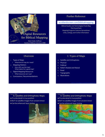
Outline MapsOutline Map of AsiaOutline Map of AntarcticaOutline Map of the Eastern HemisphereOutline Map of the Former Soviet UnionOutline Map of the MediterraneanOutline Map of Middle AmericaOutline Map of North AmericaOutline Map of South AmericaOutline Map of Southeast AsiaOutline Map of U.S.-Mexican BorderOutline Map of the Western HemisphereOutline Map of AfricaOutline Map of AustraliaOutline Map of EuropeOutline Map of Latin AmericaOutline Map of MexicoOutline Map of the Middle EastOutline Map of the Pacific RimOutline Map of South Central AsiaOutline Map of the United StatesOutline Map of the World1
Asia180 60 NianDegrid160 20 e seM 140 Eaest of Prim40 120 60 80 100 re60 NePrim0 ianMerid N4020 00400400800800N1200 Miles0 1200 KilometersProjection: Azimuthal Lambert Equal Area60 EEquator80 E100 E120 ENote: Dotted lines indicate indefinite boundaries.Courtesy:Arizona Geographic AllianceDepartment of Geography, Arizona State UniversityTerry Dorschied
Antarctica160 E140 EInternationalInternational Dateline180 160 W140 W70 S120 W120 E80 S100 W100 E80 E80 W60 WPrimePrime Meridian60 E40 E40 W20 W20 E0 Projection:Projection:Stereographic
Eastern Hemisphere60 eimPrNorthPole(90 N)75 rMeaidi0 n45 90 EE135 E75 60 45 45 30 Equator30 15 Degrees Nor th of15 Equator0 oSouthf Equator0 15 eMPr i mreesDe g15 diaer i30 n30 30 15 esgreDe45 0 tMWof esP.15 45 60 75 rime Meridiant of PEas90 105 120 45 135 150 .60 75 75 SouthPole(90 S)00100020003000 Miles1000 2000 3000 KilometersProjection: Airy Azimuthal
The Former Soviet Unioni a n 40 of Prime Merid180 100 70 NN80 st60 N 0 Ea6016esreD e g 40 20 180 80 N70 N60 N0 120180 1243BEL1234AR E20KRAIDOOLUMRUSSIALITHUANIALATVIAESTONIANE160 NRUSSIAENKAZARBAIJAN40 EGIOR IZETUKHSTUA50GEARMEA N40ENTAANISISTKMEKRZBNKYRG0YZST2000TAJIKSTAN800 Miles800 KilometersProjection: Lambert Equal-Area120 E100 ECourtesy:Arizona Geographic AllianceDepartment of Geography, Arizona State UniversityBarbara Trapido-Lurie E80 E60014060 E400400
Mediterranean Sea Region10 W5 W0 5 E10 E15 E20 E25 E30 E35 E40 E45 E45 N45 N40 NPrimeMeridian40 N35 N30 N0020020040040035 N600 Miles30 N600 KilometersProjection: Albers Conic5 W0 5 E10 E15 E20 ENote: Dotted lines indicate indefinite boundaries.25 E30 E35 E
Middle America115 W110 W105 W100 W95 W90 W85 W80 W75 W65 W70 W60 W30 N25 N20 N15 N10 N005 N200300400600 Miles600 KilometersProjection: Albers ConicStandard Parallels 30 N, 5 N110 W105 W100 W95 W90 W85 W80 W75 W70 W65 W
75 NNorth America E165N60 N7515 W0 18 N4530 WW5 16 N60 W45 N150 W4530 N N30 W6015 N N105 W120 W05005001000 Miles1000 KilometersProjection: Chamberlin Trimetric75 W090 W135 W15
South America10 N10 N0 0 10 S10 S20 S20 S30 S30 S40 S40 SS50 50 S100 W90 W80 W70 W60 W50 W0040 W40040030 W800 Miles800 KilometersProjection: Lambert Equal - Area20 W
Southeast Asia025 N0200300400600 Miles25 N600 KilometersProjection: Polyconic20 N20 N15 N15 N10 N10 N5 N5 NEquator0 0 5 S5 S10 S10 S95 E100 E105 E110 E115 E120 E125 E130 E135 E140 E
U.S. Mexico Border States120 W115 W110 W105 W100 W95 WCALIFORN35 NIA35 NARIZONANEW MEXICOBAJIARNFOALIACTEXAS30 N30 NSONORANORTCHIHUAHUAECOAHUILA100200300 MilesULI200MA0100300 KilometersTA0Projection: Albers ConicStandard Parallels 34 N, 26 N120 W25 NPA SNUEVOLEON25 N115 W110 W105 W100 WCourtesy:95 WArizona Geographic AllianceDepartment of Geography, Arizona State UniversityBarbara Trapido-Lurie
Western HemisphereNorthPole(90 N)75 180 135 45 90 WW75 60 60 45 30 InternEquatationoral Dateline30 45 Degrees Nor th of15 15 Equator0 Southof Equator0 15 reesDeg15 30 30 165 45 150 135 120 105 180 60 f Prime 45 Merid 30 Eof astP.60 .M75 Westo45 nia165 90 Degrees60 75 75 SouthPole(90 S)00100020003000 Miles1000 2000 3000 KilometersProjection: Airy Azimuthal
Africa0 15 W15 E30 E45 E30 N30 N15 N15 NEquator0 0 Prime Meridian15 S15 S0200 400 6004000800 Miles800 KilometersProjection: Miller StereographicAzimuthal30 S30 S15 W0 15 E30 E45 ENote: Dotted lines indicate indefinite boundaries.Courtesy: Arizona Geographic AllianceDepartment of Geography, Arizona State UniversityTerry Dorschied
Australia & New Zealand150 E140 E130 E10 S170 E160 E120 E10 S20 S20 S30 S30 S0200400600 Miles40 S40 S0300600 KilometersProjection: Albers ConicStandard Parallels 16 S, 44 S110 E120 E130 E140 E150 E160 E170 E180
Europe20 W0 20 E40 EPririmme Meridian80 N60 N60 N50 N50 N40 N40 N00200200400600 Miles400Projection:0 20 E
Latin America30 N20 N10 NEquator0 10 S20 S30 S0040 S600600120012001800 Miles1800 KilometersProjection: Azimuthal Stereographic130 W120 W110 W100 W90 W80 W70 W60 W50 W40 W30 W20 W
Mexico with its States115 W110 W105 W100 W95 W90 W85 WBAJAC30 NAL30 �NLOTA M AAZACATECAS12345SAN LUISPOTOSÍE345PUEBLACHMICHOACÁNO20 NLGORAALIMHIDAVECOYUCATÁN2CPEJALISCOGUTOJUAIC20 NAANMÉXTRIYANA1AGUASCALIENTESQUERÉTARODISTRITO ISUR25 NASNIA25 NZTABASCOCAGUERRERO015 N0100200200300OAXACA400 MilesCHIAPAS15 N400 KilometersProjection: Albers Conic115 W110 W105 W100 W95 WSource: Columbia Gazetteer of the World,editor Saul B. Cohen, 199890 W
Southwest Asia / North Africa30 W15 W0 15 E30 E45 E60 E75 E45 N30 N30 N15 NEquator0PrimeMeridian0 15 N0300300600600900 Miles900 KilometersProjection: Albers Conic0 15 E30 ENote: Dotted lines indicate indefinite boundaries.45 E60 E0
Pacific Rim60 N60 N40 NInternational Dateline40 N20 N20 NEquator0 0 20 S20 S40 S40 S00100200200300 Miles300 KilometersProjection: Robinson60 S100 E120 E140 E160 E180 160 W140 W120 W100 W60 S80 W60 W
South Central Asia60 E65 E70 E75 E80 E85 E90 E95 E35 N35 N30 N30 N25 N25 N20 N20 N15 N15 N10 N10 N5 N5 N65 E70 E75 E80 E85 ENote: Dotted lines indicate indefinite boundaries.90 E95 E
The United States130 W125 W120 W115 W110 W105 W100 W95 W90 W85 W80 W75 W70 W45 N45 N40 N40 N35 N35 N30 N30 N155 W20 N065 N100 Mi00 100 Km02000400 Mi100200300 Miles25 N300 KilometersProjection: Lambert Conformal ConicStandard Parallels 33 N, 45 N0 200 400 Km105 W160 W100 W95 W90 W85 W80 W75 W140 WCourtesy: Arizona Geographic AllianceDepartment of Geography, Arizona State UniversityBarbara Trapido-Lurie
WorldDegrees West of Prime Meridian180 160 140 120 100 80 60 40 20 Degrees East of Prime Meridian0 80 60 Degrees No r thof Equator40 20 EquatorEquatorth of0 egreDeousS20 Prime Meridian40 60 80 20 40 60 80 100 120 140 160 180
1 Outline Maps Outline Map of Asia Outline Map of Antarctica Outline Map of the Eastern Hemisphere Outline Map of