Transcription
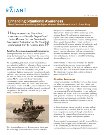
C A S ES T U D YEnhancing Situational AwarenessNaval Demonstration Using the Rajant Wireless Mesh BreadCrumb - Case Study“Improvements to SituationalAwareness are Directly Proportionalto the Mission Success Probability.Leveraging Technology is the Smartestand Fastest Way to Achieve This. .”CAPE FEAR SITUATIONAL AWARENESS DEMONSTRATIONAs the port security boat made its routine patrolsalong the blackwater Cape Fear river, the sound of itsengine was suddenly disrupted by a loud alarm sound.An unidentified, potentially hostile water craft hadbeen identified within five kilometers. In an instant, anArmy security boat on patrol was alerted. Preciseinformation about the unidentified craft, GPScoordinates, digitized maps, water speed, type of craft,and other important data was immediately shared withthe port and Army boats, and the Mission OperationCenter (MOC) located on shore with mobilecommunications and security personnel on foot.Hundreds of miles away, the Fleet Area Control andSurveillance Facility (FACSFAC) received the real-timedetailed information via a satellite link and coordinateda response to the invading craft with the port andArmy security boats.being used in hundreds of mission criticaldeployments. At the core of this technology is theportable Rajant ‘BreadCrumb’, a wireless devicecapable of securely transporting critical sensor andradar information in real time. Located on the port andArmy security boats, military vehicle on shore, amoored inflatable aerostat balloon, the harbor pier andwearable by security personnel, the BreadCrumb isable to transmit and receive large amounts of video,sensor, voice or other data, while each maintainingmultiple connections through a meshing architecture.This resiliency and mobility is critical for enhancingsituational awareness.Improvements to situational awareness are directlyproportional to the mission success probability.Leveraging technology is the smartest and fastest way toachieve this. This case study will outline the details ofthis situational awareness demonstration done inpartnership with Solipsys.Situation AwarenessMilitary commanders need to know where their troopsare, where their enemies are, and other various vitalinformation about the battle area. Situation Awareness(SA) involves being aware of what is happening aroundyou to understand how information, events, and yourown actions will impact both your immediate and longterm goals and objectives. In many situations, there aretechnological and situational complexities that thedecision-maker needs to filter in order to make aninformed decision.In these situations, having complete, accurate and upto-the-minute SA is essential. For this reason, SA hasbeen recognized as a critical, though often elusive,foundation for successful decision-making across abroad range of complex and dynamic systems.This situational awareness demonstration showcasedthe technology that is available today and currentlyA commander's headquarters is typically responsible forensuring that the appropriate information is presentedto the commander, so that he can make the bestcommand decisions. An important SA information tool
C A S ES T U D YRajant - Enhancing Situational Awarenessis the Common Operational Picture (COP), a singleidentical display of relevant operational information (e.g.position of own troops and enemy troops, position andstatus of important infrastructure such as bridges, roads,etc.) shared by more than one command.Exercise PurposeThe Rajant BreadCrumb wireless mesh devices wereutilized to extend the reach, coverage and functionality ofthe Raytheon Expeditionary C3 Solution. In addition,the BreadCrumbs were used to create a resilient wirelessmesh network among security boats, Mission OperationsCenters (MOC), mobile vehicle and convoy operations,multiple sensors and security personnel. The exercisealso successfully conducted an ad hoc field integration ofEC3 and Rajant BreadCrumb capability to several Navyaerostat assets demonstrating their utility to provideextended Situational Awareness via a flexible WANcapability.Location of ExerciseMilitary Ocean Terminal Sunny Point (MOTSU), CapeFear River, North Carolina. The Sunny Point facility,opened in 1955, is operated by the 597th TransportationTerminal Group. The facility is on a 16,000-acre, Armyowned site near the Cape Fear River with 212,000 squarefeet of building space.BackgroundNAVY EXPEDITIONARY COMBAT COMMANDNavy Expeditionary Combat Command (NECC) wasestablished in January 2006 as one of the Navy’s leadcommanders. NECC centrally manages the current andfuture readiness, resources, manning, training andequipping of approximately 40,000 expeditionary sailorswho are currently serving in every theater of operation.NECC is a global force provider of expeditionarycapabilities to joint war fighting commanders.Expeditionary sailors are deployed around the globe insupport of the new “Cooperative Strategy for 21stCentury Seapower,” a joint maritime strategy signed bythe Chief of Naval Operations, Commandant of theMarine Corps and Commandant of the Coast Guard thatapplies maritime power to the responsibility ofprotecting the U.S. in an increasingly interconnected andmulti-polar world.NECC forces and capabilities are integral to executingthe new maritime strategy which is based on expandedcore capabilities of maritime power: forward presence,deterrence, sea control, power projection, maritimesecurity and humanitarian assistance and disaster relief.To enable these, NECC provides a full spectrum ofoperations, including effective waterborne and ashoreanti-terrorism force protection; theater securitycooperation and engagement; and humanitarianassistance and disaster relief.MARITIME EXPEDITIONARY SECURITY FORCEThe Maritime Expeditionary Security Force (MESF) is acapability consisting of Adaptive Force Packages (AFPs)tailored to the specific requirements of the deployment.MESF fills current warfighting gaps by providing highlytrained scalable and sustainable Expeditionary SecurityForces capable of defending mission critical assets in thenear-coast environment. MESF units provide GroundDefense, Afloat Defense, Airfield/Aircraft Security anda wide range of secondary tasks from DetentionOperations to Law Enforcement.Anti-Terrorism and Force Protection missions includeharbor and homeland defense, coastal surveillance, andspecial missions. Specialized units work together withMESF squadron staffs providing intelligence andcommunications. MESF units deploy worldwide todetect, deter, and defend an area, unit, or High Value2
C A S ES T U D YRajant - Enhancing Situational AwarenessAsset. Recent locations include the United States,Korea, Saudi Arabia, Kuwait, Bahrain, United ArabEmirates, and Egypt.well as instantly reconfigure when existing connectionsbreak or change due to a moving boat, aerostat, vehicleor other asset.BreadCrumb ME2SOLIPSYSSolipsys, a wholly-owned subsidiary of the RaytheonCompany, is an industry leader in the development ofintegrated Command and Control (C2) NetworkCentric solutions for the Domestic and InternationalDoD and Homeland Security. Solipsys delivers the C2infrastructure necessary to effectively control security/military forces in any environment. The providedsolutions assure information superiority, increasedshared awareness, deep sensor reach, aircraft control,air defense, disaster management, and time-criticaldecision making. Some of the Solipsys customersinclude the United States Air Force, United StatesNavy, United States Marine Corps, United States Army,Missile Defense Agency, Royal Australian Air Force,Iceland Defense Force and the Italian Navy.Solipsys has received industry-wide recognition in thediverse areas of sensor automation, informationsynthesis, networking and communications, andvisualization. They have introduced a suite of softwareapplications that solve the vexing problem of creatingan extensible network solution for sharing sensorinformation among distributed Joint and Coalitionforces.RAJANTFor nearly 7 years, Rajant has been creating rugged andportable wireless access points for the military and firstresponders. Rajant’s devices, called BreadCrumbs,create wireless mesh networks forming a highly-resilientmulti-hop network. They can be operated by a batteryand can support IEEE 802.11 a/b/g protocols.In addition to single switch operation, the BreadCrumbcan use stringent security including Harris SecNet 11,SecNet 54 levels (external) and AES-CCMP & TKIP.The Rajant BreadCrumb wireless mesh device is anintelligent layer–2 device that can quickly adjust to achanging network environment making it ideal forSituational Awareness applications. Because of thebuilt-in computer and InstaMesh software, eachBreadCrumb can quickly configure itself at startup as FIPS 140-2 in Process IEEE 802.11b/g Radio 11Mbps & 54 Mbps Bandwidth 100Mbps Ethernet Port & Portable (2 lbs.)BreadCrumb LX IEEE 802.11a/b/g Radio 11Mbps & 54 Mbps Bandwidth 100Mbps Ethernet Port 700MHz, 900MHz, 2.4GHz, 4.9GHz & 5.8GHzBecause it operates at layer-2, it is not burdened withoverhead routing. Other mesh technologies that useroot node or LAN Controller architectures addunnecessary routing, latency and overhead. Thesedevices are inadequate for mission-critical applications.Raytheon Surface Search RadarThe Raytheon Surface Search Radar (SSR) is anadvanced navigation and surveillance system that canbe configured for ship or land-based applications. Itsradar, processors and displays combine commercial,off-the-shelf products and specialized technologies tocreate powerful navigational awareness. Integrated datafrom its own ship sensors provides SSR operators witha comprehensive view of the maritime environment.The SSR system meets or exceeds InternationalMaritime Organization requirements and RadarTechnical Commission for Maritime Servicesrequirements for an automatic radar plotting aid.Designed for both small and large ship applications, theSSR’s shipboard configurations have been tested inoperational use by the U.S. Coast Guard. Theseconfigurations are being installed to replace the current3
C A S ES T U D YRajant - Enhancing Situational Awarenessnavigational radars on U.S. Navy and Coast Guard shipsand patrol craft.Commercial customers, as well as U.S. and foreigngovernment organizations, use land-based SSRconfigurations for Vessel Traffic Service applications. Forincreased safety and efficiency, the U.S. Coast Guard usesSSR to monitor commercial shipping in U.S. ports andwaterways. SSR is also a key sensor for CoastalSurveillance System applications, such as monitoringterritorial coastlines and Economic Exclusion Zones insupport of law enforcement operations. Data/Activity monitored at Fleet Area Control andSurveillance Facility (FACSFAC) through SatComlinkRajant BC Commander wireless mesh managementsoftware for configuration, control and monitoringThe Rajant BreadCrumbs provide extension of the SSRnetwork across the Port Security Boat and the ArmyHost Security Boat and are integrated to a thirdBreadCrumb located on the pier. The network is thenextended to the Mission Operation Center, which is amobile Comms on the Move (COTM) unit. With thisunit, a man-wearable BreadCrumb provides the securityEquipment and Setuppersonnel a high bandwidth mobile ‘pipe’ back to the 34 ft. IBU (Inshore Boat Unit) Surface Craft –MOC for transmission of video, sensor, voice or othersimulated unidentified-hostile craft Port Security Boat with sensors, laptop and dual-radio data.Rajant BreadCrumb LXFrom the MOC, the data is sent to an Intelsat satellite for Army Host Security Boat with sensors, laptop andlinkage to the Tactical Operations Center (TOC) and todual-radio Rajant BreadCrumb LXthe Fleet Area Control and Surveillance Facility Mission Operations Center (MOC)(FACSFAC). The TOC is also configured with security Aerostat moored balloon with portable lightweightpersonnel that have man-wearable BreadCrumbs.battery-operated Rajant BreadCrumb ME2Information from all of the sensors is displayed via the Comms on the Move (COTM) with man-wearableGraphical Data Fusion System (GDFS). The GDFS is aBreadCrumb ME2s for security personnel andsoftware program which correlates all sensor informationportable SatComand overlays it onto a digitized map. On a display, Intelsat Satelliteoperators can see the geographic picture, their own Tactical Operations Center (TOC) with portablelocation, the location of the sensors, and target tracks.SATCOM hub with wireless perimeter and manwearable BreadCrumb ME2s for security personnel4
C A S ES T U D YRajant - Enhancing Situational AwarenessSummaryThrough the use of the Rajant BreadCrumb wirelessmesh, the Surface Search Radar network wassuccessfully extended over the water to the port securityand Army host security boats. The secure wireless linksthat provided network connectivity to the patrol boatswere consistently maintained while the boats conductedextensive patrols of the harbor and shipping lane areasout to a range of 5 nautical miles.The Rajant BreadCrumbs were installed and operationalon the watercraft in less than 10 minutes andimmediately joined the pier-side network, where theunits maintained connection throughout the course ofthe entire exercise.The sensor and boat GPS data was successfully andseamlessly transmitted back to the MOC, TOC andFACSFAC for incorporation into the overall SA picture,allowing the commanders to make real-time decisionswith up to date information.Throughout the demonstration, sensor and locationinformation provided both tracking and early warninginformation to the command headquarters. This aided inidentification of friend or foe watercraft, as well asprovided real-time communication capabilities to theforward deployed security assets. The Solipsys SAsystem, in conjunction with the mesh network mobilecapabilities of the Rajant’s BreadCrumb units, ensuredthis demonstration was a complete success. www.rajant.comRajant Corporation 400 East King Street Malvern, PA 19355 tel 484.595.0233 fax 484.595.0244 2008 Rajant Corporation. All rights reserved. Specifications subject to change without notice. BreadCrumb and InstaMesh are trademarks of Rajant Corporation.01/26/20095
situational awareness. Improvements to situational awareness are directly proportional to the mission success probability. Leveraging technology is the smartest and fastest way to achieve this. This case study will outline the details of this situational awareness demonstration done in partne