Transcription
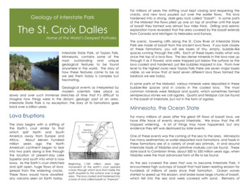
Geology of Interstate ParkThe St. Croix DallesHome of the World’s Deepest PotholesInterstate State Park, at Taylors Falls,Minnesota, contains some of themostoutstandinganduniquegeological features to be foundanywhere in the world. The story ofhow these features came to be aswe see them today is complex butfascinating.Geological events as interpreted bymodern scientists take place soslowly and over such immense stretches of time that it’s difficult toimagine how things were in the distant, geologic past of an area.Interstate State Park is no exception: the story of its formations goesback over a billion years.Lava EruptionsThe story begins with a shifting ofthe Earth’s crust similar to thatwhich split North and SouthAmerica away from Europe andAfrica.About eleven hundredmillion years ago the NorthAmerican continent began to tearinto two parts along a line throughthe location of present-day LakeSuperior and south into what is nowIowa. As the Earth’s crust stretchedand split open, huge flows of lavaspread from the widening cracks.These flows would have dwarfedany volcano seen on Earth today.For millions of years the shifting crust kept closing and reopening thecracks, and new lava poured out over the earlier flows. This lavahardened into a strong, dark-grey rock called “basalt”. In some partsof the Midwest the flows piled up one on top of another until the layerof basalt they formed was almost four miles thick. Drilling and seismicexploration have revealed that the area covered by the basalt extendsfrom Canada and Michigan to Nebraska and Kansas.The scenic, towering cliffs along the St. Croix River at Interstate StatePark are made of basalt from the ancient lava flows. If you look closelyat these formations, you will see layers of tiny, empty, bubble-likespaces running through the cliffs. Each of these layers marks what wasonce the top of a lava flow. The less dense minerals in the lava rose upthrough it as it flowed, and were trapped just below the surface as thelava cooled and hardened, just like bubbles trapped in ice. From riverlevel to the highest rocks near Taylors Falls there are seven major layersvisible, so we know that at least seven different lava flows formed thebedrock we see today.In some parts of the Midwest, various minerals were deposited in thesebubble-like spaces and in cracks in the cooled lava. The mostcommon minerals were feldspar and quartz, which sometimes formedsemiprecious stones we call agates. Quartz and feldspar can be foundin the basalt at Interstate, but not in the form of agates.Minnesota, the Ocean StateFor many millions of years after the great rift flows of basalt lava, wehave little trace of events around Interstate. We know that the riftstopped widening. A lot of things may have happened, but anyevidence they left was destroyed by later events.One of these events was the coming of the sea to the area. Minnesotahas many sedimentary or water-deposited rock formations, and fossils inthese formations are of a variety of small sea animals. In and aroundInterstate fossils of trilobites and primitive mollusks can be found. Thesedate back to Cambrian times, about 500 to 550 million years ago, whentrilobites were the most advanced form of life to be found.Beginning 1,100 million years ago,movement of the earth’s crust openedcracks through which lava from inside theearth erupted to the surface over a largearea. The lava cooled and hardened intoa layer of rock called basalt or “traprock”.As the sea covered the area that was to become Interstate Park, itencountered high outcrops of basalt that had been resisting erosion forhundreds of millions of years since their formation. Ocean wavesstarted to speed up this erosion, and broke loose large chunks of basalt,which fell into the sea and were covered with sand. Remains of
trilobites and other sea animalswere also covered by this sand,and were the cause of the fossilswe find today. A formation madefrom large pieces of rock heldtogether by fine particles is called“conglomerate”.Theconglomerate that was formedhere by the wave-rounded chunksof Precambrian basalt embeddedin a beach of Cambrian sand isMinnesota has been an ocean state morethan once. 500 to 550 million years ago,this area was gradually covered by anadvancing sea. The sandy beaches leftbehind when the sea retreated have nowbecome sandstone.one of the rarest kinds in the world.There is an outcrop of thisconglomerate near the old MillStreet road in Interstate Park, sothe formation has been named“Mill Street Conglomerate”.The sea also deposited sand and fine silt in areas farther away from thebasalt cliffs, and eventually was deep enough to cover the cliffsthemselves and deposit sand over them as well. The fine silt depositedby the Cambrian sea was compressed and hardened over time into atype of rock called shale, which may be found in a few spots alongCurtain Falls trail in the park, and near river level upstream of thehighway bridge at Taylors Falls. The sand which the sea brought anddeposited layer after layer also hardened and became sandstone. Thesandstone formations in and around the park are named “FranconiaSandstone” after the town of Franconia on the St. Croix Riverdownstream of the park. Fossils can be found in both the shale and thesandstone, but remember thatit is against the law to damagerock formations in the park orto remove any specimensfound in the park withoutspecial permission.Among the cliffs along theSandstone Bluffs Trail is thewaterfall that gave the trail itsold name, Curtain Falls Trail.The falls are dry most of theyear, running only after arainstorm or in the spring whenthe snow melts. But the ledgethe falls drops off of looks like itAs the sea covered this area, its stormwaves broke against the outcrops ofbasalt, breaking chunks loose.Thesechunks fell to the sea bottom and wereembedded in sand along with theskeletons of trilobites and other seaanimals of that period.was once the location of a much bigger falls at one time. Curtain Fallsformed recently, only ten or eleven thousand years ago, and a lothappened between the retreat of the sea and the beginning ofCurtain Falls.Minnesota’s Four Seasons:Winter, Winter, Winter, & WinterTheseasretreatedfromMinnesota, but returned againmany times before leaving forgood. But they never reachedas far as Interstate Park afterCambrian times.There is noclear evidence in the park ofevents after the sea’s retreat untilrelatively recent times, about 100thousand years ago.The last glacial ice to cover this area wasthe Grantsburg Sublobe, which blockedThis was the time of the lastthe drainage of the meltwater from theadvance of the great ice sheetsnorth and forced the St. Croix to run eastfrom the north. Minnesota hadof its present course at Taylors Falls.been covered with ice severaltimes before, but the most recentadvance (called the Wisconsin Ice Age because it left so many tracesin that state) was the one that affected Interstate Park the most andgave the scenery here its final touches.Imagine a time of cold, when summers were not warm enough to meltall of the snow that fell the winter before. After years of this, the snowpiled up deep enough to crush the snow at the bottom of the pile intoice, and then piled up more. Even ice will flow if enough pressure is puton it, and when it is forced to flow, it is hard to stop. Great, mile-thickflows of ice, glaciers, moved slowly over Minnesota from the north,eventually covering most of the state.A glacier is a very powerful cause of erosion. It can wear away hills,freeze into boulders and drag them for hundreds of miles (slowly butsurely), and gouge out broad valleys in which to flow more easily. Amoving glacier changes the landscape it moves over, but we can’t seevery much evidence of this at Interstate. What we see mostly is the St.Croix River and its valley, which formed as the glaciers were meltingaway for the last time.
After the meltback of the Grantsburg Sublobe,the St. Croix flowed in its present course pastTaylors Falls. Its size was tremendously increasedby the meltwater draining from Glacial LakeDuluth via the course of today’s Brule River. Thishuge flow cut the gorge we see today.The St. Croix didn’t alwaysfollow the course we see itin today. There is evidencethat it once flowed througha valley farther west, wherethe Sunrise River is now. Butglaciers disturb the normalpaths of flowing water.When a glacier melts away,all of the rocks and othersediment frozen into it getdumped as the ice melts.Plains and ridges of sandandgravelcalled“moraines” are the result.The earlier course of the St. Croix was clogged by moraines as theglacial ice retreated, and the river had to find a new course. It flowedaway from its older channel and for many years it ran east of TaylorsFalls, forming a valley that is still visible today near Dresser, Wisconsin. Atthat time, Taylors Falls was still covered by the ice of the GrantsburgSublobe of the glacier, but when the ice melted, the river was able torun where the ice had been, where it runs today. But it didn’t look at alllike it does today, because there were no cliffs and no deep gorge.The St. Croix was in a wide, shallow valley at first.Taylors Falls – the WaterfallThen came the final chapter of the story of Interstate Park’s geology. Ithappened very recently in terms of geological time- only ten thousandyears ago.If you imagine the amount of water that you’d get from melting a milethick sheet of ice the size of the State of Minnesota, and then imagineall of that water running down one river, you’ll have an idea of whatmade the St. Croix Valley and its features look as they do today. As theice melted, the Glacial St. Croix River became much larger than theriver we see now. But this alone doesn’t account for the mile-widevalley that today’s river runs in.Glacial Lake Duluth, the ancestor of present-day Lake Superior, wasalso filling up with meltwater from the glaciers. The lake’s eastern endwas still blocked by an arm of the glacier, so the water had nowhere togo. It rose until it was four or five hundred feet higher than the level oftoday’s Lake Superior. It became deep enough to overflow the hillsaround it to the south, at the point where the Brule River of Wisconsinnow enters the lake.Once the lake began to overflow, the rushing water cut the gap evenwider and deeper, so that the water could run out faster. This hugeflood joined the Glacial St. Croix and poured south through what is nowInterstate Park, gouging out a valley wide and deep enough to let itflow smoothly. This flood continued for tens, possibly hundreds of years,before the ice melted away from the eastern exit of Glacial LakeDuluth and allowed water to flow towards the Atlantic Ocean insteadof to the south.If you stand in the campground at Interstate today, you’ll be standingnear the bottom of the Glacial St. Croix River. If you stand at theoverlooks along the highway or the River Trail, you’ll be standing at apoint that was covered by the river when it was at its largest. If youstand at the overlook on the Sandstone Bluffs Trail, you’ll be able to lookout over the mile-wide valley that the Glacial St. Croix once flowed in.The most dramatic reminders of the size and force of the Glacial St.Croix are found at the north entrance to the Interstate Park, near thehighway bridge. Here you can see the high cliffs of the narrow rivergorge called “The Dalles of the St. Croix”. These cliffs were carved fromsolid basalt by the river as it cut its channel ten thousand years ago. Atfirst the river flowed over the top of the basalt formations, but farthersouth it cut deep into the much more easily eroded sandstone, and afalls or rapids formed. This waterfall, though it was never seen by anyhuman that we know of, wasthe original ancestor of TaylorsFalls. Curtain Falls, fed by icemelting to the west, alsoformed at this time when itscreek reached the muchdeeper valley of the GlacialSt. Croix and fell to meet theriver.Water going over the edge ofa falls wears away the edgerapidly, and the turbulentwater pounding away at thefoot of the falls also wearsrock away and underminesthe falls.As a result, aAt its maximum, the Glacial St. Croix Rivercovered all of the area occupied by thetown of Taylors Falls, Highway 8, andInterstate’s potholes.
waterfall will gradually cut its way upstream. The waterfall on theGlacial St. Croix moved upstream rapidly because of the tremendoussupply of water power coming from Glacial Lake Duluth, and becausethe basalt along the course of today’s St. Croix River had beenweakened by an early period of earth movement and faulting. Theerosion of the basalt by the falls of the Glacial St. Croix created theDalles and its scenic cliffs. There is little left to see of the falls now thatthe river has succeeded in cutting its way through the basalt. All thatremained when the first white settlers came was an impressive rapids,which was named (along with the town) Taylors Falls, after Jesse Taylor,who built a sawmill on the Minnesota side of the rapids. The lower partof this rapids is at the foot of the highway bridge over the river, and theupper part is hidden by a hydroelectric dam built in the early 1900’s.World’s Deepest PotholesThe Glacial St.Croix left morethan a wide valleyand high cliffs toimpress visitors. Italso drilled holesinthebasalt,some of them sodeepthatit’shard to see howwater alone couldform them.Thetruth is that wateralone couldn’t dothe job. But, lookat a fast-movingstream, and see ifwater is the onlythingmoving.Fast,powerfulstreams carry a lotof sediment withthem, and the Glacial St. Croix was faster and bigger than any river inNorth America today. It carried huge amounts of silt and sand, andyou can see how the rocks it once ran over were smoothed by this“liquid sandpaper”.Eddies in the rapids swirl silt against rock, cutting a shallowdepression. As the hole enlarges, more silt is trapped andcutting increases. Larger stones are trapped and wornsmooth while a spiral current may cut a corkscrew patterninside the pothole. When the potholes are close together, anincrease in size may wear away the wall between them,forming a single, oval-shaped pothole. As the glacial riverretreated it often filled these holes in with sand, soil, and silt.If you take another look at a fastmoving stream where it tumbles downa rapids over a rocky bottom, you’llprobably find spots where the waterforms a swirl or eddy that spins andstays in one place. You may even finda small pothole on the bottom of thestream below the eddy. If there isenough water power and enoughsand and silt in the water, an eddy likethis will gradually carve a shallow holein the rock of the river bottom. As thehole gets bigger, more water will swirlthrough it, and that will help the riverwear away the rock even faster. If astone too big for the current to movegets into the hole, the swirling silt will carve away at it, and graduallymake it smooth and round enough to roll around on the bottom of thepothole. Such “grindstones” are frequently found in potholes. If theriver becomes slower or smaller, the wearing process will stop, and thepothole and its grinders will eventually be left high and dry.Remember the Glacial St. Croix and its rapids? If you look around thearea between Interstate’s Interpretive Center and the old steamboatlanding at the edge of the river, you’ll find a lot of potholes that werecarved out when the river was deep and strong from the glacialmeltwater.They could not have been formed except for thecombination of the very hard basalt rock of the lava flows, thetremendous force of the water draining from Glacial Lake Duluth, andthe softer sandstone downstream being worn away rapidly so that awaterfall could form.Interstate Park contains more potholes in a smaller area than any otherlocation in the world, and has the world’s deepest known potholes aswell. The deepest one that has been measured accurately, the“Bottomless Pit”, is just under sixty feet deep and twelve to fifteen feetwide. Another pothole nearby is suspected of being even deeper, overeighty feet. The widest pothole in the park is “The Cauldron” near theboat landing: it is over twenty feet wide. It has never been checked fordepth, because it is nearly full of sand, rocks and boulders. Smallerpotholes range in size from a few inches across to five or more feet.If you look hard and try to count every pothole in the park, you shouldbe able to find more than a hundred of them, all in an area of less thantwenty acres. More may yet remain to be discovered under the
sediment of the small marsh beside the road to the landing. Many ofthe low gullies that run through the area were formed when a string ofpotholes had the walls between them worn away by the force of theriver. These then became new channels for the river’s main flow, andfrequently caused more potholes to form downstream of them. Ourbiggest potholes are in an area where several such channels cometogether, right on the edge of the marsh. Who knows? Maybe the truebiggest pothole in the world is yet to be discovered. Interstate Parkcontains many wonders, but its potholes are the most special of all.Text:Illustrations:Minnesota Department of Natural ResourcesDivision of Parks and TrailsInterpretive Services2009Photographs:ProjectCoordinator:Dave CrawfordJoe NiznikKeith LeamanTony RixKacie CarlsonRon Miles
For millions of years the shifting crust kept closing and reopening the cracks, and new lava poured out over the earlier flows. This lava hardened into a strong, dark-grey rock called “basalt”. In some parts of the Midwest the flows piled up one on top of another until the layer of basalt