Transcription
GTS-220 SERIESELECTRONICTOTAL STATION2002
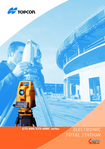
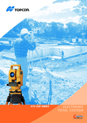
The All Weather standard for Total StationsFeaturesSuperior Basic Function for measuring distance & angleThe GTS-220 Series is provided with a distance measuring range of 3,000mto a single prism (GTS-229: 2,000m), while maintaining high accuracy (2mm 2ppmxD) m.s.e.(GTS-229: (3mm 3ppmxD) m.s.e.).As for distance measuring time, data updates at a high rate speed of1.2 seconds in the fine measurement mode. (0.7 seconds in the coarse mode,and 0.4 seconds in the tracking mode).This shorter distance measurement time will allow you to increase yourefficiency and productivity in the field.Increased Internal Memory for Data StorageThe GTS-220 Series has the internal memory to store up to 8,000 points for datacollection, or up to 16,000 points for layout work.The Topcon GTS-220 Series is the innovativesuccessor to the best selling GTS-210 SeriesTotal Stations. The GTS-210 Series with“Waterproof” design brought revolution tothe surveying industry with features anddurability. Now the new GTS-220 Series hasup-graded its basic functions for distanceand angle measurement in addition tomaintaining superb durability against theenvironment.The GTS-220 Series is also provided witha longer life battery for 10 hoursoperation, and various applicationprograms making surveying work quickand simple in the field. The featuresincluded with the “All Weather” highlyproductive GTS-220 Series TotalStations are setting a new standard forsurveying!!Dual-Axis CompensatorDual-axis compensation is available for GTS-223/ 225/226 model.This dual-axis tilt sensor automatically corrects the vertical and horizontalangle compensation for mis-leveling error, ensuring accurate and reliableangle readings.Compact and Light WeightThe GTS-220 Series is compact and weighsonly 4.9 kg (instrument body with on-boardbattery and handle grip). Due to this smallsize and weight you can easily transport toand around the job site. In addition thenew style carrying case gives addedconvenience.Easy to useThe clearly layed out keyboard anddisplay ensure easy operation. Themenu driven software is easy to learnand use with a complete range ofsurveying and setting out routines. TheGTS-223 and 226 have 2 side displays,the GTS-226 and the GTS-229 have thedisplay and keyboard on one side.Waterproof IPX6!!The GTS-220 Series can stand up to anywet weather condition that can occurin the field, giving the great benefit ofnot experiencing down time due tobad weather. The waterproofness (IPX6)of the GTS-220 Series assures durableperformance in the field under all conditionsas an “All Weather” Total Station.The degree of protection against waterfor Topcon’s GTS-220 Series is basedon the standard IEC529, defined as“Water projected in powerful jets”against enclosure from any directionshall have no harmful effects. (IPX6)
Long Life Battery: 10 hours!Topcon’s new BT-52QA Ni-MH on-board battery allows 10 hours of continuousmeasurement in the angle/distance mode, and can last 45 hours on the job forangle measurement only. This long life battery will eliminate the need formultiple batteries on the job. One (1) BT-52QA will be sufficient for most fullday surveying work.OptionsPoint Guide System (Factory Option)Topcon’s field proven Point Guide function is a factory option for theGTS-220 series. Get on line quickly and easily with this feature. Two (2)LED lights, one flashing and one constant, help identify the correctalignment for setting out.Laser Plummet (Factory Option)The GTS-220 Series is provided with a conventional plummet as astandard, while a laser plummet located in the alidade is available asan option. With this Laser Plummet, you can set up the instrument fastand easy and have a clearly visible laser spot on the ground.SoftwareFull functionallity surveying and stake out software is included on-boardthe instrument. All models in the series have the same powerful yet easyto use software routines. For example:ResectionInstrument coordinates can be calculated by measuring known points(Maximum 7 points) stored in the internal memory. Scale factor canbe used in the calculation and standard deviation of measurement canbe calculated.Side shotSet the instrument on a known point. After collecting the side shotangle and distance, the side shot point coordinate is calculated andstored in the coordinate data file.
Menu structureMENU1/3F1 : DATA COLLECTF2 : LAYOUTF3 : MEMORY MGR. NTOCCUPIEDPOINTREMOTE ELEVATIONMEASUREMENTONMINIMUMREADINGBACK SIGHTBACK SIGHTMISSING LINEMEASUREMENTOFFAUTO POWER OFFFS/SSLAYOUTZ COORDINATE OFOCCUPIED POINTLEVELTILTSELECT A FILESELECT A FILEAREACALCULATIONERROR CORRECTIONP CODE INPUTNEW POINTSIDE SHOTRESECTIONPOINT TO LINEMEASUREMENTBATTERY TYPECONFIGGRID FACTORApplication measurementZ coordinate of occupied point (benchmark elevation)Remote elevation measurement (REM)KVDThis feature measures theheight where a prism cannot be placed directly.Measurement can beextended along theplumb line as the heightis continuously displayed.VDVDMissing line measurement (MLM)Multiple lines can be drawn between;1. the first point and the last point.2. the last 2 points.Horizontal distance, difference in height and slope distanceare calculated. Coordinate file data and manual input dataare available to be used.HDKnownPointKnown Point(Z coordinate Unknown)KnownPointBSDVDHDCAArea calculationArea can be calculatedusing measured data orfile data Point-to-line measurementZP (n, e, z)znPrism P2Prism P1Plane offset measurementeR. HTLineBA (0, 0, 0)Coordinates can be calculatedfor points where direct measurements to a prism can not beP2P3taken, for example measurementsto points on a wall or plane.Three random points (P1, P2, P3)on the plane will be measuredfirst to determine the measured plane and their angles anddistances temporarily stored. Then sight the unknown pointon the plane and the instrument calculates and displayscoordinates and distance values of desired point.P1P0Z coordinate and directionangle of the instrumentcan be calculated andreset by measuringZ coordinate of knownpoints (Max. 10 points)HDSDVDKnownPointKnownPointEINS. HTCInstrument PointNCreate a new coordinateby measuring to twopoints.The 1st point becomesthe origin and the 2ndpoint becomes theN axis direction.
SPECIFICATIONSMODEL mmObjective Lensdiameter 45mm (EDM:50mm)Magnification(x)30xImageErectField of View1 30’Resolving Power2.5”Minimum focusing distance1.3mDISTANCE MEASUREMENTCondition 11 Prism3,000m2,000m3 Prisms4,000m2,700m9 Prisms5,000m3,400mCondition 21 Prism3,500m2,300m3 Prisms4,700m3,100m9 Prisms5,800m4,000mCondition 1: Slight haze with visibility about 20km (12.5 miles) moderate sunlight with light heat shimmerCondition 2: No haze with visibility about 40km (25 miles), overcast with no heat shimmer.Accuracy (2mm 2ppmXD*) m.s.e. (3mm 3ppmxD*)m.s.e.Least count in measurementsFine mode1mm/0.2mmCoarse mode10mm/1mmTracking mode10mmMeasurement display11digits: max.display 9999999.9999Measuring timeFine mode1mm: 1.2sec.(Initial 4 sec.)0.2mm: 2.8sec.(Initial 5 sec.)Coarse mode0.7sec.(Initial 3 sec.)Tracking mode0.4sec.(Initial 3 sec.)(The initial time will be different by a conditionand setting EDM off time.)Atmospheric correction range-999.9 to 999.9ppm (By 0.1ppm)Prism constant correction range-99.9 to 99.9mm (By 0.1mm)ANGLE MEASUREMENTMethodAbsolute readingDetecting systemH:2 sides V:1 sideH:1 side V:1 sideMinimum gon)Accuracy n)Measuring timeLess than 0.3sec.Diamter of circle71mmTILT CORRECTION (AUTOMATIC INDEX)Tilt SensorDual AxisSingle AxisMethodLiquid typeCompensating range 3’Correction unit1”(0.1mgon)LEVEL SENSITIVITYCircular level10’/2mmPlate level30”/2mm40”/2mmOPTICAL PLUMMET TELESCOPEMagnification3xFocusing Range0.5m to infinityImageErectField of view5 DURABILITYWater protectionIPX6(with BT-52QA)Ambient temperature range-20 C to 50 COTHERSDimensions343(H)x184(W)x150(D)mmInstrument height176mmWeightInstrument (with battery)4.9kgPlastic carrying case3.2kgBATTERY BT-52QA (Ni-MH)Output voltage7.2VCapacity2.7AHMaximum operating time at 20 C10 hours (12,000 points)including distance measurementAngle measurement only45 hoursWeight0.3kgBATTERY CHARGER BC-27CRInput voltageAC230VFrequency50/60HzRecharging time (at 20 C)1.8hoursOperating temperature 10 C to 40 CWeight0.5kg* D: measuring distance(mm)** Standard deviation base on DIN18723.Designs and specifications here in are subject to change without notice.
Standard set compositionGTS-220 seriesBattery BT-52QABattery charger BC-27CR (230V)Tool kit with casePlastic carrying caseSilicon clothPlastic rain coverPlumb bob setLens capSun shadeInstruction .Optional accessoriesTROUGH COMPASS-6DIAGONAL EYEPIECE-10SOLAR FILTER-6SOLAR RETICULE-6DK-7More than 70 years of experienceFor 70 years, Topcon has been a leading manufacturer in industrial,medical and positioning enhancement tools. This broad experiencehas created a basis for Topcon’s wide product line for basically everypositioning need, whether it’s for construction or surveyingapplications.For the construction industry, Topcon offers a complete range ofinnovative laser and sonic solutions, including industry leadingproducts for interior, utility, general construction and machine controlapplications.For surveying applications, Topcon manufacturers and supplies acomplete range of optical measuring products, from digital and opticallevels to theodolites and robotic total stations, and a full line of GPS satellite positioning solutions.Product & Service supportTo assure that your Topcon product maintains peak performance, yourlocal Topcon dealer offers factory trained certified service technicians.And just in case service assistance isn’t available in your area, ourEurope wide network of Topcon offices, offer repair and return servicepolicies second to none.Innovation, not imitationDuring the last decades, Topcon has brought many innovativesolutions to the industry, that offer the contractor significant productivityincrease and greater ease of use. That’s the key to leadership, and thereason Topcon is the world’s leading supplier of laser and surveyinginstruments. Some examples of unique Topcon technologies: Waterproof auto level The integrated total station, “The Guppy” The compact coaxial total station (GTS-1) World’s First laser with beam scanning technology The first waterproof total station GreenBeam visible construction lasers Automatic excavator control system World’s First 3-D machine control (3D-MC LPS) 5” Grade laser with automatic alignment & remote control Horizontal self leveling laser with liquid compensator First robotic total station with instant beam lock system(GTS-800A and RC-2) First satellite-directed automatic 3D machine control system(3D-MC GPS)Your Topcon PartnerTOPCON EUROPE B.V.Essebaan 112908 LJ Capelle a/d IJsselThe NetherlandsPhone: 31-(0)10 - 458 50 77Fax:31-(0)10 - 458 50 45E-mail: survey@topcon.nlhttp: //www.topconeurope.comItem number: 5310751Language: EnglishPrinted: 11-2002Certificatie No. 03682548TOPCON EUROPE B.V.Capelle a/d IJssel, The Netherlands
reason Topcon is the world’s leading supplier of laser and surveying instruments. Some examples of unique Topcon technologies: Waterproof auto level The integrated total station, “The Guppy” The compact coaxial total station (GTS-1) World’s First laser with beam scanning technol