Transcription
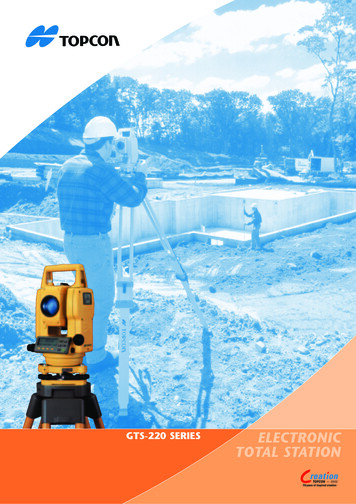
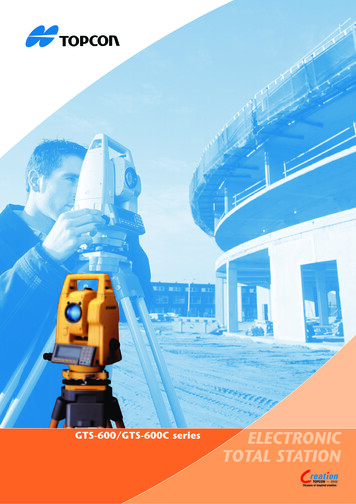
GTS-600/GTS-600C seriesELECTRONICTOTAL STATION2002
All weather, High Performance total stationsIf there was ever a total station built for toughsite performance and to meet the demands ofhigh production survey work, the TopconGTS-600 series is it. Packed with performanceenhancing software routines, high capacitymemory, the best in optical technology andadvanced electronics, the GTS-600 seriesdelivers today’s busy surveyor theperformance he demands in a total station.Outstanding featuresWater proof protectionThe degree of protection against penetration by water is classified asIP65 (GTS-600C; IP54) against international standard IEC529. This ensuresthat when used under wet site conditions rainwater will not penetratethe instrument body. This high degree of water protection allows thecontinuation of surveying work during heavy rain and ensures aninstrument that can be relied upon day after day, with no down time dueto the need for workshop repairs.Measurement specificationsThe GTS-600 Series consists of 4 models, GTS-601, 602, 603 and 605 with1” (0.3mgon), 2” (0.6mgon), 3” (1.0mgon) and 5” (1.5mgon) accuracyrespectively. All models have dual axis compensation. The high accuracymodels GTS-601 and GTS-602 have a minimum reading of 0.5” (0.1mgon)whilst GTS-603 and GTS-605 have a minimum reading of 1” (0.2mgon).The distance measuring range to a single prism is 3,000 m for all models,except GTS-605, which has a distance range of 2,000m. The very fastdistance measurement time of 4 seconds for the initial measurement andan update rate of 1.3 seconds, in fine mode, ensure an effortless workprocess and increases efficiency and productivity.The compact, robustconstruction with IPX-5water protection ensuresthat GTS-600 is built fortough site conditions anda demanding workingregime.Add to this the uniqueAuto-Focus feature ofthe GTS-600AF models,the optional point guideand/or the laser plummet, and the surveyor hasunprecedented convenience and ease of use.Absolute encoderThe absolute encoder system in the GTS-600 seriesensures angle measurement stability and maintenanceof the horizontal zero position, even when there isloss of power. When powering up the instrumentyou are immediately ready to measure, as there isno need to rotate the telescope to initialise thehorizontal and vertical circles.Long life batteryThe compact internal clip-on Nickel MetalHydride battery has enough power for over6 hours measurement and can be recharged,using battery charger BC-27CR, in only 1 hour.High capacity internal memoryThe memory area is divided into a program areaand a data area. The program area is 2MBcapacity and the data area has a capacity of320KB, sufficient for coordinates of approximately 5,000 points.Graphic Display/Numeric KeyboardAll measurements and calculations areclearly visible on the large graphic displayand operation is made easy by the use of thefull numeric keyboard with software driven functionkeys and alpha character input.
Advanced optionsCompact Flash Card System (GTS-600C)For users that require more flexibility in handling theirdata, the GTS-600C Series offers the possibility toexpand on the instruments internal data memory of320 KB RAM. By using the internal card reader, industrystandard Compact Flash cards can be easily inserted in the total station to storeor upload data from and to the internal memory of the instrument. This offersflexibility in data handling and ease of transfering data from site to office.Data cards of upto 32MB can be used, increasing the internal memory capacityof 5,000 points.Auto focus (GTS-600AF series)Topcon is the first to introduce this time saving, convenience technologyto a high performance total station. The Auto Focus can focus in a matterof seconds at the point sighted through the telescope. Just direct thetelescope to the prism or target position using the sighting scope, pressthe “AF” key and the focus will be set automatically. This dramaticallyincreases convenience and speed with which points can be located andviewed through the telescope. Manual focussing is performed by rotationof the focussing dial positioned conveniently next to the telescopeeyepiece.Point guideAvailable as factory option is the Point Guide. This feature makes stakeout work easier and faster. Two lights emitted from the instrument,guide the rod person to the correct stake out direction.Laser plummetAlso available as an option is the laser plummet, to replace the standardoptical plummet, which is built into the instrument body. The laserplummet is a red laser beam, which produces a clearly visible red spoton the vertical axis of the instrument. This clearly marks the position forquick and easycentering of theinstrument overa point.
Measurement softwareStandard measurement routines are performed with the basicapplication software of the GTS-600 series. This easy to usesoftware covers all the measurement routines for surveyingand includes extensive routines for stake out work.LayoutThe ‘Layout” program permits direct coordinate input for singlepoint stake out or the option for layout job creation and filemanagement for datainput from a coordinatefile. This program is easyto use for quick stake outjobs. More advancedstake out options areavailable in SSS600.N(X)Layout Point (N0,E0,Z0)ZH-AHDNaE(Y)CInstrument PointHorizontal ;;;;;;;;;;;;;;;;;;;;;;;;HDSDVDMissing LinemeasurementProgram to calculatethe distance and heightdifference betweenremote ;;;;;;;;;;;;;;;;;;;;;;HDSDAVDHDBRemote elevationmeasurementEasy to use routine formeasurement of theheight of mLBLHVDHDAoffGPT-6000/6000CLine programProgram to calculate theheight of inaccessiblepoints above a definedbase line.Survey software (SSS600)The GTS-600 series has a pre-installed field software package,Standard Survey Software (SSS600). This package includesextensive routines for all surveying and stake out proceduresand calculations. Easy to read and use menu structure. Overview of JOB status in main menu. Re-computation of co-ordinates after editingmeasured data (e.g. prism height, offset). Measured co-ordinates are displayed in themeasurement screen when recording. When setting out, points are displayed in graphics onthe display. The Point Code library has a layer table structure.Point codes can be uploaded to the internal memoryor created directly in the instrument. Multiple job files can be created. Easy to use field observation procedures for traverseand detail point measurement and offset points. Multiple backsight orientations with calculation ofresiduals. Resection program including calculation of residuals,the possibility to remove or add observations,calculation with scale factor, storage of measurements, continuous display of standard deviation ofresults. Cross section survey procedure. Point-to-line calculation. Point-to-line setting out routine. Control point coordinate library. Extensive editing facilities. DXF download. Printed output reports. Cut and fill reports can be generated for staked outpoints. Definition of road alignments and stake out. Traverse adjustment. Computation of occupied point elevation byobservation to a known point. Area calculation using previously stored points. Building plot setting out routine to definebatterboard intersection points. Computation and storage of Missing linemeasurements. Input of taped dimensions to fill in missing points.
SPECIFICATIONSGTS-601/601CTELESCOPELengthObjective lens diameterMagnificationField of viewResolving powerMinimum focusDISTANCE MEASUREMENT1 Prism(*)3 Prism(*)9 Prism(*)Measuring accuracyMeasuring time(initial measurement)Min. readingANGLE MEASUREMENTAccuracy (DIN18723)Min. readingTILT SENSORTypeMethodRangeDisplay unitCircular levelPlate levelOPTICAL PLUMMETMagnificationFocussing rangeField of viewOTHER FUNCTIONSOperating systemInternal data memoryOperating temperatureWater proofDimensionsWeight (incl. battery)DisplayKey boardPOWER SOURCEBattery BT-50QBattery charger mm30x1 30’2.5”1.3m3,000m4,000m5,000m (2mm 2ppm) m.s.e.Fine: 1mm 1.3sec (4sec) - Coarse: 0.7sec (3sec) - Tracking: 0.4sec2,000m2,700m3,400m(3sec)Fine: 1mm/0.2mm - Coarse: 1mm - Tracking: 10mm1” (0.3mgon)2” (0.6mgon)0.5”/1”(0.1/0.5mgon)3” (1.0mgon)5” (1.5mgon)1”/5”(0.2/1.0mgon)Dual axisLiquid type 3’1”10’/2mm30”/2mm3x0.5m 4 (Ø91mm/1.3m)MS-DOS ver. 3.22320 KB (up to 5,000 points)-20 C 50 CIPX 5178(L) x 230(W) x 343(H) mm5.8kg2 side graphic LCD display, size max. 40 chr. x 10 lines, with backlight,heater function, and contrast adjustment2 side 21 keys (6 function keys, 15 numeric keys) / 1 power keyOutput voltage: 7.2V Capacity: 2.7Ah (NI-MH)Operating time: 6 hours (distance and angle) - 9 hours (angle only)With discharge functionRecharging time: 1 hour(*) Slight haze visibility about 20 km.Designs and specifications herein are subject to change without notice.
Standard set compositionGTS-600(C) series1 pc.Battery BT-50Q1 pc.Battery charger BC-27CR1 pc.Tool kit with case1 setPlastic carrying case1 pc.Silicon cloth1 pc.Plastic rain cover1 pc.Plumb bob set1 pc.Lens cap1 pc.Instruction manual1 vol.Optional accessoriesTROUGH COMPASS-6Compass fordetermining magneticnorth. Used byattaching to thehandle. Shock proofconstruction.DIAGONALEYEPIECE-10For easy observationto the zenithposition.SOLAR FILTER-6A filter designedfor direct collimationof the sun.SOLAR RETICULE-6A reticule designedfor collimation ofthe sun. Can beused together withSolar Filter.BACK PACK-2Back pack with softcase and aluminumframe is compactand light, yet ishighly shockproofand rainproof.OPTICAL PLUMMETTRIBRACHThis is a detachabletribrach havingbuilt-in opticalplummet telescope.More than 70 yearsof experienceFor 70 years, Topcon has been a leading manufacturer inindustrial, medical and positioning enhancement tools.This broad experience has created a basis for Topcon’swide product line for basically every positioning need,whether it’s for construction or surveying applications.For the construction industry, Topcon offers a completerange of innovative laser and sonic solutions, includingindustry leading products for interior, utility, generalconstruction and machine control applications.For surveying applications, Topcon manufacturers andsupplies a complete range of optical measuring products,from digital and optical levels to theodolites and robotic totalstations, and a full line of GPS satellite positioning solutions.Your Topcon PartnerTOPCON EUROPE B.V.Essebaan 112908 LJ Capelle a/d IJsselThe NetherlandsPhone: 31-(0)10 - 458 50 77Fax:31-(0)10 - 458 50 45E-mail: survey@topcon.nlhttp: //www.topconeurope.comItem number: 5310731Printed: 08-2002Certificatie No. 03682548TOPCON EUROPE B.V.Capelle a/d IJssel, The Netherlands
All weather, High Performance total stations If there was ever a total station built for tough site performance and to meet the demands of high production survey work, the Topcon GTS-600 series is it. Packed with performance enhancing software routines, high capacity memory, the best in opt