Transcription
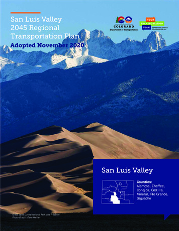
San Luis Valley2045 RegionalTransportation PlanAdopted November 2020San Luis ValleyCounties:Alamosa, Chaffee,Conejos, Costilla,Mineral, Rio Grande,SaguacheGreat Sand Dunes National Park and PreservePhoto Credit: Dave Hattan
The San Luis Valley TPR is a large Region that borders New Mexico onthe southern edge. The valley is surrounded by high mountain rangesincluding the Sangre de Cristos and San Juan Mountains and includesthe counties of Alamosa, Chaffee, Conejos, Costilla, Mineral, RioGrande, and Saguache. The TPR is primarily served by the US 160,US 285 US 50 and SH 17 corridors. The Region is home to two rivers,the Arkansas and Rio Grande, which run through the central valleyand its small agricultural and tourist-based towns. The Region’srecreational attractions such as the Great Sand Dunes National Park,the Rio Grande River, and the impressive mountain ranges continueto attract more and more visitors and new residents to the valley.Dear Neighbor,As Chair of the San Luis Valley TPR,representing Alamosa, Chaffee, Conejos,Costilla, Mineral, Rio Grande, and Saguachecounties, it is my responsibility to ensurethat our area’s transportation needs andpriorities are recognized, made easilyaccessible, and communicated to the publicand key transportation decision-makers.This RTP accomplishes these goals and more.It recognizes current needs and priorities,while formulating solutions to keep pacewith Regional growth and changingconditions.This document is the reflection of TPRmember input, various types of data andinformation, and public sentiment. AnRTP that reflects the overall priorities andneeds for our area is vital at a time of limitedfunding for transportation. This plan isintegrated into the Statewide TransportationPlan, demonstrating the important role thattransportation in the San Luis Valley Regionplays in the overall state transportationsystem. This plan will help inform decisionsCDOT makes about the state’s transportationsystem.PAGE 2This plan is intended to be a living,useful document that is referred to whentransportation decisions are being made andas the TPR implements projects and strategicactions documented herein. This RTP will berevisited periodically to ensure that we areon the right path toward accomplishing thevision and goals set forth by it.Your familiarity with our Region’stransportation needs and priorities and thechallenges that we face is important now andinto the future. I invite you to review thisplan and become more engaged in the SanLuis Valley’s transportation future.San Luis Valley TPR MembersComposed of elected and appointed officials, the TPR is responsible for establishing Regional priorities and needs,developing the multimodal RTP, and ongoing planning coordination with CDOT.Members include: AlamosaAlamosa CountyAntonitoBlancaBonanzaBuena VistaCenterChaffee CountyConejos CountyCostilla CountySTATE & FEDERALREQUIREMENTSThis Regional Transportation Plan (RTP) is the long-rangetransportation document that guides the continuing developmentof a multimodal transportation system for the San Luis ValleyTransportation Planning Region (TPR). The Plan recognizes currentneeds and identifies solutions to address changing conditions. ThePlan communicates the San Luis Valley TPR’s transportation needsand priorities to the Colorado Department of Transportation (CDOT)and Colorado’s Transportation Commission. This Plan reflects theTPR members’ input, data and background information, and publicsentiment. It extends out 25 years to 2045 but has a particularfocus on the first 10 years, allowing decision-makers to considertransportation investments in the San Luis Valley today, tomorrow,and in the future. CreedeCrestoneDel NorteHooperLa JaraManassaMineral CountyMoffatMonte VistaNathrop Poncha SpringsRio Grande CountyRomeoSaguacheSaguache CountySalidaSan LuisSan Luis Valley Council ofGovernmentsSouth ForkLegislation at both the state (§43-1-1103, C.R.S.) and federal (CFR 450.206) levels, as well as statetransportation planning rules (2 CCR 601-22), requires the development of a comprehensive, long-rangeStatewide Transportation Plan that encompasses at least a 20-year period and incorporates the prioritiesand needs of the TPRs across the state. The state and federal requirements have been followed in thecreation of this Plan.Every four to five years, CDOT updates the Colorado Statewide Transportation Plan (Your TransportationPlan), which serves as a long-range planning tool and identifies Regional and statewide trends and issues.RTPs are developed to inform the Statewide Transportation Plan and to prioritize transportation projectsin the Region.Plan Development ProcessThis 2045 RTP was developed over approximately one year and included three primary phases: identification oftransportation needs, development of projects, and plan creation. The TPR and public input, along with a data-drivenanalysis, was critical to plan development. The Coordinated Public Transit and Human Services Transportation Plan wasdeveloped concurrently and can be found in Appendix A.Sincerely,Michael YohnSan Luis Valley TPR ChairPAGE 3
San Luis Valley TPRRegional Transportation StorySafetyThe Regional Transportation Story provides a snapshot of current and anticipated future conditions in the Regionby 2045. The story summarizes the condition of the transportation infrastructure within the Region, how thetransportation system is used, and the people relying on the system. Combined, this information shows the uniquenessof the TPR and helps identify the greatest needs in the 0020,000Employment13,60612,392Population &Employment2015Nearly 16 percentpopulation growth andapproximately 19 percentemployment growth isexpected in the Regionthrough 2045.2045YearSource: CDOT Statewide Travel Demand Model, 2015 and 2045.Aging PopulationVehicle Travel & CongestionAging adults have unique travel needs;they often need public transportationservices as alternatives to drivingas well as roadway improvementssuch as better signing, striping, andlighting. San Luis Valley is expected toexperience continuing growth in the agingpopulation. Older adults are expectedto account for approximately 19% of thepopulation in 2045 and require specialconsiderations in transportation planning.While the total vehicle miles traveledare anticipated to increase by 43percent in the Region from 2015to 2045, the travel experienceis anticipated to remain at anacceptable level of service withminimal congestion compared toother highways around the State.The increase in travel on the Region’shighways will have an impact on theroad conditions; more traffic meansthe roads deteriorate more rapidly.3.01M2.11MVehicle Miles Traveled43%2015 2045Increase invehicle milestraveled (VMT)Source: CDOT Statewide TravelDemand Model, 2015 and 2045.Road Conditions Drivability life is the remaining “life” of the surface of the road andindicates how long a highway will have acceptable road surface anddriving conditions.Most of the highways in the San Luis Valley TPR have moderatedrivability life (4-10 years). These highways will require surfacetreatments in the coming years to avoid significant deterioration,especially in light of the increasing travel in the Region.Drivability life is lowest on SH 149 west of Creede, on SH 112 betweenUS 285 and SH 17, as well as some sections of SH 114 west of Saguache.Bridges in poor conditions are located: on SH 112 east of Del Norte, onUS 50 north of Sargents, on US 285 just north of Antonito, and on SH142 east of Manassa.PAGE 413%HighDrivabilityLife87miles60miles537milesTop 3 Crash Types1. 2. 3.ROADWAYDEPARTUREWILDLIFECONGESTIONRELATEDSource: CDOT Crash Database, 2014-2018.Colorado Freight Corridors10,0000CDOT’s Whole System Whole Safety initiative heightens safety awarenessby taking a systematic approach to safety. The goal of the program isto improve the safety of Colorado’s transportation network by reducingthe rate and severity of crashes and improve safety conditions for thosetraveling by all modes. Understanding crash patterns helps to identifyappropriate safety improvements. For example, wild animal collisionscan be mitigated with fencing along the roadway and/or a wildlifebridge/tunnel. Since 1998, CDOT Region 5 has used a data drivenapproach to safety analysis which is used to prioritize and select safetyprojects for the Statewide Transportation Improvement Program ifeSource: CDOT Asset Management Database, 2019.Colorado Freight Corridors are highway routes in Colorado that are critical for interRegional and interstate commercialvehicles to transport goods. These corridors have been identified as the most critical routes to facilitating themovement of goods into, out of, and within Colorado. Several Colorado Freight Corridors pass through the Region: SH17, US 24, US 50, US 160 and US 285.TransitThe San Luis Valley TPRhas limited transit serviceavailable. Currently, BustangOutrider provides interregionalconnectivity with two routespassing through the San LuisValley TPR. One route operatesfrom Gunnison to Denver (US 50)and one from Alamosa to Pueblo,which operates on SH 17, US 285,and US 50. Neighbor to NeighborVolunteers is the only local andRegional transit service providerin this Region; it offers a fixedroute bus service, the Eagle LineShuttle, and a demand responseservice, the Chaffee Shuttle.Human service transportationproviders in the Regioninclude Starpoint, Blue Peaksdevelopmental Services, Inc.,Conejos County Departmentof Social Services, NorthernersSeniors, Inc., Alamosa County,Costilla County Department ofSocial Services, Chaffee Shuttle(Neighbor to Neighbor), and RedWillow.Bicycling &WalkingScenicBywaysA High Demand Bicycle Corridor isa designation used by CDOT to planand prioritize bicycle investmentand maintenance around the state.High demand bicycle corridors inthe Region include US 50 and SH291 (west of Salida), US 285 (Southof Poncha Springs), and SH 160(Alamosa to Durango).Scenic byways are designated routesthat have unique features that donot exist elsewhere in the UnitedStates; these byways often promotetourism and economic developmentadjacent to the corridors.State highways serve as “MainStreet” through Antonito (US 285),La Jara (US 285), Saguache (US285), Manassa (SH 142), Creed (SH149), San Luis (SH 159), Del Norte(US 160), Montevista (US 160),Alamosa (US 160), Fort Garland(US 160), Blanca (US 160), BuenaVista (US 24), and Salida (SH 291).These highway sections requireadditional considerations and shouldbe designed so that people walking,parking, bicycling, accessing transit,and driving can all interact safely.People are more inclined to walk inplaces that feel safe and inviting.Los Caminos AntiguosPhoto Credit: Dave HensleyEconomicVitalityPrimary economic generators in theSan Luis Valley include agriculture,outdoor recreation, and tourism.Transportation allows agriculturalgoods to leave the TPR and supportsvisitor access to the TPR for tourismand recreation.AirportsThere is one commercial airport,located in Alamosa, The San LuisValley Regional Airport. Generalaviation airports in the areainclude: Buena Vista, Salida,Saguache, Center, Del Norte,Creede, Monte Vista and Blanca.Scenic byways in the Region includeLos Caminos Antiguos, CollegiatePeaks and Silver Thread.SalidaPhoto Credit: Nathan Bilow from Colorado.comPAGE 5
San Luis Valley TPR’sTransportation Focus AreasRegional TransitTransportation impacts the lives of residents, employees, and visitors of Colorado in various ways across the state. TheTPR members identified the following topics that highlight what is most relevant and unique to the San Luis Valley TPRwhen it comes to transportation.TourismPhoto Credit: Dave HattanOne of the main economic drivers for the Region is tourism. The Region’s diverseecosystems offer visitors a broad range of outdoor recreational activities suchas hiking, hunting, camping, and skiing in the San Juan and Sangre de Cristomountains where people can visit popular places such as as Wolf Creek or Monarchski areas via US 160 or US 50. The Region also offers a diverse historical landscapealong the Rio Grande and Arkansas Rivers, where visitors come to fish, raft, cycle,and enjoy touring the valley and learning about its cultural heritage.As the population of the San Luis Valley TPR continues to grow and age, morealternative modes of transportation are needed for people who do not haveaccess to a car, those who want an alternative to driving, and as a strategyfor congestion management. The Region is home to a significant population ofolder adults (65 ), and others with a greater need for transportation options.Local and Regional transit service is essential for people’s daily needs such asgroceries, medical care, jobs, and social services. Bustang Outrider providesInterRegional service that connects Alamosa and Salida with major activitycenters including Pueblo and Denver. Neighbor to Neighbor Volunteers/TheChaffee Shuttle is a local transit provider in the area. Providing reliabletransit service is one way to maintain the overall well-being and quality oflife for those who choose to live, work, and recreate in the valley.Outreach booth at SummerFest on the Rio,Alamosa (July 2019)Photo Credit: CDOTFederally-ManagedPublic LandsThe Region is home to the Great Sand Dunes NationalPark and Preserve, which has one of America’s mostdiverse landscapes. A few miles to the west from theGreat Sand Dunes sits the Monte Vista National Refuge,an important wetland ecosystem for the Region.Surrounding the valley, the San Juan and Sangre deCristo high mountain ranges hold a significant forestedlands, which are managed and protected by the Bureauof Land Management (BLM) and US National Forests.Browns Canyon National Monument is a populardestination located within the area under the FederallyManaged Public Lands. US 50, US 160, SH 17, and SH150 provide access to these federally-managed publiclands.The red and gold routes represent the state and localroutes that provide primary access to the FLTP and areeligible to receive funding through the FLAP. The SanLuis Valley TPR desires a more integrated approach toplanning and programming projects of mutual interestPAGE 6Freight and RailThe San Luis Valley TPR economy is rooted in agriculture, and as suchthere is significant number of routes used for moving valuable goodsthroughout the Region on a daily basis. From local farm-to-table to moreindustrialized farming, agriculture plays an essential role in the Region.The main corridors also serve Regional freight and connect local productionto the rest of the state and nation. The valley has five designated freightcorridors: SH 17, US 24, US 50, US 160 and US 285. The importance of thesecorridors relies not only on supporting local connectivity for accessing anddelivering fresh products and goods to markets, it supports critical north tosouth and east to west links of the network system, improving its resiliency.Freight rail lines serving the San Luis Valley TPR include San Luis Centraland San Luis Rio Grande Railroad. The Tennessee Pass Rail Line presents apotential opportunity for expanded rail activity.Road ConditionsWell maintained roads are essential to thequality of life for residents, employees, andvisitors to the San Luis Valley TPR. Whenroads are well maintained in the Region,drivers are safer, the wear and tear on cars,trucks, and heavy vehicles is minimized,goods and services can be provided in theRegion, recreational areas can be accessed,and transit services can reliably be provided.It is more cost effective to maintain aroadway than let it fall into disrepair andreconstruct it. As the foundation of ourtransportation system, the condition of ourroads determines the level of mobility fora range of modes, whether biking along thehighway for recreation, safely transportingagricultural goods to a destination, or usinga wheelchair to cross the highway in adowntown community.Enhanced access to nature has a beneficial impactboth to the long term quality of life enjoyed bycommunity members and the economic vitality ofthe businesses that support the strong and growingtourism and resource extraction sectors. The FederalLands Transportation Program (FLTP) and Federal LandsAccess Program (FLAP) were created by Congress todedicate funding towards improving and maintainingaccess to national parks, forests, wildlife refuges,national historic sites, and many other recreationand resource extraction site types. The map showsfederally-managed public lands in the Region and themileage of the FLTP color coded by the federal agencythat owns the routes.between federal, state, and local agencies in theRegion. Appendix C provides more detail and includesan initial list of project needs that are intended to bethe basis for collaboration during the next planningcycle under this 2045 RTP.Photo Credit: Flickr by Daniel(Scrubhiker - USCdyer)Photo Credit: ChaffeeShuttle.comEnvironmental MitigationThe rules governing the statewide planning processemphasize Colorado’s continually greater integration ofmultimodal, cost effective, and environmentally soundtransportation. These planning regulations require the plansto be coordinated with other state and federal agenciesresponsible for land use management, natural resources,environmental protection, conservation, and historicpreservation; include a discussion of impacts to minority andlow income communities; identify and discuss activities thatmay have the greatest potential to restore and maintain theenvironmental functions affected by the plan; and, identifyand discuss potential environmental mitigation measures.The state and federal requirements have been followed inthe creation of this plan.Photo Credit: Dave HattanPAGE 7
Vision:Vision & GoalsPhoto Credit: Felsburg Holt & UllevigThe San Luis Valley envisions a sustainable, safe, andefficient transportation system that supports the Region’sagricultural and tourism-based economies through capacityand safety improvements, and expanded local and Regionalpublic transportation options. The transportation system willaccommodate and enhance the Region’s quality of life, whilepreserving the cultural and the natural environment thatmake the TPR a great place to live, work, and visit.Goals: Provide for sustainable economic growthwith supportive and efficient transportationinfrastructure and programs.Improve transportation linkages and modalalternatives for commerce, tourism, andtransportation-dependent populations.Improve connections to other Colorado Regionsand surrounding states to benefit economicdevelopment, trading, and markets.Minimize impacts to the Region’s air, water,scenic view corridors, wildlife habitat, andcultural resources.Provide mobility to the traveling public at anacceptable level of service.Maintain the existing system in the mostefficient manner possible.Improve the safety of the transportation system.Provide a safe and efficient airport system thatmaximizes the existing investment and meetsinter- and intra-state travel and emergencyneeds, while supporting Colorado’s diverseeconomy. Identify, evaluate, and prioritize transportationdevelopment options that enhance traveland can be implemented through existing orreasonably anticipated funding.Improve and increase bicycle and pedestrianfacilities.Increase passenger and freight rail opportunities.Improve safety for bicyclists and pedestrians inbusiness centers.Increase transit connectivity through enhancedintercity and demand response services thatsupport the Region’s diverse populationEnsure the transit system contributes to theeconomic vitality of the Region by providingoptions and minimizing transportation costs forresidents, businesses, and visitorsSupport the needs of the Region’s diversepopulation by providing access to basic andcritical services such as medical, employment,educational, and recreational servicesSeek funding opportunities to maintain existingservices and expand the transit networkExpand mobility options to ensure access withinthe Region and to other Colorado Regions andNew MexicoWhat We’ve Heard:Photo Credit: Felsburg Holt & UllevigOver a five-month period, CDOT officials engaged local and Regionalstakeholders and community members in the San Luis Valley TPR — inperson, over the phone, and online. As a result, we heard from manyresidents throughout the TPR and learned about how they travel.Outreach in the Region included: Corridor Needs MapMeetings with Alamosa, Chaffee, Conejos, Costilla, Mineral, RioGrande, and Saguache CountiesA booth at SummerFest on the RioA pop-up booth at the Alamosa WalmartRegional planning meeting in AlamosaA Telephone Town HallOver 130 online survey responsePAGE 8Through a significant public engagement process, we’ve taken what we heard from county officials, key stakeholders,and the public in the San Luis Valley Region and compared it with key data findings (e.g., crash patterns, roadcondition, congestion points) to identify corridor transportation needs, as shown on the map. The corridor needs wereused to develop projects to address the greatest needs of each highway. A range of multimodal transportation optionswere considered to address the corridor needs.Online Map Comments by CategorySurvey respondents were asked to communicate personal transportation challenges on an interactive map. The piechart shows the breakdown of comments by key categories in the San Luis Valley TPR.10%13%PavementTravel Options:Bicycle & PedestrianSafetyTravel Options:Rail & TransitTrafficFreight12%Through this stakeholder and publicoutreach, the highest prioritytransportation trends and issuesin the San Luis Valley TPR wereidentified as: Road Condition and SafetyLack of Travel OptionsGrowth and Congestion30%16%19%Source: Your Transportation Plan MetroQuest Online Survey (2019)PAGE 9
San Luis ValleyTransportation ProjectsThe Region’s transportation project list ischaracterized by a mix of transit, bicycle,pedestrian, and intersection/interchangeimprovement projects. The list also includessafety-related projects that address shoulderdeficiencies, passing lanes, and other safetyimprovements like wildlife mitigation. The projectlist was developed by first aligning previouslyidentified projects with the known corridor needsand then adding new projects to address unmetneeds. The full project list includes the projectsbest suited to meet the transportation needs of theRegion between now and 2045.RegionalPrioritiesThe San Luis Valley TPR comprehensive project listincludes:105TOTALPROJECTS 520M TOTALCOST(APPROXIMATE)The Colorado Transportation Commission’s guiding principles of Safety, Mobility, Economic Vitality, Asset Management,Strategic Nature, and Regional Priorities are the basis for project selection in Colorado. The San Luis Valley TPRestablished Regional Priorities by ranking projects based on each project’s ability to meet the project criteria, asdefined specifically for the San Luis Valley TPR below.SafetyIMPROVESAFETYMOBILITYROAD CONDITIONSWALKINGTRANSITENHANCEBICYCLINGAddressing known safety problems is a top priority. These include the importance ofintersections, passing lanes, shoulders, and wildlife crashes. Considerations include data,level of service, speed limit, and driver perception.The full project list is included in Appendix B.Mobility1Refinedcorridorneeds usingTPR feedback2Aligned thepreviouslyidentifiedprojects in theRegion withthe corridorneeds3Identifiedadditionalprojectsto addressunmet needs4Compiled acomprehensivelist of candidateprojectsThe San Luis Valley TPR is interested in maximizing road capacity and access to traveloptions to ehnance mobility. This includes minimizing congestion, providing reliableinfrastructure, enhancing connections for the general public and for commercial trucktraffic, providing efficient technology, eliminating “gaps”, and improving multimodal optionsand facilities.Economic VitalityTransportation should support vibrant main streets and the movement of goods andservices in and through the Region. A holistic approach was emphasized to support freight,agriculture, access to recreation, tourism, and jobs.Asset ManagementThe Region will maximize the project opportunities to combine asset management (road andbridge conditions) projects with already planned projects for mobility, safety, and economicvitality. Integrating technology and maximizing planned projects will support asssetmanagement in the Region.Strategic NatureThe San Luis Valley TPR is interested in leveraging partnerships and prioritizing projectsthat support Regional and/or statewide objective. Other considerations include maximizingresources, innovative financing, and balancing short term and long-term needs.Statewide Plan outreach booth at SummerFest on the Rio, Alamosa (July 2019)Photo Credit: CDOTPAGE 10PAGE 11
San Luis Valley TPR Priority Project ListSan Luis Valley TPR’s Top 20Project PrioritiesThe top 20 projects for the San Luis Valley TPR are estimated to cost over 215 million, including 15 highway projectsand 5 transit projects. The top highway project involves intersection improvements where two of the Region’smajor highways meet in Poncha Springs, US 50 and US 285. The projects also address streetscaping, wayfinding, andmultimodal needs in Poncha Springs and Saguache. Intersection improvements are included for Buena Vista, Salida andAlamosa. Other projects include shoulder studies and improvements on several highways, as well as passing lanes onUS 60 Wolf Creek pass and on SH 149. The top transit project is a Transit Center in Alamosa. Transit projects include afixed-route and demand response services south of Alamosa and a one-stop shop for all services. Many of these projectsin local communities will provide significant economic, freight, public health, and tourism benefits to the Region. Theproject list reflects the Region’s top priority projects, most of which are currently unfunded. The timing for projectcompletion will depend on transportation funding availability. The full project list can be found in Appendix B.11/19/20201 US 50 and US 285 intersection improvements2X Project RankUS 285 multimodal, streetscaping, and wayfindingimprovements in the Town of SaguacheCorridor Improvement243 US 160 and SH 17 intersection improvements toimprove safety and mobilityBUENAVISTAT-2 924Location Specific Improvement4 SH 291 intersection and pedestrian improvementsCHAFFEE5 US 285 shoulder widening from Center to SaguacheUS 160 and Pike Avenue intersection safety6 improvements7US 160 Trinchera safety improvements includingintersection improvements and wildlife structure andfencing8US 50 multimodal, streetscaping, and wayfindingimprovements in Poncha Springs9US 24 and Steel and US 24 and DePaul-Baylorintersection improvements in Buena Vista285T-1 1 8GUNNISON VALLEY50PONCHASPRINGS50291SALIDA4 14CENTRAL FRONT RANGEBONANZARankPlanningProjectIDHighway(s)10073US 50, US285220693US 50 and US 285 intersection improvements 3.90US 285US 285 multimodal, streetscaping, and wayfindingimprovements in the Town of Saguache 0.751312US 160US 160 and SH 17 intersection improvements toimprove safety and mobility 4.5042070SH 291SH 291 intersection and pedestrian improvements 2.5051051US 285US 285 shoulder widening from Center toSaguache 33.6862061US 160US 160 and Pike Avenue intersection safetyimprovements 3.0071315US 160US 160 Trinchera safety improvements includingintersection improvements and wildlife structureand fencing 6.5082456US 50US 50 multimodal, streetscaping, and wayfindingimprovements in Poncha Springs 2.0092039US 24US 24 and Steel and US 24 and DePaul-Baylorintersection improvements in Buena Vista 8.00101296SH 17SH 17 shoulder widening north of Mosca 37.50112050SH 112SH 112 pedestrian crossing in the Town of Centerat the school 0.75 91.98121302US 160US 160 Wolf Creek Pass to the east passing lanes,shoulder widening, curve corrections, rockexcavation and rockfall protection, chain stationreconstruction and fiber optics ITS132038SH 17US 160 highway and multimodal improvementsfrom Rio Grande River Bridge to SH 17 8.80142044US 50US 50 pedstrian crossing improvements in Salida 0.60152054SH 149SH 149 passing lanes and pull-outs 4.00Transit 11319US 285Poncha Springs Crossroads Welcome CenterImprovements 0.75Transit 22492VariousOutrider Improvements at Three Locationsbetween Alamosa and Buena Vista 0.25Transit 31309US 160Alamosa Transit Center 2.80Transit 42531RegionwideOne-stop shop for transportation for San LuisValley (call center, website, mobile application) 1.00Transit 52532SH 17Northeast San Luis Valley Transit Service 2.16114210 SH 17 shoulder widening north of MoscaSAGUACHEthe school12US 160 Wolf Creek Pass to the east passing lanes,shoulder widening, curve corrections, rockexcavation and rockfall protection, chain stationreconstruction and fiber optics ITS13US 160 highway and multimodal improvementsfrom Rio Grande River Bridge to SH 1714 US 50 pedstrian crossing improvements in Salida15 SH 149 passing lanes and pull-outsTransit ProjectsSAGUACHE MOFFATT-2285CREEDE5171014915MINERAL12160DEL NORTESOUTHFORKCENTER11211RIO GRANDET-4PAGE 123 13 T-2 159LA JARA15136SANFORDROMEOOne-stop shop for transportation for San Luis Valley(call center, website, mobile application)Projects Not Mapped150368Outrider Improvements at three locations betweenAlamosa and Buena VistaT-5 Northeast San Luis Valley Transit ServiceSOUTH CENTRALALAMOSAMONTEVISTAPoncha Springs Crossroads Welcome CenterT-3 Alamosa Transit CenterHOOPERMOSCAT-1 improvementsT-2CRESTONEANTONITO285142SAN LUISCOSTILLA159NORTHKEY11 SH 112 pedestrian crossing in the Town of Center atPrimaryProjectTypeCost( M)Project NamePROJECT BENEFITS:PROJECT TYPES:PedestrianOperationsEconomic VitalityBicycleCapacity
lighting. San Luis Valley is expected to experience continuing growth in the aging population. Older adults are expected to account for approximately 19% of the population in 2045 and require special considerations in transportation planning. Aging Population. While the total v