Transcription
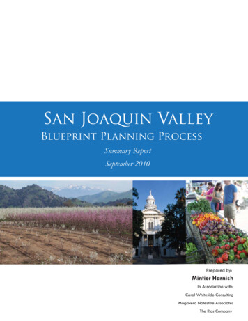
San Joaquin ValleyBlueprint Planning ProcessSummary ReportSeptember 2010Prepared by:Mintier HarnishIn Association with:Carol Whiteside ConsultingMogavero Notestine AssociatesThe Rios Company
San Joaquin ValleyBlueprint Planning ProcessSummary ReportSeptember 2010Prepared by:Mintier HarnishCarol Whiteside ConsultingMogavero Notestine AssociatesThe Rios Company
CreditsFresno Council of GovernmentsTony Boren, Executive DirectorBarbara Steck, SJV Blueprint Program ManagerTom Webster, SJV Blueprint Roadmap Project ManagerKern Council of GovernmentsRonald Brummett, Executive DirectorDarrel Hildenbrand, Project ManagerBecky Napier, Project ManagerKings County Association of GovernmentsTerri King, Executive DirectorChristina Lehn, Project ManagerMadera County Transportation CommissionPatricia Taylor, Executive DirectorRichard Poythress, Project ManagerMerced County Association of GovernmentsJesse Brown, Executive DirectorMarjie Kirn, Project ManagerSan Joaquin Council of GovernmentsAndrew Chelsey, Executive DirectorKim Anderson, Project ManagerAnthony Zepeda, Project ManagerMike Swearinger, Senior Regional PlannerStanislaus Council of GovernmentsVince Harris, Executive DirectorCharles Turner, Project ManagerTulare County Association of GovernmentsTed Smalley, Executive DirectorElizabeth Wright, Project ManagerMintier HarnishLarry Mintier, FAICP, PrincipalJim Harnish, PrincipalTed Holzem, Project ManagerJessica Law, AICP, AssociateVadim Sidelnikov, Research AssistantCarol Whiteside ConsultingCarol WhitesideMogavero Notestine AssociatesMichael NotestineDavid MogaveroRenner JohnstonThe Rios CompanyAngie Rios, PrincipalChristina Alejo, Research Director2Summary Report - September 2010
San Joaquin Valley Blueprint Planning ProcessSummary ReportTable of ContentsSection 1. IntroductionPage 3Section 2. Participants and Key PlayersPage 7Section 3. Planning ProcessPage 21Section 4. Valley BlueprintPage 27Section 5. Eight COG BlueprintsPage 37Section 6. Next Steps/ImplementationPage 51Section 7. BibliographyPage 54Summary Report - September 20101
Kings CountyAssociation ofGovernmentsThe eight Valley Regional Planning Agencies carried out an ambitious, inclusive processthat created a clear vision for future growth in San Joaquin Valley. Now the RegionalPlanning Agencies are embarking on the next phase of the Blueprint process: creating anongoing framework for implementing the Blueprint to integrate the 12 Smart Principlesand Preferred Growth Scenario concept into local planning practices.2Summary Report - September 2010
San Joaquin Valley Blueprint Planning ProcessSummary Report1. IntroductionThe San Joaquin Valley Blueprint is the result of an unprecedented effort toplan for the future of the San Joaquin Valley. This report provides an overview of the first four years of the San Joaquin Valley Blueprint (2005-2009),including the key players and participants, and the results of the Valleywideplanning effort. The report is divided into six sections. Section 1 introducesthe Valley Blueprint and provides some background on blueprint planningin California. Section 2 describes the agencies, organizations, and individualsthat made the Valley Blueprint possible. Section 3 describes five stages ofthe Valley Blueprint planning process. Sections 4 and 5 describe the resultsof the Valleywide Blueprint effort and the eight county Blueprints thatserved as a foundation for the Valleywide Blueprint. Finally, Section 6 summarizes the next steps in implementing the San Joaquin Valley Blueprint.The San Joaquin Valley Blueprint planning process began in 2006. MercedCounty Association of Governments, in coordination with the Great ValleyCenter, led the Valleywide Blueprint effort on behalf of the San JoaquinValley organizations. Seven Valley COGs and one RTPA participated in theValley Blueprint: the Council of Fresno County Governments (FresnoCOG), the Kern Council of Governments (Kern COG), the Kings CountyAssociation of Governments (KCAG), the Madera County TransportationCommission (MCTC), the Merced County Association of Governments(MCAG), the San Joaquin Council of Governments (SJCOG), the Stanislaus Council of Governments (Stan COG), and the Tulare County Association of Governments (TCAG). Throughout this report these eight organizations are referred to collectively as the Valley Regional Planning Agencies.With funding from the California Regional Blueprint Planning Program, theeight Valley Regional Planning Agencies prepared separate countywide blueprints, which were then consolidated into a single Valleywide Blueprint. Theprocess included three major phases: 1) Values and Vision; 2) Goals, Objectives, and Performance Measures; and 3) Evaluation of Alternative GrowthScenarios.On April 1, 2009, the San Joaquin Valley Regional Policy Council, the decision-making body for the Valleywide process, approved Scenario B and 12Smart Growth Principles, concluding the planning phase of the San JoaquinValley Blueprint planning process. The Valley Blueprint is a vision for thefuture of the San Joaquin Valley, in which less land is consumed for development, more resources are preserved for future generations, distinctivecommunities are enhanced, and more travel choices are available.Summary Report - September 20103
Blueprint OriginsRegional planning in California has evolved over the last six decadesthrough a variety of initiatives, planning efforts, and other broad-basedmovements. Major forces such as the emergence of single-function Stateinfrastructure planning agencies and heightened awareness of environmental and growth impacts have raised serious questions about how communities should grow.Following World War II the State began building large-scale infrastructuresystems (e.g., highways, water supply systems) to support increased demandfor residential development. In 1962 the United States Congress passed legislation requiring the formation of metropolitan planning organizations(MPOs) in regions with populations greater than 50,000. MPOs werecharged with ensuring that expenditures of governmental funds for transportation projects and programs were based on a continuing, cooperative,and comprehensive planning process. During this time local governmentsalso began to form councils of governments (COGs) that served as FederalMPOs and as the State regional transportation planning agencies (RTPAs).In the 1960s and 1970s many COGs were formed through joint powersagreements.Despite improved institutional arrangements at the local, regional, and statelevel, funding and maintenance of public facilities (e.g., schools, highways,water delivery systems) did not keep pace with growth. During the 1980sand 1990s rapid growth throughout the state’s most populated areasalarmed citizens and lawmakers and raised concerns regarding growthrelated challenges such as air quality, regional economic health, overcrowded schools, affordable housing, urbanization of prime agriculturalland, and water shortages. These issues prompted COGs and MPOs to consider how they could address growth and manage resources on a regionalscale.State and local governance reforms in the 1990s set the stage for COGs/MPOs to begin conducting focused regional planning. As a result, innovative regional environmental programs (e.g., habitat conservation plans) provided new planning tools for coordinating local land use policy. At the sametime a growing national “smart growth” or “sustainable development”movement was gaining popularity and promoting integrated planning forland use, infrastructure, and the environment. Several states, includingMaryland, New Jersey, Oregon, and Florida, passed new or modified regional growth management legislation that included smart growth themes4Summary Report - September 2010
San Joaquin Valley Blueprint Planning ProcessSummary Reportand a focus on regional coordination. California COGs/MPOs increasinglylooked to these models to address their regional issues.By the late 1990s California COGs/MPOs had taken on greater responsibilities and had expanded their traditional role as transportation planningagencies by addressing broader planning issues related to air quality, the environment, affordable housing, and land use. They began working with cities and counties to develop local land use strategies that would address regional issues. In the early 2000s, facing increasing growth pressures, fourmetropolitan regions (San Francisco Bay Area, Sacramento, San Diego, andLos Angeles) launched visioning processes to develop regional land usegrowth scenarios and smart growth principles. These were the first effortsby California COGs/MPOs to engage in blueprint planning.Prompted by the success of these regional efforts, in 2005 the State createdthe California Department of Transportation’s California Regional Blueprint Planning Program (Blueprint Program) to assist COGs/MPOs in conducting regional planning efforts that would result in consensus by regionalleaders, local governments, and stakeholders on a “Blueprint” for a 20-yearplanning horizon (through 2025). The Blueprint Program emphasized collaboration with stakeholders at all levels to address issues such as housingneeds, job creation, traffic congestion, and air quality. The Blueprint Program continues to provide resources and grant funding to COGs/MPOs tointegrate local land use planning across broad, multi-jurisdictional regions,while recognizing the key land use authority of counties and cities.Summary Report - September 20105
LIST OF ACRONYMSCalifornia Air Resources Board (CARB)California Business, Transportation, and Housing Agency (BTHA)California Partnership for the San Joaquin Valley (Partnership)California Partnership for the San Joaquin Valley, Land Use, Housing, and AgricultureWorkgroup (LUHA)California Regional Blueprint Planning Program (Blueprint Program)Central California Regional Obesity Prevention Program (CCROPP)Council of Fresno County Governments (Fresno COG)Councils of Governments (COGs)Great Valley Center (GVC)Kern Council of Governments (Kern COG)Kings County Association of Governments (KCAG)Local Government Commission (LGC)Madera County Transportation Commission (MCTC)Merced County Association of Governments (MCAG)Metropolitan Planning Organizations (MPOs)Regional Transportation Planning Agency (RTPA)San Joaquin Council of Governments (SJCOG)San Joaquin Valley Air Pollution Control District (SJVAPCD)San Joaquin Valley Blueprint (Valley Blueprint)San Joaquin Valley Blueprint Coordinating Committee (BCC)San Joaquin Valley Blueprint Project Managers (Project Managers)San Joaquin Valley Blueprint Regional Advisory Committee (BRAC)San Joaquin Valley Planners Workgroup (Planners Workgroup)San Joaquin Valley Regional Policy Council (Regional Policy Council)Stanislaus Council of Governments (Stan COG)Tulare County Association of Governments (TCAG)University of California at Davis Information Center for the Environment (UC Davis ICE)6Summary Report - September 2010
San Joaquin Valley Blueprint Planning ProcessSummary Report2. Participants and Key PlayersMany agencies, organizations, and individuals contributed to the success ofthe Valley Blueprint. The Valley Regional Planning Agencies and theirmember agencies coordinated and managed the Valley Blueprint planningprocess primarily through the San Joaquin Valley Regional Policy Counciland the San Joaquin Valley Blueprint Project Managers (Project Managers).The San Joaquin Valley Blueprint Coordinating Committee (BCC), made upof the Project Managers, State agencies, and other stakeholders, developedand oversaw major components of this process. The BCC, through varioussubcommittees, (e.g., the San Joaquin Valley Blueprint Regional AdvisoryCommittee (BRAC) and the San Joaquin Valley Planners Workgroup(Planners Workgroup)), conducted stakeholder and community outreachcampaigns and provided technical resources.Many other organizations and individuals were also critical to the Blueprintplanning process. City and county elected and appointed officials and staffsupported their COG’s efforts to the make the Blueprint process relevant,effective, and meaningful. The Great Valley Center (GVC) played a pivotalrole in providing research support and in coordinating the extensive outreach programs. The California Partnership for the San Joaquin Valleyworked with the Valley Regional Planning Agencies and GVC throughoutthe process. The California Business, Transportation, and Housing Agency(BTHA), Caltrans, and the San Joaquin Valley Air Pollution Control District(SJVAPCD) provided critical funding and technical expertise. UC DavisInformation Center for the Environment (UC Davis ICE) provided essential technical, analytical, and modeling support for the development andevaluation of alternative growth scenarios. Other partners, such as the LocalGovernment Commission (LGC) and the Central California Regional Obesity Prevention Program (CCROPP) also provided invaluable assistance.Finally, the Valley Blueprint planning process relied on input from hundreds of community organizations and business leaders and thousands ofValley residents. These stakeholders were vital to the process.Summary Report - September 20107
Valley Regional Planning AgenciesThe Valley Regional Planning Agencies came together in 2006 to initiate theSan Joaquin Valley Regional Blueprint Process. All eight of the RegionalPlanning Agencies were involved in each stage of the process.Fresno Council of GovernmentsFresno COG represents 16 member agencies including Fresno County andthe cities of Clovis, Coalinga, Firebaugh, Fowler, Fresno, Huron, Kerman,Kingsburg, Mendota, Orange Cove, Parlier, Reedley, San Joaquin, Sanger,and Selma. Mayors from each of the cities and the chairman of the countysupervisors sit on the COG 16-member Policy Board. The Policy Boarddirected and oversaw the Fresno COG Blueprint process, and ultimatelyselected a preferred growth scenario. The Policy Board was advised by theFresno COG Blueprint Roundtable throughout the process. The Roundtable met monthly during the visioning and growth scenario planning phasesto discuss and make recommendations on the Blueprint. Fresno COG Policy Board endorsed the Fresno Blueprint concept on May 29, 2008. In 2009the Fresno COG took over the Valley Blueprint management role previously filled by MCAG (see below for additional information about the roleof MCAG).Kern Council of GovernmentsKern COG represents 12 member agencies including Kern County and thecities of Arvin, Bakersfield, California City, Delano, Maricopa, McFarland,Ridgecrest, Shafter, Taft, Tehachapi, and Wasco. City council membersfrom each of the incorporated cities, two county supervisors, and ex-officiomembers representing Caltrans, the Golden Empire Transit District, andthe Joint Planning Policy Board make up the Kern COG Board of Directors. To guide development of the Blueprint, Kern COG created fourRoundtable groups: Planning Directors Roundtable, Community and Economic Development Directors Roundtable, Environmental and Social Equity Roundtable, and Business and Industry Roundtable. Kern COG staffparticipated in the Roundtable meetings and relied on input from theRoundtables to develop the structure of and content for the public outreachmeetings. Kern COG staff updated the Kern COG Board monthly on thestatus of the Kern Regional Blueprint Program. The Kern COG Board ofDirectors approved the Final Report and preferred scenario on November20, 2008.8Summary Report - September 2010
San Joaquin Valley Blueprint Planning ProcessSummary ReportKings County Association of GovernmentsKCAG represents five member agencies including Kings County and thecities of Avenal, Corcoran, Hanford, and Lemoore. KCAG is governed by acommission of two county supervisors and one city council representativefrom each of the cities. A Kings County Blueprint Planners Group consisting of local planners was created to provide direction to KCAG staffthroughout the Blueprint effort. KCAG staff communicated regularly withlocal advisory boards, city councils, and the County Board of Supervisors tokeep them apprised of Blueprint progress. The KCAG Commission approved the KCAG Blueprint Principles and the KCAG Preferred GrowthAlternative in August 2008.Madera County Transportation CommissionMCTC represents three member agencies including Madera County and thecities of Chowchilla and Madera. MCTC is governed by a Policy Board ofthree county supervisors, two city council members from the City ofMadera, and a city council member from the City of Chowchilla. MCTCformed the Madera Blueprint Roundtable Committee early in the Blueprintprocess to facilitate a more focused discussion of the Blueprint and its implications for local agency planning efforts. The Madera Roundtable included planning staff from each of the cities and the county. MCTC stafffacilitated all the Madera Roundtable meetings and provided the PolicyBoard with detailed information on public workshop input, Blueprint scenario development, and performance measures.The MCTC Policy Board approved the Madera County Blueprint Report onSeptember 17, 2008. The Report reflected a consensus among the PolicyBoard and Blueprint Roundtable that the Low Change scenario was mostappropriate for Madera County. On May 20, 2009, the MCTC Policy Boardreaffirmed support for the eight Blueprint principles developed during theMadera County Blueprint process.Summary Report - September 20109KingsCountyAssociation ofGovernments
Merced County Association of GovernmentsMCAG represents seven member agencies including Merced County andthe cities of Atwater, Dos Palos, Gustine, Livingston, Los Banos, andMerced. The MCAG Governing Board includes all five county supervisorsand a city council member from each of the six incorporated cities. MCAGworked with an MCAG Planners Roundtable to develop the alternativegrowth scenarios.MCAG coordinated the Valley Blueprint planning process including grantadministration, coordination, and outreach from the beginning in 2006through the approval of the Valley Blueprint vision and principles in 2009.In 2009 MCAG transferred management responsibilities for Valley Blueprint implementation to Fresno COG.San Joaquin Council of GovernmentsSJCOG represents eight member agencies including San Joaquin Countyand the cities of Escalon, Lathrop, Lodi, Manteca, Ripon, Stockton, andTracy. SJCOG is governed by a Board of Directors made up of threecounty supervisors, three elected officials from the City of Stockton, andone elected official from each of the other six jurisdictions. In addition, representatives from Caltrans District 10, the San Joaquin Regional TransitDistrict, and the Port of Stockton are ex-officio members and play an advisory role to the SJCOG Board of Directors. SJCOG created two advisorygroups: the Blueprint Leadership Group and the Blueprint Planners Roundtable. Both groups were responsible for reviewing staff work, providing input on the process, and recommending actions to the SJCOG Board of Directors. The Blueprint Leadership Group consisted of local communitystakeholders representing a variety of interests, including local builders/developers, State/local agencies and advisory boards, advocacy groups, economic development, public transit agencies, farming/agribusinesses, citizengroups, environmental protection organizations, and educators. The Blueprint Planners Roundtable consisted of planning/community developmentdirectors from each jurisdiction in the county. SJCOG staff was responsiblefor the administrative, technical, and facilitation aspects of the process. TheSJCOG policy board approved the San Joaquin County Regional BlueprintVision on January 28, 2010.10Summary Report - September 2010
San Joaquin Valley Blueprint Planning ProcessSummary ReportStanislaus Council of GovernmentsStan COG represents 10 member agencies including Stanislaus County andthe cities of Ceres, Hughson, Modesto, Newma
metropolitan regions (San Francisco Bay Area, Sacramento, San Diego, and Los Angeles) launched visioning processes to develop regional land use growth scenarios and smart growth principles. These were the first efforts