Transcription
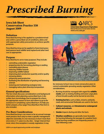
Prescribed BurningIowa Job SheetConservation Practice 338August 2009www.ia.nrcs.usda.govDefinitionPrescribed burning is fire applied to a predeterminedarea within a prescribed set of conditions, dates andwith appropriate safety precautions to achieve specificpurposes.Prescribed burning can be applied to forest land, grassland, pasture land, wildlife land, hayland and other landuses as appropriate.Purpose controlling undesirable vegetationpreparing sites for harvesting, planting or seedingcontrolling plant diseasereducing wildfire hazardsimproving wildlife habitatimproving plant production quantity and/or qualityremoving debrisenhancing seed productionfacilitating the distribution of grazing and browsinganimalsrestoring and maintaining ecological sitesmanaging native plant diversity/compositionGeneral specificationsNRCS PhotoPrescribed burns serve many purposes. They include:be necessary to burn two or more consecutive years tocontrol undesirable sprouting woody vegetation. Otherconsiderations: Burning should be managed with regard for wildlifeneeds, such as nesting, feeding and cover. Large plotsof land should usually not be burned at one time.This fact sheet discusses considerations and backgroundinformation when planning a prescribed burn. It describes burn terminology, how to prepare for a burn,the appropriate season to burn and where to go to forassistance in completing a prescribed burn. To help youbetter prepare, a four-page Prescribed Burn Plan form isalso included. Existing barriers, such as lakes, streams, wetlands,roads and constructed firebreaks are used in the burn.Pre-Burn Considerations Smoke impacts during and after the burn.Prescribed burning is not meant to be an annual management practice. Burn only to meet a specific managementobjective. Generally, it is not necessary to burn more thanonce every 3-7 years (i.e. dry sites – longer interval thanmesic sites). One exception is woody vegetation. It mayUSDA is an equal opportunity provider and employer. Cultural resources, and threatened or endangeredplants and animals. Weather conditions are generally more favorablefor burning following the passage of a weather front.Good burning conditions are frequently present 1-3days following a rain.
Prescribed BurningBurn TerminologyBackfire: A fire set to spread against the wind to burnmore slowly and remove more vegetation and litter.Backfires are often used to create a black line for additional safety when a head fire is used on the same burn area.Ring Fire: A common technique that starts with a backfire, then a flank fire is lit after a safe black line is established. This is followed by the headfire, creating a firearound the entire perimeter of the burn area.Fire Boss: A person who supervises all phases of the application of a prescribed burn.Strip Headfire: A technique that requires setting a lineor series of lines upward from a firebreak so no singleline can develop enough heat or convection to escape orcross the firebreak.Firebreak*: A space clear of flammable materials to stopfire from moving out of the burn area. It also serves as aline from which to work and facilitate the movement ofpersonnel and equipment.Flankfire: A fire burning across the prevailing wind direction.Headfire: A fire set to spread with the wind. Headfiresare the fastest and hardest to control. They are used tomanage taller shrubs and trees, leaving the most litterunburned.Mop Up: The process of checking the entire perimeter ofthe burn area to ensure all fires or smoldering materialsare out. This could include cow chips, logs, dead trees andsmall areas still burning.High Volatile Fuels: Fuels with large amounts of compounds, such as fats, waxes or oils, that are highly flammable and can produce firebrands or wind-borne flaming debris. One example is the Eastern Red Cedar. Highvolatile fuels can be burned with proper precautions.Low Volatile Fuels: Fuels with small amounts of highlyflammable compounds, including most grasses and hardwood trees. These fuels can burn safely within a widerrange of environmental conditions than high volatilefuels.*Types of FirebreaksNatural firebreaks are the most secure of all firebreaks,followed by permanent roads, bare soils and mowedfirebreaks. All firebreaks should be checked by the burnboss prior to each burn. Firebreaks must be at least 15feet in width or 4 times the fuel height, whichever ismost. Natural Firebreaks - primarily lakes, rivers andlarger streams; usually interconnected with othertypes of firebreaks. Permanent Roads - roads create a fuel free widthof 15 to 20 feet. Permanent road firebreaks requireno special burn day treatments, and allow rapid,safe ignition with routine ignition and holdingforces.2 Bare Soil Firebreaks - firebreaks are tilled to buryalmost all vegetation within a week of the burndate. Bare soil firebreaks should be reseeded quicklywith legume species and some grasses to preventexcessive erosion risk. Bare soil firebreaks are notrecommended on steep, erosive slopes or on prairieremnants or sites established to native prairie vegetation. Mow-wetlined Firebreaks - prepared by mowingas close to the ground as possible with rotary orsickle mowers beginning one year in advance toencourage enough green growth and reduce litterbuildup to stop the fire.
Recommendations for Prescribed BurningPurpose: To improve quality of wildlife habitatVegetative TypeSeason to BurnFrequency of BurnWarm Season Native GrassesApril 1-May 153-5 years for Mesic* sites 5 years for Xeric** sitesForbsSeptember 1-February 13-5 yearsCool Season GrassMarch 1-April 153-5 yearsNative Prairie RemnantsDepends on composition andobjectiveDepends on composition andobjective(depends on management objectives andcommunity needs)(when natives have 1/2 to 3 inches new growth,less than 1 inch preferred)(when cool season grasses have 2 inches or lessnew growth)Note: Burn only 1/3 to 1/4 of site per year to provide more diversity, structure and duff.* Mesic is characterized by a moderately moist hydrology.** Xeric is characterized by a dry to very dry hydrology.Purpose: To improve forage quality for grazing, haying and biomass productionVegetative TypeSeason to BurnFrequency of BurnWarm Season Native GrassesApril 1-May 153-5 yearsCool Season GrassApril 1-May 152-4 years(when natives have 1/2 to 3 inches new growth,less than 1 inch preferred)( 2 inches of new growth; less than 1 inch preferred)Mixed Warm and Cool Season GrassesUse above date to promote growth ofdeclining group2-5 yearsPurpose: To control undesirable vegetationVegetative TypeSeason to BurnFrequency of BurnCedar TreesSeptember 1-May 203-5 years(effective 5 feet tall)Deciduous Trees and ShrubsBuck BushOsage OrangeAutumn Olive, DogwoodSumac, LocustOthers . . .Introduced GrassesApril 1-May 15(when buds start to swell)2 consecutive years, then every3-5 years as needed(combine with mechanical/chemical controls)April 20-May 203-5 years(when introduced grasses have 5-10 inches newgrowth)(may combine with mechanical controls)Reduce Noxious Weeds (Perennials)Before FloweringAs NeededOther Undesirable PlantsVaried-for specific species; seek expertadviceVaried-for specific species; seek expertadvice3
Prescribed BurningPre-Burn Timetable12 Months Prior to Burn Develop Prescribed Burn Plan Mow firebreaks bi-monthly during growing seasonbefore burn Remove dead trees and brush piles that are within 20feet of firebreaks Scout for any safety concerns to burn crew, such aspoison ivy or old fence wireNRCS Photo3 Months Prior to Burn Notify adjacent landowners/neighbors of intent toconduct a prescribed burn. Ask if residents have medical conditions that would worsen if there is smoke Arrange for crew and equipment needed1 Month Prior to Burn Obtain necessary permits Clear vegetation around access points for vehicleentry to burn area1-2 Days Prior to Burn Check weather forecast for day of burn Notify adjacent landowners/neighbors of intent toconduct prescribed burn Drive around site to check firebreaks and accesspoints Test to insure that all burn equipment is functioningproperlyDay of Burn Check weather forecast Review pre-burn checklist prior to ignition Ensure remnant livestock, equipment, pets are removed if needed Notify fire department/sheriff, etc. Be sure burn crew understands the implementationplanPrescribed Burn PlanBurn plans should be planned and implemented bytrained personnel. Information about burn plans is available at your local NRCS office. For assistance, you may alsocontact: 4your local fire departmentPheasants ForeverThe Nature ConservancyTechnical Service Provider (TSP)To stimulate growth of grass species, the best time to burnis just as the desired species starts to break dormancy in thespring. A good rule of thumb is to burn when the desiredspecies–warm or cool season grass–has one inch of newgrowth.To stimulate forb components of prairie plantings, fall burnsshould be used. This would normally be from September tolate winter. Department of Natural Resources (DNR)local county conservation boardThe remainder of this brochure is a sample burn plan tobe used as background information. The sample planwill allow you to be better prepared for a burn, and it willanswer many in-depth questions you may still have abouta prescribed burn.Helpful WebsitesMore information about Prescribed Burn Plans is availableon the following websites: www.netexpress.net/ okeefe/(Iowa Burn Weather Forecast) d.org/inl/prescribed t/iacb/
PRESCRIBED BURN RES TO BURN:TOWNSHIP: SECTION: Burn Class: 1 2 3 4 5 6PLANNED DATE FOR BURN: EXPIRATION DATE:*Notification of units of government :Local Fire Dept.(Name)(phone)Sheriff/County Dispatch (phone)Notification of Neighbors (a month in advance plus the day before the A. DESCRIPTION OF BURN AREA :Program/Land use:A1) Woody Plant Species (list species, size, and plants/acres):A2) Herbaceous Plant Species (list species, height and condition):A3) Fuel Load:Fine fuel (grass/forbs)Predominant fuel ht.A4) Soil Types:Tons/AcreFeetSlope %%Volatile FuelsAspect:%Area*B. OBJECTIVE AND TIMING OF BURN : (Rank if more than one)Reduce deciduous trees/shrubs (April 1–May 15)Increase warm season grasses April 1–May 15)Reduce cedar trees (Sept. 1–May 20)Reduce cool season grass (April 20-May 20)Reduce noxious perennial weeds (before flowering)Improve wildlife habitat (Only burn 1/3 of site)Distribute grazing (When warm season grasses are 1” – 3”)Increase forbs/diversity (Sept 1-February 1)Remove LitterGive details below if needed:*ItemsRequired toMeet ConservationPractice Standard338 PrescribedBurning5
Prescribed Burning*C. SPECIFIED CONDITIONS FOR DAY OF BURN : (NOTE – All factors have to be within prescription!)(Burn forecast is available at: http://www.netexpress.net/ okeefe/)Preferred:Acceptable Conditions:NF1. Air Temperature 40 – 70 degrees F.NENW%2. Relative Humidity 30% - 60%.3. Soil Damp to Touch as Time of Burn.WEmph4. Wind Speed 5 – 15mph5. Preferred Wind Direction steady from:6. (Acceptable Wind Direction-must enter in box;SWSEmay also indicate on diagram at right with an X)S*D. PREPARATION OF AREA FOR BURNING (see attached burn plan map): Firebreaks must be at least 15 feet in width or 4 times the fuel height, whichever is greater. Plowed, disked and burned firebreaks, being essentially devoid of fuel, provide least danger of fire escape. Frequently mowed breaks (at least bi-monthly entire growing season before burn) provide good access and facilitate control Mowed and cool-season grass firebreaks have fuel available that can provide an avenue for fire escape. Smoke from greengrowth reduces visibility, inhibiting control line monitoring. Regardless of firebreak used, thatch/litter accumulation of any kind can allow fire to creep out of burn unit, rake clean toreduce risk. Heavy fuels loads: High Mowed fire intensity reduction lines (12” stubble), will be installed if fine fuel exceeds 1.5 ton/acre. Fuelreduction line width will be at least 10 feet @ 1.5 T/A and 20 feet @ 3T/A.1. Firebreak Construction: (type of fire line, width in feet. Also indicate on burn plan map.)2. Existing firebreaks: (streams, roads, tilled field, etc. Show on burn plan map)3. Items to address: (protection of power line poles, signs, cable/phone junction boxes, dead tree removal, etc.)4. Potential Hazardous Area within Burn Area: (power lines, snags, structure, obstacles to vehicle access, plastic drain tile, underground utilities, etc.)E. ADJACENT AREAS: (Outside of Burn Area)1. Special Precaution Areas (also drawn on attached burn plan map):*leaf litter, dry grass, roads, structures, smoke dispersions, etc.Precautions needed: (include backup or secondary firebreaks if necessary)2. Smoke Management Plan* Include smoke sensitive areas, i.e. avoid sending smoke into residential areas, neighbors, airports, hospitals, busyroadways, power lines, etc.* Note wind directions, which would be unacceptable for burning for each specific hazard6
*F. TOOLS/EQUIPMENT NEEDED : (include type and number of rakes, swatters, drip torches, backpack pump, other)F1. Equipment ChecklistF2. Preburn protection needs1. Pumper Truck1. Remnant Livestock2. Drip torch(s)2. Feeders3. Fire weather kit3. Pens and Barns4. Tractor/Maintainer4. Utility Poles5. Two-way Radios5. Oil/gas/pipelines6. Gas (40%)/Diesel (60%)6. Fences7. Chain Saw7. Hunting Facilities8. Flappers8. Headquarters9. Drinking Water9. Desirable wooded areas10. Livestock sprayers10. Windmills11. Sprayer Fuel11. Water Storage Facilities12. Rake(s)12. Special habitat areas13. Flagmen13. Haystacks14. Flags for flagmen14. Equipment15. NOAA radio15. Liability insurance16. Matches or lighter16. Critically eroding areas17. Backpack Sprayers17. Livestock working fact18. All cotton clothing/NOMEX18. Vehicles19. Shovel(s), pliers19. Inspection of fireguards20. Cellular phone20.Additional equipment or considerations:*G. PERSONNEL REQUIRED FOR BURN :(Include number of people and their role. It’s recommended that burning be done by certified personnel.)PositionNameFire er/SprayerSuppression CrewSuppression CrewSuppression CrewWeather/Communications7
Prescribed BurningH. SPECIAL CONSIDERATIONS:Precautions to prevent fire escape:I. SUPPRESSION PLAN IF FIRE ESCAPES: (NOTE any contingency plans, i.e. secondary firebreaks: creeks, roads, disked breaks,authorities to contact. Provide burn map to fire dept. noting field access, hazards, etc.)J. PATROL AND MOP-UP PLAN: Patrol entire perimeter of burned area, put out all flames and smoke within 20 feet of burn linePay special attention to smoldering leaf/litter, dung pats, course woody debris, corn cobs or other coarse fuels.*K. IGNITION PLAN :(see attached burn plan map)1)Ignition Time (avoid variable winds, usually occur late morning):2)Method of Firing/Firing Sequence (describe below):(backing fire, flank fire, head fire, strip head, etc. also indicate on map)PRESCRIBED BURN PLAN MAP(Attach aerial photos, topographic map or line-drawing if scale is appropriate)8
Suggested legends for indicating pertinent information on aerial photo or topo map.LegendApproximate Scale:Inches permile:Or:Inches perfeet:B-B-B-B-B-B-BBurned FirebreakP-D-P-D-P-D-PTilled/Mowed FirbreakCS-CS-CS-CSCool Season Grass FirebreakHM-HM-HMHigh Mowed fuel intensity reduction lineOther legend informationIPWA,B,etc.1,2,etc(A1) WIND--- Ignition pointWater SourceFire CrewsFiring SequenceFiring DirectionWind DirectionPlan Prepared by (name and organization):*Signature :Date:Date:Plan addresses all items required in the Conservation Practice Standard (338 Prescribed Burning):NRCS Signature:Date:IF BURN PLAN EXPIRED BEFORE IMPLEMENTATION, PLAN HAS BEEN REVIEWED AND RECERTIFIED BY (PREPARER):Signature:Date:*Landowner acknowledgement and acceptance of burn plan preparation and liabilityI, have requested the preparation of this prescribed burn plan; mysignature establishes my acceptance of full liability resulting from the implementation of this plan.9
Prescribed BurningPRESCRIBED BURN CHECKLIST(To be reviewed and filled out DAY OF BURN)NOTE: Parties igniting a prescribed burn may be liable for damages resulting from the fire and control cost, should fire escape thedesignated area.*A. Pre-burn Checklist : (Day of Burn)1. Weather forecast favorable: http://www.netexpress.net/ okeefe/)2. Necessary firebreaks constructed3. Potential hazards accounted for4. Special precaution areas noted5. Backup/secondary firebreak locations noted6. Safety equipment adequate7. Tools/equipment on-site8. Personnel needed available9. Special considerations reviewed with crewIF ANY OF THE ABOVE ARE ANSWERED “NO”, DO NOT BURNYES NOYES NOYES NOYES NOYES NOYES NOYES NOYES NOYES NO10. Actual weather at burn:Acceptable Conditions:Preferred:Actual:Time Recorded:1. Air Temperature 40-70 degrees F.F2. Relative Humidity 30%-60%%RH3. Soil Damp to Touch at Time of Burn4. Wind Speed 5-15 mphmph5. Acceptable Wind Direction steady from:YES NO6. Preferred Wind Direction steady from:YES NO7. Actual wind Direction:11. Fronts or changes expected?YESNO12. Notification of units of government made:Local Fire Dept.(name)Sheriff/County Dispatchphone:phone:13. Notification of NeighborsName: Phone:Name: Phone:Name: Phone:Name: Phone:14. Necessary permits obtained (if any):YES NOAdditional Comments:Checklist completed by:10DATE:
*B. Post-burn Evaluation (Day of Burn):1. Burning method used2. Start of burnBeginning Time: a.m. ( ) p.m. ( )Mop Up CompletedEnding Time: a.m. ( ) p.m. ( )3. Observed change in weather conditions during the burn:4. Fire behavior: (check one)a. Spottingnone( )b. Difficult to controlc. Convection columnd. Fire whirlsfew( )yes ( )yes ( )yes ( )many( )no ( )no ( )no ( )5. Objective of burn met:yes ( )no ( )6. Post-burn management plan (additional treatments needed):7. Future burn neededYes ( )No ( )8. Other comments:Evaluation Completed by:Signature:Date:*Items Required To Meet Conservation Practice Standard 338 Prescribed Burning11
Prescribed Burning 2 Backfire: A fire set to spread against the wind to burn more slowly and remove more vegetation and litter. Backfires are often used to create a black line for addition-