Transcription
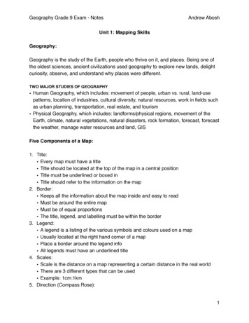
Geography Grade 9 Exam - NotesAndrew AboshUnit 1: Mapping SkillsGeography:Geography is the study of the Earth, people who thrive on it, and places. Being one ofthe oldest sciences, ancient civilizations used geography to explore new lands, delightcuriosity, observe, and understand why places were different.TWO MAJOR STUDIES OF GEOGRAPHY Human Geography, which includes: movement of people, urban vs. rural, land-usepatterns, location of industries, cultural diversity, natural resources, work in fields suchas urban planning, transportation, real estate, and tourism Physical Geography, which includes: landforms/physical regions, movement of theEarth, climate, natural vegetations, natural disasters, rock formation, forecast, forecastthe weather, manage water resources and land, GISFive Components of a Map:1. Title: Every map must have a title Title should be located at the top of the map in a central position Title must be underlined or boxed in Title should refer to the information on the map2. Border: Keeps all the information about the map inside and easy to read Must be around the entire map Must be of equal proportions The title, legend, and labelling must be within the border3. Legend: A legend is a listing of the various symbols and colours used on a map Usually located at the right hand corner of a map Place a border around the legend info All legends must have an underlined title4. Scales: Scale is the distance on a map representing a certain distance in the real world There are 3 different types that can be used Example: 1cm:1km5. Direction (Compass Rose):1
Geography Grade 9 Exam - NotesAndrew Abosh It is very important to inform the reader of the map which direction is north Should be at the top of the map This can be done using a compassScales:A scale shows the relationship between the distance on a map and the actual distanceon the Earth’s surface.There are three different types of scales:1. Direct Statement Scale: Uses words to describe the relationship between a distance on a map and aspecific distance on the Earth’s surface, for example: (1cm:1cm)2. Linear Scale: A ruler that is divided into units of distance, for example:3. Representative Fraction: Usually shown as a ratio. First term is always “1:”, which represents the distance on the map Second term represents the actual distance on the Earth’s surface Represent the same unit of measurement on both terms of the ratio For example: 1:10,000Timezones:There are six (6) timezones in Canada.In the world, there are twenty-four (24) timezones.Canada’s Location:Canada is located in the Western Hemisphere.Great Lakes:Ontario touches four lakes: Lake Ontario, Lake Huron, Lake Erie, and Lake Superior.2
Geography Grade 9 Exam - NotesAndrew AboshLines of Latitude and Longitude:Latitude: Imaginary lines that run east to west (left to right) around the globe Think FAT LAT Run parallel to one another, meaning they never meet Maximum is 90 N (North Pole) or 90 S (South Pole) Main line of latitude is the equator (0 ) Two other important lines include Tropic of Cancer (23.5 N) and Tropic ofCapricorn (23.5 S) Divides globe into northern or southern hemisphereLongitude: Imaginary lines that run north to south (up and down) around the globe Think long Meet at the poles Nickname: Meridians. Max is 180 W or 180 E 0 is at the prime meridian - main line Divides the globe into the eastern and western hemisphere P.M runs through Greenwich, England - used for timezonesLatitude always comes first.International Dateline: Follows the 180 Longitude If you cross the date line moving eastward, you add a day. If you cross movingwestward, you lose a day.Rotation:When the earth spins on its axis, it’s called rotation.3
Geography Grade 9 Exam - NotesAndrew AboshCompass:A method of finding direction. It is found in the shape of a circle.Map of Canada:Provinces, follow by their capitals:Alberta - EdmontonNova Scotia - HalifaxBritish Columbia - VictoriaOntario - TorontoManitoba - WinnipegPrince Edward Island - CharlottetownNew Brunswick - FrederictonQuebec - Quebec CityNewfoundland and Labrador - St. John'sSaskatchewan - ReginaTerritories, followed by their capitals:Yukon - WhitehorseNorthwest Territories - YellowknifeNunavut - Iqaluit4
Geography Grade 9 Exam - NotesAndrew AboshCanada’s five great lakes are: Lake Ontario, Lake Huron, Lake Michigan, Lake Erie, andLake Superior.Canada’s three oceans are: Atlantic, Pacific, and Arctic. KNOW THE LOCATION OF ALL THESE ON A MAP OF CANADA. Unit 2: Physical GeographyLandform Regions:5
Geography Grade 9 Exam - NotesAndrew AboshThe Six Factors that Affect Climate:Latitude, ocean currents, winds and air masses, elevations, relief, near water.These can be remembered by using the nemonic: L O W E R Near Water.Geological Areas:Earth is 4.55 billion years old. Earth’s history has been divided into four time periodscalled eras — Cenozoic, Mesozoic, Paleozoic, and Precambrian.Precambrian (Earliest Life): Major Geological Event: Formation of Canadian Shield Mountains Major Biological Event: 1st living multicellular organismPaleozoic (Ancient Life): Major Geological Events: The Appalachian Mountains formed Parts of North America covered by seas Major Biological Event: Organisms such as fish, insects, and amphibians evolvedMesozoic (Middle Life): Major Geological Events: Formation of Rockies Marks the beginning of the break up of Pangaea Major Biological Events: Dinosaurs and other reptiles roamed about First known flowering plants, birds, and mammals evolvedCenozoic (Recent Life): Major Geological Events: Ice age due to glaciers developed as a result of a slight cooling of the Earth’s climate Completion of Rocky Mountains Major Biological Events: Shaping of continents Humans and mammals develop6
Geography Grade 9 Exam - NotesAndrew AboshRelief Precipitation Model:In Canada, relief precipitation commonly happens in British Columbia, and Alberta.Anywhere near mountains usually.Maritime and Continental Climates:Maritime — Influenced by closeness of an ocean or other large water bodies.Temperature range tends to be small and precipitation is high. For example: Halifax,Nova Scotia.Continental — Develops away from the influence of the ocean. The annual temperaturerange tends to be large and precipitation is low. For example: Winnipeg, Manitoba.Maritime climate is much cooler than continental.Canada’s Rocks:Types of Rock:1. Igneous Rock “Fire Rocks” It is formed directly from cooling and solidification of molten rock (magma) It is found in British Columbia, Manitoba, Yukon, Northern Quebec, Newfoundland Types: Intrusive (Plutonic) — Underground Extrusive (Volcanic) — Surface7
Geography Grade 9 Exam - NotesAndrew Abosh Examples: Extrusive — Lava, pumice Intrusive — Granite2. Sedimentary Rocks It is formed from igneous rock that was eroded by wind, water, and ice Tiny pieces of igneous was carried into the sea by running water Mixed with sand/silt on ocean floor Pressure from overlying sediments transforms the fragments into solid rock It is found in Edmonton, Regina, Toronto, London Examples: Coal, Natural Gas, Oil3. Metamorphic Rock It is formed when heat and pressure increase with depth below the Earth’s crust Rock undergoes metamorphosis (to change properties, to transform, to becomesomething else) These rocks may contain deposits of metallic minerals It is found in the Canadian Shield Examples: Gold, silver, copper8
Geography Grade 9 Exam - NotesAndrew AboshPlate Tectonics:1. Divergent — These are zones where 2 plates move away fromeach-other, allowing magma from the mantle to rise up andsolidify as a new crust.2. Convergent — 1 plate is pulled beneath another(subduction), forming a deep trench. The long, narrowzone where the 2 plates meet is called a subduction zone.3. Transform — At this plate, boundaries plates grind past each-other side byside. They are responsible for causing many of California’s earthquakes.All these contribute to continental drift: J. Tuzo Wilson, a Canadian helped develop the theory of Plate Tectonics This theory states that the Earth’s outer shell is made up of about 20 plates consistingof Continent and Ocean Movement causes earthquakes, mountains, tsunamis, volcanoesPangaea — About 300 million years ago the plates were situated in a certain way sothat all the continents came together. This land formed a supercontinent calledPangaea.Continental Drift: In 1915, Alfred Wegner, a German scientist developed the theory of how Pangaeabroke up and the continents drifted in different directions. His evidence for this was the following:1. He saw a jigsaw fit between South America and Africa2. He found fossils of the same plants and animals on different continents3. There are mountains with similar age and structure on both sides of the AtlanticOcean4. Ice sheets covered South Africa, India, Australia, and South Africa (places thatare warm today). His reasoning was that these places were closer to the SouthPole.9
Geography Grade 9 Exam - NotesAndrew AboshNatural Vegetation:The part of plant life which grows in wild without without direct or indirect help ofhumans, and which easily adapts to the constraints of natural environment in size,structure, and requirements.Leaching and Calcification:Leaching — Removes minerals from soil by water as it moves downward through thesoil.Calcification — Water carries dissolved minerals upward through the soil.Climate tationJulyMonthsSeptemberNovemberPrecipitation (mm)Temperature (Celcius)Climate Graph of 0Temperature10
Geography Grade 9 Exam - NotesAndrew AboshClimate Statistic Table:High Temperature (HT) — Month and temperature with the highest degree; for ex. July,18 CLow Temperature (LT) — Month and temperature with the lowest degree; for ex.January, -15 CTemperature Range (TR) — HT - LT /or/ HT - (LT)Average Temperature (AT) — The monthly average temperature for a year addedtogether, then divided by 12.Season of Heaviest Precipitation (SHP) — Season when precipitation is the highest.Add all the Winter mm, add all the Summer mm and select the season with the largervalue. Winter October to March, Summer April to SeptemberClimate Type (CT) — Continental or Maritime. Add Winter Summer precipitation. If 1000mm Maritime, If 1000mm ContinentalUnit Three: CultureMigration:Immigration — Movement of people into a region or country. For example: A man fromGermany enters Canada.Emigration: Movement of people out of a region or country. For example: A man leavesGermany.Migration: Movement of people from one place to another.Push Factors: These push people away and make them want to leave. For example:pollution, war, weather, dull social life, natural disasters, and famine.Pull Factors: People move to a place because there are things that are attractive, theseare called Pull Factors. For example: great weather, good housing, lively social life,promise of freedom.11
Geography Grade 9 Exam - NotesAndrew AboshIntervening Obstacles: Factors that discourage/or stop people from following theirdecision to leave. For example: fear of unknown, family left behind, high cost of travel,cost of immigration.Some problems immigrants might have adjusting to their new country, include: culturalshock, stereotyping, language barriers, prejudice/discrimination, getting around the city,education, making friends, adjusting to new cuisine.They are attracted to Canada for the following reasons: multiculturalism, religion, stores,entertainment.Three Types of Immigrants:1. Independent Immigrant Awarded based on education, skills, and experience.2. Family Immigrants To allow families to reunite.3. Refugees Someone who fears persecution in his/her home country. Must arise for reasons of race, religion, nationality, political opinion, or membership.Canada’s Point System:The system was designed to test future immigrants to see if they were “good enough” tolive in Canada. We have it to keep us safe from criminals, and make sure most citizensof Canada can communicate with one-another. It is fairly effective, but not 100%.Population Pyramids:1. Stable Pyramid: A population pyramid showing an unchanging pattern of births anddeaths. Steady birth rate with an equally large workforce Babies are being born at the same rate as people are aging Need good health care to accommodate births and deaths Need steady employment for the large workforce12
Geography Grade 9 Exam - NotesAndrew Abosh2. Increasing Pyramid: A population pyramid showing a broad base, indicating a highproportion of children, a rapid rate of population growth and a low proportion of lowerpeople. Elderly are dying off Large population growth at the base High birth and death rates Majority of population is below 14 years old Need to build more schools, recreation centres, health care buildings, day carebuildings3. Decreasing Pyramid: A population pyramid showing lower numbers of percentagesof younger people. Low birth rate and a large work force (15-44 years old) The population is aging (high death rate), therefore decreasing with time With fewer babies being born, the population is decreasing Need for more nursing homes, retirement homes, hospitals/pharmaceuticalsPopulation Density and Population Distribution:Population Density — The number of people living per km2 of an area.Population Distribution — The arrangement or spread of people living in a given area.Urban Growth:The rate of growth of an urban population.Population Settlement Patterns:There are three main types of settlement patterns:1. Dispersed: Spread out, agricultural areas, activity based.2. Concentrated: Where people are focused on small areas, resources support people,people live close together.3. Linear: Arranged along a line, groups located along transportation routes (highway),water, mountains, borders.13
Geography Grade 9 Exam - NotesAndrew AboshCanada’s Immigration History:In the past, Canada has experienced both periods of high immigration and periods oflow immigration.Periods of High Immigration 1905-1914 Europeans came to Canada because the Canadian government promisedfree land in the prairies. People come to Canada when times are good: jobs, solid opportunitiesPeriods of Low Immigration 1930-1945 World War 2 People don’t come to Canada when times are bad: war, lack of jobsDemography:All per 1000 people, except Doubling Time, and Population Density.Birth Rate (Number of Births Per Year / Total Population) x 1000Death Rate (Number of Deaths Per Year / Total Population) x 1000Natural Increase Rate (Birth Rate - Death Rate)Immigration Rate (Number of Immigrants Per Year / Total Population) x 1000Emigration Rate (Number of Emigrants Per Year / Total Population) x 1000Net Migration Rate (Immigration Rate - Emigration Rate)Population Growth Rate (Natural Increase Rate Net Migration Rate)Doubling Time 70 / Population Growth RatePopulation Density Total Population / Total Area (km)14
Geography Grade 9 Exam - NotesAndrew AboshRural Settlement Patterns:Factors that influence rural settlement: resources, transportation, government policy.There are three rural settlement patterns:1. The Long Lot of Southern Quebec Influences: Resource: Agriculture Transportation: St. Lawrence River Boat Government Policy: Each settler receives a piece of land along the waterfront. Long thin farms built along the river and stretched back long distances from thewater.2. Concession System of Southern Ontario Influences: Resource: Rich Agriculture Transportation: Roads — Later railway, each settlement access to a road. Government Policy: Survey system already in place. Concession system: Land is divided equally by concessions roads – farms 40 to80ha in size.3. Section System of the Southern Prairies Influences: Resource: Agriculture Transportation: Roads, later railway Government Policy: Didn’t want the U.S. to have the land. Lots were too small;families needed large lots for a larger harvest. Land was divided into blocks (9.6km by 9.6km). Each block was divided into 36sections – each section was divided into for quarter sections.Ontario’s Population:Is commonly referred to as a salad, or cultural mosaic.Canada’s Society:Is known to be a multicultural society.15
Geography Grade 9 Exam - NotesAndrew AboshLand Use Patterns:1.2.3.4.5.Residential (40%): Where people live, land used to build homes.Transportation (32%): Land used to transport goods/people.Institutional (10%): Land used to build schools, hospitals, office buildings, etc.Open Space (7%): Land used for leisure, vacant unused land, public/private.Industrial (6%): Land used for factories/wholesale. Where products are made largebuildings close to highway, people work here.6. Commercial (5%): Land used for buildings that sell services.Country with the Largest Population:China, with 1.4 billion as of 2013.Unit 4: Natural ResourcesIndustries:1. Primary Industries: Extracting raw materials from the ground or water — mining,forestry, farming, fishing.2. Secondary Industries: Manufacturing products by putting things together — autoassembly plants, factories, construction.3. Tertiary Industries: Providing services to others, supports society — doctors,lawyers, teachers. MOST CANADIANS WORK IN THIS INDUSTRY4. Quaternary Industries: Sub-sector of tertiary, requires scientific research.Fish:In the east coast, the main type of fish caught is cod.In the west coast, salmon is the main type of fish caught.Canada’s Oil Province:Alberta, with over 95%.Ecological Footprint:Measure of land area, to suggest the ecological pressure created by residents of a country.16
Geography Grade 9 Exam - NotesAndrew AboshBasic and Non-Basic Activities:Basic Industries — Selling goods or services to people outside of the local community.This brings new money into the local economy.Non-Basic Industries — Selling goods or services to people within the local community.This recycles existing money in the local economy.Location Factors:Tertiary Industry Sector This is the largest sector in the Canadian economy. Over 70% of Canadian workers are employed in this service.Availability of Raw Materials Manufacturers need a raw reliable source of raw materials. May be extremely important to locate near the raw materials.Location of Markets Companies want to be located near their customers. Products can be delivered faster; delivery costs can be minimized.Labour Supply A company must consider the availability/cost of labour. Manufacturers in Canada are likely to employ skilled workers.Availability of Freshwater/Power A basic need of most kinds of manufactures is an abundant supply of fresh water andpower.Transportation Depending on the type of product being made, companies will rely on differentsources of transportation.Political Factors Governments can make decisions that will help to attract new business to a city,province, or country.17
Geography Grade 9 Exam - NotesAndrew AboshUnit 5: Global ConnectionsImports and Exports:Import — Bring (goods or services) into a country from abroad for sale.Export — Send (goods or services) to another country for sale.Protectionism:Government’s policy of using tariffs and having rules that limits imports.Major Canadian Imports and Exports:Canada’s largest imports are vehicles.Canada’s largest exports is oil.NAFTA and the UN:North American Free Trade (NAFTA) — Agreement which promotes free trade with theUnited States and other countries.United Nations (UN) — An international organization formed in 1945 to increase politicaland economic cooperation among member countries.Tariffs:Tax on an import.Types of Countries:1. DevelopedHigh incomeGood housingLots of foodCan afford many luxuries (cars, electronics, etc.)Excellent healthcareAccess to education18
Geography Grade 9 Exam - Notes2. Newly InstitutionalizedGoing through the process of being developedEconomics are related to factoriesImproving healthcareNeed to work on their incomes, services, and quality of life3. DevelopingLowest levels of economics and social growthMost people live in povertyDon’t have enough food and freshwaterLack of good housingDon’t have basic necessities of lifeAndrew AboshPeacekeeping and Peacemaking:Peacekeeping — Where the parties in a conflict have agreed to work toward peace.Peacemaking — Where there has been no peace agreement and military operationsmay be necessary to create peace.19
Geography Grade 9 Exam - NotesAndrew Abosh(Copyright) 2015 Andrew AboshI do not take full credit for the work; information comes from various sources.Use the notes at your own risk. I am not to blame if anything is incorrect or missing.20
Geography Grade 9 Exam - Notes Andrew Abosh Canada’s five great lakes are: Lake Ontario, Lake Huron, Lake Michigan, Lake Erie, and Lake Superior. Canada’s three oceans are: Atlantic, Pacific, and Arctic. KNOW THE LOCATION OF ALL THESE ON A MAP OF CANADA. Unit 2