Transcription
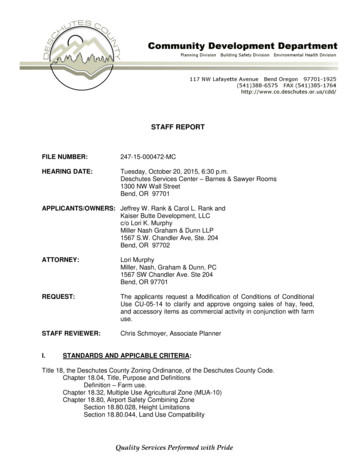
STAFF REPORTFILE NUMBER:247-15-000472-MCHEARING DATE:Tuesday, October 20, 2015, 6:30 p.m.Deschutes Services Center – Barnes & Sawyer Rooms1300 NW Wall StreetBend, OR 97701APPLICANTS/OWNERS: Jeffrey W. Rank & Carol L. Rank andKaiser Butte Development, LLCc/o Lori K. MurphyMiller Nash Graham & Dunn LLP1567 S.W. Chandler Ave, Ste. 204Bend, OR 97702ATTORNEY:Lori MurphyMiller, Nash, Graham & Dunn, PC1567 SW Chandler Ave. Ste 204Bend, OR 97701REQUEST:The applicants request a Modification of Conditions of ConditionalUse CU-05-14 to clarify and approve ongoing sales of hay, feed,and accessory items as commercial activity in conjunction with farmuse.STAFF REVIEWER:Chris Schmoyer, Associate PlannerI.STANDARDS AND APPICABLE CRITERIA:Title 18, the Deschutes County Zoning Ordinance, of the Deschutes County Code.Chapter 18.04, Title, Purpose and DefinitionsDefinition – Farm use.Chapter 18.32, Multiple Use Agricultural Zone (MUA-10)Chapter 18.80, Airport Safety Combining ZoneSection 18.80.028, Height LimitationsSection 18.80.044, Land Use Compatibility
Chapter 18.84, Landscape Management (LM) Combining ZoneSections 18.84.080, Design Review StandardsChapter 18.116, Supplementary ProvisionsSection 18.116.030, Off-street parking and loadingSection 18.116.031, Bicycle parkingSection 18.116.035, Bicycle commuter facilitiesSection 18.116.040, Accessory UsesChapter 18.124, Site Plan ReviewSection 18.124.060 Approval CriteriaSection 18.124.070, Required Minimum StandardsChapter 18.128, Conditional UsesSection 18.128.015, General Standards Governing Conditional UsesII.BASIC FINDINGS:A.LOCATION: The subject property has an assigned address of 4626 SW QuarryAvenue, Redmond, and is identified on County Assessor’s map 16-12-12 as tax lot 100.The subject property is located approximately two (2) miles south of the City Limitsboundary of Redmond.B.ZONING: The subject property is zoned Multiple Use Agricultural (MUA-10), and is alsowithin the Landscape Management (LM) and Airport Safety (AS) combining zones. It isdesignated Rural Residential Exception Area on the Deschutes County ComprehensivePlan Map.C.SITE DESCRIPTION: The subject property is 8.68 acres in size, roughly rectangular inshape and is generally level. There is an existing dwelling, three large hay barns, thecurrent retail operation, a chicken coop, a horse barn, a feed storage building andmultiple outbuildings on the property. There also appears to be several types of heavyequipment stored on the property, including semi-trucks, trailers, as well as storagecontainers. There appears to be an area of pasture in the southern portion of theproperty. The property is accessed from an existing driveway off of SW Quarry Avenue,which is a paved road that connects to Highway 97 approximately 470 feet east of thesubject property.File No. 247-15-000472-MC, Staff ReportPage 2
Source: Google Earth 2015D.SURROUNDING USES AND ZONING:A portion of the subject property abutsHighway 97 on the east and NW Quarry Avenue on the north. Land uses in the areaconsist primarily of rural residences, small scale farming and two commercial uses.Zoning surrounding the property consists of MUA-10 except to the northeast which isdesignated EFU-TRB subzone. The EFU-zoned property to the northeast is owned byDiamond B Trailer Sales, a retail business that sells trailers and farm supplies. Many ofthe MUA-10 zoned properties contain dwellings. However, the abutting property to theeast is vacant land owned by the Oregon Department of Parks and Recreation and isalso zoned MUA-10. To the south is the Schultz Farm and Garden, a horticultural retailoperation, on a 10-acre parcel zoned MUA- 10.E.PROPOSAL: The applicants propose to modify the conditions of approval of Land UseFile CU-05-14. The applicant requests a Modification of Conditions of Conditional UseCU-05-14 to clarify and approve ongoing sales of hay, feed, and accessory items ascommercial activity in conjunction with farm use. Specifically, the applicants state thepurpose of the modification is to: “ clarify and to ratify the applicant’s continuation ofselling hay, feed, and accessory items ("incidentals") as a commercial use in conjunctionwith farm use”.File No. 247-15-000472-MC, Staff ReportPage 3
The applicant has submitted a plot plan, a burden of proof statement and 19 exhibits,which are incorporated herein by reference.F.PUBLIC AGENCY COMMENTS: The Planning Division sent notice of the land useapplication to several public agencies and received the following responses:County Senior Transportation Planner: Peter Russell, County Senior TransportationPlanner, provided his comments on the proposal in an email to the applicants’ attorneyon August 25, 2015. An excerpt of the email is provided below:I’ve looked at the burden of proof and it never clearly states how much square footagewill be in which use, so for discussion purposes I’ve taken the size of the barn (5,040square feet) and utility building (2,400 square feet) for 7,440 square feet of buildingspace for a reasonable worst-case scenario. I then did calculations for trip generationbased on various uses from the most recent edition of the Institute of Traffic Engineers(ITE) manual. I talked with George Kolb, County Engineer, and he has agreed with thisapproach. It appears you’ll need to do a Site Traffic Report and analyze the drivewayonto Quarry and the intersection of Quarry/97. This is the lowest level of traffic analysiswe require. You don’t need to do a Traffic Impact Analysis (TIA) which is a morecomplex traffic study.The reason I did this is because Deschutes County Code (DCC) 18.116.310(C) requirestraffic analysis for any land use that will generate more than 50 weekday trips. (When aland use application is tied to a code enforcement case, we assume the site is agreenfield development or in other words analyze the site as if it were vacant; whetherthe site is generating now or has generated traffic in the past based on the disputed landuse is irrelevant.) If the use will generate more than 50 weekday trips, then trafficanalysis is required; the traffic analysis in turn is based on the trip generation for the 4-6p.m. peak hours.There are two admitted challenges for this particular land use. One, is finding an ITEcategory that either matches or is a close analog to the proposed use. The combinationof agricultural and related uses did prove difficult as the burden of proof lists a fairamount of potential related uses, but not how much space each use would take. Beloware several categories from the ITE, why I chose them, and what the expected tripgeneration rates came out to be. The second challenge is for some of these land usecategories, there are no weekday trip rates; I extrapolated the number of potentialweekday trips from the provided p.m. peak hour data. Typically, the weekday rate ishigher than p.m. peak hour rate.I’m not saying this is perfect, but it’s the best I could come up with based on theinformation provided. If I had more detailed information about the square footage beingused for each use, that would be helpful.Warehousing (Land Use 150)Storage of materials primarily, but may include office space and maintenanceareas. The County is using this for determining transportation system developmentcharges (SDCs) for grow operations.3.56 weekday trips per 1,000 square feet; 0.32 p.m. peak hour trips per 1,000 squarefeet.File No. 247-15-000472-MC, Staff ReportPage 4
3.56 X 7.44 26.48 weekday trips. No traffic analysis needed.Tractor Supply Store (Land Use 810)Specializes in sale of agricultural and garden equipment, power tools, vehiclemaintenance parts and heavy-duty outdoor machinery. May also offer ancillary itemsand accessories.No weekday trip generation rate, p.m. peak hour rate is 1.40 trips per 1,000 square feet.1.40 X 7.44 10.41 p.m. peak hour trips. Based on 10. 41 trips per hour over two hours(10.41 X 2 20.82 trips) and the business being open for six more hours, the site wouldonly need to average 5 trips per hour for remaining six hours to meet the 50-tripthreshold. Traffic study required.Pet Supply Superstore (Land Use 866)Specializes in sale of pets and pet supplies, food and accessories.No weekday trip generation rate, p.m. peak hour is 3.38 trips per 1,000 square feet.3.38 X 7.44 25.15 p.m. peak hour trips. Based on 25.15 trips per hour over two hours,the 50-trip threshold would be met in two hours. Assuming only 25 trips are generated in4-6 p.m. peak hours, the business being open for six more hours would only have togenerate slightly more than 4 trips per hour to meet the 50-weekday tripthreshold. Traffic study required.Again, these are just first-magnitude assessments based on the information supplied. Ifyou have any questions, please let me know. Thanks.Peter Russell, County Senior Transportation Planner, provided additional comments onthe proposal in an email to staff on October 12, 2015. These comments were inresponse to the applicant’s attorney’s 10/12/15 email to staff that she had “ confirmedwith the owner that he has one employee each day”. An excerpt of Mr. Russel’s10/12/15 email is provided below:With one employee the daily trip total goes to 38 trips, which is still below the 50-tripthreshold for traffic analysis set by DCC 18.116.310. No further traffic analysis isneeded. We’ll still have to determine transportation system development charges(SDCs), which are currently set at 3,852 per p.m. peak hour trip. Typically, in theabsence of specific p.m. peak hour data, we’ve deferred to the fact site-generated trafficin the p.m. peak is usually 10% of the daily traffic.In this case, that would mean 3.8 trips, which is 10% of 38. The SDC would then be 3,852 X 3.8 14,638.Deschutes County Road Department: George Kolb, PE, County Engineer, provided thefollowing comments in an email submitted 9/18/15 (excerpted):I have looked over Peter Russell’s email dated 8/25/2015 and agree with Peter that aSite Traffic Report will be required for this application. I will defer any comments I haveFile No. 247-15-000472-MC, Staff ReportPage 5
on possible road improvements until after I have had a chance to review the Site TrafficReport.Redmond Fire and Rescue: Clara Butler, Deputy Fire Marshal, submitted the followingcomments on September 18, 2015:Developer must disclose the use for this space to apply codes accurately.WATER: Fire Safety during Construction – 2014 OFC Chapter 33o Approved fire department access roads, required water supply, fire hydrants, andsafety precautions shall be made available as soon as combustible material arriveson site.Area without Fire Hydrants: NFPA 1142 Requirementso If the structure is being built in an area without a public water supply system, then thewater flow requirements will come from NFPA 1142.o Note: The following information will need to be provided in order to determineaccurate water flow requirements. Building height, length and width Use of the building Type of construction Whether the structure 100 sq ft or larger and within 50 feet of any otherstructures Structures with Automatic Sprinkler systems – 2012 NFPA 1142 Chapter 7o The authority having jurisdiction shall be permitted to waive the water supplyrequired by this standard when a structure is protected by an automatic sprinklersystem that fully meets the requirements of NFPA 13 or 903.3.1.2 NFPA 13R of theOFC. Area Separation – Appendix B 104.2o Portions of buildings which are separated by fire walls without openings constructedin accordance with the International Building Code (table 705.4) are allowed to beconsidered as separate fire flow calculation areas.ACCESS: Premises Identification – 2014 OFC 505.1o Approved numbers or addresses shall be placed on all new and existing buildings insuch a position as to be plainly visible and legible from the street or road fronting theproperty. Said numbers shall contrast with their background and visible at night.Number/letter shall be a minimum of 4” high and a 0.5” stroke width. Fire Apparatus Access Roads – 2014 OFC Section 503 & Appendix Do Fire apparatus access roads shall extend to within 150 ft of all portions of thebuilding as measured by an approved route around the exterior of the building.o Fire apparatus access roads shall have an unobstructed width of not less than 20feet and an unobstructed vertical clearance of not less than 13 feet 6 inches.File No. 247-15-000472-MC, Staff ReportPage 6
oooFire apparatus roads shall be designed and maintained to support the imposed loadsof 70,000 lbs and shall be surfaced so as to provide all-weather driving capabilities.The required turning radius of a fire apparatus access road shall be 30 feet insideand 50 feet outside.The grade of the fire apparatus access roads shall be within the limits established bythe fire code official (10%). Fire Lanes – 2014 OFC 503.3 & Appendix Do Approved signs or other approved notices shall be provided for fire apparatus accessroads to identify such roads or prohibit the obstruction thereof. Such signs or noticesshall be kept in legible conditions at all times. The stroke shall be 1 inch with letters 6inches high and read “No Parking Fire Lane”. Spacing for signage shall be every50 feet. Recommended to also (in addition to Fire lane signs) paint fire lane curbs inbright red paint with white letters.o Appendix D Section 103.6.1 Roads 20-26 Ft. Wide: Shall have Fire Lane signsposted on both sides of a fire lane.o Appendix D Section 103.6.2 Roads more than 26 Ft. Wide: Roads 26-32 ft wideshall have a Fire Lane signs posted on one side of the road as a fire lane. Aerial Access Roads – 2014 OFC Appendix D, Section 105o Buildings or portions of buildings or facilities exceeding 30 feet in height above thelowest level of fire department vehicle access shall be provided with approved fireapparatus access roads and capable of accommodating fire department aerialapparatus. Overhead utility and power lines shall not be located within the aerial fireapparatus access roadways. At least one of the required access routes meeting thiscondition shall be located within a minimum of 15 feet and a maximum of 30 feetfrom the building, all access roads shall have an unobstructed width of not less than26 feet and shall be positioned parallel to one entire side of the building. Dead-Ends – 2014 OFC Section 503.2.5o Dead-end fire apparatus access roads in excess of 150 feet in length shall beprovided with an approved area for turning around fire apparatus. Contact RedmondFire & Rescue for requirements. Additional Access – 2014 OFC Section 503.1.2o The fire code official is authorized to require more than one fire apparatus accessroad based on the potential for impairment of a single road by vehicle congestion,conditions or terrain, climatic conditions or other factors that could limit access. Emergency Access Road Gates – 2014 OFC Appendix D 103.5o Minimum 20 feet wide.o Gates shall be swinging or sliding type.o Shall be able to be manually operated by one person.o Electric gates shall be equipped with a means of opening by emergency personnel &approved by fire official.o Locking devices shall be fire department Knox Key Switch purchased from A-1 Lock,Safe Co., Curtis Safe & Lock, on line at www.knoxbox.com, or contact Redmond Fire& Rescue for an order form.o Section 503.3: Install a sign on the gate “No Parking-Fire Lane”File No. 247-15-000472-MC, Staff ReportPage 7
Key Boxes – 2014 OFC Section 506.1o An approved key box shall be installed on all structures equipped with a fire alarmsystem and /or sprinkler system. Approved key boxes can only be purchased at A-1Lock Safe Co., Curtis Safe and Lock, on line at www.knoxbox.com, or contactRedmond Fire & Rescue for an order form. Commercial & Industrial Development – 2014 OFC Appendix D 104o Buildings exceeding three stories or 30 feet in height shall have at least 2 means offire apparatus access for each structure.o Where 2 access roads are required, they shall be placed not less than ½ the lengthof the overall diagonal dimension of the property or area to be served, measured in astraight line between accesses.If there are questions regarding Fire Code issues, please contact the Redmond Fire lara.butler@redmondfireandrescue.org .G.PUBLIC COMMENTS: The Planning Division sent notice of the proposed land useapplication to all property owners within 250 feet of the subject property. One comment,received via email, was received in response to the notice, which expressed favor to theproposed use. Specifically, on September 30, 2015, an email from Jacob Hueners, wasprovided to staff by the applicants’ attorney. In the email, Mr. Hueners states:I have no problem whatsoever with the business practices of Quarry Hay andFeed. Which is my direct neighbor to the east.H.REVIEW PERIOD: This application was submitted on August 28, 2015 and acceptedand deemed complete on September 27, 2015. The 150th day on which the Countymust take final action is February 24, 2016. The applicants also submitted the land usesign affidavit indicating that the required land use sign was posted on the property onSeptember 17, 2015.I.LOT OF RECORD: The subject property is recognized as a legal lot of record pursuantto being lot 1 in block 1 of Long Butte Tracts subdivision.J.LAND USE HISTORY: Landscape Management approval (LM-02-217) was granted forthis property for a manufactured home with a carport, barn and utility building. Inresponse to a code complaint (C03-233), the applicants submitted a Conditional Useapplication (CU-05-14). The application was denied by the hearings officer and theApplicants timely filed an appeal on July 5, 2005 (A-05-4). On July 27, 2005 theDeschutes County Board of County Commissioners ("Board ") issued Order # 2005-068accepting de novo review on the appeal. On October 3, 2005, the Board issued adecision reversing the hearings officer's decision and conditionally approving thecommercial hay and livestock feed sales from the subject property. LandscapeManagement approval (LM-07-44) was granted for this property for three hay sheds andan addition to an existing hay shed on the property. In 2014, code violation complaintswere filed with the County (Case File Nos. C-14-14, C-14-15 and C-14-16) alleging theapplicants sold items not authorized under the conditional use permit approval. Thesubject modification application was submitted by the applicant as an effort to clarify andauthorize ongoing sales of hay, feed, and associated accessory items as commercialactivity in conjunction with farm use.File No. 247-15-000472-MC, Staff ReportPage 8
III.PRELIMINARY FINDINGS:Title 22 of the Deschutes County Code, the Development Procedures OrdinanceA.Chapter 22.36, LIMITATIONS ON APPROVALS1.Section 22.36.040. Modification of Approval.A.An applicant may apply to modify an approval at any time after aperiod of six months has elapsed from the time a land use actionapproval has become final.STAFF RESPONSE: This standard is met because the Board's decision on File CU-05-14 (A05-04) became final twelve days after it was mailed on October 3, 2005, therefore more than sixmonths have elapsed since the land use action approval became final.B.Unless otherwise specified in a particular zoning ordinanceprovision, the grounds for filing a modification shall be that achange of circumstances since the issuance of the approval makesit desirable to make changes to the proposal, as approved. Amodification shall not be filed as a substitute for an appeal or toapply for a substantially new proposal or one that would havesignificant additional impacts on surrounding properties.STAFF RESPONSE: In response to this criterion, the applicant’s burden of proof statementprovides the following:The County issued a code violation, spurred by the complaint of a competitor, allegingthat the applicant was engaging in commercial activities in conjunction with farm use thatwent beyond the scope
c/o Lori K. Murphy Miller Nash Graham & Dunn LLP 1567 S.W. Chandler Ave, Ste. 204 Bend, OR 97702 ATTORNEY: Lori Murphy Miller, Nash, Graham & Dunn, PC 1567 SW Chandler Ave. Ste 204 Bend, OR 97701 REQUEST: The applicants request a Modification of Conditions of Conditional Use CU